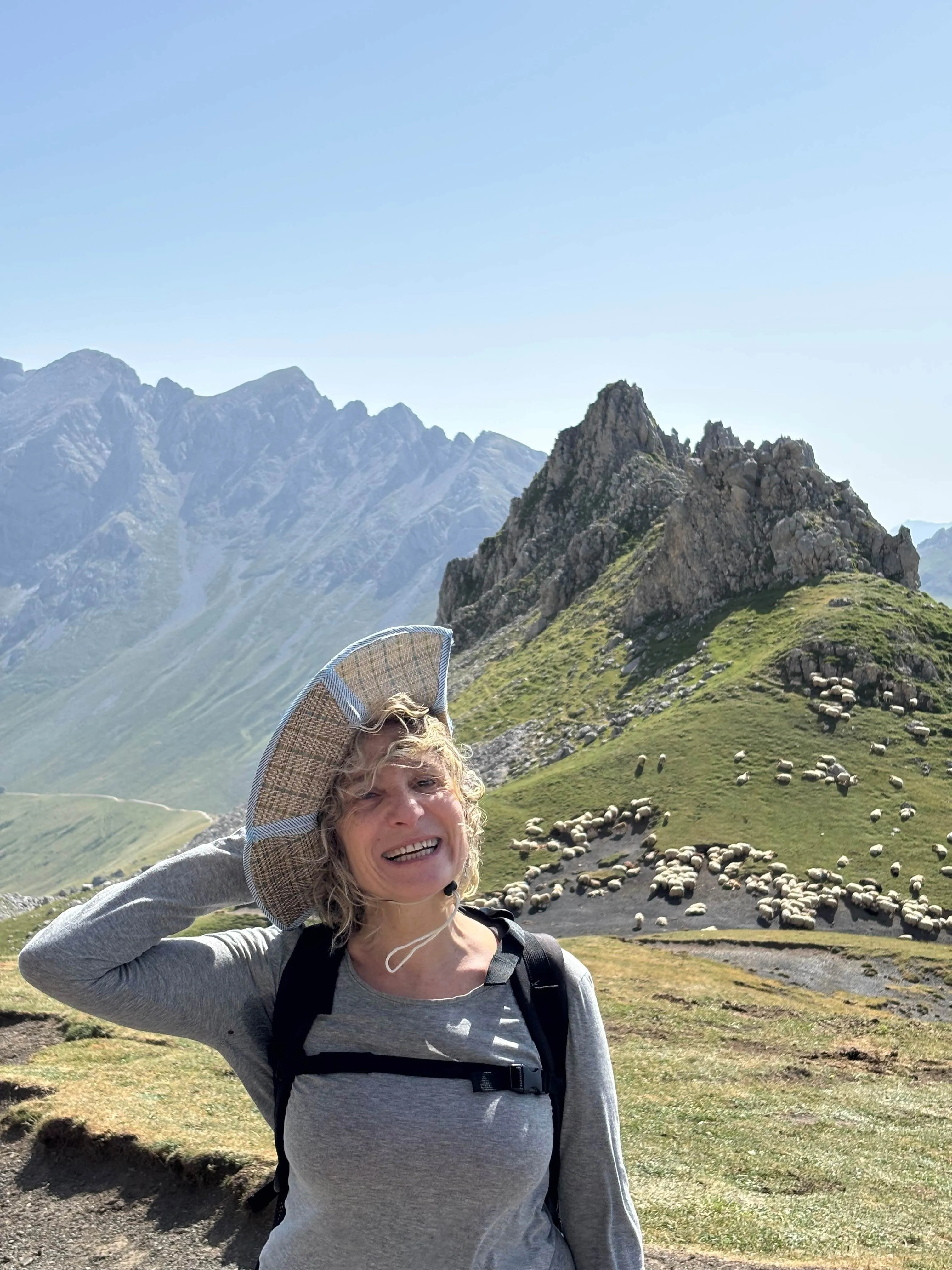
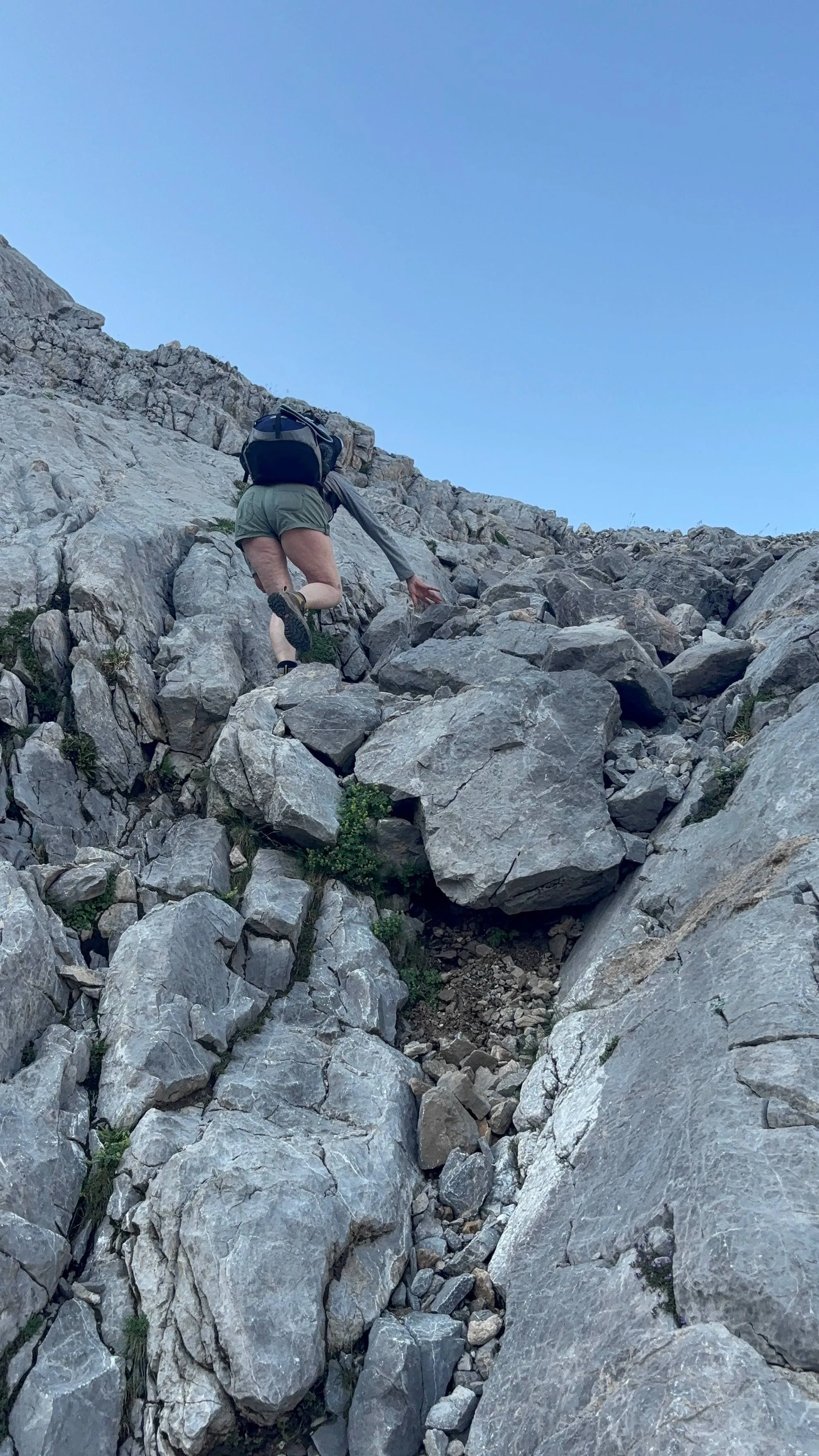
Picos de Europa - Medium Trek

Duration: 5 days
Trails: T3 trails
Distance: 10 - 15 km per day
Ascent per day: 500 - 1000 m ascent per day

> Walk beneath the towering Picu Urriellu (2,519 m), the symbol of the Picos de Europa
> Stay in historic mountain refuges along the way
> Hike through valleys surrounded by peaks over 2,500 metres high

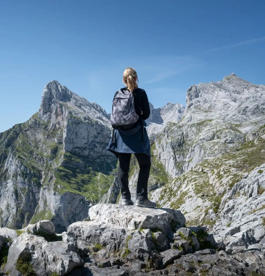
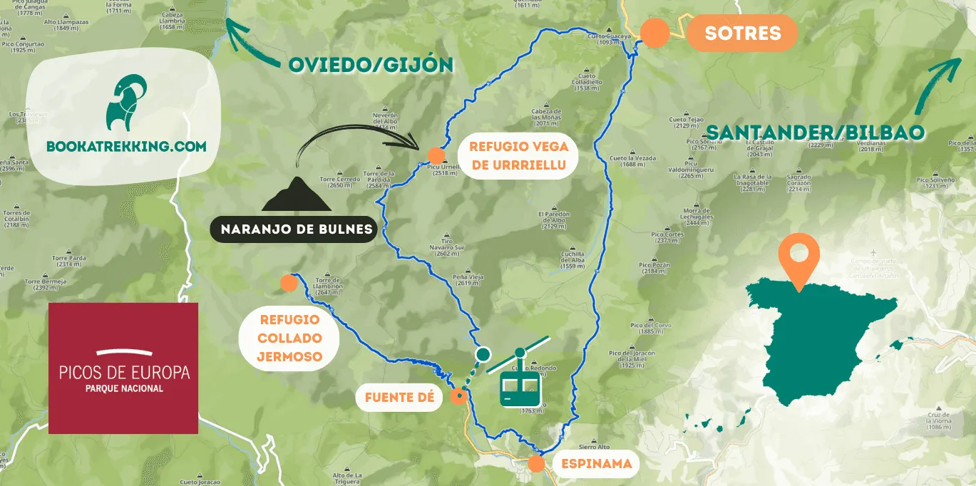
The Picos de Europa Medium Trek is a 5-day adventure that takes you deep into Spain's first National Park, combining spectacular limestone walls, glacial valleys and mountain pastures for an unforgettable trekking experience. Starting and finishing in Sotres, this route follows ancient trails used by shepherds and mountaineers for centuries.

The route takes you over breathtaking high mountain passes and into the shadow of the legendary Picu Urriellu (also known as Naranjo de Bulnes), one of Spain's most iconic peaks. Hiking alongside other towering peaks, you'll pass through deep gorges carved by raging rivers, rugged plateaus and lush valleys where wildlife roams free.

Each night you'll stay in traditional accommodation, where warm hospitality and hearty local cuisine await you after a rewarding day on the trail. Perfect for those looking for a mix of challenge and beauty, this trek captures the essence of adventure in the Picos de Europa.

Important: This route is only suitable for experienced hikers with technical mountaineering skills and previous experience of trekking in similar high mountain terrain.

Itinerary

Day
1

Sotres - Refugio Vega de Urriellu

Duration: 05:30 h
Distance: 10 km
Ascent: 1140 m
Descent: 170 m

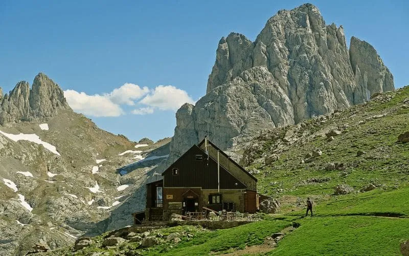
Today you set off from Sotres for your first stage. After just over a kilometre, you'll pass the 'Invernales del Texu', a sort of abandoned village built by shepherds to shelter their flocks in winter. The path then climbs, offering magnificent views of Naranjo de Bulnes (also known as Picu Urriellu), one of the most striking peaks in the Picos de Europa. Continuing through green valleys where cows graze, you’ll pass Refugio de la Terenosa, where you can stop for a drink. On the way you'll pass the Refugio de la Terenosa, where you can stop for a drink before the steady climb. The path becomes increasingly rocky and the views more rugged. You might even spot an ibex high up on the rocks!

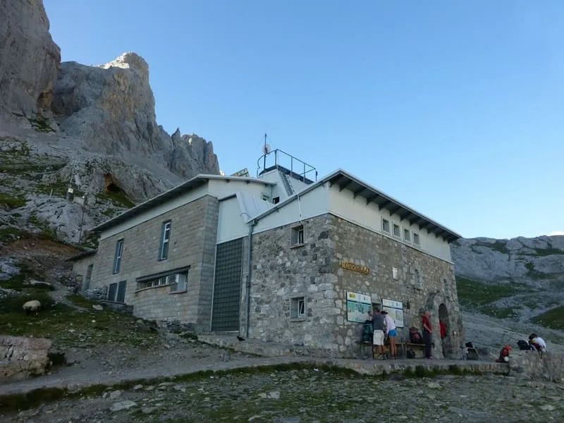
Your destination for the day is the Refugio de Urriellu, at the foot of Picu Urriellu. The current building has been in use since 1990, and due to its remote location, construction materials were brought in by Spanish Army Chinook helicopters. During your stay, you're likely to meet Tomás Fernández López, who has been the hut's manager since 1991 and knows the area like no other.

Refugio Vega de Urriellu

Info
Refugio Vega de Urriellu
Day
2

Refugio Vega de Urriellu - Fuente Dé

Duration: 05:35 h
Distance: 10.6 km
Ascent: 520 m
Descent: 1390 m

Your day begins at Refugio Vega de Urriellu, nestled beneath the dramatic Picu Urriellu (also known as Naranjo de Bulnes). From the hut, the trail heads southwest, descending through the Garganta del Jou Sin Tierre, surrounded by towering peaks like Torre del Pomelo (2326 m). From here, take the path on the left, which follows the "El Anillo de Picos" route past Garganta de los Boches. Shortly after, the trail splits in two, both leading to Collado Horcados Rojos. We recommend taking the left-hand path, as the right one includes a very steep and exposed section.

At Collado Horcados Rojos, you’ll rejoin the original route. From here, the trail turns southeast and crosses the spectacular Horcados Rojos area—one of the highlights of the trek and a perfect spot for photos!

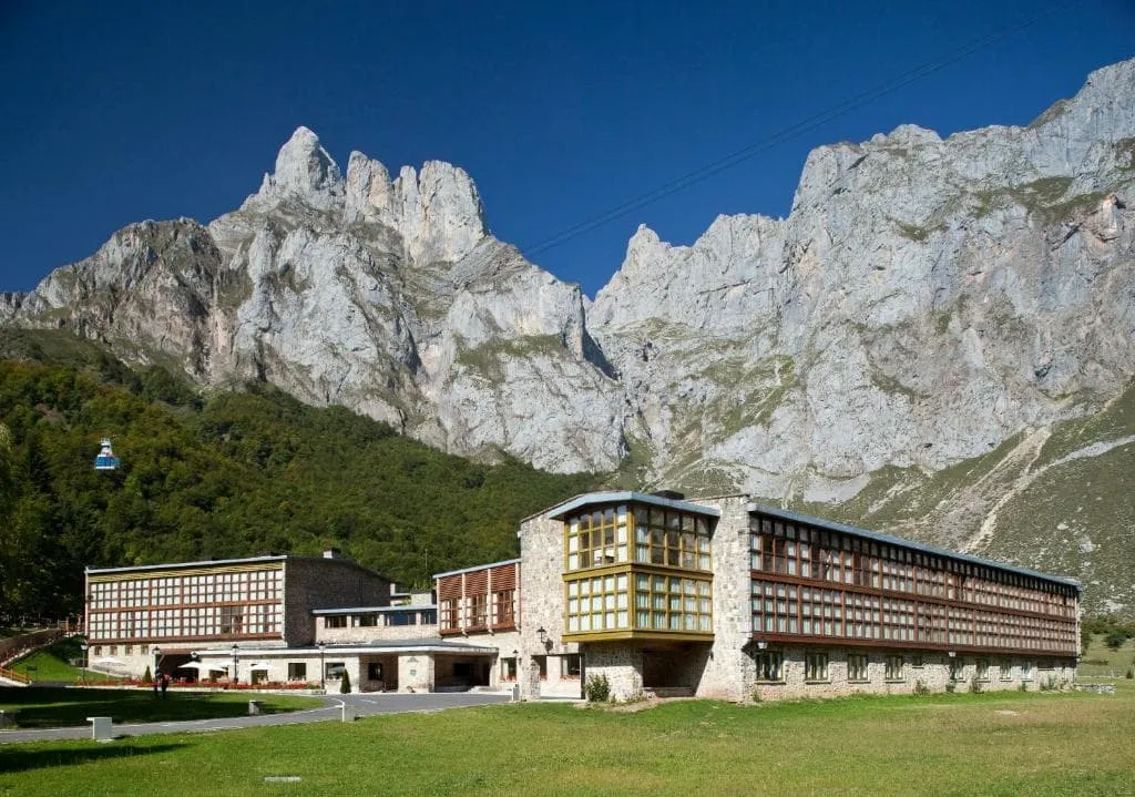
Once you reach the Mirador de El Cable, you are very close to the cable car station that takes you down to Fuente Dé. Take this to avoid a steep and long descent and enjoy the views of open pastures and scattered beech woods. The rolling alpine meadows contrast sharply with the jagged peaks, with herds of cows and horses grazing peacefully in the distance. Congratulations, you have reached Fuente Dé, the end of your second stage - now you can relax after a long day's trekking!

Note: Today is one of the most challenging days, especially the first third of the stage (about 4 km on T3 trails), as it includes a potentially dangerous section. Please be aware of your own walking ability and the difficulty of the trail—take your time and mind your step.

Parador de Fuente Dé (Fuente Dé)

Info
Parador de Fuente Dé (Fuente Dé)
Day
3

Fuente Dé - Refugio Collado Jermoso

Duration: 05:45 h
Distance: 9 km
Ascent: 1150 m
Descent: 200 m

The route from Fuente Dé to the Collado Jermoso Refuge is one of the most spectacular in the Picos de Europa, combining forests, alpine meadows and high mountain terrain with breathtaking views.

From Fuente Dé, the route gradually climbs along a path that crosses the beautiful Áliva Valley, surrounded by the peaks of the Oriental Massif. The route enters a more rugged landscape and crosses the Vega de Liordes, a wide plateau surrounded by imposing rock faces. Here begins the most demanding part of the route, with a steep climb along the Canal de Pedabejo to the Collado de Pedabejo (1,900m), where the views of the central macizo of the Picos de Europa are spectacular.

The final stretch follows an aerial path with impressive panoramic views to the Collado Jermoso Refuge (2,064m), one of the best situated refuges in the entire mountain range. The reward for this strenuous day is the famous sunset over the mountains, one of the most iconic of the Picos de Europa.

Refugio Collado Jermoso

Info
Refugio Collado Jermoso
Day
4

Refugio Collado Jermoso - Espinama

Duration: 07:00 h
Distance: 13.5 km
Ascent: 370 m
Descent: 1520 m

Leaving the refugio behind, this stage begins by retracing your steps back toward Fuente Dé. The morning is marked by a steep and technical descent through rocky switchbacks that demand careful footing. As you descend, the imposing limestone walls of the Torre del Llambrión (2,647m) dominate the skyline and provide an impressive backdrop.

The route re-enters the Vega de Liordes, a vast alpine meadow surrounded by towering peaks—an ideal place for a break before continuing down. From here, the path follows an old mining track and zigzags through the Canal del Embudo, where the high alpine terrain gradually gives way to lush forests.

Reaching Fuente Dé, the trail levels out and picks up the Camino de Fuente Dé, a historic route lined with beech forests and mountain streams. From there, it continues along the River Deva to Espinama, where you can celebrate the end of another rewarding stage with a well-earned rest in this charming mountain village.

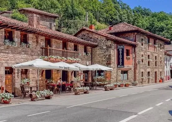
Posada Maximo (Espinama)

Info
Posada Maximo (Espinama)
Day
5

Espinama - Sotres

Duration: 05:45 h
Distance: 14.5 km
Ascent: 730 m
Descent: 580 m

The last day of your adventure starts in Espinama and follows a scenic route and the second half along the River Duje, which cuts through the Valle de Áliva. The route climbs gradually, offering a gentle but steady climb through alpine meadows, with the imposing peaks of the Picos de Europa towering above.

Continuing north, you'll pass Portilla del Boquejón, a mountain pass with breathtaking views of the valley behind you and the rugged limestone terrain ahead. Soon you'll reach the Ermita de la Virgen de la Salud, a small chapel in a peaceful highland setting that marks the highest point of today's walk.

From here the descent begins as you make your way through the Vegas de Sotres, a vast open pasture where cattle graze under the watchful eye of the surrounding peaks. Along this stretch you'll find a natural spring, the perfect place to fill your water bottle before the final descent. Finally, the trail leads to Sotres, the highest village in the Picos de Europa, where your journey ends - the perfect opportunity to celebrate with a well-deserved Asturian meal!

Included

  • Full travel guide

    You’ll receive access to our trekking app, which serves as your complete digital travel guide for the Picos de Europa. Inside, you’ll find everything you need for your trek: route descriptions, hiking maps, navigation support, payment information, and all the key details specific to your journey.

  • Hotels, Hostels or Huts

    We arrange your accommodation on the Picos de Europa in hotels, hostels or huts along the way. We have selected accommodations on our trek based on the length of each stage and recommendations from hikers who have gone before us on the Picos de Europa.

  • Half-board in Huts

    Accommodation at the huts includes dinner and breakfast. We will arrange this for you as well. This allows you to travel lighter and have one less thing to worry about. Bear in mind that lunch is not included, but it can be purchased at the huts. Here you can also buy an array of snacks and bottled water.

  • Breakfast in hotels (where possible)

    Accommodation in the hotels includes breakfast whenever possible. We will arrange this for you as much as possible in advance. Please note that lunch and dinner are not included, but can be ordered at the accommodation or in the village.

  • Navigation support

    Our trekking app also includes built-in navigation support. With GPS-based maps and offline access, you can follow the trail confidently and stay on route even without mobile signal.

Excluded

  • Traveling to and from

    You have to make your own way to the starting point. The total amount does not include personal transport.

  • Transfers

    Should you need any form of (public) transport on location, this is not part of the trekking package. This includes the use of taxi, bus, cable cars, gondolas, ferries, etc.

  • Travel Insurance

    Your international travel insurance is your own responsibility. Discuss your itinerary with the insurance company before your trek.

  • Personal expenses

    Personal expenses on such as souvenirs, drinks, and other similar expenses are for your own account.

FAQ

  • Is a Hut-To-Hut Trek in Picos de Europa Suitable for Me?

  • What is the Best Season for the Picos de Europa?

  • How to Travel to Picos de Europa?

  • How to Get To the Starting Point of the Picos de Europa Trek

  • End point: Sotres

  • What if the dates I want are not available?

  • If I book now, can I immediately arrange the rest of my trip?

  • How do I know if this trek is right for me?

How to Book

  • Booking

  • Availability

  • Cancellation policy

Reviews

Reviews