Advanced Traverse of the 3 Refuges: Posets-Maladeta NP

Duration: 4 days
Trails: T2 trails
Distance: 0 - 10 km per day
Ascent per day: 500 - 1000 m ascent per day

> Trek around Pico Posets/Tuca de Llardana (3,375 m), the 2nd-highest in the Pyrenees
> Cross high passes and wild alpine terrain over 4 demanding days
> Sleep in traditional Pyrenean huts

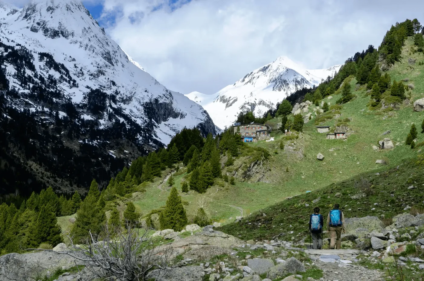
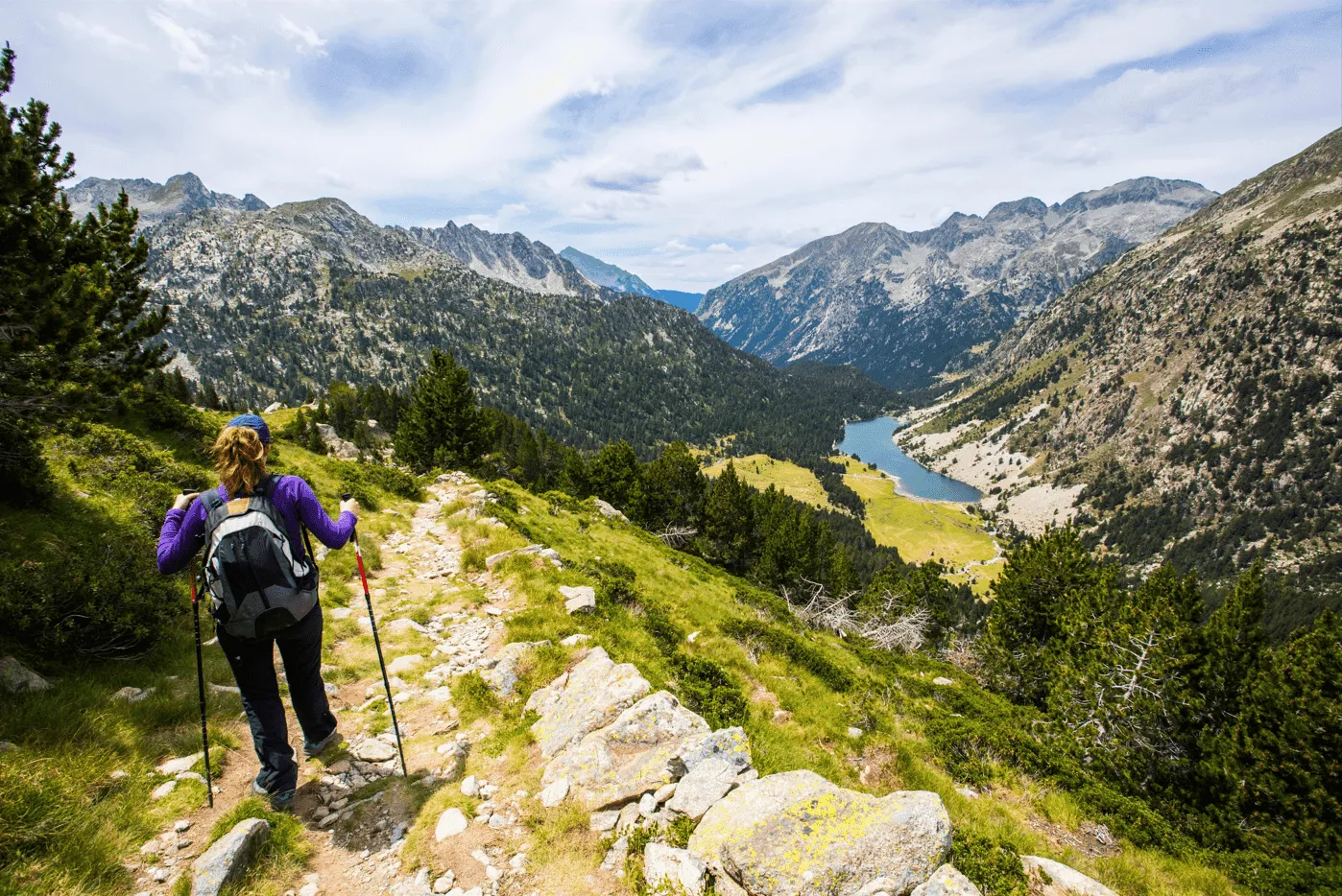
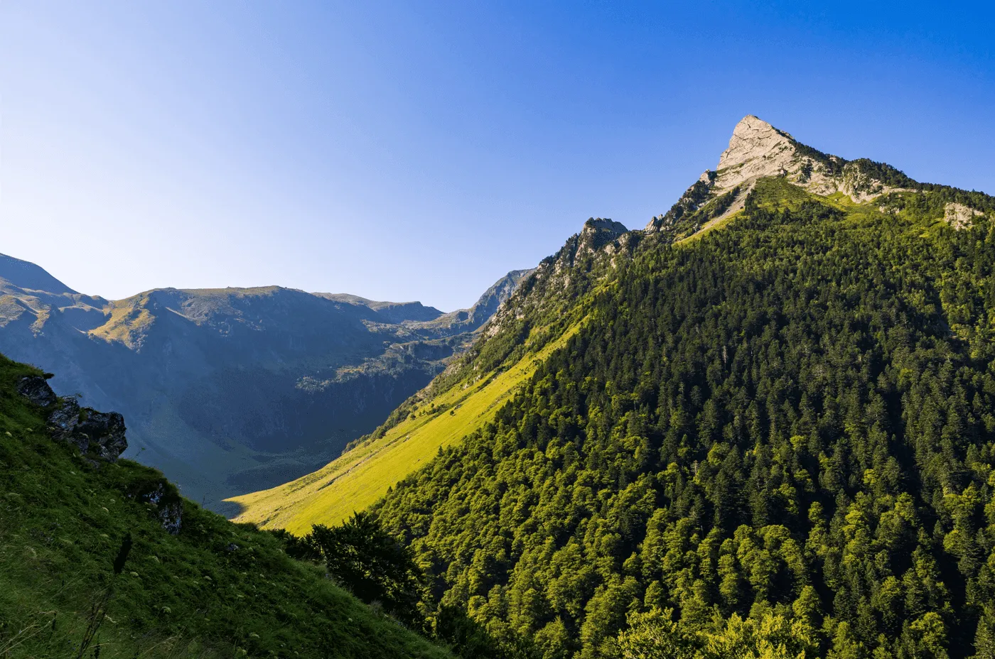
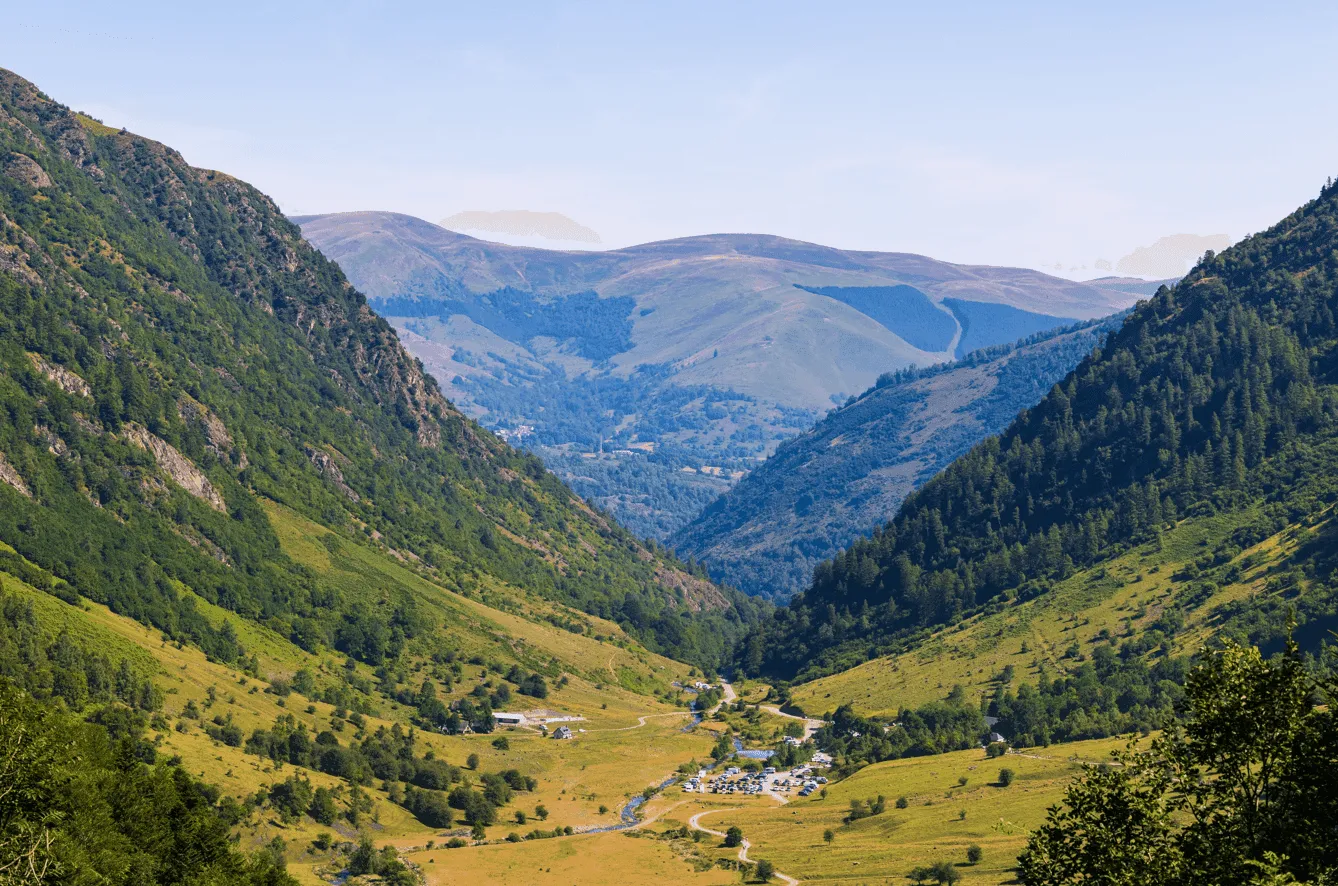
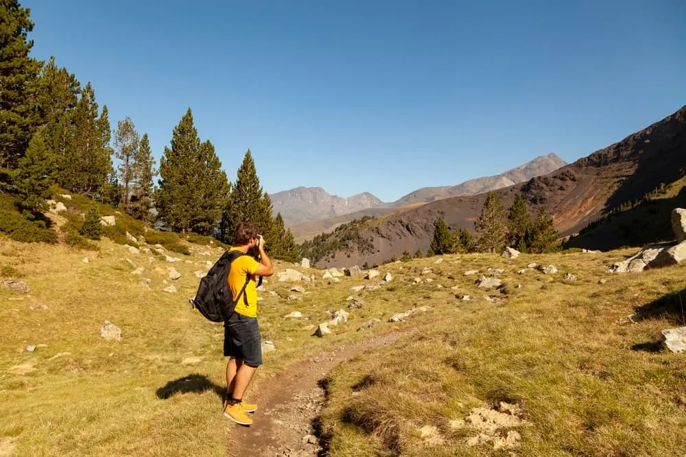
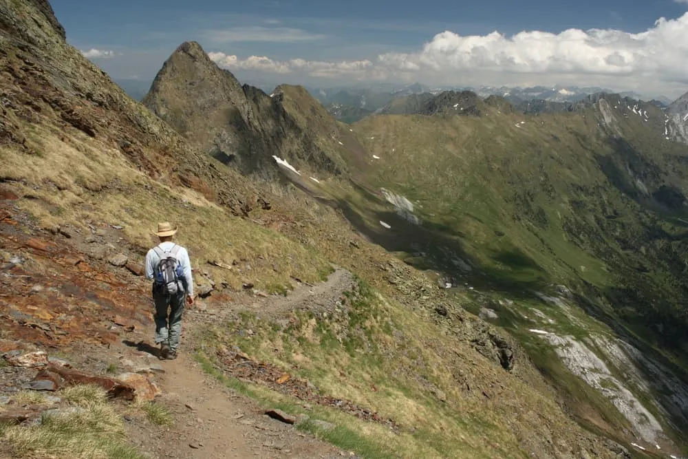
This 4-day advanced trek is a spectacular loop around the mighty Pico Posets in the Posets-Maladeta Natural Park. Designed for experienced hikers, the route connects three iconic mountain refuges via high passes, glacial valleys, and panoramic ridgelines. Ready for a full immersion into the raw beauty of the Spanish Pyrenees?

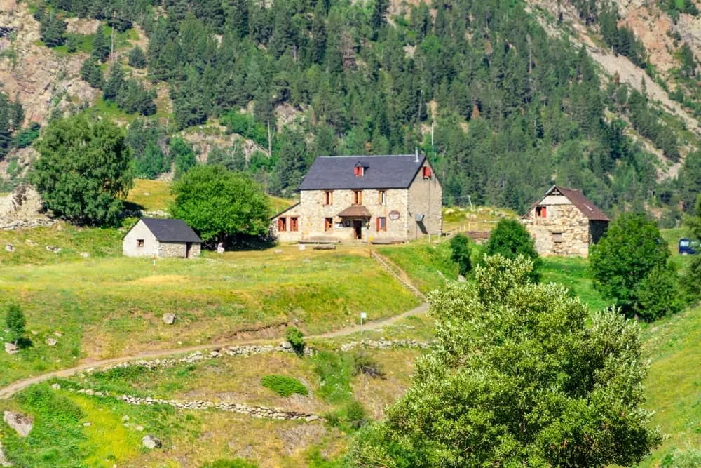
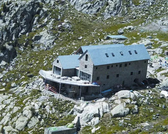
You’ll overnight in Refugio de Estós, Refugio de Viadós, and Refugio Ángel Orús, all set in remote, breathtaking locations. Expect steep climbs, rocky trails, and jaw-dropping views at every turn. If you’re ready for a challenge and want to experience the wilder side of the Pyrenees, this traverse delivers.

Itinerary

Day
1

Valle de Estós - Refugio de Estós

Duration: 02:50 h
Distance: 8.3 km
Ascent: 560 m
Descent: 10 m

This stage starts off gently as you leave the Valle de Estós car park and follow the wide forest track into one of the most beautiful glacial valleys in the Posets–Maladeta Natural Park. The route steadily ascends through pine forests, meadows and open valleys, where the peaks of Perdiguero and Clarabides begin to appear in the distance.

Shortly after setting off, you will reach the Embalses de Estós reservoirs, which are located alongside the Estós River. As you progress deeper into the valley, the landscape opens up to reveal broad pastures dotted with streams, picturesque bridges such as the Aiguacari Bridge and charming traditional shepherd's huts such as the Santa Ana Cabin and the Cabaña del Tormo. The latter is nestled next to the Tuca Gargallosa peak (1,800 m). At the Estós–Batisielles junction, take the path on your right to enter the forested area of La Mosculuera. Shortly after kilometre 5, be sure to visit the Mirador de Gorgas de los Galantes to admire the stunning waterfall.

The final stretch follows the river upstream until the Refugio de Estós comes into view. Perched on a grassy terrace, the refuge boasts superb views and is surrounded by classic Pyrenean scenery. The wide path and moderate gradient make this an accessible and enjoyable introduction to the traverse, allowing you to settle into the rhythm of the trek. With its welcoming atmosphere and mountain backdrop, the refuge is the perfect place to spend the night before tackling the more challenging stages ahead.

Refugio de Estós

Info
Refugio de Estós
Refugio de Estós
Day
2

Refugio de Estós - Refugio de Viadós

Duration: 05:25 h
Distance: 11.2 km
Ascent: 720 m
Descent: 860 m

From the stone refuge in the Estós Valley, this challenging route ascends to the high Puerto de Chistau Pass (2,572 m) to later descend into the secluded Gistaín Valley, where the welcoming Viadós Hut awaits. Throughout the day, views open up to the surrounding 3,000-metre peaks and wild hanging valleys.

From the Refugio de Estós, the route ascends along a clear path into the upper valley and soon gets close to the impressive Cascada de Clarabide waterfall. Steeper trails lead to port of Chistau and on to a traverse under the rocky flanks of Pico Chistau (2,794 m). Enjoy the spectacular views of Posets and the Clarabide peaks as you reach the high altitude watershed. Beyond the pass, the trail drops onto stony downhill slopes towards the Pleta de Añes Cruces.

You will pass the simple Cabane d'Anescruses, while the path eases into grassy pastures and forest, crossing streams and old shepherd terraces. Then, you will join a track above the Río Cinqueta walking towards the hut. On the way, enjoy views towards both Barranco del Milá y Barranco de Añés. A final gentle descent will bring you to the Refugio de Viadós, which is set among traditional bordas and meadows. Here, you can enjoy a hot meal and a rest before the next day

Refugio de Viadós

Info
Refugio de Viadós
Refugio de Viadós
Day
3

Refugio de Viadós - Refugio Ángel Orús

Duration: 06:10 h
Distance: 11 km
Ascent: 1130 m
Descent: 750 m

This challenging mountain route takes you from the lush pastures surrounding the Refugio de Viadós to the picturesque location of the Refugio Ángel Orús. Along the way, you will visit high lakes and pass through a panoramic pass between the Posets and Eriste massifs. Expect steep, rocky paths, long ascents and sweeping views of soaring peaks.

The path crosses several barranco streams and climbs steadily through forests and meadows before emerging from the trees and continuing along open slopes beneath the northern buttresses of Posets. Next, a clear mountain trail follows the Barranco de la Ribereta, passing relatively close to the Millares waterfall and some shepherd's huts. The path then steepens, becoming more challenging as it winds its way through flowery meadows and rocky steps towards Forqueta Pass, the highest point of the day at 2,840 metres. From here, it descends to the cirque that holds the beautiful Ibón de Lardaneta lake, situated at an altitude of 2,676 metres.

Skirting the lake's shore, the route continues downwards across broken terrain, running parallel to the Torrent de la Ribereta in the namelike valley. After crossing a metal bridge, a rough descent on narrow switchbacks begins. Later, the view opens up and the path becomes gentler, leading directly to the Refugio Ángel Orús via grassy and dwarf pine terraces. Take time to enjoy the terrace and its views of the surrounding peaks.

Refugio Ángel Orús

Info
Refugio Ángel Orús
Refugio Ángel Orús
Day
4

Refugio Ángel Orús - Valle de Estós

Duration: 06:35 h
Distance: 13.7 km
Ascent: 640 m
Descent: 1430 m

From the balcony of the Ángel Orús refuge, you will ascend to Eriste before descending through a series of lakes into the lush, green valley of Estós. On the ascent, you will encounter rocky paths, and on the descent back towards the valley floor, the path is long and sometimes steep.

From the hut, a clear path climbs, crossing the Aigüeta de Eriste stream via short zigzags. You will soon emerge from the dwarf pines onto open slopes. The route then rises steadily, with a challenging section of about 5.5 km from Torrent de Lardaneta to the Ibón de l'Aigüeta de Batisielles. You will then reach the stunningly beautiful Ibón de Eriste, where you can enjoy breathtaking views of the Posets mountain range and the intricate ridges of the distant peaks. Beyond this point, the trail undulates across the high terrain, passing Ibón de la Plana and Plana Pass, the highest point of the day at 2,680 metres.

You will then start walking downhill, passing Ibón Grande de Batisielles on the way to the meadows. A long descent then begins, passing Fuente de Coronas and Cabaña de Santa Ana. The final kilometres follow tracks alongside the Río Estós, leading gently down to the valley. The trek ends here, with easy access to Benasque and other villages in the valley. Well done!

Included

  • Full travel guide

    You’ll receive access to our trekking app, which serves as your complete digital travel guide for the Posets-Maladeta Tour. Inside, you’ll find everything you need for your trek: route descriptions, hiking maps, navigation support, payment information, and all the key details specific to your journey.

  • Accommodation

    During your Posets-Maladeta Tour, you will spend your nights in mountain huts. In the mountain huts we normally only book dormitories, but we can look into private rooms on request. If the private rooms are fully booked or not available in the hut, we automatically book a bed in dormitories for you. Please note that private rooms are more expensive and there will be an additional charge for this.

  • Half-board in Huts

    Accommodation at the huts includes dinner and breakfast. We will arrange this for you as well. This allows you to travel lighter and have one less thing to worry about. Bear in mind that lunch is not included, but it can be purchased at the huts. Here you can also buy an array of snacks and bottled water.

  • Navigation support

    Our trekking app also includes built-in navigation support. With GPS-based maps and offline access, you can follow the trail confidently and stay on route even without mobile signal.

Excluded

  • Traveling to and from

    You have to make your own way to the starting point. The total amount does not include personal transport.

  • Transfers

    Should you need any form of (public) transport on location, this is not part of the trekking package. This includes the use of taxi, bus, cable cars, gondolas, ferries, etc.

  • Lunch

    Half-board is included in the price of this trek. Lunch, however, is not. You can get something to eat at the mountain huts along the way.

  • Travel Insurance

    Your international travel insurance is your own responsibility. Discuss your itinerary with the insurance company before your trek.

  • Personal expenses

    Personal expenses on such as souvenirs, drinks, and other similar expenses are for your own account.

FAQ

  • Starting Point: Valle de Estós Parking

  • End Point: Valle de Estós Parking

  • What if the dates I want are not available?

  • If I book now, can I immediately arrange the rest of my trip?

  • How do I know if this trek is right for me?

How to Book

  • Booking

  • Availability

  • Cancellation policy