Beginner Dirigée De Luchon

Duration: 4 days
Trails: T2 trails
Distance: 0 - 10 km / 0 - 6 mi per day
Ascent per day: 500 - 1000 m / 1640 - 3281 ft ascent per day

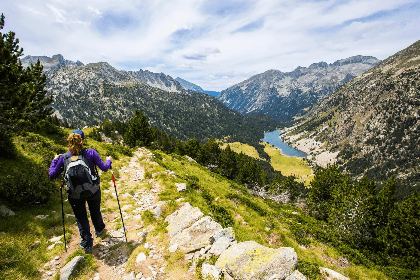
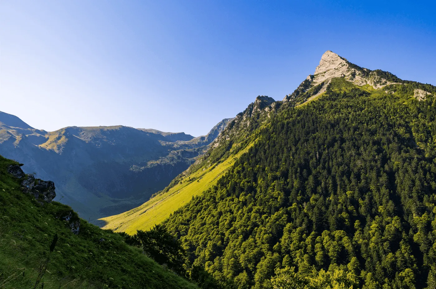
> From forest to open pasture
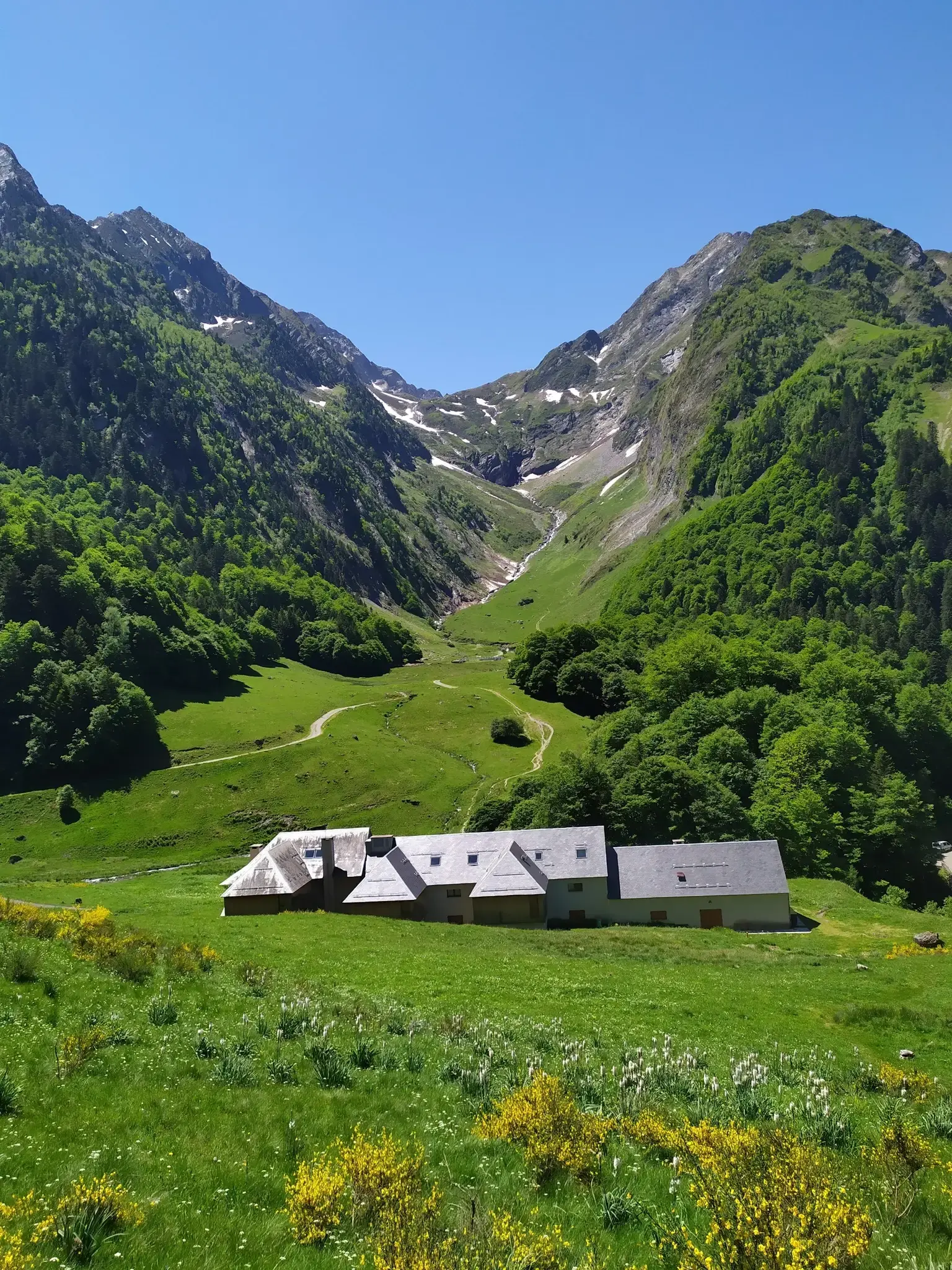
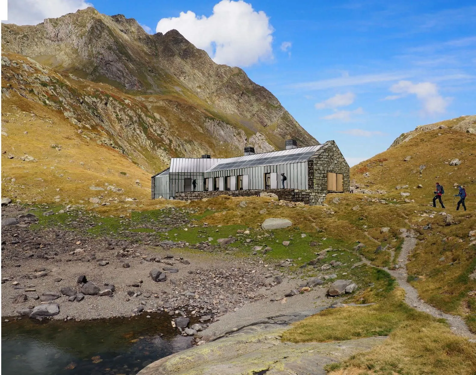
> Sleep in Pyrenean mountain huts
> Cross into Spain via Port de Vénasque

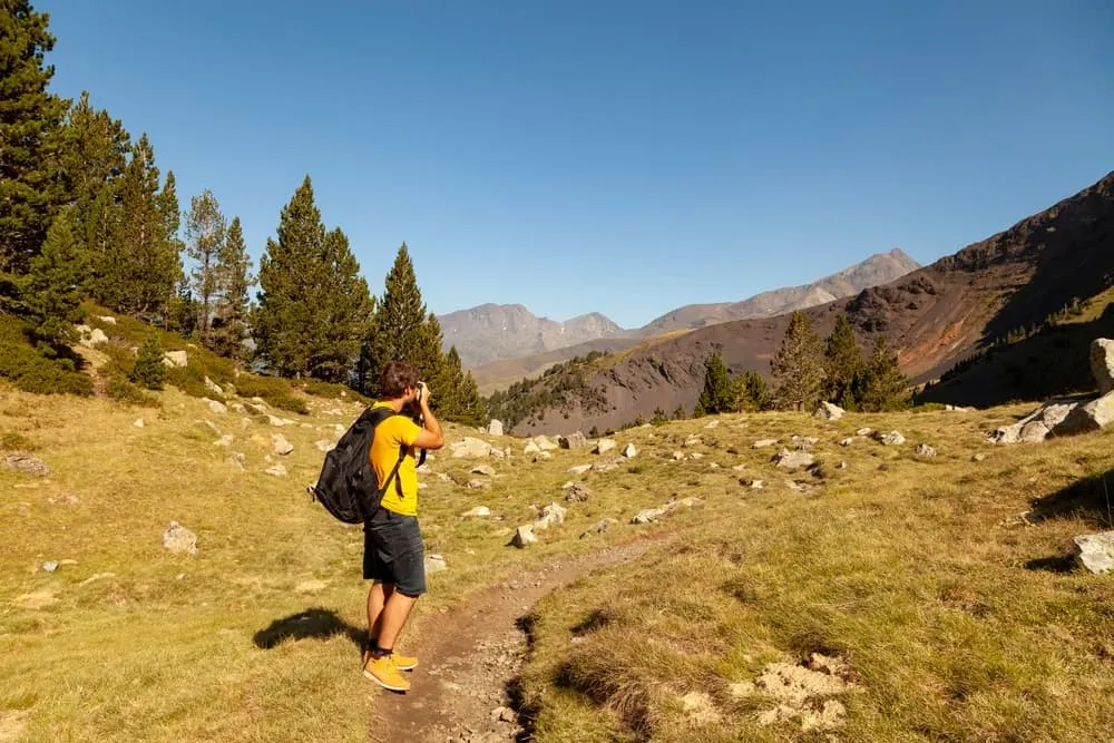
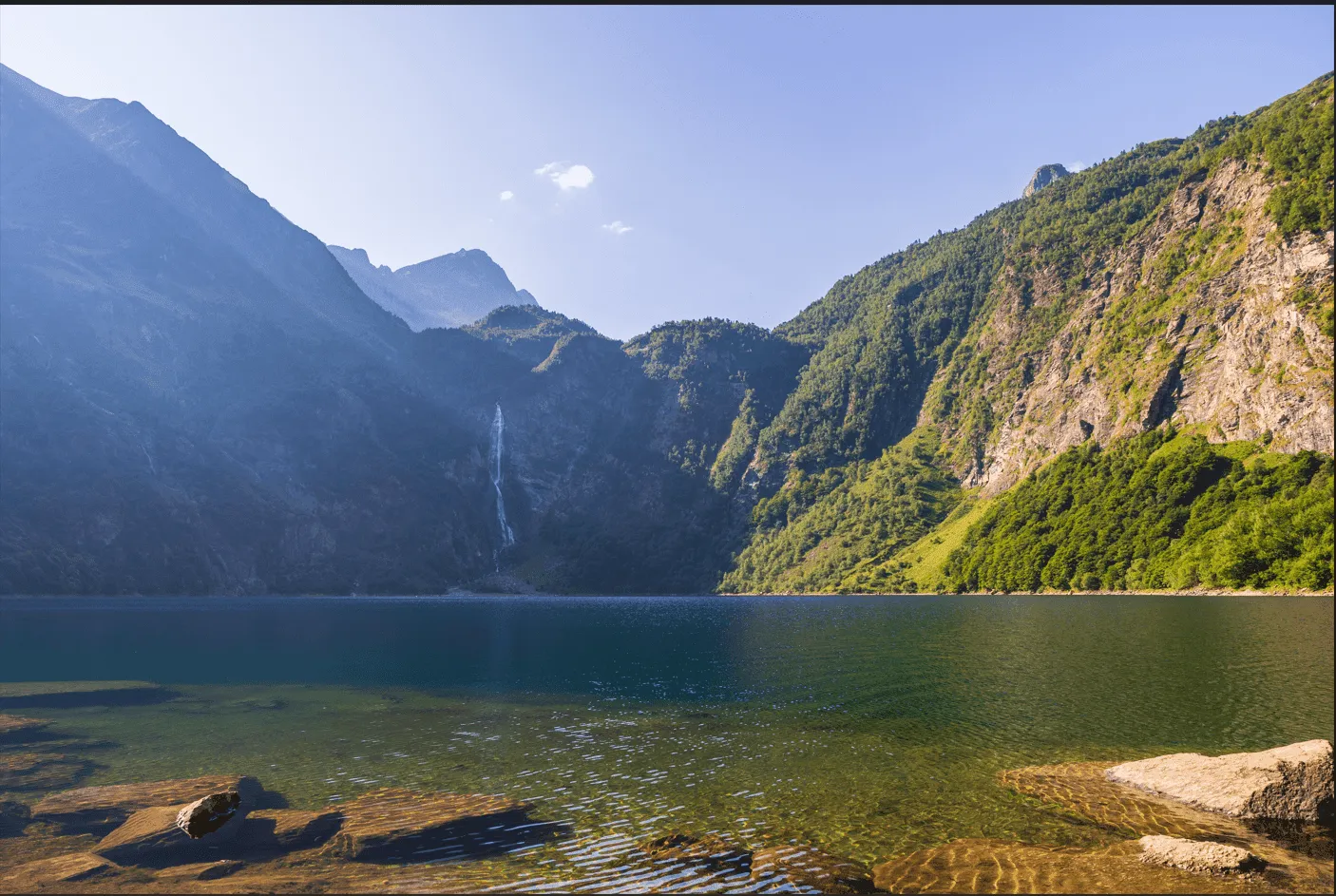
There is a memorable moment on this trek, often just after you step above the final band of trees leaving Bossòst, when the landscape suddenly opens and the full sweep of the mountains appears at once. The cool valley drops away behind you, wide grassy slopes stretch forward, and the frontier ridge rises in clean lines against the sky. Later, near the Vénasque lakes, the scenery changes again: deep blue water beneath steep rocky walls, open plateaus, and the calm sense of being fully surrounded by high Pyrenean terrain.

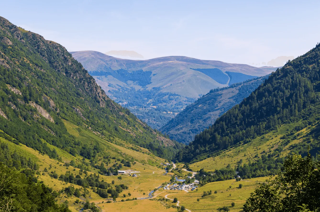
Across four days, the route carries you from the quiet woods of Val d’Aran to the historic Hospice de France, climbs into the high-mountain basin around the Boum de Vénasque, and then descends into the green meadows of the Artiga de Lin. The final approach into Vielha gently transitions from wild landscapes to village life. It’s an ideal trek for hikers looking for an accessible yet varied multi-day experience, with comfortable refuges to welcome you each evening.

Itinerary

Day
1

Bossost - Hospice de France

Duration: 02:59 h
Distance: 7.38 km / 4.6 mi
Ascent: 530 m / 1739 ft
Descent: 440 m / 1444 ft

Leaving the village of Bossòst, the route starts on a quiet forest path that climbs gently through beech and fir trees. The first part of the walk is shaded and peaceful, with soft ground underfoot and small streams running alongside the trail. As you make your way uphill, the forest slowly opens up and glimpses of the surrounding mountains begin to appear.

After a while, the trees give way to wide, grassy hillsides. The terrain becomes more open, the views get bigger, and the path turns into a clear track across the high pastures of the Val d’Aran. This middle section feels bright and spacious, with long views towards the ridges near Còlh de Barèja and the gentle plateau of Campsaure.

Once the meadows are crossed, the trail dips back into a patch of forest on the French side of the ridge. Here the atmosphere changes again: mossy stones, cool shade, and a quieter, more enclosed path lead you down toward the valley. When the trees finally part, the landscape opens suddenly, revealing the wide glacial valley of the Hospice de France. A short, easy final stretch brings you to the refuge, surrounded by grassy terraces and steep mountain walls.

Hospice de France

Info
Hospice de France
Hospice de France
Day
2

Hospice de France - Refuge de Vénasque

Duration: 03:01 h
Distance: 5.23 km / 3.2 mi
Ascent: 860 m / 2822 ft

From the Hospice de France the trail begins gently, crossing open grassy slopes with wide views into the surrounding valley. The path is easy to follow and gives you a chance to warm up your legs before the climb begins in earnest. Soon the terrain steepens and you reach a long series of zigzags that carry you up the mountainside. These switchbacks are well-built and steady, allowing you to gain height quickly while the views behind you grow broader with every turn.

Higher up, the landscape becomes much more alpine. The grassy slopes fade away and the ground turns into a mix of rock, gravel and scattered boulders. The path winds across open, exposed terrain, with rugged ridges rising on both sides and deep shadowed valleys far below. This part of the stage feels wild and dramatic, with constant panoramic views that make the effort of the climb more than worthwhile.

As you reach the final section, the ground levels out and the trail traverses a high, stony plateau. Here the atmosphere is unmistakably high-mountain, quiet and expansive. Just before the refuge comes into view, the landscape opens suddenly to reveal a series of beautiful mountain lakes. The largest, the Boum de Vénasque, lies deep and blue in its rocky basin, while smaller lakes sit just above it. A short walk brings you to the Refuge de Vénasque, perched above the water and surrounded by towering peaks.

Refuge de Vénasque

Info
 Refuge de Vénasque
Refuge de Vénasque
Day
3

Refuge de Vénasque - Refugio de la Artiga de Lin

Duration: 04:05 h
Distance: 8.88 km / 5.5 mi
Ascent: 410 m / 1345 ft
Descent: 1180 m / 3871 ft

When you leave the Refuge de Vénasque, you immediately walk through an impressive high-mountain landscape. The trail crosses a rocky plateau dotted with small lakes, while the deep blue Boum de Vénasque lies just below. The path is easy to follow and feels wide and open, with rugged peaks rising on all sides and a true sense of being deep in the Pyrenees. It’s a beautiful and tranquil start to the day.

As the route continues, the terrain gradually narrows and guides you toward the Port de Vénasque, the natural pass that forms the border between France and Spain. The final approach to the pass climbs steadily on a clear zigzagging path carved into the rock. At the top, a fantastic viewpoint opens up: you can look far into both countries, with peaks, valleys and lakes stretching out in every direction. The descent on the Spanish side begins right away, following a long series of tight hairpin turns that safely lead you down the steep mountainside. The scenery changes quickly here, shifting from bare, rocky slopes to gentler grasslands as you lose altitude.

Lower in the valley, the trail becomes softer and enters a stretch of forest, where the shade and greenery are a welcome change after the exposed descent. The final part of the stage crosses open meadows and follows a calm track through the trees. As the terrain becomes flatter, the surroundings turn lush and peaceful, with streams and woodland all around. Soon the Refugio de la Artiga de Lin comes into view on a grassy clearing — a quiet, scenic spot that marks the end of this varied and memorable mountain stage.

Refugio de la Artiga de Lin

Info
Refugio de la Artiga de Lin
Day
4

Refugio de la Artiga de Lin - Vielha

Duration: 06:10 h
Distance: 16.3 km / 10.1 mi
Ascent: 730 m / 2395 ft
Descent: 1230 m / 4035 ft

Leaving the Refugio de la Artiga de Lin, the stage begins in a peaceful mountain meadow surrounded by dense forest and steep valley walls. A wide, easy path leads you gently downhill across open grasslands before entering a shaded woodland. The trail passes through tall trees, and the nearby river becomes visible at several points as it moves over stones in the valley. This first section is sheltered and calm, offering a straightforward start to the day.

As you continue, the forest gradually thins and the valley opens up again. The path crosses a mix of light woodland and broad pastures, offering relaxed walking on smooth ground. Here the scenery becomes quieter and more rural, with rolling fields and scattered clearings. The route is never steep or demanding, making this middle section very comfortable as you approach the lower end of the valley.

The final part leads onto wider tracks and easy walking paths that guide you toward the first houses near Vielha. You cross small bridges, walk past open fields, and soon the trail merges with roads leading into town. The transition from nature to village happens gradually: first isolated homes, then residential streets, and finally the center of Vielha itself. It’s a smooth approach that marks the end of the trek in a well-serviced Pyrenean town.

Included

  • Full travel guide

    You’ll receive access to our trekking app, which serves as your complete digital travel guide for the Posets-Maladeta Tour. Inside, you’ll find everything you need for your trek: route descriptions, hiking maps, navigation support, payment information, and all the key details specific to your journey.

  • Accommodation

    During your Posets-Maladeta Tour, you will spend your nights in mountain huts. In the mountain huts we normally only book dormitories, but we can look into private rooms on request. If the private rooms are fully booked or not available in the hut, we automatically book a bed in dormitories for you. Please note that private rooms are more expensive and there will be an additional charge for this.

  • Half-board in Huts

    Accommodation at the huts includes dinner and breakfast. We will arrange this for you as well. This allows you to travel lighter and have one less thing to worry about. Bear in mind that lunch is not included, but it can be purchased at the huts. Here you can also buy an array of snacks and bottled water.

  • Navigation support

    Our trekking app also includes built-in navigation support. With GPS-based maps and offline access, you can follow the trail confidently and stay on route even without mobile signal.

Excluded

  • Traveling to and from

    You have to make your own way to the starting point. The total amount does not include personal transport.

  • Transfers

    Should you need any form of (public) transport on location, this is not part of the trekking package. This includes the use of taxi, bus, cable cars, gondolas, ferries, etc.

  • Lunch

    Half-board is included in the price of this trek. Lunch, however, is not. You can get something to eat at the mountain huts along the way.

  • Travel Insurance

    Your international travel insurance is your own responsibility. Discuss your itinerary with the insurance company before your trek.

  • Personal expenses

    Personal expenses on such as souvenirs, drinks, and other similar expenses are for your own account.

FAQ

  • Starting Point: Bossòst

  • End Point: Vielha

  • What if the dates I want are not available?

  • If I book now, can I immediately arrange the rest of my trip?

  • How do I know if this trek is right for me?

How to Book

  • Booking

  • Availability

  • Cancellation policy