
Central Circuit Rwenzori Mountians Trekking
Duration: 8 days
Trails: T3 trails
Distance: 10 - 15 km per day
Ascent per day: 500 - 1000 m ascent per day
> Maximimal summit success
> Amazing views
> One of the remote routes
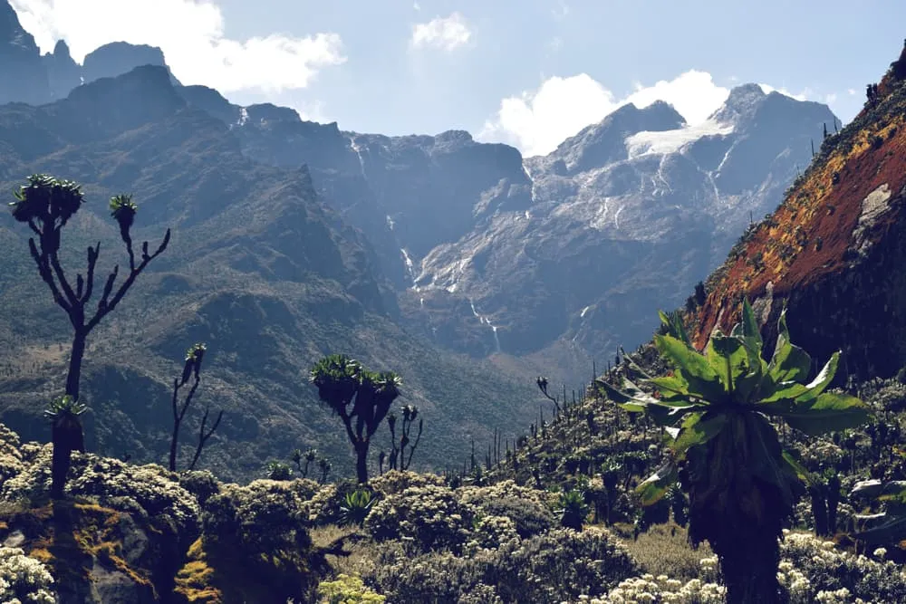
8 Days Climbing Rwenzori Mountain via the central circuit is an adventure of a lifetime, due to its amazing views and remoteness. This route maximizes the chances for summit success rate by many hikers. In this 8 day Rwenzori Mountains climb via the central circuit route, you will profit from a large extent of acclimatization on the mountain by walking long stretches on the mountain and slighter altitude gains. The Rwenzori Central Circuit Trail is one of the most remote routes that you don't want to miss out!
This trek is operated by
Itinerary
Day
1
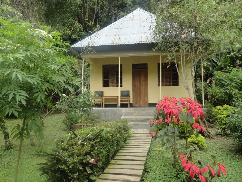
Transfer to Ruboni Community Camp
You will be welcomed by an experienced and professional tour guide of Rwenzori Mountaineering Service from Kampala and start the journey with a drive to Kasese town which is the next biggest town to Rwenzori Mountains national park, lunch will be en route as it will be advised by the safari guide. The journey is likely to take you around 7-8 hours and Dinner and overnight are planned to be at Ruboni Community Camp.
Ruboni Community Camp
Day
2
Ruboni Community Camp – Nyabitaba
Duration: 03:20 h
Distance: 6.5 km
Ascent: 930 m
Descent: 20 m
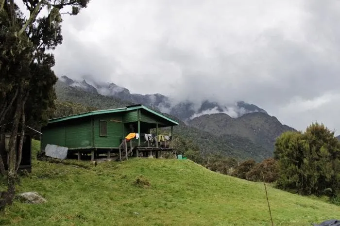
You will have early morning breakfast and head to the briefing point for Rwenzori mountain hiking tour from the experienced Rwenzori national park rangers and Rwenzori Mountaineering services Team ( R M S) and later start the hike at around 8 am through the bamboo, high elephant grass, and dense bushes. You will climb some rocks and bluff, crossing river Mahoma then to Nyabitaba hut where you will spend the night. You will expect to see some animals like white colobus monkeys, blue monkeys, three-horned chameleon and the Rwenzori turaco along this route. The journey will take you 4-5 hours.
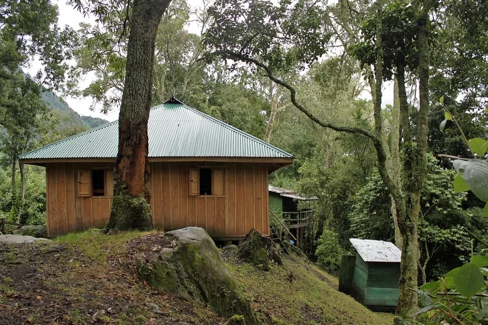
Nyabitaba Hut
Day
3
Nyabitaba to John Matte
Duration: 03:30 h
Distance: 7 km
Ascent: 830 m
Descent: 60 m
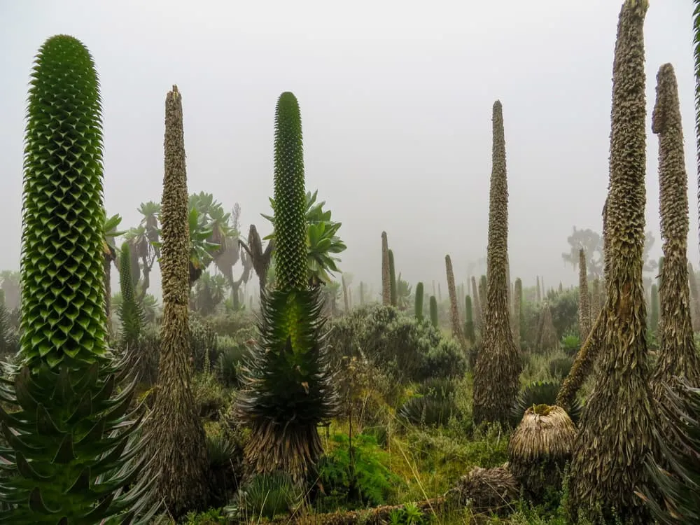
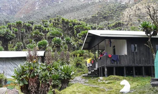
You will move through the forest about half an hour to the Kurt Shafer bridge, the confluence of Mubuku and Bujuku rivers. Then through the bamboo forest. Slippery moss-covered rocks for a couple of hours. Proceed to Nyamulenge rock shelter where you will have a view of mount Stanley. Then you will reach John Matte hut where you will spend the night. This place will offer you a beautiful view of mount Stanley and Margherita glacier.
John Matte hut
Day
4
John Matte to Bujuku
Duration: 03:00 h
Distance: 5.8 km
Ascent: 560 m
Descent: 20 m
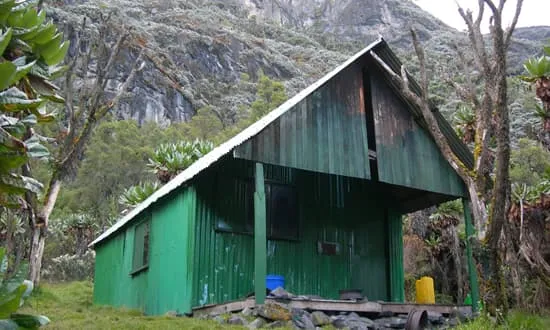
After morning breakfast, Move from John Matte hut across the Bujuku River to the lower Bigo bog. A steep section past the hut leads to upper to Bigo and half of this a boardwalk has been constructed. You will have a lunch break at a beautiful narrow stream at the upper end of this bog. The southern end of the lake is in a majestic setting, with Mt. Baker to the South, Mt. Stanley to the west and Mt. Speke to the north. Dinner and overnight stay at Bujuku Hut.
Bujuku hut
Day
5
Bujuku to Kitandara
Duration: 02:30 h
Distance: 4.6 km
Ascent: 490 m
Descent: 420 m
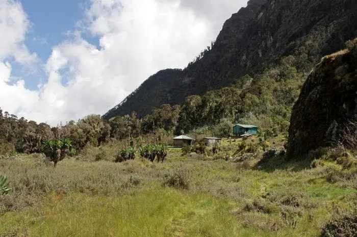
Leave Bujuku hut to a new trail. This trail rises and falls twice before finally climbing steeply about 14,345 ft (4,372 m) to Scott Elliot Pass. While at the steepest section a short strong ladder will help us get by. The ladder will lead to Elena Hut 14,700 ft (4,430 m). You will then continue straight. A few steps below the pass, there is a sheltered spot for a very good break before Elena Hut. This is the base camp for climbing 16,763 feet/5,109m to Margherita peak in the Mt.Stanly Complex and requires an additional day, in case the weather is bad. It can rain, snow, and wind can blow in any season.
Kitandara Hut
Day
6
Kitandara to Guy Yeoman
Duration: 03:00 h
Distance: 6 km
Ascent: 260 m
Descent: 810 m
If you are aiming at Margherita peak (5109m), you will continue to the base of the Stanley Glacier. To reach the summit of Margherita, it will take you about 5-7 hours depending on the weather conditions and the pace of climbing this mountain. This tough walk takes you over three glaciers, slippery rock, ice and very exposed areas which are open on many sides. Note that this climb is for only physically fit and technical climbers. Climb on to the glacier, cross the Stanley Plateau and proceed with the ascent. Acclimatized to fog, altitude sickness and coolly weather, scramble up to the summit of Margherita, the highest peak of the Rwenzoris. Given the high altitude and the tough conditions even if you do not reach the peak, don’t get disappointed. Prepare for your return through the Scott-Elliot pass, where there are spectacular views back to Bujuku Lake and Mount Speke and down to the Kitandara Lakes. After the trail that takes you through an alpine zone of sparse vegetation and rough boulders, descend past the Kitandara Lakes for dinner and overnight stay at the Kitandara Hut
Guy Yeoman Hut
Day
7
Guy Yeoman to Nyabitaba to Nyakalengija
Today, from Guy Yeoman, take on the trail that ascends steeply up the headwall, spreading out from the base of Mount Baker and continuing along the southern side of the mountain to Fresh field Pass. At this point, you can see the Congo to the west and Mount Stanley to the north. From the pass, take on the long trail passing the rock shelter at Bujongolo, the base camp for the historic expedition by the Duke of Abruzzi in 1906. Overnight at Ruboni Community Camp.
Ruboni Community Camp
Day
8
Drive back to Kampala / Entebbe Airport
The guide will pick you up from the camp in the morning after your breakfast and drive you back to Kampala to the airport for your flight back home.
Contact our Trekking Expert
Jan Bakker
Included
Excluded
FAQ
What if the dates I want are not available?
If I book now, can I immediately arrange the rest of my trip?
How do I know if this trek is right for me?
How to Book
Booking
Availability
Cancellation policy
Just for You
