Escapardenne Eislek Trail

Duration: 7 days
Trails: T3 trails
Distance: 15 - 20 km / 9 - 12 mi per day
Ascent per day: 500 - 1000 m / 1640 - 3281 ft ascent per day

> Complete one of the 'Leading Quality Trails - Best of Europe'
> Literally cross the border
> A true escape on foot in the Ardennes

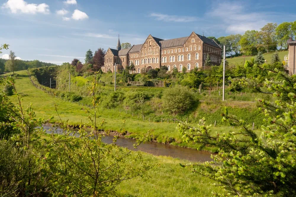
In the Luxembourg and Belgium Ardennes, you will find two of the ‘Leading Quality Trails - Best of Europe’, namely the Lee Trail and the Eislek Trail. These two hikes together are called the Escapardenne Trail. This 159 kilometer long hike is divided into the relatively short Lee Trail. This hike is only 53 kilometers, which can be hiked in 3 days. The remaining 106 kilometers are part of the Eislek Trail.

The Escapardenne Eislek Trail is probably the best-known trail in the Benelux among hikers who want to train for a real hut-to-hut hike in the Alps, and is even sometimes compared to the GR20 on Corsica. Indeed, the deeply incised valleys provide a good number of altimeters in one of the rougher parts of the Ardennes.

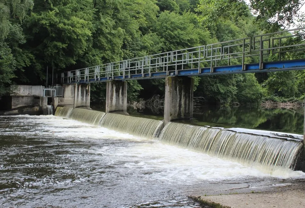
The Eislek Trail is the second part of the Escapardenne Trail and runs from Kautenbach to La Roche-en-Ardenne, in 106 kilometers. This is a long-distance trail that connects the Grand Duchy of Luxembourg with the Walloon province of Luxembourg. So it crosses borders, and not just literally!

In this hike you will again find a lot of variation in the surroundings and you will have considerable ascents and descents. In addition, in this route you will find a compelling history, and the dream of William of Orange is vividly told. It is also possible to take the via ferrata here, if you dare.

Itinerary

Day
1

Arrival in Kautenbach

Today you will have to make your way to Kautenbach. Here, you will spend the night preparing for your Escapardenne Eislek Trail adventure.

Hotel Huberty Kautenbach (Kautenbach)

Info
Hotel Huberty Kautenbach (Kautenbach)
Day
2

Kautenbach - Clervaux

Duration: 08:45 h
Distance: 24 km / 14.9 mi
Ascent: 820 m / 2690 ft
Descent: 660 m / 2165 ft
Lowest Point: 260 m / 853 ft
Highest Point: 470 m / 1542 ft
At the station of Kautenbach you will find the starting point of the Escapardenne Eislek Trail. You start right away with a tough first hiking day, so make sure you leave on time. Soon, after a steep climb, you have a beautiful panoramic view of Kautenbach. Soon you pass the campsite of the same name. After this, the trail leads you past Schüttburg, a castle 85 meters above the valley of the Clerve. The trail continues in the direction of Lellingen over which you have beautiful views just before you descend. You walk a short distance along the railroad track, and this gives you the opportunity to also take a look at Lellingen itself. You continue along the Geeslay rock and walk past the villages of Wilwerwiltz and Enscherange. You continue on forest paths towards Drauffelt, then walk through the Irbich valley. A little further on you have the first beautiful views of the St. Mauritius Abbey of Clervaux, which is getting closer and closer. After a descent you will reach the overnight location for tonight, in Clervaux.

Koener Hotel & Spa (Clervaux)

Info
Koener Hotel & Spa (Clervaux)
Day
3

Clervaux - Moulin d'Asselborn

Duration: 06:50 h
Distance: 19.6 km / 12.2 mi
Ascent: 480 m / 1575 ft
Descent: 470 m / 1542 ft
Lowest Point: 370 m / 1214 ft
Highest Point: 500 m / 1640 ft
Today you leave Clervaux behind, and follow the trail towards the mysterious forest of Beischend. Along the route you will find several memorials, such as a plane shot down by "Friendly Fire" or the Cinqfontaines, and an old monastery built at the beginning of the 20th century. The Troine River is one of the last Luxembourg rivers you will see along the way. It is almost completely in its natural state. Following the path to the source of this river, the mill of Asselborn appears on the horizon. In this mill, in addition to a hotel and restaurant, you will find an art gallery and mill museum. In addition, you can witness the operation of the water mill.

Domaine du Moulin d'Asselborn (Moulin d’Asselborn)

Info
Domaine du Moulin d'Asselborn (Moulin d’Asselborn)
Day
4

Moulin d'Asselborn - Houffalize

Duration: 06:40 h
Distance: 20.4 km / 12.7 mi
Ascent: 230 m / 755 ft
Descent: 300 m / 984 ft
Lowest Point: 340 m / 1115 ft
Highest Point: 510 m / 1673 ft
Leaving the Asselborn mill, the trail follows the valley until it reaches Barteshaus. This is an old farmhouse, located in the center of the picturesque village of Hoffelt, in the heart of the Luxembourg Ardennes. Here you will find the remains of the canal between the Meuse and Moselle rivers, an idea of Napoleon. After about 8 kilometers of walking you pass the border between Luxembourg and Belgium! Here you directly find La Ligne des Crêtes, the old railroad line between Bastogne and Gouvy. A little further on you pass the entrance to the canal tunnel between the Meuse and Moselle rivers. This tunnel was never completed because Belgium became independent in 1830. You continue your way through the woods and pass Le Moulin Lemaire before arriving in Houffalize, formerly an important center for leather tannery and milling.

Hotel du Commerce (Houffalize)

Info
Hotel du Commerce (Houffalize)
Day
5

Houffalize - Nadrin

Duration: 08:15 h
Distance: 23.5 km / 14.6 mi
Ascent: 580 m / 1903 ft
Descent: 600 m / 1969 ft
Lowest Point: 270 m / 886 ft
Highest Point: 440 m / 1444 ft
You leave Houffalize via a steep path in the old part of the town and soon you are back in the forest. You cross the Petit-Eau, a tributary of the Ourthe. After a steep climb, you'll reach Nabiselle, a plateau with beautiful views. A little further on you will have to cross the Ourthe via a footbridge, above a small weir. Then you have a beautiful panoramic view of the Barrage de Nisramont reservoir, where the western and eastern Ourthe merge. You pass Laid Tier, and a little further in the route, you can make a choice in the route. You can choose to follow the route as we have described it, but you must be focussed. Should it be rainy or already getting dark, at this point it is better to choose the descent. You pass the Nisramont dam complex, built in 1958. Just before you reach Nadrin, you will find Le Hérou, a 1,400-meter-long rock face that rises almost vertically along the Ourthe River.

La Fermette Blanche (Nadrin)

Info
La Fermette Blanche (Nadrin)
Day
6

Nadrin - La Roche-en-Ardenne

Duration: 06:55 h
Distance: 18.8 km / 11.7 mi
Ascent: 580 m / 1903 ft
Descent: 670 m / 2198 ft
Lowest Point: 220 m / 722 ft
Highest Point: 440 m / 1444 ft
From Nadrin, for the first part, you have the choice of which path to take. If you keep to the right, you follow the path as we describe it here. Are you looking for something more challenging? Then keep left, which will lead you to a via ferrata and you will climb Le Hérou by means of chains hanging along the rock. If it is raining, it is wise to keep to the right, and thus skip this challenging section. You start with a fast and steep climb to get to Le Hérou, from where you also have an immediate steep descent, to the foot of the rock. The trail leads you further through the forest, until you pass Le Cheslé. This is a Celtic camp near the village of Bérismenil, and was a former refuge for the inhabitants of nearby villages. A little further on you pass the propeller monument, where a propeller from the B17 that crashed during World War II. You continue walking through the woods, along streams and with beautiful views of Maboge, and the end point of this hike, La Roche-en-Ardenne.

Hotel Beau Rivage (La Roche-en-Ardenne)

Info
Hotel Beau Rivage (La Roche-en-Ardenne)
Day
7

Departure

After breakfast, our services and your Escapardenne Trail adventure will be over. Have a safe trip back home!
See entire itinerary

Included

  • Accommodation

    We will arrange your accommodation on the Escapardenne Trail in hotels, inns, and guesthouses. Accommodation will be private in single, double or twin rooms and with en-suite bathroom where possible.

  • Full travel guide

    We will send you on your way with a digital travel guide which includes a route description, interactive Escapardenne Trail hiking maps, and the most important information applicable to your trek.

  • Baggage Transfer

    This trek includes the transfer of your luggage throughout the entire Escapardenne Trail trek. Your bags will be picked up every morning from the hotel lobby and will be driven to your next next accommodation. Baggage transfers allow you to travel lighter during the day and enjoy the walk in a more relaxed manner.

  • Breakfast

    Breakfast is, if possible, included in this trek and it will be provided every morning at your accommodation.

Excluded

  • Traveling to and from

    You have to make your own way to the starting point. The total amount does not include personal transport. This also applies to any transport from the end point of your trail.

  • Transfers

    If you require any form of public or local transport during the trek, it is not included in the package unless stated otherwise. This applies to taxis, buses, cable cars, gondolas, and similar services.

  • Travel Insurance

    Your international travel insurance is your own responsibility. Discuss your itinerary with the insurance company before your trek.

  • Lunch and Dinner

    Breakfast is, if possible, included in the price of the trek. You can get lunch and dinner at the shops, hotels, and restaurants along the way.

FAQ

  • What and Where Is the Escapardenne?

  • Do I Do the Lee Trail or the Eislek Trail?

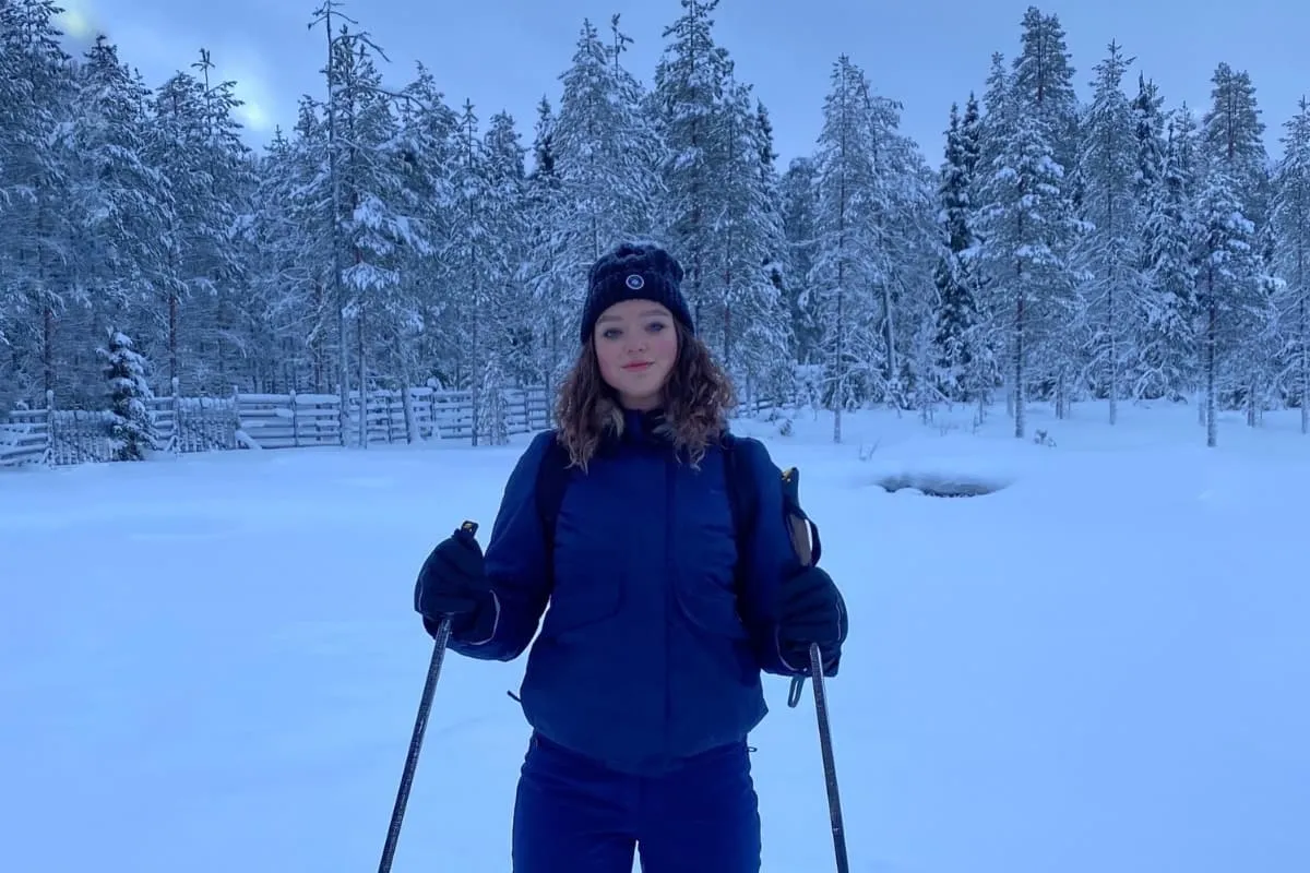
  • What Is the Best Season for the Escapardenne Trail?

  • Getting to and From the Escapardenne Trail

Just for You