Expert Coronallacs Traverse

Duration: 5 days
Trails: T2 trails
Distance: 15 - 20 km per day
Ascent per day: More than 1000 m ascent per day

> Complete Andorra’s legendary Coronallacs loop in 5 days
> Cross high mountain passes and sleep in iconic huts
> Experienced hikers only: altitude, endurance, and views guaranteed

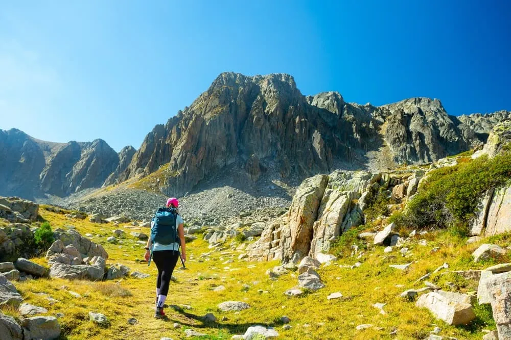
The Coronallacs is a condensed version of Andorra's flagship long-distance route for experienced hikers. It links the country's four guarded mountain huts in just five days. Designed for experienced trekkers, this challenging route through the Pyrenees features significant elevation gain, rocky terrain and stunning panoramic views of some of the country's wildest terrain.

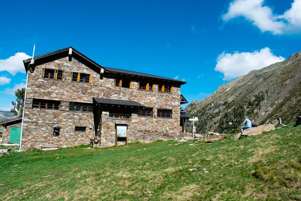
Along the way, you will border Spain and France, staying in the Refuges of Sorteny, Juclà, l’Illa and Comapedrosa, which are all nestled high in alpine valleys surrounded by peaks. While this trek requires solid fitness and sure-footedness, it rewards you with remote trails, turquoise lakes and the full Andorran mountain experience, all packed into one unforgettable adventure.

Itinerary

Day
1

Les Escaldes - Refugi de L'Illa

Duration: 05:10 h
Distance: 12.5 km
Ascent: 1420 m

The Coronallacs adventure starts in Les Escaldes, the gateway to the Madriu-Perafita-Claror Valley. This stunning landscape is a UNESCO World Heritage Site and one of Andorra's most iconic natural features. From the outset, the trail steadily ascends, leaving the urban landscape behind and entering rugged alpine terrain sculpted by glacial valleys and granite formations. The long, steady ascent requires endurance and focus, but the well-marked trail is rewarded with pure alpine air and stunning vistas, such as Pic de Perafita (2,753 m) in the distance.

Follow the course of the Madriu River through dense pine forests and past traditional stone bordas (Andorran agricultural villages), relics of the country's pastoral heritage. You will walk alongside the Camí de l'Ossa beside the Riu Madriu. This path is made up of rocks embedded in a tree-lined road and opens up to reveal clearings in the forest. Refugi de Fontvert is located halfway through the valley and is the perfect place to rest and recharge. Shortly afterwards, you will come across the Farga del Madriu ruins. As you climb higher, the landscape opens up to reveal meadows and stony terrain with fewer trees and stunning panoramic views.

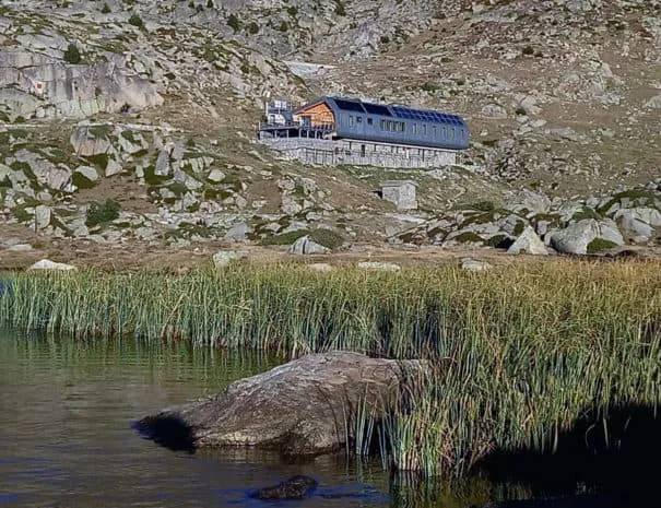
The final section crosses the high cirque of the Madriu Valley and leads to the beautifully situated Refugi de l’Illa (2,490 m), located near the glacial Lake de l’Illa. Surrounded by granite peaks and pristine, high-mountain silence, this remote, atmospheric hut is the perfect place to spend your first night, deeply connected to the wild spirit of Andorra’s highlands.

Refugi de L'Illa

Info
Refugi de L'Illa
Refugi de L'Illa
Day
2

Refugi de L'Illa - Refugi de Juclar

Duration: 09:00 h
Distance: 21.4 km
Ascent: 1360 m
Descent: 1540 m

This challenging stage, full of ups and downs, takes you on a long, rugged journey through some of Andorra's most stunning high mountain landscapes.The route quickly ascends through a landscape of granite peaks and glacial lakes, tracing ancient shepherd trails across the upper Madriu Valley. Today's route also takes in Estany Primer and Estany de Juclà, two of Andorra's largest lakes, framed by steep cliffs and alpine meadows.

Not far from Pic dels Pessons (2,864 m), you can enjoy stunning views of the enchanting Pessons Lakes, including les Fonts, Meligar, Rodó, Forcat and many more! Then, a short zigzag section starts to descend through rugged terrain dotted with boulders and mountain tarns. Next to Estany Primer, there is a restaurant where you can enjoy a drink and the lake views while taking a rest. Continue downhill through green meadows, passing through Pla de les Pedres. Then, cross a road and climb again through forests and wide, undulating hillsides.

You will reach Pic d'Ortafà III (2,595 m) and pass through Port Dret (2,560 m) and the impressive Les Vaques Pass (2,570 m). From there, you will begin a steep descent towards the Vall de Siscaró and its lakes. Continue walking through a wooded area alongside Riu Siscaró, where you will find a beautiful waterfall before the trail opens up into a meadow. Once you reach the Font del Travenc bridge, the descent will end and the final uphill section of the day will begin alongside the Juclar waterfall.

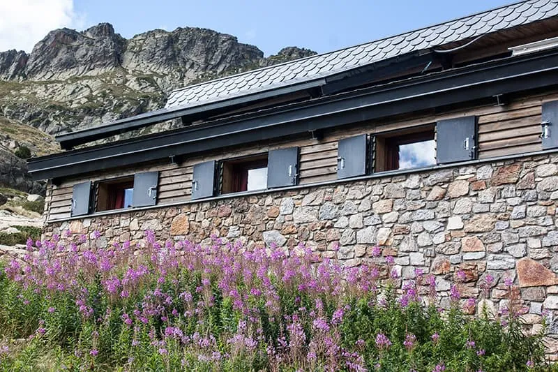
The significant elevation gain and loss throughout the day make this route suitable only for experienced hikers. Upon arrival at the Refugi de Juclà, which is located beside its namesake lake, hikers are rewarded with one of the most stunning sunset views in the country. Surrounded by granite walls and mirrored waters, it’s the perfect place to take in the solitude of the High Pyrenees before continuing your Coronallacs loop.

Refugi de Juclar

Info
Refugi de Juclar
Refugi de Juclar
Day
3

Refugi de Juclar - Refugi Borda de Sorteny

Duration: 07:00 h
Distance: 17 km
Ascent: 1210 m
Descent: 1550 m

This stage links the Juclà Lakes with the secluded Sorteny Valley. The path steadily climbs through high alpine terrain towards the Collada de Meners pass. You will cross a landscape shaped by ice and wind, with jagged ridgelines and crystal-blue tarns all around you

After an undulating start, the route reaches its lowest point at the Port d'Incles junction, next to the Manegor River Valley. The long ascent from there is rewarded with sweeping views of the French peaks to the north and the rugged terrain of Andorra to the south. En route to Cabana Sorda and the nearby lake, you will pass through the wonderful atmosphere of Pleta de Cabana Sorda. Shortly afterwards, you will reach the second highest point of the day: Col de la Coma de Varilles (2,630 m).

Later, you will then descend to cross a small granite slab plateau and a mountain meadow through which the waters of the Portelles River flow. After passing the small Coms de Jan hut, you will begin a new ascent through vegetation below Bony de la Pala de Jan (2,525 m) before reaching Meners Pass (2,670 m), the highest point of the stage. Well done!

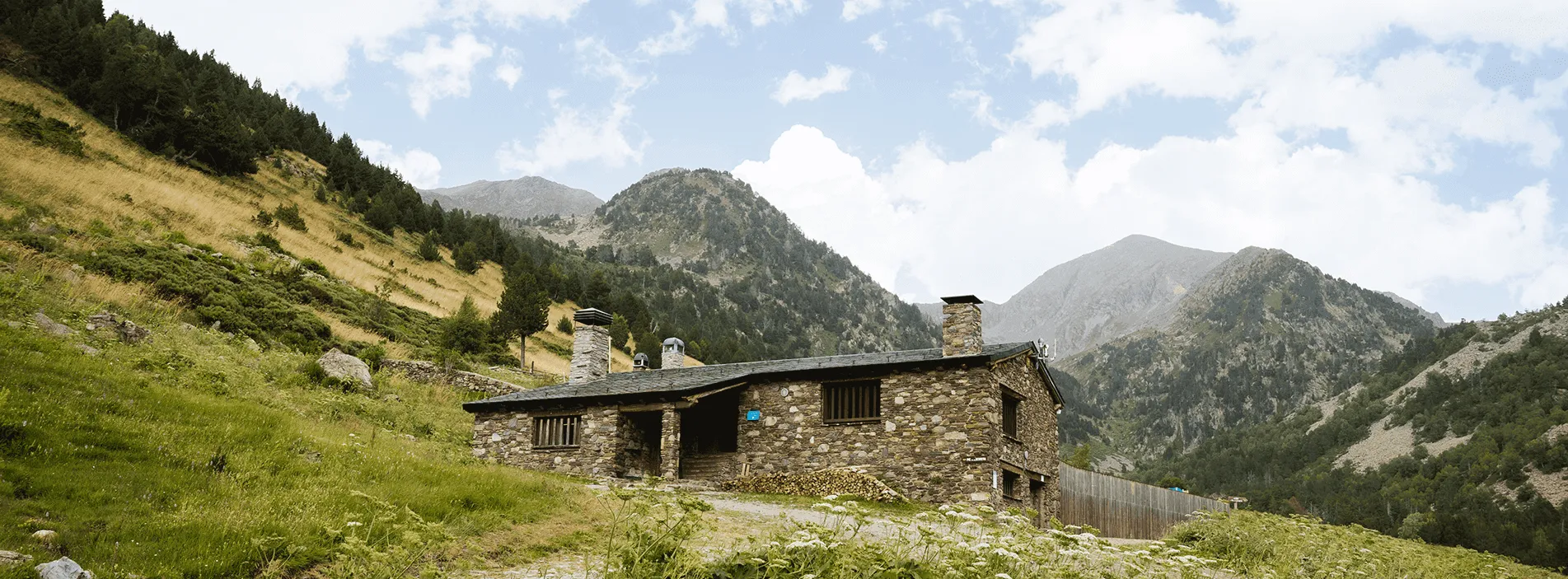
The final stretch is downhill and leads into the Sorteny Nature Park, Andorra's first protected natural area and a place renowned for its exceptional biodiversity. A short descent alongside the river will lead you to the beautifully situated mountain hut of Refugi Borda de Sorteny, surrounded by wildflower meadows and towering summits. After a challenging day of ascending high passes and covering long distances, you will feel a profound sense of achievement.

Refugi Borda de Sorteny

Info
Refugi Borda de Sorteny
Day
4

Refugi Borda de Sorteny - Refugi de Comapedrosa

Duration: 09:10 h
Distance: 19.5 km
Ascent: 1680 m
Descent: 1380 m

This stage connects two nature parks: La Vall de Sorteny and Les Valls del Comapedrosa. As you climb towards the high ridges of Andorra, you will find alpine pastures with wide paths and rocky slopes with narrower trails. Early morning is the best time to spot chamois grazing in the distance and eagles soaring above.

The route begins with a 6 km descent through alpine pastures, running parallel to the Riu de Sorteny, followed by wooded areas, especially along the Sender de l'Esquirol and the Riu de Rialb. Almost at the end of the descent, you will pass through El Serrat and Llorts, two tiny mountain villages where you can stop for a warm meal. Next, a challenging ascent through rocky forest slopes will take you to the Pic del Clot del Cavall, at an altitude of 2,586 metres. You will be crossing multiple mountain streams, and the landscape will gradually become greyer and the lush vegetation will slowly disappear as you gain altitude. As you get close to the top, you will have views of the Estanys de L'Angonella. Congrats, you made it!

Next, you will descend steeply to the junction of the Pollós and Comapedrosa rivers, passing through tall forests and small clearings. Once you have crossed a cattle grid, the final ascent of the day begins, following the course of a mountain stream towards the Refugi de Comapedrosa. Not far from Collet de Comapedrosa (2228 m), the trail reveals the beautiful hut set in a natural amphitheatre next to Estany de les Truites. Now, enjoy a true sense of isolation and achievement.

Refugi de Comapedrosa

Info
Refugi de Comapedrosa
Day
5

Refugi de Comapedrosa - Les Escaldes

Duration: 07:05 h
Distance: 19 km
Ascent: 580 m
Descent: 1770 m

The final stage begins deep in the heart of Andorra's highest mountains. After spending several days immersed in the wild Pyrenees, the final day offers a grand finale in the form of a long and varied descent that takes you full circle back to Les Escaldes. The path gradually transitions from rugged alpine terrain to gentler, wooded hillsides, but the sense of wilderness remains.

The route retraces your steps for around 2.5 kilometres, then continues through undulating terrain until you reach Coll de les Cases (1,960 metres), followed shortly afterwards by Pic del Solà d'Erts (1,980 metres). Below Roc de la Cauba (1,819 m), you will follow a beautiful wooded trail, passing old bordas and crossing mountain streams, which reconnects you with Andorra’s cultural landscapes.

The final kilometres of the descent are relatively flat, first walking parallel to the La Massana parish and the Valira del Nord river. You will then close the loop of the Coronallacs Trail, returning to where it all began. You will return to the city with tired legs, but having crossed the four great natural parks of Andorra. This is a fitting conclusion to one of the most complete and demanding high-mountain adventures in the Pyrenees.

Included

  • Full travel guide

    You’ll receive access to our trekking app, which serves as your complete digital travel guide for the Coronallacs Traverse. Inside, you’ll find everything you need for your trek: route descriptions, hiking maps, navigation support, payment information, and all the key details specific to your journey.

  • Accommodation

    During your Coronallacs Traverse, you will spend your nights in mountain huts. In the mountain huts we normally only book dormitories, but we can look into private rooms on request. If the private rooms are fully booked or not available in the hut, we automatically book a bed in dormitories for you. Please note that private rooms are more expensive and there will be an additional charge for this.

  • Half-board in Huts

    Accommodation at the huts includes dinner and breakfast. We will arrange this for you as well. This allows you to travel lighter and have one less thing to worry about. Bear in mind that lunch is not included, but it can be purchased at the huts. Here you can also buy an array of snacks and bottled water.

  • Navigation support

    Our trekking app also includes built-in navigation support. With GPS-based maps and offline access, you can follow the trail confidently and stay on route even without mobile signal.

Excluded

  • Traveling to and from

    You have to make your own way to the starting point. The total amount does not include personal transport.

  • Transfers

    Should you need any form of (public) transport on location, this is not part of the trekking package. This includes the use of taxi, bus, cable cars, gondolas, ferries, etc.

  • Lunch

    Half-board is included in the price of this trek. Lunch, however, is not. You can get something to eat at the mountain huts along the way.

  • Travel Insurance

    Your international travel insurance is your own responsibility. Discuss your itinerary with the insurance company before your trek.

  • Personal expenses

    Personal expenses on such as souvenirs, drinks, and other similar expenses are for your own account.

FAQ

  • How to get to the Starting Point of the Expert Coronallacs

  • End Point: Les Escaldes‑Engordany

  • What if the dates I want are not available?

  • If I book now, can I immediately arrange the rest of my trip?

  • How do I know if this trek is right for me?

How to Book

  • Booking

  • Availability

  • Cancellation policy