Preferred date sold out?
Discover our hut-to-hut treks in Switzerland with availability in August or September and secure your adventure before it's too late!

Grisons-Glarus Traverse - Advanced

Duration: 4 days
Trails: T4 trails
Distance: 10 - 15 km / 6 - 9 mi per day
Ascent per day: More than 1000 m / 3281 ft ascent per day
> Traverse the Grisons-Glarus alpine ridge in 4 unforgettable days
> Stay overnight in wild, remote SAC huts above the glaciers
> We’ll arrange your accommodation—just bring your alpine legs

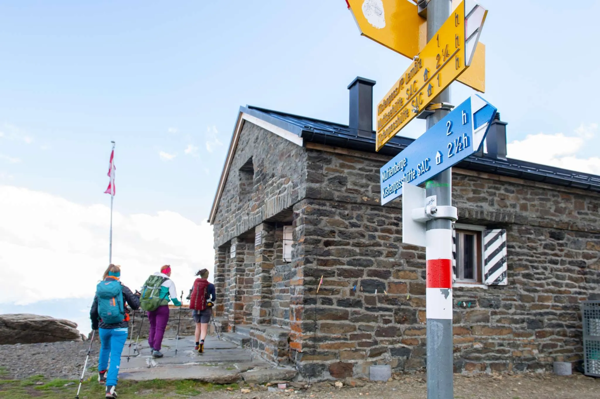
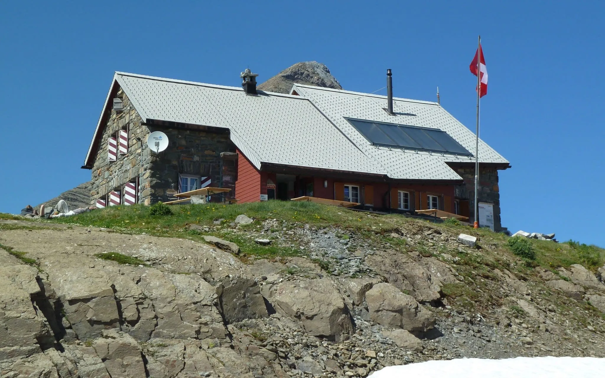
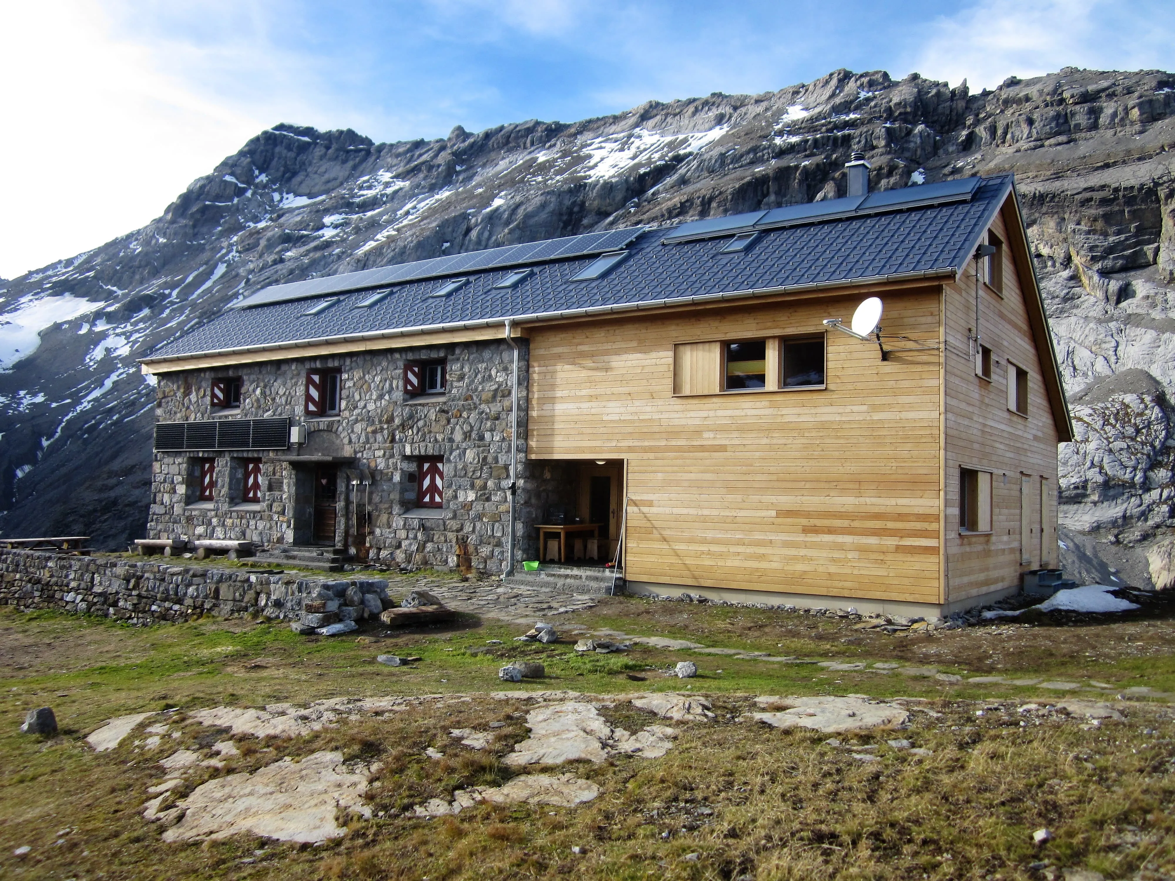
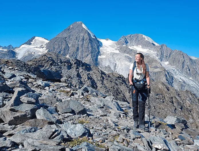
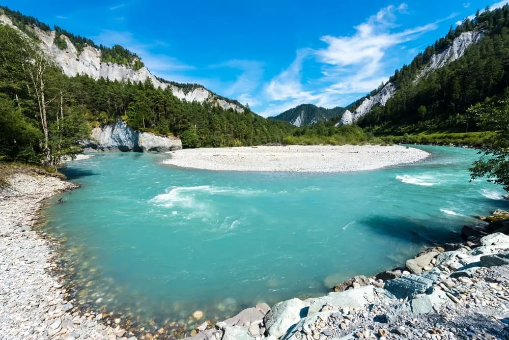
Let’s face it—most hikes flirt with the mountains. This one marries them. The Grisons-Glarus Traverse is a hardcore four-day hike across the ice-clad spine of eastern Switzerland. From the turquoise waters of the Limmernsee to the dramatic drop-offs below Clariden, this trek slices through the rawest ridgelines the Alps have to offer. No towns, no tourists, just you, the trail, and the sky. You’ll sleep in SAC huts like Muttseehütte, Bifertenhütte, and Claridenhütte, each a lonely outpost in a sea of stone and snow.

This route is for experts only—think glacier crossings, high-altitude scrambles, and exposed ridges. But if you’ve got the skills and the stamina, this is your kind of pilgrimage. It's not just a hike. It's a rite of passage.

Itinerary

Day
1

Tavanasa - Bifertenhütte

Duration: 06:00 h
Distance: 13 km / 8.1 mi
Ascent: 1690 m / 5545 ft
Descent: 10 m / 33 ft
Lowest Point: 790 m / 2592 ft
Highest Point: 2460 m / 8071 ft

From the quiet village of Tavanasa, follow the forest trails that wind up through alpine meadows toward the upper Val Frisal. The ascent is long and steady, with over 1,500 meters of elevation gain—your legs will know it's the first real day. As you leave the tree line, the landscape opens up into a wild cirque of rock, water, and snow.

About 7.5 kilometers in, the trees give way to a wide view over the valley. The Flim waterfalls glint in the distance, pouring silver down the cliffs. It’s a good place to pause and let the silence catch up.

The final approach to Bifertenhütte cuts across a rocky slope and leads to the hut tucked beneath the Tödi massif. It's quiet up here—just the sound of marmots, melting snow, and your own footsteps. Time to kick off your boots and let the altitude do the talking.

Bifertenhütte

Info
Bifertenhütte
Bifertenhütte
Day
2

Bifertenhütte - Muttseehütte

Duration: 07:45 h
Distance: 14.5 km / 9 mi
Ascent: 1160 m / 3806 ft
Descent: 1150 m / 3773 ft
Lowest Point: 1840 m / 6037 ft
Highest Point: 2890 m / 9482 ft

Leave Bifertenhütte behind and follow the rugged alpine trail as it climbs toward the high shoulder near the Kistenpass. Just beyond the cliffs overlooking the Limmernsee, the route crosses into Graubünden at Pass Lembra—where limestone gives way to loose scree and sky. The path skirts the flanks of Muttenberg, and with a short detour, you can reach its summit for a sweeping 360-degree view that makes the effort worthwhile.

The trail soon delivers you to the shores of the Muttsee, an austere reservoir framed by rock and reinforced by a 1-km solar farm glinting along the dam wall. This improbable lake at 2,500 meters is both an alpine landmark and a renewable powerhouse. The Muttseehütte stands nearby, a welcoming refuge after hours of exposed, high-mountain terrain.

But don’t stop just yet. Continue past the hut and descend a steep zigzag path to the Limmerensee below. Encircled by towering cliffs and glacier-capped peaks, the turquoise waters feel like a hidden world. The return climb is slow and quiet, retracing your steps to Muttseehütte as the day fades and the sky softens.

Muttseehütte

Info
Muttseehütte
Muttseehütte
Day
3

Muttseehütte - Claridenhütte

Duration: 08:15 h
Distance: 14.8 km / 9.2 mi
Ascent: 1490 m / 4888 ft
Descent: 1540 m / 5052 ft
Lowest Point: 1020 m / 3346 ft
Highest Point: 2550 m / 8366 ft

Leave the turquoise waters of the Muttsee behind and step onto one of the wildest segments of this traverse. First, follow the dam wall east and then up the rocky switchbacks to the Kistenpass. It’s a stiff climb, but the views stretch wide across Glarus and far into Graubünden.

Once over the pass, the trail becomes quieter and more alpine. You'll descend gradually into a stony high valley, then cross the Linth River where it still feels like a stream. From there, the trail climbs steadily again, always up, into solitude and scree.

The final stretch is steep. A short rope section helps with balance as you near the cliffs below Claridenhütte. And then it’s there, tucked into the rock. You made it. Just you, the air, and the sound of nothing at all.

Claridenhütte

Info
Claridenhütte
Claridenhütte
Day
4

Claridenhütte - Bergstation Urnerboden-Fisetengrat

Duration: 06:00 h
Distance: 11.3 km / 7 mi
Ascent: 480 m / 1575 ft
Descent: 1540 m / 5052 ft
Lowest Point: 1370 m / 4495 ft
Highest Point: 2910 m / 9547 ft

From Claridenhütte, the trail climbs steadily for 3 km to the summit of Gemsfairenstock. At nearly 3,000 meters, the views are wide and dramatic—Tödi, Bifertenstock, and Clariden rise in every direction, and a shrinking glacial lake shimmers below. It’s a beautiful but fragile landscape, shaped by time and change.

The descent begins with a turn along a new ridgeline, dropping toward the broad saddle of Fisetenpass. Set between Gemsfairenstock and Fisetengrat, the pass offers a quiet pause with sweeping views and a sense of crossing from one alpine world into another.

From there, the trail winds down into the Urnerboden, Switzerland’s largest alp. As you approach the small white Kapelle St. Erhard and the scattered homes of the village, the steepness gives way to stillness, and the valley opens wide to welcome you in.

Included

  • Full travel guide

    You’ll receive access to our trekking app, which serves as your complete digital travel guide for the Grisons-Glarus Traverse. Inside, you’ll find everything you need for your trek: route descriptions, hiking maps, navigation support, payment information, and all the key details specific to your journey.

  • Accommodation

    During your Grisons-Glarus Traverse, you will spend your nights in mountain huts. In the mountain huts we normally only book dormitories, but we can look into private rooms on request. If the private rooms are fully booked or not available in the hut, we automatically book a bed in dormitories for you. Please note that private rooms are more expensive and there will be an additional charge for this.

  • Half-board in Huts

    Accommodation at the huts includes dinner and breakfast. We will arrange this for you as well. This allows you to travel lighter and have one less thing to worry about. Bear in mind that lunch is not included, but it can be purchased at the huts. Here you can also buy an array of snacks and bottled water.

  • Navigation support

    Our trekking app also includes built-in navigation support. With GPS-based maps and offline access, you can follow the trail confidently and stay on route even without mobile signal.

Excluded

  • Traveling to and from

    You have to make your own way to the starting point. The total amount does not include personal transport.

  • Transfers

    Should you need any form of (public) transport on location, this is not part of the trekking package. This includes the use of taxi, bus, cable cars, gondolas, ferries, etc.

  • Lunch

    Half-board is included in the price of this trek. Lunch, however, is not. You can get something to eat at the mountain huts along the way.

  • Travel Insurance

    Your international travel insurance is your own responsibility. Discuss your itinerary with the insurance company before your trek.

  • Personal expenses

    Personal expenses on such as souvenirs, drinks, and other similar expenses are for your own account.

FAQ

  • How to Get to the Starting Point of the Route

  • How to Leave From the Endpoint of the Grisons-Glarus Traverse Trek

  • What if the dates I want are not available?

  • If I book now, can I immediately arrange the rest of my trip?

  • How do I know if this trek is right for me?

How to Book

  • Booking

  • Availability

  • Cancellation policy

Packing List for the Grisons-Glarus Traverse

  • Information

  • Essentials

  • Extras