Intermediate Parc des Écrins Tour

Duration: 4 days
Trails: T2 trails
Distance: 10 - 15 km per day
Ascent per day: 500 - 1000 m ascent per day

> Experience the wild beauty of the Parc des Écrins on a 4-day hut-to-hut adventure
> Follow alpine trails past glaciers, mountain lakes, and flower-filled meadows
> Stay in authentic French refuges with hearty meals and warm alpine hospitality

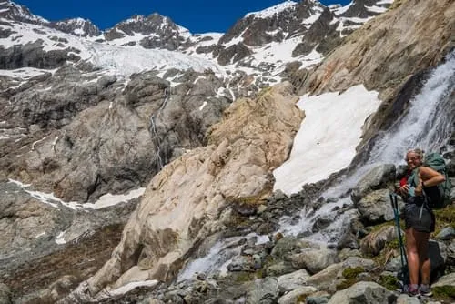
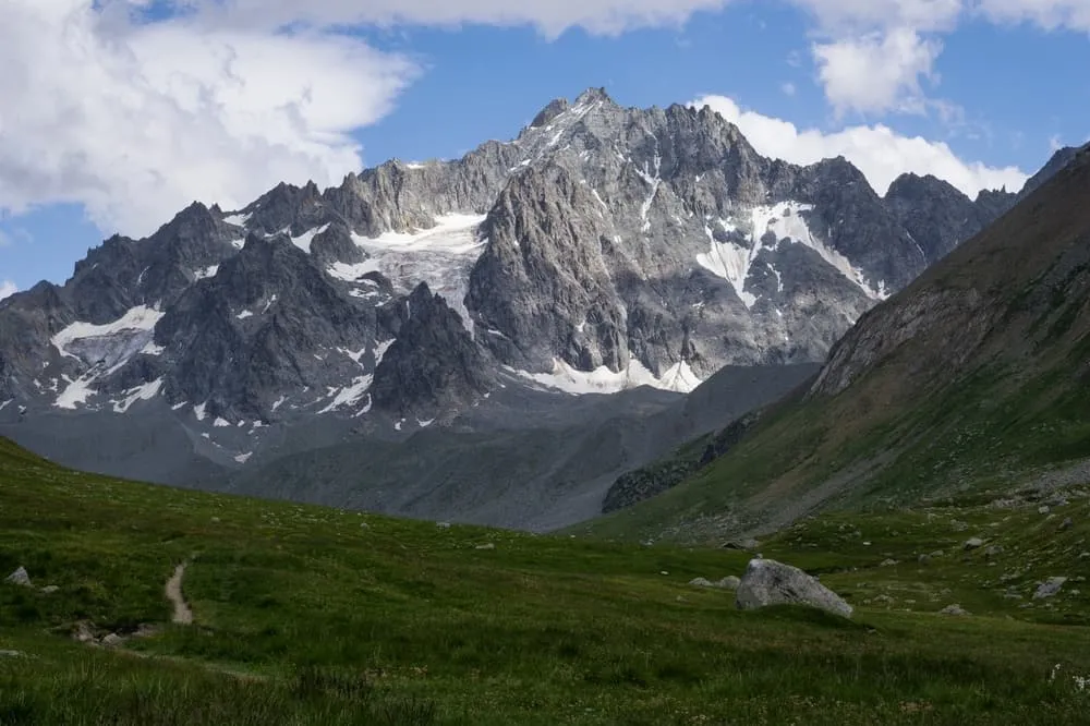
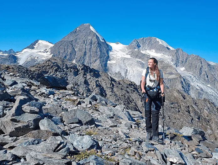
The Intermediate Parc des Écrins Tour is a 4-day journey through the heart of the French Alps, perfect for hikers with solid fitness and a love for high mountain scenery. Starting in Le Monêtier-les-Bains and finishing at Barrage du Chambon, the route connects picturesque valleys, glacial passes, and tranquil plateaus surrounded by the peaks of the Écrins massif. Trails are well-marked yet varied, offering a balance of challenge, nature, and serenity.

Along the way, you’ll stay in traditional mountain huts such as Refuge de l’Alpe de Villar-d’Arène, Gîte Auberge Chez Baptiste, and Refuge du Fay, each offering a cozy retreat after a rewarding day on the trail. The combination of rugged landscapes, friendly mountain life, and breathtaking views makes this tour a true alpine classic in a compact and unforgettable format.

Itinerary

Day
1

Le Monetier-les-Bains - Refuge de l'Alpe de Villar-d'Arène

Duration: 05:20 h
Distance: 13.4 km
Ascent: 880 m
Descent: 280 m

Your adventure begins in the charming alpine village of Le Monêtier-les-Bains, surrounded by the peaks of the Écrins. The trail leads you along forested paths, alpine streams, and wildflower meadows as you gradually gain elevation. The higher you climb, the more expansive the views become, with the Glacier du Casset glistening in the distance.

This first stage is a steady introduction to the Parc des Écrins. With around 880 meters of ascent, the day offers a balanced mix of challenge and beauty. Keep an eye out for marmots and ibex along the ridges as you approach the high alpine zone.

Reaching Refuge de l’Alpe de Villar-d’Arène, you’ll find a warm welcome and hearty mountain food. Surrounded by meadows and streams, it’s the perfect place to rest and soak in the silence of the French Alps.

Refuge de l'Alpe de Villar-d'Arène

Info
Refuge de l'Alpe de Villar-d'Arène
Day
2

Refuge de l’Alpe de Villar-d’Arène - Gîte Auberge Chez Baptiste

Duration: 04:55 h
Distance: 13.6 km
Ascent: 510 m
Descent: 800 m

Your second day begins at the peaceful Refuge de l’Alpe de Villar-d’Arène, surrounded by open meadows and the distant rumble of meltwater streams. From the first steps, you rejoin the Romanche Valley and head gently downhill, following a beautiful high-alpine landscape carved by glaciers and rivers. The trail offers wide, open views toward the surrounding summits and the shimmering Arsine ponds, creating a serene and gentle start to the stage.

With moderate ascents and long, flowing descents totaling around 510 meters of climbing and 800 meters of descent the path winds past viewpoints overlooking the Glacier d’Arsine and the cascading waterfalls of the upper Romanche. As the route continues, the terrain gradually softens and the valley becomes greener and more pastoral, with the Romanche River guiding your way through a mix of woodland, open meadows, and rocky stretches. It’s a day to enjoy steady hiking, rich alpine scenery, and plenty of peaceful spots along the water.

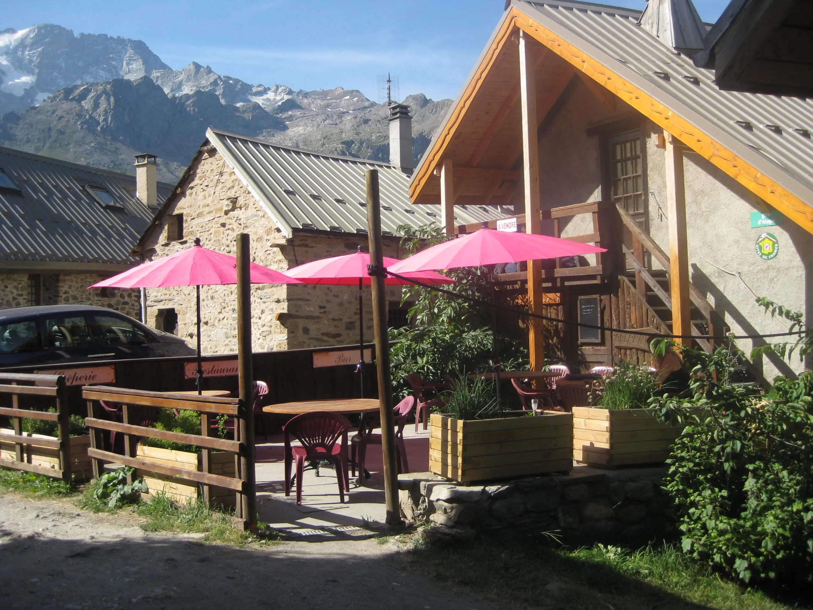
The final kilometers follow a pleasant riverside trail leading into the hamlet of Villar-d’Arêne. Here, surrounded by traditional stone houses and the calm rhythm of village life, you arrive at Gîte Auberge Chez Baptiste. Expect a warm welcome, hearty homemade food, and a comfortable atmosphere, the perfect place to rest your legs and recharge for the next stage of your Parc des Écrins adventure.

Gîte Auberge Chez Baptiste

Info
Gîte Auberge Chez Baptiste
Day
3

Gîte Auberge Chez Baptiste - Refuge du Fay

Duration: 03:40 h
Distance: 8.72 km
Ascent: 690 m
Descent: 230 m

The stage begins in the quiet hamlet around Gîte Auberge Chez Baptiste, and shortly after setting off you pass through the small settlement of Le Clot Raffin. Here the valley opens into gentle pastures with wide alpine views. As soon as you leave the hamlet behind, the trail starts to rise steadily toward the open hillsides above Villar-d’Arêne. The scenery becomes increasingly wild and expansive, with rolling grassy slopes, scattered streams, and the rugged silhouettes of the Écrins peaks framing the horizon.

The route climbs gradually along natural mountain paths, gaining around 690 meters of elevation as it leads deeper into the high country. A key highlight of the stage is reaching the Plateau d’Emparis, a broad and beautiful alpine plateau known for its sweeping views and peaceful grassy expanses. This area has been shaped by ancient glaciers, creating a mix of open plateaus, rock formations, and panoramic viewpoints over the surrounding valleys and summits. The hike offers a varied blend of forest edges, open alpine meadows, and small watercourses that bring life to the landscape. Toward the final part of the stage, the path gently descends before rising again into the basin where the refuge is located.

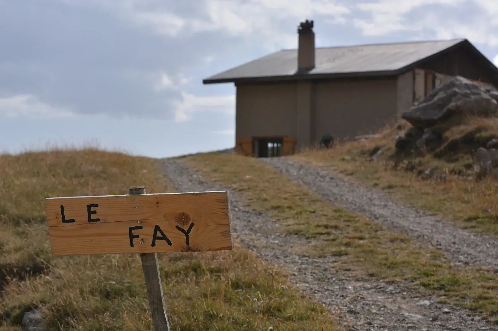
Refuge du Fay appears tucked into a peaceful high-alpine hollow, surrounded by grassy slopes and mountain streams. Its remote and sheltered location gives it a wonderfully atmospheric feel. Expect a warm welcome, simple and comforting mountain food, and a quiet evening in one of the most tranquil corners of the Parc des Écrins.

Refuge du Fay

Info
Refuge du Fay
Refuge du Fay
Day
4

Refuge du Fay - Barrage du Chambon

Duration: 04:05 h
Distance: 10.3 km
Ascent: 60 m
Descent: 1280 m

The stage begins in the quiet alpine basin around Refuge du Fay, where grassy slopes and scattered rock formations set the tone for your final day. The trail heads out across open high ground before gradually tipping downward, offering clear views toward the deep valley carved out by the waters of the Romanche. As you move along the traverse, the landscape shifts between wide open meadows, pockets of forest, and steep mountain flanks overlooking the Lac du Chambon far below.

A long descent defines this final stretch, with more than 1,200 meters of elevation loss as the route leads toward Mizoën. The trail alternates between rocky switchbacks, natural hillside paths, and easier forest tracks, giving each section its own character. With every step downward, the scenery opens toward the blue surface of the lake, framed by dramatic ridges and the last high summits of the Écrins massif. It is a varied and rewarding finish, with plenty of viewpoints inviting you to pause and take in the surroundings.

The final part of the stage continues toward the shoreline, eventually reaching the Barrage du Chambon bus stop. Here, beside the water and surrounded by steep mountain walls, your journey comes to a peaceful close. This is a fitting endpoint to reflect on the past days spent crossing alpine plateaus, valleys, and untamed high-mountain terrain within one of France’s most beautiful national parks.

Included

  • Full travel guide

    You’ll receive access to our trekking app, which serves as your complete digital travel guide for the Tour des Écrins. Inside, you’ll find everything you need for your trek: route descriptions, hiking maps, navigation support, payment information, and all the key details specific to your journey.

  • Accommodation

    During your Tour des Écrins, you will spend your nights in mountain huts. In the mountain huts we normally only book dormitories, but we can look into private rooms on request. If the private rooms are fully booked or not available in the hut, we automatically book a bed in dormitories for you. Please note that private rooms are more expensive and there will be an additional charge for this.

  • Half-board in Huts

    Accommodation at the huts includes dinner and breakfast. We will arrange this for you as well. This allows you to travel lighter and have one less thing to worry about. Bear in mind that lunch is not included, but it can be purchased at the huts. Here you can also buy an array of snacks and bottled water.

  • Navigation support

    Our trekking app also includes built-in navigation support. With GPS-based maps and offline access, you can follow the trail confidently and stay on route even without mobile signal.

Excluded

  • Traveling to and from

    You have to make your own way to the starting point. The total amount does not include personal transport.

  • Transfers

    Should you need any form of (public) transport on location, this is not part of the trekking package. This includes the use of taxi, bus, cable cars, gondolas, ferries, etc.

  • Lunch

    Half-board is included in the price of this trek. Lunch, however, is not. You can get something to eat at the mountain huts along the way.

  • Travel Insurance

    Your international travel insurance is your own responsibility. Discuss your itinerary with the insurance company before your trek.

  • Personal expenses

    Personal expenses on such as souvenirs, drinks, and other similar expenses are for your own account.

FAQ

  • How to Get To the Starting Point of the Parc des Écrins Tour

  • How to Get From the Endpoint Back

  • What if the dates I want are not available?

  • If I book now, can I immediately arrange the rest of my trip?

  • How do I know if this trek is right for me?

How to Book

  • Booking

  • Availability

  • Cancellation policy

Packing List for the Tour des Écrins

  • Information

  • Essentials

  • Extras