Kungsleden Trail: Hemavan to Ammarnäs

Duration: 6 days
Trails: T2 trails
Distance: 15 - 20 km per day
Ascent per day: 250 - 500 m ascent per day

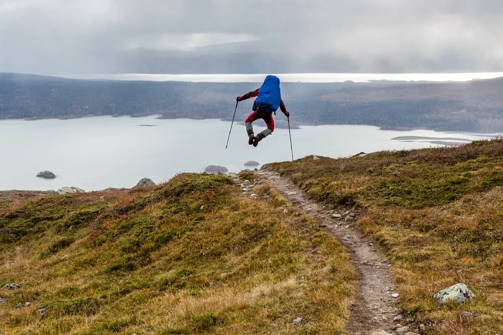
> Hike the entire route in the Vindelfjällen nature reserve
> Explore lake Tärnasjön and its 7 bridges
> Enjoy the beautiful reindeer herding in the distance

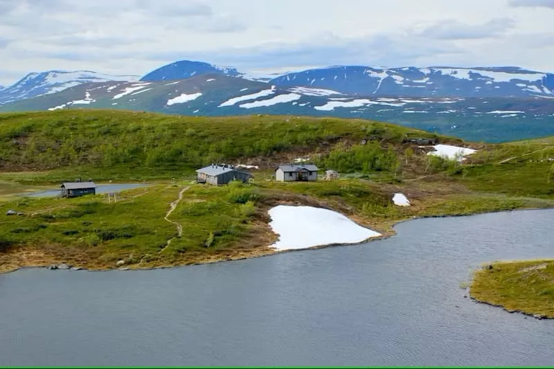
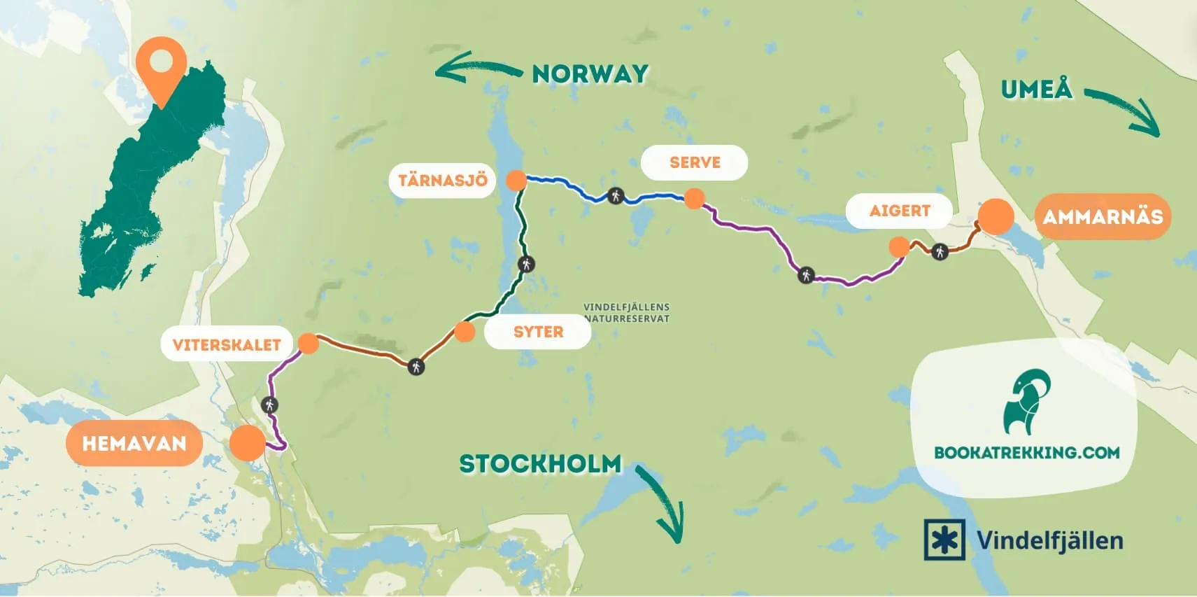
The Kungsleden trail is a 6-day adventure through some of Sweden's most beautiful scenery, from Hemavan to Ammarnäs in the Vindelfjäll nature reserve, one of the country's largest protected areas. Its purpose is to preserve a South Sami mountain area that contains almost all the natural types characteristic of the Swedish mountains.

This Signature Trail covers rugged terrain and showcases a variety of ecosystems, from mountain birch forests and quiet lakes to U-shaped valleys and towering ridges. The route takes you through remote areas with stunning views of the surrounding peaks and wetlands where you can see the unspoilt wildlife of this miniature Lapland.

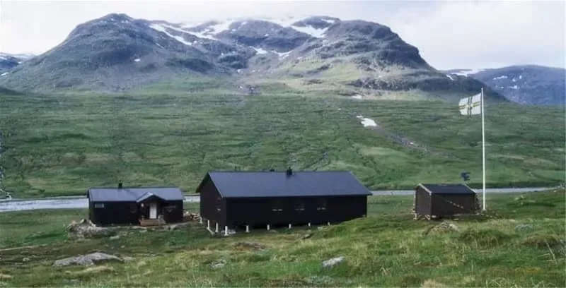
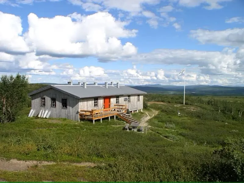
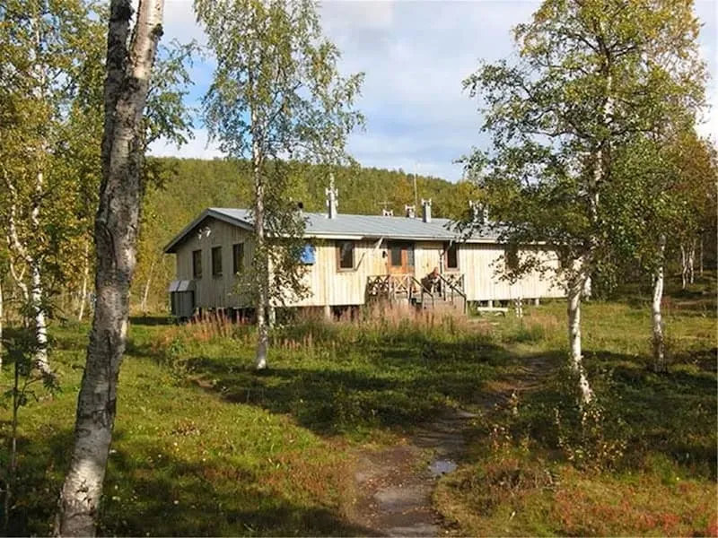
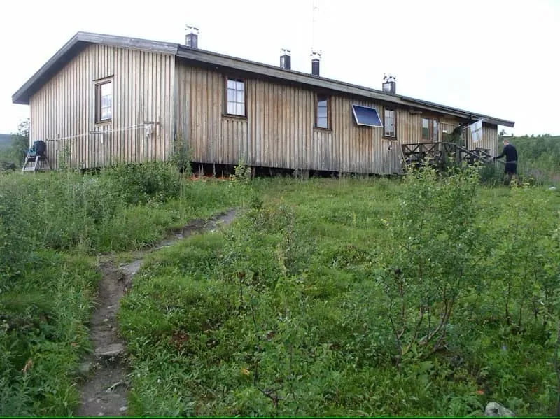
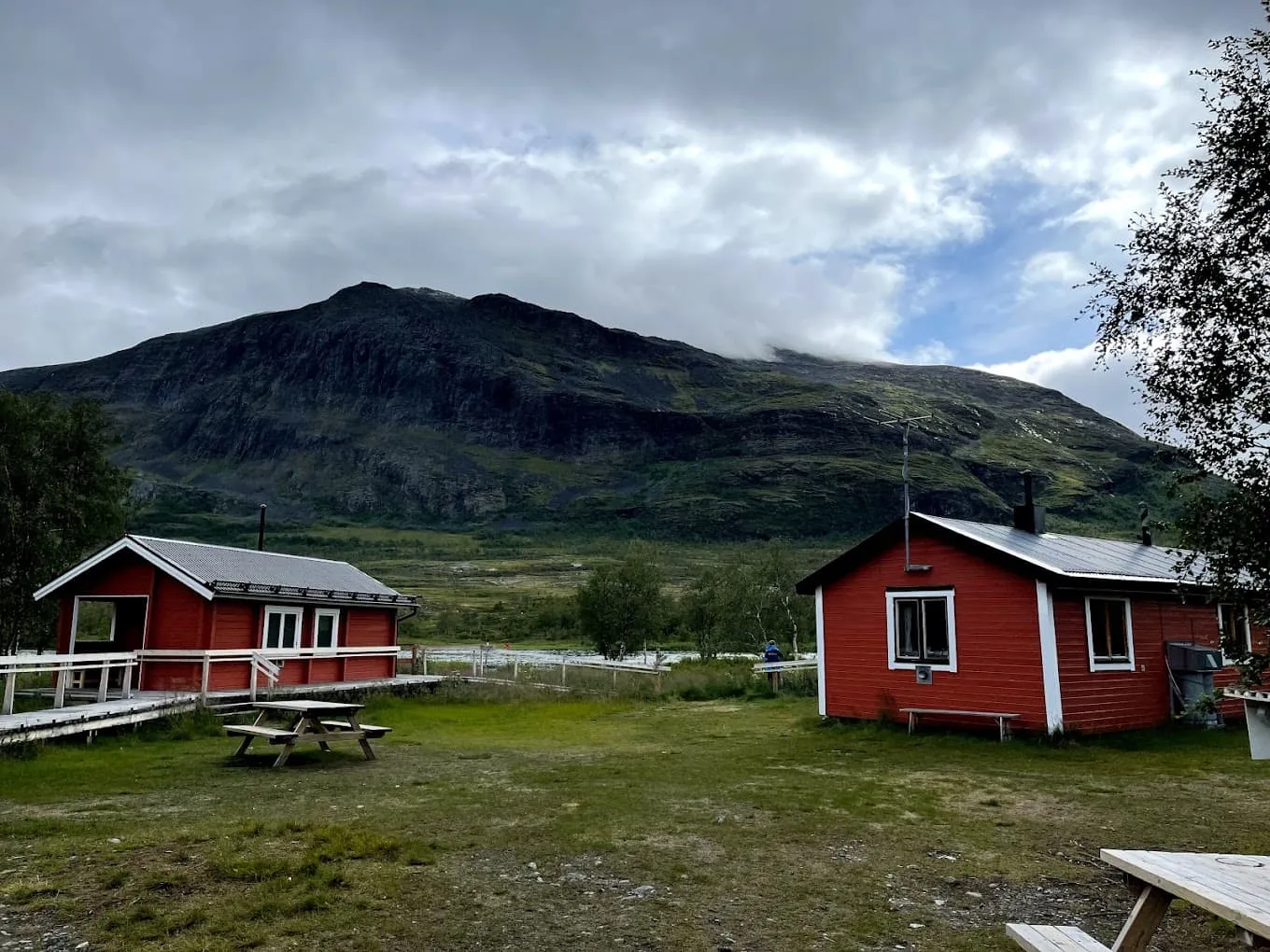
Throughout the trek you will be staying in comfortable, well-equipped cabins, ensuring a truly immersive experience. Each cabin has a small shop where you can buy food and mountain equipment, so you can pack light. An unforgettable experience for adventurous hikers, combining intense and rewarding stages with the peace and quiet of Sweden's remote countryside.

Itinerary

Day
1

Hemavan - Viterskalet

Duration: 04:00 h
Distance: 11.5 km
Ascent: 450 m
Descent: 110 m

From the small village of Hemavan, the southern entrance to Kungsleden, the trail heads north and uphill through rolling countryside. This is a beautiful part of the Vindelfjällen nature reserve, where wide valleys narrow as high mountains rise. The first part of the trail passes close to Storbäcken gorge, which you can enjoy with a short detour. From the bridge you can look down into the deep gorge below, but only if you're not afraid of heights!

After a steep section you enter the Syterskalet valley, lined with steep mountains, and end with a mostly flat walk above the tree line along the murmuring Syterbäcken stream for about 4 km. From Viterskalsstugan you can see Artfjället and the glaciers of Okstindarnas in Norway for miles on a sunny day. The cabin you'll be staying in is beautifully situated in the middle of the U-shaped valley that divides Storfjället.

STF Viterskalet

Info
STF Viterskalet
STF Viterskalet
Day
2

Viterskalet - Syter

Duration: 04:30 h
Distance: 12.7 km
Ascent: 200 m
Descent: 310 m

Between Viterskalsstugan and Syterstugan, the Kungsleden trail runs through the deep, spectacular U-shaped valley of Syterskalet. During the long hike through the mighty Ska, you walk through a lush landscape framed by steep rock faces and high alpine peaks. Large herds of reindeer often graze in Syterskalet, so be careful not to disturb them. In some parts of the first section there are easier trails that you can use that run parallel to the original one.

The last few kilometres to Syterskalet are downhill and end at the cabin in beautiful surroundings by Svärfarsbäcken at the northern end of Storfjället.

STF Syter

Info
STF Syter
STF Syter
Day
3

Syter - Tärnasjö

Duration: 04:45 h
Distance: 14.5 km
Ascent: 80 m
Descent: 180 m

This is the start of a long but easy and beautiful hike through the mountain birch forest along Lake Tärnasjön. The trail starts at a high point and then descends through the forest towards the flat areas of Lake Tärnasjön, with part of the trail going down to the beach. Coming from the south and shortly after the start, you can enjoy the view and see what lies ahead. Are you looking forward to it?

Just 4 kilometres from the start you reach the unique archipelago of Lake Tärnasjön, where 7 bridges cross the lake and its hundred islands formed by a Rogen moraine. The stage ends in a mountain birch forest on the eastern shore of Lake Tärnasjön.

STF Tärnasjö

Info
STF Tärnasjö
STF Tärnasjö
Day
4

Tärnasjö - Serve

Duration: 05:00 h
Distance: 13.8 km
Ascent: 420 m
Descent: 330 m

The trek begins with a short ascent and gradually moves away from the mountains of Norra Storfjället. You walk out of the birch forest and into a winding valley with undulating terrain and easy high points. Today you will pass a number of swamps and small lakes full of fish, such as Tjärven and Siejdáge.

After some flat, marshy terrain, there is another ascent just after lake Servvejávrrie. At Servvetjåhkka, the highest point of theday, the view is spectacular and the summer trail leads down to Servestugan, your hut for the night. Time to relax and recharge your batteries after an exciting day!

STF Serve

Info
STF Serve
STF Serve
Day
5

Serve - Aigert

Duration: 07:10 h
Distance: 19.5 km
Ascent: 580 m
Descent: 500 m

Another day of rolling countryside with alternating uphill and downhill sections. The stage begins with a climb to the foot of Vuomatjåhkkas, here there is a picnic hut here where you can take a break if needed. The trail continues towards Lill-Aigert (1076 m), from where you can see down towards Tjulträsket. The last stretch to the cabin follows a babbling brook until you reach Ruovdatjjávrátje lake, where Aigert Fjällstuga is located.

This is one of the highest parts of the Kungsleden Trail. The stage is challenging, so be prepared, well rested, and wait for good weather. But don't worry, your efforts will be rewarded with magical views and a sense of the grandeur of Vindelfjällen.

STF Aigert

Info
STF Aigert
STF Aigert
Day
6

Aigert - Ammarnäs

Duration: 02:45 h
Distance: 8 km
Ascent: 40 m
Descent: 410 m

The last day is a short, easy walk, mostly downhill. You descend below the tree line and walk through a mountain birch forest to the village of Ammarnäs. Halfway there is a beautiful view of the Ammarnäs delta. There are several picnic areas with great views where you can rest or have a snack.

The last part is on a gravel road, follow the signs down to Ammarnäs, cross the bridge over Tjulån and end up at the Vindelfjällen Visitor Centre. From here you can explore the village further or continue on to your next destination. Your adventure on the Kungsleden trail in Vindelfjällen is over. See you soon on the trails!

Included

  • Full travel guide

    You’ll receive access to our trekking app, which serves as your complete digital travel guide for the Kungsleden Trail. Inside, you’ll find everything you need for your trek: route descriptions, hiking maps, navigation support, payment information, and all the key details specific to your journey.

  • Accommodation

    During your Kungsleden Trail, you will spend your nights in mountain huts. In the mountain huts we normally only book dormitories, but we can look into private rooms on request. If the private rooms are fully booked or not available in the hut, we automatically book a bed in dormitories for you. Please note that private rooms are more expensive and there will be an additional charge for this.

  • Navigation support

    Our trekking app also includes built-in navigation support. With GPS-based maps and offline access, you can follow the trail confidently and stay on route even without mobile signal.

Excluded

  • Traveling to and from

    You have to make your own way to the starting point. The total amount does not include personal transport.

  • Travel Insurance

    Your international travel insurance is your own responsibility. Discuss your itinerary with the insurance company before your trek.

  • Personal expenses

    Personal expenses on such as souvenirs, drinks, and other similar expenses are for your own account.

  • Meals

    Meals are not included in the price on the Kungsleden Trail unless otherwise indicated in the inclusive list. You can get something to eat at the mountain huts along the way or get food in the towns at the bottom of the route. If you want hot food at the hut, remember to ask for it as soon as you arrive at the hut.

FAQ

  • Is The Kungsleden Trail For Me?

  • What is The Best Season For The Kungsleden Trail?

  • Getting To And From Abisko and Nikkaluokta

  • How to Get To the Starting Point in Vindelfjällen

  • End point: Ammarnäs

  • What if the dates I want are not available?

  • If I book now, can I immediately arrange the rest of my trip?

  • How do I know if this trek is right for me?

How to Book

  • Booking

  • Availability

  • Cancellation policy