Preferred date sold out?
Discover our trekking adventures in Italy with availability in August, September or October and secure your spot before it’s too late!

More Rosengarten for Families

Duration: 4 days
Trails: T2 trails
Distance: 0 - 10 km per day
Ascent per day: 250 - 500 m ascent per day

> Explore more Rosengarten in 4 easygoing days
> Stay in rifugios the whole family will love
> We’ll arrange every overnight on your route

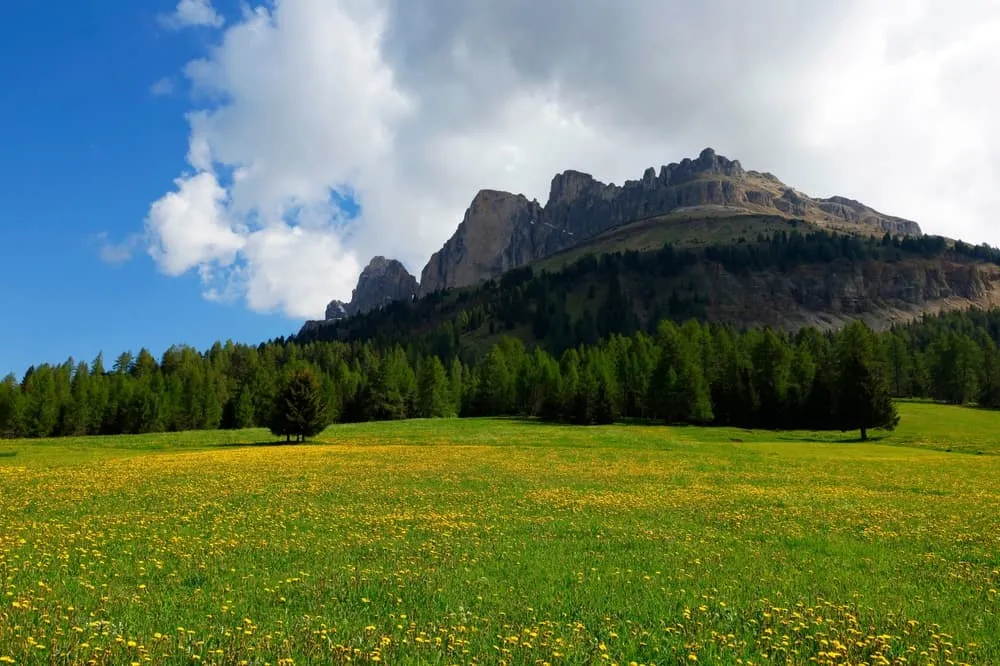
Your kid just spotted her first ibex. Your son’s convinced he’s a mountain goat. Meanwhile, you're walking between dramatic cliffs with a picnic in your pack and no phone signal in sight. That’s More Rosengarten for Families. More memories, more marmots, more Dolomites.

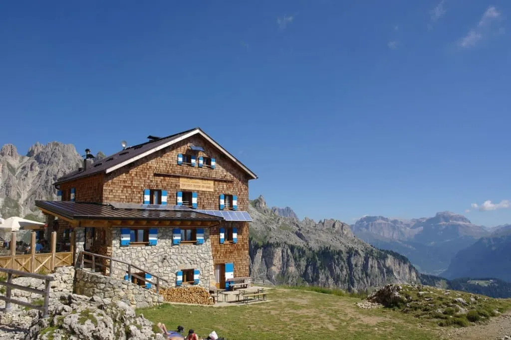
This 4-day loop begins at the Kölner Hütte and winds through the Rosengarten like a greatest hits playlist for adventurous families. You’ll sleep at Rifugio Roda di Vael, enjoy the charm and calm of Grasleitenhütte, and wrap up with pizza and pink peaks at Rifugio Vajolet. The final stretch down to St. Zyprian is the perfect cooldown before heading back to the real world—with your kids already asking when they can come back.

Itinerary

Day
1

Kölner Hütte - Rifugio Roda di Vael

Duration: 02:00 h
Distance: 5.4 km
Ascent: 160 m
Descent: 200 m
Lowest Point: 2130 m
Highest Point: 2310 m

Start at the Kölner Hütte and follow the marked trail towards Rifugio Roda di Vael. After approximately 800 meters, reach a rock spring where a small waterfall crosses the path. The water here is cold and clear, offering a refreshing pause in a peaceful alpine setting.

Continue along the path through open terrain and rocky sections. Around 2.5 kilometers in, reach a panoramic point with a clear view of the Latemar massif. This section offers excellent photo opportunities, with wide vistas of the Dolomites stretching into the distance.

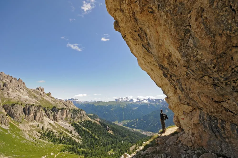
Follow the trail further as it winds along the base of steep cliffs. At approximately 3.5 kilometers, walk beneath immense rock walls with a nearby waterfall in sight. The rock formations and the view of the Catinaccio range make this one of the most impressive moments of the hike.

Shortly before arriving at Rifugio Roda di Vael, pass through a sea of scattered boulders. The trail finishes after 5.4 kilometers at the rifugio, where the landscape opens up once more. The route is well-marked and varied, offering a rich experience of natural features and alpine views throughout.

Rifugio Roda di Vael

Info
 Rifugio Roda di Vael
Rifugio Roda di Vael
Day
2

Rifugio Roda di Vael - Rifugio Vajolet

Duration: 03:00 h
Distance: 8.8 km
Ascent: 430 m
Descent: 480 m
Lowest Point: 1830 m
Highest Point: 2270 m

From Rifugio Roda di Vael, follow the route Alta Via dei Fassani as it descends gently toward Malga Vael. After approximately 1.2 kilometers, reach the small snack station where you can take a short break and enjoy the early views of the surrounding peaks. Continue on the marked trail toward the Rosengarten panorama point. At around 4.2 kilometers from the start, arrive at the panoramic viewpoint near the cable car station. From here, enjoy a wide and dramatic view of the entire Rosengarten massif — a truly unforgettable sight.

Continue along the route in the direction of Rifugio Vajolet. After another kilometer, the trail opens up into a scenic section with uninterrupted views of the Rosengarten peaks. This stretch offers several good spots to pause and take in the landscape. Follow the trail as it ascends toward Rifugio Preuss and continues to Rifugio Vajolet.

Shortly before reaching the final destination, pass a plaque placed in memory of Dr. Vinicio dalla Vecchia, located less than one kilometer before the end of the route. The hike concludes at Rifugio Vajolet, surrounded by towering rock formations and offering the possibility to rest, refresh, or stay overnight.

Rifugio Vajolet

Info
Rifugio Vajolet
Rifugio Vajolet
Day
3

Rifugio Vajolet - Grasleitenhütte

Duration: 02:15 h
Distance: 4.12 km
Ascent: 360 m
Descent: 430 m
Lowest Point: 2150 m
Highest Point: 2590 m

From Rifugio Vajolet, continue along the trail heading towards the Grasleitenpass. After approximately 1.2 kilometers, the route offers a beautiful viewpoint into the Grasleiten valley. Continue through this scenic section of the valley as the path ascends gradually towards Rifugio Passo Principe.

At around 2 kilometers from the starting point, a clear day reveals a panoramic view over the Vajolet valley. From here, you can see the Vajolethütte in the distance, surrounded by the Vajolet Towers. The trail ahead and the descent into the valley are also visible from this point.

At 2.2 kilometers, you reach Rifugio Passo Principe, the highest point of the route. This traditional mountain hut preserves the spirit of early alpine refuges and is managed by an experienced Alpine Guide. The hut sits in a strategic position and is an excellent place to rest or seek advice about the surrounding peaks.

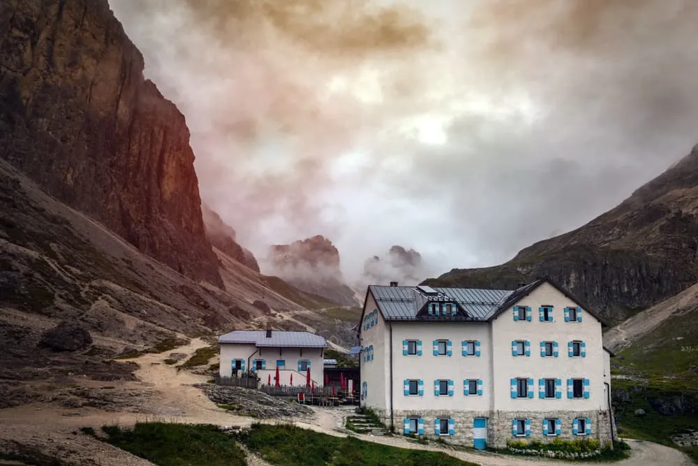
From Rifugio Passo Principe, descend along the trail towards Grasleitenhütte. The descent is steep in places and requires good footwear and alpine experience. The route ends at Grasleitenhütte, a quiet and remote hut nestled in the valley.

Grasleitenhütte

Info
Grasleitenhütte
Grasleitenhütte
Day
4

Grasleitenhütte - St. Zyprian

Duration: 03:00 h
Distance: 8.119 km
Ascent: 30 m
Descent: 1040 m
Lowest Point: 1100 m
Highest Point: 2140 m

Start at Grasleitenhütte and follow the descending trail toward St. Zyprian. After approximately 1.5 km, reach a mountain stream crossing. The open terrain offers wide panoramic views of the surrounding peaks. This spot is ideal for a short rest, to refill your water bottles, and to cool your feet in the fresh alpine water.

Continue along the same path. After another 2.5 km, cross a series of wooden bridges through the Tschamintal. In this section, pass by the Kleiner Wasserfall, the Hohen Steg spring, and the Sprudelnde Quelle. The cold, clear water and shaded forest surroundings make this one of the most scenic and refreshing stretches of the route.

Proceed for another kilometer to arrive at a bathing and resting area beside the stream. Located next to a bridge and nestled under trees, this peaceful spot invites you to pause or take a dip in the cool water.

Follow the trail further to reach the Steger Säge, around 1.5 km before the end of the route. This historic sawmill is a fine example of a Venetian water-powered mill. Once the Natural Park House of the Sciliar–Catinaccio Nature Park, it now serves as a summer visitor center. Visitors can also explore the adjoining sawyer’s house on the upper floor.

Today’s route ends in the village of St. Zyprian, a charming alpine hamlet known for its sweeping views of the Rosengarten massif and its tranquil, nature-filled atmosphere. It also marks the conclusion of this 4-day trek.

Included

  • Full travel guide

    You’ll receive access to our trekking app, which serves as your complete digital travel guide for the Rosengarten. Inside, you’ll find everything you need for your trek: route descriptions, hiking maps, navigation support, payment information, and all the key details specific to your journey.

  • Accommodation

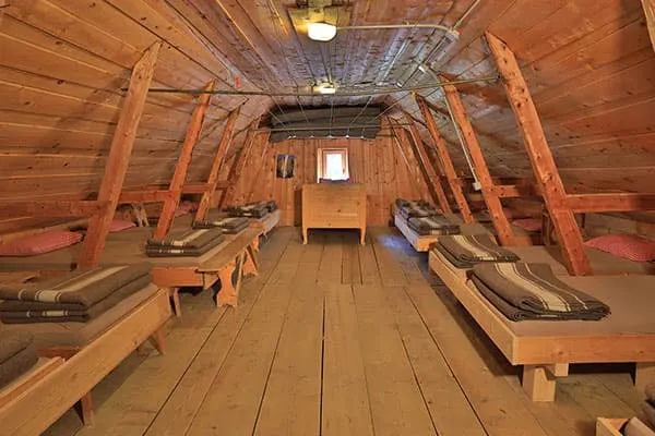
    During your Rosengarten, you will spend your nights in mountain huts. In the mountain huts we normally only book dormitories, but we can look into private rooms on request. If the private rooms are fully booked or not available in the hut, we automatically book a bed in dormitories for you. Please note that private rooms are more expensive and there will be an additional charge for this.

  • Half-board in Huts

    Accommodation at the huts includes dinner and breakfast. We will arrange this for you as well. This allows you to travel lighter and have one less thing to worry about. Bear in mind that lunch is not included, but it can be purchased at the huts. Here you can also buy an array of snacks and bottled water.

  • Navigation support

    Our trekking app also includes built-in navigation support. With GPS-based maps and offline access, you can follow the trail confidently and stay on route even without mobile signal.

Excluded

  • Traveling to and from

    You have to make your own way to the starting point. The total amount does not include personal transport.

  • Transfers

    Should you need any form of (public) transport on location, this is not part of the trekking package. This includes the use of taxi, bus, cable cars, gondolas, ferries, etc.

  • Lunch

    Half-board is included in the price of this trek. Lunch, however, is not. You can get something to eat at the mountain huts along the way.

  • Travel Insurance

    Your international travel insurance is your own responsibility. Discuss your itinerary with the insurance company before your trek.

  • Personal expenses

    Personal expenses on such as souvenirs, drinks, and other similar expenses are for your own account.

FAQ

  • How to Get To the Starting Point of the Little Rosengarten Trek

  • Travel From the Ending Point of the Little Rosengarten Trek

  • What if the dates I want are not available?

  • If I book now, can I immediately arrange the rest of my trip?

  • How do I know if this trek is right for me?

How to Book

  • Booking

  • Availability

  • Cancellation policy

Packing List for the Rosengarten

  • Information

  • Essentials

  • Extras

Reviews

Reviews