Advanced Traverse of the 3 Refuges: Ter i Freser

Duration: 4 days
Trails: T3 trails
Distance: 10 - 15 km per day
Ascent per day: 500 - 1000 m ascent per day

> Complete the challenging Ter i Freser Traverse of the 3 Refuges
> Cross rugged terrain and high passes in Catalonia’s eastern Pyrenees
> Stay in simple but welcoming huts

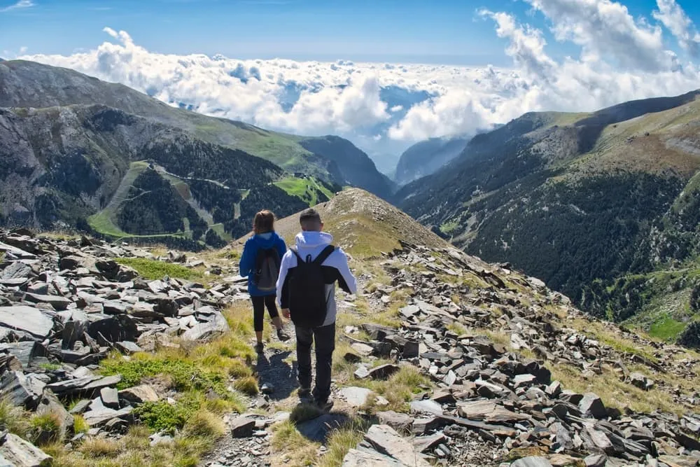
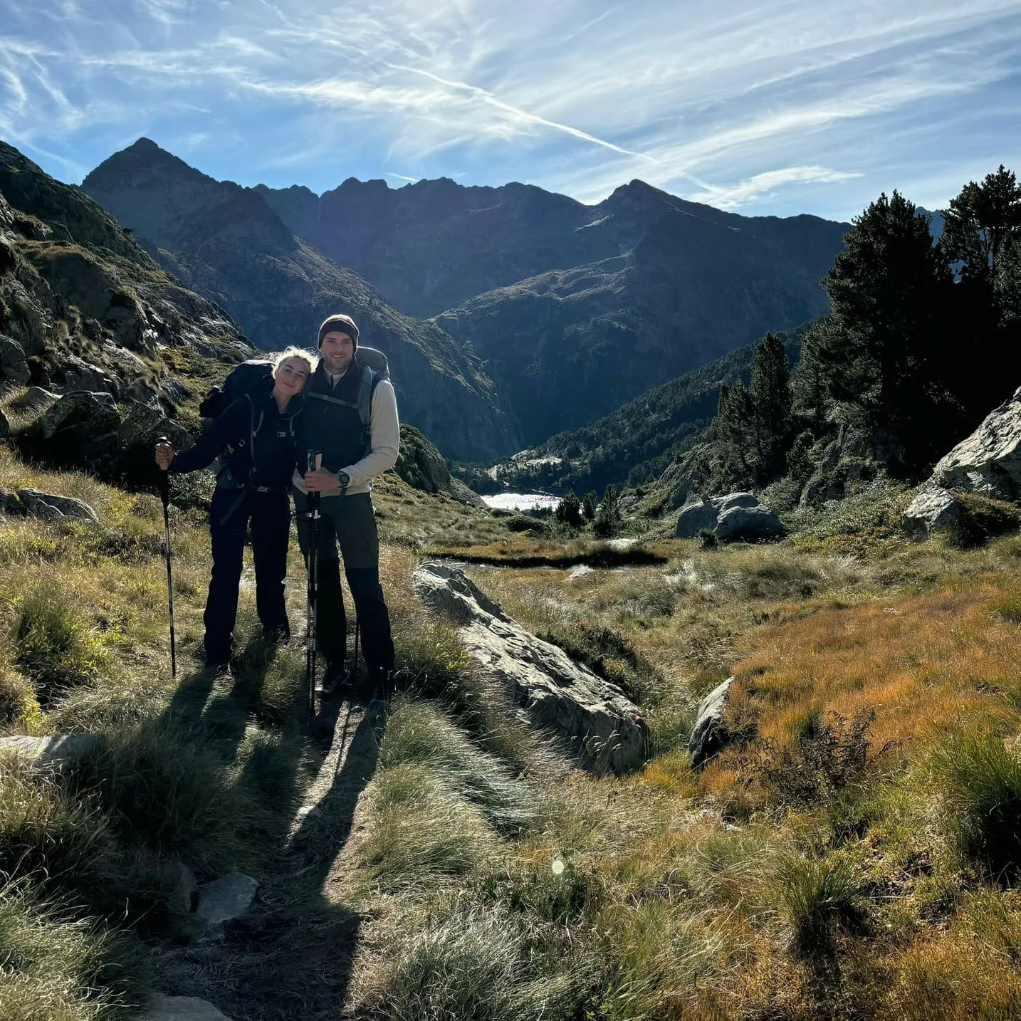
This advanced 4-day trek takes you on a full loop through the wild and less-travelled eastern Pyrenees of Catalonia. Known as the Traverse of the 3 Refuges, the route connects the remote huts of Coma de Vaca, Pic de L'Àliga de Núria and Ras de Carançà, which are surrounded by jagged peaks, glacial valleys and untamed nature.

Expect steep climbs, rocky trails and unforgettable views of the Ter i Freser valley. This route is perfect for seasoned hikers looking to escape the crowds and immerse themselves in the heart of Catalonia’s alpine landscape. Short on days, big on adventure!

Itinerary

Day
1

Queralbs - Refuge Coma de Vaca

Duration: 04:00 h
Distance: 8.6 km
Ascent: 920 m
Descent: 90 m

The route begins in the stone-built village of Queralbs and follows the wild upper valley of the River Freser. The trail quickly climbs steadily through forests and rocky gorges, always alongside the river. Gradually, the landscape opens up to reveal a wide alpine basin where the secluded Refuge Coma de Vaca is nestled amongst towering Pyrenean peaks.

You start walking along a road to meet River Freser, then follow its banks upstream on a well-marked trail. The route then climbs through shady woodland and past waterfalls, entering the narrow Gorges del Freser via sections of narrow rocky and gravel paths, footbridges, and short, steep zigzags beside the torrent and forest vegetation.

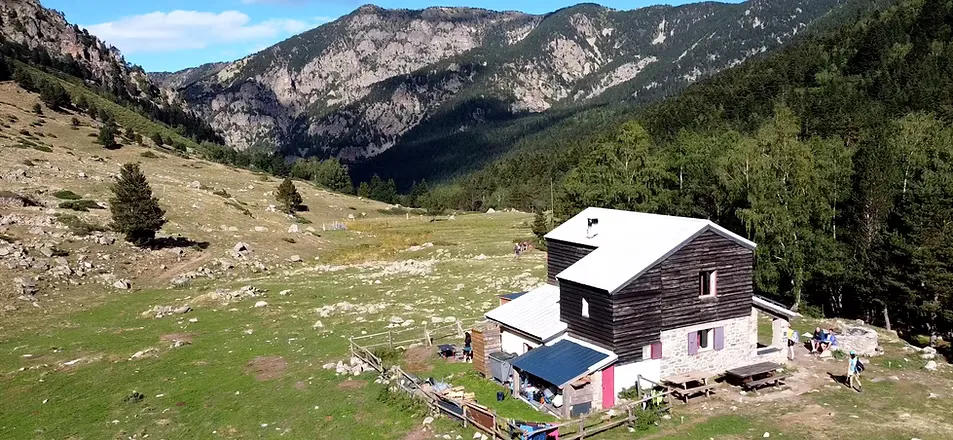
Leaving the gorge, the valley widens, the gradient becomes steeper at times, and the trail crosses pastures and stony slopes with views of Balandrau (2,585 m) and Puig de Fontlletera (2,581 m). A final moderate ascent through open meadows leads directly to the Refuge Coma de Vaca, which is perched on a terrace above the river. There, dinner, warmth and bunkrooms await.

Refugi de Coma de Vaca

Info
Refugi de Coma de Vaca
Day
2

Refuge Coma de Vaca - Refuge du Ras de la Carança

Duration: 05:20 h
Distance: 13 km
Ascent: 830 m
Descent: 990 m

This high mountain crossing links two remote mountain huts via the granite skyline of the eastern Pyrenees. Starting in the peaceful Coma de Vaca basin, the route climbs to the border ridge before dropping down into the rugged Carança Valley in France. Along the way, you will pass beneath the peaks of Bastiments (2,881 m), Pic de la Dona (2,702 m) and Gra de Fajol (2,714 m), enjoying sweeping vistas of ridges and cirques. You will then reach a secluded hut nestled amongst pine trees and pastures.

From there, the path follows a clear, cairned trail through the upper Freser Valley. It soon steepens through boulders and alpine grass until you reach Marrana Pass (2,530 m). The ascent continues into a wide cirque nestled beneath the rocky flanks of the Bastiments peak. Here, the panorama opens up to reveal views of the surrounding three-thousand-metre peaks.

A final push will bring you to a broad frontier col between Bastiments and Pic de la Dona at 2,820 m, the highest point of the day. The landscape suddenly drops away here towards France, with the serrated ridge of the Carança spread out beneath your feet. From Coll de la Geganta (2,606 m), the trail turns north and continues via a long descent into the Carança basin. First, it passes over stony slopes, then it crosses gentler, grassy terraces where ibex often graze.

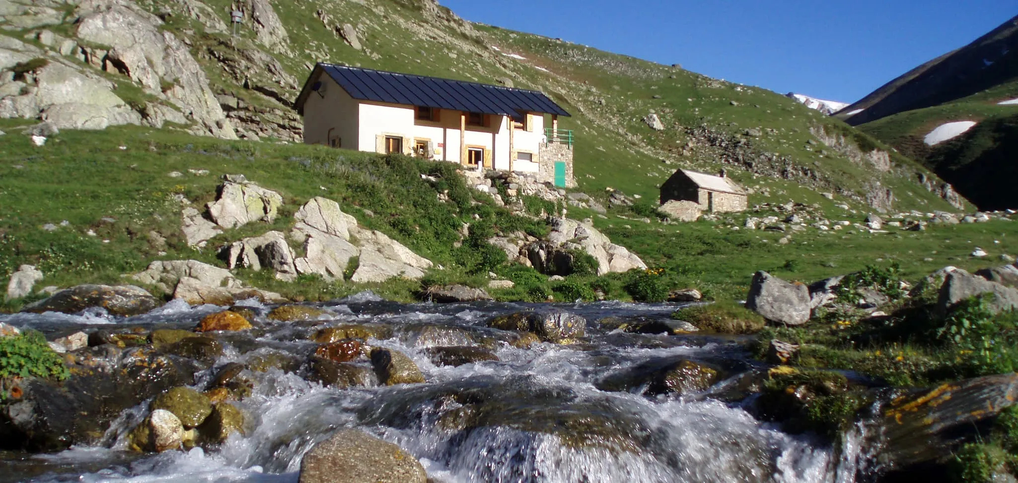
The valley narrows again and a final traverse through a pine forest leads to the Refuge du Ras de la Carança, which is nestled on a shelf above the torrent. Here, you can leave your backpack, enjoy a drink on the terrace and settle into the dormitories for the night.

Refuge Ras de la Carança

Info
Refuge Ras de la Carança
Day
3

Refuge du Ras de la Carança - Alberg de Pic de l'Áliga

Duration: 06:30 h
Distance: 13.5 km
Ascent: 1080 m
Descent: 800 m

This challenging alpine traverse links the secluded Carança Valley with the Núria Cirque. It stays high on the frontier crest before descending to a balcony above the sanctuary. After ascending to Coll de Carançà (2,724 m), the route continues alongside mountain lakes, beneath towering peaks and offering constant views of granite walls and hanging valleys.

From the refuge, the trail ascends the Carança Valley via a challenging path alongside the La Carançà stream, climbing through trees and boulders. The ascent reaches Estany de Carançà, the first lake of the day, located next to the pleasant picnic spot of Abri Étang de La Carançà. Shortly afterwards, Estany Negre and Estany Blau come into view, just before Coll de Carançà (2,724 m) and the Pass of the Nine Crosses (2,770 m). Here, you will re-enter Spain from France, where the border is crossed and panoramic views of the Catalan side open up.

A downhill path then passes beneath rocky flanks and occasional cairns, as well as small tarns. From the frontier ridge, the route turns south and begins the long descent towards Núria. Initially, it follows stony slopes and then passes through softer pastures threaded with streams, where you may see cows and horses grazing.

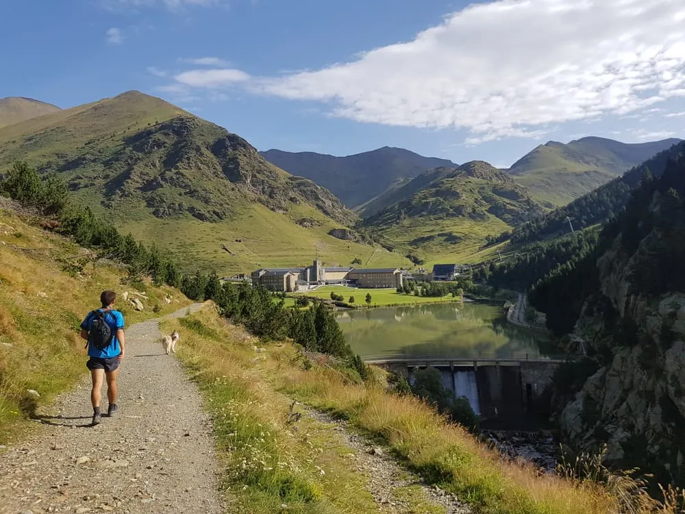
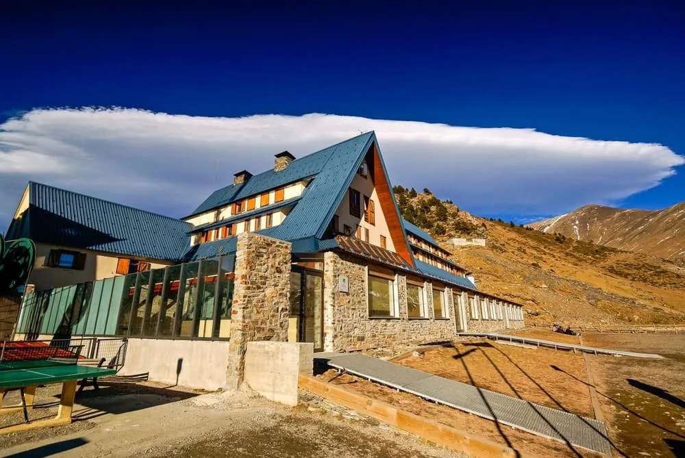
Joining a broader path, you will descend into the amphitheatre surrounding the Basílica de la Mare de Déu de Núria and its small lake. A final short but steep climb takes you up through pastureland and scattered pine trees to the Alberg de Pic de l'Áliga, which is perched above the valley.

Alberg Pic de L'Àliga de Núria

Info
Alberg Pic de L'Àliga de Núria
Day
4

Alberg de Pic de l'Áliga - Queralbs

Duration: 03:15 h
Distance: 8.6 km
Ascent: 20 m
Descent: 960 m

This final section is an undulating downhill walk, leaving the balcony-like setting of the hut behind as you descend back into the valley. The route follows the historic path between Núria and Queralbs, carved into the cliffs high above the river. As you make your way down, you will be accompanied by waterfalls, airy viewpoints and glimpses of Puigmal (2,910 m) and Tossa del Pas dels Lladres (2,661 m), before reaching the villages and roads below.

From the refuge, a stony footpath winds down through pastureland and scattered pine trees, leading back to the Núria sanctuary and lake. Here, you will briefly join busier paths near the railway station. The path then leaves this area behind and follows an excellent trail above the Riu de Núria stream. This trail alternates between shady woodland and open sections, offering views of the gorge, the Cremal Bridge, and waterfalls such as the Salt de la Cua de Cavall cascade. The Cova de Sant Rafael cave and the beautiful stone Cremal Bridge will appear on your way down.

As the valley widens, the path becomes gentler. Passing farmhouses and small meadows, you will eventually catch sight of the stone houses of Queralbs. You enter the village via cobbled streets, climbing gently to the Romanesque church and central square. Here, cafés and bars provide the perfect place to celebrate reaching your destination. Congratulations, you made it!

Included

  • Full travel guide

    You’ll receive access to our trekking app, which serves as your complete digital travel guide for the Ter i Freser Traverse. Inside, you’ll find everything you need for your trek: route descriptions, hiking maps, navigation support, payment information, and all the key details specific to your journey.

  • Accommodation

    During your Ter i Freser Traverse, you will spend your nights in mountain huts. In the mountain huts we normally only book dormitories, but we can look into private rooms on request. If the private rooms are fully booked or not available in the hut, we automatically book a bed in dormitories for you. Please note that private rooms are more expensive and there will be an additional charge for this.

  • Half-board in Huts

    Accommodation at the huts includes dinner and breakfast. We will arrange this for you as well. This allows you to travel lighter and have one less thing to worry about. Bear in mind that lunch is not included, but it can be purchased at the huts. Here you can also buy an array of snacks and bottled water.

  • Navigation support

    Our trekking app also includes built-in navigation support. With GPS-based maps and offline access, you can follow the trail confidently and stay on route even without mobile signal.

Excluded

  • Traveling to and from

    You have to make your own way to the starting point. The total amount does not include personal transport.

  • Transfers

    Should you need any form of (public) transport on location, this is not part of the trekking package. This includes the use of taxi, bus, cable cars, gondolas, ferries, etc.

  • Lunch

    Half-board is included in the price of this trek. Lunch, however, is not. You can get something to eat at the mountain huts along the way.

  • Travel Insurance

    Your international travel insurance is your own responsibility. Discuss your itinerary with the insurance company before your trek.

  • Personal expenses

    Personal expenses on such as souvenirs, drinks, and other similar expenses are for your own account.

FAQ

  • Starting Point: Queralbs

  • End Point: Queralbs

  • What if the dates I want are not available?

  • If I book now, can I immediately arrange the rest of my trip?

  • How do I know if this trek is right for me?

How to Book

  • Booking

  • Availability

  • Cancellation policy