Half Alta Via 2 - Alternative Route with Hotel Before and After

Duration: 8 days
Trails: T3 trails
Distance: 10 - 15 km per day
Ascent per day: 500 - 1000 m ascent per day

> The first 6 stages of the Alta Via 2 – via an alternative route
> Accommodation before and after the trek in Lajen or Brixen is included
> Forget the logistics—we’ve already got your stay at the Rifugios sorted

The Alta Via 2 is one of the most iconic long-distance treks in the Italian Dolomites. It’s packed with adventure – steep paths, dramatic ridgelines, and heart-pumping Via Ferratas. Only experienced hikers with mountain skills and a head for heights should take on the challenge – are you ready?

We’ve designed an alternative 6-day version of the Half Alta Via 2 for when the classic route, including Rifugio Genova, is fully booked. This itinerary starts in Lajen, with your first night on the trail at scenic Rifugio Resciesa, before rejoining the main trail and continuing to San Pellegrino.

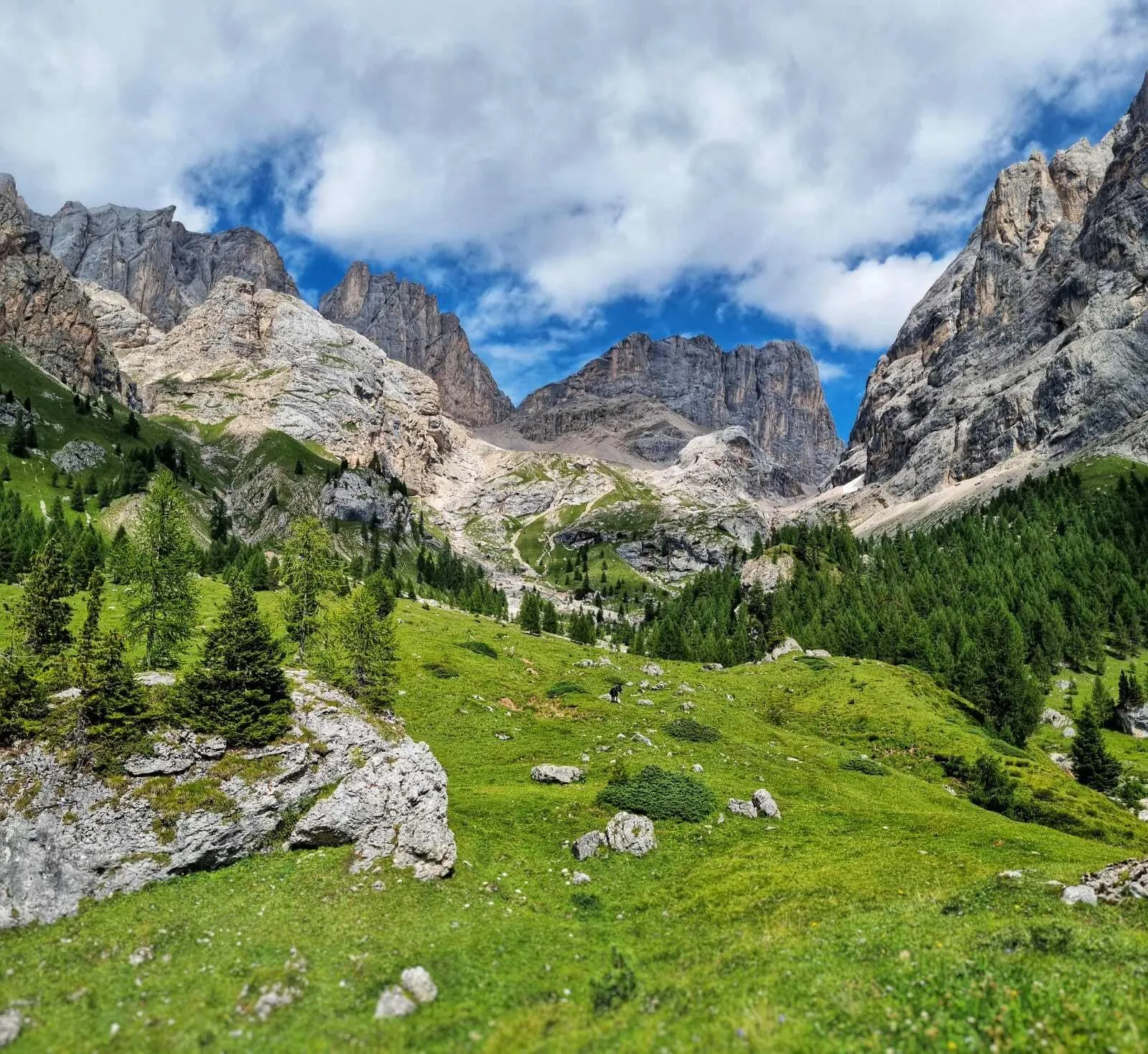
This route covers the less technical northern half of the Alta Via 2. While you’ll still encounter Via Ferratas along the way, they are more manageable than those in the southern stages – making this a great option for trekkers who want a challenge without taking on the most demanding sections.

Your accommodation in Lajen (or Brixen) before and after the trek is included – giving you time to relax and recharge on both ends of your adventure. Expect epic views, unforgettable trails, cozy mountain huts, and fantastic Northern Italian food along the way.

Itinerary

Day
1

Arrival in Lajen

Today, make your way to Lajen, or Laion in Italian. Take the time to settle in, explore the peaceful surroundings, and relax — tomorrow, your trek begins.

If the accommodation options in Lajen are full, we will arrange your stay in Brixen (Bressanone), only a 30-minute bus ride away.

Gasthof Zur Sonne (Lajen)

Info
Gasthof Zur Sonne (Lajen)
Day
2

Lajen - Rifugio Resciesa

Duration: 04:45 h
Distance: 9.92 km
Ascent: 1090 m
Descent: 20 m
p>Your trek kicks off with a mostly uphill stage, easing you into the rhythm of the mountains. Leaving Lajen behind, the trail leads you steadily upward, passing the charming Church of St. Jacob and Valentin. Not far along, you'll reach the Unterpulghütte hut – a perfect spot to take a break and recharge with a drink or snack.

As you continue climbing, keep an eye out for the unique sculptures carved into the forest trees – a creative touch that adds a bit of magic to the trail. A little further on, just before reaching today’s final destination, you'll arrive at a panoramic viewpoint offering sweeping views over the valley around Lajen. After one last stretch, you’ll arrive at Rifugio Resciesa – your home for the night.

Resciesa hut (Raschötz Hütte)

Info
Resciesa hut (Raschötz Hütte)
Day
3

Resciesa hut (Raschötz Hütte) - Rifugio Firenze

Duration: 03:55 h
Distance: 9.79 km
Ascent: 480 m
Descent: 610 m

From Resciesa Hut, head towards Seceda, following a scenic path through alpine meadows with stunning views of the Odle Group. The route gradually ascends before reaching Fermeda Hut, a great spot for a break. From here, continue past the Seceda chairlift station, where you’ll get one of the most iconic panoramas in the Dolomites.

The trail then descends through rolling pastures before entering forested terrain. The final stretch is steeper as you make your way down to Rifugio Firenze, nestled in the heart of the Puez-Odle Nature Park.

Rifugio Firenze

Info
Rifugio Firenze
Day
4

Rifugio Firenze - Rifugio Franco Cavazza al Pisciadù

Duration: 05:30 h
Distance: 12.5 km
Ascent: 1130 m
Descent: 570 m
From Rifugio Firenze (Regensburgerhütte), hike toward the town of Selva Gardena. When you reach Daunëi, stay on path 3, hiking through Val de Chedul. From here there is a succession of slight ascents and descents, splits, boulders, small towers and meadows until you reach the wide Dolomite saddle of Passo Gardena (Grödner Joch, 2,121 m). From this-pass follow path no. 666 and you will encounter the possibility of a Via Ferrata along the way to the "Franco Cavazza" Rifugio in Pisciadù at 2585 meters.

Rifugio Franco Cavazza al Pisciadù

Info
Rifugio Franco Cavazza al Pisciadù
Day
5

Rifugio Pisciadù - Rifugio Castiglioni Marmolada

Duration: 07:20 h
Distance: 17.1 km
Ascent: 720 m
Descent: 1240 m

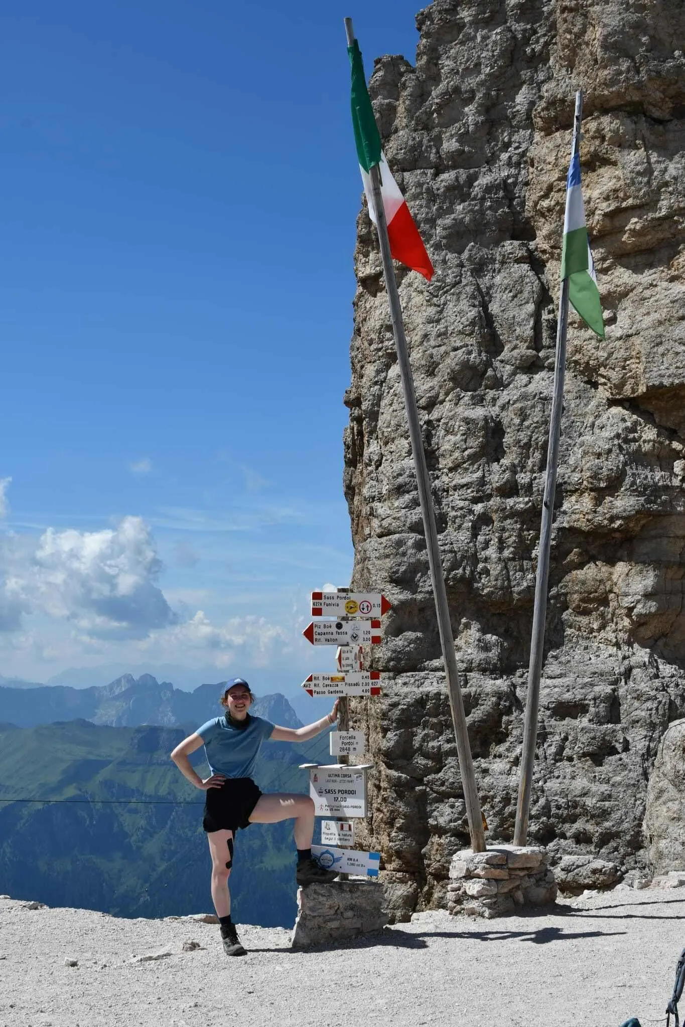
From Pisciadù Hut take path n. 666 southwards, along the eastern shore of the lake. Above the Val de Tita, there are two possibilities: an easier path, or a section equipped with fixed ropes. The path then continues on gravel and sometimes on patches of snow up to a saddle. The trail then goes up to Dante's Altipiano del Sella where, in case of fog, you must follow the signs very carefully. You then turn southwards, cross the plateau, and descend to Forcella d'Antersass, at 2861 m, where path n. 666 ends. You now start walking on path n. 647.

Continue south to the top of the Antersass (Zwischenkofel, 2907 m). You can circumvent the summit through the path on the right, but if the weather is nice it is worth taking a look from the top. You will then descend to Boè Hut (Bambergerhütte, 2871 m). From Boè Rifugio take path n. 627 up to Forcella Pordòi Rifugio (2829 m) from where you can enjoy a splendid panorama. At the rifugio, a wide and steep scree slope begins; you can follow the numerous switchbacks, or let yourself "slide" on the soft gravel. Finally, the path leads down to Passo Pordòi, at 2239 meters. From Passo Pordòi, take path 601 southwards, towards a chapel. Following the eastern slope of Sass Beccè, the trail leads to Rifugio Baita Fredarola, 2370 m. From Fredarola Rifugio, the path bends eastwards to enter the Vièl dal Pan (Path of Bread), an ancient path between the Val di Fassa and the Agordino. The path is wide and panoramic, especially on the Marmolada that stands out gigantic in front of it. At about halfway along the path there is the Rifugio Vièl dal Pan, 2432 m. From Rifugio Viel Dal Pan follow the path up to the junction with path n. 698. Follow path n. 601 to the south, then turn west along the steep meadows, until you reach the nearby Rifugio Castiglioni Marmolada (2044 m).

Rifugio Castiglioni Marmolada

Info
Rifugio Castiglioni Marmolada
Day
6

Rifugio Castiglioni Marmolada - Rifugio Contrin

Duration: 03:55 h
Distance: 11.3 km
Ascent: 490 m
Descent: 540 m
From Rifugio Castiglioni Marmolada descend to Pian Trevisan (1681m) along the "Via Neva" (path 605), an old mule track used in the past by tourists and porters to reach the top of the Marmolada. Continue through the forest to the village of Penia (1554m) and immediately after the village, ascend on the left to Val Contrin (path 602) via "Locia de Contrin" (1736m) to the mountain hut of the same name (2016m).

Rifugio Contrin

Info
Rifugio Contrin
Day
7

Rifugio Contrin - Passo San Pellegrino/Moena

Duration: 05:00 h
Distance: 11.4 km
Ascent: 680 m
Descent: 780 m
Behind the Rifugio Contrin, at 2.016 m, take path n. 607 on the right. After passing a stream, cross the Lasté de Contrin until you reach a plateau. Here you go left, going up to a back of mountain rocks that divides two small valleys. Follow the trail until you reach a large sign that marks the fork with path n. 612. Continue along the steps that take you to the Cime Ciadine. Finally, you reach the saddle of the Cirelle Pass at 2,682 m. Descend the opposite slope towards Val da la Tas-cia. On the military road, cross the plateau of the Busc da la Tas-cia and then descend through switchbacks towards the valley where you will find Rifugio Fuciade, at 1,972 m. From Rifugio Fuciade, a dirt road leads along the Fuciade valley. After 20 minutes you will reach the main road, which will lead you to Passo San Pellegrino. After arriving here, it is a short trip by bus to your last overnight stay in Moena or Passo san Pellegrino.

Hotel Arnika Wellness (Passo San Pellegrino)

Info
Hotel Arnika Wellness (Passo San Pellegrino)
Day
8

Departure day

After breakfast, your trip and our services come to an end. From Moena or Passo San Pellegrino, you can take a bus back to Bressanone or Bolzano.
See entire itinerary

Included

  • Booking the huts

    We will take care of arranging accommodation on the Alta Via 2 for you. We will also provide you with a detailed itinerary for every stage and instructions on how to get to the trailhead.

  • Full travel guide

    We will send you on your way with a digital travel guide that includes a route description for the Alta Via 2, interactive hiking maps, and the most important information applicable to your trek

  • Accommodation

    During your Alta Via 2, you will spend your nights in mountain huts. In the mountain huts we normally only book dormitories, but we can look into private rooms on request. If the private rooms are fully booked or not available in the hut, we automatically book a bed in dormitories for you. Please note that private rooms are more expensive and there will be an additional charge for this.

  • Accommodation before and after the tour

    Accommodation before and after the trek is included. Breakfast is part of your stay.

  • Half board (where possible)

    Accommodation in the huts includes dinner and breakfast, unless otherwise indicated in the exclusive list. This allows you to travel lighter and not have to worry about an extra meal. Please note, however, that lunch is not included, but can be purchased at the huts.

Excluded

  • Traveling to and from

    You have to make your own way to the starting point. The total amount does not include personal transport.

  • Transfers

    Should you need any form of (public) transport on location, this is not part of the trekking package. This includes the use of taxi, bus, cable cars, gondolas, ferries, etc.

  • Lunch

    Half-board is included in the price of this trek. Lunch, however, is not. You can get something to eat at the mountain huts along the way.

  • Travel Insurance

    Your international travel insurance is your own responsibility. Discuss your itinerary with the insurance company before your trek.

  • Personal expenses

    Personal expenses on such as souvenirs, drinks, and other similar expenses are for your own account.

  • Via Ferrata equipment

    Via Ferrata equipment (helmet, harness, via ferrata set) are not included in the price, but will be available for rent in the town(s) close to the starting point.

FAQ

  • Where Does the Alta Via 2 Start and How Do I Get There?

  • Difficulty of the Alta Via 2: Is This Trek Right for Me?

  • When Is the Best Season to Hike the Alta Via 2 in the Dolomites?

How to Book

  • Booking

  • Availability

  • Cancellation policy

Reviews

Reviews

Just for You