Preferred date sold out?
Discover our trekking adventures in Italy with availability in August, September or October and secure your spot before it’s too late!

Intermediate Anello delle Dolomiti Friulane

Duration: 5 days
Trails: T2 trails
Distance: 0 - 10 km per day
Ascent per day: 500 - 1000 m ascent per day
> For seasoned trekkers craving a wilder Dolomites
> Loop the raw Friulian peaks in 5 intense days
> Stay high in remote rifugios: Giaf, Flaiban Pacherini, Pordenone, Padova

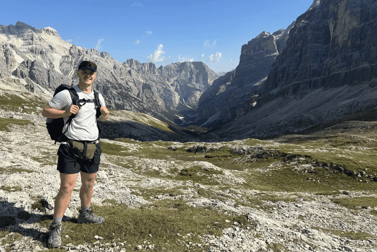
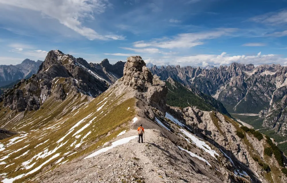
Wake to the whistle of marmots, lace up with the sunrise, and walk straight into the silence of the Dolomiti Friulane. No crowds. No frills. Just you, the mountains, and a trail that doesn’t care who you are.

The Anello delle Dolomiti Friulane is a rugged loop through the wildest corner of the Dolomites. It’s 5 days of solitude, scree, and serious elevation. From the forests near Calalzo di Cadore to the lonely passes above Rifugio Flaiban, every meter gained is hard-earned. And worth it.

This one’s for the sure-footed, the mountain-hungry, the hikers who feel most alive when the world drops away. Ready to get a little savage?

Itinerary

Day
1

Calalzo di Cadore - Rifugio Giaf

Duration: 07:00 h
Distance: 15.6 km
Ascent: 1410 m
Descent: 730 m
Lowest Point: 680 m
Highest Point: 2050 m

Start in Calalzo di Cadore and follow Via Piduel along the edge of town. Cross the Lago di Cadore Bridge and continue on Via Piduel until the intersection with path no. VA-B18. Turn left and begin the gradual ascent into the forested landscape of the Dolomites.

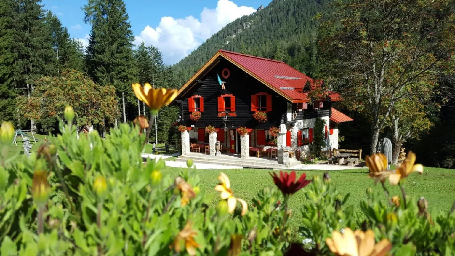
After around 3 hours of gentle climbing, reach Rifugio Padova, an idyllic mountain hut with excellent food and panoramic views. It is a good place to take a break before continuing the Friulian trekking tour.

From the Rifugio, follow path no. VA-B17. The trail becomes steeper as it climbs toward Forcella Scodavacca. After 3 kilometers of ascent, reach the highest point of the day. From this saddle, there is the option to climb Monte Cridola, though the route is rocky and requires care.

Descend from Forcella Scodavacca for another 4 kilometers. The trail leads through alpine terrain with open views of the pass behind you. Continue on the path until Rifugio Giaf, where the first stage of the trek ends.

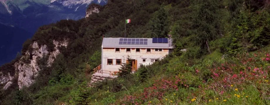
Rifugio Giaf

Info
Rifugio Giaf
Rifugio Giaf
Day
2

Rifugio Giaf - Rifugio Flaiban Pacherini

Duration: 05:12 h
Distance: 9.36 km
Ascent: 1000 m
Descent: 820 m
Lowest Point: 1420 m
Highest Point: 2130 m

From Rifugio Giaf follow the Truoi dai Sclops, a scenic trail known for its wildflowers, towards Forcella Urtisiel. The path ascends gradually for about 2 km before reaching Forcella Urtisiel, the first peak of the day. The trail narrows sharply here, with steep drops on both sides. From the saddle, enjoy panoramic views of the surrounding Dolomite peaks.

Continue on the trail for another 2 km to reach a viewpoint overlooking the Cimoliana Valley. From this point, take in the beautiful views of the Torrente Cimoliana winding through the rocky landscape. The path descends briefly before ascending again through alpine terrain.

At 5.5 km from the starting point, arrive at Canpuros, a fairy-tale alpine prairie surrounded by rocks and scattered trees. In summer, this meadow is filled with wildflowers and offers a peaceful resting spot.

From Canpuros continue on trail no. 349 for another 2 km to reach Forcella dell’Inferno, the second peak of the route. From the saddle begin the descent towards Rifugio Flaiban Pacherini. The trail descends steadily for about 2 km and leads to the end point of this stage.

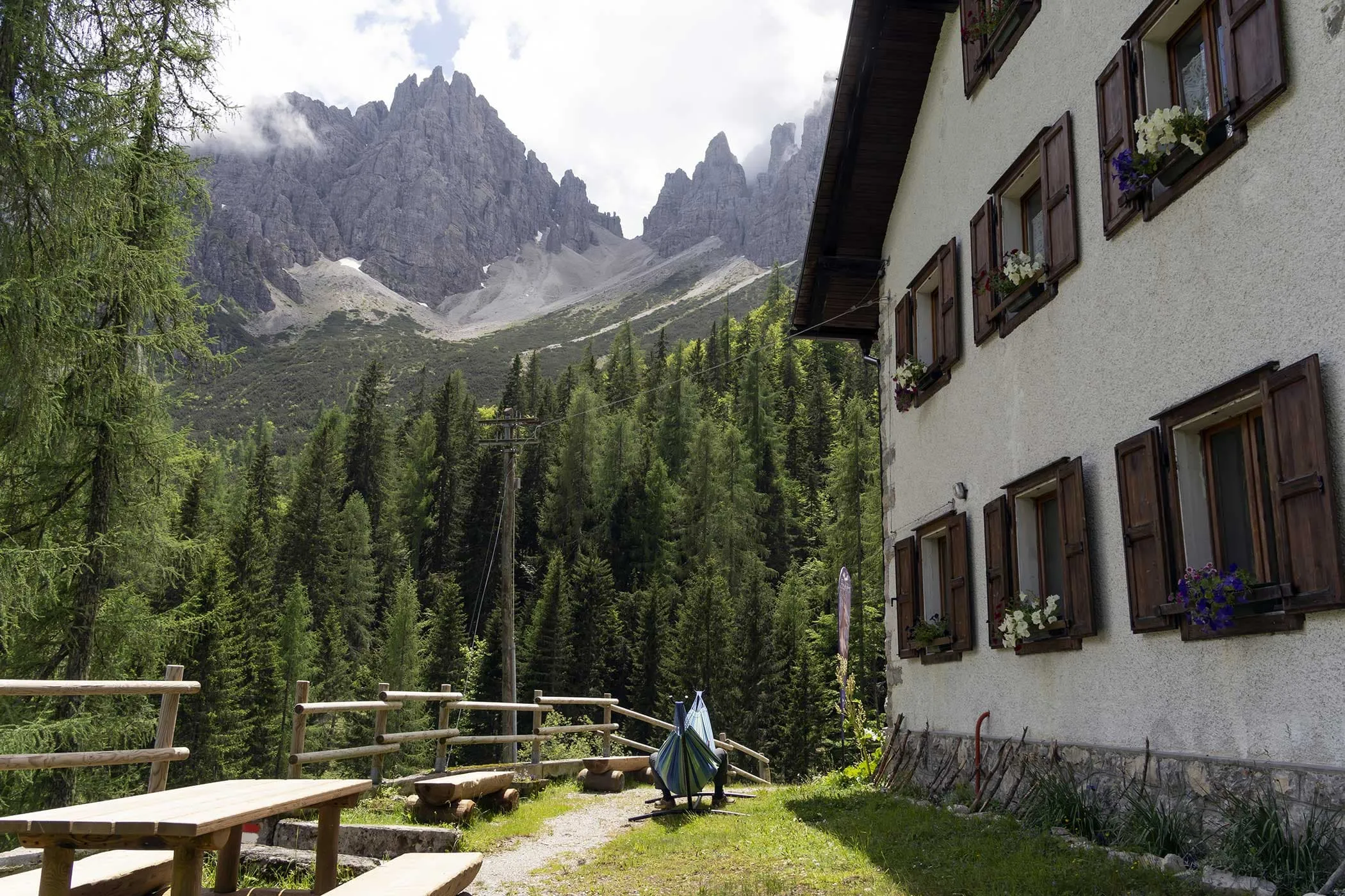
Rifugio Flaiban Pacherini

Info
Rifugio Flaiban Pacherini
Day
3

Rifugio Flaiban Pacherini - Rifugio Pordenone

Duration: 03:30 h
Distance: 7.75 km
Ascent: 490 m
Descent: 880 m
Lowest Point: 1170 m
Highest Point: 2050 m

From Rifugio Flaiban Pacherini follow the path VA-B18 for approximately 1.3 km to reach Passo del Mus, the highest point of the stage. From the pass, enjoy panoramic views over the surrounding valleys and peaks.

Continue on the descent for less than 500 meters to arrive at a small alpine pond. The area is scattered with boulders and offers a quiet, scenic atmosphere.

Keep following the trail for around 1 km to reach Casone Val dell'Inferno. This is a lush green basin filled with alpine flowers and marked by a large, cube-shaped rock in the center.

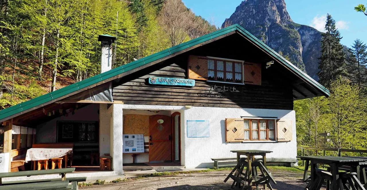
The final 4 km of the stage begin with a steady descent, followed by a mostly flat section through forested paths and open terrain until Rifugio Pordenone, the endpoint of this day’s hike.

Rifugio Pordenone

Info
Rifugio Pordenone
Rifugio Pordenone
Day
4

Rifugio Pordenone - Rifugio Padova

Duration: 05:00 h
Distance: 7.25 km
Ascent: 1060 m
Descent: 1000 m
Lowest Point: 1230 m
Highest Point: 2090 m

From the start of the trail, follow the marked path as it begins to ascend steadily through forest and rocky terrain. After approximately 1.3 kilometers, reach the first viewpoint from which the bell tower of Val Montanaia becomes visible in the distance.

Continue on the same trail for another 1.3 kilometers to arrive at Bivacco Giuliano Perugini. This bivouac is located on an open ridge and offers breathtaking views of the Campanile di Val Montanaia. It is an ideal place to pause and admire the dramatic landscape of the Friulian Dolomites.

From the bivouac, follow the steep trail for another 2 kilometers until you reach Forcella Montanaia. This is the highest point of the route. The final ascent is demanding and should be approached with caution, especially during late autumn when the ground may be frozen and slippery.

From Forcella Montanaia, begin the descent along the marked path that leads back into the valley. The trail gradually winds down through scree and forest, concluding the trek in a remote and scenic part of the Dolomites.

Rifugio Padova

Info
Rifugio Padova
Rifugio Padova
Day
5

Rifugio Padova - Calalzo di Cadore

Duration: 02:50 h
Distance: 9.3 km
Ascent: 100 m
Descent: 640 m
Lowest Point: 680 m
Highest Point: 1290 m

From Rifugio Padova, follow the same path you walked on day 1, descending through the forest on the marked trail towards Calalzo di Cadore. The descent begins gradually and continues through larch woods and rocky sections. Midway through the route, cross a small mountain stream using concrete stepping stones. Take a short break to enjoy the cool air and the sound of the flowing water.

The path then becomes wider and merges with a gravel forest road. The terrain alternates between natural trails and easy gravel sections. The final stretch leads gently downhill on a paved road, arriving in the town of Calalzo di Cadore, marking the end of this 5-day adventure.

Included

  • Full travel guide

    You’ll receive access to our trekking app, which serves as your complete digital travel guide for the Dolomiti Friulane. Inside, you’ll find everything you need for your trek: route descriptions, hiking maps, navigation support, payment information, and all the key details specific to your journey.

  • Accommodation

    During your Dolomiti Friulane, you will spend your nights in mountain huts. In the mountain huts we normally only book dormitories, but we can look into private rooms on request. If the private rooms are fully booked or not available in the hut, we automatically book a bed in dormitories for you. Please note that private rooms are more expensive and there will be an additional charge for this.

  • Half board (where possible)

    Accommodation in the huts includes dinner and breakfast, unless otherwise indicated in the exclusive list. This allows you to travel lighter and not have to worry about an extra meal. Please note, however, that lunch is not included, but can be purchased at the huts.

  • Navigation support

    Our trekking app also includes built-in navigation support. With GPS-based maps and offline access, you can follow the trail confidently and stay on route even without mobile signal.

Excluded

  • Traveling to and from

    You have to make your own way to the starting point. The total amount does not include personal transport.

  • Transfers

    Should you need any form of (public) transport on location, this is not part of the trekking package. This includes the use of taxi, bus, cable cars, gondolas, ferries, etc.

  • Lunch

    Half-board is included in the price of this trek. Lunch, however, is not. You can get something to eat at the mountain huts along the way.

  • Travel Insurance

    Your international travel insurance is your own responsibility. Discuss your itinerary with the insurance company before your trek.

  • Personal expenses

    Personal expenses on such as souvenirs, drinks, and other similar expenses are for your own account.

FAQ

  • How to Get to the Starting Point of the Anello Delle Dolomiti Friulane

  • End point: Calalzo di Cadore

  • What if the dates I want are not available?

  • If I book now, can I immediately arrange the rest of my trip?

  • How do I know if this trek is right for me?

How to Book

  • Booking

  • Availability

  • Cancellation policy

Packing List for the Dolomiti Friulane

  • Information

  • Essentials

  • Extras