Expert Alta Via Delle Dolomiti Friulane

  • Duration
    Total 4 days
    Average 5h 35min
  • Distance
    Total 44.4 km
    Average 11.1 km
  • Ascent
    Total +3870 m
    Average +968 m
  • Descent
    Total -3750 m
    Average -938 m

> Cross the wildest Dolomites of them all
> Stay overnight in mountain huts along the route
> Only for true mountain adventurers

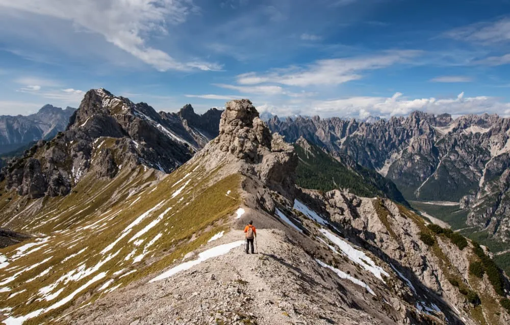
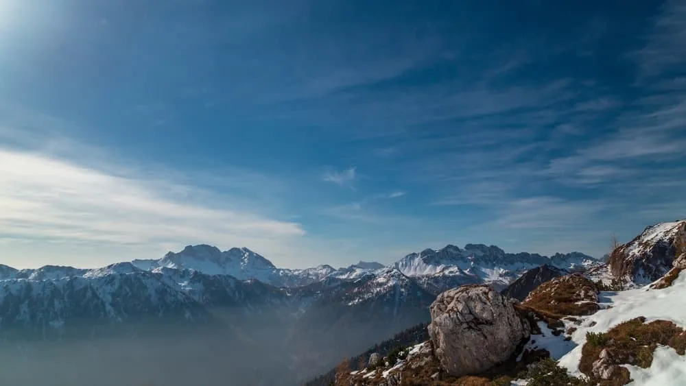
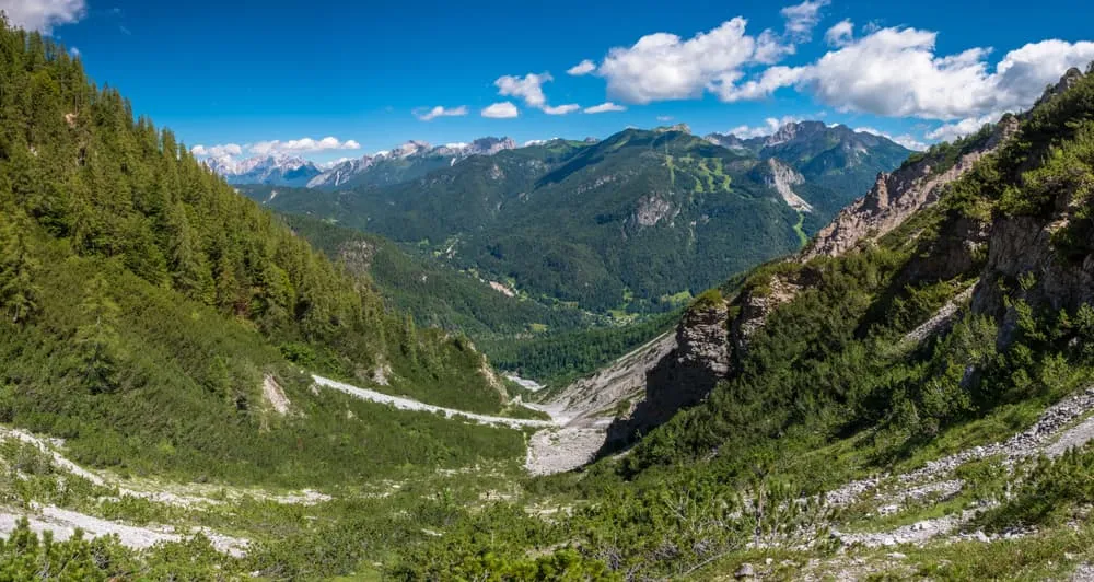
There is a moment, just before sunrise, when the silence in the Dolomiti Friulane is so complete it almost sings. You step out of the hut — pink morning light reflects on jagged limestone towers, not a soul in sight. This is the Alta Via delle Dolomiti Friulane: raw, remote, and unforgettable. Where other Alta Vias lead you past cappuccinos and hot showers, this expert route brings everything back to the essence. Just you, the trail, and the untouched Dolomiti d’Oltre Piave.

In a demanding 4-day hut-to-hut Dolomites trek, you will cross scree fields, climb exposed passes, and descend into valleys where ibex roam more often than people. With overnight stays in Rifugio Padova, Rifugio Giaf, and Rifugio Flaiban Pacherini, you will connect the wildest parts of the Carnic and Gailtal Alps. Expect T4-T5 terrain and alpine experience. But if you are ready for a pure mountain adventure, far from the crowds, this is your Dolomites hut-to-hut trek.

Make no mistake: this is not a hike for beginners. But for experienced mountaineers who truly want to feel the untamed Dolomiti Friulane, the Alta Via delle Dolomiti Friulane will stay with you forever.

Itinerary

Day
1

Calalzo di Cadore - Rifugio Padova (Expert Route via Troi di San Vincenzo)

Duration: 07:40 h
Distance: 17.2 km
Ascent: 1410 m
Descent: 860 m

This route climbs from Calalzo di Cadore to Rifugio Padova, with 1,410 m of ascent, so it is a demanding climb despite the manageable distance. The profile rises almost continuously from the valley towards higher forest and mountain terrain, before easing near the final approach. Expect a varied route with village edges, forest tracks, steep paths and quieter high sections. Navigation on the Troi di San Vincenzo, a T3-rated section spanning just over 1 km, requires extra attention.

From the town, the route crosses the Via Piduel bridge and climbs away from the valley, entering forested paths almost immediately. The lower part gradually gains height through wooded slopes towards Monte Piduel (1,581 m). An intersection marks the start of the Troi di San Vincenzo trail, where the route becomes more demanding underfoot and less straightforward to follow.

Between kilometres 5.7 and 7, the route follows the Troi di San Vincenzo. When leaving the trail that passes by Pian de Coliniei, at around 1,250 m, the new path can be difficult to spot and the markings are poor. After roughly 200 m, just below Monte Piduel, the path may become unclear or disappear in places, with fallen trees to bypass until you rejoin the main path towards Padova hut. After this section, the track becomes easier to follow again towards Monte Vedorcia (1,852 m), near Rifugio Tita Barba, a good place for a break.

You then continue towards Rifugio Padova, following the trail before turning north below the imposing Forcella Spe pass (2,049 m). Expect narrow paths, loose rocks, forest sections and mountain streams to cross along the way. After the long climb and the final traverse through higher terrain, the mountain hut gives you a clear place to rest, eat and settle in after a route that asks for both stamina and careful navigation.

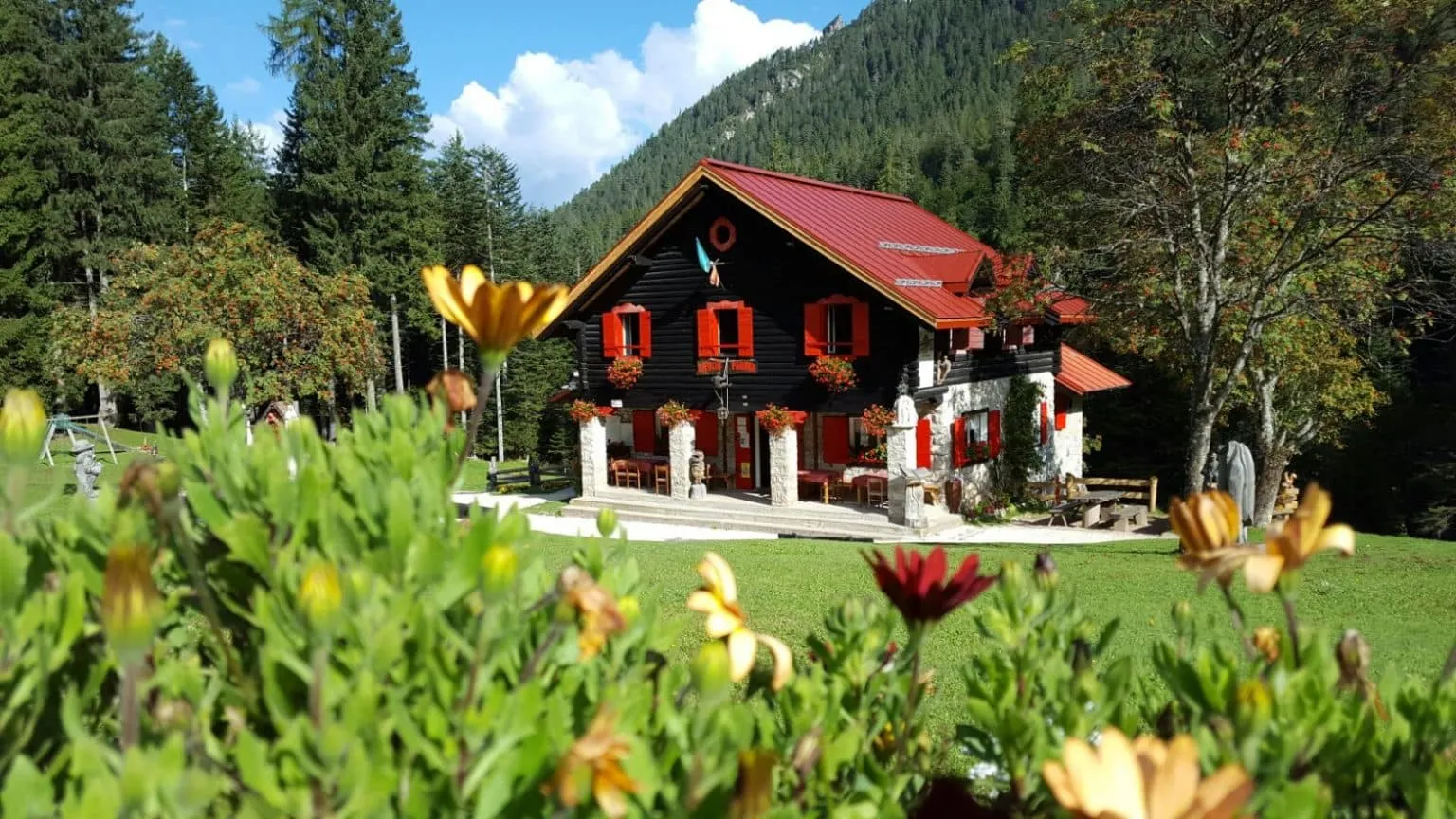
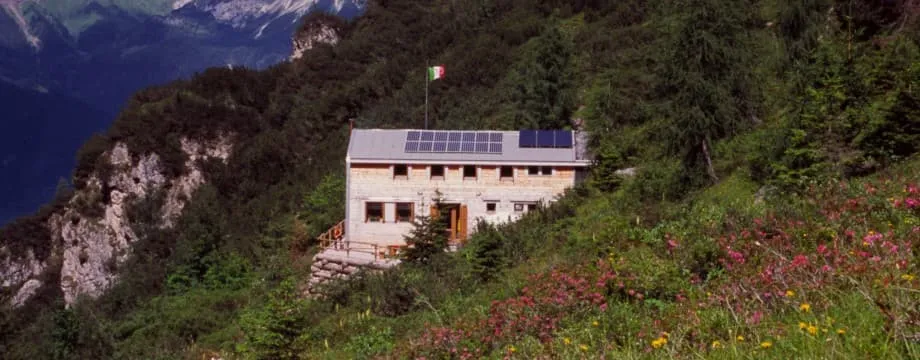
Rifugio Padova

Info
Rifugio Padova
Rifugio Padova
Day
2

Rifugio Padova - Rifugio Giaf (Expert Route)

Duration: 04:50 h
Distance: 7.2 km
Ascent: 1030 m
Descent: 910 m

This route leads from Rifugio Padova to Rifugio Giaf, with 1,030 m of ascent and 910 m of descent in a short but serious mountain stage. The climb is demanding from the start and the terrain becomes increasingly rocky as you approach the high section. This is an expert route, especially after Forcella Monfalcon di Forni (2,250 m), where the descent is steep, rough and hands-on in places. Move carefully and do not underestimate the downhill.

From Rifugio Padova, the trail climbs past the Ancoraio del Gatto area and continues towards the junction for Forcella Monfalcon di Forni (342). The route then enters higher, rockier terrain between Cadin d'Arade (2,040 m) and Las Busas Pass (2,320 m), with Croda di Giaf (2,523 m) and the surrounding towers close by. Around the pass, expect exposed ground, loose rock and sections where the path demands full attention before the descent begins.

After the pass, the descent towards Rifugio Giaf is technical and demanding. In places, you may need to use your hands and hold onto rocks to move down safely. Take your time, keep space between hikers and avoid rushing, especially if the rock is wet or your legs are tired from the climb. The route then continues past the short T4-rated section around Forcella del Cason (2,228 m) and over lower rocky terrain towards the hut.

After zigzagging down from the higher terrain, you arrive at Rifugio Giaf after a compact but tough mountain crossing. The mountain hut is a welcome place to rest, eat and recover after a route that asks for strong legs, surefootedness and careful movement on the descent.

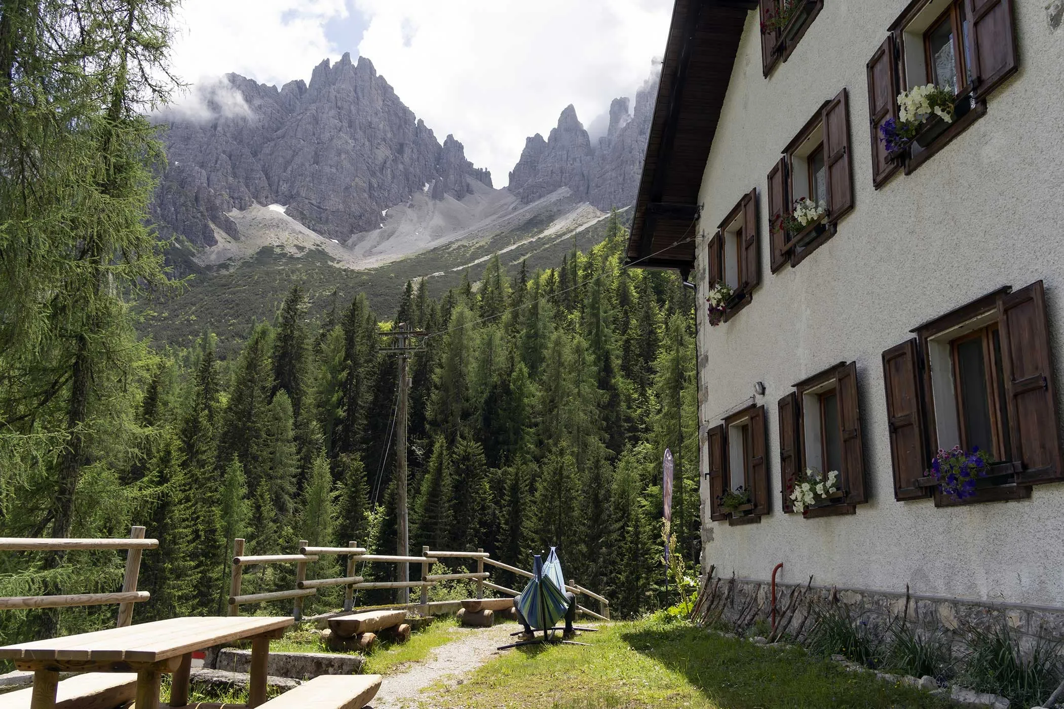
Rifugio Giaf

Info
Rifugio Giaf
Rifugio Giaf
Day
3

Rifugio Giaf - Rifugio Flaiban Pacherini (via CAI 362)

Duration: 05:30 h
Distance: 9.7 km
Ascent: 1010 m
Descent: 820 m

From Rifugio Giaf, follow the Truoi dai Sclops, a scenic trail known for its wildflowers, towards Forcella Urtisiel. This is a compact but demanding mountain stage, with 1,000 m of ascent and 820 m of descent. The path climbs steadily from the hut area, gaining height below Croda di Giaf (2,523 m) before reaching the higher, more open terrain around Forcella Urtisiel (1,990 m).

Near Forcella Urtisiel, the trail narrows sharply and the terrain becomes more exposed, with steep drops on both sides. Take your time here and keep a sure step, especially if the path is wet or visibility is poor. From the saddle, you get wide views of the surrounding Dolomite peaks. The trail then continues towards a viewpoint over the Cimoliana Valley, with views of the Torrente Cimoliana winding through the rocky landscape below. After a short descent, the route climbs again through alpine terrain towards Canpuros, a beautiful alpine meadow surrounded by rocks and scattered trees.

From Canpuros, continue towards Forcella dell’Inferno and Forcella Fantulina Alta. From the saddle, the route turns onto the challenging section of Sentiero 369a and begins the final descent towards Rifugio Flaiban Pacherini. This part crosses rough alpine terrain, with narrow paths, rocky ground and a steady descent towards the hut.

Rifugio Flaiban Pacherini

Info
Rifugio Flaiban Pacherini
Day
4

Rifugio Flaiban Pacherini - Forni di Sopra

Duration: 04:20 h
Distance: 10.3 km
Ascent: 420 m
Descent: 1160 m

This route descends from Rifugio Flaiban Pacherini to Forni di Sopra, with 1,160 m of descent and only 420 m of ascent. The profile climbs briefly at the start towards the higher section around Passo dei Suola (2,000 m), then drops for most of the route through forest, slopes, waterfalls and riverbed terrain. It is a mainly downhill stage, but the lower part needs attention because the trail may be affected by flood erosion around the Torrente Rovadia.

From Rifugio Flaiban Pacherini, the trail climbs towards Passo dei Suola before turning downhill past the slopes below the mountains. The descent continues through wooded terrain towards the Rovadia rverbed. From an altitude of around 1,200 metres, the path may have been significantly altered by flood erosion, with several mountain streams crossing the riverbed. Follow the cairns carefully for a little over 2 kilometres, after which the trail should become more clearly defined.

After the riverbed section, the route continues more clearly towards Forni di Sopra, passing viewpoints over the village and the surrounding valley. You arrive in Forni di Sopra after a long descent from the mountain hut, with the village offering a practical place to rest and settle in after the final lower section.

Contact our Trekking Expert
Jelle Tekstra
Jelle Tekstra
Jelle Tekstra

Included

  • Full travel guide

    You’ll receive access to our trekking app, which serves as your complete digital travel guide for the Dolomiti Friulane. Inside, you’ll find everything you need for your trek: route descriptions, hiking maps, navigation support, payment information, and all the key details specific to your journey.

  • Accommodation

    During your Dolomiti Friulane, you will spend your nights in mountain huts. We normally book dormitories, but private rooms are available upon request and cost €75 extra per room per night. If no private rooms are available, we will automatically book a bed in a dormitory.

  • Half-board in Huts

    Accommodation at the huts includes dinner and breakfast. We will arrange this for you as well. This allows you to travel lighter and have one less thing to worry about. Bear in mind that lunch is not included, but it can be purchased at the huts. Here you can also buy an array of snacks and bottled water.

  • Navigation support

    Our trekking app also includes built-in navigation support. With GPS-based maps and offline access, you can follow the trail confidently and stay on route even without mobile signal.

Excluded

  • Traveling to and from

    You have to make your own way to the starting point. The total amount does not include personal transport.

  • Transfers

    Should you need any form of (public) transport on location, this is not part of the trekking package. This includes the use of taxi, bus, cable cars, gondolas, ferries, etc.

  • Lunch

    Half-board is included in the price of this trek. Lunch, however, is not. Many huts offer packed lunches, which can usually be requested the night before. Alternatively, you can stop for lunch at mountain huts along the way.

  • Travel Insurance

    Your international travel insurance is your own responsibility. Discuss your itinerary with the insurance company before your trek.

  • Personal expenses

    Personal expenses on such as souvenirs, drinks, and other similar expenses are for your own account.

FAQ

  • How to Get to the Starting Point of the Dolomiti Friulane

  • How to leave the endpoint of the Alta Via delle Dolomiti Friulane

  • What if the dates I want are not available?

  • If I book now, can I immediately arrange the rest of my trip?

  • How do I know if this trek is right for me?

  • Can meals be adapted to my dietary requirements?

How to Book

  • Booking

  • Availability

  • Cancellation policy

Packing List for the Dolomiti Friulane

  • Information

  • Essentials

  • Extras