Preferred date sold out?
Discover our trekking adventures in Italy with availability in August, September or October and secure your spot before it’s too late!

Best of Dolomites

Duration: 5 days
Trails: T2 trails
Distance: 10 - 15 km / 6 - 9 mi per day
Ascent per day: 500 - 1000 m / 1640 - 3281 ft ascent per day

> Hike from Lago di Misurina to Lago di Braies
> Sleep in classic Dolomites rifugios
> Our team books your huts for 5 days of high alpine adventure

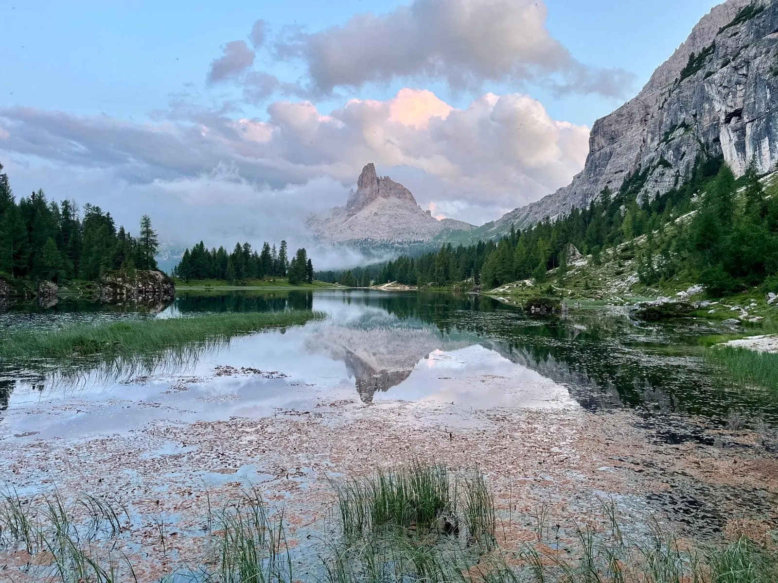
Waking up to the rising sun casting fire on the Tre Cime di Lavaredo. Watching marmots play in the grass below the Croda Rossa. The fresh scent of pine in the air as you descend into the wilderness around Lago di Braies. Yes, this is the Best of the Dolomites—and it’s all yours in just 5 unforgettable days. From one stunning lake to another, this trek is a greatest hits album of the Italian Dolomites. Think of it as the "Dolomite Mixtape"—but with sweaty socks, warm strudel, and a heavy dose of vertical.

This trek is tailor-made for seasoned hikers. Each day is packed with iconic views and punchy terrain. You’ll start at the magical Lago di Misurina, sleep in rifugios like Auronzo and Dreizinnenhütte, pass the legendary Drei Zinnen, and wind your way past Dürrenstein and Seekofel all the way to picture-perfect Lago di Braies. It’s five days, four rifugios, and one epic trek across the best of what the Dolomites have to offer.
Itinerary

Day
1

Misurina - Rifugio Auronzo

Duration: 04:00 h
Distance: 10.4 km / 6.5mi
Ascent: 690 m / 2264ft
Descent: 150 m / 492ft
Lowest Point: 1740 m / 5709ft
Highest Point: 2310 m / 7579ft

Start your hike at the Misurina bus stop with a relaxing walk along the shores of Lago di Misurina, then head toward Lago d’Antorno, where the Tre Cime di Lavaredo begin to rise dramatically in the distance. It’s an easy and scenic warm-up before the real climb begins.

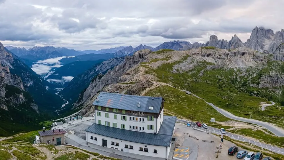
From Lago d’Antorno, the trail ascends steadily for 5 km toward Rifugio Auronzo. Along the way, enjoy sweeping views of the Cadini di Misurina, pass the striking tower-shaped rocks of Ciadin, and take a short detour to a hidden waterfall trail. The scenery becomes more impressive with every step until you arrive at the panoramic perch of Rifugio Auronzo.

If you're up for a bit more, a 4 km out-and-back extension leads to a stunning viewpoint just 2 km past the hut. It’s a short effort for unforgettable Dolomite views before returning the same way to Auronzo, where the day’s trek ends on a high note.

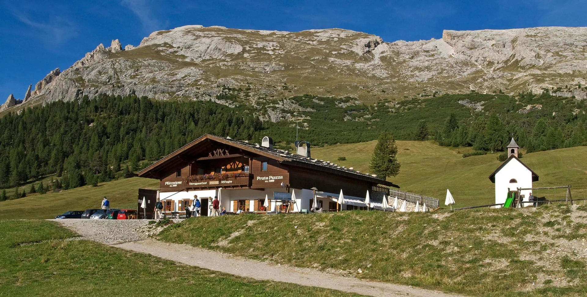
Rifugio Auronzo

Info
Rifugio Auronzo
Rifugio Auronzo
Day
2

Rifugio Auronzo - Dreizinnenhütte

Duration: 05:50 h
Distance: 14.4 km / 8.9 mi
Ascent: 500 m / 1640 ft
Descent: 1270 m / 4167 ft
Lowest Point: 1530 m / 5020 ft
Highest Point: 2530 m / 8301 ft

From Rifugio Auronzo, the trail starts with a stunning stretch along the southern flank of the Tre Cime di Lavaredo. Within the first kilometer, you’ll pass the Cappella degli Alpini and the Paul Grohmann Monument, both tucked beneath the towering peaks. With the Drei Zinnen constantly in view, it’s an iconic start that sets the tone for the day.

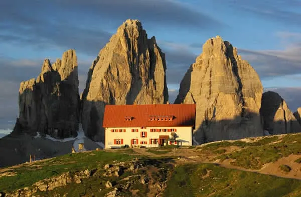
The path climbs steadily toward Büllelejoch Hut, passing crystal-clear alpine lakes like Lake of Lavaredo and Lago di Cengia. After a short break at the hut, the descent begins—offering views of a serene mountain lake and the dramatic Schusterplatte, before arriving at Rifugio Antonio Locatelli, perfectly perched above the Lakes of the Plains.

From here, the final 5 km is a steeper descent through rugged alpine terrain toward Dreizinnenhütte. Tired legs aside, this is one of those hikes where the scenery just keeps getting better, all the way to the last step.

Dreizinnenhütte (Locatelli)

Info
Dreizinnenhütte (Locatelli)
Day
3

Dreizinnenhütte - Dürrensteinhütte (Rifugio Vallandro)

Duration: 06:30 h
Distance: 14.3 km / 8.9 mi
Ascent: 800 m / 2625 ft
Descent: 1160 m / 3806 ft
Lowest Point: 1400 m / 4593 ft
Highest Point: 2390 m / 7841 ft

From the Dreizinnenhütte, the trail descends steeply down the far side of Tre Cime di Lavaredo. As the peaks fade behind you, the path winds along the Fiume Rienza through quiet forests and grassy clearings. Near the valley floor, a few hidden campsites by the stream offer a peaceful glimpse into the heart of Tre Cime Nature Park.

After reaching the bottom, a short but steep climb kicks in. The trail narrows as you pass a handrailed cave section before ascending to the Bavarian Alpine Corps War Memorial—the highest point of the day. It’s a striking place, both for its history and the wide-open views across the Dolomites.

From there, the trail eases into a gentle descent through pine forest, soft underfoot and shaded by towering trees. As you emerge into open pasture, the Dürrensteinhütte comes into view—a quiet refuge with sweeping mountain views. Drop your pack, settle in, and let the calm of the plateau take over.

Dürrensteinhütte (Rifugio Vallandro)

Info
Dürrensteinhütte (Rifugio Vallandro)
Day
4

Dürrensteinhütte (Rifugio Vallandro) - Rifugio Biella (Seekofel Hütte)

Duration: 05:25 h
Distance: 12.8 km / 8 mi
Ascent: 730 m / 2395 ft
Descent: 440 m / 1444 ft
Lowest Point: 1950 m / 6398 ft
Highest Point: 2360 m / 7743 ft

Leaving Dürrensteinhütte, the trail begins gently, with early views of the crimson walls of Croda Rossa (Hohe Gaisl) lighting up the morning. After a few kilometers, the ascent begins in earnest, drawing you deeper into alpine terrain where the air is thinner and the silence more complete.

At 4.5 km, you reach the Gaiselleite Trail—a narrow, exposed path that traverses the mountainside with the help of fixed cables. It winds down toward the Rossalm hut, then climbs steeply again to a quiet bench overlooking Croda del Becco—a perfect place to pause before the final challenge.

The last stretch is tough and technical. You descend into a stony basin, then push upward to the Forcella Sora Forno saddle, the highest point of the day. From here, it’s a short but dramatic walk to Seekofelhütte, tucked beneath towering cliffs, remote and utterly peaceful.

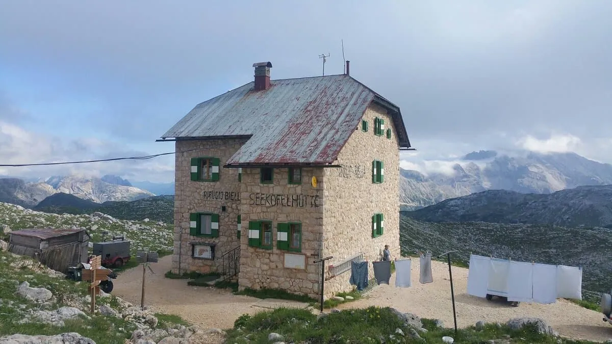
Rifugio Biella (Seekofel Hütte)

Info
Rifugio Biella (Seekofel Hütte)
Day
5

Seekofelhütte (Rifugio Biella) - Lago di Braies

Duration: 02:50 h
Distance: 6.4 km / 4mi
Ascent: 40 m / 131ft
Descent: 870 m / 2854ft
Lowest Point: 1490 m / 4888ft
Highest Point: 2360 m / 7743ft

From the plateau in front of Croda del Becco, the descent begins with a short but exciting via ferrata. Iron rungs and cables help you safely navigate the exposed section, and as you move forward, the wide-open views of the Dolomites make the extra effort feel effortless.

The trail then drops steadily through rocky terrain and sparse larch woods. After about 3 kilometers, you arrive at the stone cairns beside Lago di Braies—a quiet and beautiful moment where the mountain meets the water, and every stacked stone tells a story.

The final stretch hugs the lake’s edge, a peaceful 2-kilometer walk toward the Pragser Wildsee bus stop. Wooden boats drift on the surface, the iconic chapel peeks through the trees, and the end feels as memorable as the journey itself.

Included

  • Full travel guide

    You’ll receive access to our trekking app, which serves as your complete digital travel guide for the Best of Dolomites. Inside, you’ll find everything you need for your trek: route descriptions, hiking maps, navigation support, payment information, and all the key details specific to your journey.

  • Accommodation

    During your Best of Dolomites, you will spend your nights in mountain huts. In the mountain huts we normally only book dormitories, but we can look into private rooms on request. If the private rooms are fully booked or not available in the hut, we automatically book a bed in dormitories for you. Please note that private rooms are more expensive and there will be an additional charge for this.

  • Half-board in Huts

    Accommodation at the huts includes dinner and breakfast. We will arrange this for you as well. This allows you to travel lighter and have one less thing to worry about. Bear in mind that lunch is not included, but it can be purchased at the huts. Here you can also buy an array of snacks and bottled water.

  • Navigation support

    Our trekking app also includes built-in navigation support. With GPS-based maps and offline access, you can follow the trail confidently and stay on route even without mobile signal.

Excluded

  • Traveling to and from

    You have to make your own way to the starting point. The total amount does not include personal transport.

  • Transfers

    Should you need any form of (public) transport on location, this is not part of the trekking package. This includes the use of taxi, bus, cable cars, gondolas, ferries, etc.

  • Lunch

    Half-board is included in the price of this trek. Lunch, however, is not. You can get something to eat at the mountain huts along the way.

  • Travel Insurance

    Your international travel insurance is your own responsibility. Discuss your itinerary with the insurance company before your trek.

  • Personal expenses

    Personal expenses on such as souvenirs, drinks, and other similar expenses are for your own account.

FAQ

  • How to Get to the Starting Point of the Best of Dolomites

  • How to Leave From the Endpoint of the Best of Dolomites

  • What if the dates I want are not available?

  • If I book now, can I immediately arrange the rest of my trip?

  • How do I know if this trek is right for me?

How to Book

  • Booking

  • Availability

  • Cancellation policy

Packing List for the Best of Dolomites

  • Information

  • Essentials

  • Extras