Intensive Venediger Höhenenweg

Duration: 5 days
Trails: T3 trails
Distance: 10 - 15 km per day
Ascent per day: 500 - 1000 m ascent per day
> Hike through Austria's oldest National Park
> Stay in historic Austrian mountain huts
> Breathtaking views of the Großvenediger

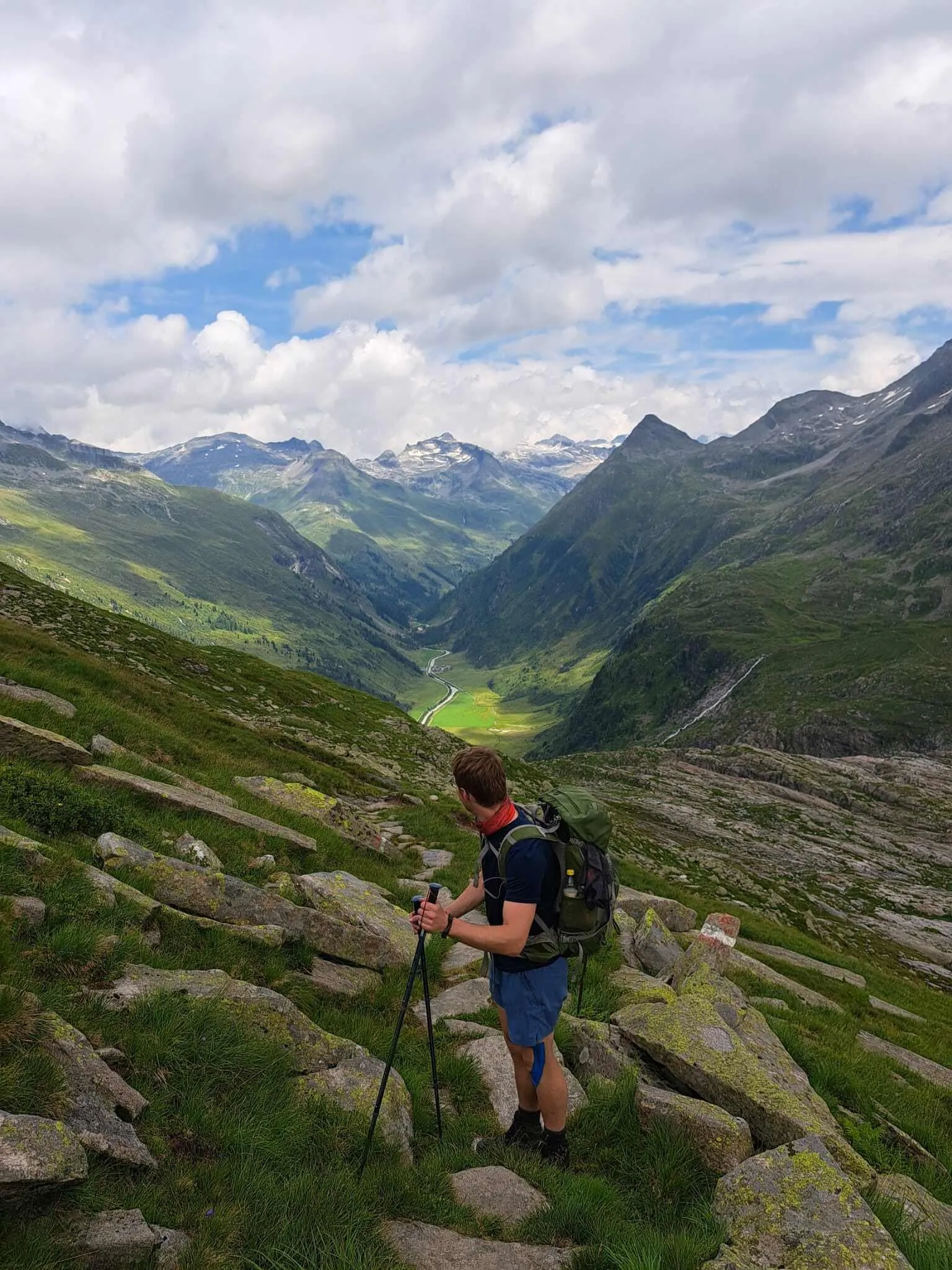
The Venetian High Road, better known as "Venediger Höhenweg" in German, is a popular long-distance hiking trail in the Austrian Alps. This route offers hikers spectacular views of some of the most impressive mountain landscapes in Austria, including the Venediger Group, from which the route takes its name.

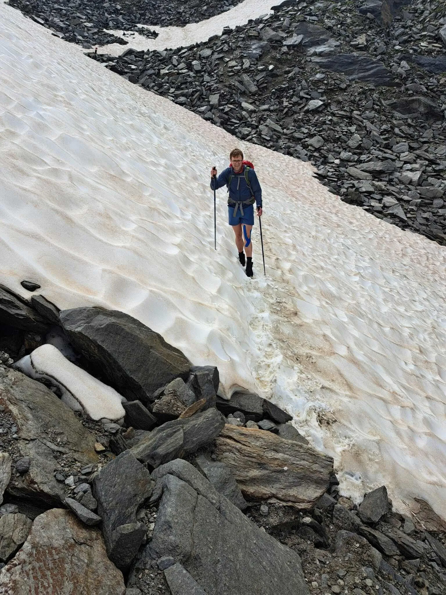
One of the best things about the Venediger Höhenweg is the variety of landscapes. The steep mountain passes and rugged trails will test you but you will be rewarded with impressive mountain peaks, glaciers, mountain lakes, rivers and alpine meadows. In short, you can fully enjoy true Austrian beauty on this tour. The Venediger Group dominates the panoramic view with its distinctive peaks, including the Großvenediger, Austria's 4th highest mountain.

All in all, this challenging hiking trail offers an unforgettable hiking experience for nature and mountain lovers. As this route combines several stages of the original route, it is essential you have hiking experience to ensure you reach the hut in time. With a little sense of adventure and the right pace, you can hike around the Grossvenediger in less than a week.

Itinerary

Day
1

Hinterbichl - Johannishütte

Duration: 09:00 h
Distance: 16.4 km
Ascent: 1470 m
Descent: 680 m
You start the Venediger Höhenweg hike with a leisurely walk from the cozy village of Hinterbichl. The first 3 km (1,8 miles) you walk along the Isel River to the Ströden parking lot and the start of the Hohe Tauern National Park. To slightly shorten the full distance of today's stage, you could park at this parking lot and begin your mountain adventure from here. The 2 km (1,2 miles) that follows is a gentle hike and shortly after you pass the Stornalm, the trail goes up considerably steeper for 4 km (2,4 miles) and after about 2.5 hours you have gained 640 m (2.099 feet) in elevation. At the end of this climb the Essener-Rostocker-Hütte can be found, where it may be time for a small break. Do pack your bag again quickly because the Türmljoch awaits you. After a 2 km (1,2 miles) walk you will be at the foot of this 2,844 meter (9.330 feet) peak. Spread over 4.5 km (2.8 miles) you climb via zigzag paths to 2,761 meters (9.058 feet) and walk along the Türmljoch Spitze. You descend directly back to the Johannishütte, where a cold beer awaits

Johannishütte

Info
Johannishütte
Day
2

Johannishütte - Bonn-Matreier Hütte

Duration: 08:00 h
Distance: 12.4 km
Ascent: 1250 m
Descent: 660 m
The real challenge of the Venediger Höhenweg begins today and can be compared slightly to some sections of the Stubaier Höhenweg. Are you ready for it? The narrow paths and rugged terrain demand the right mindset. Fortunately, you'll be aided by the steel cables in the mountains that you can hold onto. With some climbing and scrambling, you'll be guided over the Zopetscharte (2,958m/9.704ft) and past the Tulpspitze (3,054m/10.019ft). After ascending for 3.5 km (2,2 miles), the descent begins, which will take you down to a lower point in the same way and through the same landscape. Here, you can take a break at the Eisseehütte. After you continue, you will be walking along narrow paths where you can look relatively steeply down the side, so be sure to leave your fear of heights at home. This does provide impressive panoramic views of the surrounding mountain peaks and a true sense of freedom. After completing two-thirds of the hike, you'll need to conquer two more steep ascents over a span of 2,5 km (1,5 miles). Then, you'll arrive at the Bonn-Matreier Hütte, the endpoint for today.

Bonn-Matreier Hütte

Info
Bonn-Matreier Hütte
Day
3

Bonn-Matreier Hütte - Badener Hütte

Duration: 05:30 h
Distance: 9.2 km
Ascent: 530 m
Descent: 680 m
Your Venediger Höhenweg continues. During this stage, you'll begin with a short ascent to the highest point of the day. Once you reach 2.840 meters (9.317), you'll walk over the Galtenscharte with the 2.986-meter-high (9.796 feet) Galtenkogel on your right. Immediately after crossing the mountain ridge, the descent of over 500 meters (1.640 feet) begins. For 4 kilometers (2,5 miles), you'll walk through a lower-lying area where you'll trade the rocky landscape of the mountain ridge for greener plains. You'll pass narrow mountain paths and steep mountain walls before steadily ascending to the Badener Hütte.

Badener Hütte

Info
Badener Hütte
See entire itinerary

Included

  • Booking the huts

    We will take care of arranging accommodation on the Venediger Höhenweg for you. We will also provide you with a detailed itinerary for every stage and instructions on how to get to the trailhead.

  • Full travel guide

    We will send you on your way with a digital travel guide that includes a route description for the Venediger Höhenweg, interactive hiking maps, and the most important information applicable to your trek

  • Accommodation

    During your Venediger Höhenweg, you will spend your nights in mountain huts. In the mountain huts we normally only book dormitories, but we can look into private rooms on request. If the private rooms are fully booked or not available in the hut, we automatically book a bed in dormitories for you. Please note that private rooms are more expensive and there will be an additional charge for this.

  • Half-board

    Accommodation at the huts includes dinner and breakfast. We will arrange this for you as well. This allows you to travel lighter and have one less thing to worry about. Bear in mind that lunch is not included, but it can be purchased at the huts. Here you can also buy an array of snacks and bottled water.

Excluded

  • Traveling to and from

    You have to make your own way to the starting point. The total amount does not include personal transport.

  • Transfers

    Should you need any form of (public) transport on location, this is not part of the trekking package. This includes the use of taxi, bus, cable cars, gondolas etc.

  • Lunch

    Half-board is included in the price of this trek. Lunch, however, is not. You can get something to eat at the mountain huts along the way.

  • Travel Insurance

    Your international travel insurance is your own responsibility. Discuss your itinerary with the insurance company before your trek.

  • Personal expenses

    Personal expenses on such as souvenirs, drinks, and other similar expenses are for your own account.

FAQ

  • What and Where is the Venediger Höhenweg?

  • Is the Venediger High Trail Suitable for Me?

  • What Is the Best Season for the Venediger Höhenweg?

How to Book

  • Booking

  • Availability

  • Cancellation policy

Packing List for the Venediger Höhenweg

  • Information

  • Essentials

  • Extras

Book Now
Free cancellation up to two weeks in advance!
Starting at
per person
persons
Book Now
Contact our Trekking Expert
Manon Weusthof
Manon Weusthof

Just for You