GR20 in Corsica: The Toughest Hut-to-Hut Trek

Rintsje Bosch
Rintsje Bosch
Rintsje Bosch
04 Oct 2024 18 min read
GR20 in Corsica:  The Toughest Hut-to-Hut Trek
GR20 in Corsica: The Toughest Hut-to-Hut Trek
Trekking experts per destination
Free cancellation up to eight weeks in advance
Quick personal advice

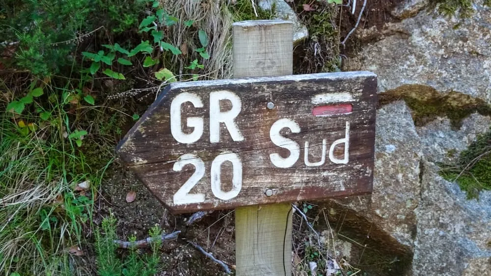
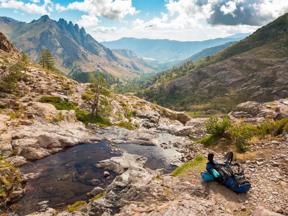
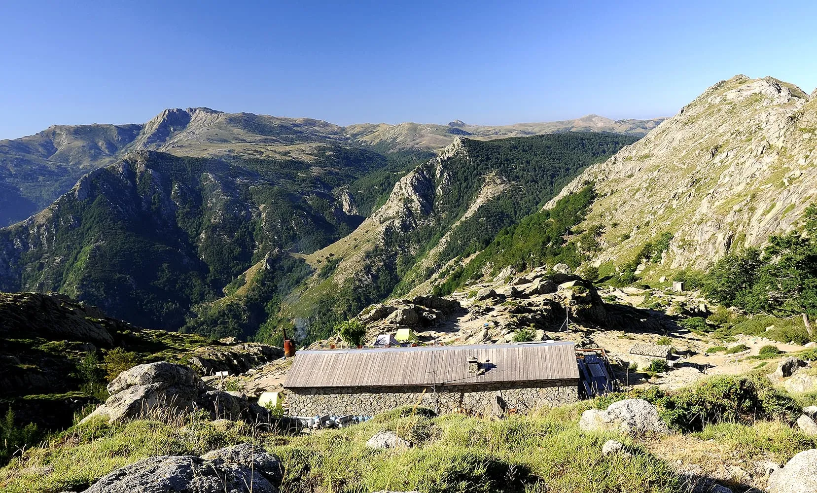
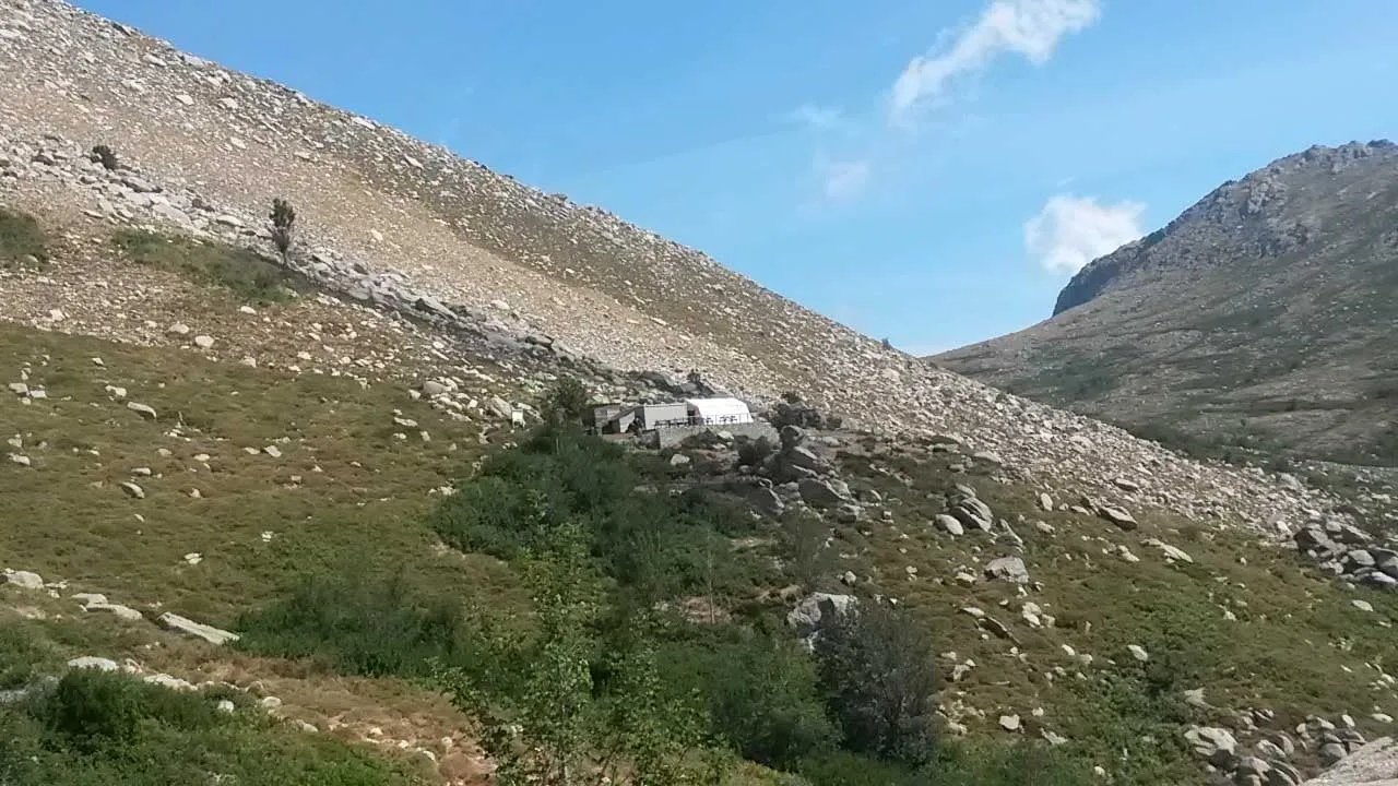
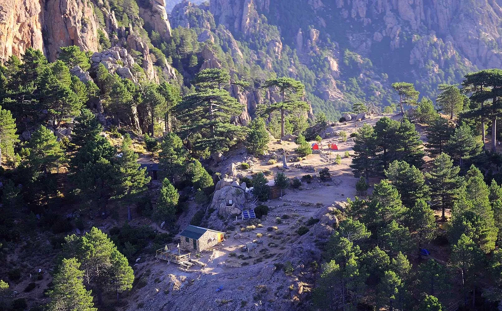
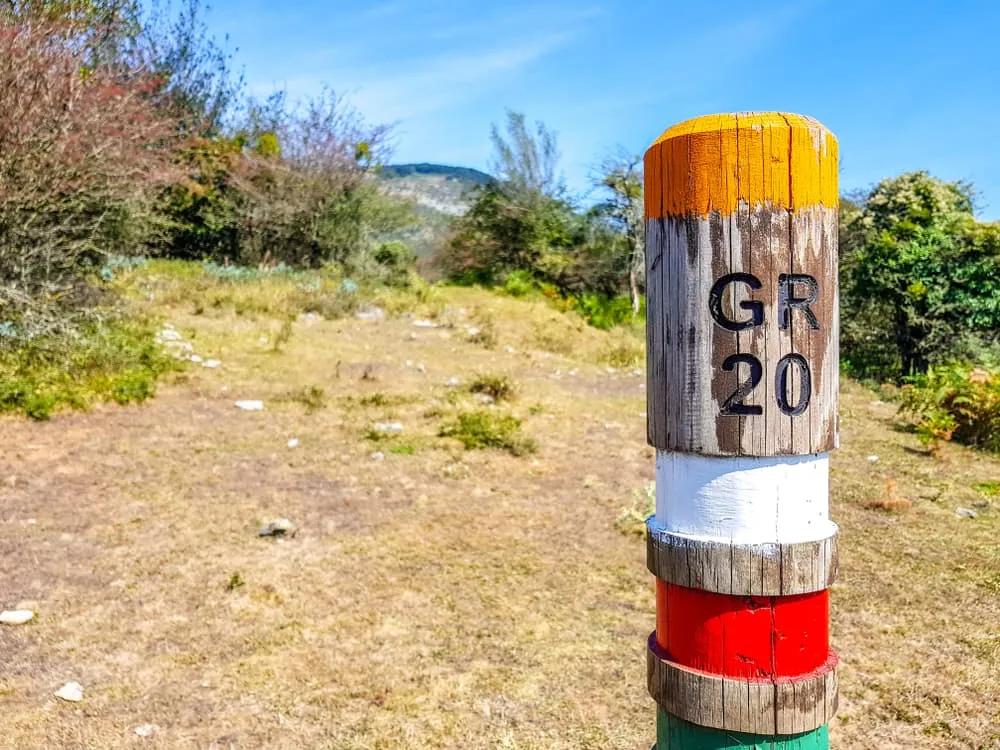
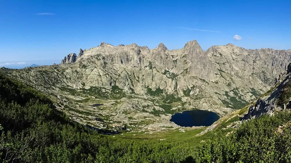
The GR20, also known as Fra li Monti is a GR (Grande Randonnée) footpath that crosses the Mediterranean island of Corsica running approximately from north to south. The entire trail is about 180 km long with 12,000 m of elevation gain. Although it takes about 15 days to complete it, the route can be divided into 2 stages: the northern part, between Calenzana and Vizzavona, and the southern part, between Vizzavona and Conca. This GR route is considered one of the toughest of all GR routes, are you brave enough to give it a try? Below you will find all the information you need about the route, the stages, a map, and a kit list for your GR20 hike in Corsica!

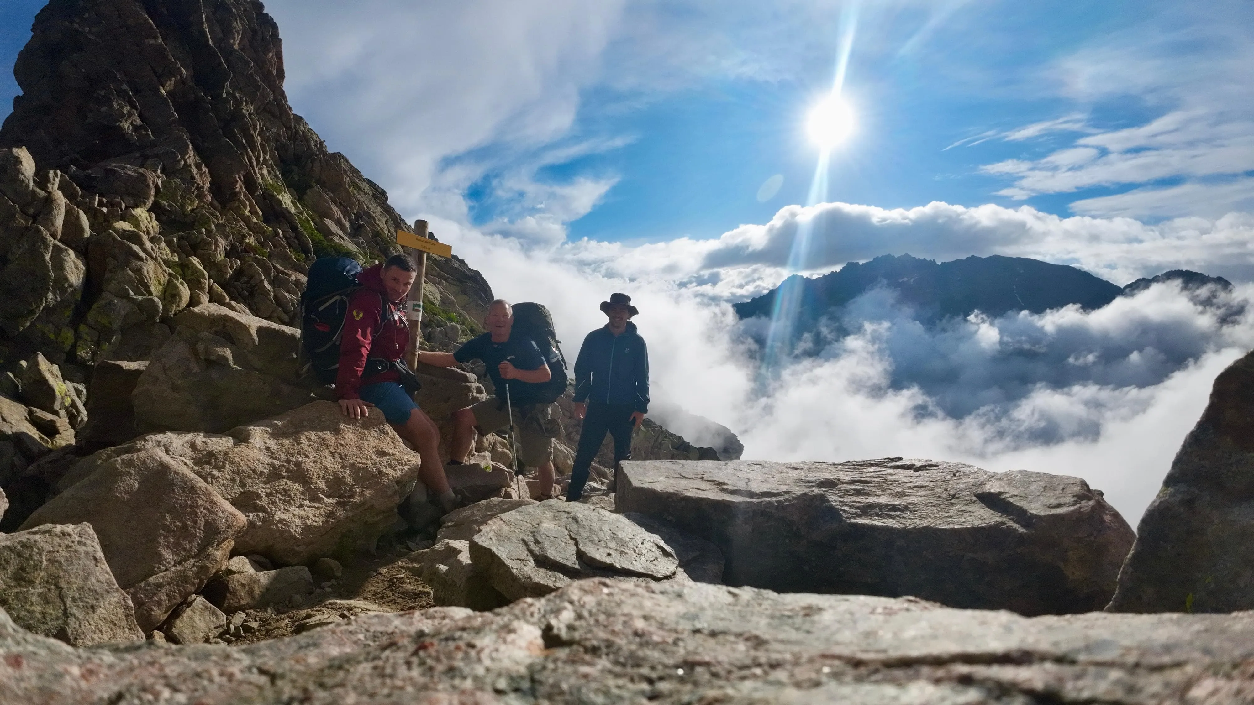
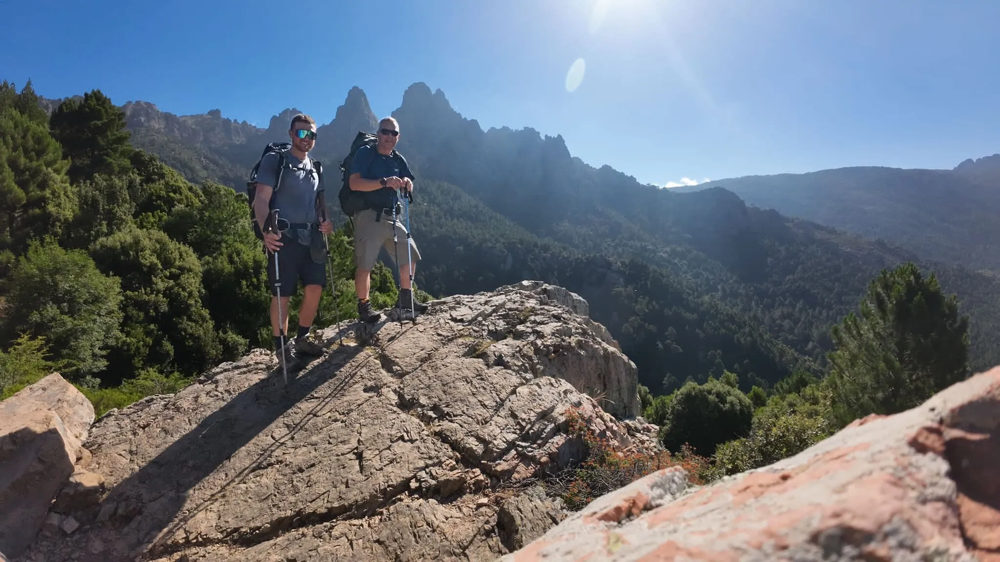
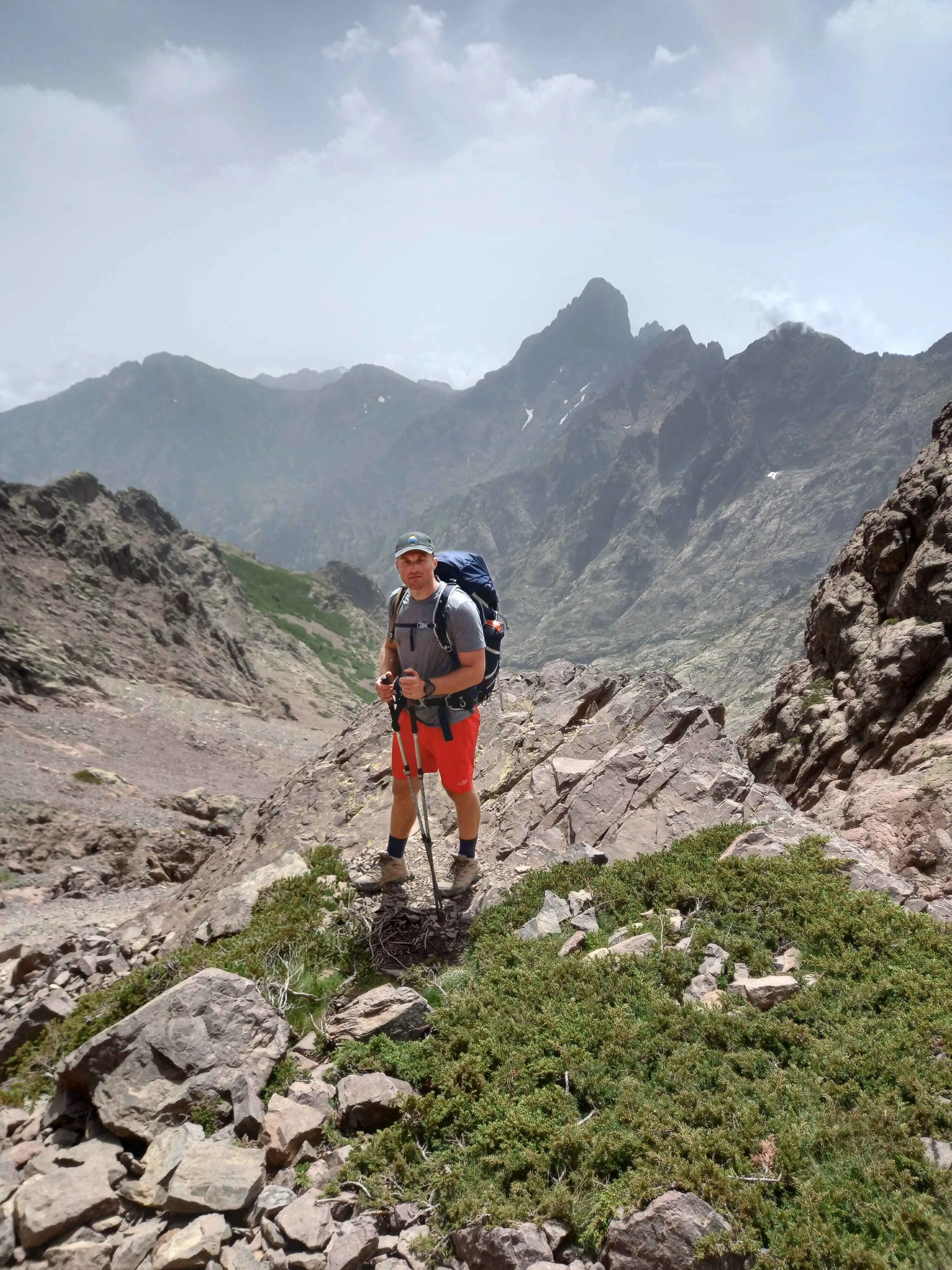
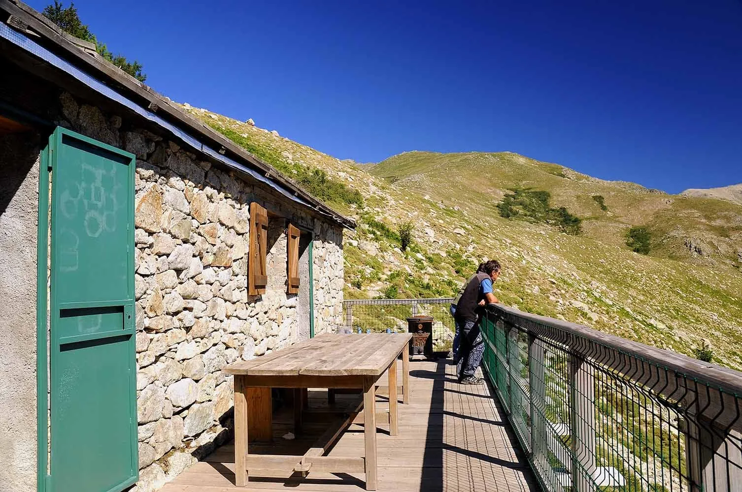
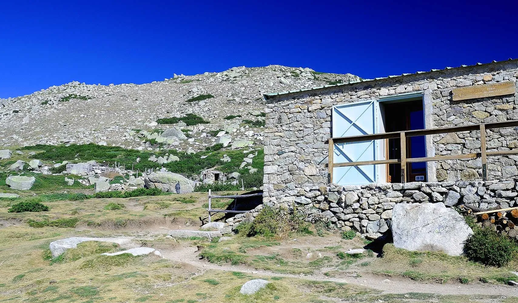
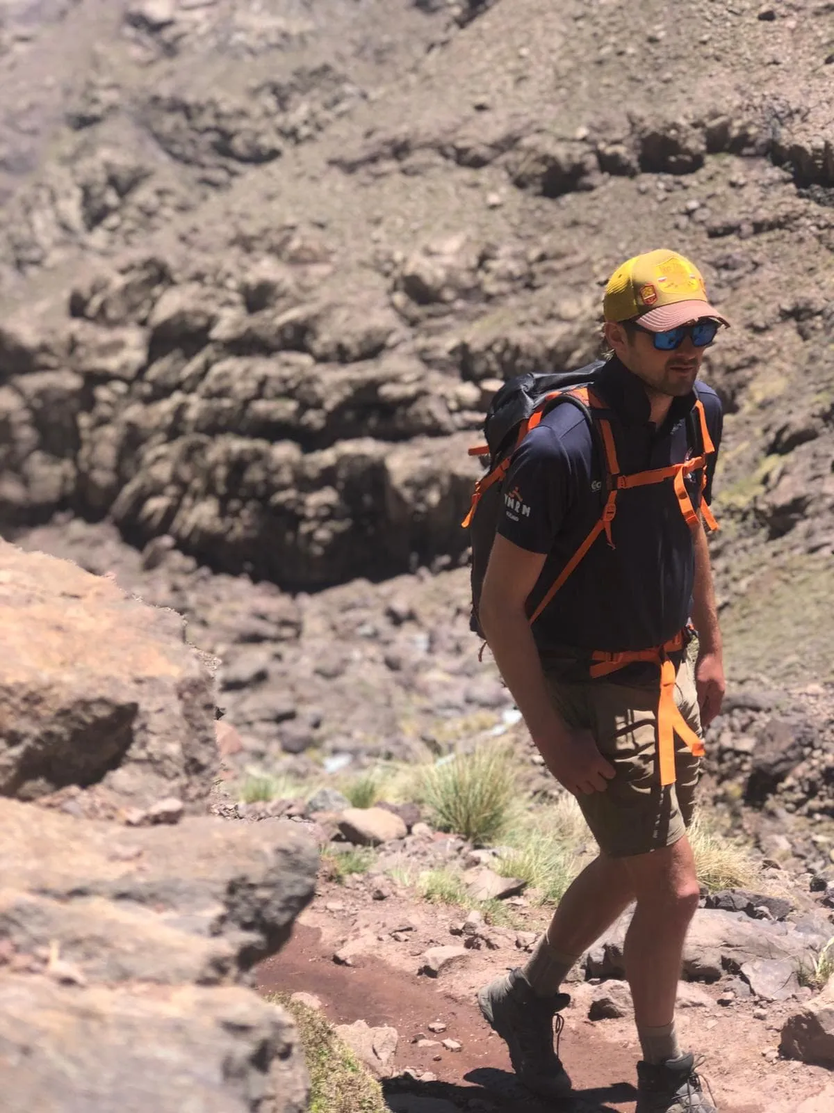
For the GR20, some hiking experience in steeper terrain is advisable. The trek requires some scrambling, use of chains, and a ladder (on the Northern section) to tackle the rocky landscape and mountain ridges. As one of the most demanding routes for France hut to hut hiking, this trail is best suited for confident mountain walkers who can read route notes and locate their position on a map when needed. You will find all the information to face this challenge as prepared as possible.

Where Is the GR20?

The GR20 is one of the many trekking options that France has to offer. Trekking in France should be on every trekker's wish list, starting with the breathtaking GR20 route. GR stands for Grande Randonnée, which is best translated as "long distance trail" in French. The GRs are a network of long-distance trails in Europe located mostly in France, Belgium, the Netherlands, and Spain. The GR20 is considered to be the most difficult of all these routes and is located on the French island of Corsica, Corse in French, on the Tyrrhenian sea. Its Corsican name is Fra li Monti, which means "across the mountains" in Corsican.

What Is the Best Season for the GR20 on Corsica?

If you are planning your GR20 trek, we advise you to go in late June or early September. During this time, most huts are open and the weather is not too hot. Also, the trail won't be as crowded as during July or August.

Between November and May, there is snow on the trails, which makes the trek quite dangerous. Also, during these months there are no hosts in the refuges, which means that you have to carry all the food. During winter, from February to April, the GR20 can only be completed by experienced cross-country skies with a professional guide. This winter variant of the GR20 is known as l'Alta Strada.

What Is the Best Season for the GR20 on Corsica?

How Do I Get to Corsica?

As mentioned above, Corsica is a French island on the Tyrrhenian Sea, also known as Corse in French. You can reach the island either by boat or by plane. There are 4 airports on the island, 2 in the north and 2 in the south. If you are planning on starting the trek from the north, then it is advisable to land in Calvi (CLY). If you are planning on starting from the south, the closest airport to Conca is Figari (FSC). The airlines flying directly to the island are Air France and Air Corsica, with flights departing from Paris, Marseille, and Nice. The flights take usually 1 to 1,5 hours.

You can also reach the island by boat. Between April and September, there are daily ferry rides from Toulon, Nice or Marseille. Of course, this option is cheaper than the plane but it takes longer. The ferry ride from the coastline to the island takes around 6 hours. If you want to take a ferry to the southern section of the island, it will be even longer.

How Do I Reach the Starting and Ending Points of the GR20?

The starting and endpoints of the GR20 are Calenzana village in the north of the island and Conca in the South. Vizzavona is the midway point and easily accessible if you want to walk one half of the trail.

Once you get to a port or airport in Corsica, it is quite easy to get to the trailhead, both north, and south. If you land in Calvi (north), you can take a 30-minute ride by bus or cab to Calenzana. A cab usually costs between 20 and 30 euros per ride while the bus costs around 8 euros. If you land in Figari (south), we recommend taking a bus to Conca. The ride is 2,5 hours long and taking a taxi to Conca can be quite expensive.

GR20 Corse - Should I Start From the North or From the South?

You can walk the GR20 trail in either direction, from north to south, or from south to north. Which is the best option? Well, it depends on your physical condition and what you expect from the whole experience. The trail can be divided into two parts: the northern part starts in Calenzana and stops in Vizzavona. It is the most difficult part, because of the steep and rocky paths, but it is also considered the most beautiful half. The southern part of the GR20 goes from Vizzavona to Conca (or the other way around) and is easier, but less spectacular. The Coscione plateau with its green meadows is, however, breathtaking.

You can walk in either direction through the whole trail or you can choose to walk any of the two halves. The traditional route starts in the north and ends in the south. Since the GR20 can be quite crowded and most hikers walk southwards, some people recommend starting from the south and making your way to the north.

GR20 Corse - Should I Start From the North or From the South?

GR20 Map

Below you will find a map with the GR20 from Calenzana to Conca. You can see some of the huts along the way and the city of Vizzavona, the mid-point of the trek that divides the northern from the southern half.

Accommodation on the GR20: Staying in Refuges

The mountain huts along the GR20 offer basic accommodation and food. These refuges are under the regional Corsican natural park’s authority and can host 25-50 people depending on the hut. Hosts manage the huts from the end of May to early October. Outside of this time frame, the refuges are open but not manned and there is no food available.

The refuges usually have one large dormitory with wooden bunk beds equipped with mattresses. You can also sleep in a tent near the refuges. You can rent a tent at the hut as well. It is forbidden to camp in other places along the trail. Independent of which accommodation type you choose, you must always bring your own sleeping bag.

Huts do have electricity. However, charging your phone or camera can be quite a challenge given the number of trekkers and the limited number of sockets. Make sure to carry extra batteries or a (solar) powerbank with you.

What to expect in the huts

  • Indoor kitchen and eating area
  • Dormitory room with bunk beds
  • The bunk beds have two levels and mattresses are side by side. Bring your own sleeping bag!
  • Cold outdoor showers and toilets
  • An outdoor kitchen with cooking facilities
  • Bins for rubbish

Food on the GR20 Trek

Half board is not included when you book your accommodation. You can choose to carry food with you or you can get your meals at the huts. You can always find a freshwater spring in the vicinity of the refuges. You can also buy food and reserve a hot meal and breakfast. Bear in mind that the hot meals must be reserved upon arrival.

Breakfasts are often prepared the night before and handed out so you can leave as early as you want the next day. As regards lunch, if you are passing a refuge between 12h and 14h you will often find a small lunchtime menu with choices, such as cheese and omelets, pasta, Corsican soup, and plates of smoked charcuterie. If you order dinner (remember to ask for it as soon as you get to the hut!), it is usually served from 19h onwards. There may be more trekkers than seats available, so be patient. Dinner usually consists of three courses which vary from hut to hut. Bear in mind that you will be in the mountains, so don't expect over elaborated dishes. Also, you will be expected to bring your own knife to mealtimes, so don't forget to carry one!

Menus vary from one hut to the other and their meals usually depend on the stock they have. Hot dinners can cost between 15-20 euros, while breakfast and dinner cost around 8-12 euros each. Refuges are the only places where you can buy food and get drinking water along the trail. However, there are some stages where you can go shopping in the villages below. All refuges have an indoor kitchen that you can use. These are equipped with gas, water, and kitchen utensils. Remember to always keep a lighter, or match with you! You might find there are only 4 gas rings available for a large number of hungry trekkers, so try to be patient.

Highlights on the GR20 Trail

This spectacular trek is full of stunning views and breathtaking rock formations. Here are some of the highlights you will encounter during your trek:

  • Cirque de la Solitude: a steep and challenging part between Refuge d'Asco Stagnu and Refuge de Tighjettu, where hikers have to climb using the chains bolted to the rock.
  • Lac de Nino: a glacial lake in the middle of the grassy meadows between Refuge de Ciottulu di i Mori and Refuge de Manganu.
  • Lac de Melo and Lac de Capitello: two glacial lakes surrounded by rugged rocks between Refuge de Pietra Piana and Refuge de l'Onda.
  • Monte d'Oro: the 12th highest summit of Corsica.
  • Monte Incudine (2134 m): the highest mountain of Corse du Sud (Southern Corsica) with great vistas of the Plateau de Coscione between Refuge d'Usciolu and Refuge d'Asinao.
  • Aiguilles de Bavella: spectacular cliffs between Refuge d'Asinao and Refuge de Paliri.

Highlights on the GR20 Trail

Stages on the GR20 - Which Itinerary Should I Follow?

Here is a detailed 15-stage itinerary for the full GR20 trek. Remember that if you don't want to complete the whole trek, you can start from any end of the route and end half-way, in Vizzavona. At Bookatrekking.com, we have packages for both the entire tour and just the North and South halves. Here you can find all our options.

Day
1

Calenzana - Refuge d'Ortu di u Piobbu

Duration: 05:55 h
Distance: 11.4 km
Ascent: 1370 m
Descent: 90 m

This long initial climb takes you directly from the narrow streets of Calenzana into the mountains. As the path winds its way up above the Balagne hills, olive groves, terraces and the scent of the maquis gradually disappear. Further up, the forest closes in around you, offering glimpses of the bay and the surrounding mountains through the trees. The day ends on a rocky crest, not far from the hills beneath Monte Corona.

From the village, the route continues along paved streets and stairs before joining a stony mule track through dense shrubbery. After a while, the path steepens as it winds through the scented maquis towards Bocca u Corsu, the first vantage point overlooking the Bay of Calvi. The ascent continues through a pine forest to Arghjova's terrace and then along the ridge to Bocca à U Saltu (1,250 m). Beyond the grassy col, the path traverses a challenging section and ascends towards Bocca à U Bazzichellu (1,486 m).

As you near the end, the rocky terrain gives way to scattered pine trees and small grassy terraces. The refuge is located just beyond a bend, perched on a hillside with sweeping views back to the Balagne region. It is the perfect place to rest, enjoy the evening colours and plan your next adventure.

Refuge d'Ortu di u Piobbu

Info
Refuge d'Ortu di u Piobbu
Day
2

Refuge d'Ortu di u Piobbu - Refuge de Carrozzu

Duration: 04:05 h
Distance: 7.5 km
Ascent: 600 m
Descent: 850 m

This high route connects two rocky refuges via a winding mountain ridge. From the grassy terrace of the first refuge, the ascent is initially gentle before rising steeply towards a chain of passes. Once you have climbed above the last pines, you will be rewarded with views of Punta Innominata (1,986 m) and the distant bulk of Monte Cinto (2,706 m). After reaching the highest point of the main ridge, the route continues downhill through darker forests to the second refuge.

From there, a cairned path climbs through twisted pines and granite slabs. A clear spring and scattered stone ruins provide an opportunity for a brief rest before the long ascent. The path then tightens into zigzags on the ridge below Bocca di Pisciaghja/Piccaia (2,012 m), offering deep views into the Bonifatu forest, before traversing airy balconies. After a rocky scramble section, you cross Bocca di l'Innominata, located between Punta Innominata (1,986 m) and Punta Ghialla (2,085 m).

The descent begins with rocky steps, which then soften into earthen paths winding through tall pines. Gradually, the sound of running water grows louder as you cross small streams and shaded gullies. A final contouring track leads to a grassy clearing, amongst the trees of which you will see stone buildings and tent platforms. Here, you can cool your feet in the nearby stream and watch the evening mist drift along the valley.

Refuge de Carozzu

Info
Refuge de Carozzu
Refuge de Carozzu
Day
3

Refuge de Carozzu - Refuge d'Asco Stagnu

Duration: 04:05 h
Distance: 5.3 km
Ascent: 710 m
Descent: 570 m

From the wooded hollow around the refuge, the route climbs back into the high mountains. The path soon leaves the pines for a jagged ridge below Muvrella (2,148 m), where cliffs and distant summits surround you on all sides. After the main ascent, the character changes as you drop towards a wide cirque above the Asco valley, finishing the day among ski lifts, dark forest and the small settlement of Haut Asco.

From the terraces you first follow a narrow path through pines to the Spasimata stream. Chains help you across polished slabs and ledges, with pools and small waterfalls below. After crossing the famous hanging footbridge the trail steepens, climbing in tight zigzags on rocky steps. Higher up, the trees thin and you reach a rough basin of boulders and slabs, then continue to the pass near Muvrella, the high point of the day.

Beyond the crest the path turns towards the Asco side and begins a long descent. Loose stone gives way to earth paths and then to wider tracks as you approach the ski area. The noise of the river grows louder and chairlifts appear above the trees. A final stroll across open ground leads to the cluster of lodgings and facilities at Haut Asco, where hot showers, cold drinks and wide mountain views wait for you.

Refuge d'Asco Stagnu

Info
Refuge d'Asco Stagnu
Day
4

Refuge d'Asco Stagnu - Refuge de Tighjettu

Duration: 06:30 h
Distance: 8.3 km
Ascent: 1160 m
Descent: 910 m

Starting from the small ski station in the Asco valley, this route wastes no time in heading for the high ground below Monte Cinto (2,706 m). A long, steady climb leads from shady pines onto bright granite slabs and scree, with widening views over jagged ridges. After reaching the rocky shoulder near Pointe des Éboulis (2,607 m), the mood shifts as you drop into the wild upper Golo valley towards the hidden bowl of Tighjettu.

From the buildings the path quickly leaves the pistes and follows the Ruisseau du Tighiettu upstream, climbing on granite steps beside clear pools. Soon chains appear to protect short traverses across smooth slabs and ledges, before the trail steepens into stony zigzags. Higher up you pass Lac d’Argentu, then tackle a final tiring haul on loose scree to the col near Pointe des Éboulis, where cliffs fall away on both sides and the skyline of Paglia Orba (2,525 m) comes into view.

The descent into the Golo valley starts steep, weaving down gullies and boulder fields before easing onto gentler paths beside the stream. Small waterfalls, rock slabs and occasional pine patches brighten the way as you lose height. Near the bottom, the route leaves the main valley and climbs briefly into a side basin, where the refuge appears on a grassy shelf hemmed in by granite walls. Here you can drop your pack, soak aching feet in the river and watch the evening colours.

Refuge de Tighjettu

Info
Refuge de Tighjettu
Refuge de Tighjettu
Day
5

Refuge de Tighjettu - Refuge de Ciottulu di i Mori

Duration: 03:30 h
Distance: 6.8 km
Ascent: 650 m
Descent: 330 m

From the rocky hollow around the refuge, this shorter stage drops gently into the wild valley beneath Paglia Orba (2,525 m) and Capu Tafunatu (2,335 m). The path threads between boulders and pines, with balcony views of cliffs and the white ribbon of the Golo far below. Clear pools and smooth slabs invite a pause before the route turns towards a hanging basin, where the next refuge waits high above the river.

From the buildings you follow a stony track downhill, soon joining the Golo and its side streams. The trail meanders along the water, crossing smooth granite and small wooden bridges, past deep basins that glow turquoise in the sun. After a final series of crossings, the way swings away from the river and begins to climb on dusty zigzags, gaining height steadily towards the saddle above the valley.

Near the crest the terrain opens into rough pasture, scattered with rocks and low grass. A last push over broken slabs brings you to the refuge, perched on a shoulder with sweeping views towards the Niolu plateau and the jagged skyline of Paglia Orba. Once you drop your pack, there is time to watch the light change on the cliffs and to listen to the distant murmur of the river far below.

Refuge de Ciottulu di i Mori

Info
Refuge de Ciottulu di i Mori
Day
6

Refuge de Ciottulu di i Mori - Refuge de Manganu

Duration: 08:50 h
Distance: 23.7 km
Ascent: 700 m
Descent: 1080 m

This long traverse links the rocky eyrie of Ciottulu di i Mori with the wide meadows around Manganu. The morning begins among bare ridges and the upper Golo river, then slips into dark pine forests and the open col of Vergio. Later the character changes again as you climb towards the grassy bowl of Lac de Nino, where streams meander through bright pozzines. A final rolling path leads across the plateau to the refuge, tucked above the Tavignanu valley.

From the hut the trail drops beside the young Golo, passing small waterfalls and smooth granite slabs near the bergerie de Radule. Wooden bridges and narrow paths lead you into dense laricio pine forest, before a gentler track brings you out at the buildings and chapel of the Vergio pass. After crossing the road, an old mule path climbs again through scattered pines and pastures, heading towards the rounded ridge of Bocca a Reta.

Beyond the crest, views open over Paglia Orba (2,525 m), Monte Cinto (2,706 m) and the broad basin that hides Lac de Nino. The path drifts down across sponge-like turf and shallow pools where horses and cows often graze. Following the newborn Tavignanu, you cross small streams and weave between granite blocks until the roofs of Manganu appear ahead. The refuge sits on a grassy step above the valley, a laid back place to cool your feet and watch the evening clouds.

Refuge de Manganu

Info
Refuge de Manganu
Refuge de Manganu
Day
7

Refuge de Manganu - Refuge de Petra Piana

Duration: 04:50 h
Distance: 8.7 km
Ascent: 800 m
Descent: 570 m

From the quiet pastures around Manganu, the route quickly slips back into big mountain ground. A steady climb leads towards a serrated skyline above the Tavignanu valley, with Monte Rotondo (2,622 m) looming across the cirque. As you gain height, the grassy bowl falls away and a rocky ridge takes over, guiding you into a wilder world of shattered granite, hanging basins and hidden lakes that glint far below the passes.

From the refuge the path climbs gently at first, contouring above the Tavignanu before turning sharply into the main ascent. The trail threads between boulders and short rock steps towards Bocca alle Porte (2,255 m), where chains help on steeper slabs and the ground becomes more alpine. Beyond the col you follow an airy ridge past the summit of Punta alle Porte (2,313 m), balconies dropping to Lac de Capitellu and Lac de Melo, both set deep in a dark cirque.

Later the route dips off the crest, descending on loose stones and sandy zigzags into a high basin above the Restonica valley. The rock slowly gives way to patches of grass and scattered pines, and a stream appears beside the path. A final, easier traverse leads straight to the refuge on its grassy knoll, perched above converging valleys. Here you can unclip your pack, top up water and watch the last light fade from the grey walls of Monte Rotondo.

Refuge de Petra Piana

Info
Refuge de Petra Piana
Day
8

Refuge de Petra Piana - Refuge de l'Onda

Duration: 04:20 h
Distance: 10 km
Ascent: 420 m
Descent: 850 m

Beginning high on the shoulder below Monte d’Oro (2,389 m), this stage drops from open granite into a surprisingly green valley. The path follows the lively Manganello stream, where waterfalls, slides and deep rock pools sparkle between slabs. As the valley widens, chestnut and pine trees take over, before a final climb leads back into the open. The refuge appears on a grassy knoll, looking out over folds of forested ridges and the twisting course of the river below.

From the refuge you first descend on a rocky path, quickly trading alpine grass for heather, juniper and scattered pines. The trail joins the Manganello, crossing a wooden bridge and then following the river upstream. Clear pools and smooth boulders invite a pause, with cascades never far away. Passing shepherds’ huts and old stone walls, you continue along the water until the way finally leaves the stream and turns uphill through denser forest.

A steady climb on soft forest paths brings you back into more open ground, where scattered rocks and low shrubs return. Soon the roofs of the refuge come into view on a rounded shoulder above the valley. Stone buildings, grassy terraces and a nearby stream make it an easy place to linger. Once your boots are off, you can stretch out in the grass and watch the evening light drift over the ridge of Monte d’Oro.

Refuge de l'Onda

Info
Refuge de l'Onda
Refuge de l'Onda
Day
9

Refuge de l'Onda - Le Vizzavona

Duration: 05:30 h
Distance: 10.6 km
Ascent: 660 m
Descent: 1140 m

From the grassy knoll by the hut you quickly head into the open high mountains. The trail climbs towards the ridge of Punta Muratellu (2,141 m), with ever wider views of Monte d’Oro (2,389 m) and the deep valley of Vizzavona. On the crest everything feels big and empty, granite under your feet and waves of forest far below. Then a long descent begins into a world of water and pines.

The path follows the rocky Muratello ridge and then drops more steeply, over boulders and smooth slabs where you are happy to use your hands now and then. With every bend the forest draws closer and the Agnone stream sounds louder. Lower down you wander past the Cascades des Anglais, where clear pools, natural rock slides and wooden bridges almost beg for a swim or lunch break.

After the waterfalls the path becomes wider and softer and you follow the river through shaded pine forest. Slowly the first houses appear between the trees and you feel the inhabited world coming closer. A final stretch past a chapel, railway line and small cafés brings you into the heart of Vizzavona. Here you can drop your pack, order a drink and look back at the granite ridge hanging high above the village.

Le Vizzavona

Info
Le Vizzavona
Le Vizzavona
Day
10

Le Vizzavona - Gîte U Fugone

Duration: 05:50 h
Distance: 14 km
Ascent: 920 m
Descent: 280 m

This route leads you from the cool forests of Vizzavona up onto the open central ridge of Corsica. The day starts among chestnut and pine trees with the sound of rivers close by, then slowly climbs to grassy shoulders and scattered rocks. Higher up, views open to Monte Renoso (2,352 m) and the valleys of Gravona and Fiumorbo. The day finishes at the bergeries and ski station of E Capanelle, perched on a gentle saddle surrounded by rolling summits.

From the village you follow quiet lanes and forest paths, crossing clear streams near stone bridges and natural pools. The trail then begins to climb in long zigzags through beech and pine forest, passing old stone walls and the ruins of shepherds’ huts. Above Saparecce, the trees thin and the route gains a ridge with wide views back to Monte d’Oro and ahead to Monte Renoso. A rising traverse past the Bergerie d’Alzeta and open pastures leads towards the ski slopes.

Near the end, the terrain becomes gentler and tracks fan out across the grassy saddle. Soon you pass the first stone huts and ski buildings of E Capanelle. The refuge sits just above the road, close to the bergeries, with views over forested valleys and rounded summits. Once you arrive, you can drop your pack, refill water and settle on the terrace while the evening light softens the surrounding ridges.

Gite u Fugone

Info
Gite u Fugone
Gite u Fugone
Day
11

Gîte U Fugone - Refuge de Prati

Duration: 07:20 h
Distance: 17.7 km
Ascent: 910 m
Descent: 700 m

Leaving the ski hamlet of E Capannelle, this stage trades the busy refuge terrace for long, quiet forest paths. The route contours the eastern flank of Monte Renoso, crossing grazing clearings and streams hidden under beech and pine. Far from the rocky crests of the north, the mood is softer here, with glimpses of round summits and distant villages. Later in the day the terrain steepens again as the way climbs back to the high ridge where the next refuge sits.

From the buildings a pleasant path leads through scattered pines to the bergeries of Traggette, then descends gently to the Casaccia bridge over the Marmano stream. The trail keeps a roughly level line across shady slopes, weaving between clearings, stone walls and old shepherds’ huts. Higher meadows and a short detour give views of the Pozzi wetlands, a patchwork of pools and bright turf. Gradually you drop to the road at Col de Verde (1,289 m), where the San Petru di Verde relais invites a pause.

After the col the GR turns back into the forest, climbing more steeply on a rocky path. Beech and pine thin as you approach Bocca d’Oru (1,846 m), where the ridge suddenly reveals both the Tyrrhenian coast and the interior peaks. A final airy traverse along the crest leads to the refuge, perched on a grassy shoulder just below the summit ridge. Once you arrive, you can watch clouds race over the skyline while the lights of the eastern plain appear far below.

Refuge de Prati

Info
Refuge de Prati
Refuge de Prati
Day
12

Refuge de Prati - Refuge d'Usciolu

Duration: 04:50 h
Distance: 10.8 km
Ascent: 620 m
Descent: 680 m

This ridge-heavy day keeps you high above the valleys almost from the first steps out of the refuge. The path follows the long crest south, hopping from grassy knolls to broken granite and dwarf pines, with views to the Tyrrhenian coast on one side and the wild inland ridges on the other. When the air is clear you can pick out Monte Renoso behind you and Monte Incudine ahead, giving a real feeling of crossing the heart of Corsica.

From the refuge the trail climbs gently to regain the crest, then runs along rocky ribs and short grassy sections past Punta Capellu and a scattering of old shepherd shelters. Occasional descents into shallow saddles bring you into heather and low pines before the path kicks up again towards Bocca di Laparo, a panoramic notch between the Taravo and Fiumorbo valleys. The last part of the traverse dances over tilted slabs and knobbly blocks, always with the wind close at your shoulder.

Approaching the final ridge, the ground becomes rougher but the views grow even wider. The roofs of the refuge appear suddenly on a narrow shoulder, strung along the crest like a small stone village in the sky. Once you arrive you can drop your pack, refill water from the spring and watch evening clouds race over the ridge, while the lights of hamlets on the eastern plain begin to flicker far below.

Refuge d'Usciolu

Info
Refuge d'Usciolu
Refuge d'Usciolu
Day
13

Refuge d'Usciolu - Refuge d'Asinao

Duration: 07:35 h
Distance: 21 km
Ascent: 800 m
Descent: 1010 m

From the airy ridge around the refuge, this long day leads from jagged granite to the grazing lands of the Cuscionu plateau and back into serious mountains again. The morning follows high ground with sea views in clear weather, before dropping to wide, marshy meadows where ponies and cows roam between streams. Later, a steady climb brings you onto the shoulder of Monte Incudine (2,134 m), followed by a final descent towards the remote shepherd country around the next refuge.

From the buildings a cairned path follows the crest over Punta di l’Usciolu and Punta Scaddatta (1,834 m), with early glimpses of the Tyrrhenian coast. After Bocca di l’Usciolu (1,805 m) the terrain becomes gentler and the trail drops towards the Cuscionu plateau, crossing springs and wet grassy hollows. Passing bergeries and low stone walls, you wander among scattered pines and free roaming animals while the skyline of Monte Incudine slowly grows ahead.

Near Bocca Stazzunara (2,021 m) the path swings onto rough slabs and begins a sharper descent, with views stretching to the Aiguilles de Bavella. Stony zigzags lead across gullies and patches of maquis before the gradient finally eases. The buildings of the refuge and surrounding bergeries appear on a grassy shoulder above the Asinao valley, a relaxed place to soak tired feet in the stream and watch the sun drop behind Monte Incudine.

Refuge d'Asinau

Info
Refuge d'Asinau
Refuge d'Asinau
Day
14

Refuge d'Asinau - Refuge de Paliri

Duration: 06:15 h
Distance: 15.5 km
Ascent: 500 m
Descent: 970 m

This section of the trail starts in Refuge d'Asinau (1536 m) and ends in Refuge de Paliri (1055 m).

Highlights:
- Bergerie d'Asinau
- Crête de Pargulu
- Col de Bavella
- Several viewpoints along the way

Leaving the stony bowl of Asinau, this stage ties together jagged granite towers, shady forests and glimpses of the sea. A steady climb leads towards the skyline beneath Monte Incudine, then the path swings across a ridge facing the famous Aiguilles de Bavella. Here pink rock needles rise above dark pines, and on clear days the Tyrrhenian coast shimmers in the distance. Later, the mood softens as you descend towards Bavella and continue along rolling ridges to the remote perch of Paliri.

From the refuge the trail climbs on rocky steps and pockets of maquis to Bocca di u Pargulu, a wide notch with grandstand views of the Bavella spires. A balcony traverse follows, sometimes weaving through low pines, sometimes over smooth slabs, before dropping through denser forest towards the chapel and cafés at the road pass. Beyond the traffic, the way returns to quiet paths, undulating past springs, viewpoints and old boundary cairns as it edges steadily towards Paliri.

Near the end, granite gives way to scattered pines and pale rock terraces. The refuge appears suddenly above a small col, its stone buildings tucked among boulders with wide views to the Aiguilles de Bavella and the eastern coastline. Once your boots are off, you can wander to nearby lookouts, watch clouds slide around the towers and let the evening light pull colour out of every ridge and ravine.

Refuge de Paliri

Info
Refuge de Paliri
Refuge de Paliri
Day
15

Refuge de Paliri - Conca

Duration: 05:20 h
Distance: 13.3 km
Ascent: 290 m
Descent: 1090 m
The last stage descends from Refuge de Paliri (1055 m, the highest point of the stage) to Conca (252 m).

Just like the Tour du Mont Blanc, another famous French trek, the GR20 is well marked with red and white rectangles on rocks, boulders, and trees. There are also small stone heaps along the trail. Alternative paths are marked with a different colour. Bear in mind that it is easy to get on an alternative path without meaning to or to lose your way, so having a good map and a compass is necessary.

As stated above, huts do have electricity. However, charging your phone or camera can be quite a challenge given the number of trekkers and the limited number of sockets. Having a charged phone is not just a luxury, it is also a safety measure. You might not need it for yourself, but if you come across an injured trekker, you will need to ask for help and a charged phone is key. Make sure to carry extra batteries with you or a solar charger.

Navigation on Corisca, Is the GR20 route well signposted?

Packing List for the GR20

It doesn't matter where you are trekking or for how long: carrying the right equipment with you is paramount. For a hiking trip in the mountains, a good is backpack essential. Its size will depend on how many days you will be spending in the mountains, the season, and the clothes you will be taking with you. We have prepared a packing list with some essential clothing that you should include and some extras that you may find useful:
  • Essentials

  • Extras

Safe Hiking Tips for the GR20

When hiking, it is wise to be aware of a few points. Even if this is not your first time, you should never underestimate the mountains. Good tour planning and compliance with the regulations in the mountains will significantly increase safety. To ensure that your hiking adventure is a safe and enjoyable experience, here below you can find a list of 8 recommendations for safe hiking in the mountains:
  • Know your limits

    Hiking the GR20 is the perfect outlet to escape from daily life. It is an endurance sport along with a beautiful nature experience with a positive effect on body and mind —as long as one is in good shape and has a realistic picture of one's possibilities and limits—. Never overestimate yourself or underestimate the route. Don't overdo it! Always choose the slower option and take more time for your plans. Hiking under time pressure is not fun and at too fast a pace it can be dangerous. Be wise!

  • Plan carefully

    Good planning is half the work! Hiking maps, literature, the Internet and expert advice are invaluable when planning the route of the GR20 and enable you to determine the length, altitude difference, difficulty and conditions of the hike. When planning group treks, the itinerary should always be planned for the weakest member of the group! The weather in the mountains can change incredibly quickly and rain, wind and cold all increase the risk factor. For this reason, always check the weather forecast beforehand and contact our trekking experts to find your way before you start.

  • Be fully equipped

    Equipment is everything. In the most extreme case, it makes the difference between life and death, and in any case, it definitely makes the difference between having fun and having a bad time. Food and water, sunscreen and waterproof and warm clothes must always be in your backpack, as well as a first aid kit and a mobile phone with a full battery (in case there is an emergency). However, packing light makes hiking easier, so don't take too much extra luggage with you. Your equipment should always be suitable for the terrain you'll be hiking on in the GR20 .

  • Wear suitable footwear

    Good walking shoes protect your feet and provide a better fit. Shoes with a good fit, with non-slip soles, water-resistant and lightweight are a must for additional walking pleasure during the GR20 . Trail running shoes are great for a weekend in the mountains, but on longer hikes or more technical trails, you'll want at least A/B hiking boots. That means it is recommended wearing high mountain shoes that are water-repellent with extra ankle support to prevent sprains.

  • Stay on marked trails

    GR20 has endless marked hiking trails, which are controlled and maintained and should not be deviated from. It may be tempting, but it's not a good idea to take shortcuts or alternative routes through unmarked terrain. It increases the risk of disorientation and you're more likely to get lost and have accidents or fall in the mountains. Even steep slopes of packed old snow are often underestimated and dangerous. Are you in doubt? Better don't do it. For easy navigation we work with our trusted partner Komoot, whose interactive maps, also available offline, provide you with the necessary digital means to get from A to B. As a backup, make sure to bring a hiking guide or a paper map with you. FYI, 75% of stumbles occur due to carelessness on marked paths or roads, not in open terrain!

  • Take regular breaks

    Remember you're on a hiking trip. Timely and regular breaks not only provide welcome relaxation but also make it possible to enjoy the GR20 . The body needs a regular food and drink intake to maintain performance and concentration. Our advice is that if you have little time, it's better to follow the short itinerary than to speed up the long one.

  • Stay reachable

    If you are hiking solo or in small groups it is advisable to inform people back home about your plans, what route you are taking and when you plan to return. Even small incidents can lead to unpleasant emergencies so make sure you are available at all times. Bring a charged phone containing at least the phone numbers of immediate family members, your accommodations en route and the emergency phone numbers operating on the GR20 .

  • Respect nature

    Leave no rubbish behind, prevent noise, stay on the marked trails, do not disturb wildlife or grazing animals, and respect protected areas.

Where Can I Book the GR20 ?

At Bookatrekking.com you can book the self-guided GR20 and many other treks. We take care of all the details for you, including arranging accommodations and providing you with relevant information well in advance of your trek. Find our offers here. Our easy-to-use platform allows you to browse and compare different trekking options and to find the perfect fit for your interests, abilities, and budget.

If you have any questions about a specific trek or need help choosing the right one for you, our team of trekking experts is here to assist you. Simply reach out to us and we will be happy to provide you with personalized recommendations and advice to help you plan the trekking adventure of a lifetime.

Comments

About Us

At Bookatrekking.com, you will find the trek that will make your life unforgettable. Whether you want to explore the Inca Trail or climb Kilimanjaro. Bookatrekking.com has a wide and varied range of first-class treks. No false promises are made here. Transparent prices and bookings are fixed instantly. Find, compare, book and trek!
Read more about us
About Us
About Us

Also Interesting