Trekking experts per destination
Free cancellation up to eight weeks in advance
Quick personal advice

Walking the Dingle Way. The Dingle Way is an enchanting trek in the Dingle Peninsula, in Ireland. This is a rare slice of Ireland where Gaelige (Gaelic) is still spoken, century-old crofts huddle below the mountains, and where you can find ancient sites scattered across a sparsely populated area.

The Dingle Way is located along the shoreline of the westernmost point in mainland Ireland and is situated north of the Kerry Way and the Beara Way. This breathtaking trail guides you through remarkable archaeological sites, surrounded by coastal and mountain scenery. If you are looking for a trekking adventure in Ireland, the Dingle Way is a great option!

The Origin of the Dingle Way

The Dingle Way (Irish: Slí Chorca Dhuibhne) is a long-distance trail around the Dingle Peninsula in County Kerry, Ireland. Covering 179 kilometers (101 miles), this circular route begins and ends in Tralee and is typically completed in nine days. It is designated as a National Waymarked Trail by the National Trails Office of the Irish Sports Council and is managed by the Dingle Way Committee and Kerry County Council.

The Dingle Way is located along the shoreline of the westernmost point in mainland Ireland and is situated north of the Kerry Way and the Beara Way. This breathtaking trail guides you through stunning archaeological sites, surrounded by coastal and mountain scenery. If you are looking for a trekking adventure, the Dingle Way is a great option for walking holidays Ireland has to offer!

Best Season to Walk the Dingle Way

Contrary to other treks in Europe, like the  Alta via 2 in the Dolomites  and the  Salzburger Almenweg  in Austria, where you can only trek during the summer months, you can walk the Dingle Way all year round.  The popular season is between March and October, May being the most recommended month. What you should know is that weather conditions are frequently wet and windy, regardless of the season that you choose, so pack the necessary wet/warm weather gear and always have an extra, dry pair of shoes to wear at the end of the day. A good rain jacket and overtrousers will be your best allies. 

The Dingle Way Map

Below you will find a map detailing the 9 stages of the Dingle Way, starting and ending in Tralee, in the Dingle Peninsula:

Itinerary: Dingle Way Walking Route

The Dingle Way starts and ends in the city of Tralee in the Dingle Peninsula, in the county of Kerry, Ireland. The trail is traditionally divided into 9 stages with an average walking time of 7 hours per day. Below you will find a description of each of the stages on the Dingle Way:

Day
1

Arrival in Tralee

Today you will have to make your way to Tralee. In Tralee, you will spend the night at a hotel preparing for your Dingle Way adventure.

Grand Hotel Tralee (Tralee)

Info
Grand Hotel Tralee (Tralee)
Day
2

Tralee - Camp

Duration: 04:55 h
Distance: 17.8 km / 11.1 mi
Ascent: 320 m / 1050 ft
Descent: 280 m / 919 ft

The first stage of the Dingle Way, from Tralee to Camp, offers a beautiful introduction to the varied landscape of the Dingle Peninsula. The route begins in the lively town of Tralee, where you will find the official starting point at the Kerry County Museum. From there, you follow the towpath along the Tralee Ship Canal toward the village of Blennerville, known for its distinctive white windmill.

After crossing the canal, you leave the bustle of the town behind and walk along quiet country roads and farm tracks that gently rise along the northern slopes of the Slieve Mish Mountains. Along the way, you pass through green meadows, trickling streams, and enjoy panoramic views over Tralee Bay and the surrounding hills.

A notable feature along the route is the crossing at the Finglas River, where large stepping stones and a rope handrail help you cross. Just before reaching Camp, you pass the ruins of the medieval Killelton Oratory, a silent witness to the region’s rich history. The stage ends in the charming village of Camp, nestled at the foot of the mountains. Here, you can relax and enjoy the local hospitality in one of the pubs before continuing on to the next stage.

Camp Junction House (Camp)

Info
Camp Junction House (Camp)
Day
3

Camp - Annascaul

Duration: 05:08 h
Distance: 18.2 km / 11.3 mi
Ascent: 380 m / 1247 ft
Descent: 400 m / 1312 ft

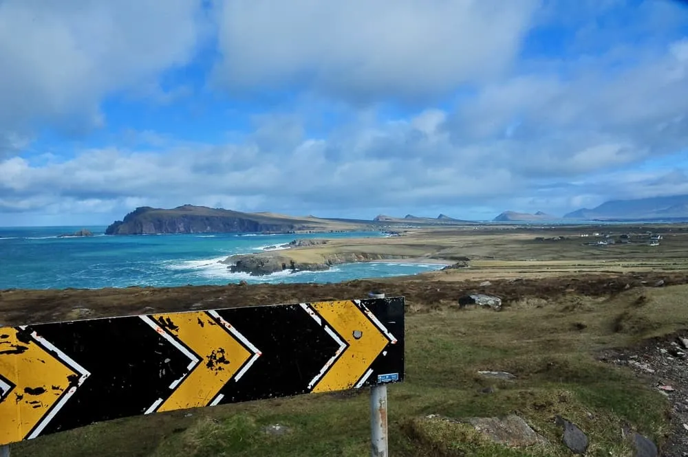
The stage from Camp to Annascaul on the Dingle Way is a varied walk that takes you through rolling hills, along rugged mountain slopes, and eventually to the dramatic south coast of County Kerry. It’s a route full of contrasts: quiet country lanes, green fields, wide-open views, and cultural heritage all blend seamlessly along the way.

Soon after leaving Camp, the trail begins a gradual climb with views of the imposing Caherconree Mountain, an 835-meter-high peak crowned by a megalithic fort said to date back to the Iron Age. As you ascend, you’re rewarded with sweeping views over the unspoiled Irish countryside and, in the distance, the Atlantic Ocean.

The path continues along rural tracks toward the southern coastline of the peninsula, eventually reaching the iconic Inch Beach. This vast sandy beach, made famous by the film Ryan’s Daughter, is a perfect place to pause, with nearby cafés and pubs where you can enjoy a snack or drink with a sea view.

Just before arriving in the village of Annascaul, you pass by Lough Anscaul, a picturesque glacial lake nestled in a broad U-shaped valley. In the surrounding fields, you will find ancient standing stones, silent witnesses to the region’s long history. The day ends in the charming village of Annascaul, the birthplace of the renowned Irish polar explorer Tom Crean. A visit to his former pub, The South Pole Inn, makes for a perfect conclusion to this stage. Here, you can not only relax and recharge, but also learn more about Crean’s heroic Antarctic expeditions.

The Old Anchor Inn (Annascaul)

Info
The Old Anchor Inn (Annascaul)
Day
4

Annascaul - Dingle

Duration: 06:29 h
Distance: 23.4 km / 14.5 mi
Ascent: 400 m / 1312 ft
Descent: 430 m / 1411 ft

After leaving Annascaul, the trail winds toward the coast, where you arrive at the ruins of Minard Castle. This 16th-century structure sits dramatically on a stony beach and offers sweeping views over Dingle Bay and the Iveragh Peninsula across the water. It’s a perfect spot for a short break or photo opportunity. From there, you continue through the countryside toward the village of Lispole, where the remains of the old Lispole Railway Viaduct serve as a reminder of the former railway line that once connected Tralee and Dingle. The landscape becomes increasingly open, with views of the imposing mountains Croaghskearda and An Cnapán Mór rising in the distance, creating a strong sense of being immersed in nature.

Later on, you cross the Garfinny River via a bridge, and the trail curves southwest. Here, you can already feel the coast and Dingle drawing near. The stage ends in the vibrant harbor town of Dingle, where you’re welcomed by colorful streets, lively pubs, and the renowned Irish hospitality.

Dingle Harbour Lodge (Dingle)

Info
Dingle Harbour Lodge (Dingle)
Day
5

Dingle - Dunquin/Ballyferriter

Duration: 05:57 h
Distance: 21.4 km / 13.3 mi
Ascent: 410 m / 1345 ft
Descent: 370 m / 1214 ft

The route begins in the lively harbor town of Dingle and leads you westward along a breathtaking coastline, following quiet country roads and unpaved paths. You soon reach the charming village of Ventry, where a beautiful sandy beach stretches along the bay. From there, the trail gradually ascends along the slopes of Mount Eagle, offering impressive views over the ocean, the Blasket Islands, and the rugged landscape as a reward for your efforts.

Along the way, you pass ancient beehive huts (clocháns), which are a reminder of the early Christian settlement in this area. As you approach Slea Head, one of the westernmost points of Ireland, the landscape becomes increasingly spectacular. Here, you walk along dramatic cliffs with unforgettable views over the vast Atlantic Ocean. This stage offers a perfect blend of natural beauty, culture, and history.

An Portán Guest House (Dunquin)

Info
An Portán Guest House (Dunquin)
Day
6

Dunquin/Ballyferriter - Cuas

Duration: 06:30 h
Distance: 24.5 km / 15.2 mi
Ascent: 210 m / 689 ft
Descent: 210 m / 689 ft

The stage from Dunquin to Cuas on the Dingle Way is one of the most scenic and varied sections of the trail. From the moment you leave Dunquin, a landscape unfolds filled with rugged cliffs, secluded bays, and panoramic views of the Atlantic Ocean and the Blasket Islands.

One of the first highlights along this route is Slea Head, one of the westernmost points of Ireland. Here, you will enjoy spectacular views over the sea and the surrounding coastline. Nearby, you will pass the well-known Coumeenoole Beach, a beautiful, remote beach that frequently appears in films, a perfect spot for a short break.

As you continue, the trail leads past the ancient beehive huts (clocháns), early stone dwellings that reflect the early Christian history of the region. The path then winds along the slopes of Mount Eagle, offering ever-changing vistas over the peninsula, the inland mountains, and the coastline. Not far from Dunquin, you will also find the Blasket Centre, where you can learn more about the rich culture and history of the island group just off the coast.

This stage combines quiet paved roads with unpaved paths and short beach sections. The terrain is generally easy to walk, though some parts can become muddy in wet weather.

An Bothar Pub (Cuas)

Info
An Bothar Pub (Cuas)
Day
7

Cuas - Cloghane

Duration: 06:45 h
Distance: 21.3 km / 13.2 mi
Ascent: 770 m / 2526 ft
Descent: 800 m / 2625 ft

The stage from Cuas to Cloghane on the Dingle Way is without a doubt one of the most impressive and challenging sections of this long-distance trail. The route starts in the hamlet of Cuas, where you quickly begin a steep ascent toward the shoulder of Mount Brandon, the highest point of the Dingle Way.

This climb is physically demanding and requires a good level of fitness. However, those who take on the challenge are richly rewarded: along the way, breathtaking panoramas unfold over the rugged peninsula, the Atlantic Ocean, and the surrounding mountains. After reaching the summit, a long and often steep descent leads you to the village of Cloghane on the northern side of Mount Brandon. The trail can be muddy and slippery, especially after rainfall. In case of poor weather and low visibility, it is strongly recommended to skip this stage and travel to Cloghane by transport instead.

O'Connors Guesthouse (Cloghane)

Info
O'Connors Guesthouse (Cloghane)
Day
8

Cloghane - Castlegregory

Duration: 04:15 h
Distance: 16.8 km / 10.4 mi
Ascent: 50 m / 164 ft
Descent: 60 m / 197 ft
After Cloghane, you follow a quiet, undulating road that turns north after Drom Hill. This section of the Dingle Way is about 3.5 km long before it takes you through Drom and Farrendalouge and rejoins the coast at Fermoyle. The stretch between Fermoyle and Kilshannig is mainly on sandy beaches with several streams to cross. After a day of heavy rain or high tide, these streams can become extremely deep. It is advisable to go to the higher sand dunes, where they are easier to cross.

Harbour House B&B (Castlegregory)

Info
Harbour House B&B (Castlegregory)
Day
9

Castlegregory - Camp

Duration: 04:35 h
Distance: 17.6 km / 10.9 mi
Ascent: 110 m / 361 ft
Descent: 50 m / 164 ft
The first part of today's route is mainly along the beach. Then you arrive at Castlegregory. This is a quiet village with a special charm. When leaving Castlegregory, the path goes through a boggy area. At Aughacasla, the path takes you past Tralee Bay, where you have a wonderful view of the water, the beach, and the towering mountains in the distance.

Camp Junction House (Camp)

Info
Camp Junction House (Camp)
Day
10

Camp - Tralee

Duration: 04:52 h
Distance: 18 km / 11.2 mi
Ascent: 230 m / 755 ft
Descent: 280 m / 919 ft
On the last day of the hike, you cross the Finglas River and head uphill to the valley. You will come across the well-preserved ruins of Killelton Oratory. The trail leads you past some breathtaking glacial valleys and continues over swampy terrain. The path continues into an open mountainside before reaching the Slieve Mish mountain range. You then walk through Blennerville, where you will find the windmill. Then you come to Princes Quay again, with a little further on the Kerry County Museum; the ending point of this walk.

Grand Hotel Tralee (Tralee)

Info
Grand Hotel Tralee (Tralee)
Day
11

Departure

After breakfast, our services and your Dingle Way adventure will be over. Have a safe trip back home!

How to Get to the Starting Point of the Dingle Way

The Dingle Way starts and ends in Tralee, the Couty of Kerry's main town and administrative hub. The Dingle Way trail starts at the Town Park Gate to the west side of the Ashe Hall at the end of Denny Street, near the Kerry County Museum. The Dingle Way is traditionally walked clockwise, from Tralee towards the north to Camp, and then southwest towards Annascaul.

How to get to Tralee?

The most convenient way is flying to Kerry Airport, which is located 12 miles/19 kilometers outside town, and gets flights from Dublin, London-Luton, London-Stansted, and Frankfurt-Hahn.

You can also reach Tralee via train from Mallow, where you can get a connection to/from Cork and Dublin. Train services run every two hours almost every day, except on Sundays, when the services are less frequent. There are also direct buses that connect Tralee with Cork, and, with a change at Limerick, from Galway and Dublin.

Dingle Way Accommodation

On the Dingle Way, you can either spend the night in a cozy hotel or in a typical Irish B&B, where you’ll receive a warm welcome and enjoy a hearty Irish breakfast. However, accommodation options can be limited, especially during peak season. The Dingle Way is a popular trek in Ireland and it welcomes thousands of trekkers every year. To secure your preferred accommodations, it’s essential to plan your itinerary carefully and book well ahead of time, since the hotels get fully booked months in advance.

Baggage Transfer on the Dingle Way

The Dingle Way is a popular trek that attracts many hikers each year. The tourism industry in the Dingle Peninsula welcomes these visitors and has developed several services to make the trek around the peninsula easier and lighter. One such service is baggage transfer, which is also very popular in other treks in the British Isles, like the Great Glen Way and the West Highland Way, both in Scotland.

There are several agencies that offer baggage transfers during the Dingle Way and most charging approximately €15 per bag, per day. The Baggage transfer companies pick up your bags every morning from your hotel and make sure that they are waiting for you at your next stop when you arrive. That way, you can enjoy the trek without any extra weight on your shoulders. Quite convenient, isn't it?

Baggage Transfer on the Dingle Way

Camping on the Dingle Way

Well, technically there is no law prohibiting camping or wild camping in the Dingle Peninsula and you probably find many stories of people who have done it. If you want to give it a try, you can do so. However, if you want to go camping on the Dingle Peninsula you should consider the following first: the terrain along the Dingle Way can be very exposed, which means that there is little or no shelter on higher ground from the strong winds and the rain. In Spring, much of the uplands can be very muddy, and finding a dry spot can be a difficult task. If you still want to go camping on the Dingle Way, make sure that you are prepared and have the right equipment for it, Ireland's weather is not exactly camping-friendly!

Not sure yet or want to discuss your plans for the Dingle Way with one of our trekking experts? Get in touch today and turn your dreams into memories!

Packing List for the Dingle Way

No matter where you go hiking or for how long, bringing the right equipment is of utmost importance. For your hike, the first thing you need is a good backpack. The size of it will depend on the number of days you will be trekking, the season and the clothes you take with you. If you have luggage transport, the comfort level of your daypack is most important. We have compiled a packing list with a few essential items of clothing you should bring and some extras you might find useful:
  • Essentials

  • Extras

Is Walking the Dingle Way Safe?

In terms of difficulty, the Dingle Way is an easy to moderate hike. There are some stretches on the way that are more demanding since they include some steep climbs and sheer drops. Visibility can also be a challenge at times due to fog and low clouds, especially on stage 6, from Feohanagh to Cloghane. Despite the occasional poor visibility, the Dingle Way is a safe trek. The path is wide and the trail is clearly marked with a yellow arrow on black background.

Is Walking the Dingle Way Safe?

Safety tips for the Dingle Way

Although this is far from being a trek in the Himalayas, unexpected things can always happen and you might also find obstacles on the hiking trails along the way. The Dingle Way is safe, the trails are quite straight forward and there is not an extreme difference in altitude. However, for your safety, every hike deserves a level of respect; respect for the terrain, the trails, wildlife and vegetation, local rules and regulations, and above all, your physical capabilities and safety. Therefore, for an unforgettable and safe hiking memory, please keep the following safety recommendations in mind:

  • Know your limits

    Always prepare each stage carefully to use your energy wisely, respect your physical and mental limitations, and avoid taking unnecessary risks. When ascending or descending, if applicable, always use the aids provided, such as handrails and ropes. Is this trek suitable for you? Well, familiarize yourself with the grading system and figure out if this trek matches your capabilities. If you still need professional advice you can always contact Bookatrekking.com experts.

  • Stay on marked trails

    The most important thing is to never leave the marked paths. For easy navigation we work with our trusted partner Komoot, whose interactive maps, also available offline, provide you with the necessary digital means to get from A to B in the Dingle Way. As a backup, make sure to bring a hiking guide or a paper map with you.

  • Fully equipped

    Make sure you have the necessary gear for the conditions you'll be facing, including appropriate clothing, footwear, and any necessary equipment for the terrain you'll be hiking on. Always wear clothing adapted to the weather of Dingle Way and protect yourself from cold and wetness or heat and sun. Besides, make sure you carry enough food and water for the duration of your trek. On the way, you might (or might not) be able to buy snacks.

  • Stay reachable

    If you are hiking solo or in small groups it is advisable to inform people back home about your plans, what route you are taking and when you plan to return. Even small incidents can lead to unpleasant emergencies so make sure you are available at all times. Bring a charged phone containing at least the phone numbers of immediate family members, your accommodations en route and the emergency phone numbers operating in the Dingle Way.

  • Respect for nature

    Do not litter, prevent noise, stay on the marked trails, do not disturb wildlife or grazing animals, and respect protected areas.

Where Can I Book the Dingle Way?

At Bookatrekking.com you can book the self-guided Dingle Way and many other treks. We take care of all the details for you, including arranging accommodations, organizing luggage transportation and providing you with relevant information well in advance of your trek. Find our offers here. Our easy-to-use platform allows you to browse and compare different trekking options and find the perfect fit for your interests, abilities, and budget.

If you have any questions about a specific trek or need help choosing the right one for you, our team of trekking experts is here to assist you. Simply reach out to us and we will be happy to provide you with personalized recommendations and advice to help you plan the trekking adventure of a lifetime.

Comments

About Us

At Bookatrekking.com, you will find the trek that will make your life unforgettable. Whether you want to explore the Inca Trail or climb Kilimanjaro. Bookatrekking.com has a wide and varied range of first-class treks. No false promises are made here. Transparent prices and bookings are fixed instantly. Find, compare, book and trek!
Read more about us
About Us
About Us

Also Interesting