Kerry Way: Everything About Ireland's Finest Walk

Natascha Langelaan
Natascha Langelaan
Natascha Langelaan
28 Feb 2024 10 min read
Kerry Way: Everything About Ireland's Finest Walk
Trekking experts per destination
Free cancellation up to eight weeks in advance
Quick personal advice

The Kerry Way, in Irish Slí Uíbh Ráthaigh, is the most famous and popular long-distance hiking trail in Ireland. The Kerry Way, located 'between' the Dingle Way and the Beara Way, is a circular walking route of approximately 214 kilometers across the Iveragh Peninsula. This route starts and ends in Killarney. This is the walking alternative to the famous Ring of Kerry driving route and passes through some of Ireland’s most spectacular scenery. In this blog post, we have included all you need to know to walk the Kerry Way, including the route, the map, distance, baggage transfer services, accommodations, and more!

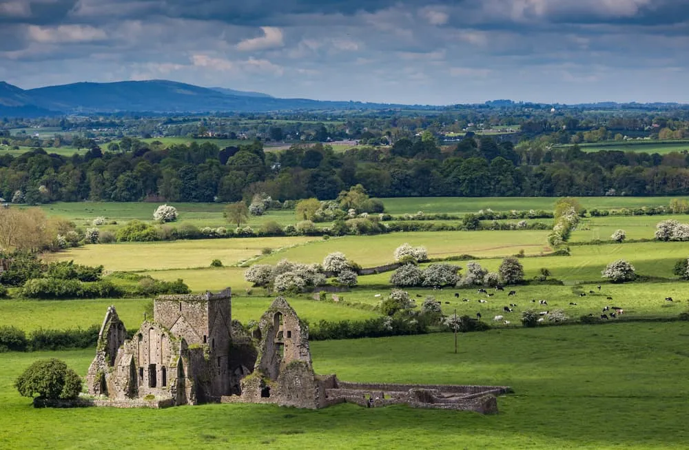
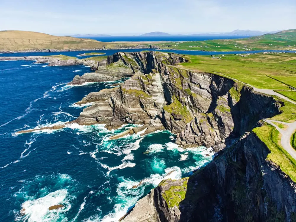
Crossing mountains and valleys, passing lakes, old forests, and wild bogs, the route comes with a lot of variety. From the cliffs and sandy beaches, you can enjoy beautiful views over the many rocky islands. You come across numerous archaeological finds, giving the route a strong historical character. The route is divided into 9 stages and starts and ends in Killarney. Whether you are an experienced hiker or just starting out, the Kerry Way is for everyone. There are plenty of challenges in this long-distance walk for everyone! If you're looking for unforgettable walking holidays in Ireland, the Kerry Way is a perfect choice. Are you ready for this adventure? Let’s go!
The Kerry Way: History and Overview

With over 200 kilometers, the Kerry Way is Ireland's longest signposted hiking trail and also one of the most popular ones. The route was first proposed and developed by members of the Laune Mountaineering Club in 1982. It was Seán Ó Súilleabháin, the chairman, who realised "there was a spider's web-like network of roads and paths that could be combined to form a route around Kerry." He began drawing the trail that we know now as the Kerry Way. The full route was completed in 1989 and opened by Frank Fahey, TD, Minister of State for Youth and Sport.

For the first few days, the Kerry Way crosses through the foothills of the MacGillycuddy’s Range, reaching a height of 1000 meters and home to 9 of the 10 highest peaks in Ireland. As you begin to reach the coast, the hills level off and you get beautiful views of the Kerry coastline. From the colorful coastal town of Waterville, the Kerry Way heads east again to Kenmare, providing breathtaking views of Puffin, Scarrif and Devenish Island. On the last day, the Kerry Way leads you through the beautiful Killarney National Park, a worthy conclusion to this extremely varied and spectacular walking tour.

The Kerry Way: History and Overview

Distance: How Long is The Kerry Way?

The Kerry Way is a circular trail and starts and ends in Killarney. The trail is 214 kilometers long, which is equal to 133 miles, and is divided into 9 stages. Along the way, the route takes hikers through mountains, valleys, lakes, old forests, sandy beaches, and archaeological remains.

Kerry Way: Weather and Best Season

You can walk the Kerry Way all year round. The most popular season is March to October. May being the most recommended month. What you should know is that the weather conditions are frequently wet and windy, regardless of the season that you choose, so pack the necessary wet/warm weather gear and always have an extra, dry pair of shoes to wear at the end of the day. A good rain jacket and overtrousers will be your best allies.

The Kerry Way Map and Navigation

Below, you will find a map with the 9 stages of this circular walk, with the starting and ending point in Killarney.

The Kerry Way: Route From Day to Day

The Kerry Way is divided into 9 stages, starting and ending in Killarney. The Kerry Way is a hard trail to walk on some days, however, on other days, the trail is more easy. Below, you will find the 9 stages of the Kerry Way:

Day
1

Arrival in Killarney

Today you will have to make your way to Killarney. In Killarney, you will spend the night at a hotel preparing for your Kerry Way adventure.

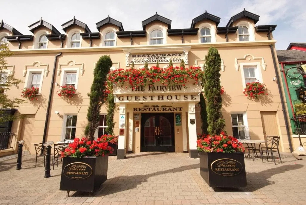
The Fairview Boutique Hotel (Killarney)

Info
The Fairview Boutique Hotel (Killarney)
Day
2

Killarney - Black Valley

Duration: 06:45 h
Distance: 24.3 km
Ascent: 450 m
Descent: 390 m

This stage leads you out of lively Killarney and straight into the wild, quiet heart of the Kerry mountains. The route gradually trades lakeside paths and forest tracks for a more remote valley setting, with the dramatic Gap of Dunloe and the Black Valley shaping the day. It feels like stepping away from civilisation into a deeper, more rugged landscape.

Leaving Killarney, the trail follows peaceful paths along Lough Leane before entering Killarney National Park. You pass highlights such as Torc Waterfall and forested slopes beneath Torc Mountain, then continue along the Old Kenmare Road. The path slowly climbs through woodland and open ground, with views towards the MacGillycuddy’s Reeks. The highest point comes near the approach to the Gap of Dunloe, after which the route turns into a long, gradual descent.

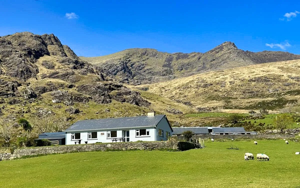
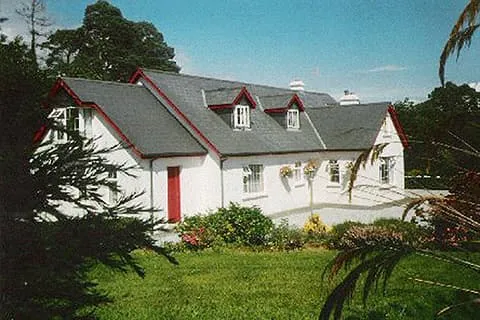
The descent brings you into the remote Black Valley, where the landscape feels vast and untouched. Quiet tracks wind between rivers, stone walls and scattered farmsteads. Shamrock Farmhouse sits in this peaceful setting, a simple and welcoming place to end the day, surrounded by mountains and the deep silence of the valley.

Shamrock Farmhouse (Black Valley)

Info
Shamrock Farmhouse (Black Valley)
Day
3

Black Valley - Glencar

Duration: 06:40 h
Distance: 21.2 km
Ascent: 590 m
Descent: 600 m

A long, hard mountain crossing leaves the Black Valley and heads for Glencar, full of wild valley floors, high passes, lonely lakes and proper Kerry drama. The climbing comes in two big waves, first through Bridia Valley and later over Beann Dhearg Pass, with the Reeks standing around like they own the place. Which, frankly, they do.

From Shamrock Farmhouse, the route follows the Black Valley past abandoned stone cottages and Cummeenduff Lough, then pushes west into Bridia Valley between Brassel Mountain and Broaghnabinnia (745 m). After gentler valley ground, the trail climbs towards Beann Dhearg Pass, rising to around 350 metres, with views back towards MacGillycuddy’s Reeks and the rough heart of the mountains.

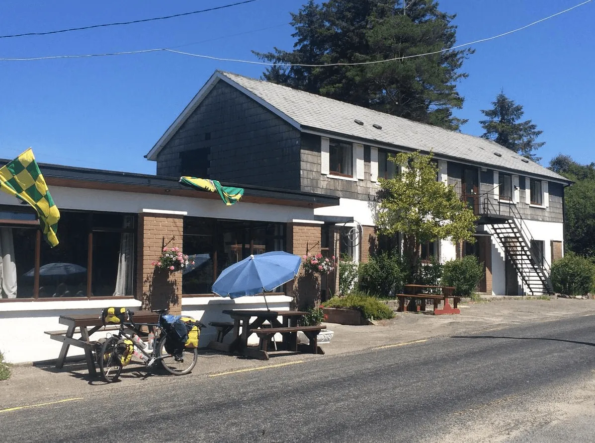
Beyond the pass, the route drops towards Lough Acoose, then loops through quieter lanes, lakeside views and the Enchanted Mossy Forest before easing into Glencar. The Climber’s Inn is a perfect mountain finish: warm, simple, welcoming, and exactly the sort of place where tired legs and big stories suddenly become best friends.

The Climber's Inn (Glencar)

Info
The Climber's Inn (Glencar)
Day
4

Glencar - Glenbeigh

Duration: 05:00 h
Distance: 17.7 km
Ascent: 310 m
Descent: 370 m

This stage links the quiet valley of Glencar with the coastal charm of Glenbeigh, combining inland calm with sweeping sea views. It is a gentler day in terms of terrain, yet rich in atmosphere, as mountains slowly give way to the Atlantic. Lough Caragh and the distant Dingle Peninsula set the tone, with a mix of forest, open hillside and shoreline guiding the way.

Leaving Glencar, the route follows peaceful tracks through farmland and along the edge of Lough Caragh, where the water reflects the surrounding hills. A gradual climb brings you towards the Windy Gap, a modest pass that opens up wide views across the landscape. From here, the trail descends steadily, with glimpses of Dingle Bay appearing ahead. The path continues through a mix of quiet roads and tracks, passing viewpoints over Rossbeigh Beach and the coastline.

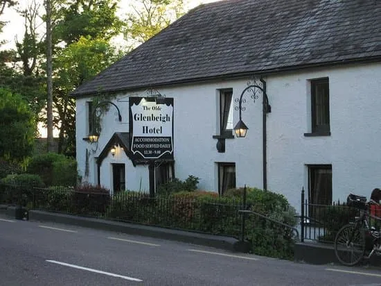
As you approach Glenbeigh, the air turns more coastal and the scenery opens wide. The village sits near the edge of Dingle Bay, with long sandy stretches and rolling waves nearby. Your accommodation awaits in this relaxed setting, a perfect place to unwind after a day that gently carries you from mountains to sea.

The Glenbeigh Hotel (Glenbeigh)

Info
The Glenbeigh Hotel (Glenbeigh)
Day
5

Glenbeigh - Cahersiveen

Duration: 08:45 h
Distance: 31.5 km
Ascent: 560 m
Descent: 560 m

This is a long and rewarding coastal stage, linking Glenbeigh with Cahersiveen along the edge of the Atlantic. The route blends mountain tracks with sweeping sea views, where the Dingle Peninsula remains in sight across the water. It is a day of distance and rhythm, with open landscapes, old paths and the constant presence of the ocean guiding you west.

Leaving Glenbeigh, the trail follows the shoreline near Rossbeigh Beach before turning inland on rising tracks. A steady climb brings you onto higher ground beneath the slopes of Drung Hill, where wide views open over Dingle Bay. The route then undulates across open hillsides and quiet valleys, passing old ruins and remote stretches. After the high point, the path gradually descends, with the terrain softening as you approach the outskirts of Cahersiveen.

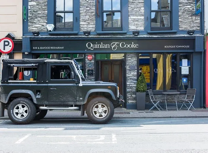
As you near the town, the landscape shifts back to fields, roads and scattered houses. Cahersiveen appears along the water, with its bridges and colourful buildings marking a lively return to civilisation. Quinlan & Cooke Boutique Townhouse offers a comfortable and stylish place to end this long day, right in the heart of town.

Quinlan & Cooke Boutique Townhouse (Cahersiveen)

Info
Quinlan & Cooke Boutique Townhouse (Cahersiveen)
Day
6

Cahersiveen - Waterville

Duration: 08:50 h
Distance: 30.4 km
Ascent: 780 m
Descent: 790 m

This is one of the longer and more demanding coastal stages, carrying you from Cahersiveen to the seaside town of Waterville. The route blends inland ridges with sweeping Atlantic views, with Valentia Island and the Skellig coast never far from sight. It is a day of contrasts, where quiet hills and wide ocean horizons meet in a steady westward journey.

Leaving Cahersiveen, the trail climbs gradually through farmland and onto higher ground, passing viewpoints over Valentia Island and the entrance to the Skelligs. A more sustained ascent brings you along open ridges with wide views across the Atlantic and inland mountains. The route then descends towards lower ground before rising again over rolling hills, with highlights such as Coomduff and views over Lough Currane adding variety along the way.

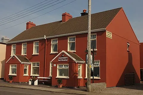
The final stretch leads you down towards the coast, where the landscape opens and the sea returns fully into view. Waterville appears stretched along the shoreline, backed by hills and facing the Atlantic. Clifford’s Ocean View offers a fitting end to the day, a place to rest with the sound of the ocean never far away.

Clifford's Ocean View (Waterville)

Info
Clifford's Ocean View (Waterville)
Day
7

Waterville - Caherdaniel

Duration: 04:45 h
Distance: 17.2 km
Ascent: 310 m
Descent: 290 m

This coastal stage links Waterville with Caherdaniel, offering a relaxed but scenic day along the Ring of Kerry. The route mixes quiet inland paths with stretches close to the Atlantic, where wide views over Ballinskelligs Bay and the Skellig Islands set the tone. It is a gentle transition between lively seaside and more remote coastal landscapes.

Leaving Waterville, the trail follows the shoreline before gradually climbing inland, revealing sweeping views over the Atlantic and the Skellig Islands. A steady ascent brings you to higher ground, after which the route descends through open countryside towards Derrynane. Along the way, highlights include views over Kenmare Bay and the surrounding hills, before reaching the historic grounds of Derrynane Abbey and nearby beaches.

The final stretch leads past Derrynane House and along sandy shores, where the sea is never far away. Caherdaniel appears quietly along the coast, surrounded by rolling hills and sheltered bays. The Olde Forge offers a warm and welcoming finish, a perfect place to unwind after a day shaped by sea air and soft coastal light.

The Olde Forge (Caherdaniel)

Info
The Olde Forge (Caherdaniel)
Day
8

Caherdaniel - Sneem

Duration: 05:15 h
Distance: 18.3 km
Ascent: 400 m
Descent: 410 m

A varied and tougher walk leaves Caherdaniel and heads east towards Sneem, with Kenmare Bay glittering to the south and the hills steadily taking over. The route mixes quiet lanes, old tracks, stream crossings and rolling upland ground. It is a hard one, not because of one monster climb, but because the day keeps serving up short, punchy rises. Classic Kerry, always another little sting.

From The Olde Forge, the route climbs out of Caherdaniel with views over Kenmare Bay, then passes Coomnahorna Old Burial Ground and a scenic stream-side trail. The path rises and dips through open hillside towards Staigue Wishing Seat and Staigue Fort, with a notable climb to around 180 metres before rolling onward through the hollow way.

After the high middle section, the route gradually loses height through quieter countryside, with long views towards the Sneem area and the islands of Kenmare Bay. The final kilometres ease into Sneem, where Coomassig View gives a peaceful finish just beyond the village buzz. Hills done, bay still sparkling, fine work all round.

Coomassig View (Sneem)

Info
Coomassig View (Sneem)
Day
9

Sneem - Kenmare

Duration: 10:00 h
Distance: 36.1 km
Ascent: 640 m
Descent: 630 m

This is a long and varied stage linking Sneem with Kenmare, following the southern shores of Kenmare Bay. The route combines quiet roads, woodland paths and open stretches with constant views over the water. It is a rewarding day, with a steady rhythm of gentle climbs and descents, always guided by the shifting light over the bay.

Leaving Sneem, the trail follows the coastline eastwards, offering wide views across Kenmare Bay and towards the Beara Peninsula. The path stays mostly low, weaving between small inlets and passing through peaceful countryside. Around halfway, the route continues along quiet lanes and forest tracks, with occasional climbs that open up broader views of the bay and surrounding hills.

As you approach Kenmare, the landscape becomes softer, with more woodland and signs of village life returning. The final stretch leads gently towards the town, where colourful streets and a lively atmosphere welcome you back. An Bruachan offers a comfortable and friendly place to settle in, a well-earned rest after a long day along the water’s edge.

An Bruachan (Kenmare)

Info
An Bruachan (Kenmare)
Day
10

Kenmare - Killarney

Duration: 07:35 h
Distance: 26.4 km
Ascent: 630 m
Descent: 620 m

This final stretch brings you from Kenmare to Killarney, linking two lively towns through a landscape of lakes, forests and mountain views. It is a varied and rewarding day, with steady climbs early on and a long, gentle descent towards Killarney National Park. Along the way, the scenery shifts from open countryside to one of Ireland’s most iconic natural settings.

Leaving Kenmare, the route gradually climbs through quiet backroads and open hills, with views back over Kenmare Bay. The ascent is steady but never overwhelming, leading you towards higher ground where the landscape opens up. As you continue, the trail descends into the edges of Killarney National Park, passing near Torc Mountain and offering glimpses of the surrounding lakes.

The final section is a real highlight, following forest trails and lakeside paths past Muckross Lake and towards Lough Leane. As Killarney comes into view, the atmosphere shifts to something more lively again. You arrive in town with plenty of options to relax and celebrate the journey, a fitting end surrounded by lakes, woodland and mountain backdrops.

The Fairview Boutique Hotel (Killarney)

Info
The Fairview Boutique Hotel (Killarney)
Day
11

Departure Day

After breakfast, our services and your Kerry Way adventure will be over. Have a safe trip back home!

Kerry Way Accommodation

On the Kerry Way, you can either spend the night in a cozy hotel or in a typical Irish B&B, where you will receive a warm welcome and a typical Irish breakfast. There are also campsites along the path. Wild camping is also an option. If you choose to wild camp, keep the following in mind. The wind can change in a few hours from calm to strong. Ask for drinking water at nearby houses whenever possible, as stream water is unreliable due to the presence of grazing sheep.

Luggage Transport on the Kerry Way

The Kerry Way is a popular trek that attracts thousands of hikers each year. Thanks to this popularity, there is always a possibility to have your luggage transported. Each morning, your suitcase will be picked up from your hotel and delivered to your next accommodation by the end of the day. Quite convenient, isn't it?

Walk the Kerry Way: Starting and Ending Point

The Kerry Way begins and ends in Killarney. Since it is a circular route, the path can be walked in both ways. Killarney is reachable by public transport.

Starting point

To get to Killarney, you first have to travel to either Kerry Airport, Cork Airport, Dublin Airport or Shannon Airport. From there, you can take the train or bus to Killarney. You can also drive to Killarney by car. Killarney is a vibrant tourist town. Here you can find many traditional farms, the Killarney National Park, castles and of course the Irish Whiskey Experience.

Ending point

Since the Kerry Way is a circular walk, the route also ends in Killarney. You can travel to one of the airports by train or bus. In case you came by car, you can pick it up where you left it.

Walk the Kerry Way: Starting and Ending Point

Packing List for the Kerry Way

No matter where you go hiking or for how long, bringing the right equipment is of utmost importance. For your hike, the first thing you need is a good backpack. The size of it will depend on the number of days you will be trekking, the season and the clothes you take with you. If you have luggage transport, the comfort level of your daypack is most important. We have compiled a packing list with a few essential items of clothing you should bring and some extras you might find useful:
  • Essentials

  • Extras

Safety tips for the Kerry Way

Although this is far from being a trek in the Himalayas, unexpected things can always happen and you might also find obstacles on the hiking trails along the way. The Kerry Way is safe, the trails are quite straight forward and there is not an extreme difference in altitude. However, for your safety, every hike deserves a level of respect; respect for the terrain, the trails, wildlife and vegetation, local rules and regulations, and above all, your physical capabilities and safety. Therefore, for an unforgettable and safe hiking memory, please keep the following safety recommendations in mind:

  • Know your limits

    Always prepare each stage carefully to use your energy wisely, respect your physical and mental limitations, and avoid taking unnecessary risks. When ascending or descending, if applicable, always use the aids provided, such as handrails and ropes. Is this trek suitable for you? Well, familiarize yourself with the grading system and figure out if this trek matches your capabilities. If you still need professional advice you can always contact Bookatrekking.com experts.

  • Stay on marked trails

    The most important thing is to never leave the marked paths. For easy navigation we work with our trusted partner Komoot, whose interactive maps, also available offline, provide you with the necessary digital means to get from A to B in the Kerry Way. As a backup, make sure to bring a hiking guide or a paper map with you.

  • Fully equipped

    Make sure you have the necessary gear for the conditions you'll be facing, including appropriate clothing, footwear, and any necessary equipment for the terrain you'll be hiking on. Always wear clothing adapted to the weather of Kerry Way and protect yourself from cold and wetness or heat and sun. Besides, make sure you carry enough food and water for the duration of your trek. On the way, you might (or might not) be able to buy snacks.

  • Stay reachable

    If you are hiking solo or in small groups it is advisable to inform people back home about your plans, what route you are taking and when you plan to return. Even small incidents can lead to unpleasant emergencies so make sure you are available at all times. Bring a charged phone containing at least the phone numbers of immediate family members, your accommodations en route and the emergency phone numbers operating in the Kerry Way.

  • Respect for nature

    Do not litter, prevent noise, stay on the marked trails, do not disturb wildlife or grazing animals, and respect protected areas.

Where Can I Book the Kerry Way?

At Bookatrekking.com you can book the self-guided Kerry Way and many other treks. We take care of all the details for you, including arranging accommodations, organizing luggage transportation and providing you with relevant information well in advance of your trek. Find our offers here. Our easy-to-use platform allows you to browse and compare different trekking options and find the perfect fit for your interests, abilities, and budget.

If you have any questions about a specific trek or need help choosing the right one for you, our team of trekking experts is here to assist you. Simply reach out to us and we will be happy to provide you with personalized recommendations and advice to help you plan the trekking adventure of a lifetime.

About Us

At Bookatrekking.com, you will find the trek that will make your life unforgettable. Whether you want to explore the Inca Trail or climb Kilimanjaro. Bookatrekking.com has a wide and varied range of first-class treks. No false promises are made here. Transparent prices and bookings are fixed instantly. Find, compare, book and trek!
Read more about us
About Us
About Us

Also Interesting