Full Kerry Way

  • Duration
    Total 11 days
    Average 7h 4min
  • Distance
    Total 223.1 km
    Average 24.8 km
  • Ascent
    Total +4670 m
    Average +519 m
  • Descent
    Total -4660 m
    Average -518 m

> Complete the Kerry Way in 11 days (9 stages)
> Enjoy the beauty of Ireland
> Accommodation before & after included

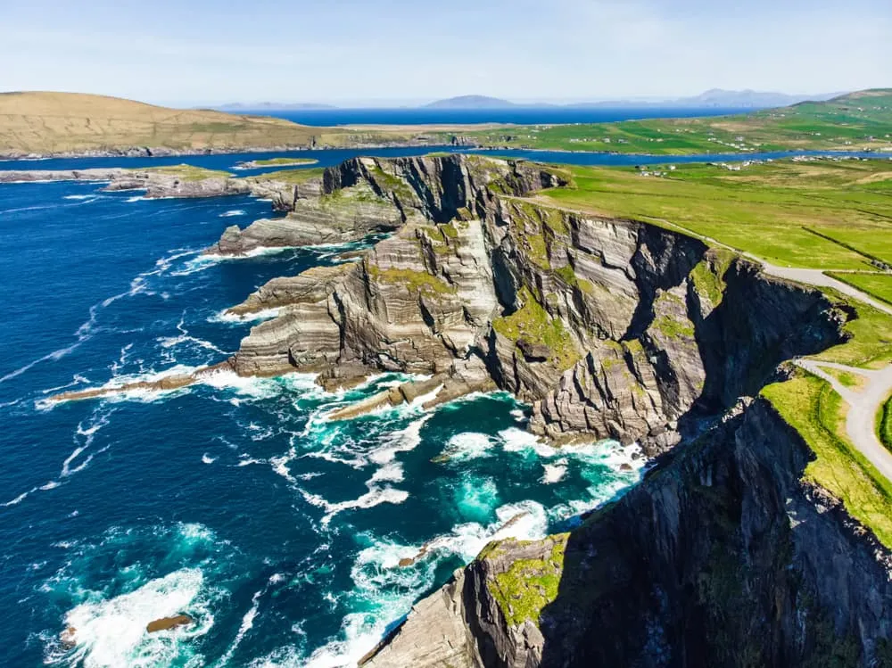
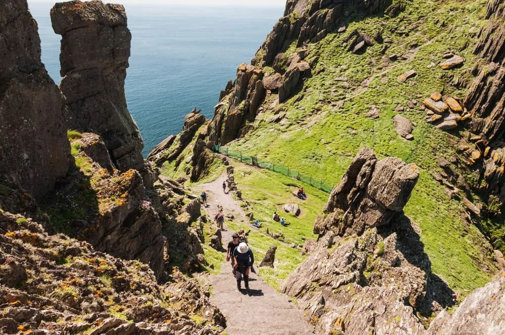
With just over 1000 meters, the Carrauntoohil, Ireland’s highest mountain, isn’t exactly a highlight. But what Ireland lacks in height, it more than makes up for in rough natural beauty. One of the best ways to experience this is by walking the Kerry Way, a circular walking route of approximately 214 kilometers across the Iveragh Peninsula. This route starts and ends in Killarney. This is the walking alternative to the famous Ring of Kerry driving route, and passes through some of Ireland’s most spectacular scenery. Crossing mountains and valleys, passing lakes, old forests and wild bogs, the route comes with a lot of variety. From the cliffs and sandy beaches you can enjoy beautiful views over the many rocky islands. You pass numerous archaeological remains, giving the route a strong historical character.

The Kerry Way is 214 kilometers long, which is equal to 133 miles. The route is divided into 9 stages, and starts and ends in Killarney. Whether you are an experienced hiker or just starting out, the Kerry Way is for everyone.

Itinerary

Day
1

Arrival in Killarney

Today you will have to make your way to Killarney. In Killarney, you will spend the night at a hotel preparing for your Kerry Way adventure.
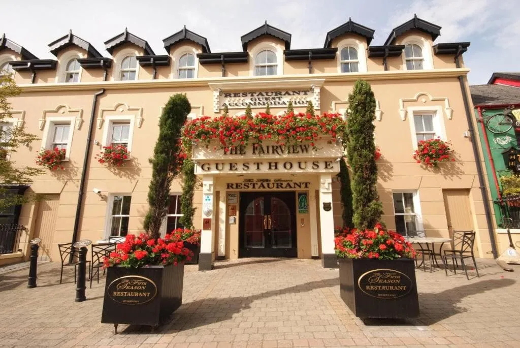
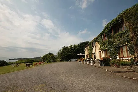
The Fairview Boutique Hotel (Killarney)
Day
2

Killarney - Black Valley

Duration: 06:45 h
Distance: 24.3 km
Ascent: 450 m
Descent: 390 m

This stage leads you out of lively Killarney and straight into the wild, quiet heart of the Kerry mountains. The route gradually trades lakeside paths and forest tracks for a more remote valley setting, with the dramatic Gap of Dunloe and the Black Valley shaping the day. It feels like stepping away from civilisation into a deeper, more rugged landscape.

Leaving Killarney, the trail follows peaceful paths along Lough Leane before entering Killarney National Park. You pass highlights such as Torc Waterfall and forested slopes beneath Torc Mountain, then continue along the Old Kenmare Road. The path slowly climbs through woodland and open ground, with views towards the MacGillycuddy’s Reeks. The highest point comes near the approach to the Gap of Dunloe, after which the route turns into a long, gradual descent.

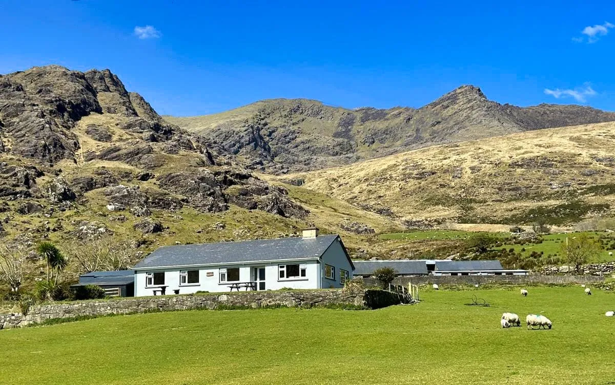
The descent brings you into the remote Black Valley, where the landscape feels vast and untouched. Quiet tracks wind between rivers, stone walls and scattered farmsteads. Shamrock Farmhouse sits in this peaceful setting, a simple and welcoming place to end the day, surrounded by mountains and the deep silence of the valley.

Shamrock Farmhouse (Black Valley)
Day
3

Black Valley - Glencar

Duration: 06:40 h
Distance: 21.2 km
Ascent: 590 m
Descent: 600 m

A long, hard mountain crossing leaves the Black Valley and heads for Glencar, full of wild valley floors, high passes, lonely lakes and proper Kerry drama. The climbing comes in two big waves, first through Bridia Valley and later over Beann Dhearg Pass, with the Reeks standing around like they own the place. Which, frankly, they do.

From Shamrock Farmhouse, the route follows the Black Valley past abandoned stone cottages and Cummeenduff Lough, then pushes west into Bridia Valley between Brassel Mountain and Broaghnabinnia (745 m). After gentler valley ground, the trail climbs towards Beann Dhearg Pass, rising to around 350 metres, with views back towards MacGillycuddy’s Reeks and the rough heart of the mountains.

Beyond the pass, the route drops towards Lough Acoose, then loops through quieter lanes, lakeside views and the Enchanted Mossy Forest before easing into Glencar. The Climber’s Inn is a perfect mountain finish: warm, simple, welcoming, and exactly the sort of place where tired legs and big stories suddenly become best friends.

The Climber's Inn (Glencar)
Day
4

Glencar - Glenbeigh

Duration: 05:00 h
Distance: 17.7 km
Ascent: 310 m
Descent: 370 m

This stage links the quiet valley of Glencar with the coastal charm of Glenbeigh, combining inland calm with sweeping sea views. It is a gentler day in terms of terrain, yet rich in atmosphere, as mountains slowly give way to the Atlantic. Lough Caragh and the distant Dingle Peninsula set the tone, with a mix of forest, open hillside and shoreline guiding the way.

Leaving Glencar, the route follows peaceful tracks through farmland and along the edge of Lough Caragh, where the water reflects the surrounding hills. A gradual climb brings you towards the Windy Gap, a modest pass that opens up wide views across the landscape. From here, the trail descends steadily, with glimpses of Dingle Bay appearing ahead. The path continues through a mix of quiet roads and tracks, passing viewpoints over Rossbeigh Beach and the coastline.

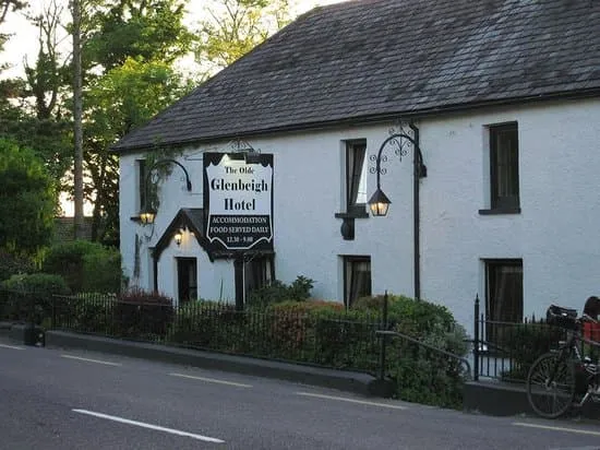
As you approach Glenbeigh, the air turns more coastal and the scenery opens wide. The village sits near the edge of Dingle Bay, with long sandy stretches and rolling waves nearby. Your accommodation awaits in this relaxed setting, a perfect place to unwind after a day that gently carries you from mountains to sea.

The Glenbeigh Hotel (Glenbeigh)
Day
5

Glenbeigh - Cahersiveen

Duration: 08:45 h
Distance: 31.5 km
Ascent: 560 m
Descent: 560 m

This is a long and rewarding coastal stage, linking Glenbeigh with Cahersiveen along the edge of the Atlantic. The route blends mountain tracks with sweeping sea views, where the Dingle Peninsula remains in sight across the water. It is a day of distance and rhythm, with open landscapes, old paths and the constant presence of the ocean guiding you west.

Leaving Glenbeigh, the trail follows the shoreline near Rossbeigh Beach before turning inland on rising tracks. A steady climb brings you onto higher ground beneath the slopes of Drung Hill, where wide views open over Dingle Bay. The route then undulates across open hillsides and quiet valleys, passing old ruins and remote stretches. After the high point, the path gradually descends, with the terrain softening as you approach the outskirts of Cahersiveen.

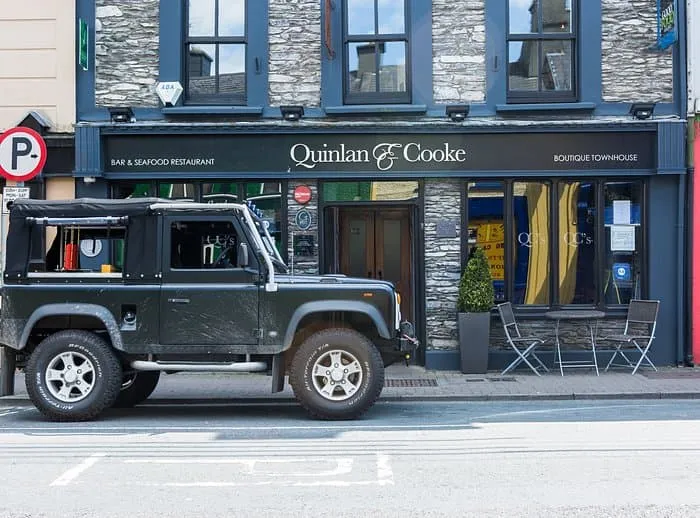
As you near the town, the landscape shifts back to fields, roads and scattered houses. Cahersiveen appears along the water, with its bridges and colourful buildings marking a lively return to civilisation. Quinlan & Cooke Boutique Townhouse offers a comfortable and stylish place to end this long day, right in the heart of town.

Quinlan & Cooke Boutique Townhouse (Cahersiveen)
Day
6

Cahersiveen - Waterville

Duration: 08:50 h
Distance: 30.4 km
Ascent: 780 m
Descent: 790 m

This is one of the longer and more demanding coastal stages, carrying you from Cahersiveen to the seaside town of Waterville. The route blends inland ridges with sweeping Atlantic views, with Valentia Island and the Skellig coast never far from sight. It is a day of contrasts, where quiet hills and wide ocean horizons meet in a steady westward journey.

Leaving Cahersiveen, the trail climbs gradually through farmland and onto higher ground, passing viewpoints over Valentia Island and the entrance to the Skelligs. A more sustained ascent brings you along open ridges with wide views across the Atlantic and inland mountains. The route then descends towards lower ground before rising again over rolling hills, with highlights such as Coomduff and views over Lough Currane adding variety along the way.

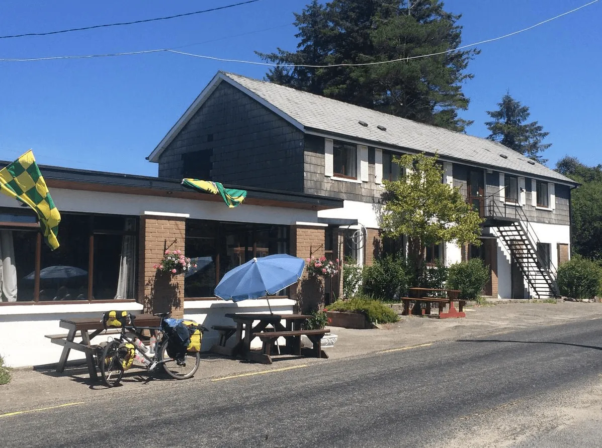
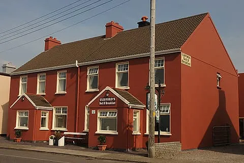
The final stretch leads you down towards the coast, where the landscape opens and the sea returns fully into view. Waterville appears stretched along the shoreline, backed by hills and facing the Atlantic. Clifford’s Ocean View offers a fitting end to the day, a place to rest with the sound of the ocean never far away.

Clifford's Ocean View (Waterville)
Day
7

Waterville - Caherdaniel

Duration: 04:45 h
Distance: 17.2 km
Ascent: 310 m
Descent: 290 m

This coastal stage links Waterville with Caherdaniel, offering a relaxed but scenic day along the Ring of Kerry. The route mixes quiet inland paths with stretches close to the Atlantic, where wide views over Ballinskelligs Bay and the Skellig Islands set the tone. It is a gentle transition between lively seaside and more remote coastal landscapes.

Leaving Waterville, the trail follows the shoreline before gradually climbing inland, revealing sweeping views over the Atlantic and the Skellig Islands. A steady ascent brings you to higher ground, after which the route descends through open countryside towards Derrynane. Along the way, highlights include views over Kenmare Bay and the surrounding hills, before reaching the historic grounds of Derrynane Abbey and nearby beaches.

The final stretch leads past Derrynane House and along sandy shores, where the sea is never far away. Caherdaniel appears quietly along the coast, surrounded by rolling hills and sheltered bays. The Olde Forge offers a warm and welcoming finish, a perfect place to unwind after a day shaped by sea air and soft coastal light.

The Olde Forge (Caherdaniel)
Day
8

Caherdaniel - Sneem

Duration: 05:15 h
Distance: 18.3 km
Ascent: 400 m
Descent: 410 m

A varied and tougher walk leaves Caherdaniel and heads east towards Sneem, with Kenmare Bay glittering to the south and the hills steadily taking over. The route mixes quiet lanes, old tracks, stream crossings and rolling upland ground. It is a hard one, not because of one monster climb, but because the day keeps serving up short, punchy rises. Classic Kerry, always another little sting.

From The Olde Forge, the route climbs out of Caherdaniel with views over Kenmare Bay, then passes Coomnahorna Old Burial Ground and a scenic stream-side trail. The path rises and dips through open hillside towards Staigue Wishing Seat and Staigue Fort, with a notable climb to around 180 metres before rolling onward through the hollow way.

After the high middle section, the route gradually loses height through quieter countryside, with long views towards the Sneem area and the islands of Kenmare Bay. The final kilometres ease into Sneem, where Coomassig View gives a peaceful finish just beyond the village buzz. Hills done, bay still sparkling, fine work all round.

Coomassig View (Sneem)
Day
9

Sneem - Kenmare

Duration: 10:00 h
Distance: 36.1 km
Ascent: 640 m
Descent: 630 m

This is a long and varied stage linking Sneem with Kenmare, following the southern shores of Kenmare Bay. The route combines quiet roads, woodland paths and open stretches with constant views over the water. It is a rewarding day, with a steady rhythm of gentle climbs and descents, always guided by the shifting light over the bay.

Leaving Sneem, the trail follows the coastline eastwards, offering wide views across Kenmare Bay and towards the Beara Peninsula. The path stays mostly low, weaving between small inlets and passing through peaceful countryside. Around halfway, the route continues along quiet lanes and forest tracks, with occasional climbs that open up broader views of the bay and surrounding hills.

As you approach Kenmare, the landscape becomes softer, with more woodland and signs of village life returning. The final stretch leads gently towards the town, where colourful streets and a lively atmosphere welcome you back. An Bruachan offers a comfortable and friendly place to settle in, a well-earned rest after a long day along the water’s edge.

An Bruachan (Kenmare)
Day
10

Kenmare - Killarney

Duration: 07:35 h
Distance: 26.4 km
Ascent: 630 m
Descent: 620 m

This final stretch brings you from Kenmare to Killarney, linking two lively towns through a landscape of lakes, forests and mountain views. It is a varied and rewarding day, with steady climbs early on and a long, gentle descent towards Killarney National Park. Along the way, the scenery shifts from open countryside to one of Ireland’s most iconic natural settings.

Leaving Kenmare, the route gradually climbs through quiet backroads and open hills, with views back over Kenmare Bay. The ascent is steady but never overwhelming, leading you towards higher ground where the landscape opens up. As you continue, the trail descends into the edges of Killarney National Park, passing near Torc Mountain and offering glimpses of the surrounding lakes.

The final section is a real highlight, following forest trails and lakeside paths past Muckross Lake and towards Lough Leane. As Killarney comes into view, the atmosphere shifts to something more lively again. You arrive in town with plenty of options to relax and celebrate the journey, a fitting end surrounded by lakes, woodland and mountain backdrops.

The Fairview Boutique Hotel (Killarney)
Day
11

Departure Day

After breakfast, our services and your Kerry Way adventure will be over. Have a safe trip back home!
Contact our Trekking Expert
Justa Atema
Justa Atema
Justa Atema

Included

  • Accommodation

    We will arrange your accommodation on the Kerry Way in hotels, inns, and guesthouses. Accommodation will be private in single, double or twin rooms and with en-suite bathroom where possible.

  • Full travel guide

    You’ll receive access to our trekking app, which serves as your complete digital travel guide for the Kerry Way. Inside, you’ll find everything you need for your trek: route descriptions, hiking maps, navigation support, payment information, and all the key details specific to your journey.

  • Baggage Transfer

    This trek includes the transfer of your luggage throughout the entire Kerry Way trek. Your bags will be picked up every morning from the hotel lobby and driven to your next accommodation. If you want to exclude this service, contact our experts after booking. This reduces the price by €7.50 per day, per person.

  • Navigation support

    Our trekking app also includes built-in navigation support. With GPS-based maps and offline access, you can follow the trail confidently and stay on route even without mobile signal.

  • Breakfast (when possible)

    We will arrange breakfast for you whenever possible. Some accommodations on the Kerry Way, however, do not allow us to pre-book it. In those cases, you can usually request breakfast for the next morning directly at the accommodation (at your own expense), or simply enjoy one of the cafés in the area.

Excluded

  • Traveling to and from

    You have to make your own way to the starting point. The total amount does not include personal transport. This also applies to any transport from the end point of your trail.

  • Transfers

    If you require any form of public or local transport during the trek, it is not included in the package unless stated otherwise. This applies to taxis, buses, cable cars, gondolas, and similar services.

  • Travel Insurance

    Your international travel insurance is your own responsibility. Discuss your itinerary with the insurance company before your trek.

  • Lunch and Dinner

    Breakfast is, if possible, included in the price of the trek. You can get lunch and dinner at the shops, hotels, and restaurants along the way.

FAQ

  • Kerry Way: Weather and Best Season

  • Luggage Transport on the Kerry Way

  • Traveling to and From

  • What if the dates I want are not available?

  • If I book now, can I immediately arrange the rest of my trip?

  • How do I know if this trek is right for me?

  • Can meals be adapted to my dietary requirements?

How to Book

  • Booking

  • Availability

  • Cancellation policy