Expert Andorra Lakes Loop

  • Duration
    Total 5 days
    Average 7h 51min
  • Distance
    Total 93.5 km
    Average 18.7 km
  • Ascent
    Total +6180 m
    Average +1236 m
  • Descent
    Total -6180 m
    Average -1545 m

> Discover 20 alpine lakes in 5 challenging stages
> Cross high mountain passes and sleep in 4 iconic huts
> Experienced hikers only: altitude, endurance, and views guaranteed

The Andorra Lakes Loop is Andorra's flagship hut-to-hut trek for experienced hikers, designed for those who want to experience the country's highlights in just five days. The route links Andorra's four guarded mountain refuges while crossing high passes, rocky terrain, and more than 20 crystal-clear alpine lakes, all set against the dramatic backdrop of the Pyrenees.

Along the way, you'll hike close to the borders of Spain and France, spending the nights in the mountain refuges of Sorteny, Juclà, l'Illa, and Comapedrosa. Expect significant elevation gain, remote mountain trails, and spectacular panoramas every day. If you're looking for a demanding trek that packs the very best of Andorra into one unforgettable adventure, this is it.

Itinerary

Day
1

Les Escaldes/Engordany (Andorra la Vella) - Refugi de L'Illa

Duration: 05:05 h
Distance: 12.3 km
Ascent: 1420 m

The route starts in Les Escaldes, an urban area located right next to Andorra la Vella, the capital of the principality. At the Pont de la Tosca over the Engordany River you will start ascending steadily into the Madriu-Perafita-Claror Valley. With 1,440 m of ascent, this is a demanding climb from the start, with little flat ground once you leave town. The route follows the GR7 into the valley, moving from the urban edge into forested slopes, river terrain and open high mountain surroundings.

After leaving Escaldes-Engordany, the trail enters the Madriu-Perafita-Claror Valley, a UNESCO World Heritage landscape, and continues towards Entremesaigües and the Sassanat bridge. You pass the bordes of Ràmio and Fontverd Refuge before reaching La Farga, a reminder of the valley's ironworking past. Between Fontverd and Riu dels Orris Refuge, the path runs through forest and higher valley terrain, with the Madriu River often close by. Higher up, the route reaches the Pla de l'Ingla, a flatter area where the river divides across the gentle ground. From here, the climb continues past Riu dels Orris Refuge and into more open terrain, where the first lakes appear.

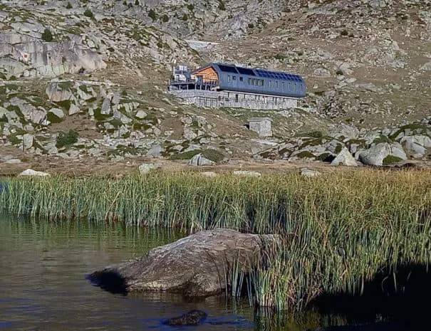
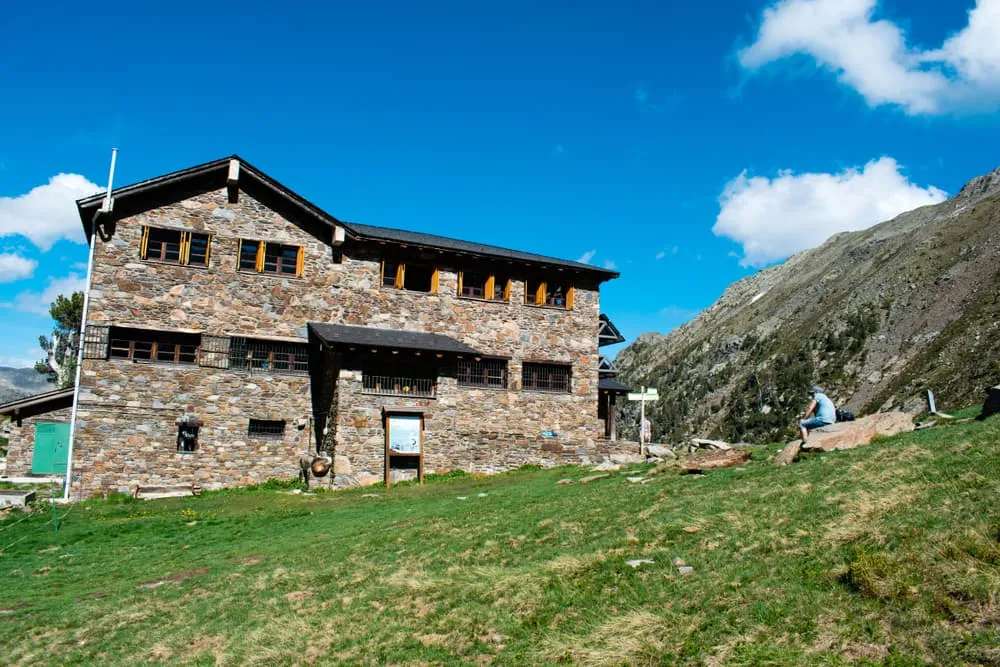
Before reaching the hut, you pass Lake Bova on your right and Lake Rodó on your left, with the Forcats lakes nearby. You arrive at Refugi de l'Illa, beside the dam and high lakes of the upper valley. After a long, steady ascent, the mountain hut gives you a clear place to rest, recover and prepare for the next mountain section.

Refugi de L'Illa

Info
Refugi de L'Illa
Refugi de L'Illa
Day
2

Refugi de L'Illa - Refugi de Juclar

Duration: 09:50 h
Distance: 21.6 km
Ascent: 1360 m
Descent: 1540 m

Today, you will hike a long, demanding mountain stage with 1,360 meters of ascent and 1,540 meters of descent. This is the toughest section of the loop because the terrain is slow and technical. Expect rocky paths, steep gradients, winding descents, and narrow sections where good route-finding skills are necessary throughout the day.

From Refugi de l’Illa, the route crosses high mountain terrain near the Pessons Lakes. You will have views of Pic dels Pessons (2,864 m). Next, a short zigzag section begins the descent towards Estany Primer through rugged terrain dotted with boulders and mountain tarns. Be patient and allow plenty of time to complete this section. Near the lake, there is a restaurant where you can stop for a drink before continuing down through Pla de les Pedres.

After crossing the road, the route climbs again through forests and open slopes toward Port Dret (2,560 m) and the impressive Les Vaques Pass (2,570 m). This section goes almost straight up across the contour lines and feels steep. From there, the route descends toward the Vall de Siscaró. Pass the Siscaró lakes, then follow a narrow, rocky, and steep trail down beside the Riu Siscaró. After this descent, follow the track towards the Font del Travenc bridge and the Juclar waterfall. The final uphill section of the day begins there.

At the junction between Estany de Baix de Siscaró and Estany de Siscaró, you can follow a trail with various waterfalls to your left instead of taking the signposted shortcut towards Refugi de Juclar with GR markings. The route ends with an ascent beside the Juclar waterfall to the Refugi de Juclar mountain hut, which sits beside the lake.

Refugi de Juclar

Info
Refugi de Juclar
Refugi de Juclar
Day
3

Refugi de Juclar - Refugi Borda de Sorteny

Duration: 07:35 h
Distance: 17.1 km
Ascent: 1210 m
Descent: 1550 m

This challenging mountain route connects the Juclà Lakes with the secluded Sorteny Valley, Andorra's first designated natural reserve and a haven of exceptional biodiversity. For much of the route, you will stay high, moving through rocky terrain, passes, lakes and open slopes before dropping towards the green valleys at the end. Expect a challenging day, with repeated climbs and descents requiring steady pacing and careful footing.

From the Refugi de Juclar, the trail heads west through the high mountain terrain below the Alt de Juclar (2,588 m) pass. It then reaches its lowest point at the Port d'Incles junction, next to the Manegor River. The long ascent from there rewards you with sweeping views of the French peaks to the north and the rugged terrain of Andorra to the south. It then crosses a broad, rocky section offering views of Cabana Sorda Lake, the namesake hut, and the surrounding peaks. Shortly afterwards, you will reach the second highest point of the day: Col de la Coma de Varilles (2,630 m). You will then descend to cross a small granite slab plateau and a mountain meadow through which the waters of the Portelles River flow.

Further on, the route continues towards the Coms de Jan hut area, where there are mountain springs and waterfalls nearby, before reaching the Estany de Ransol lakes. The route then continues across the quieter upper slopes below Pic de la Serrera (2,912 m) towards the day's highest point at Meners Pass (2,670 m), before descending to the final valley. After a long and varied mountain stage, you will arrive at Refugi Borda de Sorteny, where the mountain hut will provide you with a place to rest, eat and recover.

Refugi Borda de Sorteny

Info
Refugi Borda de Sorteny
Day
4

Refugi Borda de Sorteny - Refugi de Comapedrosa

Duration: 09:40 h
Distance: 20.8 km
Ascent: 1710 m
Descent: 1410 m

This is a long mountain stage involving 1,700 metres of ascent from Refugi Borda de Sorteny to Refugi de Comapedrosa, so approach it as a challenging stage. The route also involves a significant descent of 1,400 metres, so it is important to pace yourself from the outset. You will move from La Vall de Sorteny to Les Valls del Comapedrosa, changing from a quiet high mountain crossing with forested lower sections, steep open slopes, lakes, and a long final approach into the Comapedrosa area.

From the Borda de Sorteny refuge, the trail heads down through the Sorteny Valley area towards the small mountain villages of El Serrat and Llorts, running parallel to several rivers such as the Riu de Sorteny, the Riu de Rialb and the Riu Tristaina. The route also passes through wooded areas, particularly along the Sender de l'Esquirol. After this lower section, the route climbs into rougher, more challenging mountain terrain past the Refugi de l'Angonella and near the Estanys de l’Angonella towards high peaks such as the Pic del Clot del Cavall (2,586 m). This marks the main high section of the day.

After this, the route descends to the Pollós and Comapedrosa river junction, passing the Refugi de les Fonts and wooded areas in the Comapedrosa valley. Depending on the time of the year, you will also be able to see waterfalls before the final approach to the Refugi de Comapedrosa. This hut is a welcome place to rest after a long day of serious climbing and descent.

Refugi de Comapedrosa

Info
Refugi de Comapedrosa
Day
5

Refugi de Comapedrosa - Les Escaldes/Engordany (Andorra la Vella)

Duration: 07:05 h
Distance: 21.7 km
Ascent: 480 m
Descent: 1680 m

The final stage begins deep in the heart of Andorra's highest mountains. This long final mountain stage descends from the high ground around the Refugi de Comapedrosa towards Escaldes/Engordany. The route is mostly downhill, with a significant loss in elevation of 1,680 metres, so take care of your knees and maintain a steady pace. The route takes you through open mountain terrain, forested slopes, short sections of road and valley paths, finally reaching the busier surroundings of Andorra la Vella.

From the Comapedrosa Refuge, the route passes the upper slopes of the Coll de la Botella (2,073 m) below the Port de Cabús (2,328 m), then continues along a mostly flat section towards the Collada de Montaner (2,090 m), with plenty of cable cars above you. The trail then continues eastwards through the forested Sispony Valley, passing Refugi Cortals de Sispony and offering views of the surrounding peaks. Further down, the route approaches Sispony on the outskirts of La Massana, continuing through a mix of paths and built-up valley sections.

The final kilometres lead towards Engordany and Les Escaldes, where the mountain setting gradually gives way to the town. You will arrive with the long descent behind you after crossing from the Refugi de Comapedrosa.

Contact our Trekking Expert
Laurens de Roos
Laurens de Roos
Laurens de Roos

Included

  • Accommodation

    During your Madriu Highlands, you will stay overnight in comfortable accommodations. You'll sleep in private rooms, ensuring a good night's rest after each day on the trail.

  • Full travel guide

    You’ll receive access to our trekking app, which serves as your complete digital travel guide for the Madriu Highlands. Inside, you’ll find everything you need for your trek: route descriptions, hiking maps, navigation support, payment information, and all the key details specific to your journey.

  • Accommodation

    During your Madriu Highlands, you will spend your nights in mountain huts. On this trek, only dormitory accommodation is available. Private rooms cannot be booked on this trek, so we automatically reserve beds in shared dormitories for all participants.

  • Half-board in Huts

    Accommodation at the huts includes dinner and breakfast. We will arrange this for you as well. This allows you to travel lighter and have one less thing to worry about. Bear in mind that lunch is not included, but it can be purchased at the huts. Here you can also buy an array of snacks and bottled water.

  • Navigation support

    Our trekking app also includes built-in navigation support. With GPS-based maps and offline access, you can follow the trail confidently and stay on route even without mobile signal.

Excluded

  • Traveling to and from

    You have to make your own way to the starting point. The total amount does not include personal transport.

  • Transfers

    Should you need any form of (public) transport on location, this is not part of the trekking package. This includes the use of taxi, bus, cable cars, gondolas, ferries, etc.

  • Lunch

    Half-board is included in the price of this trek. Lunch, however, is not. Many huts offer packed lunches, which can usually be requested the night before. Alternatively, you can stop for lunch at mountain huts along the way.

  • Travel Insurance

    Your international travel insurance is your own responsibility. Discuss your itinerary with the insurance company before your trek.

  • Personal expenses

    Personal expenses on such as souvenirs, drinks, and other similar expenses are for your own account.

FAQ

  • How to get to and from the Expert Andorra Lakes Loop?

  • What if the dates I want are not available?

  • If I book now, can I immediately arrange the rest of my trip?

  • How do I know if this trek is right for me?

  • Can meals be adapted to my dietary requirements?

How to Book

  • Booking

  • Availability

  • Cancellation policy