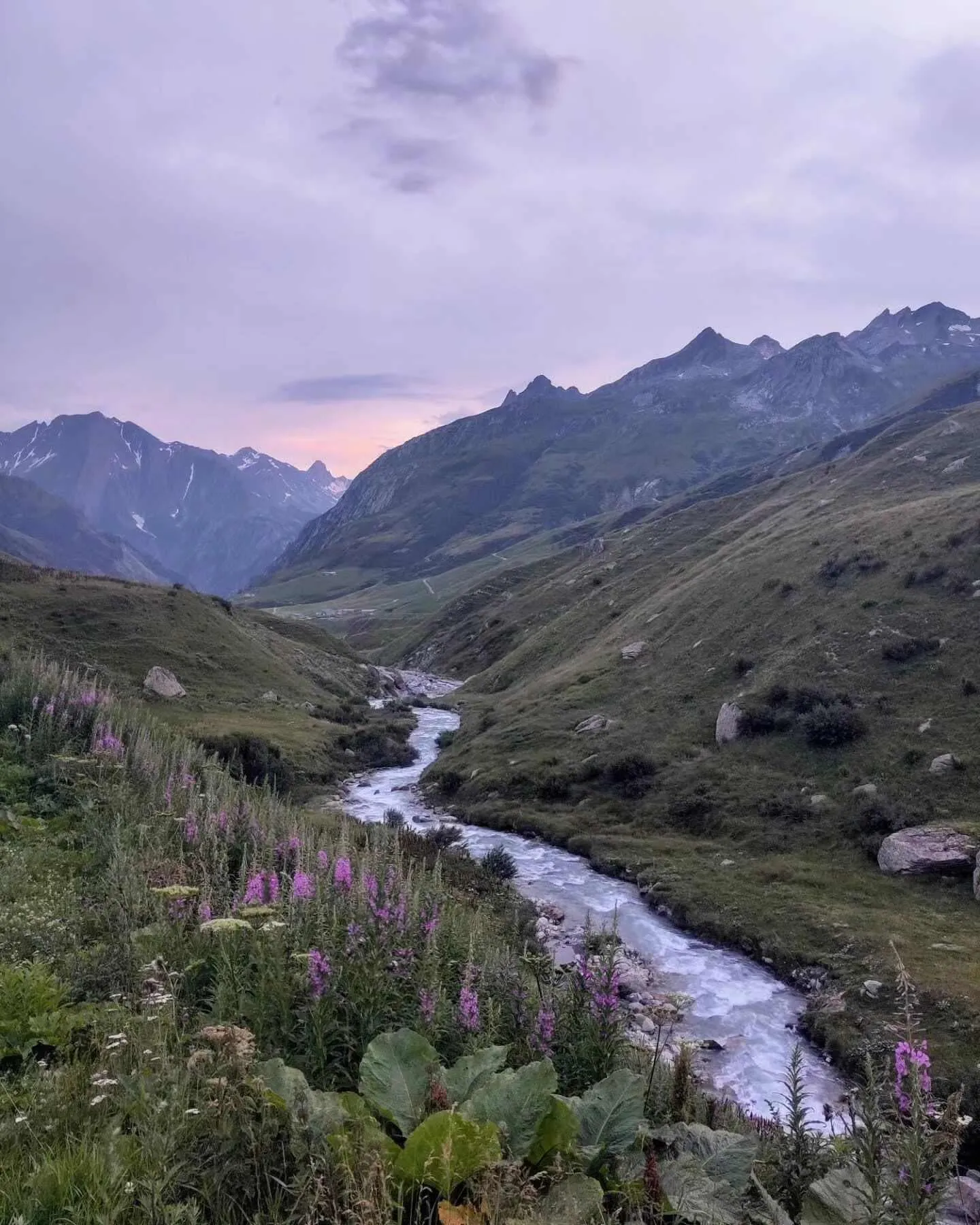
Hidden Mont Blanc Trail

  • Duration
    Total 8 days
    Average 7 h 31m
  • Distance
    Total 130.9 km
    Average 16.4 km
  • Ascent
    Total +8710 m
    Average +1089 m
  • Descent
    Total -9510 m
    Average -1189 m

> Hike the Hidden Mont Blanc Trail from Breuil-Cervinia to Courmayeur
> A challenging hut-to-hut trek for experienced and well-prepared hikers
> Spend the night in authentic Italian rifugios, arranged by Bookatrekking.com

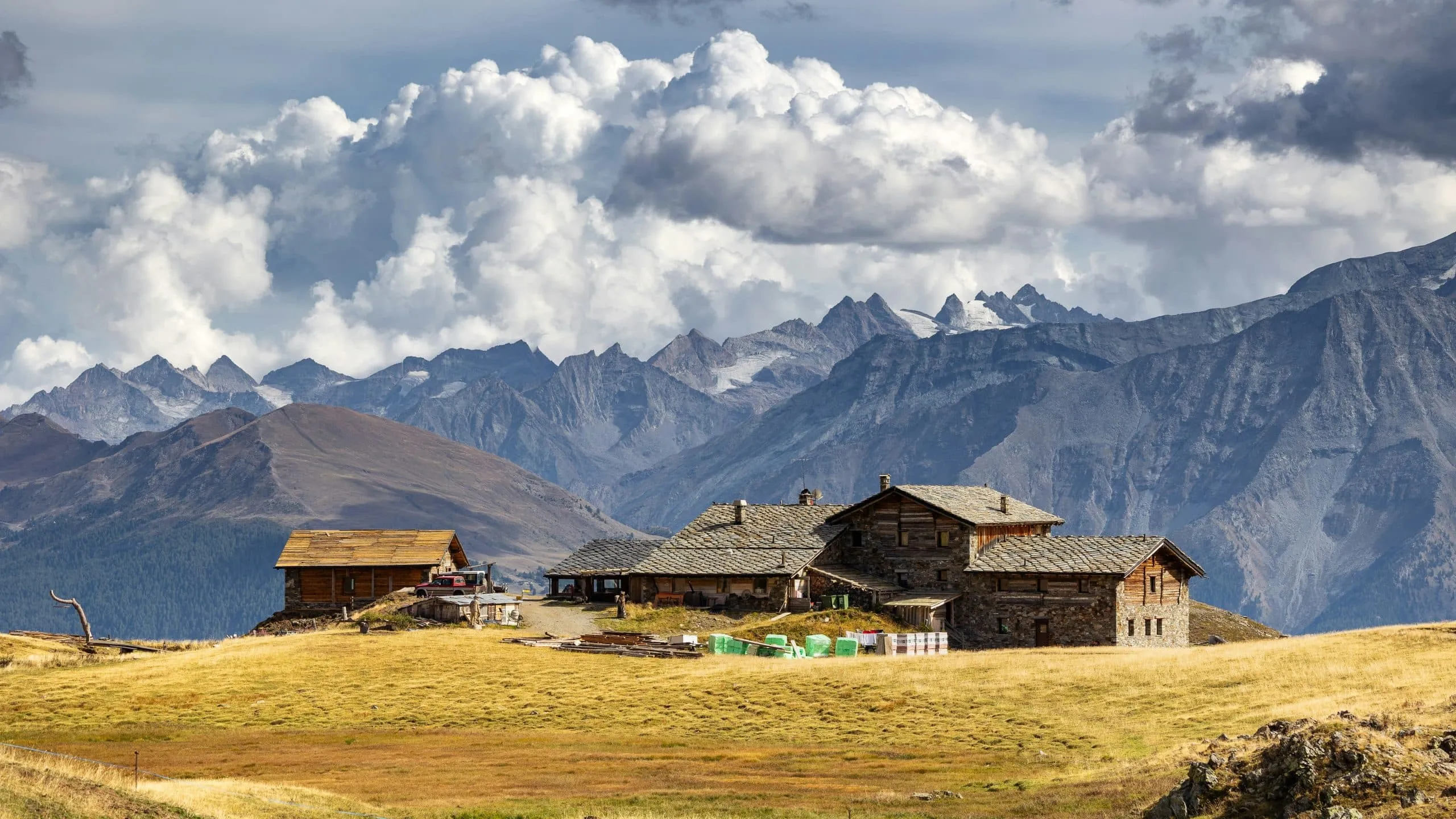
The Hidden Mont Blanc Trail takes you deep into the Aosta Valley, from the foot of the Matterhorn (Monte Cervino) to Mont Blanc (Monte Bianco). This 8-day trek connects Breuil-Cervinia with Courmayeur, crossing remote alpine valleys, high mountain passes, and clear alpine lakes along the way. With some of the highest peaks in the Alps towering around you, this is Italy with the volume turned up. Thanks to its long stages, significant elevation changes, and rugged mountain terrain, this trek is best suited for experienced hikers with good fitness and previous hut-to-hut trekking experience.

During this 8-day adventure, you'll hike the Hidden Mont Blanc Trail from Breuil-Cervinia to Courmayeur. Every day brings a new landscape, from rugged mountain terrain and open meadows to panoramic passes with views towards the Matterhorn, Grand Combin, and Mont Blanc. You'll spend each night in welcoming Italian rifugios, where dinner and breakfast are included whenever possible. Bookatrekking.com takes care of all your mountain hut bookings, leaving you free to enjoy one of Italy's most rewarding and demanding hut-to-hut trekking adventures.

Itinerary

Day
1

Breuil-Cervinia - Rifugio Jean Barmasse

Duration: 04:05 h
Distance: 10.4 km
Ascent: 600 m
Descent: 430 m

This opening stretch starts in Breuil-Cervinia and gives you a clear first taste of the route, with 10.4 km and 600 m of ascent. The walking is mostly on mountain hiking paths and regular trails, with a few short connecting sections on harder surfaces. The profile begins gently, then builds into the main climb before descending towards the lake area and easing into the final approach to the hut. It is a manageable but real mountain stage.

Leaving Breuil-Cervinia, you head across the slopes above Valtournenche, with marked viewpoints towards the Matterhorn, also called Monte Cervino, and the surrounding mountains. The route then climbs steadily into higher ground before reaching the Lago di Cignana area. After the main climb, the trail descends towards the lake basin, passing close to Cignana Window and viewpoints over the water before continuing towards the hut.

You arrive at Rifugio Jean Barmasse in a quiet mountain setting above the valley. After the main climb and the descent towards the lake, the final approach gives you time to settle in and enjoy your first evening in the mountains.

Rifugio Jean Barmasse

Info
Rifugio Jean Barmasse
Day
2

Rifugio Jean Barmasse - Rifugio Oratorio di Cuney

Duration: 08:10 h
Distance: 16.3 km
Ascent: 1320 m
Descent: 850 m

This is a serious high-level crossing, with 16.3 km of distance and a demanding climb of 1,320 m. Much of the route follows T3 terrain, so it asks for sure-footed hikers who are comfortable on rough alpine paths and repeated altitude changes. After an early descent, the profile builds into a long climb and then keeps undulating across high ground. Pace yourself well, because the effort is spread across the full route.

From Rifugio Jean Barmasse, the trail leaves the Lago di Cignana side behind and moves into rougher alpine country. The most recognisable places on or near the route include Fenêtre d’Ersaz Pass, Lake Tzan, Bivacco Tzan, Fenêtre du Tsan and Luseney Lake, with Bivacco Luca Reboulaz also marked nearby. The walking is mostly on mountain hiking paths, with a clear high-mountain feel as you cross towards the Cuney area.

You finish at Rifugio Oratorio di Cuney after a demanding approach through high terrain. Once there, you are well away from the valley, making this a memorable and atmospheric hut stop.

Rifugio Oratorio di Cuney

Info
Rifugio Oratorio di Cuney
Day
3

Rifugio Oratorio di Cuney - La Tour

Duration: 06:40 h
Distance: 14.7 km
Ascent: 440 m
Descent: 1700 m

The route to Oyace is shorter at 14.7 km, but the main feature is the long 1,700 m descent from high alpine terrain into the valley. After a short undulating start, the trail commits to a sustained downhill line that asks for steady footing and patience. Most of the route follows mountain hiking paths through open terrain. As you lose height, rocky slopes gradually give way to greener hillsides and the first signs of the village below.

Starting near Rifugio Oratorio di Cuney, you pass high points and marked places such as Col du Salvé, Bivacco Clermont and Col de Vessonaz before the route bends towards L’Ardamun. From there, the descent continues across the hillside towards Oyace. In the lower part, the landmarks become more village-focused, including the View of Oyace, Tornalla Tower and the bridge over the Buthier stream. It is a clear transition from high mountain terrain to the valley.

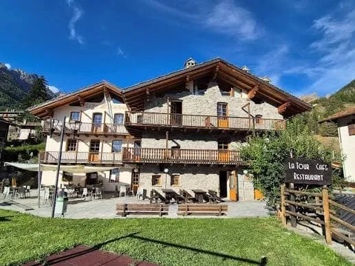
The descent brings you into Oyace, a small valley village and a welcome change after the high mountain terrain. Here you can settle into your accommodation and let your legs recover after the long downhill stretch.

La Tour

Info
La Tour
La Tour
Day
4

La Tour - Rifugio Letey-Champillon

Duration: 09:40 h
Distance: 18 km
Ascent: 2150 m
Descent: 1120 m

A big climbing route waits after Oyace, with 18.0 km of walking and a demanding climb of 2,150 m to Rifugio Letey-Champillon. The route does not simply go uphill in one push, as it also includes notable descent and flatter linking sections. That makes it a full mountain stage, both physically and mentally. You gain height steadily out of Oyace, lose it again in the middle, and then finish with another sustained rise towards Champillon.

Leaving Oyace, the route crosses the slopes towards Ollomont and passes named points including Ru du By, Saint Jean Mine, Locanda delle Minere and Col de Brison. Later, the line turns back into more open mountain terrain around Comba di Champillon and Alpe Champillon. These places help break up the route, but the overall character remains a big valley-to-hut mountain crossing with a lot of height gain.

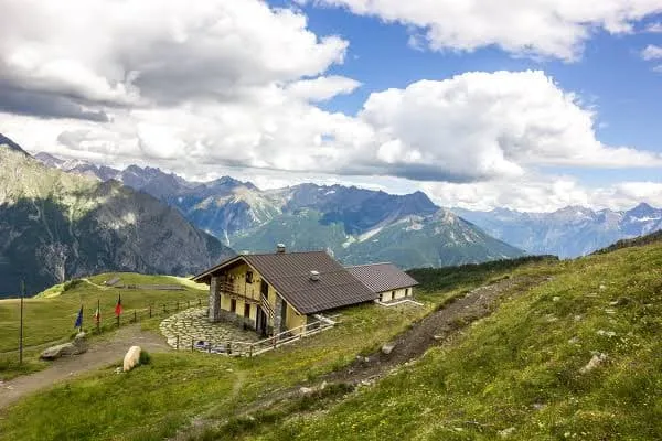
You reach Rifugio Letey-Champillon after the final climb into the Champillon area. After so much ascent, the hut feels like a well-earned finish and a very welcome place to stop.

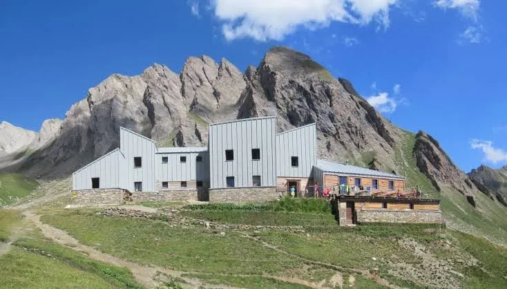
Rifugio Champillon

Info
Rifugio Champillon
Rifugio Champillon
Day
5

Rifugio Letey-Champillon - Refuge de Chaligne

Duration: 08:10 h
Distance: 18.8 km
Ascent: 1110 m
Descent: 1590 m

This varied mountain route covers 18.8 km and includes a demanding climb of 1,110 m, together with a large 1,590 m descent. You start high above Champillon, drop for a long stretch towards the valley, and then rebuild height on the way to Refuge de Chaligne. It helps to think of the route in two parts, a long descent first and a steady second-half climb afterwards. The changing terrain makes it interesting, but it is a strenuous stage.

From Rifugio Letey-Champillon, the route passes close to Col de Champillon and through Comba di Champillon before descending towards Étroubles, Saint-Oyen and the La Thuilettaz area. In the second part, the line climbs again through lower slopes and marked viewpoints, including a viewpoint towards the Matterhorn and the Madonnina di Cignod area. Around the middle, the route has a more settled valley feel before it lifts back into quieter mountain terrain.

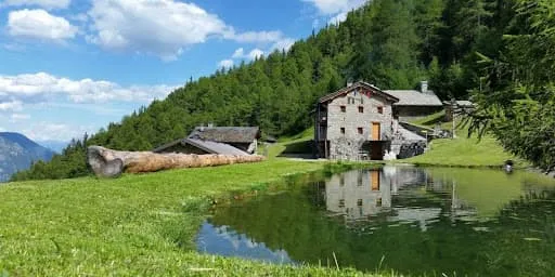
You arrive at Refuge de Chaligne after the second main climb of the route. The hut comes at the right moment, giving you a quiet mountain finish after a route with a lot of descending and rebuilding.

Rifugio Chaligne

Info
 Rifugio Chaligne
Rifugio Chaligne
Day
6

Refuge de Chaligne - Rifugio Mont Fallère

Duration: 05:15 h
Distance: 11.2 km
Ascent: 900 m
Descent: 480 m

The shorter distance to Rifugio Mont Fallère does not make this an easy route, as it still climbs 900 m and stays in high, open terrain for much of the way. From Refuge de Chaligne, the profile rises steadily towards the upper slopes, then crosses rolling ground before easing slightly on the approach to the hut. It is a compact mountain stage with broad views, exposed-feeling terrain and plenty of interest along the way.

From Refuge de Chaligne, the path climbs past the panoramic view of the Aosta Valley and the Pointe de Chaligne summit cross, then continues towards Col de Metz. Beyond that, the route crosses the Fallère area, where several small lakes are marked, including Lago Morto, Lago Clapin and Lago delle Rane. Mont Fallère Summit and Bivacco Alessandro Pansa are also shown nearby, adding to the high-mountain character of the route.

You arrive at Rifugio Mont Fallère after a final approach through high ground and small lake terrain. After settling in, you can explore the nearby open-air wooden sculpture area, which adds something distinctive to this hut stop.

Rifugio Mont Fallère Art Trail

Info
Rifugio Mont Fallère Art Trail
Day
7

Rifugio Mont Fallère - Rifugio Pier Giorgio Frassati

Duration: 09:35 h
Distance: 21.9 km
Ascent: 1590 m
Descent: 1430 m

A long and demanding mountain route connects Rifugio Mont Fallère with Rifugio Pier Giorgio Frassati, covering 21.9 km with a demanding climb of 1,590 m and 1,430 m of descent. The route first climbs away from the hut, then loses height for a long middle section before rising again towards the next hut. Because the effort is spread over so much ground, steady pacing matters more than speed. This is a full mountain stage with constant changes of rhythm.

From Rifugio Mont Fallère, you first pass near Mont Fallère Summit and Lago Fallère before descending towards the Saint-Rhémy-en-Bosses and La Thuilettaz side of the valley. Along the way, the route highlights views of the Matterhorn and continues towards the hamlets of Merdeux. In the higher second part, the route climbs again through rougher ground, with wide mountain views marking the approach towards the Frassati area.

You arrive at Rifugio Pier Giorgio Frassati after a long final approach through high mountain terrain. It is a strong hut finish, and a satisfying place to end one of the biggest routes of the trek.

Pier Giorgio Frassati Refuge

Info
Pier Giorgio Frassati Refuge
Day
8

Rifugio Pier Giorgio Frassati - Courmayeur

Duration: 08:30 h
Distance: 19.6 km
Ascent: 600 m
Descent: 1910 m

The final stretch to Courmayeur covers 19.6 km and gains 600 m, but the route is mainly defined by the very long 1,910 m descent into town. You start high, stay in mountain terrain for a long time, and only gradually work down into the valley. After the earlier routes, this finish still demands care, especially on tired legs. The route links open high ground with a long descent back towards Courmayeur.

From Rifugio Pier Giorgio Frassati, the route crosses high ground near Col de Malatrà and passes the Tsa de Sécheron Stone Cabin and the Entre Deux Sauts Pass area. It then continues into Val Ferret, where marked highlights include a waterfall in Val Ferret and several viewpoints towards Mont Blanc. Lower down, the route passes near the Walter Bonatti Hut area before continuing the descent towards Courmayeur, linking famous mountain landmarks with a clear valley finish.

You finish in Courmayeur after a long descent from the high mountains. The arrival feels very different from the hut stops, with the route ending back in town after several quieter alpine sections.

Contact our Trekking Expert
Sanne Bakema
Sanne Bakema
Sanne Bakema

Included

  • Full travel guide

    You’ll receive access to our trekking app, which serves as your complete digital travel guide for the Tour du Mont Blanc. Inside, you’ll find everything you need for your trek: route descriptions, hiking maps, navigation support, payment information, and all the key details specific to your journey.

  • Accommodation

    During your Tour du Mont Blanc, you will spend your nights in mountain huts. We normally book dormitories, but private rooms are available upon request and cost €75 extra per room per night. If no private rooms are available, we will automatically book a bed in a dormitory.

  • Half board in huts (where possible)

    Accommodation in the huts includes dinner and breakfast, unless otherwise indicated in the exclusive list. This allows you to travel lighter and not have to worry about an extra meal. Please note, however, that lunch is not included, but can be purchased at the huts. Beverages may also be charged separately at some huts.

  • Navigation support

    Our trekking app also includes built-in navigation support. With GPS-based maps and offline access, you can follow the trail confidently and stay on route even without mobile signal.

Excluded

  • Traveling to and from

    You have to make your own way to the starting point. The total amount does not include personal transport.

  • Transfers

    Should you need any form of (public) transport on location, this is not part of the trekking package. This includes the use of taxi, bus, cable cars, gondolas, ferries, etc.

  • Lunch

    Half-board is included in the price of this trek. Lunch, however, is not. Many huts offer packed lunches, which can usually be requested the night before. Alternatively, you can stop for lunch at mountain huts along the way.

  • Travel Insurance

    Your international travel insurance is your own responsibility. Discuss your itinerary with the insurance company before your trek.

  • Personal expenses

    Personal expenses on such as souvenirs, drinks, and other similar expenses are for your own account.

  • Dinner at La Tour:

    Where possible, we book accommodations on a half-board basis, but at La Tour only breakfast is included. In the evening, you can dine at the on-site restaurant, which serves typical Valdostan dishes and Italian cuisine prepared with local ingredients.

FAQ

  • What Is the Best Season for the Tour du Mont Blanc?

  • How to Get to the Starting point to Breuil-Cervinia

  • How to Get From the Endpoint Back to Breuil-Cervinia

  • What if the dates I want are not available?

  • If I book now, can I immediately arrange the rest of my trip?

  • How do I know if this trek is right for me?

  • Can meals be adapted to my dietary requirements?

How to Book

  • Booking

  • Availability

  • Cancellation policy