High Tatras Traverse

  • Duration
    Total 5 days
    Average 4h 45min
  • Distance
    Total 51.4 km
    Average 10.3 km
  • Ascent
    Total +3230 m
    Average +646 m
  • Descent
    Total -2760 m
    Average -552 m

> 5 days traverse in the High Tatras
> Tackle Rohatka Pass (2,287 m), a narrow rock face rated T5
> Climb Ryse, at 2,501 m the highest mountain in Poland

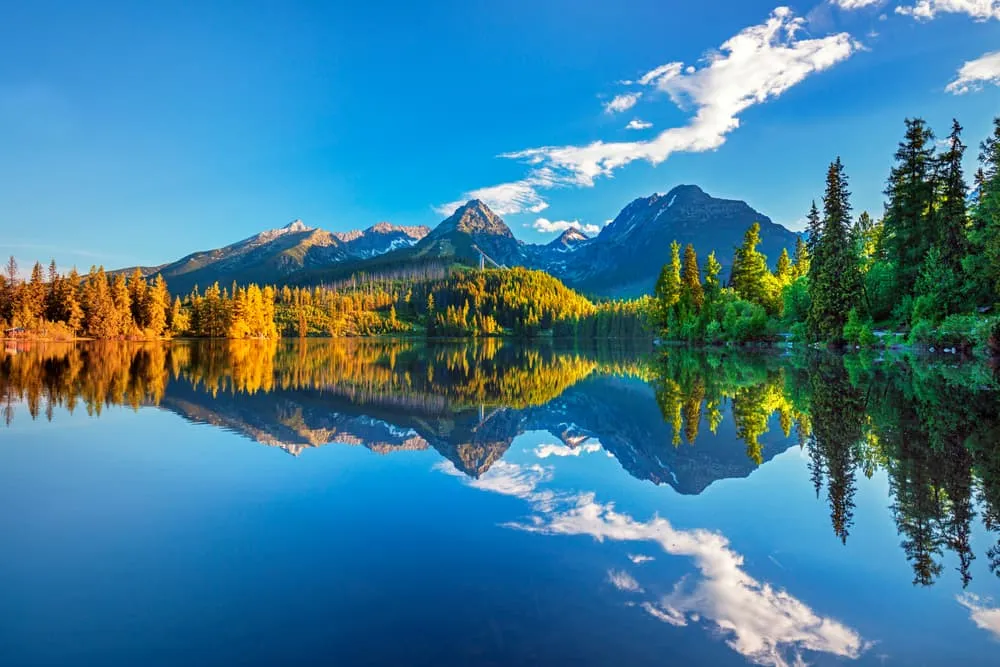
The High Tatras in the north of Slovakia is one of the most rugged European mountain ranges outside the Alps and the Pyrenees. Think steep, jagged peaks reaching altitudes of over 2600 meters, surrounded by evergreen forests and pristine alpine lakes. The Tatras are still relatively unknown outside Central Europe, though it's been an outdoor playground for the locals for decades. Huts and mountain hotels are strategically located on the shores of shimmering mountain lakes so you can trek across the mountains while sleeping in a bed with a roof over your head.

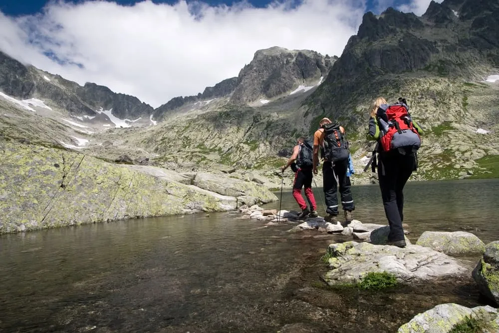
We created an exciting 5-day trek across the High Tatras, slicing right through the heart of the mountain range. The distances and vertical gain and loss are very manageable, though there are small sections where you need to have a head for heights. On day 2, you will reach Rohatka Pass (2,287 m), where you will encounter a 70-metre-long, T5-rated section below Prielom Saddle. The cherry on the cake is the ascent of the Ryse summit (2,501 m), which is exactly on the border with Poland. It is Poland's highest peak, climbed from the Slovakian side. Are you up for something different? Traverse the Tatras with us!

Note: A via ferrata set is not strictly necessary, but it can provide extra confidence when navigating exposed terrain. While helmets and gloves are optional, they can offer additional safety and a more comfortable grip when using the chains and steps.

Itinerary

Day
1

Tatranská Lomnica - Zamkovského Chata

Duration: 05:10 h
Distance: 13.4 km
Ascent: 910 m
Descent: 300 m
Lowest Point: 850 m
Highest Point: 1750 m
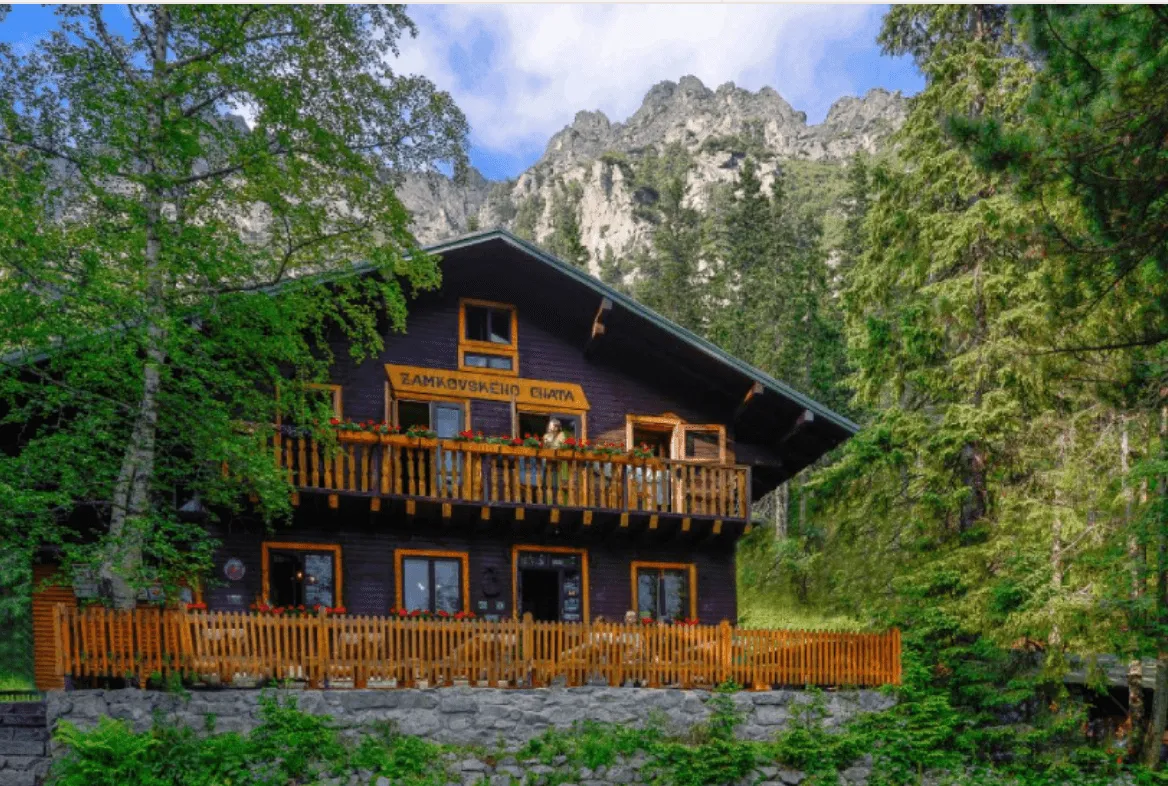
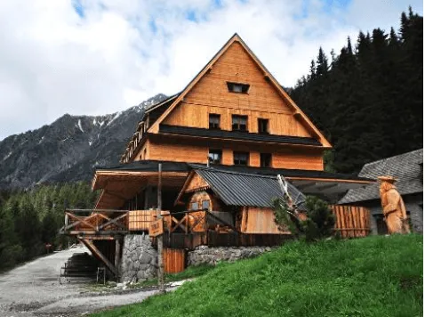
From Tatranská Lomnica you head northeast for about a kilometer and then the route veers off to the north. You enter the forest at Dolina Bielej Vody, now being away from urban development. Just before you reach the Kežmarská Biela Valley, head northwest to the proper foot of the mountains and traverse to the southwest to the trails that leads to the lifts at the mountain pond Skalnaté Plese. You keep descending gradually around the mountain called Lomnicky hrb. Shortly after you can find your cozy chalet Zamkovského in the middle of the forest.

Zamkovskeho Hut

Info
Zamkovskeho Hut
Zamkovskeho Hut
Day
2

Zamkovského Chata - Sliezsky Dom (challenging)

Duration: 05:40 h
Distance: 11.6 km
Ascent: 920 m
Descent: 720 m
Lowest Point: 1310 m
Highest Point: 2230 m

This is a short but demanding high-mountain stage, with 950 m of ascent and 750 m of descent packed into steep Tatra terrain. The route starts with a descent, then climbs steadily through Studené Doliny nature reserve towards the alpine basin around Zbojnícka Chata hut. The key point is Rohatka Pass (2,287 m) on the way to Prielom Saddle (2,290 m). This is a secured rocky pass with chains, metal rungs and exposed passages, so it requires focus, surefootedness and a good head for heights.

After the initial gentle descent alongside a waterfall, you will reach a wooden bridge over the Studené Doliny river, marking the start of the main ascent. The trail continues towards another wooden bridge over the Starolesný Stream, after which it gains more altitude and enters rougher alpine terrain. Soon, the surroundings become more open, with mountain lakes and rocky slopes near Zbojnícka Chata hut, a good place to pause before the route becomes more technical.

Walking alongside lakes, you will reach the highest point of the day at Rohatka Pass, where you will encounter the 70-metre-long Prielom Saddle T5 section — the most challenging part of the route. The trail then climbs steeply through a rocky gully with loose stones between Divá Veža (2,373 m) and Východná Vysoká (2,429 m). Here, you will need to use your hands on chains and metal steps among exposed rock passages. It is important to move slowly, maintain three points of contact at all times, and avoid crowding other hikers. Although a via ferrata set is not required for this secured section, previous alpine experience is recommended.

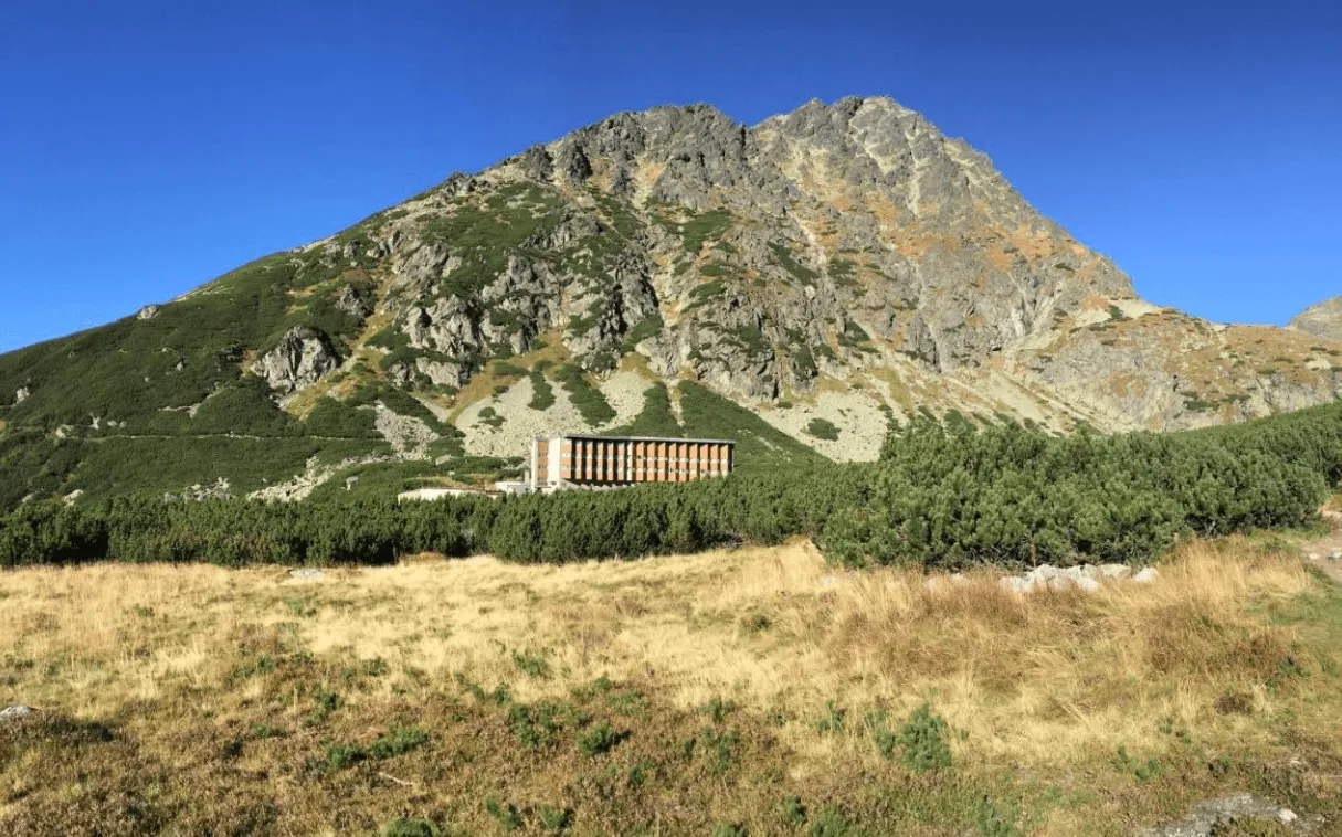
Finally, the route descends from the high, rocky section towards your accommodation beside the Velicke Lake. Take care on the descent too, especially if your legs are tired after the secured passage.

Note: If you would prefer to avoid ladders, chains and exposed terrain, take the alternative route instead.

Sliezsky Dom

Info
Sliezsky Dom
Sliezsky Dom
Day
3

Sliezsky Dom - Popradské Pleso

Duration: 04:10 h
Distance: 10 km
Ascent: 410 m
Descent: 570 m
Lowest Point: 1500 m
Highest Point: 2020 m
From Sliezsky Dom you contour around the mountain in a westerly direction, staying roughly at the same altitude until the short climb to the tiny alpine pond Batizovské Pleso. The trail keeps ascending gradually, eventually hitting the 2000 meter mark until you are on the final pass of the day. Below you can see the lake and mountain hotel Popradské Pleso. The path plunges down 400 meters, zigzagging all the way to your comfy hotel for the night.

Horský Hotel Popradske Pleso

Info
Horský Hotel Popradske Pleso
Day
4

Summit Hike Ryse

Duration: 07:00 h
Distance: 11.4 km
Ascent: 920 m
Descent: 930 m
Highest Point: 2501 m

The trail to the mountain Ryse starts easy with a gradual ascent at first. After about a kilometer and a half the summit trail veers off to the right and the character of the route changes dramatically. You start ascending steeply in an ever more rugged environment. Pass the small lake on your left and keep going up until you are at the small mountain shelter called Chata Pod Rymsi. From here it's 45 minutes to the summit of Ryse through high alpine terrain, with chains to hold on to at the most steep parts. You're now right on the border of Slovakia and Poland and on top of Poland's highest mountain. You return the same way you came. Take care, it might be harder than the way up, especially when it's wet.

Note: This is one of the most popular day hikes in the region, so we recommend starting early to enjoy the trail before it gets crowded.

Horský Hotel Popradske Pleso

Info
Horský Hotel Popradske Pleso
Day
5

Popradské Pleso - Strbske Pleso

Duration: 01:45 h
Distance: 5 km
Ascent: 70 m
Descent: 240 m
Lowest Point: 1330 m
Highest Point: 1500 m
Your hike out from the High Tatras is a fitting end to a great mountain experience. Follow the road for a couple of hundred meters and take the trail on the right, moving away from the road into the forest. Follow the scenic route all the way down to the train station at Strbske Pleso from where you can take the train to wherever your next destination is. You have traversed the Tatra mountains! Dobre urobené!
Contact our Trekking Expert
Laurens de Roos
Laurens de Roos
Laurens de Roos

Included

  • Full travel guide

    You’ll receive access to our trekking app, which serves as your complete digital travel guide for the Tatra Mountains. Inside, you’ll find everything you need for your trek: route descriptions, hiking maps, navigation support, payment information, and all the key details specific to your journey.

  • Accommodation

    During your Tatra Mountains, you will spend your nights in mountain huts. We normally book dormitories, but private rooms are available upon request and cost €75 extra per room per night. If no private rooms are available, we will automatically book a bed in a dormitory.

  • Breakfast

    Every morning breakfast is waiting for you. We will arrange this for you as well. This allows you to travel lighter and have one less thing to worry about. Bear in mind that lunch and dinner are not included, but it can be purchased in the huts.

  • Navigation support

    Our trekking app also includes built-in navigation support. With GPS-based maps and offline access, you can follow the trail confidently and stay on route even without mobile signal.

Excluded

  • Traveling to and from

    You have to make your own way to the starting point. The total amount does not include personal transport.

  • Transfers

    Should you need any form of (public) transport on location, this is not part of the trekking package. This includes the use of taxi, bus, cable cars, gondolas, ferries, etc.

  • Travel Insurance

    Your international travel insurance is your own responsibility. Discuss your itinerary with the insurance company before your trek.

  • Personal expenses

    Personal expenses on such as souvenirs, drinks, and other similar expenses are for your own account.

  • Lunch and Dinner

    Breakfast is included in the price of the trek. For lunch and dinner, you can eat at hotels, restaurants along the way, or at your accommodation at the end of each stage.

FAQ

  • When Is The Best Time To Go Trekking In The High Tatras

  • Is Hiking In The High Tatras Difficult?

  • How to Get To the Starting Point of Your Trek

  • How to Get Back at the End of the Trek

  • What if the dates I want are not available?

  • If I book now, can I immediately arrange the rest of my trip?

  • How do I know if this trek is right for me?

  • Can meals be adapted to my dietary requirements?

How to Book

  • Booking

  • Availability

  • Cancellation policy