

Sarntal Hufeisentour

  • Duration
    Total 7 days
    Average 4 h 51m
  • Distance
    Total 87.7 km
    Average 12.5 km
  • Ascent
    Total +4740 m
    Average +677 m
  • Descent
    Total -4740 m
    Average -677 m

> Walk the complete Hufeisentour through the Sarntal Alps in seven days
> Sleep by the Flaggersee at 2,481 metres and on the Penser Joch
> We book the huts, you walk

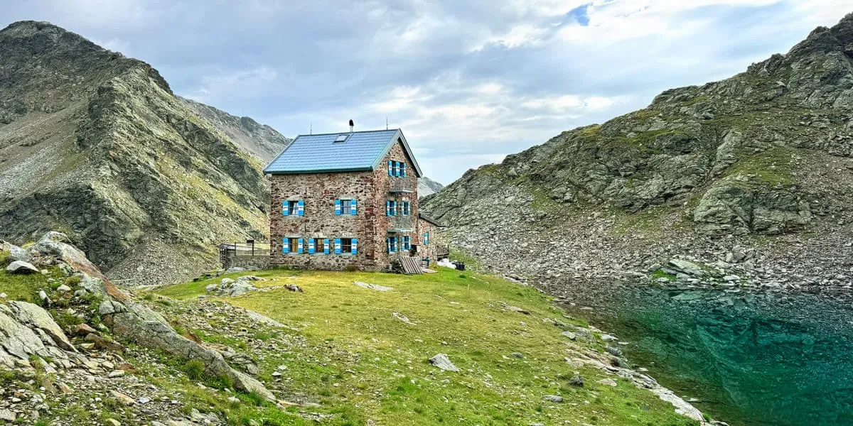
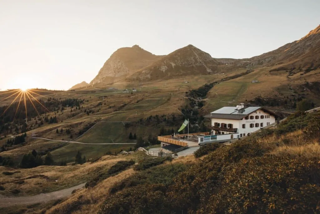
Late afternoon at the Flaggerschartenhütte. Boots off, the little Flaggersee dead still below the hut, a marmot complaining somewhere on the scree. No cable cars, no crowds, just the eastern ridge of the Sarntal Alps around you. Three days ago you were drinking coffee in Sarnthein. Not bad.

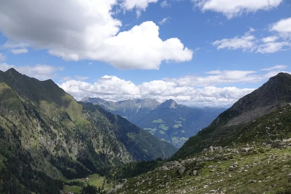
The Hufeisentour is the classic multi-day route of the Sarntal Alps, a quiet range right in the middle of South Tyrol between Bolzano, Merano and Brixen. From Sarnthein you climb to the Rittner Horn and follow the eastern ridge past the Latzfonser Kreuz and the Flaggersee to the Penser Joch. Then you cross to the western side via Weissenbach and the Meraner Hütte, back to Sarnthein. Feeling strong? Add the Sarner Weisshorn on day five. Six nights in huts and mountain inns, with far fewer people than in the Dolomites next door.

This is a trek for fit hikers who are sure-footed and have some mountain experience. Most paths are well marked, but you will find rocky and exposed sections, a steep climb of more than 1,600 metres on day one, more than 1,200 metres of descent on day five and a long 16.6 kilometre stage on day six. We book the huts, you walk. Deal?

Itinerary

Day
1

Sarnthein - Rittner Horn Haus

Duration: 06:05 h
Distance: 14.1 km
Ascent: 1620 m
Descent: 340 m
Lowest Point: 970 m
Highest Point: 2350 m

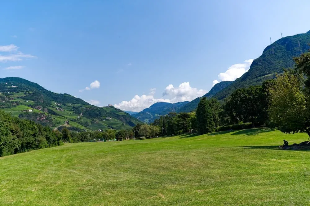
Day one starts right in the village of Sarnthein and goes straight up: more than 1,600 metres of climbing, so this is a solid opener. The first half is easy walking on wide paths through forest and alpine meadows, which gives your legs time to warm up before the real work begins.

After about 3.5 kilometres you pass a small pond with a refreshment stop, a good place for a drink. Around the six kilometre mark the landscape changes: the meadows give way to rockier ground and the trail steepens towards the Sarntaler Scharte. The last part to the notch asks for some easy use of your hands on rock, nothing extreme and no gear needed, but take your time.

From the notch the trail follows the ridge to the Rittner Horn Haus, just below the summit of the Rittner Horn. On a clear evening the panorama stretches across the Dolomites. About 14 kilometres, count on a good 6 hours.

Rittner Horn Haus

Info
Rittner Horn Haus
Rittner Horn Haus
Day
2

Rittner Horn Haus - Latzfonser Kreuz Hütte

Duration: 05:30 h
Distance: 15.2 km
Ascent: 620 m
Descent: 590 m
Lowest Point: 2050 m
Highest Point: 2350 m

A long but rewarding day along the high pastures of the eastern Sarntal ridge, mostly on good T2 mountain paths. The character of the trail changes as you go: wide alpine paths at the start, a rocky stretch in the middle and soft meadow paths and a boardwalk across the Villanderer Alm in the second half. The ups and downs stay moderate, with about 620 metres up and 590 metres down.

From the Rittner Horn Haus you drop to the Gasteiger Sattel and reach the Rittner wayside shrine after about 4 kilometres, with, if the clouds play along, a wide view over the Villanderer Alm. Right after the shrine the path turns rocky for about a kilometre as it climbs to the highest point of the day at around 2,340 metres. This is the one stretch where you step from rock to rock and choose your footing with care. On the other side waits the Totensee, a small lake in a natural amphitheatre of rock, with the little Totenkirchl chapel nearby.

From the lake the trail descends gently onto the Villanderer Alm, one of the largest high pastures in South Tyrol, where a boardwalk carries you across the moor meadows. A final climb of around 250 metres brings you to the Latzfonser Kreuz Hütte at 2,311 metres, next to the pilgrimage church of the same name. Fifteen kilometres and around five and a half hours on your feet: a proper day out.

Latzfonserkreuz refuge

Info
Latzfonserkreuz refuge
Day
3

Latzfonser Kreuz Hütte - Flaggerschartenhütte

Duration: 04:10 h
Distance: 10.4 km
Ascent: 540 m
Descent: 350 m
Lowest Point: 2140 m
Highest Point: 2490 m

A shorter stage on good T2 mountain paths, with no big climbs or technical difficulties. Some stretches run over loose stones and the trail has some exposed sections: a small challenge, nothing extreme, so there is plenty of room to enjoy the views.

The route follows the eastern ridge of the Sarntal Alps north. After an easy first two kilometres the trail dips about 130 metres and climbs back up along the ridge. The last proper climb comes after about six kilometres: a little over 200 metres up to the highest point of the day at almost 2,500 metres, reached after about 8.5 kilometres, with the Tellerjoch right in front of you. From here a rocky path leads down and across to the hut.

The Flaggerschartenhütte sits at 2,481 metres right above the turquoise Flaggersee, one of the most beautiful hut locations of the whole tour. It was built in 1913 and 1914 by the Marburg and Siegerland sections of the Alpine Club and is still supplied only by helicopter, so every beer on the terrace has flown in. With just 10.5 kilometres and a little over 4 hours of walking, you arrive in time for a long afternoon by the lake.

Flaggerschartenhütte

Info
Flaggerschartenhütte
Day
4

Flaggerschartenhütte - Alpenrosenhof

Duration: 04:10 h
Distance: 9.5 km
Ascent: 400 m
Descent: 680 m
Lowest Point: 2040 m
Highest Point: 2540 m

Lakes, streams and one last stretch on the eastern ridge. Today's trail is mostly a mountain path over rocky ground. A short section near the start and parts of the second half are narrower, with a drop on one side, so sure feet and sturdy boots are needed. The route is well marked throughout.

From the hut you climb about 60 metres above the Flaggersee to the highest point of the day at around 2,540 metres. Then it is downhill: close to 500 metres over the next four kilometres, past small mountain lakes such as the Distelsee and across the Traminbach. After about five kilometres the trail climbs again, narrower now, and after about 7.5 kilometres it takes you right over the Niedereck at around 2,300 metres, the last high point before the pass, with wide views to the north.

From there it is downhill to the Penser Joch at 2,211 metres, the pass where the eastern and western ridges of the Sarntal Alps meet. Tonight you sleep at the Alpenrosenhof, right on the pass. Short in distance at 9.5 kilometres, but the terrain keeps you busy for a little over 4 hours.

Gasthof Alpenrosenhof Penser Joch

Info
Gasthof Alpenrosenhof Penser Joch
Day
5

Alpenrosenhof - Weissenbach

Duration: 05:05 h
Distance: 12.3 km
Ascent: 380 m
Descent: 1240 m
Lowest Point: 1330 m
Highest Point: 2520 m

Today you switch from the eastern to the western ridge of the Hufeisentour and drop into the valley. The climbing is limited, but with about 1,240 metres of descent your knees will notice. No technical sections on the main route, though the steep descent from the Grölljoch asks for some concentration.

From the Penser Joch an almost flat path heads west, then rises gently along the slope with the Sarner Weisshorn in view and small mountain lakes below. A short, steady climb takes you up to the Grölljoch. On the far side the trail zigzags steeply down over scree and rocky steps, before a more gradual descent through the Oberbergtal on meadow paths and farm tracks brings you to the valley floor.

Feeling strong? From the Grölljoch you can add the summit of the Sarner Weisshorn: about 40 minutes on a steep, rocky T3 path with some easy scrambling. You can choose this option after booking, and we add the route to your personal portal.

You end the day in the village of Weissenbach in the upper Sarntal Valley, where you spend the night in a family-run village hotel before the longest stage of the tour.

Hotel Murrerhof Weißenbach

Info
Hotel Murrerhof Weißenbach
Day
6

Weissenbach - Meraner Hütte

Duration: 05:50 h
Distance: 16.6 km
Ascent: 1100 m
Descent: 490 m
Lowest Point: 1210 m
Highest Point: 2110 m

The longest day of the trek: 16.6 kilometres and about 1,100 metres of climbing. The first part rolls through the farmland of the upper Sarntal Valley on quiet paths and roads, the second half is one long climb to the western ridge.

From Weissenbach you climb gently above the valley, then descend past scattered farmsteads and traditional wooden farmhouses back to the valley floor near Rabenstein, the lowest point of the day after about 6.5 kilometres. This is where the climb begins. At first it is steady, past a small lake and up towards Aberstückl, then the path enters the gorge of the Sagbach and crosses the stream on a rustic wooden footbridge after about 11 kilometres. The last stretch is the steepest: around 550 metres up as the forest thins out and the ground turns rockier, all the way to the Missensteiner Joch at 2,128 metres. From the saddle it is a short descent to the hut.

The Meraner Hütte at 1,937 metres sits on the western ridge at the edge of the Meran 2000 area. Its kitchen is something to look forward to: the hut has a really good restaurant serving typical South Tyrolean dishes, and it is a favourite with guests. You earned it. About 16.6 kilometres, count on almost 6 hours.

Meraner Hütte

Info
Meraner Hütte
Meraner Hütte
Day
7

Meraner Hütte - Sarnthein

Duration: 03:10 h
Distance: 9.6 km
Ascent: 80 m
Descent: 1050 m
Lowest Point: 970 m
Highest Point: 1960 m

The last day is mostly downhill, with about 1,050 metres of descent and hardly any climbing. T1 paths most of the way, so you can enjoy the final views over the Sarntal Valley without much effort.

From the hut a short rise brings you to a last viewpoint at around 1,950 metres, before the trail heads down across the open alpine pastures below the western ridge. After a brief counter-climb at around 3.5 kilometres you reach the tree line, and after about 6 kilometres you pass the Sarner Skihütte, a mountain inn that makes a good spot for one last break on the terrace. From there the trail drops more steeply through the forest, losing around 600 metres in the final three and a half kilometres down to the valley floor.

Not ready to come down yet? You can stay on the ridge a little longer and walk via the Kreuzjoch to the Stoanerne Mandln, the famous stone men of the Sarntal Valley. This adds about 4 kilometres and a good hour on easy paths. You can choose this option after booking, and we add the route to your personal portal.

The Hufeisentour is complete when you walk back into Sarnthein, where you started a week ago. Time to celebrate. The last 9.6 kilometres take a little over 3 hours.

Contact our Trekking Expert
Jelle Tekstra
Jelle Tekstra
Jelle Tekstra

Included

  • Booking the huts

    We will take care of arranging accommodation on the Sarntal Alps for you. We will also provide you with a detailed itinerary for every stage and instructions on how to get to the trailhead.
  • Full travel guide

    You’ll receive access to our trekking app, which serves as your complete digital travel guide for the Sarntal Alps. Inside, you’ll find everything you need for your trek: route descriptions, hiking maps, navigation support, payment information, and all the key details specific to your journey.
  • Accommodation

    During your Sarntal Alps, you will spend your nights in mountain huts. We normally book dormitories, but private rooms may be available upon request for an additional €75 per room per night. Please note that not all huts offer private rooms, and availability is limited. If a private room is not available, we will automatically book a bed in a dormitory.
  • Half board in huts (where possible)

    Accommodation in the huts includes dinner and breakfast, unless otherwise indicated in the exclusive list. This allows you to travel lighter and not have to worry about an extra meal. Please note, however, that lunch is not included, but can be purchased at the huts. Beverages may also be charged separately at some huts.

Excluded

  • Traveling to and from

    You have to make your own way to the starting point. The total amount does not include personal transport.
  • Transfers

    Should you need any form of (public) transport on location, this is not part of the trekking package. This includes the use of taxi, bus, cable cars, gondolas, ferries, etc.
  • Lunch

    Half-board is included in the price of this trek. Lunch, however, is not. Many huts offer packed lunches, which can usually be requested the night before. Alternatively, you can stop for lunch at mountain huts along the way.
  • Travel Insurance

    Your international travel insurance is your own responsibility. Discuss your itinerary with the insurance company before your trek.
  • Personal expenses

    Personal expenses on such as souvenirs, drinks, and other similar expenses are for your own account.

FAQ

  • How to Get To the Starting Point of the Sarntal Hufeisentour

  • What if the dates I want are not available?

  • If I book now, can I immediately arrange the rest of my trip?

  • How do I know if this trek is right for me?

  • Can meals be adapted to my dietary requirements?

How to Book

  • Booking

  • Availability

  • Cancellation policy