Tour du Mont Fallère Trek

  • Duration
    Total 3 days
    Average 4 h 47m
  • Distance
    Total 34 km / 21.1 mi
    Average 11.3 km / 7.0 mi
  • Ascent
    Total +2073 m / +6801 ft
    Average +691 m / +2267 ft
  • Descent
    Total -2066 m / -6779 ft
    Average -689 m / -2260 ft

> Loop through the quiet north side of the Aosta Valley in three days
> Sleep in a renovated stone hut and in a hut full of wooden sculptures
> We book the huts, you walk

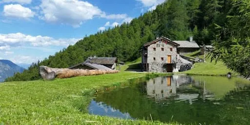
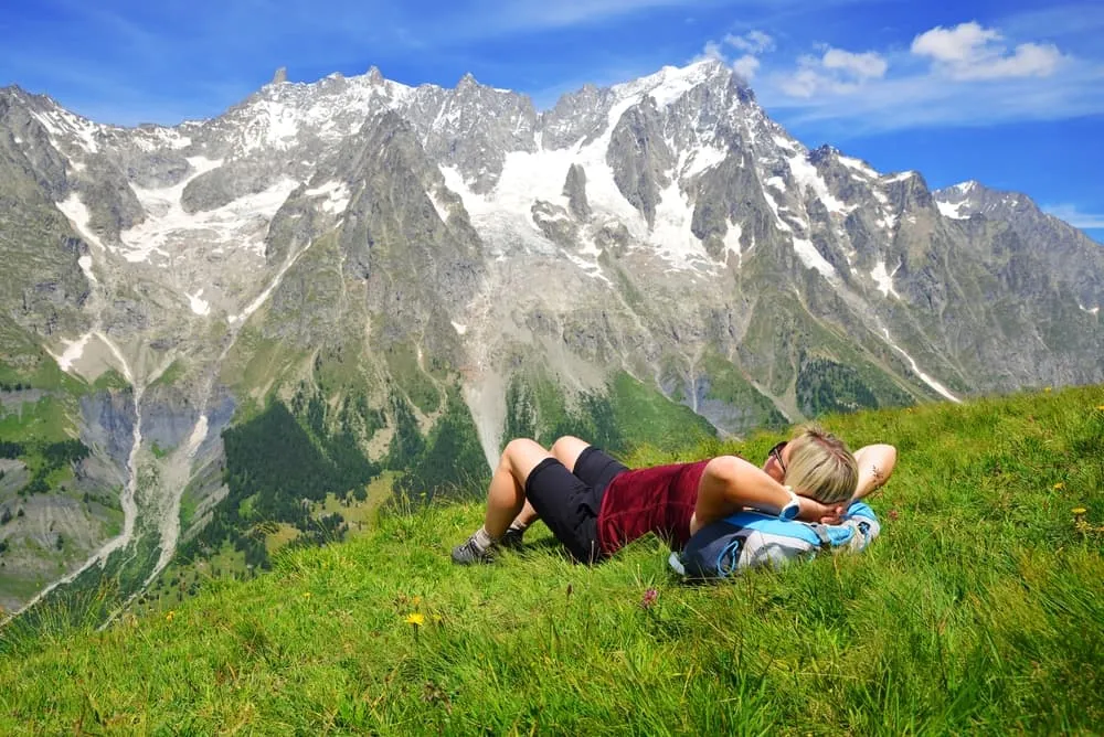
Late afternoon at Lac des Grenouilles. You drop your pack, take off your boots and find out the water is colder than you hoped. Just above the lake sits Rifugio Mont Fallère at 2,385 metres, and along the horizon the big names of the Alps line up. Dinner is in an hour. Plenty of time to check out the wooden sculptures around the hut.

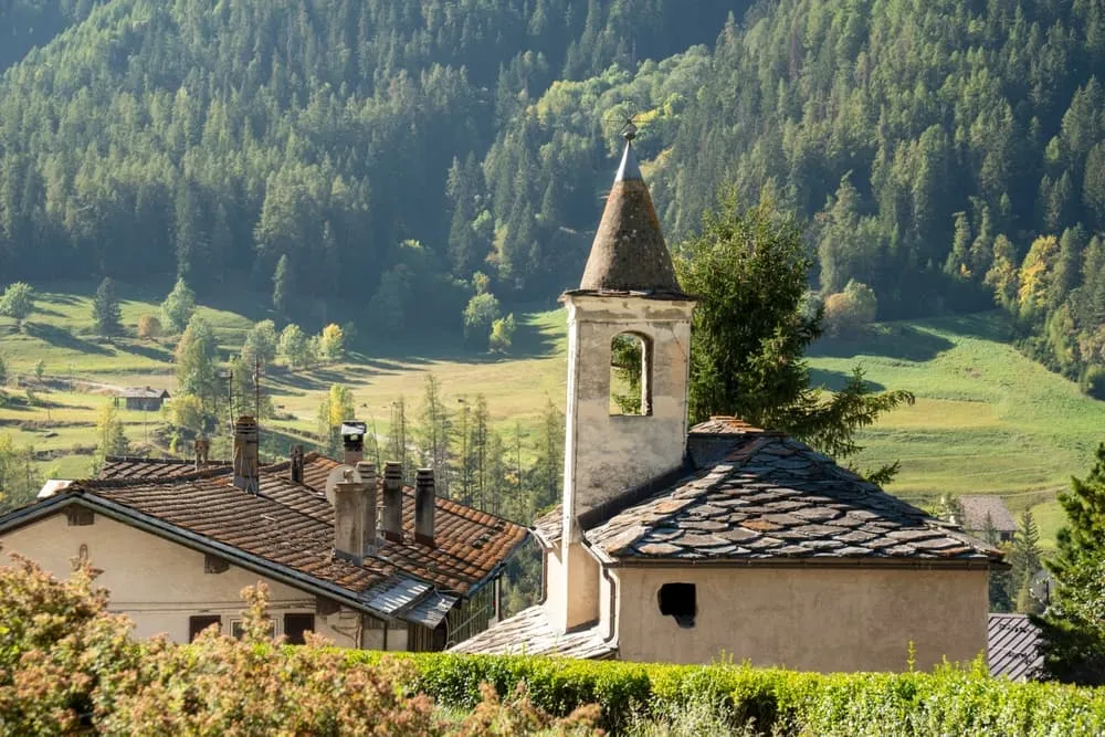
This three-day loop starts and ends in Étroubles, a medieval village on the Via Francigena between Aosta and the Great St Bernard Pass. You climb through larch and fir forest to Rifugio Chaligne, follow the Côte Tardive ridge over Pointe de Metz and past Lac Fallère to Rifugio Mont Fallère, and cross Col Fenêtre at 2,729 metres before the long descent back to Étroubles. Two nights in mountain huts with half board and Aosta Valley cooking, with cheese from the surrounding pastures.

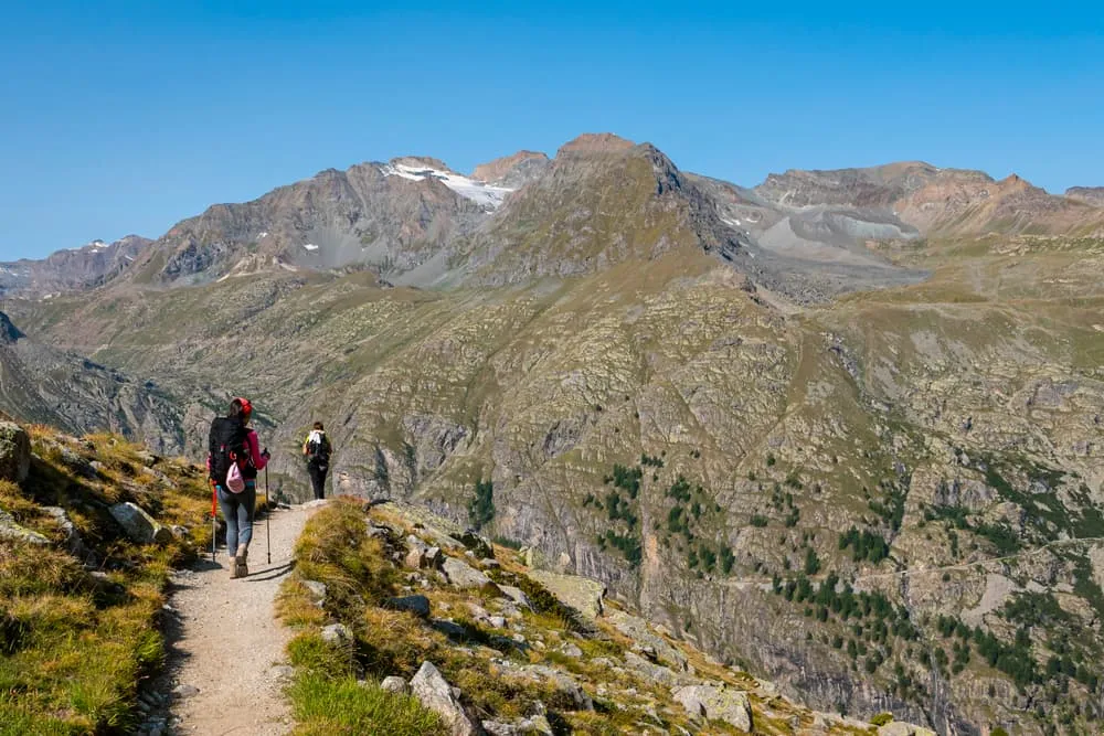
The days are not long, but the metres add up: around 850 metres of climbing on each of the first two days, and more than 1,400 metres of descent on the last. Past Col Fenêtre there is a short rocky section that is slightly exposed, and on the high grass the trail can fade, so keep an eye on the waymarks. A good trek for hikers with some mountain experience, and an option for children from about 8 years old who have hiked in the mountains before. We book the huts, you walk. Deal?

Itinerary

Day
1

Étroubles to Rifugio Chaligne

Duration: 04:05 h
Distance: 10.8 km / 6.71 mi
Ascent: 823 m / 2700 ft
Descent: 184 m / 604 ft
Lowest Point: 1275 m / 4183 ft
Highest Point: 2069 m / 6788 ft

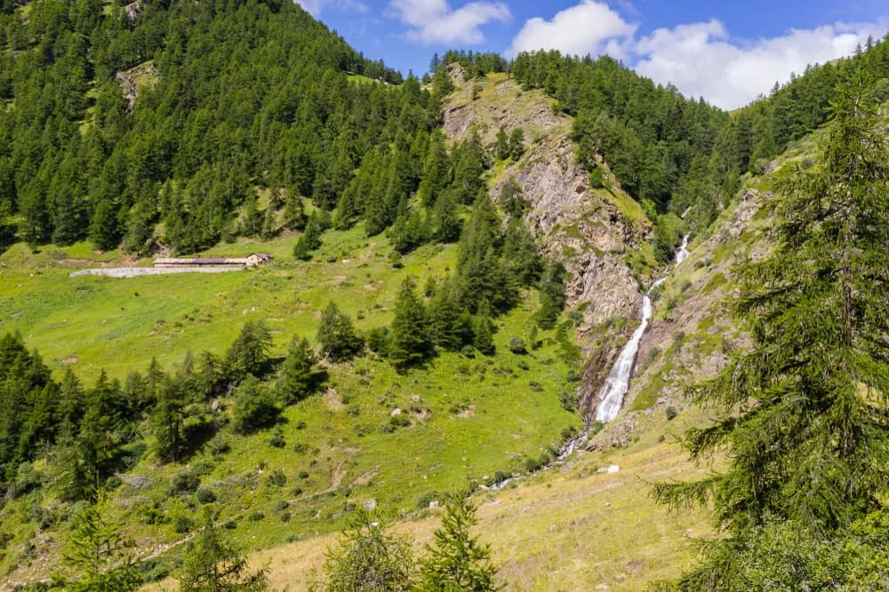
A day in the forest with a solid climb in it. From Étroubles you walk into the side valley on tracks and paths through red fir and larch, with raspberries and wild strawberries along the way in summer. Over the day you gain a little over 800 metres, with the steepest sections in the woods before you reach the open pastures.

From the car park in Étroubles, just around the corner from the Le Tunnel campsite, a paved road soon turns into an unpaved track on trail 5. After a stream, turn left towards Chaligne and follow the flat trail past an avalanche barrier. Path 5A then climbs steeply through the forest, with views back to Becca di Viou and Dent d'Hérens, before dropping gently to the Eteley pasture at 1,689 metres. A bridge takes you across the Ars torrent, with Mont Vélan in front of you. Follow the river downhill for a while, then turn right onto a wide path that climbs steadily through the forest.

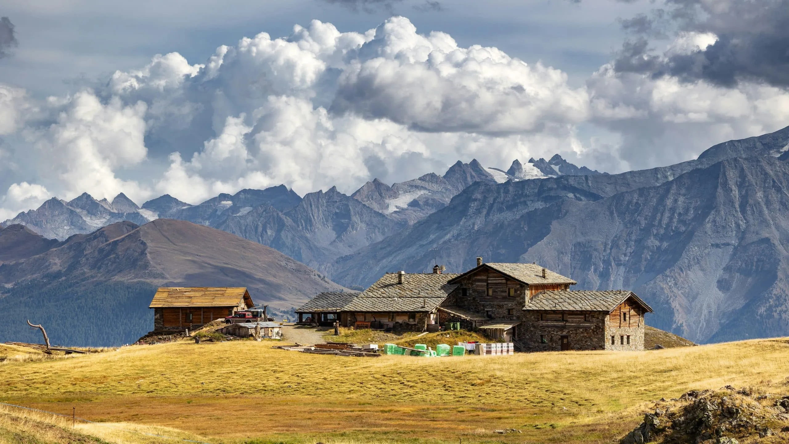
Out of the trees, facing the Ars pasture, a wide track leads via Alpe Collet to Rifugio Chaligne at 1,936 metres. Time to try the local cheese. About 11 kilometres, count on 4 hours.

Rifugio Chaligne

Info
 Rifugio Chaligne
Rifugio Chaligne
Day
2

Rifugio Chaligne to Rifugio Mont Fallère via Pointe de Metz

Duration: 05:20 h
Distance: 11.6 km / 7.21 mi
Ascent: 859 m / 2818 ft
Descent: 444 m / 1457 ft
Lowest Point: 1944 m / 6378 ft
Highest Point: 2549 m / 8363 ft

The most varied day of the trek: forest, an open grassy ridge and a string of alpine lakes. You climb about 860 metres and descend about 440. Up on the ridge you follow yellow arrows painted on the rocks, and the route takes in a bonus summit: Pointe de Metz, at around 2,550 metres the high point of the day.

From the hut, follow the signs for Côte Tardive through the forest, gently at first and then more steeply. At a clearing with a cross and benches, rhododendrons and junipers take over. Past a farm the trail climbs steeply onto the Côte Tardive ridge. Keep an eye out for edelweiss and marmot burrows, while cowbells ring from both sides of the valley. After the top of Pointe de Metz, descend to Col de Metz at 2,486 metres, where a memorial stone points the way towards Alpe Chezere.

Via the La Neuve pasture and trail 8a you reach Lac Fallère at 2,416 metres. Walk uphill to the west to Lac des Grenouilles, where Rifugio Mont Fallère comes into view at 2,385 metres. About 11.5 kilometres, count on a good 5 hours.

Rifugio Mont Fallère Art Trail

Info
Rifugio Mont Fallère Art Trail
Day
3

Rifugio Mont Fallère to Étroubles via Col Fenêtre

Duration: 04:55 h
Distance: 11.6 km / 7.21 mi
Ascent: 391 m / 1283 ft
Descent: 1438 m / 4718 ft
Lowest Point: 1319 m / 4327 ft
Highest Point: 2759 m / 9052 ft

The highest pass of the trek and a long way down. You first climb about 390 metres to Col Fenêtre at 2,729 metres, then it is downhill nearly all the way: more than 1,400 metres of descent to Étroubles. Below Col de Vertosan there is a short rocky section that is slightly exposed, so take your time there.

From the hut, walk to the Crottes pasture at 2,352 metres and take the path up the valley towards Col Fenêtre. The trail is often grassy and fades in places, so watch the waymarks. At the end of the valley it zigzags up to the pass. Turn left towards Vertosan over easy rocks, then right at Col de Vertosan. The first part of the descent crosses easy but slightly exposed rocky ground at around 2,500 metres.

After that it gets easier over grassland to the Tza di Flassin pasture at 2,258 metres. From there the path leads straight down to the Pineta di Flassin campsite, and the Percorso Vita trail takes you back to the start in Étroubles. About 11.5 kilometres, count on a solid 5 hours.

Contact our Trekking Expert
Kelly  Zwoinski
Kelly Zwoinski
Kelly Zwoinski

Included

  • Booking the huts

    We will take care of arranging accommodation on the Aosta Valley Trek for you. We will also provide you with a detailed itinerary for every stage and instructions on how to get to the trailhead.

  • Full travel guide

    You’ll receive access to our trekking app, which serves as your complete digital travel guide for the Aosta Valley Trek. Inside, you’ll find everything you need for your trek: route descriptions, hiking maps, navigation support, payment information, and all the key details specific to your journey.

  • Accommodation

    During your Aosta Valley Trek, you will spend your nights in mountain huts. We normally book dormitories, but private rooms are available upon request and cost €75 extra per room per night. If no private rooms are available, we will automatically book a bed in a dormitory.

  • Half-board in Huts

    Accommodation at the huts includes dinner and breakfast. We will arrange this for you as well. This allows you to travel lighter and have one less thing to worry about. Bear in mind that lunch is not included, but it can be purchased at the huts. Here you can also buy an array of snacks and bottled water.

  • Navigation support

    Our trekking app also includes built-in navigation support. With GPS-based maps and offline access, you can follow the trail confidently and stay on route even without mobile signal.

Excluded

  • Traveling to and from

    You have to make your own way to the starting point. The total amount does not include personal transport.

  • Transfers

    Should you need any form of (public) transport on location, this is not part of the trekking package. This includes the use of taxi, bus, cable cars, gondolas, ferries, etc.

  • Lunch

    Half-board is included in the price of this trek. Lunch, however, is not. Many huts offer packed lunches, which can usually be requested the night before. Alternatively, you can stop for lunch at mountain huts along the way.

  • Travel Insurance

    Your international travel insurance is your own responsibility. Discuss your itinerary with the insurance company before your trek.

  • Personal expenses

    Personal expenses on such as souvenirs, drinks, and other similar expenses are for your own account.

  • Accommodation before and after the trek

    Before and after the Aosta Valley Trek, you have to take care of your own accommodation.

  • Tourist tax

    Tourist tax is not included and must be paid locally at the accommodation.

FAQ

  • How to Get To the Starting Point of the Tour du Mont Fallère

  • How to Get Back From Étroubles

  • What if the dates I want are not available?

  • If I book now, can I immediately arrange the rest of my trip?

  • How do I know if this trek is right for me?

  • Can meals be adapted to my dietary requirements?

How to Book

  • Booking

  • Availability

  • Cancellation policy

Just for You

Advanced Aosta Valley Trek 1
243

Advanced Aosta Valley Trek 1

The Intermediate Aosta Valley Trek 1 is a demanding 3-day hut-to-hut route through the high alpine terrain of Italy’s Aosta Valley. Designed for intermediate and even experienced beginner hikers, this compact trek focuses on steep ascents, high mountain paths and dramatic scenery in the Gran Paradiso region. It’s ideal for those seeking a short but intense alpine challenge.
  • 3 h 50m /day
  • 9.3 km / 6 mi /day
  • +387 m / +1270 ft /day
  • -695 m / -2280 ft /day
243

Advanced

For mountain goats only
Intermediate Aosta Valley Loop Trek 2
358

Intermediate Aosta Valley Loop Trek 2

The Intermediate Aosta Valley Trek 2 is a 4-day hut-to-hut loop route through the alpine heart of Italy’s Aosta Valley. Designed for hikers with some mountain experience, the trek combines high passes, open valleys and panoramic ridgelines beneath the peaks of the Gran Paradiso region. It offers a rewarding balance between challenge and accessibility in a compact itinerary.
  • 4 h 14m /day
  • 9.0 km / 6 mi /day
  • +585 m / +1919 ft /day
  • -590 m / -1936 ft /day
358

Intermediate

Our most loved adventures
Advanced Aosta Valley Trek 1 & 2
473

Advanced Aosta Valley Trek 1 & 2

The Advanced Aosta Valley Trek 1+2 is a challenging 5-day hut-to-hut route through some of the wildest landscapes of the Aosta Valley. Designed for experienced hikers, this trek combines demanding mountain stages, high passes and remote alpine terrain, offering constant views of glacial valleys and rugged peaks. It’s an intense but rewarding journey for those seeking a true high-mountain experience in the Italian Alps.
  • 4 h 20m /day
  • 9 km / 6 mi /day
  • +578 m / +1896 ft /day
  • -783 m / -2569 ft /day
473

Advanced

For mountain goats only