Rubha Hunish
- Distance: About 6 to 8 km
- Difficulty: Hard, with rough and steep sections
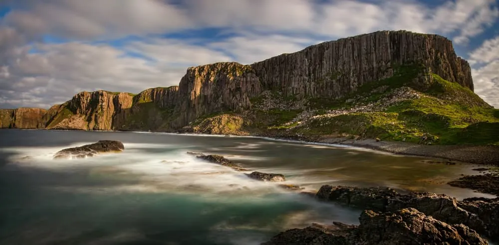
Rubha Hunish is the northernmost point of Skye. The approach involves rough moorland and a steep descent to a narrow coastal headland. It is one of the more remote walks on the island and sees far fewer visitors than the Quiraing or the Old Man of Storr. It is also the starting point of the Skye Trail long-distance route. Seabirds and seals are commonly seen from the headland.
Bla Bheinn (Blaven)
- Start and parking: Bla Bheinn car park on the road to Elgol
- Difficulty: Hard; experienced hillwalkers
Bla Bheinn stands at 928 m and is a Munro that sits apart from the main Cuillin ridge, east of Glen Sligachan. The ascent is long and steep on rough terrain but is non-technical in dry conditions. The summit gives panoramic views of the Black Cuillin, Loch Coruisk and the mainland. A full head for heights is useful on the upper section, and the descent requires care. Do not attempt in poor visibility without navigation experience.
Sgurr na Stri
- Difficulty: Hard; experienced hillwalkers
Sgurr na Stri is a modest hill with a famous view from its summit over Loch Coruisk and the Cuillin. The most common approach is a long walk from Sligachan through Glen Sligachan, passing between the Red and Black Cuillin. It is a full day out with significant distance and rough ground underfoot. Camasunary bay, reached by a separate walk from Kilmarie, offers a shorter objective with a taste of the Cuillin landscape without climbing a mountain. Loch Coruisk can be reached by seasonal boat from Elgol or on foot; the coastal path from Elgol which crosses the Bad Step, an exposed sloping slab that is not suitable for nervous walkers.
Cuillin Ridge
- Distance: About 11 to 14 km for the full ridge
- Time: 15 to 20 hours for a full traverse
- Difficulty: Mountaineering; technical scrambling and rock climbing required
The Cuillin Ridge is one of the most serious mountain ridges in the UK. The Cuillin holds twelve Munros and the highest point on Skye, Sgurr Alasdair at 992 m. The rock is gabbro, which grips well in dry conditions, but some sections are basalt, which becomes slippery when wet. The Inaccessible Pinnacle, one of the Munros on the ridge, requires a roped rock climb to summit. A full traverse takes most parties 15 to 20 hours, and most summits involve scrambling. Compasses give unreliable readings on parts of the ridge due to the magnetic gabbro. Most people who attempt the full ridge hire a qualified mountain guide. This is not a hiking objective for walkers without a background in technical mountain terrain.
Trotternish Ridge
The Trotternish Ridge is the high ground connecting the Quiraing in the north to The Storr in the south. On our route, the stage from the Quiraing to The Storr covers 23.2 km with 1,220 m of ascent and takes around 9 hours 45 minutes of walking. It is the longest day on the Skye Trail and one of the most demanding single-day walks on the island. The exposure and the distance make navigation skills and good weather essential.
For contrast on a shorter but equally iconic Scottish summit, see our guide to hiking Ben Nevis.