Preferred date sold out?
Join the waiting list, or discover our Alta Via 1 alternatives before they sell out too.

Medium Southern Alta Via 1 (Last spots!)

  • Duration
    Total 5 days
    Average 5h 33min
  • Distance
    Total 68.0 km
    Average 13.6 km
  • Ascent
    Total +3750 m
    Average +750 m
  • Descent
    Total -4320 m
    Average -864 m
> Hike the southern Alta Via 1, from Cortina d'Ampezzo to Agordo
> Pass Cinque Torri, Monte Pelmo and Monte Civetta
> A challenging trek for experienced intermediate hikers

The Alta Via 1, also known as the Dolomite High Route 1, is one of Italy's most famous trekking trails. This 5-day version follows the southern section from Cortina d'Ampezzo to Agordo, with nights in welcoming Italian rifugios.

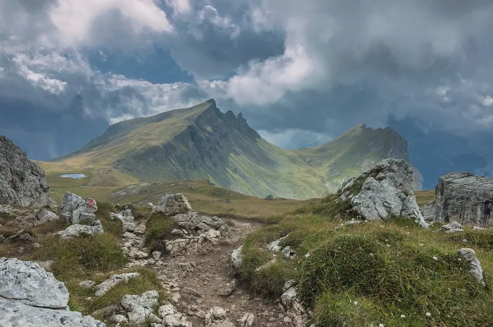
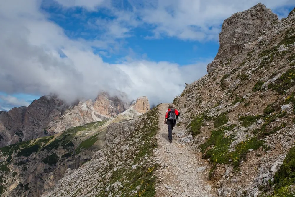
The route takes you through classic Dolomite scenery, including Cinque Torri, the Nuvolau area, Monte Pelmo and the rugged surroundings of Monte Civetta. Expect rocky mountain paths, steep climbs, long descents and a few short secured sections with ladders or fixed cables.

This trek is suitable for experienced intermediate hikers who are sure-footed and used to full days in the mountains. Bookatrekking.com arranges your huts, including dinner and breakfast, so you can focus on the trail and enjoy a compact but complete Alta Via 1 experience.

Itinerary

Day
1

Cortina d'Ampezzo - Rifugio Scoiattoli

Duration: 06:55 h
Distance: 15.8 km
Ascent: 1600 m
Descent: 570 m

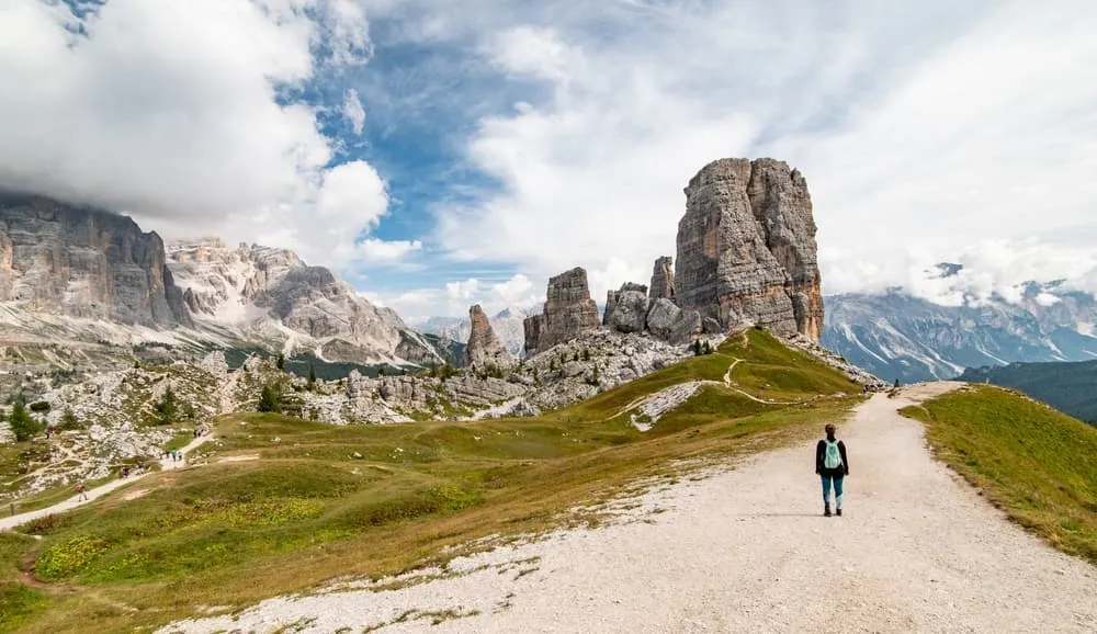
From Cortina d'Ampezzo, you start with a proper mountain climb into the Cinque Torri area. This is a strong opening stage rather than a gentle warm-up, with a long ascent that gains around 1600 m if you hike the full route. The terrain changes from town paths and paved sections to mountain hiking paths and more alpine ground higher up. It is a rewarding start, but best suited to hikers who are already comfortable with long climbs in the mountains.

The route climbs towards the slopes below Lagazuoi and the Passo Falzarego area, passing rifugios such as Pomedes and A. Dibona along the way. There are options to shorten the day by cable car or public transport, which can make sense if you want to avoid the full climb from Cortina. If you continue on foot, the landscape becomes rockier and more dramatic as you approach Cinque Torri.

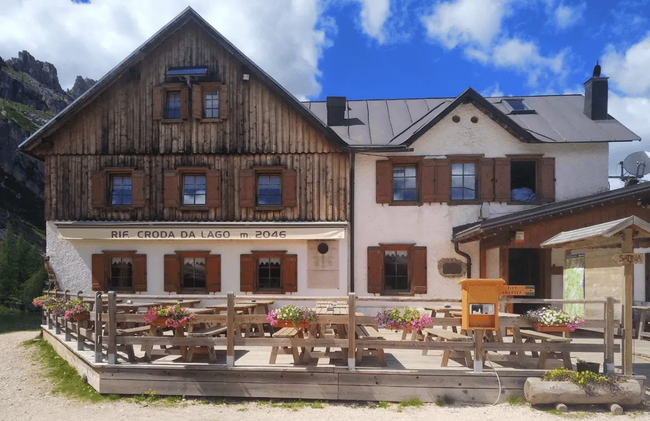
You arrive at Rifugio Scoiattoli, close to Cinque Torri. After the long climb, this is a great place to settle in, eat well and enjoy the surrounding Dolomite views.

Rifugio Scoiattoli

Info
Rifugio Scoiattoli
Rifugio Scoiattoli
Day
2

Rifugio Scoiattoli - Rifugio Passo Staulanza

Duration: 06:40 h
Distance: 16.6 km
Ascent: 580 m
Descent: 1040 m

The stage begins with the most technically challenging and exposed part of the entire route: a series of via ferrata paths with cables and ladders descending from Nuvolau into the valley. This section is thrilling but short. If you follow our route, you’ll pass by this via ferrata but won’t actually use it. You will, however, encounter a section with ladders and fixed cables to hold on to. These kinds of cables are common along the route; they are there for extra support and do not require any special equipment.

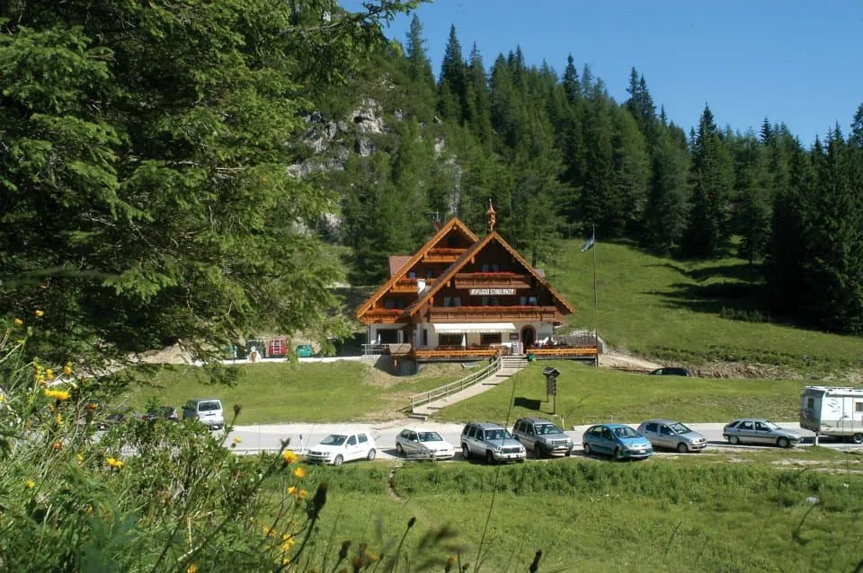
Then you descend the rest of the way to a mountain pass near the valley where you start climbing again, to the pass of Forcella Ambrizzola. As you cross this pass, the impressive Monte Pelmo looms in the background. Here you descend through stretches of forest until Monte Pelmo, also known as the Throne of the Gods, suddenly comes incredibly close. You continue past Rifugio Città di Fume to the Staulanza pass where you find the cozy Rifugio Passo Staulanza.

Tip: At Rifugio Passo Staulanza you can relax and recharge after a long day on the trails in their wellness center and hot tub with stunning views of Monte Pelmo (extra fee). The hut also offers a laundry and drying service for an additional charge, should you wish to use it.

Rifugio Passo Staulanza

Info
Rifugio Passo Staulanza
Day
3

Rifugio Passo Staulanza - Rifugio Vazzoler

Duration: 05:25 h
Distance: 16.3 km
Ascent: 900 m
Descent: 970 m

This stage takes you into the Monte Civetta area, one of the most impressive parts of the route. From Rifugio Passo Staulanza, you climb towards Rifugio Coldai with around 900 m of ascent over the day. The climb is steady and demanding, but the views towards Monte Pelmo and the surrounding rock walls make this a memorable mountain stage.

After Rifugio Coldai, the route continues to Lago Coldai, a good place to pause before moving on along the high route towards Rifugio Tissi. Around Monte Civetta, the terrain remains rocky and alpine, with paths that require steady footing. The views are excellent, but this is not a section to walk on autopilot.

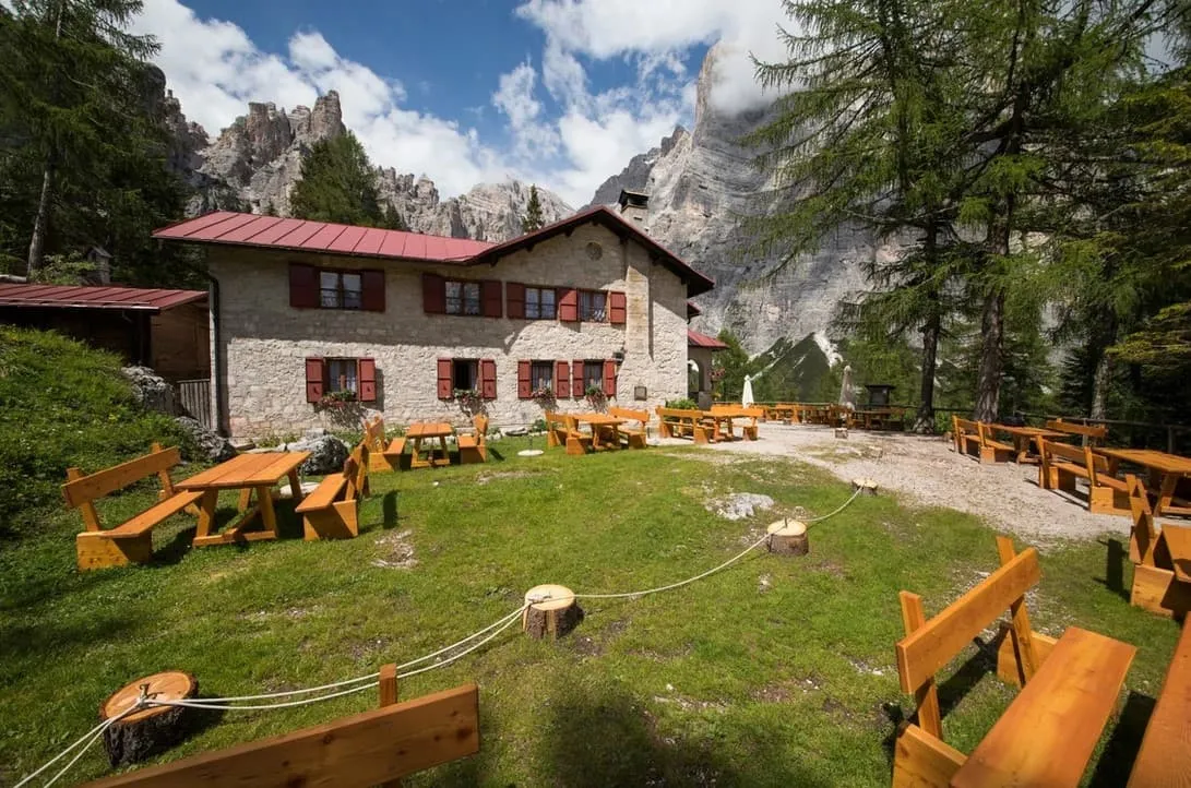
Beyond Rifugio Tissi, the route continues south and eventually descends towards Rifugio Vazzoler. The arrival feels well earned, with the stage combining climbing, descending and rough mountain terrain in one full Dolomite day.

Rifugio Vazzoler

Info
Rifugio Vazzoler
Rifugio Vazzoler
Day
4

Rifugio Vazzoler - Rifugio Carestiato

Duration: 05:15 h
Distance: 9.15 km
Ascent: 640 m
Descent: 540 m

This stage is shorter than the previous ones, but it still feels like a real mountain route. From Rifugio Vazzoler, you move along the southern side of the Civetta area, with around 640 m of ascent and rough terrain underfoot. The route crosses open mountain ground, rocky paths, gravel and alpine surfaces, so it remains scenic but never feels like a simple walk.

The trail climbs towards the passes on the way to Rifugio Carestiato. You need to stay attentive on the rougher sections, especially where loose stones and uneven ground make the walking slower. Behind you are the rock formations of the Civetta area, while the route gradually opens towards the southern part of the trek.

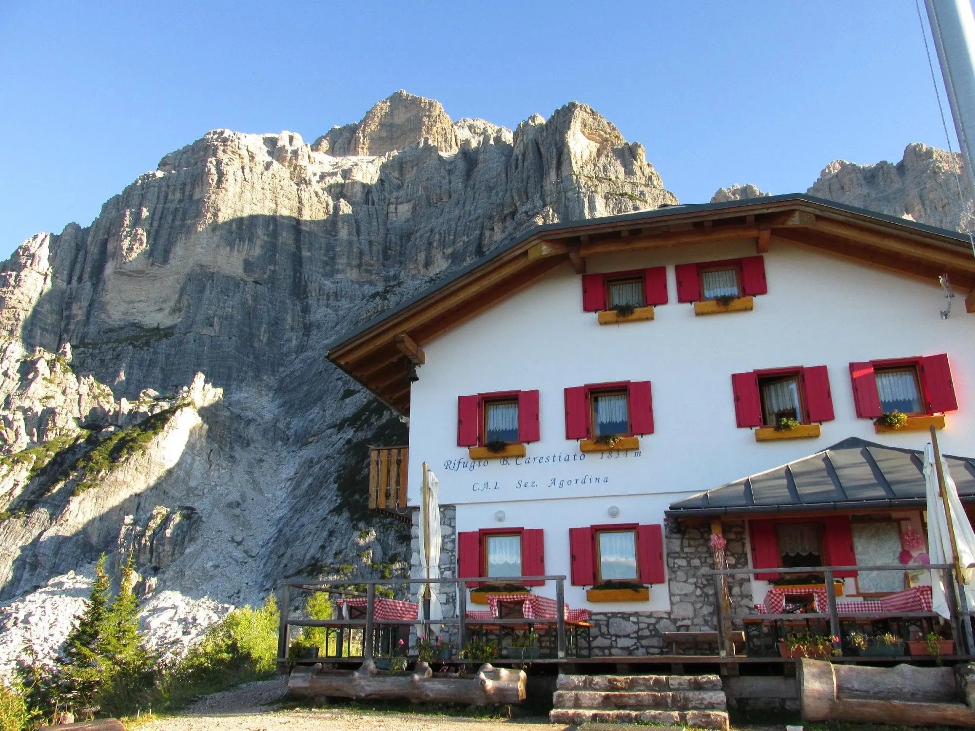
You arrive at Rifugio Carestiato after a shorter but still serious stage. The distance is manageable, but the climbing, descending and rough ground keep the mountain character right to the end.

Rifugio Carestiato

Info
Rifugio Carestiato
Rifugio Carestiato
Day
5

Rifugio Carestiato - Agordo

Duration: 03:30 h
Distance: 10.1 km
Ascent: 30 m
Descent: 1200 m

The final stretch feels like the closing chapter of a proper Alta Via 1 journey. From Rifugio Carestiato, you begin the long descent towards Agordo, leaving the high mountain terrain behind step by step. The route is mostly downhill, first on mountain paths and natural ground, later with quieter paths and road sections. Take your time, because the descent is long and can be tiring on the legs.

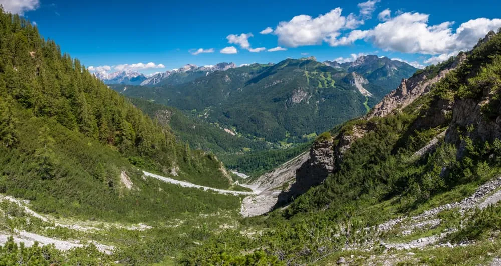
The landscape changes gradually as you lose height. Rocky slopes and open mountain ground give way to forest, lower hillsides and finally the valley. You pass Malga Framont and continue down towards Agordo, with the sense of arrival becoming stronger as the route drops closer to town. It is not a technical finale, but it still asks for steady footing.

In Agordo, the trek comes to an end. After days of rifugios, rock walls, mountain passes and long trails, this is the moment to stop, look back and enjoy what you have completed. Backpack off, boots off, and time for that well-earned birra.

Contact our Trekking Expert
Jelle Tekstra
Jelle Tekstra
Jelle Tekstra

Included

  • Booking the huts

    We will take care of arranging accommodation on the Alta Via 1 for you. We will also provide you with a detailed itinerary for every stage and instructions on how to get to the trailhead.

  • Full travel guide

    You’ll receive access to our trekking app, which serves as your complete digital travel guide for the Alta Via 1. Inside, you’ll find everything you need for your trek: route descriptions, hiking maps, navigation support, payment information, and all the key details specific to your journey.

  • Accommodation

    During your Alta Via 1, you will spend your nights in mountain huts. We normally book dormitories, but private rooms are available upon request and cost €75 extra per room per night. If no private rooms are available, we will automatically book a bed in a dormitory.

  • Half-board in Huts

    Accommodation at the huts includes dinner and breakfast. We will arrange this for you as well. This allows you to travel lighter and have one less thing to worry about. Bear in mind that lunch is not included, but it can be purchased at the huts. Here you can also buy an array of snacks and bottled water.

  • Navigation support

    Our trekking app also includes built-in navigation support. With GPS-based maps and offline access, you can follow the trail confidently and stay on route even without mobile signal.

Excluded

  • Traveling to and from

    You have to make your own way to the starting point. The total amount does not include personal transport.

  • Transfers

    Should you need any form of (public) transport on location, this is not part of the trekking package. This includes the use of taxi, bus, cable cars, gondolas, ferries, etc.

  • Lunch

    Half-board is included in the price of this trek. Lunch, however, is not. Many huts offer packed lunches, which can usually be requested the night before. Alternatively, you can stop for lunch at mountain huts along the way.

  • Travel Insurance

    Your international travel insurance is your own responsibility. Discuss your itinerary with the insurance company before your trek.

  • Personal expenses

    Personal expenses on such as souvenirs, drinks, and other similar expenses are for your own account.

FAQ

  • When Is the Best Season to Hike the Alta Via 1 in the Dolomites?

  • Difficulty of the Alta Via 1: Is This Trek Right for Me?

  • How to Get To the Starting Point of the Alta via 1

  • How to Get From the Endpoint Back to Cortina D’Ampezzo

  • What if the dates I want are not available?

  • If I book now, can I immediately arrange the rest of my trip?

  • How do I know if this trek is right for me?

  • Can meals be adapted to my dietary requirements?

How to Book

  • Booking

  • Availability

  • Cancellation policy