Alta Via del Camoscio Trek

  • Duration
    Total 3 days
    Average 3 h 57m
  • Distance
    Total 23.3 km
    Average 7.8 km
  • Ascent
    Total +1820 m
    Average +607 m
  • Descent
    Total -900 m
    Average -300 m

> Adventurous trail with exposed sections
> All overnight stays along the trail are included
> Tailored by the Bookatrekking.com experts

If you’re looking for an adventure in the Italian Dolomites, the Alta Via del Camoscio is for you. While the popular Alta Vias 1 and 2 become busier every season, Bookatrekking.com offers this alternative for those who want to explore the Dolomites in a more personal way. The Alta Via del Camoscio is a 3-day hut-to-hut hike that begins and ends in Cortina d’Ampezzo. Covering about 30 kilometers, the route combines tranquil valley walks and alpine meadows with rugged ascents, exposed sections, and breathtaking viewpoints.

This trek is ideal for adventurous beginners: the stages are relatively short—usually between 3 and 4 hours—so you can take your time without overdoing it. The first day involves a big ascent, while the following days are more moderate, letting you balance effort with enjoyment. Along the way, you’ll encounter sections with cables and stairs that add a touch of adrenaline, but also plenty of calmer trails where you can simply soak in the Dolomites at a relaxed pace.

With overnight stays in welcoming Rifugios, you’ll have the chance to rest, recharge, and savor the experience. The Alta Via del Camoscio offers a bit of everything—variety, adventure, and stunning scenery—making it the perfect introduction to hut-to-hut trekking in the Dolomites.

Itinerary

Day
1

Cortina d'Ampezzo to Rifugio Son Forca

Duration: 04:10 h
Distance: 7.39 km
Ascent: 1000 m
Descent: 20 m

From Cortina d'Ampezzo, the route climbs almost continuously to Rifugio Son Forca, with 1,000 m of ascent over a relatively short stage. It starts in town and soon leaves the valley floor behind, following a mix of streets, paths and mountain hiking trails. The gain in altitude is steady, so pace yourself from the beginning. As you climb, the surroundings become quieter and more alpine, with the Cristallo area drawing closer near the end.

The route heads north-east out of Cortina d'Ampezzo and climbs towards Rifugio Mietres before continuing onto the Col Tondo, Val Padeon Trail. Higher up, the path passes viewpoints over Cortina d'Ampezzo and the surrounding valley. The final section approaches the Son Forca area, passing a panoramic viewpoint, Son Forca Spring, a rocky cliff viewpoint and a river crossing before reaching the hut. Expect a clear uphill profile throughout, with only very little descent.

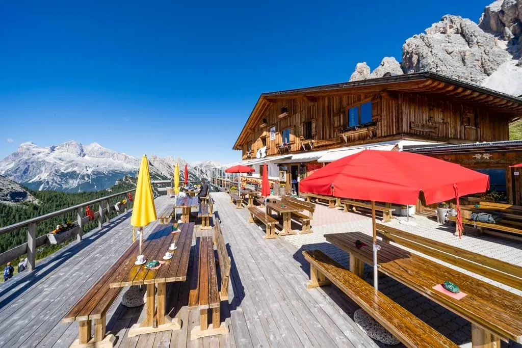
You arrive at Rifugio Son Forca, a mountain hut set high above Cortina d'Ampezzo. After the long climb, this is a good place to settle in, recover and prepare for the more technical terrain that follows on the next stage.

Note: It may be possible to shorten the first climb by taking local transport from Cortina d'Ampezzo towards Chiave. DolomitiBus urban line 5 serves the Cortina d'Ampezzo, Majon and Chiave area, but timetables and stops should be checked before departure as services can vary by season.

Rifugio Son Forca

Info
Rifugio Son Forca
Rifugio Son Forca
Day
2

Rifugio Son Forca to Rifugio Vandelli

Duration: 04:00 h
Distance: 9.02 km
Ascent: 240 m
Descent: 510 m

From Rifugio Son Forca, the route to Rifugio Vandelli is 9.02 km and includes 510 m of descent. This stage is not a simple hut-to-hut traverse, as it first loses height before climbing back into the Sorapis area. The terrain becomes more demanding near the final section, with exposed and technical parts including a steep narrow rocky passage, a metal staircase on the Monte Piana Trail and a path along the cliff.

The route leaves Rifugio Son Forca and descends from the higher slopes towards the Passo Tre Croci side. After the lower section, it joins the trail towards Lago di Sorapis and gradually moves into rougher mountain terrain below Monte Cristallo. The most important features shown on the route are the steep narrow rocky pass, the metal staircase on the Monte Piana Trail and the cliffside path. This section requires care, especially in wet conditions.

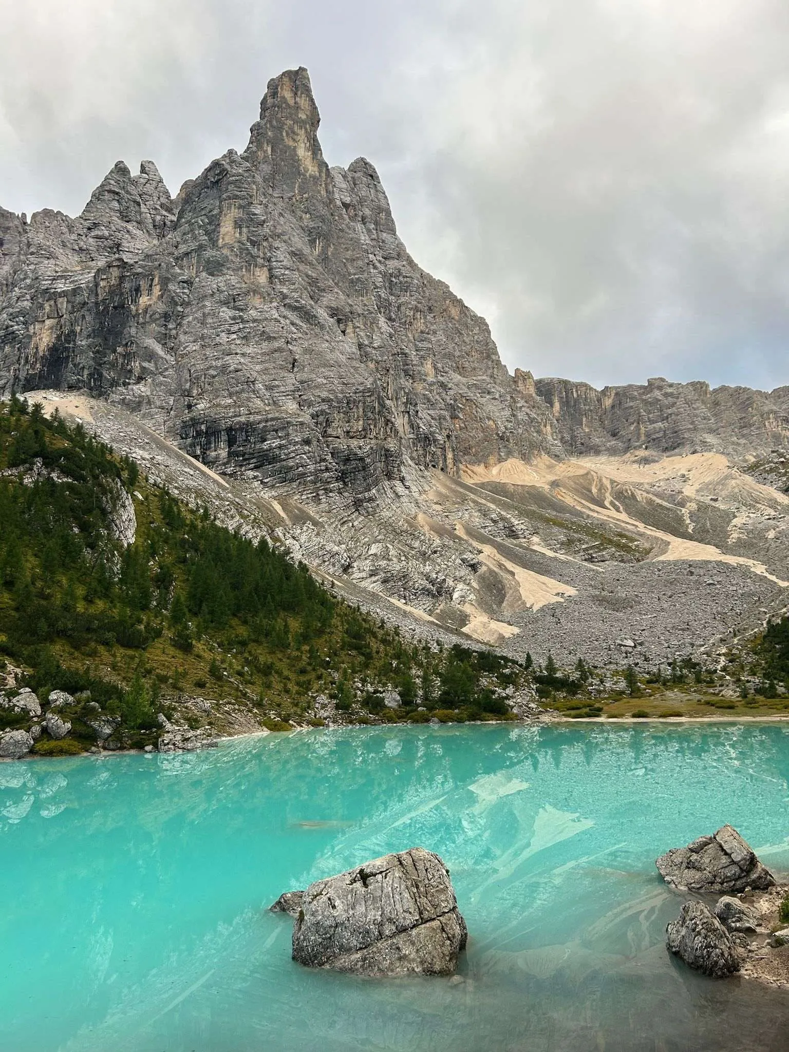
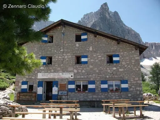
You arrive at Rifugio Vandelli, a mountain hut above Lago di Sorapis. After the exposed final approach, this is the place to rest and settle in, with the Sorapis basin close by.

Rifugio Vandelli

Info
Rifugio Vandelli
Rifugio Vandelli
Day
3

Rifugio Vandelli to Cortina d'Ampezzo

Duration: 03:40 h
Distance: 6.87 km
Ascent: 580 m
Descent: 370 m

From Rifugio Vandelli to Passo Tre Croci, the route is 6.87 km with 420 m of ascent and 540 m of descent. The distance is short, but the terrain is demanding in places. This stage includes technical and exposed mountain sections shortly after leaving the hut and again around Forcella Marcoira. It is best suited to hikers who are comfortable on rocky paths, narrow passages and secured sections where sure-footedness matters.

From Rifugio Vandelli, the path soon reaches viewpoints over Lago di Sorapis before continuing into rougher ground. The route climbs towards Forcella Marcoira, where the main ascent of the stage is concentrated. Around this section, the trail includes steep rocky terrain and exposed passages. After the pass, the route begins to descend, with a viewpoint over Monte Cristallo and Lago di Sorapis marked further along the way.

The stage finishes at Passo Tre Croci. From here, the walking route ends at the pass, where transport back towards Cortina d'Ampezzo can be arranged depending on the season and timetable.

Contact our Trekking Expert
Kelly  Zwoinski
Kelly Zwoinski
Kelly Zwoinski

Included

  • Booking the huts

    We will take care of arranging accommodation on the Alta Via del Camoscio for you. We will also provide you with a detailed itinerary for every stage and instructions on how to get to the trailhead.

  • Full travel guide

    You’ll receive access to our trekking app, which serves as your complete digital travel guide for the Alta Via del Camoscio. Inside, you’ll find everything you need for your trek: route descriptions, hiking maps, navigation support, payment information, and all the key details specific to your journey.

  • Accommodation

    During your Alta Via del Camoscio, you will spend your nights in mountain huts. We normally book dormitories, but private rooms are available upon request and cost €75 extra per room per night. If no private rooms are available, we will automatically book a bed in a dormitory.

  • Half board in huts (where possible)

    Accommodation in the huts includes dinner and breakfast, unless otherwise indicated in the exclusive list. This allows you to travel lighter and not have to worry about an extra meal. Please note, however, that lunch is not included, but can be purchased at the huts. Beverages may also be charged separately at some huts.

  • Navigation support

    Our trekking app also includes built-in navigation support. With GPS-based maps and offline access, you can follow the trail confidently and stay on route even without mobile signal.

Excluded

  • Traveling to and from

    You have to make your own way to the starting point. The total amount does not include personal transport.

  • Transfers

    Should you need any form of (public) transport on location, this is not part of the trekking package. This includes the use of taxi, bus, cable cars, gondolas, ferries, etc.

  • Lunch

    Half-board is included in the price of this trek. Lunch, however, is not. Many huts offer packed lunches, which can usually be requested the night before. Alternatively, you can stop for lunch at mountain huts along the way.

  • Travel Insurance

    Your international travel insurance is your own responsibility. Discuss your itinerary with the insurance company before your trek.

  • Personal expenses

    Personal expenses on such as souvenirs, drinks, and other similar expenses are for your own account.

  • Accommodation before and after the trek

    Before and after the Alta Via del Camoscio, you have to take care of your own accommodation.

FAQ

  • Is the Alta Via del Camoscio for Me? - Difficulty

  • When is the Best Season to Hike the Alta Via del Camoscio?

  • How to Get To the Starting Point of the Alta via del Camoscio

  • From Endpoint to Cortina D’Ampezzo

  • What if the dates I want are not available?

  • If I book now, can I immediately arrange the rest of my trip?

  • How do I know if this trek is right for me?

  • Can meals be adapted to my dietary requirements?

How to Book

  • Booking

  • Availability

  • Cancellation policy