Compact Tour des Combins

  • Duration
    Total 6 days
    Average 7h 3min
  • Distance
    Total 104.7 km
    Average 17.5 km
  • Ascent
    Total +5570 m
    Average +928 m
  • Descent
    Total -5600 m
    Average -933 m

> Complete the legendary Tour des Combins in 6 unforgettable days
> Cross Switzerland and Italy through high mountain terrain
> Stay in authentic alpine huts with spectacular views

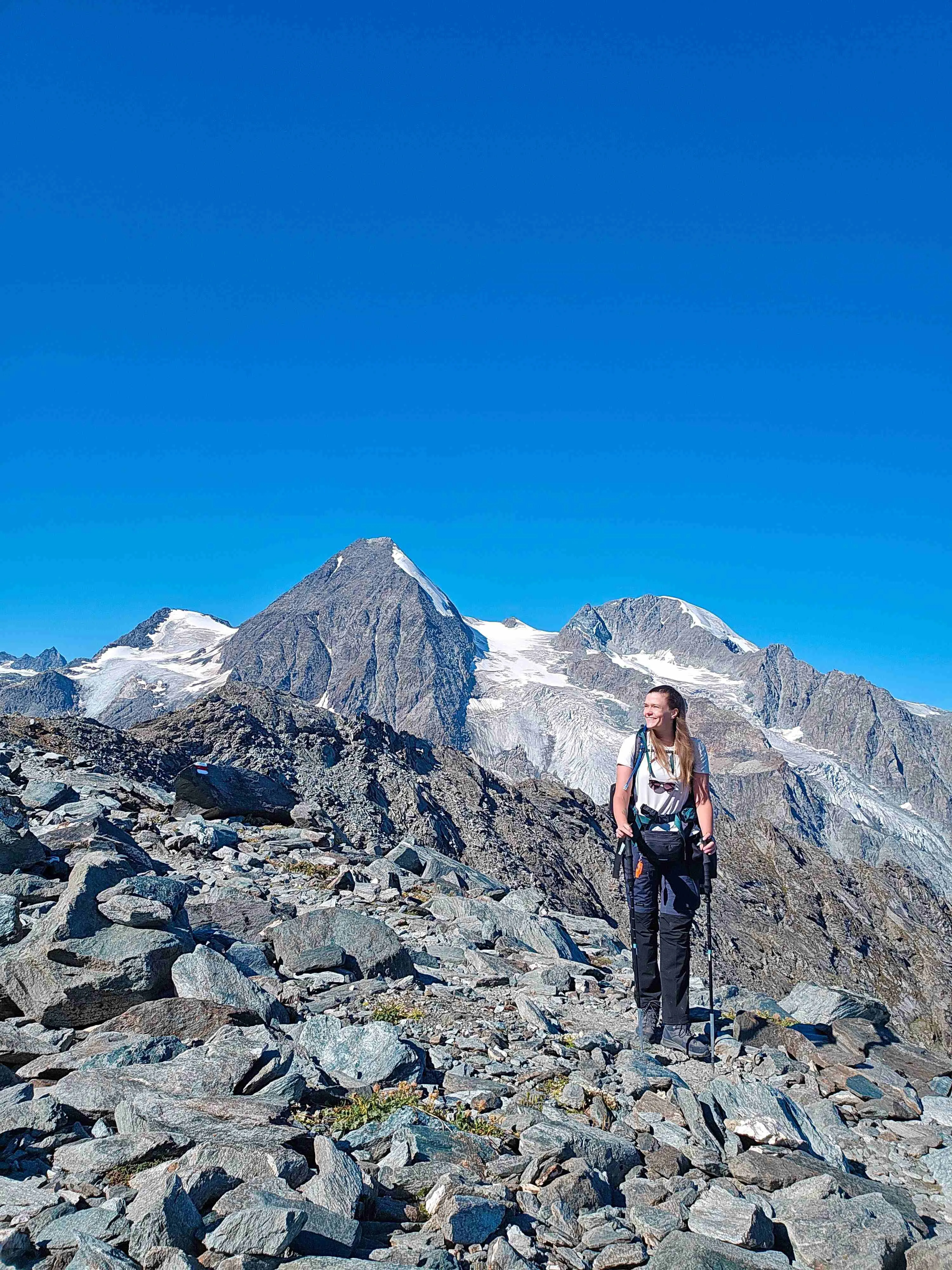
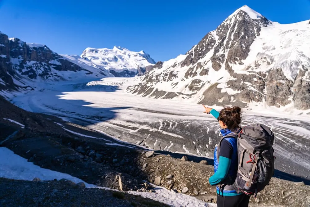
The 6-day Tour des Combins is a compact version of one of the Alps' most rewarding hut-to-hut adventures. This classic route circles the mighty Grand Combin massif, taking you through remote valleys, high mountain passes, and dramatic alpine landscapes on both sides of the Swiss-Italian border. Expect glacier views, rugged peaks, and the kind of mountain scenery that keeps you reaching for your camera.

This itinerary covers the entire route over 6 days of hiking, combining stages 3 and 4 of the original tour into one longer day. This means that you will still experience the complete loop, just in a slightly more condensed format. Along the way, you'll stay in traditional mountain huts where hearty meals and alpine hospitality await after challenging days on the trail. A true high-alpine adventure in the heart of the Alps.

Itinerary

Day
1

Bourg-Saint-Pierre - Cabane du Col de Mille

Duration: 04:45 h
Distance: 11.9 km
Ascent: 970 m
Descent: 150 m

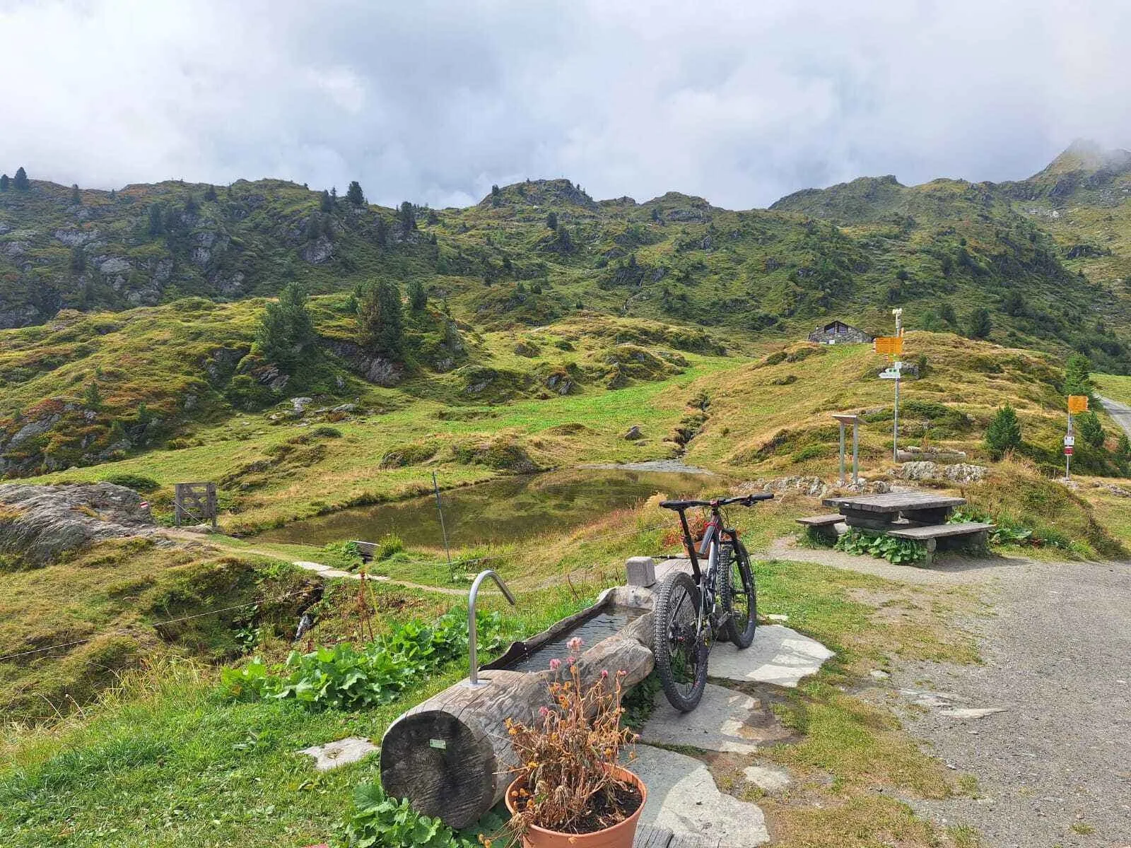
Leaving the stone lanes of Bourg-Saint-Pierre behind, the route climbs steadily into the quieter side of the valley, where forest gives way to open alpine slopes. As you gain height, the views widen towards the upper Val d’Entremont and the dark wall of the Grand Combin massif. The day is all about one long ascent, finishing high beneath Mont Rogneux (3,084 m), where the mountains suddenly feel bigger, wilder and wonderfully close.

The path starts on rising tracks above the village and soon enters larch forest, climbing in long bends through clearings and steeper hillside sections. Higher up, the trees begin to thin and the trail traverses open grass and stone beneath peaks like Pointe du Parc (2,989 m) and Grand Laget (3,133 m). Around the upper slopes, the route keeps pulling upward on a broad mountainside, with old alpine paths and big valley views making the climb feel serious but beautiful.

Near the end, the terrain opens fully and the final approach becomes more spacious and airy. Cabane du Col de Mille appears on its high perch with wide views across the valley and towards the surrounding summits. It is a brilliant place to arrive after a full climbing day, with evening light washing over the slopes below Mont Rogneux and the quiet of the high mountains settling in around the hut.

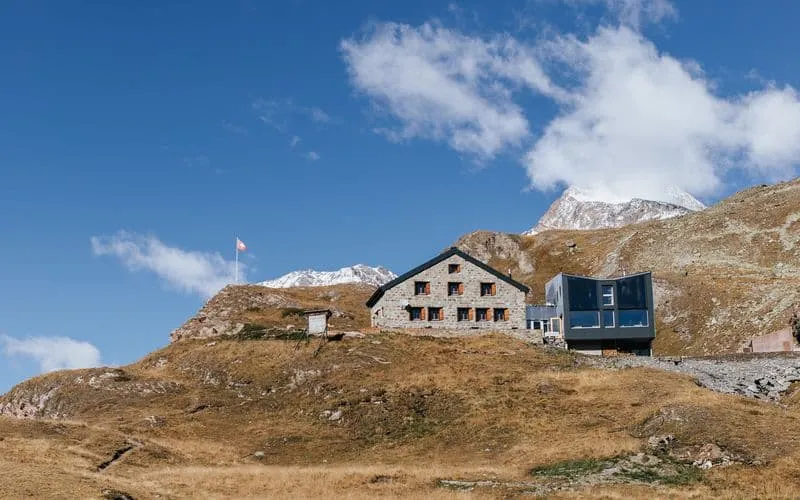
Cabane du Col de Mille

Info
Cabane du Col de Mille
Day
2

Cabane du Col de Mille - Cabane FXB à Panossière

Duration: 05:50 h
Distance: 14.6 km
Ascent: 750 m
Descent: 590 m

Leaving the high perch of Cabane du Col de Mille, this stage begins with a long descent from open alpine slopes into the upper valley, before turning once more towards the glacier world of the Grand Combin. It is a day of contrast, trading grassy mountainsides and broad valley views for roaring meltwater, hanging ice and the remote drama of the Corbassière valley. By the time you reach the hut, the glacier feels close enough to touch.

The trail drops steadily from the hut beneath Mont Rogneux (3,084 m), crossing open slopes and old alpine paths with wide views over the Val d’Entremont. Lower down, the route eases through quieter mountain pastures before curving back into the side valley of Corbassière. From there, the character changes. The path begins to climb again, passing La Maye and following the valley floor towards the glacier, with the ridges closing in and the landscape growing wilder with every step.

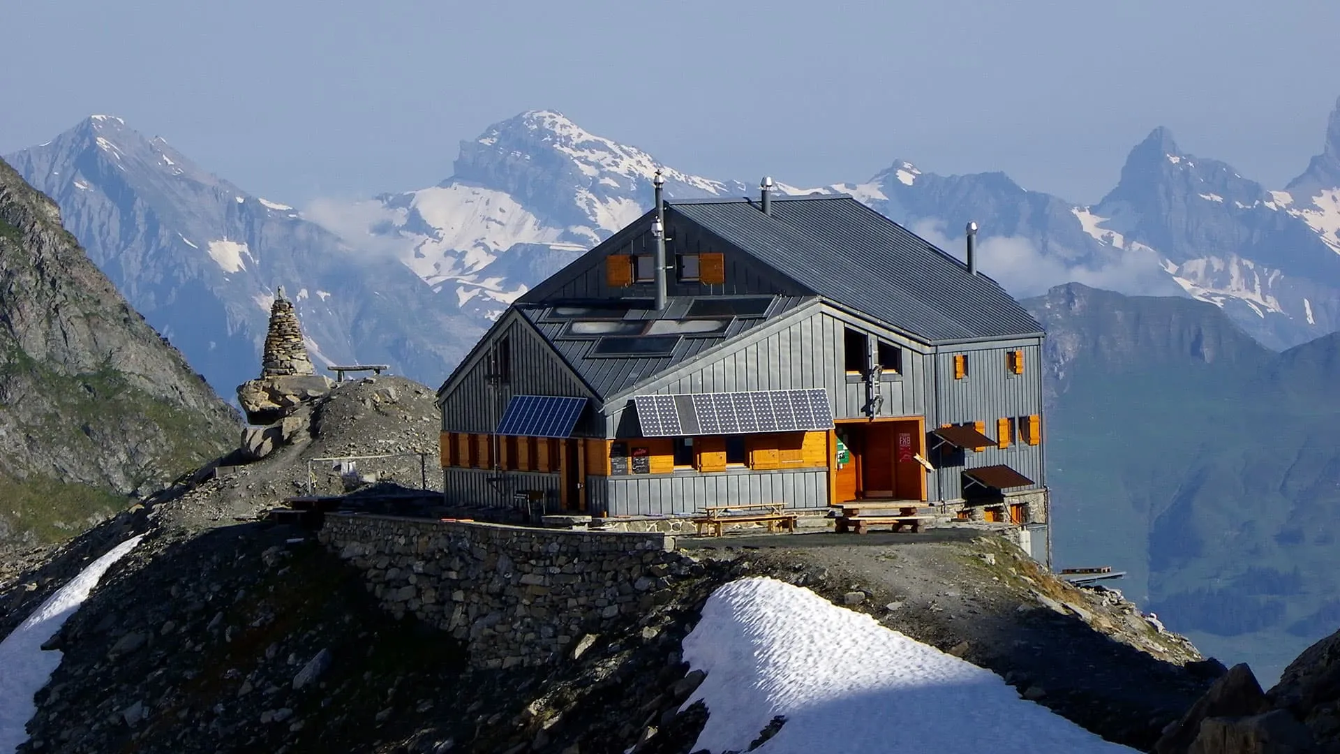
The final approach is the real highlight, crossing the famous suspension bridge above the glacier and its meltwater, with the icefall of Glacier de Corbassière and the surrounding peaks dominating the view. Beyond the bridge, a last climb brings you to Cabane FXB à Panossière, perched above the ice on a remarkable balcony. It is a brilliant place to end the day, with evening light catching the glacier and the high walls of the Grand Combin massif.

Cabane FXB à Panossière

Info
Cabane FXB à Panossière
Day
3

Cabane FXB à Panossière - Cabane de Chanrion

Duration: 07:55 h
Distance: 17.2 km
Ascent: 1060 m
Descent: 1240 m

From the high hut above the Corbassière Glacier you traverse into a wilder corner of the Val de Bagnes, trading creaking ice for turquoise reservoir and distant glaciers. The route links a rocky pass, a huge dam wall and a quiet climb to a solitary stone hut. Grand Combin at 4,314 metres slowly grows larger on the horizon, while the jagged ridge around Mont Blanc de Cheilon at 3,870 metres towers behind you.

From the hut a narrow path keeps high above the Corbassière Glacier, balcony views opening over broken ice and side peaks. The trail soon swings left and climbs more steeply across slabs and rubble toward the Col des Otanes (2,864 m) and the high point of the route. From the pass you begin a long descent of almost 1,000 metres into the Val de Bagnes, over stony tracks and grassy terraces, until the Mauvoisin dam and lake appear below.

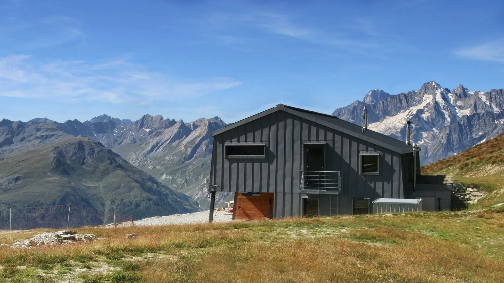
Crossing the dam, you follow an airy ledge path cut into cliffs above the turquoise water, sometimes ducking through short tunnels. Beyond the reservoir the valley widens into quieter pastures and side streams, with the Otemma Glacier pulling you onward at the head of the valley. A final steady climb leads through a hanging basin to the Cabane de Chanrion, perched on its rocky knoll, a snug lookout over ice and scree slopes.

Cabane de Chanrion

Info
Cabane de Chanrion
Cabane de Chanrion
Day
4

Cabane de Chanrion - Rifugio Letey-Champillon

Duration: 09:20 h
Distance: 22.6 km
Ascent: 1130 m
Descent: 1160 m

Leaving the rocky perch of Cabane de Chanrion, the route heads straight into a serious alpine world of moraines, pale stone and high passes. Peaks such as Mont Gelé (3,518 m) and the ridges around the Fenêtre de Durand (2,797 m), an alpine pass connecting Switzerland and Italy, frame the day from the first steps. It is a long mountain crossing with two major climbs, a remote middle section and a final descent into the greener pastures of the Comba di Champillon.

The trail first descends shortly to then climb steadily through glacial terrain towards the Fenêtre de Durand, with wild views back towards the Otemma side and the high peaks around the border ridge. From the pass, a long descent leads into stony basins and remote alpine slopes. The landscape keeps shifting between grey rock, grassy shelves and lonely streams, with that big-border-mountains feel all day long.

Beyond the second pass, the path finally drops into the softer world of the Comba di Champillon. Grass returns underfoot, the valley opens and the atmosphere turns warmer after so much stone and height. Rifugio Letey Champillon appears on the hillside above the basin, a welcoming place to end a demanding crossing. Once you arrive, you can let the day settle, refill your bottle and watch the evening light slide across the surrounding slopes.

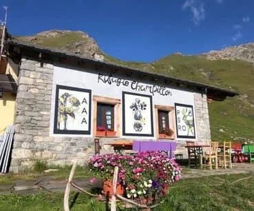
Rifugio Letey-Champillon

Info
Rifugio Letey-Champillon
Day
5

Rifugio Letey Champillon - Saint-Rhémy (Upper route)

Duration: 06:45 h
Distance: 17.5 km
Ascent: 470 m
Descent: 1500 m

Leaving the quiet slopes around the hut, the route first rises gently into the open alpine world of the Comba di Champillon. It is the last big high-mountain moment before the valley pulls you down for good. Behind you, the Grand Combin massif keeps dominating the skyline, while ahead the land slowly softens from grass and stone into larch forest and scattered hamlets. By the end, you swap remote mountain silence for the lived-in feel of the upper Great St Bernard valley.

The trail then climbs briefly to its final high point above the basin: the Col de Champillon. Here, wide views open up towards the snow-capped Alps and the broad shoulder of Mont Saron (2,681 m). From there, a long descent begins across grassy slopes and old mountain tracks, then drops into denser forest on a series of bends. Lower down, the route passes clearings, streams and quiet rural corners near Saint-Oyen, with the valley road and rooftops gradually drawing closer. It is mostly downhill, but the scenery keeps changing all the way.

As you approach Saint-Rhémy, the path eases into lanes and village tracks between stone houses and small fields. The mountains still tower above, but the mood is warmer now, more valley than wilderness. Pension Maison Farinet makes a cosy place to end the day, right in the heart of the village. Once you arrive, you can take off your boots, settle in and enjoy one last evening under the high peaks.

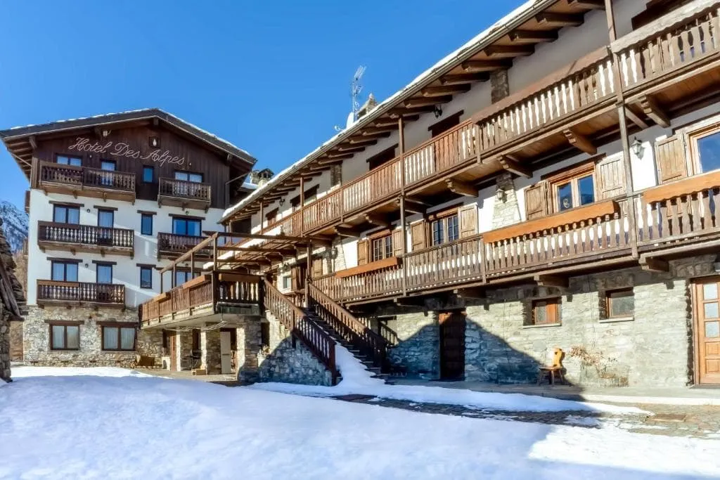
Hotel des Alpes (Saint-Rhémy)

Info
Hotel des Alpes (Saint-Rhémy)
Day
6

Saint-Rhémy - Bourg-Saint-Pierre

Duration: 07:40 h
Distance: 20.9 km
Ascent: 1190 m
Descent: 960 m

Leaving the stone houses of Saint-Rhémy behind, the route steadily climbs towards the Great St Bernard Pass (2,469 m), one of the great historic crossings of the Alps. Pastures and old tracks soon give way to a more austere mountain landscape, with the broad saddle ahead and high peaks towering above on both sides. It is a day of one long ascent followed by a gentler descent, with the atmosphere shifting from remote valley quiet to the storied pass and then down into Switzerland.

The trail rises gradually above the upper valley, passing open slopes and old mountain buildings as the views widen behind you. Higher up, the path becomes stonier and more alpine on the approach to the Col du Grand-Saint-Bernard, where the famous pass, lake and hospice create a memorable high point. From there, the route crosses the broad pass area and begins descending on easier ground, with the mountains opening towards the valley of Bourg-Saint-Pierre.

Lower down, the landscape softens into pasture, tracks and scattered buildings as you approach Bourg-Saint-Pierre. The village appears tucked into the valley floor, surrounded by steep slopes and old stone architecture that fit perfectly with the long history of this crossing. Once you arrive at your accommodation, it is a fine moment to rest, enjoy the change of country and look back towards the pass you have just crossed.

Contact our Trekking Expert
Sanne Bakema
Sanne Bakema
Sanne Bakema

Included

  • Booking the huts

    We will take care of arranging accommodation on the Tour des Combins for you. We will also provide you with a detailed itinerary for every stage and instructions on how to get to the trailhead.

  • Full travel guide

    You’ll receive access to our trekking app, which serves as your complete digital travel guide for the Tour des Combins. Inside, you’ll find everything you need for your trek: route descriptions, hiking maps, navigation support, payment information, and all the key details specific to your journey.

  • Accommodation

    During your Tour des Combins, you will spend your nights in mountain huts. We normally book dormitories, but private rooms are available upon request and cost €75 extra per room per night. If no private rooms are available, we will automatically book a bed in a dormitory.

  • Half-board in Huts

    Accommodation at the huts includes dinner and breakfast. We will arrange this for you as well. This allows you to travel lighter and have one less thing to worry about. Bear in mind that lunch is not included, but it can be purchased at the huts. Here you can also buy an array of snacks and bottled water.

  • Breakfast in Hotels

    In the Hotels, we include Breakfast for you. Bear in mind that lunch and dinner are not included, but they can be most of the time purchased in or near the hotels.

  • Navigation support

    Our trekking app also includes built-in navigation support. With GPS-based maps and offline access, you can follow the trail confidently and stay on route even without mobile signal.

Excluded

  • Traveling to and from

    You have to make your own way to the starting point. The total amount does not include personal transport.

  • Transfers

    Should you need any form of (public) transport on location, this is not part of the trekking package. This includes the use of taxi, bus, cable cars, gondolas, ferries, etc.

  • Lunch

    Half-board is included in the price of this trek. Lunch, however, is not. Many huts offer packed lunches, which can usually be requested the night before. Alternatively, you can stop for lunch at mountain huts along the way.

  • Travel Insurance

    Your international travel insurance is your own responsibility. Discuss your itinerary with the insurance company before your trek.

  • Personal expenses

    Personal expenses on such as souvenirs, drinks, and other similar expenses are for your own account.

FAQ

  • Is the Tour Des Combins Suitable for Me?

  • What Is the Best Season for the Tour Des Combins?

  • Getting to and from Bourg-Saint-Pierre

  • What if the dates I want are not available?

  • If I book now, can I immediately arrange the rest of my trip?

  • How do I know if this trek is right for me?

  • Can meals be adapted to my dietary requirements?

How to Book

  • Booking

  • Availability

  • Cancellation policy