

Express Liechtensteiner Panoramaweg

  • Duration
    Total 3 days
    Average 5 h 38m
  • Distance
    Total 39 km
    Average 13 km
  • Ascent
    Total +2930 m
    Average +977 m
  • Descent
    Total -2110 m
    Average -703 m

> Climb the Drei Schwestern, the signature peaks of Liechtenstein
> Walk the legendary Fürstensteig and sleep on the Austrian border
> Dive into a bit of Liechtenstein history around Triesenberg

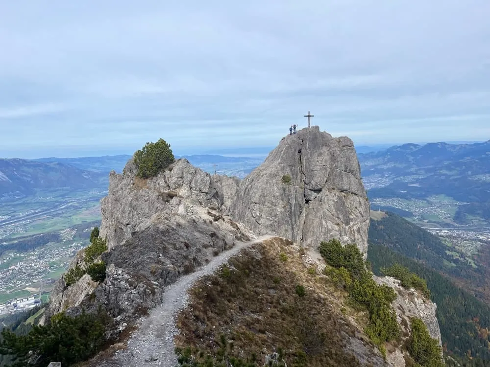
You pull yourself up the last ladder and there they are: three grey limestone towers, the Drei Schwestern, with the Rhine Valley a long way below. Up here the rock is bare and pale, almost moon-like, while the towns of Liechtenstein lie scattered in the green far beneath your boots. Coffee in Planken this morning, standing on top of the country now. Not bad for day one.

This three-day trek takes the best part of the Liechtensteiner Panoramaweg and skips the warm-up. From Planken you go straight over the Drei Schwestern and along the Fürstensteig to the Walser village of Triesenberg, where you sleep in a hotel. Day two climbs past Steg and through the Valüna Valley to the Pfälzerhütte, right on the Austrian border. On the last morning the grey peaks make way for wide green pastures as you walk down to Malbun.

This tour includes the most challenging sections of the Panoramaweg, so it is for experienced hikers only. Day one is long: 18.8 kilometres with 1,410 metres up and 1,320 metres down, with cables, ladders and scrambling on the Drei Schwestern and T4 terrain on the Fürstensteig. You need sure feet and a head for heights; specialist gear is not required. In just three days, you hike across almost the entire length of one of the smallest countries in Europe. We book the huts, you walk. Deal?

Itinerary

Day
1

Planken - Triesenberg

Duration: 08:55 h
Distance: 18.8 km
Ascent: 1410 m
Descent: 1320 m
Lowest Point: 790 m
Highest Point: 2070 m

This is the big one. From Planken you climb more than 1,200 metres straight up to the Drei Schwestern, the jagged grey limestone towers that are the signature of the whole Panoramaweg, before following the ridge to the legendary Fürstensteig. Cables, ladders, wooden steps and some hands-on scrambling make this a day for experienced hikers with sure feet and a head for heights. The Fürstensteig itself is T4 terrain.

From the Planken Saroja bus stop the trail follows the Nendler Bach into the forest and soon starts climbing in earnest. Higher up you pass a rock window that frames the Drei Schwestern, then wooden steps, ladders and cable-secured sections lead to the summit area at just over 2,000 metres. The views are huge: Garsellikopf and Kuegrat right next to you, the Rhine Valley and the towns of Liechtenstein far below. Along the ridge you continue south to the Fürstensteig, a narrow path cut into the cliffs with cables for support, and descend towards Gaflei.

Running low on energy or time? At the Gaflei Klinik bus stop you can take the bus to Triesenberg Dorfzentrum. It saves you about 620 metres of descent and roughly 2 hours; check the times on the LIEmobil website. Otherwise the trail drops through forest and meadows to Triesenberg, the old Walser village where your hotel is waiting. About 18.8 kilometres, 1,410 metres up and 1,320 metres down: count on a long 9 hours.

Hotel Restaurant Kulm (Triesenberg)

Info
Hotel Restaurant Kulm (Triesenberg)
Day
2

Triesenberg - Pfälzerhütte

Duration: 05:15 h
Distance: 13.9 km
Ascent: 1280 m
Descent: 60 m

Today is all about going up. Between Triesenberg and the Pfälzerhütte you gain about 1,280 metres and lose barely 60, so almost every step of the day is a climb. It comes in three main pushes, with easier stretches on village lanes and gravel roads in between, but your legs will feel it by the time the hut appears on the border ridge. Views over the Rhine Valley and the high ridges keep you nicely distracted.

Right after leaving the hotel you follow sections of the Walser Sagenweg, the Walser Legends Trail. Keep your eyes open for the carved wooden sculptures along the path: each one tells a Walser legend, myth or tale. The Walser were mountain farmers from the Valais who left their homeland in the 12th and 13th centuries and settled on these slopes. Higher up you reach the Old Tunnel, only 48 metres long but a real landmark: dug in 1867, it was the very first road connection to Steg. Just beyond it lies the Sücka mountain inn, a nice spot for a break if it happens to be open.

The trail then runs above Steg, with views down to the reservoir and the small Gänglesee, before turning south into the Valüna Valley, where the climb gets serious. You follow the valley past the Valüna alp pastures and the Valüna-Waldboden hut, then head up into the Naaf Valley. The final climb crosses wide alpine pastures, with views toward Hochspeler at 2,226 metres and Plasteikopf at 2,345 metres. The Pfälzerhütte sits at 2,108 metres right on the Austrian border. The hut is frequently used by hikers who want to summit the Naafkopf, which is only about 1.5 hours away.

Pfälzerhütte

Info
Pfälzerhütte
Pfälzerhütte
Day
3

Pfälzerhütte - Malbun

Duration: 02:45 h
Distance: 6.3 km
Ascent: 240 m
Descent: 730 m

A short final day that saves some of its best views for the first hour. From the hut you climb about 240 metres onto the ridge, and from there it is mostly downhill: around 730 metres of descent to Malbun. About 6.3 kilometres, count on 2 hours 45, so there is no need to rush.

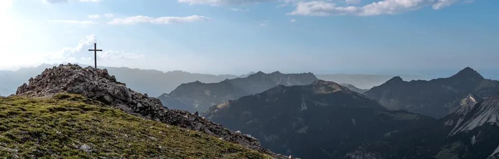
The route follows the Fürstin-Gina-Weg, a ridge trail named after Princess Gina of Liechtenstein. Soon after leaving the hut you reach the summit cross of the Augstenberg at 2,365 metres, the highest point of the day. From here the path runs along a green ridge with open views on both sides: Malbun on your left, and on your right the Nenzinger Himmel, a high alpine valley across the border in Austria.

Today the landscape stays green all the way. A second summit cross waits at the Sareiserjoch, and even up there grassy slopes surround you. From there you descend through rolling meadows and green hills towards Malbun, a small alpine village surrounded by green slopes and peaks. The trail ends at the bus stop in the village. Take a moment to look back up at the ridge before you head home or travel on.

Contact our Trekking Expert
Daphne Hendriks
Daphne Hendriks
Daphne Hendriks

Included

  • Full travel guide

    You’ll receive access to our trekking app, which serves as your complete digital travel guide for the Liechtensteiner Panoramaweg. Inside, you’ll find everything you need for your trek: route descriptions, hiking maps, navigation support, payment information, and all the key details specific to your journey.

  • Accommodation

    During your Liechtensteiner Panoramaweg, you will spend your nights in mountain huts. We normally book dormitories, but private rooms are available upon request and cost €75 extra per room per night. If no private rooms are available, we will automatically book a bed in a dormitory.

  • Half-board in Huts

    Accommodation at the huts includes dinner and breakfast. We will arrange this for you as well. This allows you to travel lighter and have one less thing to worry about. Bear in mind that lunch is not included, but it can be purchased at the huts. Here you can also buy an array of snacks and bottled water.

  • Breakfast in Hotels

    In the Hotels, we include Breakfast for you. Bear in mind that lunch and dinner are not included, but they can be most of the time purchased in or near the hotels.

  • Navigation support

    Our trekking app also includes built-in navigation support. With GPS-based maps and offline access, you can follow the trail confidently and stay on route even without mobile signal.

Excluded

  • Traveling to and from

    You have to make your own way to the starting point. The total amount does not include personal transport.

  • Transfers

    Should you need any form of (public) transport on location, this is not part of the trekking package. This includes the use of taxi, bus, cable cars, gondolas, ferries, etc.

  • Lunch

    Half-board is included in the price of this trek. Lunch, however, is not. Many huts offer packed lunches, which can usually be requested the night before. Alternatively, you can stop for lunch at mountain huts along the way.

  • Travel Insurance

    Your international travel insurance is your own responsibility. Discuss your itinerary with the insurance company before your trek.

  • Personal expenses

    Personal expenses on such as souvenirs, drinks, and other similar expenses are for your own account.

  • Tourist tax

    We pay tourist taxes in advance whenever possible. If an accommodation does not allow this, you will need to pay on-site. Most accommodations require cash, so make sure to bring some with you.

FAQ

  • How to Get To the Starting Point of the Express Liechtensteiner Panoramaweg

  • How to Get Back From Malbun

  • What if the dates I want are not available?

  • If I book now, can I immediately arrange the rest of my trip?

  • How do I know if this trek is right for me?

  • Can meals be adapted to my dietary requirements?

How to Book

  • Booking

  • Availability

  • Cancellation policy