Full Rothaarsteig Trek

  • Duration
    Total 10 days
    Average 5h 54min
  • Distance
    Total 164.7 km
    Average 20.6 km
  • Ascent
    Total +3510 m
    Average +439 m
  • Descent
    Total -3720 m
    Average -465 m
> From Brijon to Dillenburg
> The entire Rothaarsteig through the Sauerland
> Staying in pleasant Gasthofen and hotels.

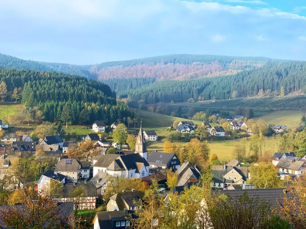
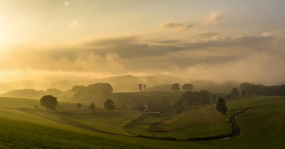
The Rothaarsteig in the Sauerland is one of Germany's top hiking trails. Less than a four-hour drive from Utrecht and combinable with a weekend in Winterberg, it is also a popular route with Dutch hikers. If you want to go hiking in Sauerland or in Winterberg, then sooner or later you come on the trail of the Rothaarsteig.

During this 10-day hiking vacation you will hike the entire Rothaarsteig and experience the Rothaar Mountains from north to south. During your hiking adventure, your stay in charming and comfortable accommodations is fully arranged, allowing you to enjoy it without any worries. All you need to do is focus on the beauty of the Sauerland!

Itinerary

Day
1

Arrival Day

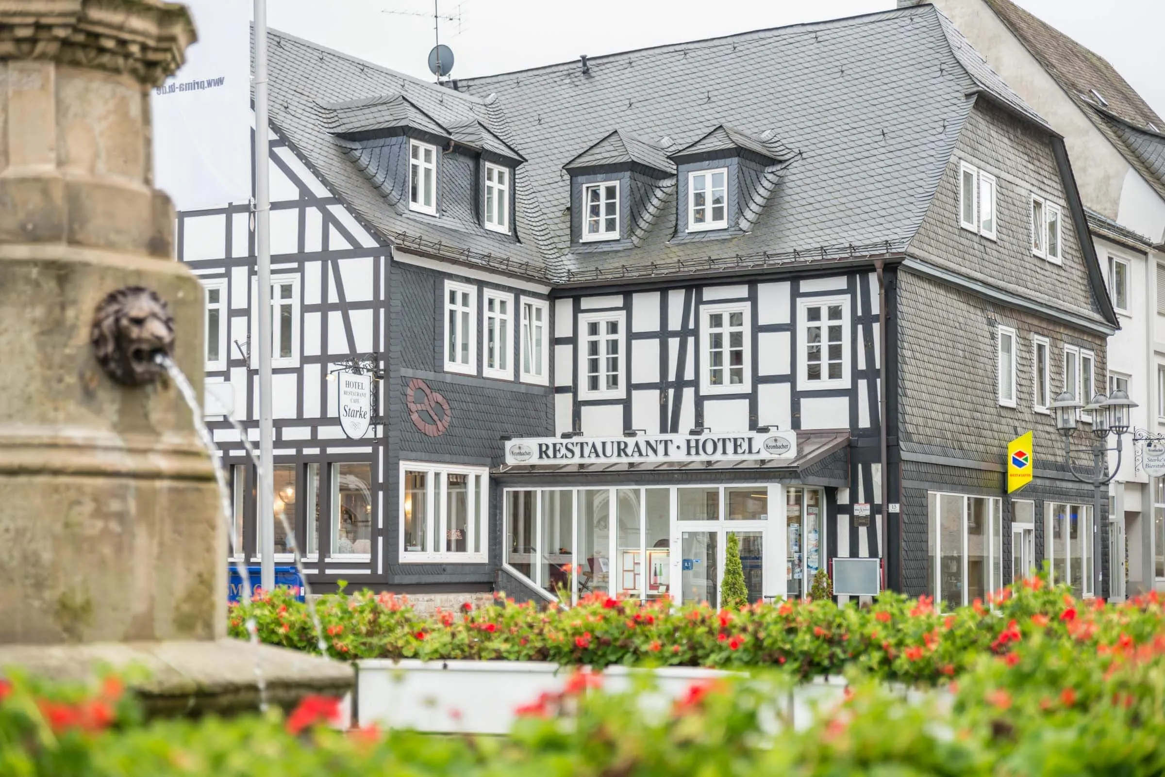
Today, your Rothaarsteig adventure begins in Brilon. After arriving, you may have some time to explore the town, a pleasant place to start the trip, with a historic center and enough options for a relaxed break before the hiking begins.

Hotel Starke (Brilon)

Info
Hotel Starke (Brilon)
Day
2

Brilon - Willingen

Duration: 07:40 h
Distance: 25.2 km
Ascent: 720 m
Descent: 600 m

This is a long opening stage from Brilon to Willingen, covering 25.2 km with 720 m of ascent. The route stays mostly in the wooded hills of the Sauerland, with a rolling profile that keeps changing throughout the day. The distance is the main challenge, together with repeated climbs and descents rather than one single long ascent. Expect forest tracks, quiet hillside paths, open viewpoints and a final approach into Willingen after a full day on the trail.

From Brilon, the route heads out through Gudenhagen and climbs into the hills south of town. Along the way, you pass viewpoints such as View of Brilon, View of Hochsauerland and the Beech Forest in Naturpark Sauerland. Further on, the trail passes near Bornstein and Hoher Eimberg at 806 m before continuing towards the Willingen area. The last section leads past viewpoints over Willingen and the Willingen Viaduct before descending into town.

The stage finishes in Willingen after a long crossing through the Sauerland hills. You arrive with the biggest distance of the day behind you and plenty of options nearby to rest, eat and settle in after the first stage of the Rothaarsteig.

Aparthotel Jägerhaus (Willingen)

Info
Aparthotel Jägerhaus (Willingen)
Day
3

Willingen - Winterberg

Duration: 06:50 h
Distance: 23.8 km
Ascent: 590 m
Descent: 500 m

Today you start in Willingen and continue to Winterberg, covering 23.8 km with 590 m of ascent. The route begins with a clear climb out of Willingen towards the higher ground around Langenberg Summit at 843 m, before settling into a long rolling section across the Sauerland hills. It is a demanding walking day mainly because of the distance, with repeated smaller climbs and descents rather than one single sustained ascent.

From Willingen, the trail climbs towards the area around Langenberg Summit and continues past the Hochheide Nature Reserve Neuer Hagen. This early high section gives the stage a strong mountain-forest feel, with open heathland and broad views before the route gradually descends towards Grönebach and Elkeringhausen. Further on, the trail passes Hillebach Bridge and St. Bonifatius Cross on the Asten Trail, then continues through forest and rolling terrain towards Winterberg.

The stage finishes in Winterberg after a long crossing through the Sauerland. You arrive with the main distance behind you and plenty of options nearby to rest, eat and settle in before continuing on the next section of the Rothaarsteig.

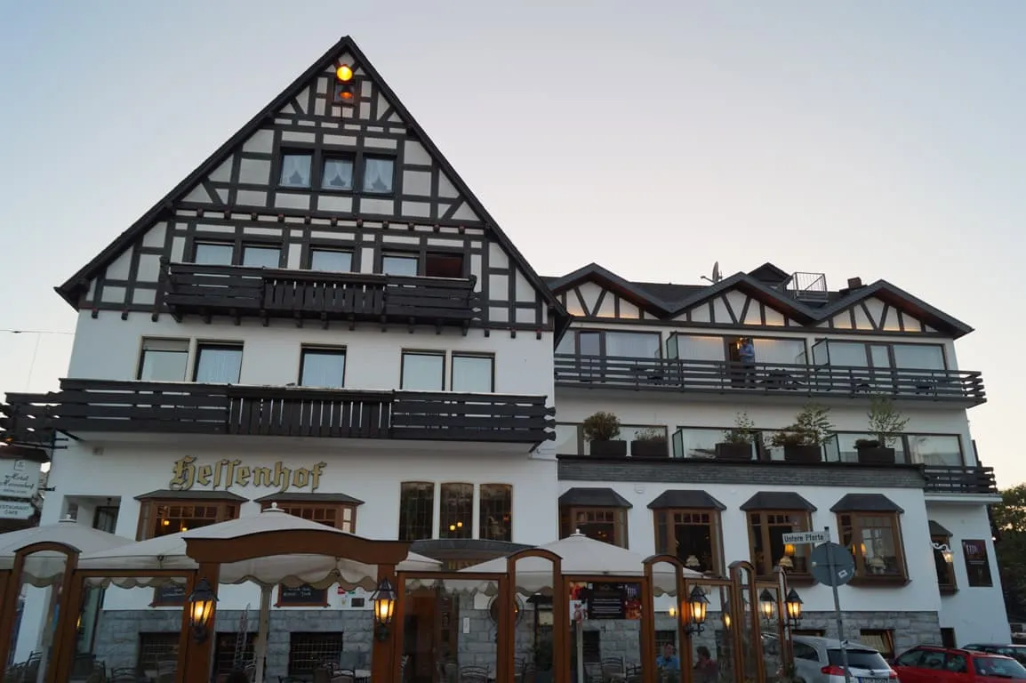
Hotel Hessenhof (Winterberg)

Info
Hotel Hessenhof (Winterberg)
Day
4

Winterberg - Schanze

Duration: 05:10 h
Distance: 18.5 km
Ascent: 370 m
Descent: 330 m

This stage leads from Winterberg to Schanze across the wooded high ground of the Sauerland. The profile is mostly rolling, with a steady climb early on, a longer middle section over higher terrain and a gentle finish towards the end. It is a varied walking day with forest tracks, open ridge sections, viewpoints and small trail highlights along the Rothaarsteig. The terrain changes often enough to keep the route interesting without one single major climb dominating the stage.

From Winterberg, the route heads out past Kreuzberg Chapel and the viewpoint over the Siebentälerweg before reaching the forested slopes outside town. The trail continues towards the Renau Valley bridge trail and viewpoints around Astenkick, with the Swedish Hut nearby. Further on, you pass the Rothaarsteig Kahler Asten Stein and views from Hoher Knochen, then continue through quieter woodland past rest areas, Opfesteine in Höller Grab and Höhlever Hut.

The final section follows forest paths towards Schanze, passing the Grenzweg historic sign and the start of the Kyrill Trail near the end. You arrive in the village after a steady day through the Sauerland hills. If your accommodation is in Schmallenberg, you can continue on foot via alternative routes, usean on demand transfer service, or arrange a taxi.

Hotel Stoffels (Schmallenberg)

Info
Hotel Stoffels (Schmallenberg)
Day
5

Schanze - Rhein-Weser Tower (through the valley)

Duration: 06:45 h
Distance: 23.4 km
Ascent: 500 m
Descent: 530 m

A long stage from Schanze to Rhein-Weser-Turm awaits, covering 23.4 km through the wooded Sauerland hills. The profile begins with a gradual descent, then settles into a rolling middle section with repeated smaller climbs and dips. This valley route stays mostly on forest paths and quiet tracks, with several viewpoints and nature highlights along the way. Because the distance is the main challenge, keep a steady pace and use the flatter sections to recover.

From Schanze, the route starts near the Kyrill Trail and heads past Klobmanns Rücken before continuing through forest towards viewpoints over the Sauerland Forest. The trail then drops towards Latrop Village and follows the valley area, with views of the Latrop Valley and forest paths through Naturpark Sauerland. Further on, the route passes around Schneidersberg and continues past viewpoints from the Rothaarsteig, Sonborn Spring and views towards Kahlenberg and the Milchenbach Valley.

The final kilometres continue through quiet forest terrain towards Rhein-Weser-Turm. After a long day on rolling paths, the finish gives you a clear place to stop, rest and take a break after the valley route from Schanze.

Zur Hahnenquelle (Rhein-Weser-Turm)

Info
Zur Hahnenquelle (Rhein-Weser-Turm)
Day
6

Rein-Weser Tower - Lützel

Duration: 04:35 h
Distance: 16.3 km
Ascent: 290 m
Descent: 350 m

This stage leads from Rhein-Weser-Turm to a point not far from Lützel, crossing a quieter section of the Rothaargebirge. The route is shorter than before, with a gentle rolling profile and most of the walking on forest tracks and calm woodland paths. The day starts with a gradual descent, then settles into smaller climbs and dips through broad forest. It is a steady stage, with enough variation to keep the walking interesting without feeling too heavy.

From Rhein-Weser-Turm, the trail heads south through continuous forest and passes near Heinsberg Heath and the Krenkel Valley Aqueduct. Further on, you walk close to the Zinsebach Valley Nature Reserve, with viewpoints towards the Siegerland and the surrounding Sauerland hills nearby. The route continues through quiet woodland, rolling gently as it heads towards the area near Lützel, passing small clearings and forest junctions along the way.

The stage ends not far from Lützel, after a calm crossing through the Rothaargebirge. You arrive with a manageable forest stage behind you, in a good position to rest and prepare for the next section of the Rothaarsteig.

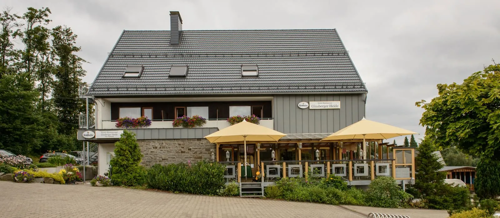
Ginsberger Heide (Lützel/Hilchenbach)

Info
Ginsberger Heide (Lützel/Hilchenbach)
Day
7

Lützel - Lahnhof

Duration: 04:35 h
Distance: 16.7 km
Ascent: 280 m
Descent: 290 m

From Lützel to Lahnhof you will be covering 16.7 km with 280 m of ascent and 290 m of descent. It is a moderate and steady section of the Rothaarsteig, with a gently rolling profile rather than any major climb. Most of the route follows quiet forest paths and broad woodland tracks through the Rothaargebirge. Expect a calm walking day with spring areas, wooded valleys and small clearings along the way.

From Lützel, the route heads into the forest and soon passes the Eder Headwaters before following the Ederbach Valley Trail. You continue through quiet woodland towards the area around Hohenroth Forester’s Lodge, with viewpoints towards the Obernau Reservoir visible nearby on the map. Further on, the trail reaches Sieg Spring, one of the main highlights of the stage, before continuing south through rolling forest terrain and passing near the Charcoal Kiln at Naturpark Sauerland.

The stage finishes in Lahnhof after a calm walk through forests, springs and gentle hills. You arrive with a manageable distance behind you, making this a good place to rest, settle in and prepare for the next section of the Rothaarsteig.

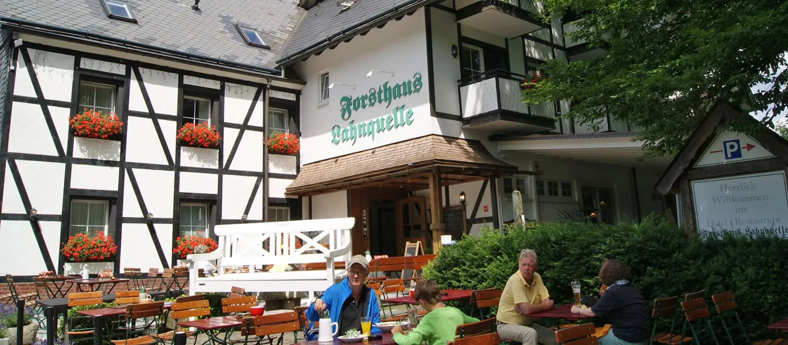
Forsthaus Lahnquelle (Lahnhof)

Info
Forsthaus Lahnquelle (Lahnhof)
Day
8

Lahnhof - Wilgersdorf

Duration: 05:35 h
Distance: 20 km
Ascent: 330 m
Descent: 470 m

This stage leads from Lahnhof to Wilgersdorf, covering 20 km with 330 m of ascent and 470 m of descent. The route follows a mostly rolling and gradually descending profile through the wooded hills between the Lahn-Dill area and the Siegerland. There are no major climbs, but the distance and repeated small height changes make it a full walking day. Expect quiet forest paths, springs, viewpoints and a long approach towards the lower ground near Wilgersdorf.

From Lahnhof, the trail starts near the highest point in the Lahn-Dill area and follows forested high ground before descending gradually. Along the way, you pass viewpoints such as Tiefenrother Höhe and continue near Bichelbach Spring and the Bettelbuche Parking Lot area. The route then keeps to calm woodland paths around Offdilln, with more views towards surrounding villages and hills before the final section leads closer to Wilgersdorf.

The stage finishes in Wilgersdorf after a long but steady route through forest and rolling terrain. You arrive with most of the descent behind you, making the village a practical place to rest, eat and settle in after the walk from Lahnhof.

Gästehaus Wilgersdorf (Wilgersdorf)

Info
Gästehaus Wilgersdorf (Wilgersdorf)
Day
9

Wilgersdorf - Dillenburg

Duration: 06:00 h
Distance: 20.8 km
Ascent: 430 m
Descent: 650 m

Covering 20.8 km with 430 m of ascent and 650 m of descent, you'll be hiking from Wilgersdorf to Dillenburg. The profile trends downhill overall, but there are several smaller climbs along the way, so it remains a full walking day. The route moves through wooded hills, quiet valleys and village edges, gradually leaving the higher Sauerland terrain behind and heading towards the lower Lahn-Dill area.

From Wilgersdorf, the trail heads south through forested terrain and passes viewpoints near the start, including the viewpoint frame in Naturpark Sauerland-Rothaargebirge. The route then continues towards Rodenbach, with views over the Roßbach Valley and a pond on the Haigerseelbach hiking route nearby. Further on, you pass quiet woodland paths above Sechshelden and approach the area around Kanzelstein Nature Reserve before the final descent towards Dillenburg.

The stage finishes in Dillenburg after a long route with more descent than climbing. You arrive in town with the forested hills behind you, making this a practical place to rest, eat and settle in after the walk from Wilgersdorf.

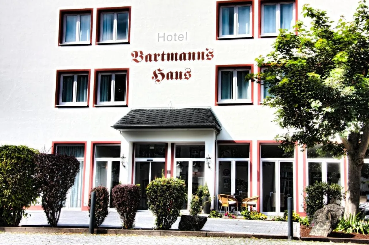
Hotel Bartmanns Haus (Dillenburg)

Info
Hotel Bartmanns Haus (Dillenburg)
Day
10

Departure day

Today, your Rothaarsteig adventure comes to an end in Dillenburg. Before leaving, you may have some time to explore the town, a pleasant place to end the trip, with enough options for a relaxed break before heading home.

Contact our Trekking Expert
Justa Atema
Justa Atema
Justa Atema

Included

  • Accommodation

    We will arrange your accommodation on the Rothaarsteig in hotels, inns, and guesthouses. Accommodation will be private in single, double or twin rooms and with en-suite bathroom where possible.

  • Full travel guide

    You’ll receive access to our trekking app, which serves as your complete digital travel guide for the Rothaarsteig. Inside, you’ll find everything you need for your trek: route descriptions, hiking maps, navigation support, payment information, and all the key details specific to your journey.

  • Navigation support

    Our trekking app also includes built-in navigation support. With GPS-based maps and offline access, you can follow the trail confidently and stay on route even without mobile signal.

  • Breakfast (when possible)

    We will arrange breakfast for you whenever possible. Some accommodations on the Rothaarsteig, however, do not allow us to pre-book it. In those cases, you can usually request breakfast for the next morning directly at the accommodation (at your own expense), or simply enjoy one of the cafés in the area.

Excluded

  • Traveling to and from

    You have to make your own way to the starting point. The total amount does not include personal transport. This also applies to any transport from the end point of your trail.

  • Transfers

    If you require any form of public or local transport during the trek, it is not included in the package unless stated otherwise. This applies to taxis, buses, cable cars, gondolas, and similar services.

  • Travel Insurance

    Your international travel insurance is your own responsibility. Discuss your itinerary with the insurance company before your trek.

  • Lunch and Dinner

    Breakfast is, if possible, included in the price of the trek. You can get lunch and dinner at the shops, hotels, and restaurants along the way.

FAQ

  • How to Get To the Starting Point of the Rothaarsteig?

  • How to Get From the Endpoint?

  • What if the dates I want are not available?

  • If I book now, can I immediately arrange the rest of my trip?

  • How do I know if this trek is right for me?

  • Can meals be adapted to my dietary requirements?

How to Book

  • Booking

  • Availability

  • Cancellation policy