

Medium Adlerweg from Innsbruck

  • Duration
    Total 7 days
    Average 5 h 56m
  • Distance
    Total 92.6 km / 57.6 mi
    Average 13.2 km / 8.2 mi
  • Ascent
    Total +4450 m / +14599 ft
    Average +636 m / +2086 ft
  • Descent
    Total -4290 m / -14076 ft
    Average -613 m / -2011 ft

> Start directly in Innsbruck
> Spend your nights in mountain huts
> The most beautiful stages of the Adlerweg

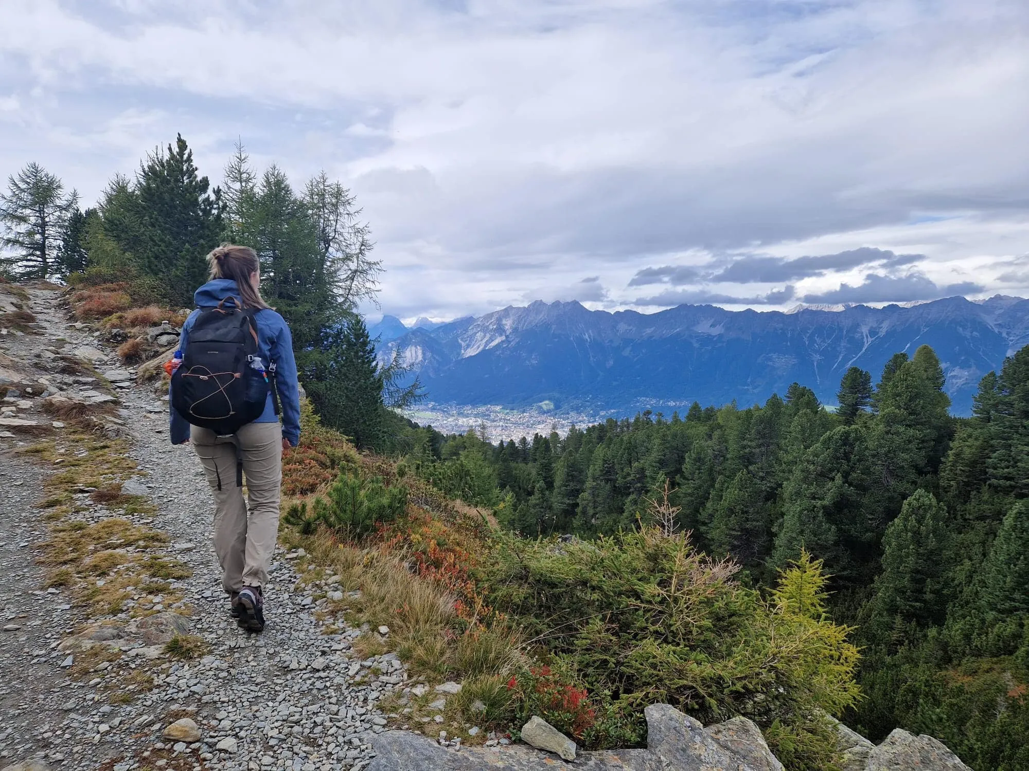
The Eagle Walk, known in German as the Adlerweg, is one of the most famous treks in Tyrol, Austria. If seen from above, the Adlerweg map resembles the silhouette of an eagle hovering in the air with its wings spread wide open, therefore its name. This famous hike runs from east to west through the whole of Tyrol and encompasses 33 stages and 413 kilometers.

One of the beauties of the Adlerweg is its versatility and variety. The trail guides you through several mountain ranges where you will discover valleys, lakes, rivers, ridges, and so much more! If you want to conquer this Austrian gem, you must know that the trail requires alpine experience, a firm foot, and a head for heights.

We have prepared this moderate, 7-day trek for those trekkers who have some trekking experience but would like to take it a little slower. Are you ready for the most beautiful stages of the Adlerweg?

Itinerary

Day
1

Innsbruck - Pfeishütte

Duration: 07:05 h
Distance: 10.7 km / 6.65 mi
Ascent: 1490 m / 4888 ft
Descent: 390 m / 1280 ft

Our hike starts in fabulous Innsbruck, at Bergstation Hungerburg. Here you have the option of bridging the first part of the hike with the Seegrubenbahn that leads all the way to Bergstation Seegrubenbahn. This tempting choice quickly saves over 900 altitude meters and keeps your legs fit for the remaining hours along the Mandlspitze to the Pfeishütte. Prefer not to take the Bergbahn? You can zigzag from Bergstation Hungerburg via the Taubental to the Goetheweg, which connects to the Adlerweg. If you want to take it easy on the first day, you can also take the Hafelekarbahn from the Seegrubenbahn to start the stage right at the top of Innsbruck.

No matter which route you choose, be ready for a demanding day in the mountains – the climbs and descents can be steep, and the terrain is rocky and rugged.

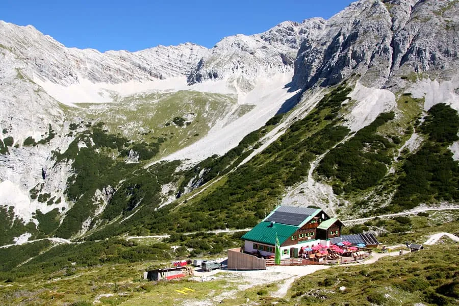
Pfeishütte

Info
Pfeishütte
Pfeishütte
Day
2

Pfeishütte - Hallerangerhaus

Duration: 05:45 h
Distance: 9.5 km / 5.9 mi
Ascent: 710 m / 2329 ft
Descent: 860 m / 2822 ft

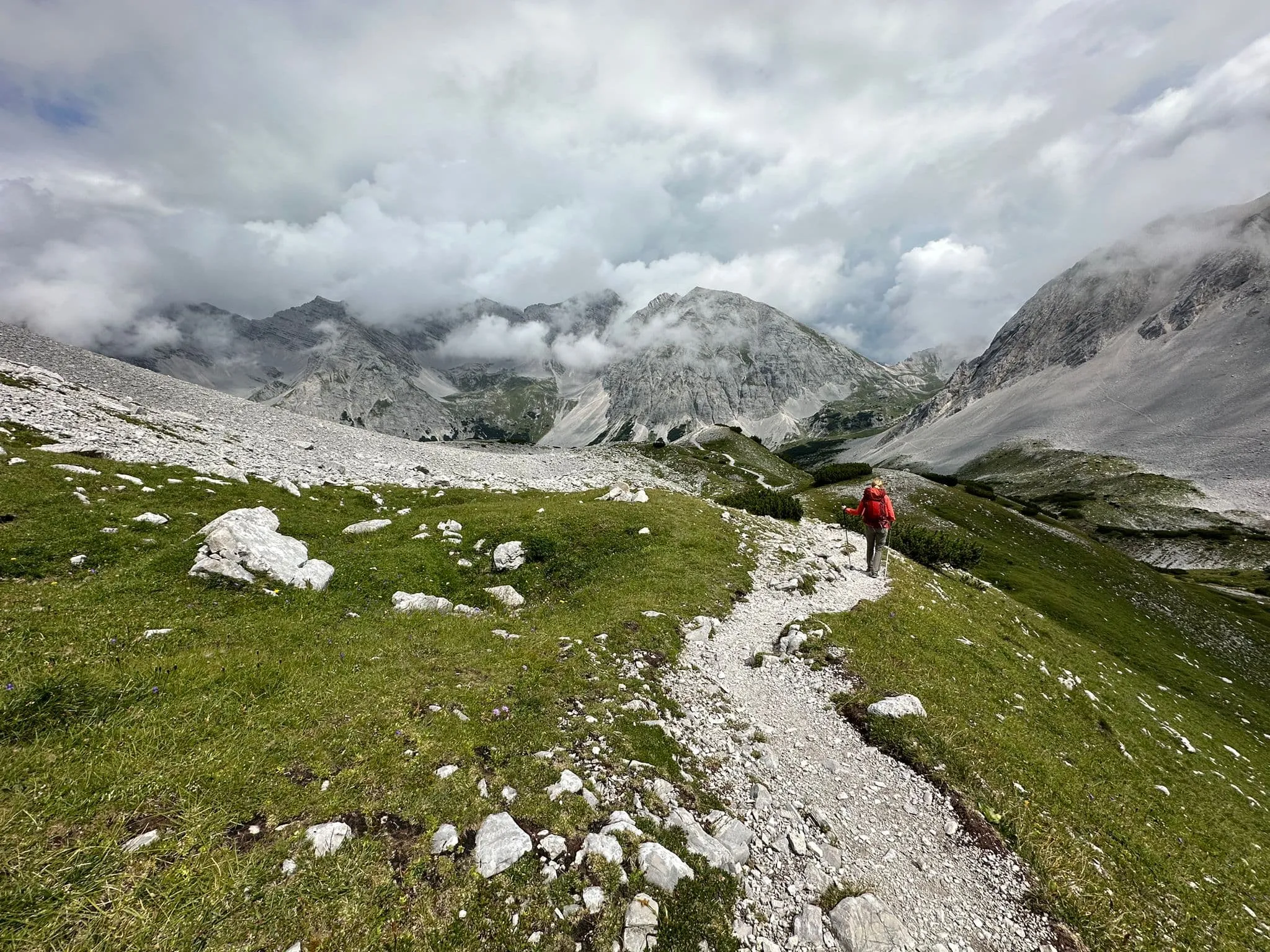
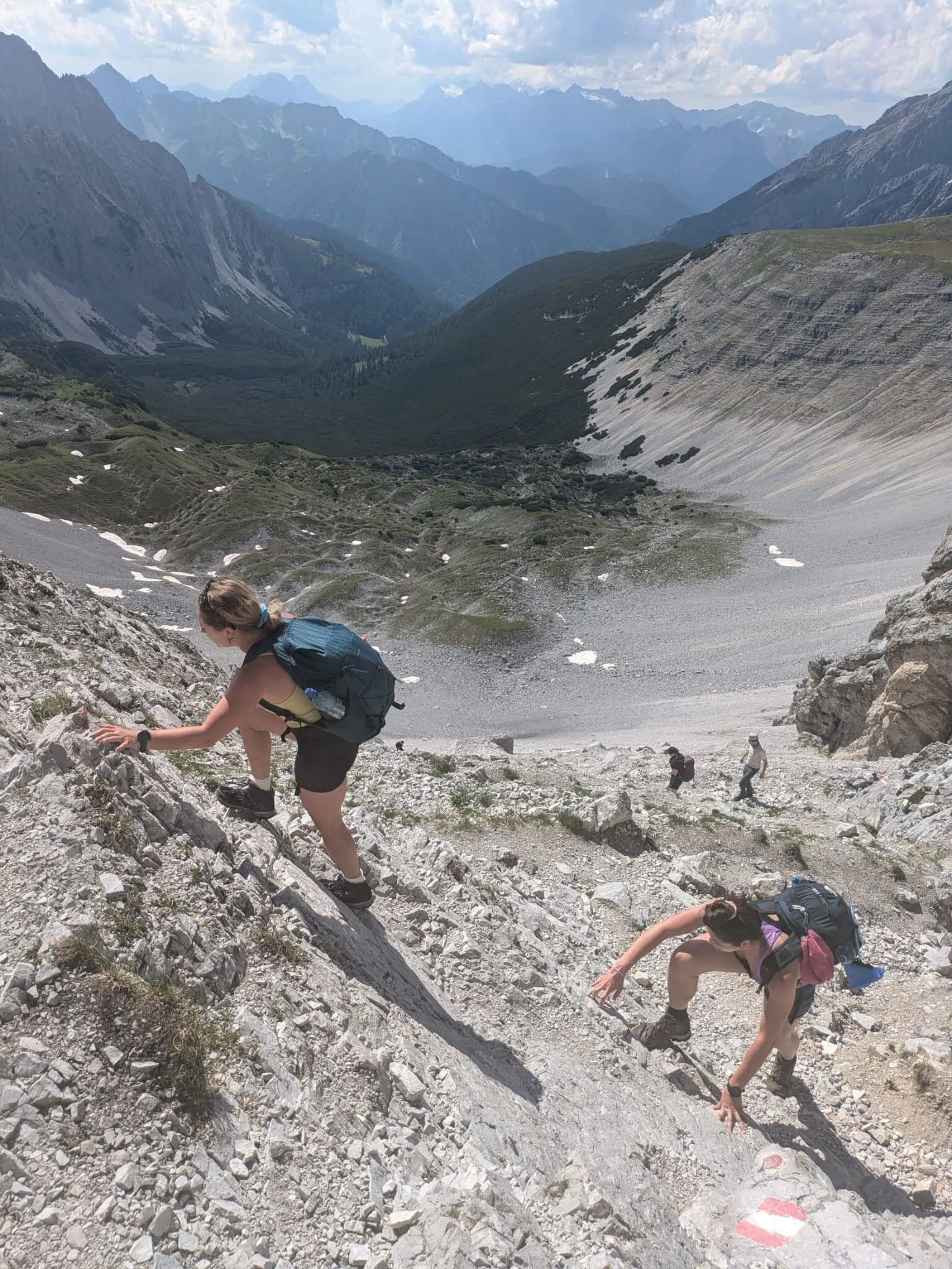
This is the most demanding day of the trek, and not because of the numbers. From the Pfeishütte you climb to the Stempeljoch, and on the other side waits a very steep descent on loose scree and rock, with drops beside the path and no cables or ropes to hold on to. In places you will use your hands for balance. You need sure feet, good descending technique and a head for heights. If you have a fear of heights, this day, and therefore this trek, is not for you.

Below the Stempeljoch the path eases and you choose between two routes to the Hallerangerhaus. The standard route continues through the Isstal and is the longer option. The shorter route follows the Wilde-Bande-Steig, with less ascent and descent, but do not mistake shorter for easier: it is a T3 mountain path over rocky terrain. Both routes meet again near Kahlstatt and continue through the Durchschlag.

Hallerangerhaus

Info
Hallerangerhaus
Hallerangerhaus
Day
3

Hallerangerhaus - Scharnitz

Duration: 06:15 h
Distance: 18.7 km / 11.62 mi
Ascent: 30 m / 98 ft
Descent: 840 m / 2756 ft
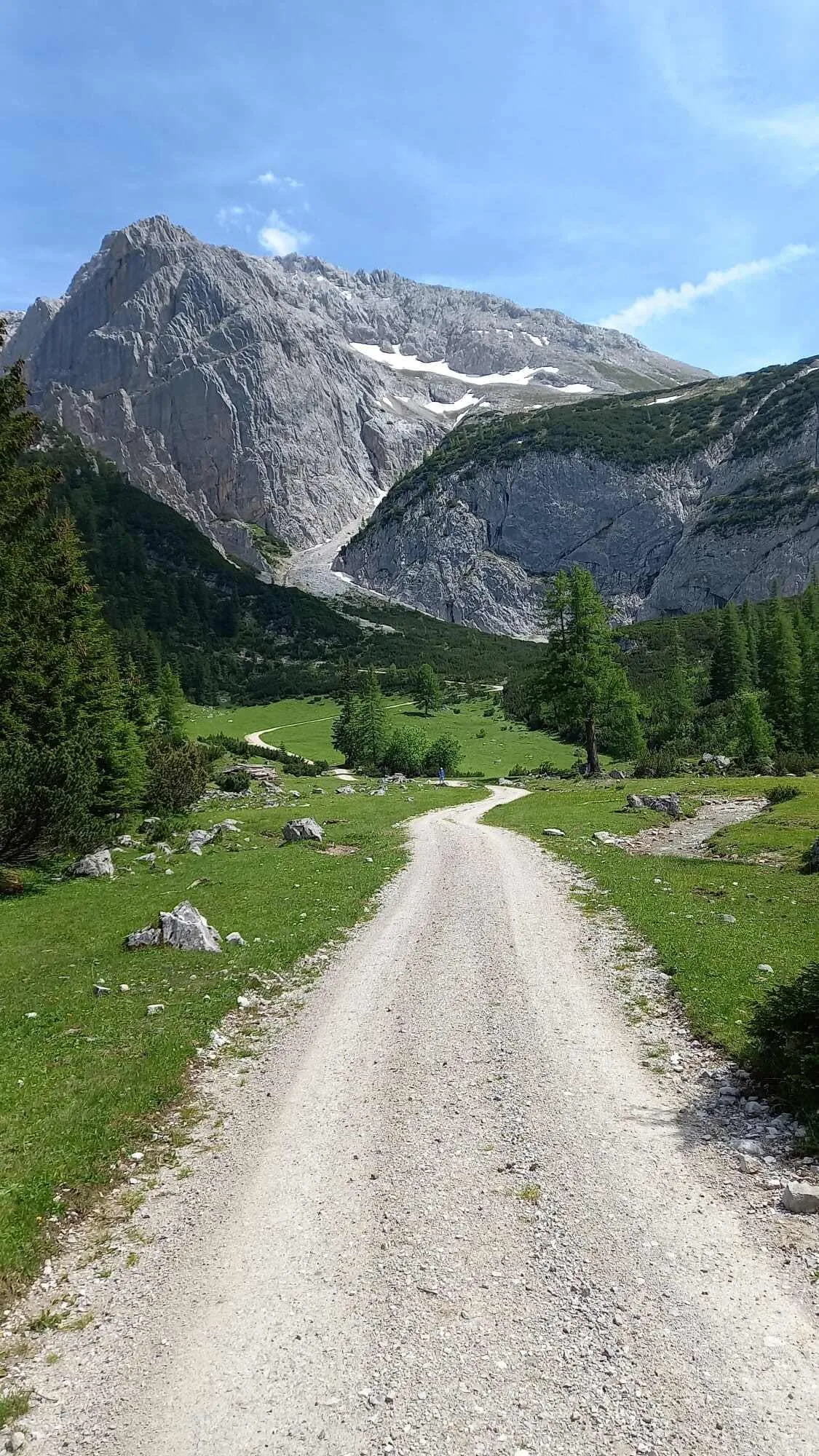
Today's route is only downhill. After a good breakfast, you hike for about an hour on a wide trail out of the valley toward the Kastenalm. From the Kastenalm, it's an easy hike with a brisk descent to Scharnitz.

Gasthof Goldener Adler (Scharnitz)

Info
Gasthof Goldener Adler (Scharnitz)
Day
4

Scharnitz - Karwendelhaus

Duration: 06:00 h
Distance: 15.7 km / 9.76 mi
Ascent: 840 m / 2756 ft
Descent: 20 m / 66 ft
After an overnight stay in cosy Scharnitz, today it's time to hike up to the Karwendelhaus. You start this day with a gradual ascent, before heading back into the mountains. After around 9 kilometres you'll pass a small waterfall and then arrive at a beautiful viewpoint. This is always a good moment for a break, and of course some photos. After this you only have a few kilometres to go before you arrive at the Karwendelhaus, where a well-earned cold beer awaits you.

Karwendelhaus

Info
Karwendelhaus
Karwendelhaus
Day
5

Karwendelhaus - Falkenhütte

Duration: 03:55 h
Distance: 8.8 km / 5.47 mi
Ascent: 490 m / 1608 ft
Descent: 410 m / 1345 ft

This is the shortest day of the trek. You descend about 400 metres to the Kleiner Ahornboden and then climb roughly the same amount back up to the Falkenhütte. You walk on wide tracks and well-maintained paths with no exposure. A few eroded, loose sections on the meadow paths ask for some care, but there is plenty of time to linger.

From the hut, a short walk takes you to the Hochalmsattel at 1,803 metres, with its summit cross and a first view of the Laliderer Wände. You then descend on tracks and a meadow path through open pasture and light forest to the Kleiner Ahornboden at around 1,400 metres. It has gnarled old sycamore maples, a few unstaffed alpine huts and a water fountain to refill your bottles, and it is much quieter than its famous big brother. After crossing a wide, usually dry stone riverbed, you climb on a forest road past the Ladizalm, whose historic alpine hut is thought to date back to the 16th century. A good path then continues through meadows to the hut. The last kilometre is the steepest, gaining around 190 metres.

The Falkenhütte (1,848 m) stands at the foot of the Laliderer Wände, limestone walls that rise almost 1,000 metres straight up. Grab a seat on the terrace and watch the climbers. About 8.8 kilometres, count on 4 hours.

Falkenhütte

Info
Falkenhütte
Falkenhütte
Day
6

Falkenhütte - Lamsenjochhütte

Duration: 06:10 h
Distance: 12.1 km / 7.52 mi
Ascent: 840 m / 2756 ft
Descent: 730 m / 2395 ft

This is the most demanding day of the trek: 840 metres up and 730 metres down, with a steep descent, a long climb and an airy traverse at the very end. Most of the route follows good mountain paths and forest roads. The final section below the Lamsenspitze, however, crosses steep slopes, and sure feet and a head for heights are needed there. Start early, because the long climb from Eng is in full sun in the afternoon.

A short climb from the hut brings you to the Spielissjoch. A well-maintained trail then traverses below the Laliderer Wände across wide scree slopes, dipping to around 1,700 metres before rising to the Hohljoch at 1,794 metres. From the col, the path drops steeply through meadows and mixed forest to the alpine village of Eng at around 1,220 metres. Take your time here: it is a long, knee-testing descent and can be slippery after rain. On the way down you look over the Großer Ahornboden, where more than 2,000 sycamore maples grow, many of them centuries old. Eng is a cluster of alpine farms with a show dairy, perfect for coffee, Apfelstrudel and a piece of local alpine cheese. Behind the last buildings the climb begins. A broad forest road with footpath shortcuts climbs past the Binsalm to the Westliches Lamsenjoch at 1,940 metres. It is never very steep, but it keeps going uphill for around 700 metres with hardly a break. From there, a nearly level path cuts across the steep slopes below the Lamsenspitze to the hut. It is not technical, but the ground falls away steeply below you, so take extra care in wet conditions.

The Lamsenjochhütte (1,953 m) sits in a rock cirque right below the walls of the Lamsenspitze. About 12 kilometres, count on 6 hours. Time for a well-deserved Kaiserschmarrn.

Lamsenjochhütte

Info
Lamsenjochhütte
Lamsenjochhütte
Day
7

Lamsenjochhütte - Maurach

Duration: 06:25 h
Distance: 17.1 km / 10.63 mi
Ascent: 50 m / 164 ft
Descent: 1040 m / 3412 ft

The last day is one long descent: just over 1,000 metres down and hardly any climbing, ending on the shores of the Achensee. There is no exposure, but the first three kilometres are steep and hard on the knees. After that, the rest of the day is a gentle walk out through the valley.

From the hut, you walk the short stretch back to the Östliches Lamsenjoch. From there, a path drops in tight switchbacks into the Gramaier Grund, losing around 500 metres in 2.5 kilometres. This is the steepest part of the whole trek. The path is stony with loose gravel in places, and trekking poles make a real difference. On the valley floor, at around 1,250 metres, the gradient eases. You continue past the Kasalm and the wide gravel bed of the Falzthurnbach on a cart track, and later on an asphalt section, through the Falzthurntal. The Sennhütte Falzthurn is your last chance for a plate of Jause and a cold beer in the mountains.

At Pertisau you reach the Achensee. The final, flat stretch follows the lakeshore to Seespitz, with the Achensee railway station and boat dock, and on to Maurach. About 17 kilometres, count on 6.5 hours.

Contact our Trekking Expert
Naida Bonnema
Naida Bonnema
Naida Bonnema

Included

  • Booking the huts

    We will take care of arranging accommodation on the Adlerweg for you. We will also provide you with a detailed itinerary for every stage and instructions on how to get to the trailhead.

  • Full travel guide

    You’ll receive access to our trekking app, which serves as your complete digital travel guide for the Adlerweg. Inside, you’ll find everything you need for your trek: route descriptions, hiking maps, navigation support, payment information, and all the key details specific to your journey.

  • Accommodation

    During the trek, you’ll stay overnight in mountain huts. Accommodation is booked in dormitories (Lager) by default. Some huts offer private rooms (€50 per room, per night) or Mehrbettzimmer / small shared rooms (€12.50 per person, per night), subject to limited availability. If you’d like an upgrade, you can leave a comment while booking or email us immediately after booking. If a private room isn’t available, your booking will be placed in a Mehrbettzimmer or dormitory instead.

  • Breakfast in Hotels

    In the Hotels, we include Breakfast for you. Bear in mind that lunch and dinner are not included, but they can be most of the time purchased in or near the hotels.

  • Half board in huts (where possible)

    Accommodation in the huts includes dinner and breakfast, unless otherwise indicated in the exclusive list. This allows you to travel lighter and not have to worry about an extra meal. Please note, however, that lunch is not included, but can be purchased at the huts. Beverages may also be charged separately at some huts.

  • Navigation support

    Our trekking app also includes built-in navigation support. With GPS-based maps and offline access, you can follow the trail confidently and stay on route even without mobile signal.

Excluded

  • Traveling to and from

    You have to make your own way to the starting point. The total amount does not include personal transport.

  • Transfers

    Should you need any form of (public) transport on location, this is not part of the trekking package. This includes the use of taxi, bus, cable cars, gondolas, ferries, etc.

  • Lunch

    Half-board is included in the price of this trek. Lunch, however, is not. Many huts offer packed lunches, which can usually be requested the night before. Alternatively, you can stop for lunch at mountain huts along the way.

  • Travel Insurance

    Your international travel insurance is your own responsibility. Discuss your itinerary with the insurance company before your trek.

  • Personal expenses

    Personal expenses on such as souvenirs, drinks, and other similar expenses are for your own account.

  • Dinner Falkenhütte and Lamsenjochhütte

    Where possible, we book the huts on a half-board basis but in the Falkenhütte and Lamsenjochhütte only breakfast is included. In the evening you can dine in the huts without any problems and pay for it in cash on the spot. So make sure you bring enough cash.

  • Dinner at Gasthof Goldener Adler

    Where possible, we book accommodations on a half-board basis, but at Gasthof Goldener Adler only breakfast is included. In the evening, you can easily have dinner at one of the restaurants in town.

FAQ

  • When Is the Best Season To Do the Adlerweg?

  • Getting to Innsbruck

  • From the endpoint back to Innsbruck

  • What if the dates I want are not available?

  • If I book now, can I immediately arrange the rest of my trip?

  • How do I know if this trek is right for me?

  • Can meals be adapted to my dietary requirements?

How to Book

  • Booking

  • Availability

  • Cancellation policy