Moderate Tour du Mont Thabor - Including accommodation

  • Duration
    Total 7 days
    Average 7 h 21m
  • Distance
    Total 86.7 km
    Average 17.3 km
  • Ascent
    Total +5200 m
    Average +1040 m
  • Descent
    Total -5210 m
    Average -1042 m

> Enjoy the French and Italian cuisine in cozy huts
> Hike our 5-day Tour du Mont Thabor itinerary that will give you a fantastic Alpine challenge
> Accommodation in Névache before and after the trek is included

The Tour du Mont Thabor, the French Alps' best-kept secret. In Vallée de la Clarée you can find unspoiled Alpine scenery, away from the beaten track, the most hospitable gites and refuges, and to top it all off: The option for a family-friendly trek. Forget the Tour du Mont Blanc, the Walker's Haute Route, and the other big names. Around Mont Thabor you can enjoy quality mountain time without having to take too much time off and without breaking the bank. We wanted to keep it all for ourselves, but happiness is only real when shared. So, allez! Let's discover the Tour du Mont Thabor and the trails of Vallée de la Clarée together! On this 7-day tour, we have included the accommodation in Névache before and after the trek.

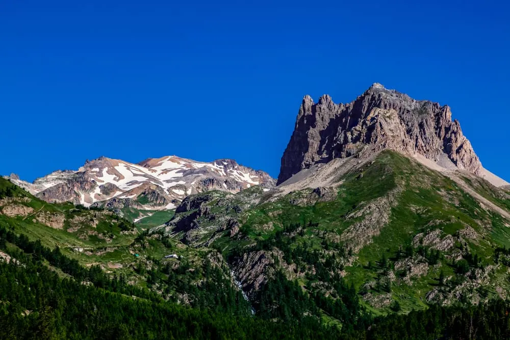
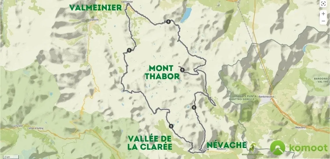
Grande Randonnée GR57 is better known as the Tour du Mont Thabor. This is a loop around the lesser known but still very prominent Mont Thabor, in Vallée de la Clarée in the Hautes-Alpes. Vallée de la Clarée is a sheltered, dead-end valley north of the fortified town of Briancon, on the border between France and Italy and forms part of the unspoilt Massif des Cerces. There are no ski slopes or other large-scale tourism, this valley is there only for hikers, cyclists, and other nature lovers. When doing the full circuit, you can expect a total distance of around 85 kilometers and more than 5,000 meters of elevation gain. You don't have to, though. Tour du Mont Thabor is easily broken up into pieces.

Itinerary

Day
1

Arrival in Las Salle Les Alpes

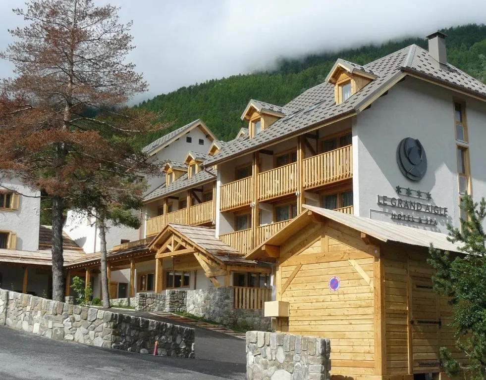
Bonjour! Welcome to France. Today you arrive in La Salle Les Alpes and are expected in a pleasant accommodation in the village. Your overnight stay includes breakfast. This hotel is a 40-minute drive from Névache, the starting point of your hike.

Le Grand Aigle Hotel & Spa (La Salle Les Alpes)

Info
Le Grand Aigle Hotel & Spa (La Salle Les Alpes)
Day
2

Névache to Refuge des Drayères

Duration: 06:50 h
Distance: 18.7 km
Ascent: 1060 m
Descent: 500 m
From Névache you follow the Clarée in a northwest direction. You follow a contour path all the way past Refuge de Ricou (coffee stop!) and Les Chaumes. Today offers a great warm-up for what's to come. Not too easy, not too hard, but it definitely gets the legs moving. You can also take an alternative route via Refuge de Laval, but if you want to do it properly, stay on the GR route.

Refuge des Drayères

Info
Refuge des Drayères
Refuge des Drayères
Day
3

Refuge des Drayères - Valmeinier

Duration: 08:30 h
Distance: 22.5 km
Ascent: 1030 m
Descent: 1410 m

This is a long and demanding mountain stage from Refuge des Drayères to Valmeinier, covering 22.5 km with 1,030 m of ascent and 1,410 m of descent. The route estimate is 8 hours and 30 minutes, but remember that this does not include breaks and can vary a lot depending on fitness, weather, and trail conditions. With a demanding climb and a big descent ahead, starting early is strongly recommended.

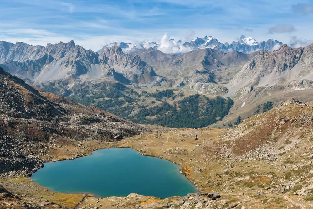
From Refuge des Drayères, the route climbs through open alpine terrain towards Lac Clarée and Round Lake before reaching Plagnette Pass at 2,525 m. This first section gives you a high mountain start, with lakes, stony paths and wide views between the surrounding peaks. After the pass, the trail continues across varied terrain and gradually works its way towards Lac Vert, the last major lake highlight of the route.

The final part is long and should not be underestimated. After Lac Vert, the route descends steeply on a narrow mountain path, losing a lot of height before reaching the valley floor, then climbs back up into Valmeinier. This last stretch can feel tiring at the end of such a long route, so keep a steady pace and take your time. Once you reach the village, you can settle into your accommodation and recover properly.

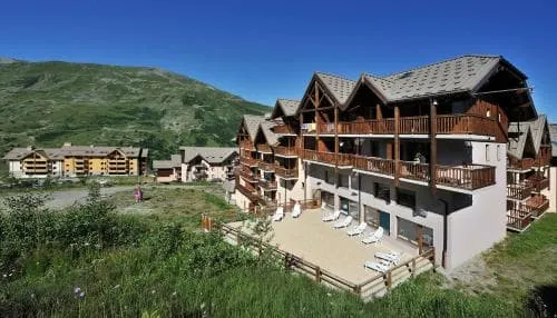
Hôtel Club Les Carrettes (Valmeinier)

Info
Hôtel Club Les Carrettes (Valmeinier)
Day
4

Valmeinier - Refuge du Mont Thabor

Duration: 07:50 h
Distance: 15.7 km
Ascent: 1490 m
Descent: 780 m

From Valmeinier, this is a long and tough day with two big climbs. Over about 15.7 km you climb around 1,490 m and descend around 780 m, so your legs will get a good workout. This is alpine terrain, with mountain paths and rocky or uneven sections, and both climbs get steeper towards the top. Start early, take regular breaks and keep a steady pace. Allow around 7 hours 5O minutes of walking.

The first climb leads up along the stream to the Col des Marches. The path starts steadily and becomes steep for the last part before the col. From the top, a long descent of almost 500 m takes you down to Refuge des Marches, a good place to rest and recharge. From the refuge, the second climb begins towards the Col de Battalières. It starts gently but becomes steep again near the top, so save some energy for this last effort of the day.

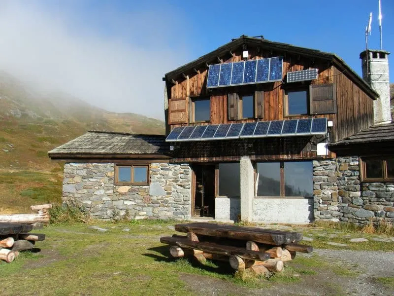
From the Col de Battalières there are fantastic views over the surrounding peaks and the Lacs Sainte-Marguerite. From here, an easy descent of about 250 m past the lakes brings you to the welcoming Refuge du Mont Thabor. Well done, time to grab a drink and enjoy the evening!

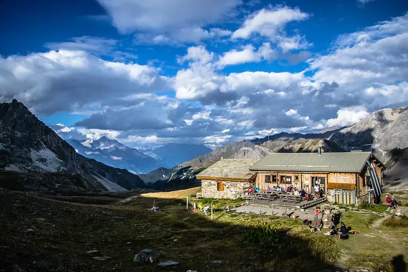
Refuge du Mont Thabor

Info
Refuge du Mont Thabor
Day
5

Refuge du Mont Thabor - Les Granges de la Vallée Étroite (Including the climb to Mont Thabor)

Duration: 07:20 h
Distance: 16.4 km
Ascent: 770 m
Descent: 1490 m

Today is summit day. From the Col des Méandes you climb to the top of Mont Thabor, the 3,178-metre peak that gives the tour its name, before descending into the Vallée Étroite. That makes for about 770 metres of climbing and 1,490 metres of descent. The slopes below the top are steep and loose in places, so this part asks for steady legs, sure feet and stable weather.

From the refuge you walk to the Col de la Vallée Étroite and on past Lac Peyron to the Col des Méandes. Here the real climb begins: a stony path zigzags up to the summit and its small chapel. On a clear day the views stretch over the Vanoise and the Écrins. You return the same way to the Col des Méandes, then start the long descent into the upper Vallée Étroite. One short stretch below the col is steep and rocky, so take your time there.

Lower down, the path passes Lac Vert and follows the valley floor to Les Granges de la Vallée Étroite, a valley that belonged to Italy until 1947. About 16 kilometres in total, count on a good 7.5 hours. Tired legs or doubtful weather? Then choose the other route option for this day, which skips the summit.

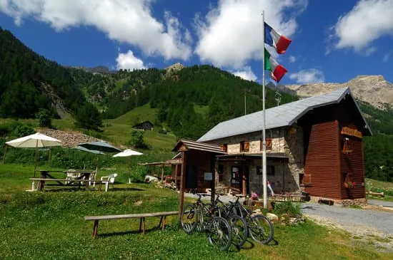
Refuge Terzo Alpini

Info
Refuge Terzo Alpini
Refuge Terzo Alpini
Day
6

Granges de la Vallée Étroite to Névache

Duration: 06:15 h
Distance: 13.4 km
Ascent: 850 m
Descent: 1030 m
One last good hiking day on the Tour du Mont Thabor. From Granges, it is about 6 hours back to the starting point of the trek; Névache. You start with walking back for around 2 kilometers to get back on the route of Tour du Mont Thabor. On the way, you will still find a few fantastic highlights and you will of course get to see undulating views. One last push to Col du Vallon, and before you know it you are enjoying a well-deserved blonde beer in Névache.

Le Grand Aigle Hotel & Spa (La Salle Les Alpes)

Info
Le Grand Aigle Hotel & Spa (La Salle Les Alpes)
Day
7

Departure Day

After breakfast, you can check out. This is the end of your Tour du Mont Thabor adventure. We hope to see you again soon. Au Revoir!
Contact our Trekking Expert
Daphne Hendriks
Daphne Hendriks
Daphne Hendriks

Included

  • Booking the huts

    We will take care of arranging accommodation on the Tour du Mont Thabor for you. We will also provide you with a detailed itinerary for every stage and instructions on how to get to the trailhead.

  • Full travel guide

    You’ll receive access to our trekking app, which serves as your complete digital travel guide for the Tour du Mont Thabor. Inside, you’ll find everything you need for your trek: route descriptions, hiking maps, navigation support, payment information, and all the key details specific to your journey.

  • Accommodation before and after the tour

    Accommodation before and after the trek is included. Breakfast is (if possible) part of your stay.

  • Half Board + Packed Lunch (Where Possible)

    Half-board (breakfast and dinner) is included at all accommodations along your trek. Some also include a packed lunch as part of a full-board stay. Where possible, we will arrange this packed lunch for you as well, so you can enjoy your trek with one less thing to worry about.

    Once the accommodations have been confirmed, more detailed information about the meals included at each accommodation will be available.

  • Navigation support

    Our trekking app also includes built-in navigation support. With GPS-based maps and offline access, you can follow the trail confidently and stay on route even without mobile signal.

Excluded

  • Traveling to and from

    You have to make your own way to the starting point. The total amount does not include personal transport.

  • Transfers

    Should you need any form of (public) transport on location, this is not part of the trekking package. This includes the use of taxi, bus, cable cars, gondolas, ferries, etc.

  • Travel Insurance

    Your international travel insurance is your own responsibility. Discuss your itinerary with the insurance company before your trek.

  • Personal expenses

    Personal expenses on such as souvenirs, drinks, and other similar expenses are for your own account.

FAQ

  • What Is the Best Season for The Tour du Mont Thabor?

  • Getting to Névache

  • What if the dates I want are not available?

  • If I book now, can I immediately arrange the rest of my trip?

  • How do I know if this trek is right for me?

  • Can meals be adapted to my dietary requirements?

How to Book

  • Booking

  • Availability

  • Cancellation policy