

Southern Alta Via 1 Trail Run

  • Duration
    Total 4 days
    Average 4 h 26m
  • Distance
    Total 75.9 km
    Average 19.0 km
  • Ascent
    Total +3615 m
    Average +904 m
  • Descent
    Total -4947 m
    Average -1237 m

> Run the southern Alta Via 1 in four days with a light pack
> Follow the trail along the foot of the Civetta from Rifugio Coldai to Rifugio Vazzoler
> We book the huts, you run

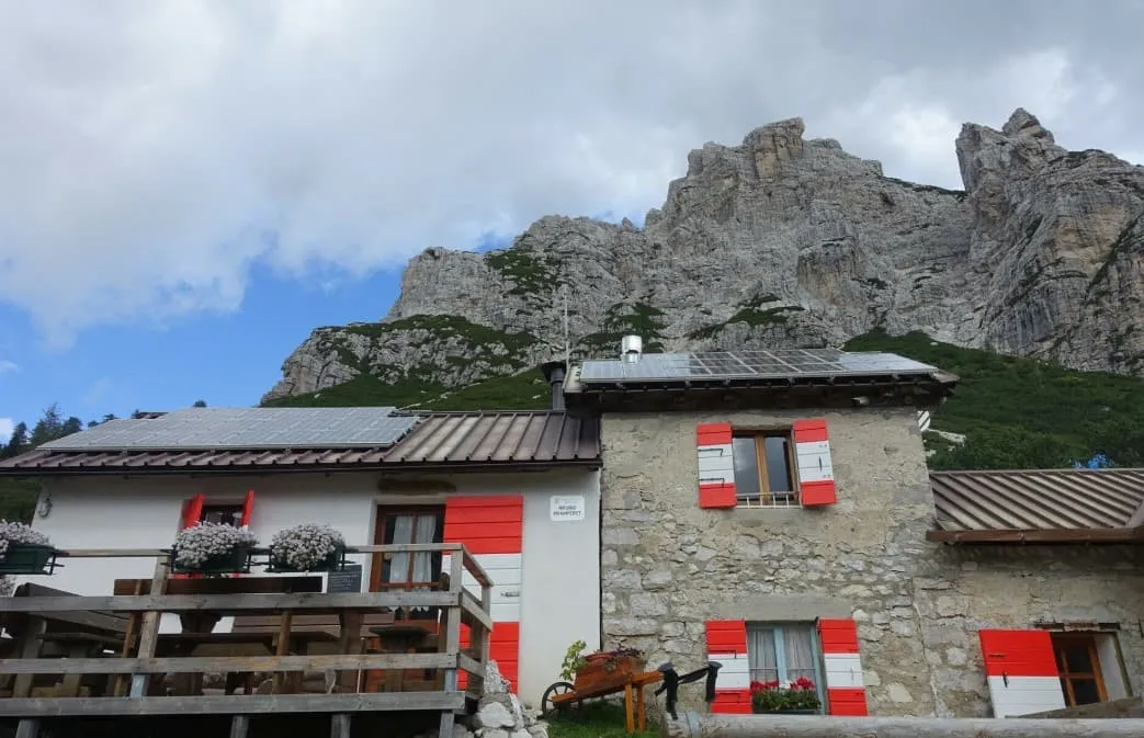
Midday at Rifugio Coldai, fifteen kilometres into the second day. The hardest climbing is behind you and the trail now runs along the foot of the Civetta, with its walls rising above you for the next nine kilometres. At the end of it is Rifugio Vazzoler, a shower and dinner.

Four days, about 76 kilometres and 3,600 metres of climbing. A bus takes you from Cortina d'Ampezzo to the start, from where you climb past the Cinque Torri to Rifugio Croda da Lago. The next day takes you over Passo Staulanza and along the Civetta to Rifugio Vazzoler, then past Rifugio Carestiato and Passo Duran to Rifugio Pramperet. The last day ends with a 2,100-metre descent to the bus at La Pissa. Three nights in mountain huts, no luggage transport.

This is for experienced trail runners who are at home on mountain trails. Days run from 11 to 25 kilometres with up to 1,060 metres of climbing, on rocky paths and long descents; most climbs you will power-hike. You carry everything yourself in a pack of about 30 litres: hut sheet, rain jacket, headlamp and food for the trail. We book the huts, you run. Deal?

Itinerary

Day
1

Parcheggio Rio Bianco to Rifugio Croda da Lago via the Cinque Torri

Duration: 03:00 h
Distance: 10.9 km
Ascent: 803 m
Descent: 578 m
Lowest Point: 1691 m
Highest Point: 2230 m

A short opener to shake the travel out of your legs, on trails that Lavaredo Ultra Trail runners know well. Take bus 052 from Cortina d'Ampezzo to Parcheggio Rio Bianco (plan your trip at mycicero.it) and you are on the trail within minutes. Keep the pace easy today: three big days are coming.

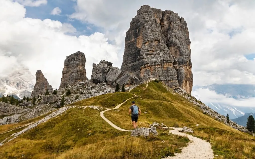
From the bus stop you power-hike up to the Cinque Torri, the five rock towers above Cortina, passing Rifugio Scoiattoli and Rifugio Cinque Torri at around 2,200 metres. This is Lavaredo country: in the 120K race the course comes past the towers on its way to Rifugio Averau and Passo Giau. From the towers a long descent takes you down to about 1,700 metres. Let it roll if your legs feel good.

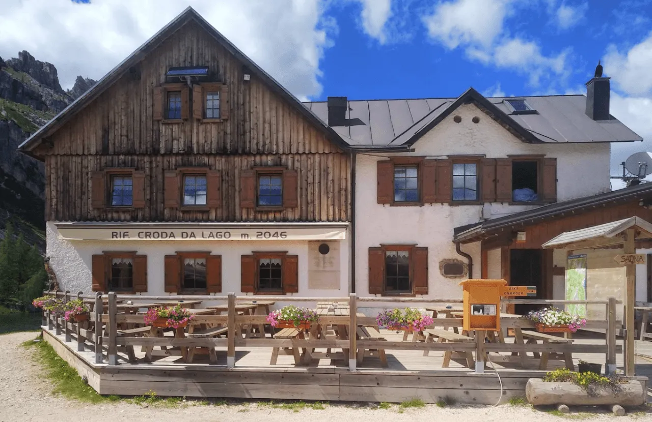
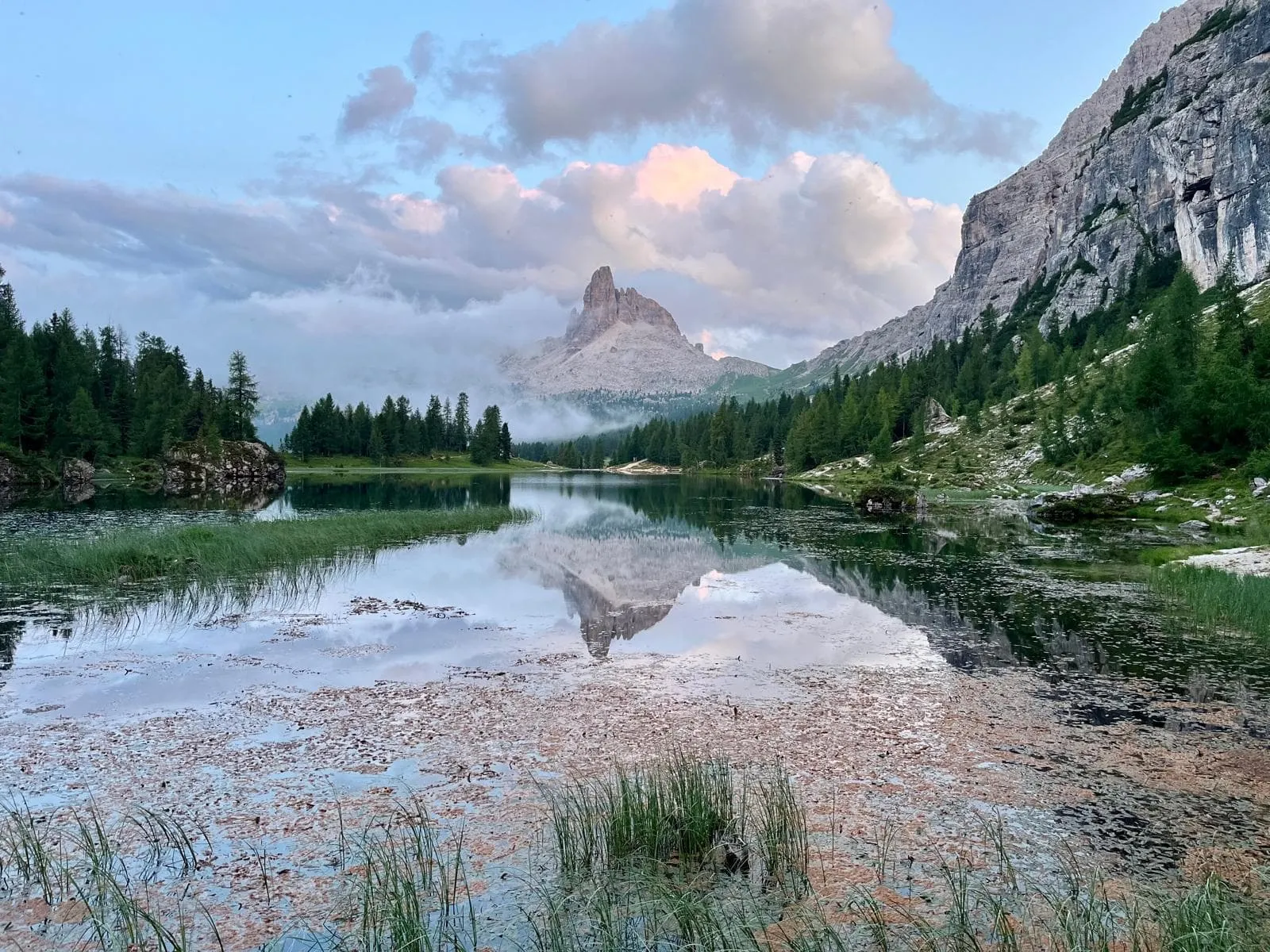
The day ends with a climb of some 350 metres to Rifugio Croda da Lago at about 2,040 metres, right next to Lago Federa. In the Lavaredo this is the last aid station before the final descent to Cortina. For you it means dinner, a bunk and the Becco di Mezzodì turning orange in the last light. About 11 kilometres, count on 3 hours.

Rifugio Croda da Lago

Info
Rifugio Croda da Lago
Day
2

Rifugio Croda da Lago to Rifugio Vazzoler via Rifugio Coldai

Duration: 05:30 h
Distance: 24.7 km
Ascent: 1038 m
Descent: 1353 m
Lowest Point: 1695 m
Highest Point: 2295 m

The queen stage: 25 kilometres, more than 1,000 metres up and 1,350 metres down, with the Pelmo and the Civetta for company. Start early, eat at every hut and save something for the second half, because the trail along the Civetta is the best running of the four days.

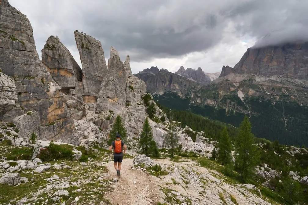
Straight from the hut you climb to the cols below the Becco di Mezzodì, where the day reaches its high point at about 2,295 metres. The first stretch towards Forcella Ambrizzola is Lavaredo terrain too, only in the opposite direction. Then it is down to Passo Staulanza at kilometre ten, the place to refuel and fill your bottles, before the climb to Rifugio Coldai at 2,123 metres.

Here the Civetta takes over. Past Lago Coldai the trail traverses below its north-west face for nine kilometres, over Forcella di Col Negro and Forcella del Col Reàn, then drops past the Torre Venezia to Rifugio Vazzoler at 1,714 metres. Mostly runnable trail with a 1,000-metre wall above you: this is why you came. About 25 kilometres, count on 5.5 hours.

Rifugio Vazzoler

Info
Rifugio Vazzoler
Rifugio Vazzoler
Day
3

Rifugio Vazzoler to Rifugio Pramperet via Passo Duran

Duration: 05:00 h
Distance: 22.2 km
Ascent: 1057 m
Descent: 902 m
Lowest Point: 1410 m
Highest Point: 1937 m

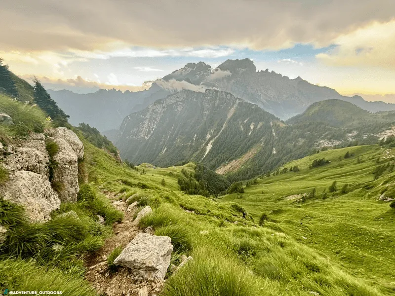
After the big one, a day to find your rhythm: 22 kilometres and just over 1,000 metres of climbing, mostly on runnable forest trails and tracks between 1,400 and 1,950 metres. Fewer people, more trees, and the Moiazza keeping watch from above.

From Vazzoler you run down to about 1,400 metres, then work your way up through the forest to Rifugio Carestiato below the Moiazza, nine kilometres in. A short descent brings you to Passo Duran, the last chance to refill your bottles and grab a coffee before the hut. From the pass you climb to a col at about 1,940 metres and traverse into the quiet Zoldo side of the mountains.

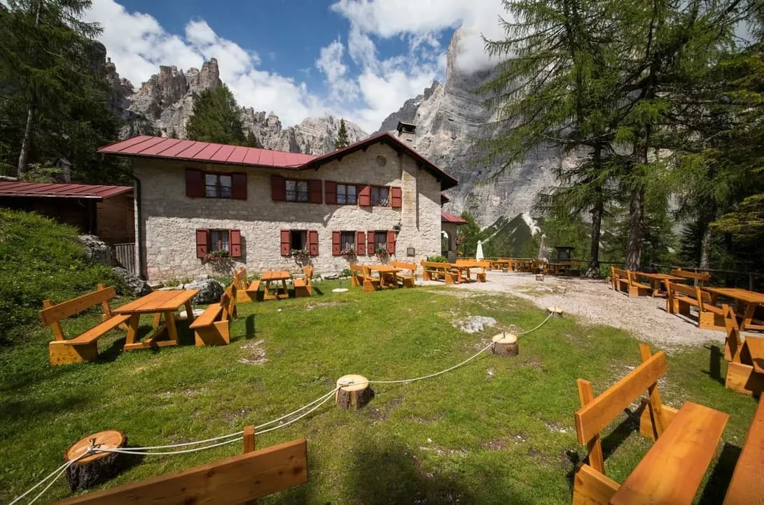
Rifugio Pramperet was built in 1923 at 1,857 metres and has just 25 beds, so dinner is a small affair with a handful of hikers and runners. Tomorrow ends with a 2,100-metre descent to La Pissa: go easy on the grappa. About 22 kilometres, count on 5 hours.

Rifugio Pramperet

Info
Rifugio Pramperet
Rifugio Pramperet
Day
4

Rifugio Pramperet to La Pissa

Duration: 04:15 h
Distance: 18.1 km
Ascent: 717 m
Descent: 2114 m
Lowest Point: 458 m
Highest Point: 2365 m

The last day starts with a climb of 500 metres straight from the hut and then drops more than 2,100 metres to the valley. Save something for the descent: that is where tired legs feel it.

In under three kilometres you climb to a col at 2,365 metres, the last high point of the trip. A steep descent takes you to Rifugio Pian de Fontana at about 1,620 metres, a good place for a final coffee in the mountains. From there the trail keeps dropping through the forest of Val Vescovà to La Pissa, at 458 metres.

The trip ends at the bus stop in La Pissa, where the bus takes you to Belluno. About 18 kilometres, count on just over 4 hours.

Contact our Trekking Expert
Jelle Tekstra
Jelle Tekstra
Jelle Tekstra

Included

  • Full travel guide

    You’ll receive access to our trekking app, which serves as your complete digital travel guide for the Alta Via 1. Inside, you’ll find everything you need for your trek: route descriptions, hiking maps, navigation support, payment information, and all the key details specific to your journey.
  • Accommodation

    During your Alta Via 1, you will spend your nights in mountain huts. We normally book dormitories, but private rooms are available upon request and cost €75 extra per room per night. If no private rooms are available, we will automatically book a bed in a dormitory.
  • Half-board in Huts

    Accommodation at the huts includes dinner and breakfast. We will arrange this for you as well. This allows you to travel lighter and have one less thing to worry about. Bear in mind that lunch is not included, but it can be purchased at the huts. Here you can also buy an array of snacks and bottled water.

Excluded

  • Traveling to and from

    You have to make your own way to the starting point. The total amount does not include personal transport.
  • Transfers

    Should you need any form of (public) transport on location, this is not part of the trekking package. This includes the use of taxi, bus, cable cars, gondolas, ferries, etc.
  • Lunch

    Half-board is included in the price of this trek. Lunch, however, is not. Many huts offer packed lunches, which can usually be requested the night before. Alternatively, you can stop for lunch at mountain huts along the way.
  • Travel Insurance

    Your international travel insurance is your own responsibility. Discuss your itinerary with the insurance company before your trek.
  • Personal expenses

    Personal expenses on such as souvenirs, drinks, and other similar expenses are for your own account.

FAQ

  • When to Go: Crowds, Best Timing, and Alta Via 1 vs Alta Via 2

  • How Difficult Is the Alta Via 1 Dolomites?

  • How to Get To the Starting Point of the Southern Alta Via 1 Trail Run

  • How to Get Back From La Pissa

  • What if the dates I want are not available?

  • If I book now, can I immediately arrange the rest of my trip?

  • How do I know if this trek is right for me?

  • Can meals be adapted to my dietary requirements?

How to Book

  • Booking

  • Availability

  • Cancellation policy