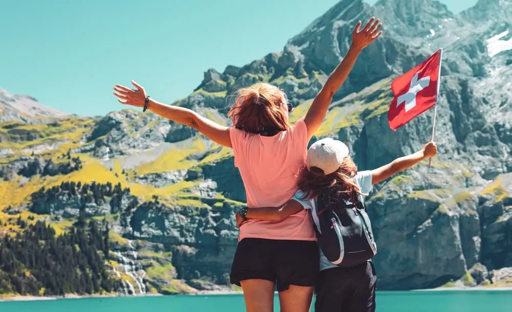
Hiking in the Bernese Oberland: Best Trails, Hut-to-Hut Routes and How to Plan Your Trip

Hiking in the Bernese Oberland: Best Trails, Hut-to-Hut Routes and How to Plan Your Trip
Trekking experts per destination
Free cancellation up to eight weeks in advance
Quick personal advice

The Bernese Oberland is the mountainous southern half of the canton of Bern, and it is the Switzerland that most people picture before they arrive: the Bernese Alps rising straight out of the Lauterbrunnen and Kander valleys, the Eiger, Mönch and Jungfrau looming above Grindelwald, ribbon waterfalls threading down sheer cliff walls, turquoise lakes and car-free villages reached by cogwheel railways. It is also the easiest place in the Alps to walk seriously without a car, because trains, cable cars and postbuses reach almost every trailhead. For hiking in the Bernese Oberland, that network changes everything: you can end each day somewhere warm with dinner already cooking, however long you have walked. At Bookatrekking we book the huts and hotels, arrange the logistics, and give you our app with offline navigation, GPX tracks and a weather forecast per stage. This guide covers where the region is and how to reach it from North America, the valleys and their walking bases, our multi-day treks, the best day hikes, difficulty, weather and season, where you sleep, and how to choose the right trip.


Why go hiking in the Bernese Oberland?

The straightforward answer: nowhere else in the Alps puts so many famous mountain faces within an hour of each other, and nowhere else makes them this accessible without specialist experience. The best hikes Bernese Oberland has to offer include easy panorama walks on mountain railways and serious high-pass crossings in the same postcode. That density matters. On most alpine trips you position yourself in one valley and explore from there. Here, the choices multiply daily.

Worth noting: the Bernese Alps are one range within the broader Swiss Alps, not the same thing. The Swiss Alps stretch from Geneva to the Austrian border; the Bernese Alps form the great northern wall of the range, the massif that catches Atlantic weather systems first and sends glaciers down from the Aletsch plateau. This distinction matters for planning, because weather patterns and trail character differ substantially between the Bernese section and the eastern or southern Alps.

The honest flip side: this is one of the most expensive corners of Europe. The honeypot viewpoints above Grindelwald and Lauterbrunnen are genuinely crowded in July and August. And weather at altitude turns faster than any forecast predicts, which is why we surface a forecast per stage in the Bookatrekking app rather than asking you to guess. None of these caveats diminishes the case for coming; they simply mean that arriving informed makes a good trip great.


Where is the Bernese Oberland and how do you get there?

The Bernese Oberland occupies the southern, mountainous part of the canton of Bern, stretching between Lakes Thun and Brienz in the north and the main alpine watershed in the south. Interlaken sits between those two lakes and functions as the region's hub: most visitors arrive here and then branch into the valleys by rail. The main walking bases are Lauterbrunnen, Wengen, Mürren, Grindelwald, Kandersteg, Adelboden, Meiringen and Gstaad. Passes such as the Grimsel and the Susten connect this side of the Alps to central Switzerland.

For a reader flying from North America, the routing is straightforward: fly into Zurich, Geneva or Basel, take the train to Bern or Spiez, and continue to Interlaken. From there the valley railways branch south towards Grindelwald and Lauterbrunnen. The whole journey from Zurich airport to Interlaken takes under two hours. A car is genuinely unnecessary and often a liability: Wengen and Mürren are completely car-free, and parking in the resort villages is limited and expensive. Regional travel passes are worth comparing before you book your rail tickets, as several options exist that cover mountain railways and cable cars — check the current offers directly with Swiss travel operators.

Interlaken itself is not a hiking destination so much as a logistics base. If you are wondering how much time to spend there before moving into the hills, an overnight to orient yourself and stock up on supplies is usually enough. The serious walking starts when you take the train south.


The best valleys and bases for hiking in the Bernese Oberland

Lauterbrunnen is the valley most visitors arrive in and never quite forget. Seventy-two waterfalls pour from the sheer walls above the flat valley floor, and Staubbach Falls drops nearly 300 metres directly over the village. From here two separate ridge terraces rise above: Wengen to the east and Mürren to the west, both car-free, both looking straight at the Eiger, Mönch and Jungfrau. The Bernese Oberland hiking trails above Mürren, particularly the North Face Trail, rank among the most dramatic in Switzerland. This base suits walkers who want high-level panorama routes with lift access built in.

Grindelwald sits directly under the Eiger north face, and the energy is different here: busier, more resort-like, but with trails that run straight into genuine mountain terrain. The gondola to First and the walk to Bachalpsee are the most popular routes, and rightfully so. This is the base for walkers who want glacier views and don't mind company.

Interlaken and the Schynige Platte suit those who want a gentler entry point. The Schynige Platte ridge and the Harder Kulm above Interlaken offer excellent panorama walking with a funicular doing the heavy lifting at the start.

Kandersteg is the quieter valley, less visited and more relaxed, which makes it a good base for anyone looking to escape the tourist circuit. It is the gateway to the Oeschinensee above and the Gemmi pass to the east, and the starting and ending point for both of our Kandersteg-based treks.

Adelboden and the Engstligen valley form a gentler, more pastoral western approach to the Bernese Alps. Engstligen Falls above the valley head is one of the finest waterfall walks in the region. This base suits families and walkers who prefer lower intensity.

Gstaad and the Saanenland lie in the soft, rounded western end of the Bernese Oberland, with a markedly different character: rolling pasture, lower passes and a more relaxed pace. Suited to easy to moderate walkers.

The Grimsel and Susten passes in the east mark the border with central Switzerland. This is glaciated, austere high country, and it forms the backdrop of our Vier Quellen Weg, which explores the headwaters of the Rhine, Rhône, Reuss and Ticino rivers.


Multi-day and hut-to-hut routes in the Bernese Oberland

Alpine hut-to-hut walking works differently from point-to-point backpacking. Staffed mountain huts and mountain hotels provide a bed, an evening meal, breakfast and a shared atmosphere at the end of each stage. You carry a hut sleeping bag liner and your personal gear for the night, but you are not carrying food or camping equipment. Stages are linked over passes, and the Bernese Oberland hut to hut network is dense enough that most trips end each day with a hot meal already waiting, somewhere that has a bed. You book in advance, particularly in July and August when the best huts fill months ahead.

The classic long route is a full Bernese Oberland traverse from Meiringen or Grindelwald westwards to Gstaad or Leukerbad: around 100 kilometres, five to eight days, over high passes including the Hohtürli at around 2,800 metres. Several operators sell versions of this route. It is rewarding but committing, and logistics require careful planning.

What we offer at Bookatrekking is shorter and better supported. Our three bookable trips each reflect a different part of the region and a different level of experience:

The Beginner Oeschinen Trek runs for six days through the Lauterbrunnen terraces and Kandersteg country, finishing at the Oeschinensee. It is our easiest introduction to alpine hut-to-hut walking, with moderate daily distances and the hut bookings and logistics handled entirely by us.

The Intermediate Oeschinensee Trek covers the same country in five days, compressing longer stages into bigger days. It is the right choice for walkers who already have mountain experience and want to push further each day.

The Vier Quellen Weg is a different proposition entirely: a high-alpine, five-day route on the Grimsel and Gotthard side, linking the sources of four great European rivers. It sits on the eastern edge of the broader region rather than in the heart of the Bernese Oberland, and it suits walkers looking for something wilder and less visited.

All three include hut bookings, half board at the mountain nights, route information and access to the Bookatrekking app.


The Oeschinensee in brief

The Oeschinensee is the turquoise glacial lake sitting above Kandersteg, ringed by the Blüemlisalp limestone wall. It is part of the Swiss Alps Jungfrau-Aletsch UNESCO World Heritage area and the scenic anchor of both our Kandersteg treks. You reach it by gondola from Kandersteg village followed by a short walk, or entirely on foot via a forest trail. It is one of the most striking lake arrivals in the Alps and the moment both our Kandersteg trips are building towards.

For the full walking routes around the lake, the SAC mountain huts, practical access detail and what to do there, see our dedicated Oeschinensee hiking guide.


Day hikes and panorama trails for hiking in the Bernese Oberland

The best hikes Bernese Oberland offers at the day-walk level are not lesser versions of the multi-day experience. They are genuinely world-class routes, many of which use the cable car or railway network to gain height before you start walking.

First to Bachalpsee above Grindelwald is the walk most visitors describe as the one they still think about. A gondola takes you to the First plateau, and the path to Bachalpsee rolls through alpine meadows with the Eiger, Mönch and Jungfrau reflected in the lake on a clear morning.

The Schynige Platte to First traverse and the Faulhorn ridge connecting them is a longer, more serious panorama route that runs high between the two gondola stations. It is one of the most consistently rewarding full-day walks in Switzerland, staying above 2,000 metres for most of its length.

The Eiger Trail runs directly beneath the north face between Eigergletscher station and Alpiglen, and it is the closest most walkers will ever get to that wall of rock. Dramatic and justifiably popular.

The Lauterbrunnen valley floor between Stechelberg and Lauterbrunnen is an easy, flat walk past waterfall after waterfall, and a good option when higher trails are wet or misty. The Mürren terrace path above on the opposite side offers the high view of the valley without significant technical demand.

The Männlichen to Kleine Scheidegg royal walk is the classic easy option: a gondola to Männlichen, a mostly flat ridge walk across to Kleine Scheidegg with the Eiger growing closer with each step, and a cogwheel railway back down. It is manageable for most ages and a reliable clear-day favourite.

The Gemmi pass above Kandersteg is a high, historically important crossing that looks down towards Leukerbad and out across the Valais. The walk from Kandersteg upward is long but well graded, and the pass itself feels genuinely remote for a path that has been in use for centuries.

Engstligen Falls above Adelboden is a quieter, less visited half-day walk that ends below one of the widest waterfall curtains in the Alps.

The Aare gorge and Reichenbach Falls near Meiringen suit a day when the high routes are in cloud: a dramatic limestone canyon walk and the waterfall immortalised by Arthur Conan Doyle, both accessible without significant climbing.


How hard is hiking in the Bernese Oberland, and who is it for?

Switzerland uses three waymarking colours that are the single most useful thing a visitor can learn before arriving. Yellow markers indicate hiking trails: good surfaces, suitable for walkers in trainers, with no exposure. White-red-white markers mean mountain trails: well-marked but narrower, with some exposed ground and real ascent and descent. White-blue-white markers mean alpine routes: technical ground, possible glacier crossings, requiring mountaineering competence.

Our treks stay on yellow and white-red-white trails. You will walk on good paths, gain and lose real elevation each day, and cross some narrow traverses where cables are fitted into the rock, but there is no glacier travel, no rope work, and no via ferrata. The altitude involved is noticeable above 2,000 metres but not a health problem for fit, acclimatised walkers.

The six-day beginner trek suits walkers who hike regularly but have not done consecutive days in the mountains before. The five-day intermediate trek suits those who are already comfortable with mountain terrain and longer days. Both require hiking boots with ankle support. Trekking poles are worth bringing for the long descents. A warm, windproof layer is useful even in August above 2,000 metres, when temperature drops quickly when the sun goes behind cloud.


The best time to go, and what the Bernese Oberland weather is really like

The high hut and trail season runs roughly from late June to late September. Snow lingers on passes into early summer, and some huts open later than others, so late June can mean finding a pass still awkwardly icy without crampons. July and August are the warmest months, the most crowded and the most thunderstorm-prone in the afternoon: a pattern so reliable that experienced alpine walkers make a habit of starting by 7 or 8 in the morning to be off exposed ridges before early afternoon.

September is the connoisseur's month. The crowds thin noticeably after the first week, the light is cleaner and the air crisper, the huts are quieter. By late September, some mountain huts and some cable cars are winding down for the season, so checking availability before you book late-September stages matters.

Outside the season, valley walking continues into November, and snowshoe routes open in winter in most valley bases. The high passes and mountain huts are closed from October to June.

Bernese Oberland weather is characterised by its speed of change. A clear morning at the valley floor can turn to thunderstorm by early afternoon on the high passes, and cloud can sit on the Eiger for days while Kandersteg stays sunny. The Bookatrekking app shows the current forecast based on the coordinates of each hut, which is the most practical way to make daily decisions about timing and route choice on a multi-day trip.


Where you sleep and what happens to your luggage

On a typical Bookatrekking trip through the Bernese Alps, you will sleep in a mixture of accommodation types. Mountain huts on the high stages are staffed SAC or private huts where you sleep in a dormitory or a small shared room, eat a set evening meal (half board) and breakfast, and follow the unspoken rules of hut life: bring a sleeping bag liner, respect quiet hours after 10pm, settle payment in cash where card machines are not available. The atmosphere in these huts is unlike anything in a hotel and is the reason many walkers return to hut-to-hut trips year after year.

When the route descends to a valley village, the accommodation shifts to a mountain hotel or guesthouse, with more privacy and comfort. Some of our packages include a mix of both.

Booking ahead is not optional in July and August. Swiss mountain huts fill months in advance. Organising this is exactly what we take off your hands: every bed on your trip is confirmed before you leave home.

Luggage works differently on days with hut nights. Your main bag travels by road or rail between valley stops. On the nights you are up at a hut with no vehicle access, you carry what you need for that night in a daypack. We provide clear guidance on the split before your trip.


Which hiking in the Bernese Oberland trek suits you — and what does it cost?

Trek Days Best for From, per person
Beginner Oeschinen Trek 6 days A first alpine hut-to-hut trek, at a gentle pace From €795
Intermediate Oeschinensee Trek 5 days Experienced walkers wanting bigger days in the same country See the trip page
Vier Quellen Weg 5 days High-alpine walking on the Grimsel and Gotthard side See the trip page

As of September 2026, per person based on two travellers.

Choosing between them: If this is your first time walking hut to hut at altitude, the six-day beginner trek is the right entry point: the pace is manageable and the stages build confidence. If you are already fit and comfortable on mountain trails, the five-day intermediate trek covers the same country with longer, more demanding days. If you want something wilder and higher, on more remote terrain away from the Lauterbrunnen tourist circuit, the Vier Quellen Weg is the choice.

How many days in Bernese Oberland? A long weekend gives you time for two or three of the famous viewpoints: the Männlichen walk, the Bachalpsee and perhaps the Mürren terrace. Five to seven days is the right window for one of our treks, combining mountain huts with valley arrivals. Ten days lets you finish a trek and spend two or three days exploring the valleys, lakes and passes at a slower pace.

Navigation: Swiss trail signage is excellent and distances are marked in hours rather than kilometres, which is a more honest measure in mountain terrain. That said, cloud and snowfields hide junctions, and a phone with network coverage is unreliable on high passes. We supply the Bookatrekking app with offline maps, GPX tracks and a weather forecast per stage, so you always know what is ahead before you set out.

For a broader look at walking holidays across Switzerland, including routes beyond the Bernese Oberland, visit our walking holidays in Switzerland overview.


Frequently asked questions about hiking in the Bernese Oberland

  • Is Bernese Oberland worth it?

    Yes, without hesitation. The Bernese Oberland offers the highest concentration of iconic alpine scenery in Europe, an unmatched network of waymarked trails, and infrastructure that makes serious mountain walking accessible to hikers who are not mountaineers. It is expensive and busy in peak season, but the walking, the huts and the landscape justify it fully.

  • How many days to spend in Bernese Oberland?

    A long weekend covers two or three of the classic viewpoint walks. Five to seven days is the right length for a proper hut-to-hut trek. Ten days allows you to combine a multi-day trek with time in the valley bases. If this is your only visit to the Swiss Alps, lean towards seven days: shorter trips tend to leave most people wanting more.

  • Which base is best for travelling in the Bernese Oberland?

    It depends on what you want. Interlaken is the practical hub for arrivals and logistics. Lauterbrunnen gives the most dramatic valley setting and the quickest access to the Mürren and Wengen terraces. Grindelwald is best for the Eiger and the First plateau walks. Kandersteg suits walkers looking for something quieter and less visited, with the Oeschinensee and Gemmi pass on the doorstep.

  • Are the Bernese Alps the same as the Swiss Alps?

    No. The Bernese Alps are one specific range within the Swiss Alps, forming the great northern wall of the main alpine chain in the canton of Bern. The Swiss Alps is the broader term covering the entire mountain system across Switzerland, from the Jura foothills to the eastern Graubünden ranges. The Bernese Alps are particularly notable for the Eiger, Mönch, Jungfrau and Aletsch glacier.

  • What language do they speak in Bernese Oberland?

    The official language is German, and the day-to-day spoken dialect is Swiss German, which is distinctly different from standard High German. In the tourist villages, hotels, mountain huts and trail offices, English is spoken widely and reliably. Signage in the mountains is in German and uses universal trail markers, so language is rarely a barrier for English-speaking hikers.

  • How difficult is the Bernese Oberland Traverse?

    The classic traverse is a long, committing multi-day route over high passes reaching close to 2,800 metres, with significant cumulative ascent and demanding terrain on several stages. It is harder and longer than our Kandersteg treks. If you are new to multi-day alpine walking, our six-day beginner trek is a more appropriate starting point and gives you a real taste of the same landscape.

  • Which month is best for hiking in Switzerland?

    September is broadly the connoisseur's choice: trails and passes are fully open, afternoon storms are less frequent than in July and August, the light is excellent for the landscape, and the huts are noticeably quieter. July and August are the warmest and most reliable for snow-free passes, but expect crowds at the famous viewpoints. Late June suits early-season walkers comfortable with possible snow on passes.

  • What is the rainiest month in Switzerland?

    June tends to be one of the wetter months in the alpine regions, particularly in the northern ranges that catch Atlantic weather systems first, including the Bernese Oberland. That said, rainfall in the mountains is highly localised and varies considerably between valleys and years. Rather than planning around monthly averages, the more useful habit is to check the forecast per stage in the Bookatrekking app before each walking day.


    For everything you need to plan the Oeschinensee in detail, including the walks around the lake, the SAC huts and the practical access, go to our full Oeschinensee hiking guide. If you are looking at other Swiss hut-to-hut routes beyond the Bernese Oberland, the Kesch Trek in Graubünden and the Tour des Muverans in the Vaud Alps are both worth a close look.

Packing List for the Oeschinensee

It doesn't matter where you are trekking or for how long: carrying the right equipment with you is paramount. For a hiking trip in the mountains, a good is backpack essential. Its size will depend on how many days you will be spending in the mountains, the season, and the clothes you will be taking with you. We have prepared a packing list with some essential clothing that you should include and some extras that you may find useful:
  • Essentials

  • Extras

Safe Hiking Tips for the Oeschinensee

When hiking, it is wise to be aware of a few points. Even if this is not your first time, you should never underestimate the mountains. Good tour planning and compliance with the regulations in the mountains will significantly increase safety. To ensure that your hiking adventure is a safe and enjoyable experience, here below you can find a list of 8 recommendations for safe hiking in the mountains:
  • Know your limits

    Hiking the Oeschinensee is the perfect outlet to escape from daily life. It is an endurance sport along with a beautiful nature experience with a positive effect on body and mind —as long as one is in good shape and has a realistic picture of one's possibilities and limits—. Never overestimate yourself or underestimate the route. Don't overdo it! Always choose the slower option and take more time for your plans. Hiking under time pressure is not fun and at too fast a pace it can be dangerous. Be wise!

  • Plan carefully

    Good planning is half the work! Hiking maps, literature, the Internet and expert advice are invaluable when planning the route of the Oeschinensee and enable you to determine the length, altitude difference, difficulty and conditions of the hike. When planning group treks, the itinerary should always be planned for the weakest member of the group! The weather in the mountains can change incredibly quickly and rain, wind and cold all increase the risk factor. For this reason, always check the weather forecast beforehand and contact our trekking experts to find your way before you start.

  • Be fully equipped

    Equipment is everything. In the most extreme case, it makes the difference between life and death, and in any case, it definitely makes the difference between having fun and having a bad time. Food and water, sunscreen and waterproof and warm clothes must always be in your backpack, as well as a first aid kit and a mobile phone with a full battery (in case there is an emergency). However, packing light makes hiking easier, so don't take too much extra luggage with you. Your equipment should always be suitable for the terrain you'll be hiking on in the Oeschinensee.

  • Wear suitable footwear

    Good walking shoes protect your feet and provide a better fit. Shoes with a good fit, with non-slip soles, water-resistant and lightweight are a must for additional walking pleasure during the Oeschinensee. Trail running shoes are great for a weekend in the mountains, but on longer hikes or more technical trails, you'll want at least A/B hiking boots. That means it is recommended wearing high mountain shoes that are water-repellent with extra ankle support to prevent sprains.

  • Stay on marked trails

    Oeschinensee has endless marked hiking trails, which are controlled and maintained and should not be deviated from. It may be tempting, but it's not a good idea to take shortcuts or alternative routes through unmarked terrain. It increases the risk of disorientation and you're more likely to get lost and have accidents or fall in the mountains. Even steep slopes of packed old snow are often underestimated and dangerous. Are you in doubt? Better don't do it. For easy navigation we work with our trusted partner Komoot, whose interactive maps, also available offline, provide you with the necessary digital means to get from A to B. As a backup, make sure to bring a hiking guide or a paper map with you. FYI, 75% of stumbles occur due to carelessness on marked paths or roads, not in open terrain!

  • Take regular breaks

    Remember you're on a hiking trip. Timely and regular breaks not only provide welcome relaxation but also make it possible to enjoy the Oeschinensee. The body needs a regular food and drink intake to maintain performance and concentration. Our advice is that if you have little time, it's better to follow the short itinerary than to speed up the long one.

  • Stay reachable

    If you are hiking solo or in small groups it is advisable to inform people back home about your plans, what route you are taking and when you plan to return. Even small incidents can lead to unpleasant emergencies so make sure you are available at all times. Bring a charged phone containing at least the phone numbers of immediate family members, your accommodations en route and the emergency phone numbers operating on the Oeschinensee.

  • Respect nature

    Leave no rubbish behind, prevent noise, stay on the marked trails, do not disturb wildlife or grazing animals, and respect protected areas.

Where Can I Book the Oeschinensee?

At Bookatrekking.com you can book the self-guided Oeschinensee and many other treks. We take care of all the details for you, including arranging accommodations and providing you with relevant information well in advance of your trek. Find our offers here. Our easy-to-use platform allows you to browse and compare different trekking options and to find the perfect fit for your interests, abilities, and budget.

If you have any questions about a specific trek or need help choosing the right one for you, our team of trekking experts is here to assist you. Simply reach out to us and we will be happy to provide you with personalized recommendations and advice to help you plan the trekking adventure of a lifetime.

About Us

At Bookatrekking.com, you will find the trek that will make your life unforgettable. Whether you want to explore the Inca Trail or climb Kilimanjaro. Bookatrekking.com has a wide and varied range of first-class treks. No false promises are made here. Transparent prices and bookings are fixed instantly. Find, compare, book and trek!
Read more about us
About Us
About Us