Oeschinensee: Complete Hiking Guide to One of Europe's Most Beautiful Lakes

Sierd van der Bij
Sierd van der Bij
Sierd van der Bij
31 Jul 2026 11 min read
Oeschinensee: Complete Hiking Guide to One of Europe's Most Beautiful Lakes
Trekking experts per destination
Free cancellation up to eight weeks in advance
Quick personal advice

Experience the Oeschinensee and the mountain huts around it — without worrying about route planning or booking your overnight stays.

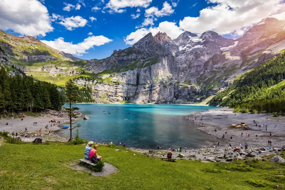
The Oeschinensee is a UNESCO World Heritage mountain lake in the Bernese Oberland, Switzerland, and one of the most rewarding destinations for anyone who loves hut to hut hiking in Switzerland. Formed by a prehistoric rock avalanche and sitting at 1,578 metres above sea level, the lake combines startling turquoise water, sheer limestone walls and genuine alpine atmosphere. Whether you are planning a half-day visit, a full day's hike or a multi-day trek through the surrounding mountains, this guide covers everything you need: how to get there, which routes to choose, when to go, what to do and how to book.


What and where is the Oeschinensee?

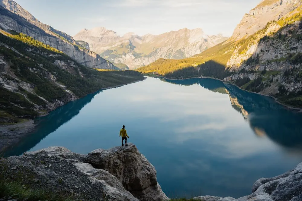
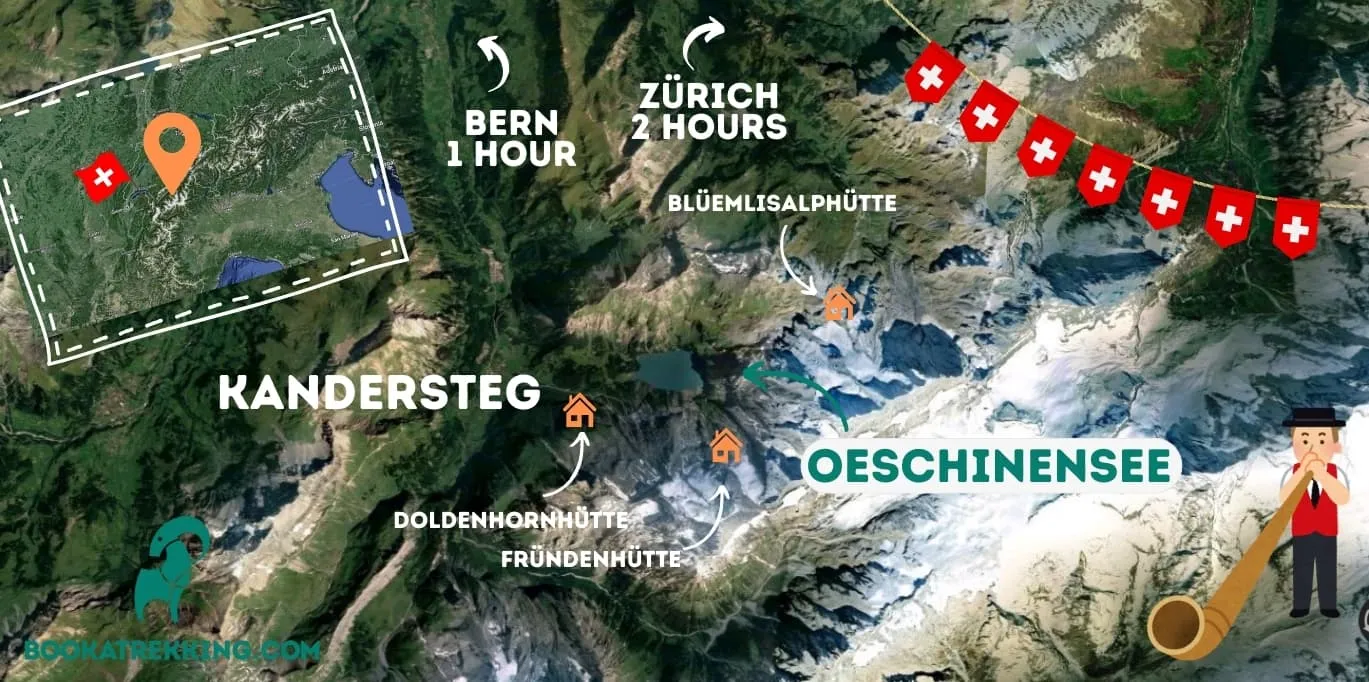
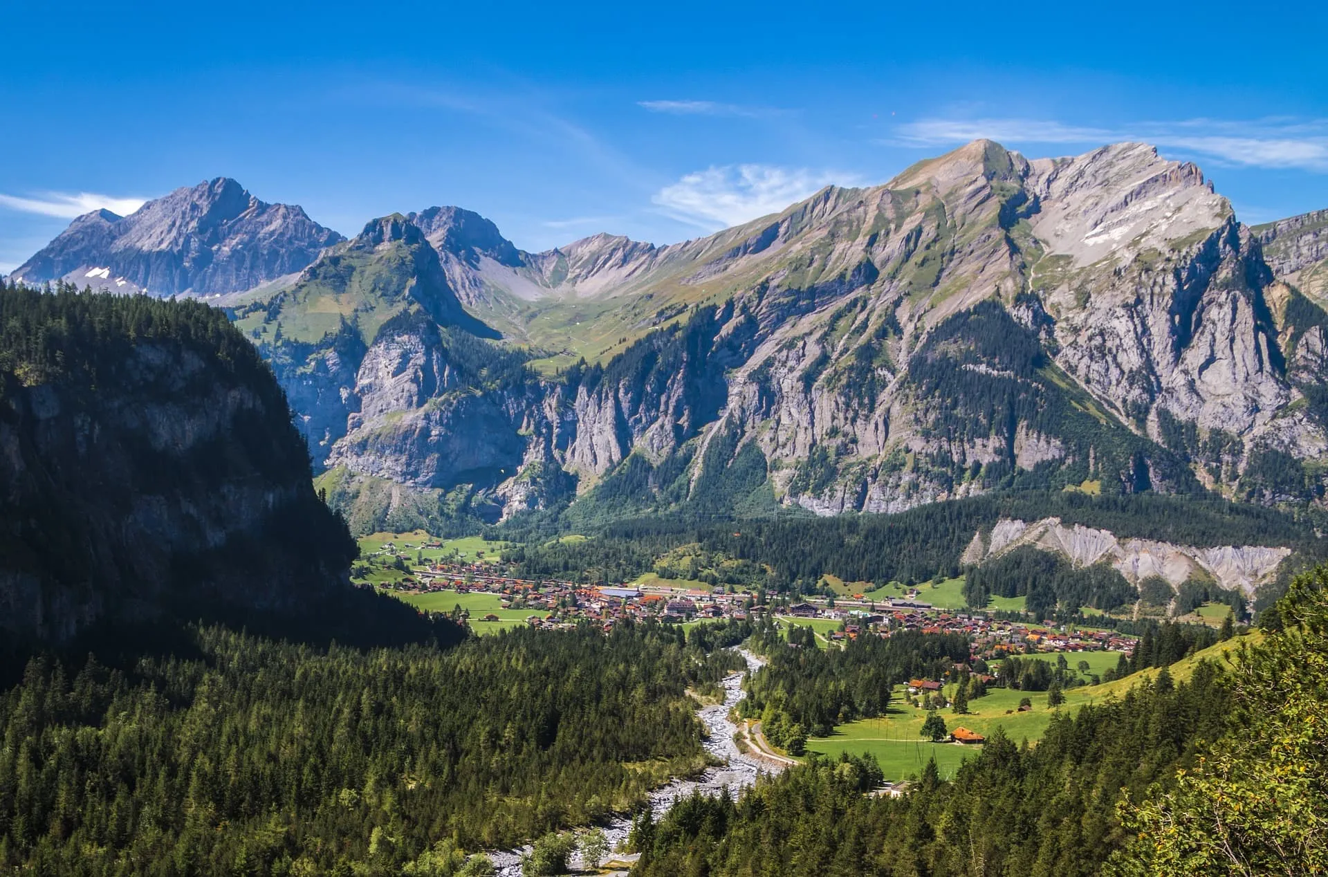
The Oeschinensee (Lake Oeschinen in English) lies above the village of Kandersteg in the Swiss Bernese Oberland, roughly one hour south of Bern by car. The lake sits at an elevation of 1,578 metres, covers 1.115 km² and reaches a maximum depth of 56 metres.

How it was formed. Large prehistoric landslides in the upper Kander valley created a natural dam between Kandersteg and Kandergrund, which impounded the lake. Geological research attributes the deposits either to a rock avalanche from the northern flank of the Doldenhorn, or to an older avalanche from the Fisistock. Estimates place the most recent major event at around 2,300 years ago. As you hike around the lake today, the dramatic cliffs and moraine ridges you see are the direct legacy of those colossal collapses.

UNESCO status. Since 2007, the Oeschinensee has formed part of the Swiss Alps Jungfrau–Aletsch UNESCO World Heritage Site, the largest glaciated area in the western Alps and the first Alpine region to receive World Heritage designation. The status reflects the lake's outstanding geological and natural significance, and it carries real consequences for visitors: trail management, visitor numbers and conservation measures are all shaped by the designation. Visiting here is not just a tick on a travel list; you are walking through a site of global importance.

The Oeschinensee is also a key stage on the Bärentrek, the most popular section of the Via Alpina 1, Switzerland's 390-kilometre alpine crossing.
Getting to the Oeschinensee from Kandersteg: gondola, walking and practical info

Closest airports and train connections

The closest major airports to the Oeschinensee are Zurich Airport and Geneva Airport, both approximately three hours from Kandersteg by train. Basel Airport is a little closer by rail. Most major European carriers serve all three airports. From either Zurich or Geneva, take a direct or connecting train to Bern, then continue to Spiez and change for Kandersteg. The Lötschberg railway line makes this a scenic journey in its own right.

By car, Kandersteg is about one hour south of Bern and roughly two hours from both Geneva and Zurich via the A6/A8 motorways.

From Kandersteg to the lake: gondola and walking options

From Kandersteg railway station, a bus runs to the gondola valley station (Talstation Oeschinen). Alternatively, the walk from the station to the valley station takes about 15 minutes on foot. From the valley station, you can either take the gondola or walk up to the lake.

Route / Option Duration Notes
Gondola (valley station to mountain station) ~5 min Cable car; book tickets in advance during peak season
Mountain station to lake shore (trail C, paved) ~20-25 min Suitable for pushchairs
Mountain station to lake shore (trail A, forest) ~90 min 450 m elevation gain; hiking boots required; not suitable for pushchairs
Hiking path from Kandersteg to lake (via valley station + trail A) ~2.5 h total Full ascent from village; challenging
Walk around the lake shore (trail K) ~10 min Flat, lake-level path; suitable for pushchairs
Gondola operating season (summer) Mid-May to mid-November Summer hours 09:00–17:30
Gondola operating season (winter) Mid-December to mid-March Winter hours 09:00–17:00
Gondola maintenance closure Mid-March to ~9 May Lake accessible on foot only during this period

Ticket prices: check current prices on oeschinensee.ch. With a SBB Half-Fare Card, GA travelcard or Swiss Travel Pass, you ride the gondola at half price. Pre-booking a time slot online is strongly recommended on weekends and public holidays, as cable car capacity is limited.

Parking. If arriving by car, follow signs to the Talstation Oeschinen valley station, where paid parking is available. Note that vehicles over 5 metres in length or 2 metres in height cannot park at the valley station; use the Schützenhaus car park or village parking instead. Electric charging stations (11 kW) are available at the P2 car park near the valley station.


Getting to the Oeschinensee from Kandersteg: gondola, walking and practical info

Hiking at the Oeschinensee: routes for every level

The Oeschinensee offers hiking for a wide range of abilities, from a gentle 20-minute stroll to a challenging multi-day mountain traverse. Here is how to pick the right option.

Is the Oeschinensee hike difficult?

Difficulty at the Oeschinensee varies enormously depending on which route you choose. The easy paved path from the gondola mountain station to the lake shore (trail C) is suitable for pushchairs and takes around 20-25 minutes with minimal elevation gain. The panoramic trail (trail D) is also straightforward. The forest hiking trail (trail A) from the valley station involves 450 metres of elevation gain and requires hiking boots and a reasonable level of fitness, but is not technically demanding. Routes towards the Heuberg viewpoint and Oberbärgli involve more ascent and mountain experience is recommended. The Fründenhütte trail has exposed T4 sections and is not suitable for inexperienced hikers.

In short: the lake itself is easy to reach; difficulty only increases if you head for higher terrain.

The hiking path to the Oeschinensee from Kandersteg

The classic approach on foot from Kandersteg follows trail A through the forest above the Öschibach stream. This takes around 90 minutes one way with 450 metres of ascent. It is a well-marked, rewarding route that rewards you with your first full view of the lake as you emerge from the tree line. The gondola removes the elevation gain if you prefer to save your legs for the trails around the lake.

The circular day hike: Heuberg viewpoint and back

The circular hike is the most popular full-day option. From the gondola mountain station, it climbs to the Heuberg viewpoint, where you look straight down onto the entire turquoise surface of the Oeschinensee from above. The route then descends via Oberbärgli (refreshments available) and Oeschibärgli to the lake shore, follows the shore path, and returns to Kandersteg or the gondola station. This hike covers the mountain hiking trail G (Läger–Heuberg–Oberbärgli, around 1h 15 min) combined with the lake circuit. Proper hiking boots and mountain experience are recommended for the Heuberg section.

The Oeschinensee with children

The lake is genuinely family-friendly if you use the gondola and the easier trails. Trail C from the mountain station to the lake is paved, approximately 25 minutes, and suitable for pushchairs. Trail D, the panoramic path, is also stroller-compatible and offers good views on the way down to the shore.

At the lake, the mountain coaster (toboggan run) operates from the mountain station down to the Berghotel am See, open to adults and children aged 8 and over. Swimming is permitted in summer, and the lake water is cold but refreshing on a warm day. For more ideas on family hiking in the Swiss mountains, see our guide to family-friendly hut-to-hut hiking in Switzerland.

Where to eat at the Oeschinensee

Several options are available at and near the lake, mostly open during the summer season from the second week of May onwards:

  • Oeschinensee Mountain Restaurant (on the lake shore): open daily 09:00–17:00; self-service; seasonal and regional cuisine.
  • Chalet Arva (hotel and restaurant at the lake): open in June, Wednesday through Sunday.
  • Bergstübli and Cafe Bar: further options at the lake area.
  • Oberbärgli: a refreshment stop on the Heuberg circuit; coffee, Apfelstrudel and cold drinks.

Pre-booked BBQ sets are also available from the main restaurant: pick up sausages, wood and equipment at the counter and use the designated BBQ areas.


Hiking at the Oeschinensee: routes for every level

Best time to visit the Oeschinensee

The Oeschinensee is open year-round, but each season offers a different experience.

June to September is the peak hiking season and the best all-round time to visit. All trails are open (subject to rockfall conditions; see below), the gondola runs full hours, the mountain huts and lakeside restaurants are operational, rowing boats are available and the lake is at its most vivid turquoise. The SAC mountain huts in the vicinity are staffed during this window. Expect the most visitors in July and August; arriving early in the morning on weekdays is the best strategy for avoiding crowds.

December to March brings a different kind of magic. Ice fishing on the lake is possible from 1 January until late March (a fishing licence is required). When conditions allow, ice walks are created across the frozen surface. The slopes around Kandersteg are also beginner-friendly for skiing and snowboarding. The gondola runs in winter between mid-December and mid-March (09:00–17:00).

April to mid-May and October to November are shoulder periods. The gondola is in maintenance between roughly mid-March and 9 May, meaning the lake is accessible on foot only. Snow can persist at higher elevations well into May. These months suit experienced hikers comfortable with variable conditions; the lake itself tends to be quieter and very atmospheric.

For up-to-date weather at each hut and trail section, the Bookatrekking app shows the current forecast based on the coordinates of each hut, which is a practical advantage when planning which day to push for the Heuberg or whether to set off for the Doldenhornhütte.


Best time to visit the Oeschinensee

What to do at the Oeschinensee

Beyond hiking, the Oeschinensee offers a varied menu of activities across the seasons:

Rowing. Rowing boats are available for rent daily from 10:00–17:30 between May and October. Reservations are not possible; it is first come, first served. Keep clear of the rock faces around the lake edge. Check current prices on oeschinensee.ch.

Mountain coaster (toboggan). The 750-metre mountain coaster runs from the gondola mountain station down towards the lake. Open daily weather permitting (09:30–17:15 when operating). Suitable for adults and children aged 8 and over.

Fishing. The lake holds Arctic char, trout and rainbow trout. Ice fishing runs from 1 January to late March; summer fishing is also permitted. A Swiss fishing licence is required in both seasons.

Winter sports. The area around Kandersteg and the lake is known for beginner-friendly ski slopes, snowboarding, sledging and snowshoeing. Ice walking across the frozen lake is possible in certain winters when conditions allow.

Safety note: rockfall hazard. At the Spitzen Stein (2,974 m), a rocky summit above the lake, rockfall risk has increased in recent years partly due to permafrost thaw linked to climate change. Authorities closed parts of the south shore in May 2020 after geologists warned of potential large rockfalls reaching the lake. In July 2025, prolonged rainfall accelerated slope movements and triggered closures of numerous trails in the Oeschiwald area. Always check the current trail status on oeschinensee.ch before visiting, especially after heavy rain. The Bookatrekking app also surfaces up-to-date trail and weather information per hut, so use it as part of your pre-trip planning.


What to do at the Oeschinensee

SAC mountain huts at the Oeschinensee

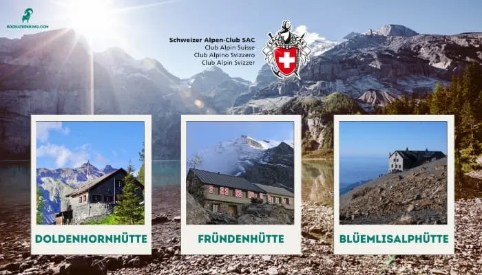
Three Swiss Alpine Club (SAC) huts sit within reach of the Oeschinensee, each offering a different character and difficulty of access.

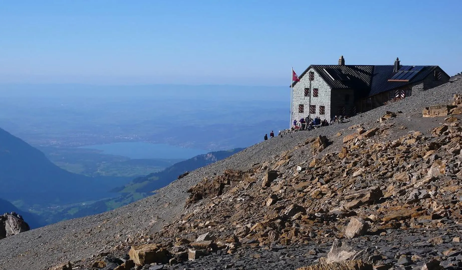
Doldenhornhütte SAC. The most accessible of the three, sitting on a rocky outcrop above Kandersteg on the Biberg. Built in traditional alpine style with simple, homely furnishings and a washroom outside the hut. Fritz and Heidi run the hut and are outstanding hosts. The surroundings offer impressive views of the Kandertal Valley and Lake Oeschinen. This is a family-friendly environment with diverse flora and is the hut used in Bookatrekking's mini hut-to-hut trek.

Fründenhütte SAC. Located a thousand metres directly above the Oeschinensee, this is a hut for experienced mountain hikers. The access trail has exposed passages, and the Fründschnuer trail behind the lake is a T4 route requiring sure-footedness and a head for heights. The receding Fründengletscher has left behind a striking landscape of small moraine lakes directly beside the hut.

Blüemlisalphütte SAC. Sits just above the Hohtürli pass (2,840 m), the crossing between Kandersteg and the Kiental. The panoramic view from here is genuinely extraordinary and justifies an overnight stay on its own. It is also the base for high-altitude routes in the Blüemlisalp group. A climbing garden is located below the hut.

The walking holidays in Switzerland that Bookatrekking offers include nights in these huts as part of managed, all-in packages, taking the logistics of hut booking and route planning out of your hands entirely.

For context on the wider alpine landscape these huts sit within, the geology of the Swiss Alps is worth reading before your trip. And if you are curious about the wildlife you might encounter on the trail, our piece on flora and fauna in Switzerland adds another layer to the experience.


SAC mountain huts at the Oeschinensee

Mini Hut-to-Hut Trek at Oeschinensee

Want to do something unique? As you now know, there are a few different SAC mountain huts in the vicinity of Oeschinen Lake. This trek allows you to do the classic Heuberg and Oeschinsee loop and adds a night at the beautiful Doldenhornhütte. Fritz and Heidi (we didn't make it up) will be your hosts, your hut will be booked and it includes half board!
Day
1

Kandersteg - Doldenhornhütte SAC

Duration: 06:30 h
Distance: 12 km
Ascent: 880 m
Descent: 670 m
Your trek starts at the upper cable car station. You can also start your hike in Kandersteg but this will add another hour to the itinerary. From the cable car, you will follow a single track hiking path to one of the absolute highlights on this hike. The view point at Heuberg allows you to take in all the turquoise magic from a bird’s eye view. You can take a quick break at Oberbärgli. Apfelstrudel, coffee and beer among other things are on the menu. You then take the switchbacks down via Oeschibärgli to the lake. You then follow the trail by the lake towards the main restaurant and the boat rentals. Where day-trippers would now go back to either Kandersteg or the cable car station, you keep going and start ascending in the forest. After a few switchbacks, you find yourself on the Biberg. Here you can find the beautiful Doldenhornhütte, where Fritz and Heidi will await you.

Doldenhornhütte

Info
Doldenhornhütte
Doldenhornhütte
Day
2

Doldenhornhütte SAC - Kandersteg

Duration: 03:00 h
Distance: 5.5 km
Ascent: 10 m
Descent: 730 m
Good morning! After a lovely breakfast, you take the same way down as you came up yesterday. The difference is that you take a left and not a right. This trail will make your approach Kandersteg from the South. It is quite an easy hike. If you are feeling strong, you can also choose to first do an out-and-back hike up from the Doldenhornhütte. Just be mindful, that the Felsenpfad on the Fisialp is a T4 segment. This is a very exposed section which requires prior experience. Don’t worry, it is not part of the regular route down. It is only optional.

Booking the mini hut-to-hut trek and multi-day treks at the Oeschinensee

Bookatrekking offers three bookable options centred on the Oeschinensee, all self-guided with accommodation, half board at huts and route information provided in advance.

Mini hut-to-hut trek (2 days). This is the entry point into the Oeschinensee overnight experience. On day one, you take the gondola from Kandersteg and follow the single-track trail to the Heuberg viewpoint, where the full turquoise panorama of the lake opens below you. A short break at Oberbärgli, then switchbacks down via Oeschibärgli to the lake shore. While day visitors turn back to the gondola, you continue along the shore and ascend through the forest to the Biberg and the Doldenhornhütte. Fritz and Heidi have your room and half-board dinner waiting. On day two, after breakfast you descend via a different trail that approaches Kandersteg from the south: an easy, satisfying return.

Beginner Oeschinen Trek (6 days). A 42.7 km route starting in Isenfluh, with the longest day covering 10.3 km. The stages are: Isenfluh to Lobhornhütte (4.4 km, +850 m), Lobhornhütte to Hotel Sonnenberg in Mürren (10.3 km, +410 m), Mürren to Rotstockhütte (6.0 km, +310 m), Rotstockhütte to Gspaltenhornhütte (6.5 km, +750 m), Gspaltenhornhütte to Blüemlisalphütte (7.3 km, +930 m), and Blüemlisalphütte to Oeschinensee Mountain Station (8.2 km, +60 m). The final day finishes directly at the lake, making the arrival feel like a genuine reward.

Intermediate Oeschinensee Trek (5 days). The same total distance (42.7 km) compressed into five days, with the longest stage at 16.3 km. Stages: Isenfluh to Lobhornhütte (4.4 km, +850 m), Lobhornhütte to Rotstockhütte (16.3 km, +720 m), Rotstockhütte to Gspaltenhornhütte (6.5 km, +750 m), Gspaltenhornhütte to Blüemlisalphütte (7.3 km, +930 m), Blüemlisalphütte to Oeschinensee Mountain Station (8.2 km, +60 m). Suited to hikers who are comfortable with longer days and solid cumulative ascent.

Both packages are all-in: hut bookings, half board, a pre-trip information pack and support from the Bookatrekking team. The Bookatrekking app gives you the route navigation and per-hut weather for each day, so you always know what to expect before you set out.


The Oeschinensee as part of the Bärentrek and the Via Alpina

The Oeschinensee is not just a day-trip destination; it is also the dramatic finale of the Bärentrek, the most popular section of the Via Alpina 1. The Via Alpina 1 is a 390-kilometre traverse of the Swiss Alps divided into 20 stages, running from Vaduz in Liechtenstein to Montreux on Lake Geneva. The Bärentrek covers the central, most celebrated section.

For through-hikers, arriving at the Oeschinensee after several days of high-alpine passes and glacial scenery carries a particular emotional weight: the turquoise lake appears below the Hohtürli pass like a destination earned. The Blüemlisalphütte, which sits just above this pass, marks the transition point between the high route and the descent to the lake.

If you are considering the full Bärentrek or the wider Via Alpina, Bookatrekking offers guided and self-guided packages for both. The Oeschinensee multi-day treks described above are designed specifically to capture this through-hiking experience without requiring you to commit to the full 390-kilometre route.


Booking the mini hut-to-hut trek and multi-day treks at the Oeschinensee

Frequently asked questions about the Oeschinensee

How long does it take to hike lake Oeschinensee?

From the gondola mountain station, the easy paved path to the lake shore takes around 20-25 minutes. Hiking up from the valley station via the forest trail (trail A) takes approximately 90 minutes one way. A full circular day hike including the Heuberg viewpoint covers around 3-4 hours of walking in total. The short lake-shore path (trail K) takes just 10 minutes.

How do I get to Oeschinensee, Switzerland?

Take a train to Kandersteg, which is roughly 3 hours from Zurich or Geneva airports and about 1 hour from Bern. From Kandersteg station, a bus connects to the gondola valley station (Talstation Oeschinen), or it is a 15-minute walk. From there, take the gondola to the mountain station and walk 20-25 minutes to the lake on the easy paved trail.

Is Oeschinensee worth visiting?

Yes, without reservation. The Oeschinensee combines a UNESCO World Heritage setting, a striking turquoise lake hemmed in by sheer limestone cliffs, genuine alpine activities (hiking, rowing, via ferrata, winter sports) and outstanding mountain huts for overnight stays. It is accessible enough for a half-day trip yet rewarding enough to anchor a week-long trek.

Is it allowed to swim in Oeschinensee?

Yes, swimming is permitted in the Oeschinensee in summer. The lake water is very cold given its alpine elevation (1,578 m), but bathing is a popular activity between June and September. There are no designated swimming zones, but stay clear of the rock faces around the lake edges and be aware of rowing boats on the water.

About Us

At Bookatrekking.com, you will find the trek that will make your life unforgettable. Whether you want to explore the Inca Trail or climb Kilimanjaro. Bookatrekking.com has a wide and varied range of first-class treks. No false promises are made here. Transparent prices and bookings are fixed instantly. Find, compare, book and trek!
Read more about us
About Us
About Us

Also Interesting