Hiking in the Pyrenees: The Best Hut-to-Hut Treks, GR10 and GR11

Sierd van der Bij
Sierd van der Bij
Sierd van der Bij
28 Oct 2026 • 12 min read
Hiking in the Pyrenees: The Best Hut-to-Hut Treks, GR10 and GR11
Trekking experts per destination
Free cancellation up to eight weeks in advance
Quick personal advice

Hiking in the Pyrenees means walking along the border between France and Spain, from the Atlantic Ocean to the Mediterranean Sea, with Andorra in the middle. The range offers granite peaks and hundreds of high-altitude lakes in the Catalan Pyrenees, green valleys and dramatic cirques on the French side, and mountain huts where you sleep high above the valleys. This guide covers the long-distance routes GR10, GR11 and HRP, the hut-to-hut circuits you can walk in three to six days, the best season, how mountain huts work, how to get there and what it costs. For a first overview, browse our 5-day hut-to-hut hikes in the Pyrenees.

Hiking in the Pyrenees: which trek suits you?

For hiking in the Pyrenees you choose between a long-distance route and a shorter hut-to-hut trek. The GR10 (French side) and GR11 (Spanish side) both run from the Atlantic to the Mediterranean and take many weeks to walk in full (about 50 to 60 days for the GR10). The HRP (Haute Route Pyrénéenne) stays close to the main ridge and is partly unmarked. Most walkers choose a section of three to six days instead. The table below shows all nine Pyrenees hiking treks we organise.

Trek Area Days Distance Ascent Meals From (per person, 2 people, 2027 season)
Petit Carros de Foc Aigüestortes, Spanish Pyrenees 3 23.7 km 1,370 m Full board 290 euros
Half Carros de Foc Aigüestortes, Spanish Pyrenees 5 41.1 km 2,240 m Full board 520 euros
Hard Carros de Foc Aigüestortes, Spanish Pyrenees 5 57.9 km 3,610 m Full board 545 euros
Full Carros de Foc Aigüestortes, Spanish Pyrenees 6 64.3 km 3,730 m Full board 665 euros
Porta del Cel Catalan Pyrenees, border with France 4 59.2 km 4,560 m Full board 465 euros
GR10 Exploration Hike French Pyrenees, Cauterets to Gavarnie 3 37.0 km 1,950 m Half board 200 euros
Hardcore GR11 Ordesa, Spanish Pyrenees 3 41.8 km 2,850 m Half board 195 euros
Andorra-Spain Traverse Andorra and Spain 4 69.9 km 4,270 m Half board 275 euros
Andorra Lakes Loop Andorra 5 93.5 km 6,180 m Half board 375 euros

First hut-to-hut trek or walking with children: start with the Petit or Half Carros de Foc. See also hut-to-hut hiking in the Pyrenees for beginners and hut-to-hut hiking in the Pyrenees with children.

Experienced hikers: the Full or Hard Carros de Foc, the GR10 Exploration Hike or the Hardcore GR11 are good choices.

Very fit and experienced: the Porta del Cel and the two Andorra treks are graded Advanced or Expert and involve long daily distances with significant ascent.

How difficult is hiking in the Pyrenees?

Hiking in the Pyrenees ranges from moderate to demanding. There is no climbing on any of our treks, but these are real high mountains with steep paths, rocky passes and long descents. The range is wide: from 23.7 km over three days on the Petit Carros de Foc to 93.5 km and 6,180 m of ascent over five days on the Andorra Lakes Loop. What matters most is a base level of fitness, a few days of hiking with a loaded backpack before you go, and well broken-in walking boots. Choose a trek based on the daily distance and ascent, not on speed.

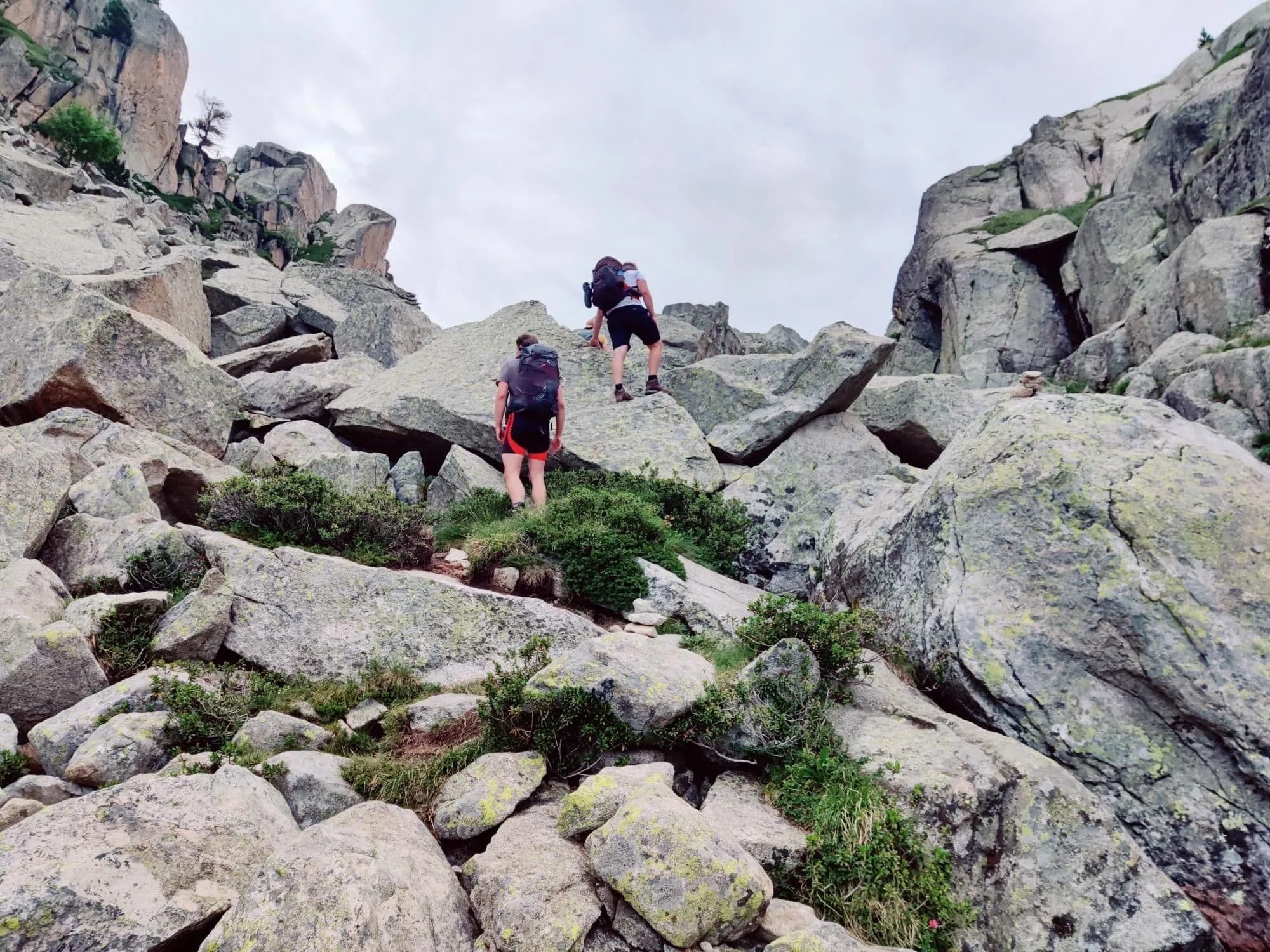
Steep and rocky sections: some stages cross steep, rocky passes where you need sure footing, especially on the Porta del Cel (the climb to Pica d'Estats) and the two Andorra treks. The trip page describes every stage, so read it before you book.

How to prepare: in the weeks before your trek, walk regularly with the backpack you will carry, include some long days with climbs and descents, and practise walking downhill with poles. If you can walk two days in a row with your pack, a three- to five-day hut-to-hut trek is within reach.

GR10: hiking the French Pyrenees

The GR10, known as the Pyrenean Way, is the main long-distance walking route on the French side of the range. It runs from Hendaye on the Atlantic coast to Banyuls-sur-Mer on the Mediterranean, roughly 900 km with a large amount of ascent; most people walking the full route need about 50 to 60 days. The trail is waymarked with red and white paint stripes. Accommodation along the way includes mountain refuges (guarded huts), gîtes d'étape (simple hiker lodges in villages) and, on some sections, campsites. There is no guarded refuge at the end of every stage, so through-hikers need to plan carefully. Most people hiking the Pyrenees walk a section of the GR10 rather than the whole route.

Our way to try hiking the French Pyrenees in three days is the GR10 Exploration Hike from Cauterets to Gavarnie in the Hautes-Pyrénées:

  • Day 1: Cauterets to Chalet du Clot, 8.9 km, 680 m of ascent
  • Day 2: Chalet du Clot to Refuge de Bayssellance below the Vignemale, 13.2 km, 1,210 m of ascent (the hardest day)
  • Day 3: Refuge de Bayssellance to Gavarnie, 14.9 km, 1,320 m of descent, arriving at the Cirque de Gavarnie, part of the Pyrénées-Mont Perdu UNESCO World Heritage site

The trek is graded Intermediate. The night at Refuge de Bayssellance, high in the French Pyrenees, gives a clear picture of what walking in the Pyrenees feels like before you commit to a longer route. For more options on the French side, see our guide to hiking in France.

GR10: hiking the French Pyrenees

Carros de Foc: hut to hut in Aigüestortes National Park

The Carros de Foc is a hut-to-hut circuit through Aigüestortes i Estany de Sant Maurici National Park in the Catalan Pyrenees, linking nine mountain huts (refugis in Catalan). The route was created in 1987 when the wardens of the refuges in the park started visiting each other on foot. Today hikers can collect a stamp from each refugi along the way, a small tradition that gives the circuit its identity.

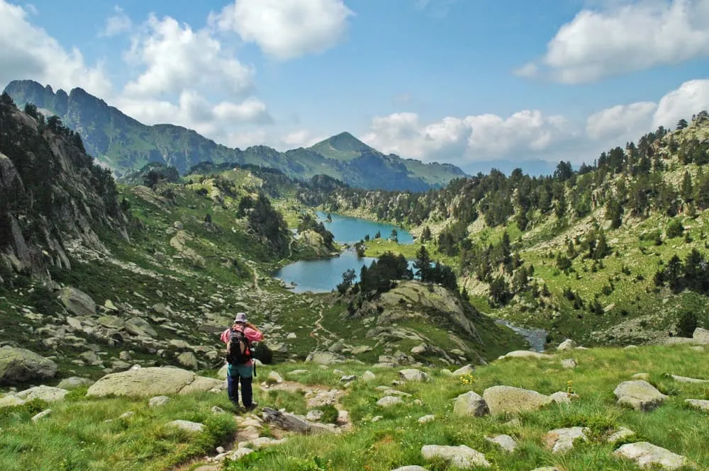
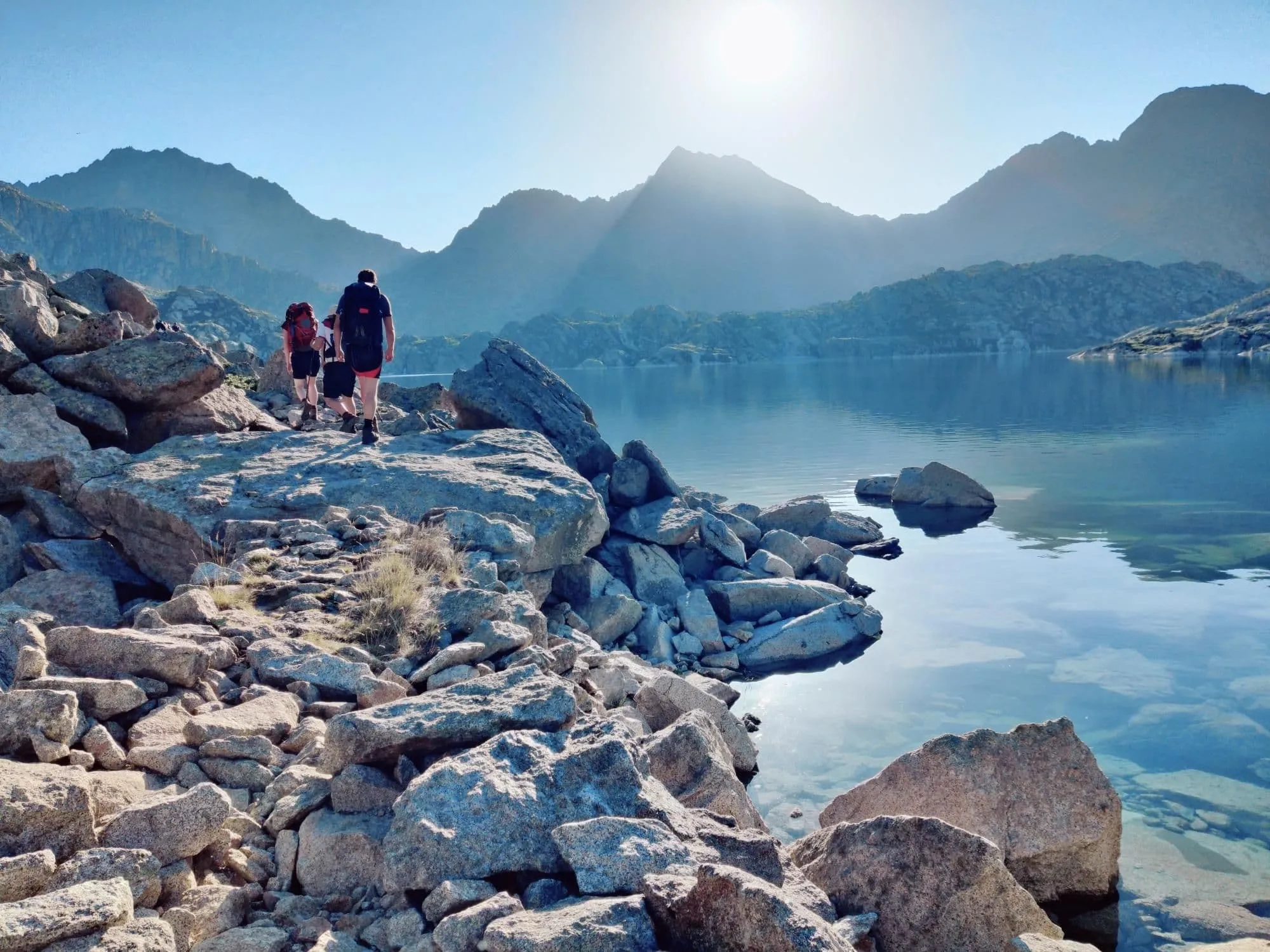
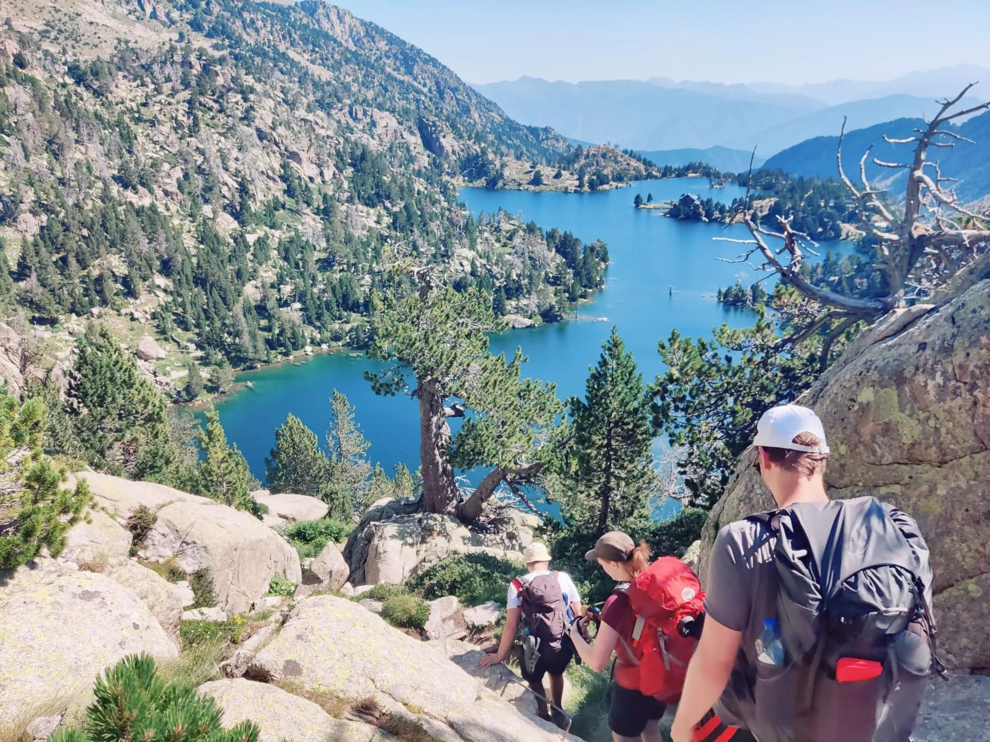
The landscape is defined by granite peaks, high passes and hundreds of mountain lakes.

We offer four versions of the Carros de Foc:

  • Petit Carros de Foc: 3 days, 23.7 km, 1,370 m of ascent, with stages of 7.1 to 8.9 km. This is our family trek, with shorter days suited to walkers who are new to hut-to-hut hiking or hiking with children.
  • Half Carros de Foc: 5 days, 41.1 km, 2,240 m of ascent, stages 6.7 to 11.4 km. A good choice for walkers with some multi-day hiking experience.
  • Hard Carros de Foc: 5 days, 57.9 km, 3,610 m of ascent, longest day 16.3 km. A demanding version for hikers who want more distance and elevation each day.
  • Full Carros de Foc: 6 days from Espot back to Espot, 64.3 km, 3,730 m of ascent, stages of 7.9 to 13.8 km. Also available as an 8-day trip with hotel nights before and after (870 euros per person when two people book together).

All versions are full board: breakfast, a packed lunch and dinner are included in the trek price. The huts on the Carros de Foc have dormitories only. For a full guide to the route, read everything about the Carros de Foc.

Carros de Foc: hut to hut in Aigüestortes National Park

Porta del Cel: hiking to the highest peak in Catalonia

The Porta del Cel ("Gate of Heaven" in Catalan) is a demanding four-day hut-to-hut circuit starting from Tavascan in the Catalan Pyrenees. The route climbs Pica d'Estats (3,143 m), the highest peak in Catalonia, which stands on the border with France. One night is spent on the French side. Most of the route lies within Parc Natural de l'Alt Pirineu, the largest natural park in Catalonia.

The four stages with exact figures from our route data:

  • Day 1: Tavascan to Refugi de Certascan, 14.6 km, 1,470 m of ascent (passing the large Certascan lake)
  • Day 2: Refugi de Certascan to Refuge du Pinet (France), 12.6 km, 1,120 m of ascent
  • Day 3: Refuge du Pinet to Refugi de Vallferrera, 13.0 km, 930 m of ascent, including the climb of about 900 m to Pica d'Estats (3,143 m) on the border
  • Day 4: Refugi de Vallferrera to Tavascan, 19.0 km, 1,040 m of ascent and 1,810 m of descent

Total: 59.2 km and 4,560 m of ascent. The Porta del Cel is graded Advanced on our trip page and is suited only to experienced mountain hikers who are comfortable on steep, rocky terrain with significant daily ascent. Every day involves more than 900 m of climbing. There is also a 5-day variant with a hotel night after the trek (575 euros per person when two people book together).

Book the Porta del Cel hut-to-hut trek or read the Porta del Cel in detail before you decide.

Porta del Cel: hiking to the highest peak in Catalonia

GR11, Ordesa and Andorra: more hiking in the Spanish Pyrenees

The GR11, also called the Senda Pirenaica, is the Spanish counterpart of the GR10. It runs from Cap de Higuer near Hondarribia in the Basque Country to Cap de Creus on the Mediterranean, about 840 km, usually split into around 45 stages. Compared to the GR10, the GR11 runs at higher elevation with wilder terrain, drier weather on the Spanish side and fewer villages along the way. Accommodation is in refugios, villages and sometimes a tent.

Our three-day taste of the GR11 is the Hardcore GR11, set in Ordesa y Monte Perdido National Park:

  • Day 1: Pradera de Ordesa to Refugio de Góriz, 12.1 km, 910 m of ascent
  • Day 2: Refugio de Góriz to Refugio de Pineta, 15.3 km, 1,040 m of ascent and 1,990 m of descent, crossing the Añisclo pass, followed by a long, steep descent into the Pineta valley
  • Day 3: Refugio de Pineta to Parzán, 14.4 km, 900 m of ascent

Total: 41.8 km and 2,850 m of ascent. As the name says, this is a demanding trek for experienced hikers. For a broader look at walking holidays in Spain beyond the Pyrenees, see our guide to walking holidays in Spain. If you want another hut-to-hut option in northern Spain, hiking in Picos de Europa is worth exploring.

Hiking in Andorra: lakes and high passes

Andorra is a small country between France and Spain with no airport. Its highest point is the Coma Pedrosa (2,942 m). We offer two expert-level treks here. The Andorra Lakes Loop is 5 days, 93.5 km and 6,180 m of ascent from Escaldes-Engordany, with daily distances of 12.3 to 21.7 km. The Andorra-Spain Traverse is 4 days, 69.9 km and 4,270 m of ascent, with the longest day at 25.2 km. Both treks are graded Expert and involve long days with significant ascent for experienced hikers only.

Haute Route Pyrénées (HRP)

The HRP is a high-level route of roughly 800 km that stays close to the main ridge of the Pyrenees, crossing between France and Spain throughout. Large sections are unmarked, and walkers need solid navigation skills and mountain experience to follow it safely. We do not offer the HRP. For most people walking in the Pyrenees for the first time, a section of the GR10 or GR11, or a structured hut-to-hut circuit, is a more practical and rewarding starting point.

GR11, Ordesa and Andorra: more hiking in the Spanish Pyrenees

Pyrenees hiking map: where are the routes?

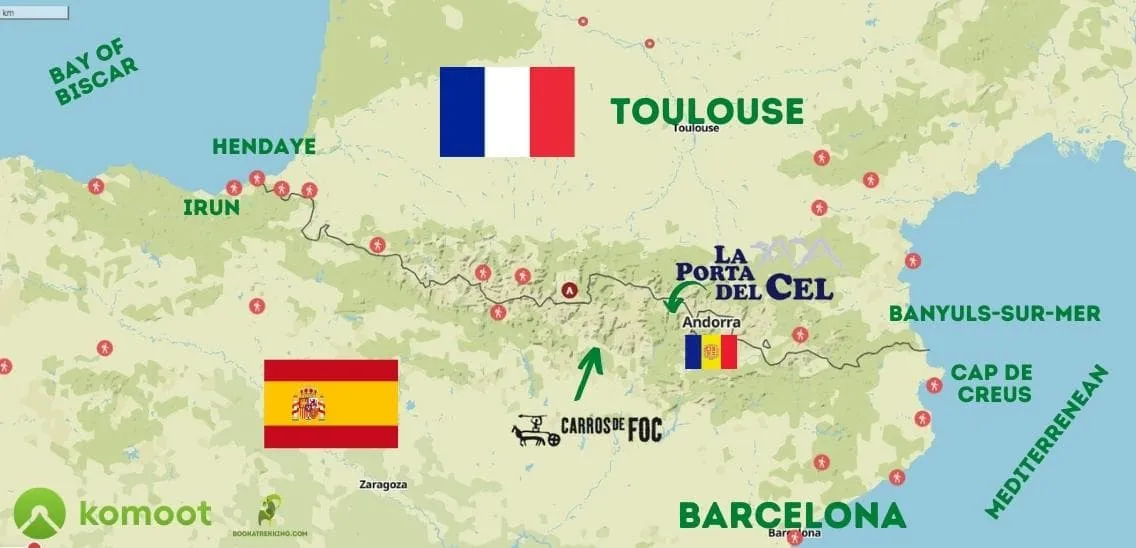
The Pyrenees stretch from the Atlantic to the Mediterranean. From west to east, the main landmarks and routes sit as follows.

At the Atlantic end, the GR10 starts at Hendaye in France and the GR11 starts near Hondarribia in Spain, a few kilometres apart. Just inland, the Camino Francés crosses the western Pyrenees from Saint-Jean-Pied-de-Port in France down to Roncesvalles in Spain; for more on that pilgrim route, read our guide to the Camino Francés.

Moving east into the Hautes-Pyrénées in France, you reach Cauterets, the start of our GR10 Exploration Hike, and then the Vignemale and the Cirque de Gavarnie (part of the Pyrénées-Mont Perdu UNESCO World Heritage site). Directly south of Gavarnie, just across the border in Spain, lies Ordesa y Monte Perdido National Park, where our Hardcore GR11 takes place.

Further east, on the Spanish side, stands Aneto (3,404 m), the highest peak in the entire Pyrenees. East of Aneto lies the Aigüestortes i Estany de Sant Maurici National Park in the Catalan Pyrenees, the setting for all four of our Carros de Foc treks.

East of Aigüestortes, near the village of Tavascan, the Porta del Cel circuit begins and climbs to Pica d'Estats on the French border. Andorra sits further east still, surrounded by France and Spain. The mountains end at the Mediterranean: Banyuls-sur-Mer in France is the final point of the GR10, Cap de Creus in Spain the final point of the GR11.

Every trip page on our site shows the daily stages of the trek on a map. For the wider story of these mountains, read about the history and geology of the Pyrenees.

Pyrenees hiking map: where are the routes?

When is the best time for hiking in the Pyrenees?

The guarded mountain huts on our treks are open in summer; the treks run from approximately mid-June to mid-September, with the Andorra treks open from early June to late September. That window is when hiking in the Pyrenees is practical for most people.

June and early July: snow can still lie on the high passes. Trails are quieter and wildflowers bloom on the lower slopes. Check the trip page for the exact opening date of each trek.

July and August: the busiest months for walking in the Pyrenees. Afternoon thunderstorms are common in the mountains; start early and aim to reach the hut before early afternoon. Hut beds must be booked in advance in summer; on our treks we arrange this for you.

September: trails are noticeably quieter, the light is clear and the days are still long enough for a full day of walking. Huts begin to close in the second half of September, so check the trip page for exact dates.

The exact opening and closing dates for each trek are listed on the individual trip page. For what to look for in the landscape through the seasons, see our guide to the flora and fauna of the Pyrenees.

Mountain huts in the Pyrenees: refuges and refugis

Mountain huts in the Pyrenees are called "refuge" in French, "refugi" in Catalan and "refugio" in Spanish. They are guarded in summer and offer dormitory sleeping with bunk beds. Dinner and breakfast are served at fixed times; a packed lunch can be ordered the evening before. Bring a sleeping-bag liner, a small towel and some cash, because not every hut accepts card payment. In summer, booking ahead is necessary. On our treks, we book the huts for you. The Carros de Foc and Porta del Cel treks are full board (breakfast, packed lunch and dinner included); the GR10, GR11 and Andorra treks are half board (breakfast and dinner included, lunch not included). For a sense of what life is like in the valleys and around these huts, read about life and traditions in the Pyrenees.

Packing list for hiking in the Pyrenees

  • Well broken-in walking boots
  • Backpack of approximately 30 to 40 litres
  • Waterproof jacket and waterproof trousers
  • Warm mid-layer (fleece or insulated jacket)
  • Hat and gloves (even in summer at altitude)
  • Sun protection: sunscreen, sunglasses, sun hat
  • Sleeping-bag liner
  • Small towel
  • Headlamp with spare batteries
  • Water bottle (at least 1 litre)
  • Small first-aid kit including blister plasters
  • Walking poles
  • Cash for huts and small purchases
  • ID and travel insurance documents

How do you get to the Pyrenees?

Getting to the Pyrenees means flying into one of several airports and then travelling by bus, train or rental car to the trailhead.

Carros de Foc and Porta del Cel: fly to Barcelona. Espot, the start of all four Carros de Foc treks, is about four hours by car northwest of Barcelona. Tavascan, the start of the Porta del Cel, is in the same region of the Catalan Pyrenees.

GR10 Exploration Hike: fly to Toulouse or Tarbes-Lourdes airport, then take the train to Lourdes and a bus to Cauterets, where the trek starts.

Hardcore GR11 in Ordesa: fly to Zaragoza or Barcelona, then travel to the village of Torla, which is the gateway to Ordesa y Monte Perdido National Park.

Andorra treks: Andorra has no airport. There are regular bus services from both Barcelona and Toulouse airports to Andorra la Vella (Escaldes-Engordany), where both Andorra treks start.

Travel to the trailhead is not included in any of our treks. Each trip page explains exactly how to reach the start point.

What to do in an emergency in the Pyrenees

The European emergency number 112 works in Spain, France and Andorra. Mobile reception is not guaranteed in the mountains, especially in remote valleys and on high passes. Before you set out each day, tell the hut warden or someone at home your planned route and estimated arrival time. Turn back if the weather turns bad; afternoon thunderstorms develop quickly in summer. Make sure your travel insurance covers hiking and mountain rescue in the mountains. On summer pastures you may encounter livestock guard dogs (patous) protecting sheep: walk calmly around the herd and do not approach or pet the dogs.

How do you get to the Pyrenees?

How much does a hut-to-hut trek in the Pyrenees cost?

A self-guided hut-to-hut trek in the Pyrenees with us costs from 195 euros per person for three days (Hardcore GR11) to 665 euros per person for the six-day Full Carros de Foc, when two people book together (2027 season, as of October 2026).

What is included:

  • Hut nights (dormitory accommodation)
  • Full board or half board as listed in the table above
  • All hut bookings made by us
  • Route descriptions and maps in our trekking app, with GPS navigation that also works offline

What is not included:

  • Travel to the start and back
  • Local transport (bus, taxi or cable car to and from the trailhead)
  • Travel insurance
  • Drinks and personal expenses
  • Lunch, on the half-board treks (GR10, GR11 and Andorra)

Booking alone as a single traveller costs more per person; the price for solo booking is shown on the trip page. Free cancellation is available up to eight weeks before departure.

Our Pyrenees treks are hut-to-hut and self-guided: you carry your own backpack from hut to hut, and luggage transfer is not part of the trek. That keeps the price low and lets you sleep high in the mountains instead of in the valley.

Browse all options on our page for 5-day hut-to-hut hikes in the Pyrenees. Our trekking experts are available to help you choose the trek that matches your experience and the time you have.

Hiking in the Pyrenees: frequently asked questions

Are the Pyrenees good for hiking?

Yes. The Pyrenees offer long marked routes, guarded mountain huts open in summer and generally quieter trails than in many parts of the Alps. The range crosses three countries (France, Spain and Andorra), with options from three-day hut-to-hut circuits to the full GR10 and GR11 long-distance routes that take many weeks.

When is the best time to hike in the Pyrenees?

Mid-June to mid-September is the main hiking season, when the mountain huts are open. July and August are the busiest months and afternoon thunderstorms are common; start each day early. September is quieter, though huts begin to close in the second half of the month and days are shorter.

Which is better, the GR10 or the GR11?

Neither is better: they suit different walkers. The GR10 runs on the French side with more villages, gîtes d'étape and green valleys. The GR11 runs on the Spanish side, at higher elevation, with wilder terrain and drier weather. Try a section of each: the GR10 Exploration Hike (3 days, French side) and the Hardcore GR11 (3 days, Ordesa) are both good introductions.

How long does it take to hike across the Pyrenees?

Hiking the full GR10 (roughly 900 km on the French side) takes about 50 to 60 days. The GR11 on the Spanish side covers about 840 km and is usually split into around 45 stages. Most people walking the Pyrenees choose a section or a hut-to-hut circuit of three to six days rather than the full crossing.

How hard is hiking in the Pyrenees?

Hiking in the Pyrenees ranges from moderate to very demanding depending on the route. There is no technical climbing on our treks, but the paths are steep, passes are rocky and descents can be long. Daily distances on our treks range from under 10 km on the Petit Carros de Foc to 25.2 km on the Andorra-Spain Traverse; the Andorra Lakes Loop covers 93.5 km and 6,180 m of ascent in five days. Choose a trek based on the daily distance and ascent per day.

Are there bears in the Pyrenees?

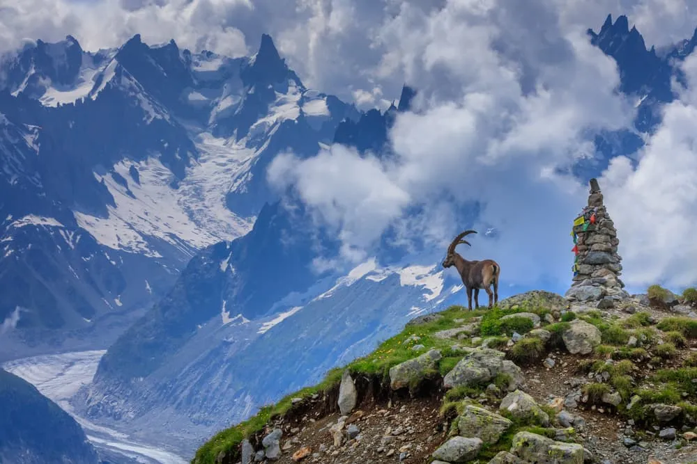
Yes, a small population of brown bears lives in the central Pyrenees, reintroduced from Slovenia since the 1990s. Encounters on the trail are very rare. On summer pastures you may also meet livestock guard dogs (patous) protecting sheep; walk calmly around the herd and do not pet them. For more on wildlife along the trails, read the guide to flora and fauna of the Pyrenees.

Can you hike hut to hut in the Pyrenees without a guide?

Yes. The Carros de Foc, the GR10 and the GR11 are all waymarked routes and many walkers go self-guided. On our treks, all of which are self-guided, we book the huts for you in advance and you get route descriptions and offline GPS navigation for every stage in our trekking app. The Full Carros de Foc is a good example of how a self-guided hut-to-hut circuit works.

Which part of the Pyrenees is best for hiking?

It depends on what you want to see. Aigüestortes in the Catalan Pyrenees is known for granite peaks and hundreds of lakes on the Carros de Foc; Ordesa and Gavarnie for deep canyons and great cirques; the Porta del Cel and Andorra for high passes and long days. For a first hut-to-hut trek, Aigüestortes is the easiest start.

Can you wild camp in the Pyrenees?

Rules differ by country and by protected area. In France a one-night bivouac in the mountains is often tolerated, while in Spain and Andorra wild camping is mostly restricted, and in national parks such as Aigüestortes and Ordesa it is not allowed or only under strict conditions. Check the local rules before you go; sleeping in the guarded huts avoids the question.

Does the Camino de Santiago cross the Pyrenees?

Yes. The Camino Francés, one of the main routes to Santiago de Compostela, crosses the western Pyrenees from Saint-Jean-Pied-de-Port in France to Roncesvalles in Spain. It is a long-distance pilgrim route with hostels (albergues) along the way, not a mountain hut-to-hut trek. Read more in our complete guide to the Camino Francés.


About Us

At Bookatrekking.com, you will find the trek that will make your life unforgettable. Whether you want to explore the Inca Trail or climb Kilimanjaro. Bookatrekking.com has a wide and varied range of first-class treks. No false promises are made here. Transparent prices and bookings are fixed instantly. Find, compare, book and trek!
Read more about us
About Us
About Us

Also Interesting