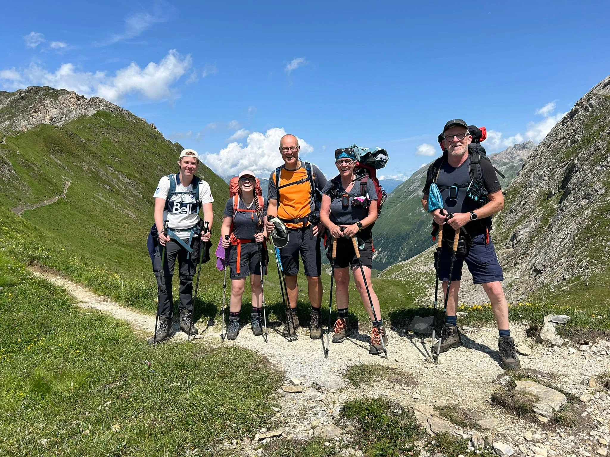
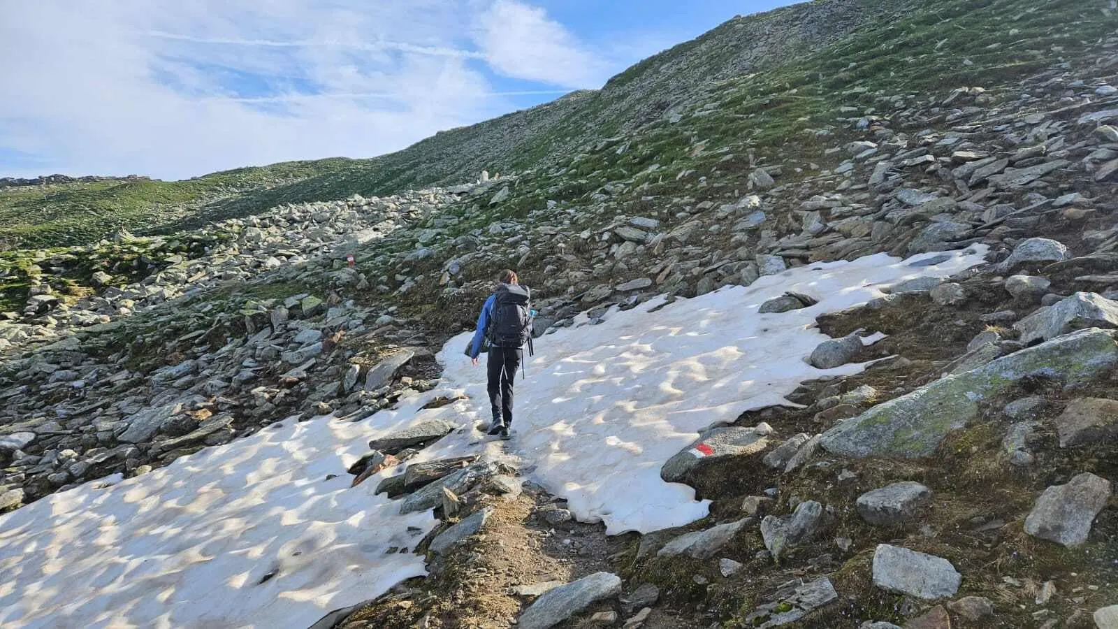
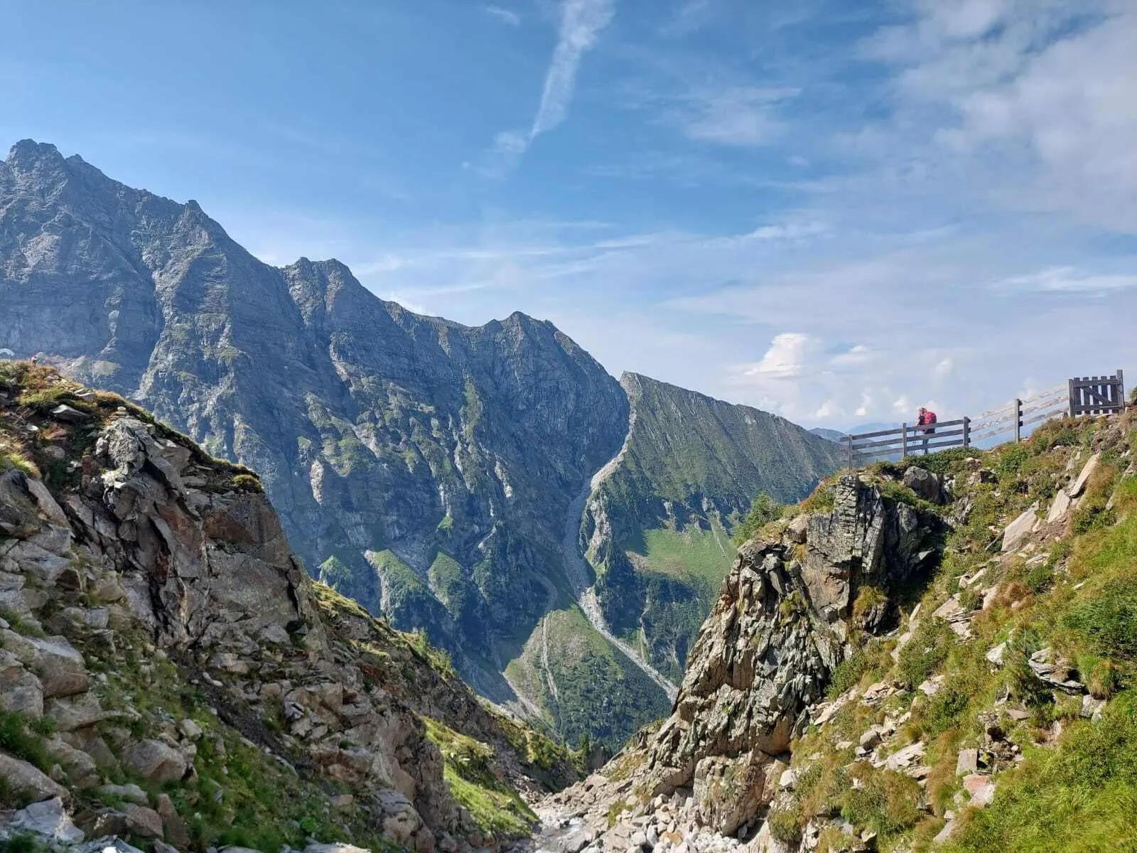
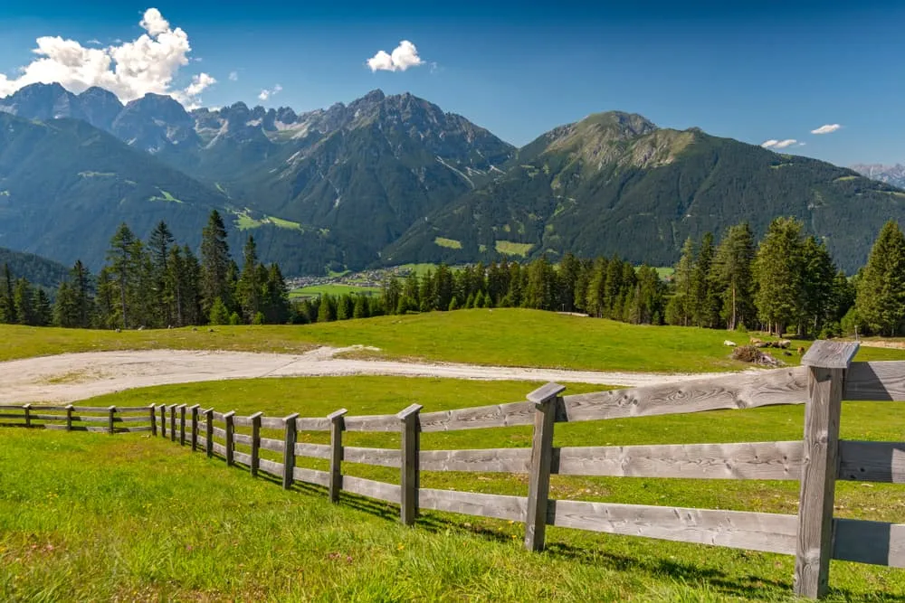
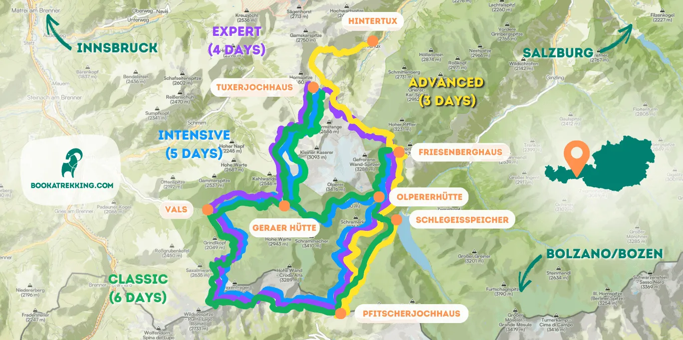
Peter Habeler Runde: Honouring A Great

By Rintsje Bosch

Find that one special trekking
Search
Peter Habeler Runde: Honouring A Great
Quick personal advice
Free cancellation up to two weeks in advance
Trekking experts per destination

Are you looking to completing the famous Peter Habeler Trek, one of the finest examples of hiking holidays in Austria? Also known as the Peter Habeler Runde, this trek is a circular route that starts and ends in Vals, a mountaineering village with 537 inhabitants in Tyrol. This trek was dedicated to the Austrian mountaineer Peter Habeler on his 70th birthday and is one of the most renowned hikes in the region. If this trek is on your to-do list, we can help you! Below you will find all you need to know to complete the Peter Habeler Runde, from a map and itinerary to a recommended packing list, safety measures, guided and self-guided walking holidays in Austria, and more!

Peter Habeler was born in Mayrhofen, in Tyrol, and made alpine history when, in 1978, he climbed Mount Everest, together with Reinhold Messner, without carrying any artificial oxygen. The Peter Habeler Trek honors his accomplishments as a mountaineer and celebrates his climbing records all over the world! Will you follow his footsteps?

Who is Peter Habeler?

Peter Habeler was born in 1942 in Mayrhofen, in Tyrol, Austria, and is known all over the world for his mountaineering experience. Among his many achievements, he was the first European to climb the Big Walls of Yosemite National Park, USA, and in 1978, together with Reinhold Messner, he made the first ascent to the top of Mount Everest without the aid of supplemental oxygen, which was previously thought to be impossible. Nowadays, he runs the "Peter Habeler Ski & Mountaineering School" in his hometown, Mayrhofen.

Book Now

When Is the Best Season To Do the Peter Habeler Runde?

Like most treks in the region, the Peter Habeler Loop can be hiked from mid-June to mid-September. During this time of the year, the chances of finding snow at higher altitudes are lower. However, always look up the weather forecast before starting your trek and be aware that, on the mountains, weather can be unpredictable. At the huts, the staff will also be able to give you some guidance and can inform you about the conditions of the trails.

When Is the Best Season To Do the Peter Habeler Runde?

Peter Habeler Trek Map

The Peter Habeler Trek is a 7-stage, circular trek. Below you will find a map detailing the route.

How Do I Get To the Starting Point of the Peter Habeler Runde Trek?

As you saw on the map, the Peter Habeler Runde is a circular trek, which means that there are various starting points for the trek. The village of Vals, in a side valley of the Wipptal, is the traditional starting point. In order to get there, the best way is to take a train from Innsbruck to St. Jodok am Brenner, and the bus line 4144 down to Vals (timetables at oebb.at). From Vals, you have to make your way to the end of the valley, where you will find the beginning of the trek. At Nockeralmen, close to the Peter Habeler Runde starting point, there is free parking (in case you travel by car) and also a bus stop in case you prefer public transport. Other starting points of the Peter Habeler Runde are from the South Tyrolean Pfitschtal to the Pfitscherjoch, in Zillertal from the Schlegeisspeicher or Hintertux, or you can also climb over the Venntal to the Europahütte directly from the Brenner Pass.

Did you know that we can book all huts and refuges for the Peter Habeler Runde for you? Check out all our options here.

What Does the Peter Habeler Trek Itinerary Look Like?

The Peter Habeler Runde is a circular tour that starts and ends in Vals, a mountain village of 537 inhabitants in the district of Innsbruck Land, in Tyrol. The tour is 56.1 kilometers long, has a total ascent and descent of 4,230 meters. We have prepared a 7-day route, but keep in mind that this trek can also be completed in 5 or 6 days. Stages 4 and 5 can easily be combined, as well as stages 6 and 7. Below are the 7 stages that make up this trek.

Day
1

Vals - Geraer Hütte

Duration: 04:20 h
Distance: 8 km
Ascent: 970 m
From Gasthaus Touristenrast at the end of the Valsertal (bus stop or free parking at the Nockeralmen) you first walk along a wide farm track (no. 502) for about one hour, ascending gently to the top of the cable car. From there, the trek leads you through an undulating, beautifully laid trail to the border of the forest. From here, follow trail no. 502 in open terrain to the Geraer Hütte, at 2,324 m.

Geraer Hütte

Info
Geraer Hütte
Day
2

Geraer Hütte - Tuxerjochhaus

Duration: 04:55 h
Distance: 9.8 km
Ascent: 760 m
Descent: 780 m
From the Geraer Hut, the stage starts north to the Steinernes Lamm (No. 527) and leads over old glacial moraines through the front Höllwand and further to the Kleegrubenscharte, Kasererscharte, and Frauenwand. Finally, a path through alpine pastures will lead you to the Tuxerjochhaus, at 2,313 meters.

Tuxerjochhaus

Info
Tuxerjochhaus
Day
3

Tuxerjochhaus - Friesenberghaus

Duration: 07:20 h
Distance: 9.5 km
Ascent: 800 m
Descent: 640 m
From the Tuxerjochhaus, follow path No. 326 downhill to below the Lärmstange. Then turn southeast to the Spannagelhaus, at 2,531 meters, and continue to the Friesenbergscharte, at 2,911 meters. Here, at the highest point of the Peter-Habeler-Runde, you can enjoy the magnificent views of the surrounding mountains. Over several zigzags, the path finally leads down to today's destination, the Friesenberghaus, at 2,498 meters.

Friesenberghaus

Info
Friesenberghaus
Day
4

Friesenberghaus - Olpererhütte

Duration: 02:20 h
Distance: 4.4 km
Ascent: 160 m
Descent: 240 m
Today you descend to the Friesenberg lake, only to climb up again over steep switchbacks. Afterward, the trail follows the Berliner Höhenweg, No. 526, for a short stretch and continues to the Olpererhütte, located at 2,389 meters.

Olpererhütte

Info
Olpererhütte
Day
5

Olpererhütte - Pfitsertsjochhaus

Duration: 04:00 h
Distance: 8.3 km
Ascent: 290 m
Descent: 410 m
This stage starts from the Olpererhütte, at 2,389 m, and follows path No. 502 towards Unterschrammachkar, at 2,280 m. A short ascent takes us below the Ameiskopf, at 2,400 meters. From there, path No. 528 runs past glacier cuts to Kastenschneid and below the Stamplkee to the Pfitscherjochhaus, at 2,276 meters.

Pfitsertsjochhaus

Info
Pfitsertsjochhaus
Day
6

Pfitsertsjochhaus - Landshuter Europahütte

Duration: 03:55 h
Distance: 7.8 km
Ascent: 530 m
Descent: 100 m
From the Pfitscherjochhaus, the path runs past small lakes and through a barren stone landscape along the Landshuter Höhenweg (No. 3 and No. 528) and leads to the Friedrichshöhe to the Landshuter Europa-Hütte, at 2,693 meters.

Landshuter Europahütte

Info
Landshuter Europahütte
Day
7

Landshuter Europahütte - Vals

Duration: 05:00 h
Distance: 9 km
Ascent: 80 m
Descent: 1410 m
From the Landshuter Europa Hut, the Geistbeckweg, path No. 529, runs towards the Sumpfschaftl, at 2,666 meters, and then guides you over the Lange Wand to the Inner Zeischalm and finally back to the trek's starting point in Vals.
Hide entire itinerary

What Is the Accommodation Like on the Peter Habeler Trek?

During the Peter Habeler Runde, you will spend your nights in cozy alpine mountain huts. At the end of each stage, a warm hut with good, homemade food will be waiting for you to relax and recharge your batteries for the next stage. Booking your huts in advance is paramount. The Peter Habeler Trek overlaps with the Berlin Höhenweg trail and the Alpine crossing from Munich to Venice, which means that the huts are quite busy, especially during July and August. The huts on this trek offer dormitory accommodation, which means that you will be sharing the room with other trekkers. Enjoy exquisite local dishes and a good beer at the end of each stage in the Peter Habeler Runde huts!

At Bookatrekking.com, we not only book your huts, we also send you on your way with a comprehensive hiking guide with the most important information for your Peter Habeler Runde, including interactive Komoot maps. Browse all our options here and turn your dreams into reality.

Packing List for the Peter Habeler Runde

It doesn't matter where you are going trekking or for how long: Carrying the right equipment with you is paramount. For a hiking trip in the mountains, you will need, first and foremost, a good backpack. Its size will depend on how many days you will be spending in the mountains, the season, and the clothes you will be taking with you. We have prepared a packing list with some essential clothing that you should include and some extras that you may find useful:
  • Essentials

  • Extras

Peter Habeler Runde: Difficulty

The Peter Habeler Runde is a moderate trek that can be completed without a guide. That being said, it is not a walk in the park. The trail goes over rough terrain and has some exposed sections, not suitable for people with a fear of heights. The narrow, exposed paths do have ropes to help with the climb. As for every high-altitude trail, the Peter Habeler Runde requires experience hiking on alpine terrain and sure-footedness. The Friesenberscharte is the most difficult part of the Peter Habeler Runde and is only accessible in good weather.

The Friesenbergscharte: The Most Difficult Part of the Peter Habeler Runde

Between Tuxerjochhaus and Friesenberghaus you will come across the Friesenbergscharte at 2,911 metres. The Friesenbergscharte is the most difficult part of your hike and can only be crossed in good weather. You walk close to the cliffs and the route is very technical. However, there are steel cables everywhere to hold on to during the most difficult parts. Because of the altitude, this part of the Peter Habeler Runde is often the first and last part to see snow and therefore can be impassable. The warden of the Tuxerjochhaus will be pleased to inform you whether the weather is good enough for your crossing. If the crossing is not possible, you can descend from the Tuxerjochhaus to Hintertux and take the bus there to skip this part of the route. That way you can still continue your Peter Habeler Runde.

Not sure yet or want to discuss your plans for the Peter Habeler Runde with one of our trekking experts? Get in touch today and turn your dreams into memories!

Safe hiking tips for the Peter Habeler Runde

When you go on walking holidays it is wise to be aware of a few points. Even if this is not your first time, you should never underestimate the mountains. Good tour planning and compliance with the regulations on the mountains will significantly increase safety. To ensure that your hiking holiday is a safe and enjoyable experience, here below you can find a list of 8 recommendations for safe hiking in the mountains:
  • Know your limits

    Hiking the Peter Habeler Runde is the perfect outlet to escape from daily life. It is an endurance sport along with a beautiful nature experience with a positive effect on body and mind —as long as one is in good shape and has a realistic picture of one's possibilities and limits—. Never overestimate yourself or underestimate the route. Don't overdo it! Always choose the slower variant and take more time for your plans. Hiking under time pressure is not fun and at too fast a pace it can be dangerous. Be wise!

  • Plan carefully

    Good planning is half the work! Hiking maps, literature, the Internet and expert advice are invaluable when planning the route in the Peter Habeler Runde and enable you to determine the length, altitude difference, difficulty and conditions of the hike. When planning group treks, the itinerary should always be planned for the weakest member of the group! The weather in the mountains can change incredibly quickly and rain, wind and cold all increase the risk factor. For this reason, always check the weather forecast beforehand and contact our trekking experts to find your way around before you start.

  • Be fully equipped

    Equipment is everything. In the most extreme case, it makes the difference between life and death, and in any case, it definitely makes the difference between having fun and having a bad time. Food and water, sunscreen and waterproof and warm clothes must always be in your backpack, as well as a first aid kit and a mobile phone with a full battery (in case there is an emergency). However, packing light makes walking easier, so don't take too much extra luggage with you. Your equipment should always be suitable for the terrain you'll be hiking on in the Peter Habeler Runde.

  • Wear suitable footwear

    Good walking shoes protect your feet and provide a better fit. Shoes with a good fit, with non-slip soles, water-resistant and lightweight are a must for additional walking pleasure during the Peter Habeler Runde. Trail running shoes are great for a weekend in the mountains, but on longer hikes or more technical trails, you'll want at least A/B hiking boots. That means it is recommended wearing high mountain shoes that are water-repellent with extra ankle support to prevent sprains.

  • Stay on marked trails

    Peter Habeler Runde has endless marked hiking trails, which are controlled and maintained and should not be deviated from. It may be tempting, but it's not a good idea to take shortcuts or alternative routes through unmarked terrain. It increases the risk of disorientation and you're more likely to get lost and have accidents or fall in the mountains. Even steep slopes of packed old snow are often underestimated and dangerous. Are you in doubt? Better don't do it. For easy navigation we work with our trusted partner Komoot, whose interactive maps, also available offline, provide you with the necessary digital means to get from A to B. As a backup, make sure to bring a hiking guide or a paper map with you. FYI, 75% of stumbles occur due to carelessness on marked paths or roads, not in open terrain!

  • Take regular breaks

    Remember you're on a hiking holiday. Timely and regular breaks not only provide welcome relaxation but also make it possible to enjoy the Peter Habeler Runde. The body needs a regular food and drink intake to maintain performance and concentration. Our advice is that if you have little time, it's better to follow the short itinerary than to speed up the long one.

  • Stay reachable

    If you are hiking solo or in small groups it is advisable to inform people back home about your plans, what route you are taking and when you plan to return. Even small incidents can lead to unpleasant emergencies so make sure you are available at all times. Bring a charged phone containing at least the phone numbers of immediate family members, your accommodations en route and the emergency phone numbers operating in the Peter Habeler Runde.

  • Respect nature

    Leave no rubbish behind, prevent noise, stay on the marked trails, do not disturb wildlife or grazing animals, and respect protected areas.

Where Can I Book the Peter Habeler Runde?

At Bookatrekking.com you can book the self-guided Peter Habeler Runde and many other treks. We take care of all the details for you, including arranging accommodations and providing you with relevant information well in advance of your trek. Find our offers here. Our easy-to-use platform allows you to browse and compare different trekking options and find the perfect fit for your interests, abilities, and budget.

If you have any questions about a specific trek or need help choosing the right one for you, our team of trekking experts is here to assist you. Simply reach out to us and we will be happy to provide you with personalized recommendations and advice to help you plan the trekking adventure of a lifetime.

Is the Peter Habeler Runde not your cup of tea and are you looking for other epic adventures? Check out one of our following blog posts:

Comments

About Us

At Bookatrekking.com, you will find the trek that will make your life unforgettable. Whether you want to explore the Inca Trail or climb Kilimanjaro. Bookatrekking.com has a wide and varied range of first-class treks. No false promises are made here. Transparent prices and bookings are fixed instantly. Find, compare, book and trek!
Read more about us
About Us

Also Interesting

Read more