Laugavegur Trail: All About Iceland’s Most Beautiful Trek

By Natascha Langelaan

Find that one special trekking
Search
Laugavegur Trail: All About Iceland’s Most Beautiful Trek
Quick personal advice
Free cancellation up to two weeks in advance
Trekking experts per destination

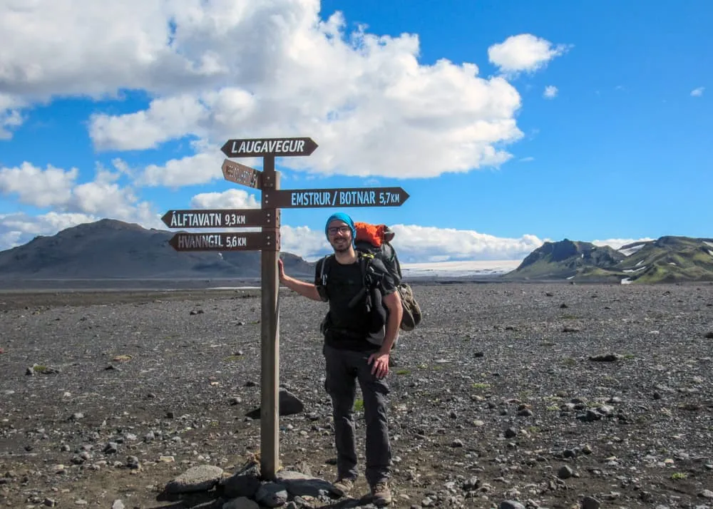
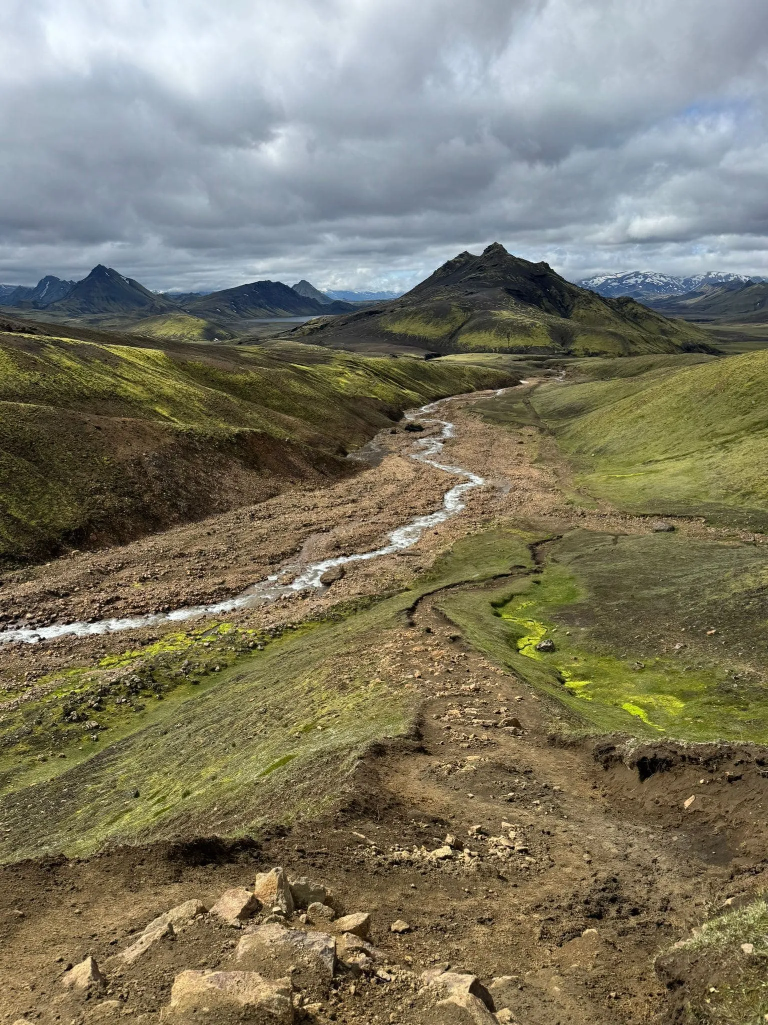
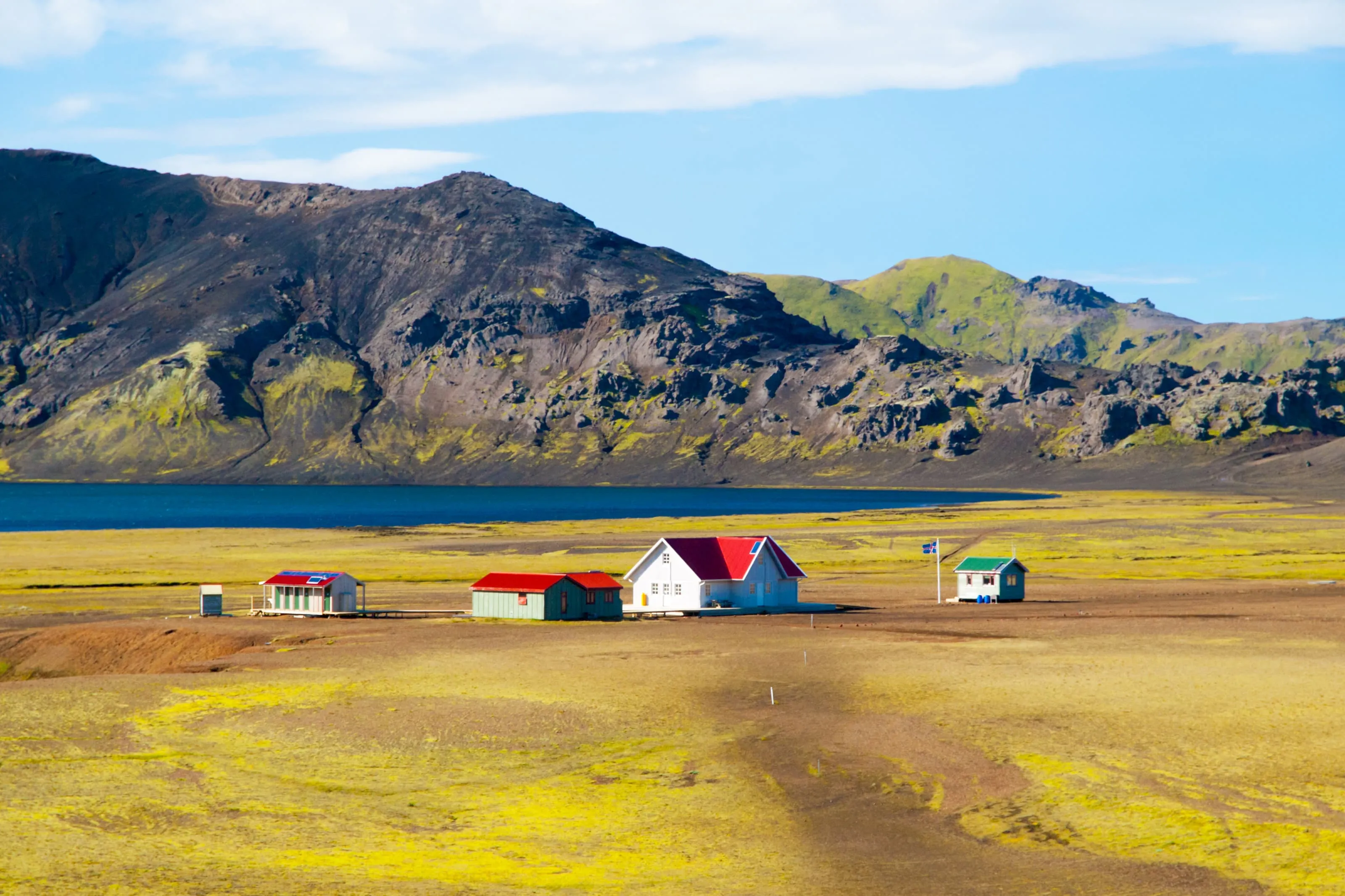
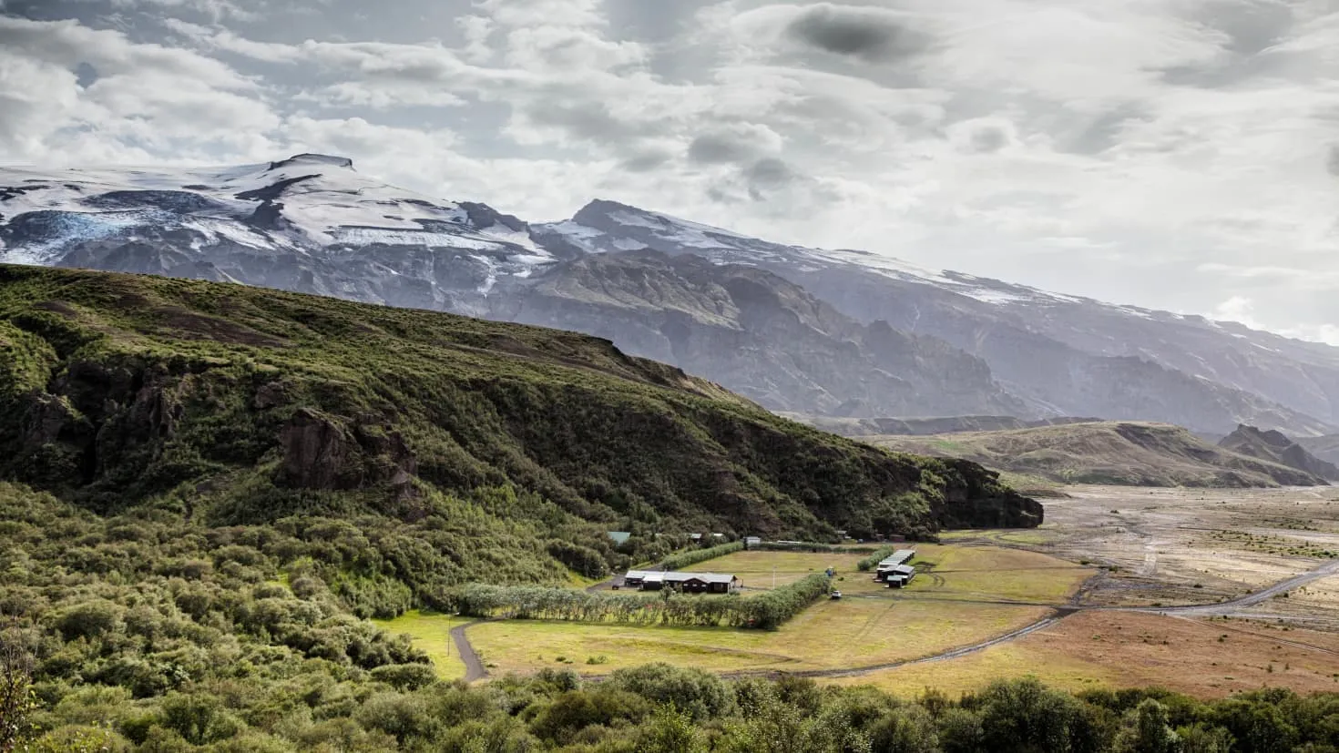
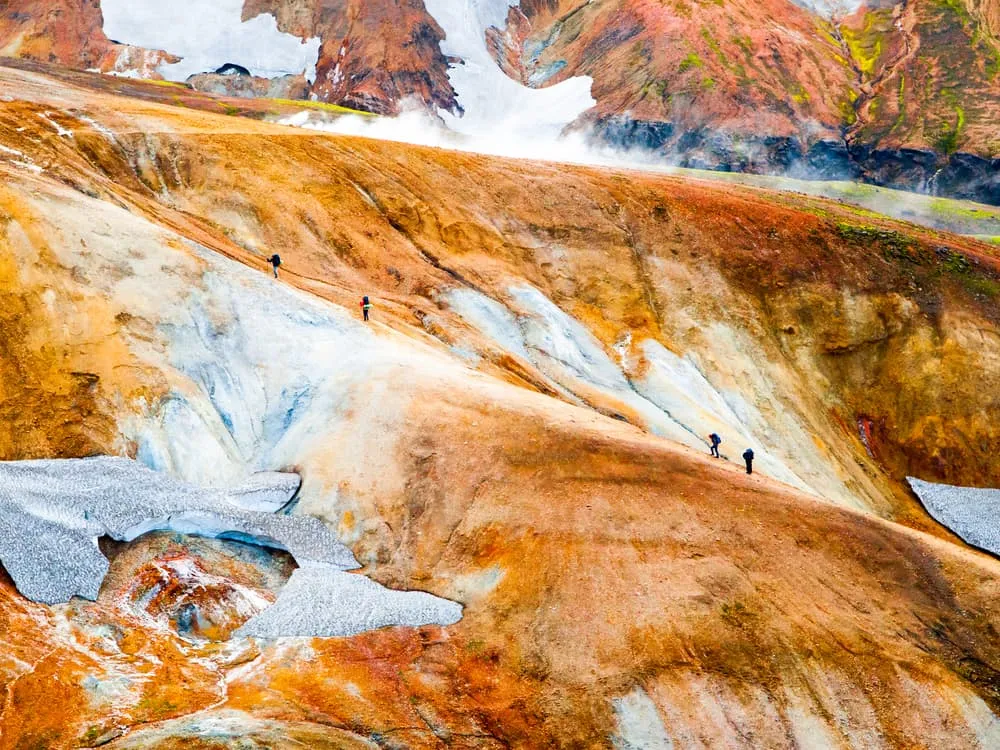
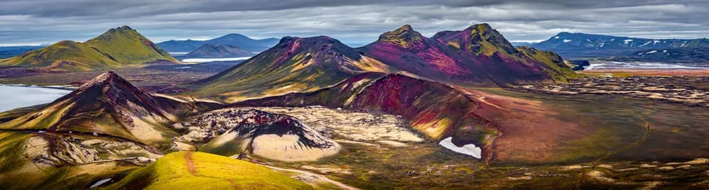
If you want to hike in Iceland, it doesn't get much better than this. The Laugavegur Trail is the most famous in Iceland and if you have seen the photos and the videos, it is not so difficult to understand how this status was achieved. The Laugavegur Trail is 55 kilometers, or 34 miles long, and offers a multi-day trek through the Icelandic wilderness. You will pass multi-colored mountains, lava fields, black sand deserts, geothermal springs, glaciers, lakes, icy river fords, grassy plains, and forests. The Laugavegur Trail has it all!

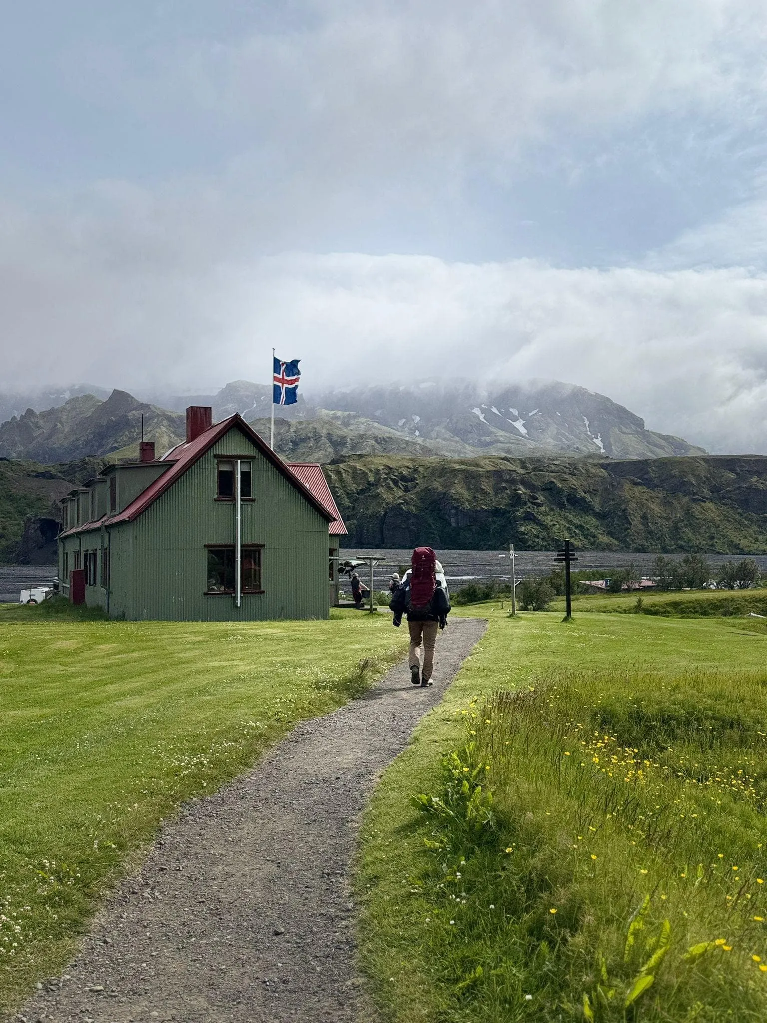
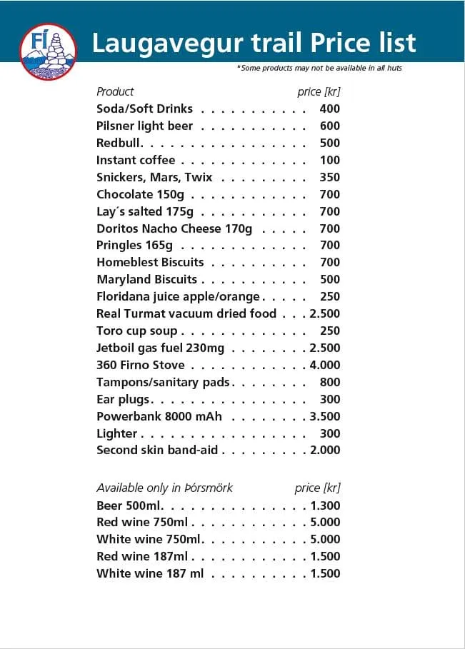
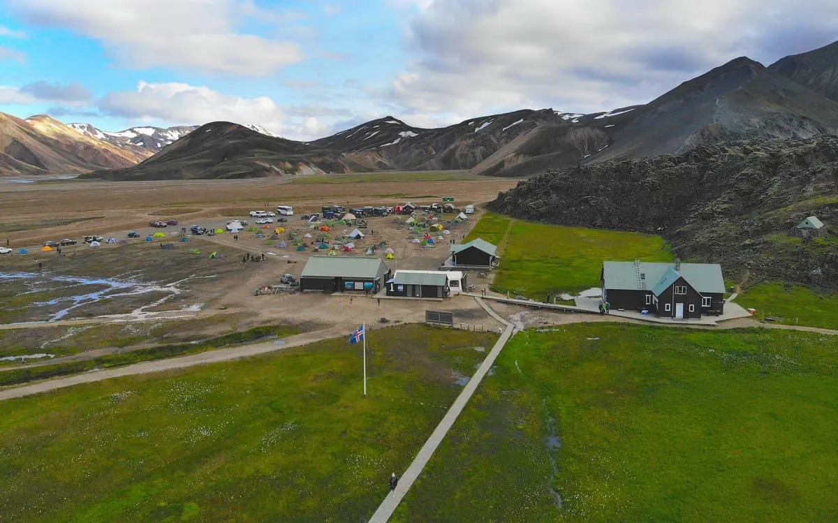
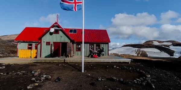
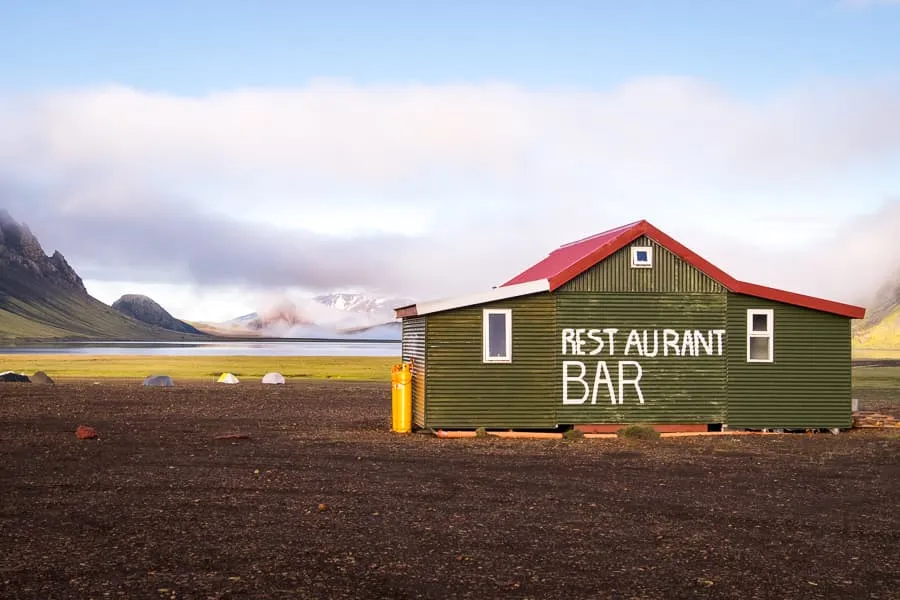
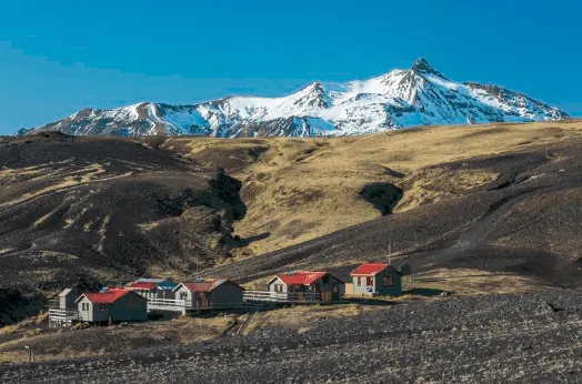
In just a 3 hour drive from Reykjavík, you can find the beautiful nature reserve Friðland að Fjallabaki, quite a mouthful. Here begins a trekking adventure that takes you through all the landscapes Iceland has to offer. Iceland in a nutshell, so to speak. Along the way, you will stay in tents or in simply furnished huts - which you have to book in advance. The food and everything you need for the trekking, you need to take yourself. You can read here how it works.

Where in Iceland Can I Find the Laugavegur Trail?

The Laugavegur Trail is located in the Southern Icelandic Highlands and connects the geothermal area of Landmannalaugar with the forested valley of Þórmörk in the South. Laugavegur means "The Way of the Water", and that is exactly what the trail does: it follows a stream. Landmannalaugar is a spectacular location, accessible only in summer, known for its colorful rhyolite mountains and bubbling hot springs, where guests are welcome to bathe. Þósmörk, on the other hand, is sheltered by mountains and glaciers and is famous for its greenery. It is so beautiful that it was named after the most praised of the Old Norse gods, Þór (Thor). The Laugavegur Trail runs from Landmannalaugar past the 'Swan Lake' Álftavatn, then you pass the black sand desert of Mælifellssandur, walk past Stórasúla which is known for its vibrant green mountain, and continue through the fields of Emstrur. Along the way, there are numerous mountain peaks, crater lakes, and volcanoes, and the trail lies in the shadow of the Mýrdalsjökull and Eyjafjallajökull glaciers. The Laugavegur Trail is 55 kilometers, or 34 miles long, and can be walked in three or more days.

Where in Iceland Can I Find the Laugavegur Trail?

Book Now

Did you know that we can book all huts and refuges for the Laugavegur Trail for you? Check out all our options here.

Laugavegur Trail Map - Where Can I Find Maps?

Every experienced hiker will agree that there is no better map than a real old-fashioned map, possibly made of paper. It is best to buy one in Reykjavik. You can get a map of the Laugavegur Trail in any bookstore in town. Fact: Laugavegur is also the name of the main shopping street in Reykjavik. Landmannalaugar, Þósmörk, and Fjallabak Walking Map published by Mal Og Mennig is a winner. The more recent work by Uwe Grunewald is also a good one. You can also find these in most bookstores in Iceland or online. For a digital overview of both the trek and the travel to the starting and from the ending point, we have put together the map below.

In Which Direction Do I Hike the Laugavegur Trail?

The trail can be started either in Landmannalaugar or Þórsmörk. However, due to the popularity of the trail, in mid-summer, it is a one-way, traditional route, from Landmannalaugar to Þórsmörk. It is fair to say that almost all Icelanders who hike Laugavegur take the route from north to south, from Landmannalaugar to Þórsmörk. The view that suddenly opens up over the southern part of the trail, Álftavatn, and the southern glacier from Jökultungur, is pure magic and is forever in the memory of those who have experienced it.

How Do I Get From Reykjavik to the Laugavegur Trail? And Back?

The best way to get to Landmannalaugar, the starting point of the Laugavegur Trail is by bus. There are two companies that sell tickets for their adventurous bus ride. Adventurous? Yes, it is definitely not a city bus ride. To get to Landmannalaugar, you follow gravel roads and cross a river. The bus is of course well equipped for this.

How Do I Get From Reykjavik to the Laugavegur Trail? And Back?

Not sure yet or want to discuss your plans for the Laugavegur Trail with one of our trekking experts? Get in touch today and turn your dreams into memories!

Where Will I Spend the Night on My Laugavegur Trek?

Staying in the Huts

On the Laugavegur Trail, you will spend the night in huts or your tent, next to a hut. There are six huts and campsites along the route, all owned by Ferðafélag Íslands (Iceland Touring Association, FÍ). Please note that it is absolutely forbidden to place your tent outside the designated areas inside the nature reserve. All the huts along the route have camping areas. In Landmannalaugar, there are good facilities and there is a dormitory for 78 people. In Hrafntinnusker, 52 people can sleep, and in Álftavatn 72 people can sleep in the huts. In Hvanngil there is room for 60 people and the same number goes in the Botnar hut in Emstrur. Þórsmörk offers a large and spacious chalet with room for 75 people.

The huts along the most popular hiking routes, such as the Laugavegur route, are very popular and it is therefore essential for hikers to book their accommodation in advance. Keep in mind that the next available accommodation in the Icelandic highlands may be many hours' walk or drive away, so plan your trip carefully. Our trekking experts are not only specialized in booking huts in the most beautiful hiking destinations in Europe but also in booking the huts on the Laugavegur Trail. They will be happy to help you, to make booking the cabins on the Laugavegur Trail easy. Check out our packages on the Laugavegur Trail, which include accommodation.

Staying in Tents

If you're staying in tents on the Laugavegur Trail, you don't need to book this in advance as there's always room for you. However, this phenomenon can lead to the campsite being quite crowded. Camping costs ISK 2500 per person per night, which is approximately €20. You'll need to pay this on-site to the hut owners upon arrival. Payment can be made with a credit card or in cash in Icelandic Krona. This fee grants you access to the showers and drinking water in the huts. For the showers, you'll need to pay separately. You'll pay ISK 500 for 5 minutes, which is about €4. Payment can also be made in Icelandic Krona. Please note that there are no showers available in Hrafntinnusker.

Where Will I Spend the Night on My Laugavegur Trek?

What Is Life Like in an Icelandic Hut?

If you stay in an Icelandic hut, you must bring your own sleeping bag, as no sleeping bags or blankets are provided. The huts are warm, so the sleeping bag does not have to be of Arctic quality. In the larger huts, you can expect both running water and water toilets, but in some smaller huts, you will have to fetch water from a nearby stream and use a latrine or outdoor toilet. Please note that it is not possible to buy hot, ready-made meals in most Icelandic huts. You will therefore have to bring your own food while hiking in Iceland. The exception to this is the huts along the popular Laugavegur walking route. There, all huts sell some supplies, such as dried food for backpacking, soft drinks, and bars, as well as cookers and gas. Only in Langadal in Þórsmörk is it possible to buy beer and wine.

Moreover, in all, except the largest huts, you cannot leave any waste or rubbish behind but have to take it back to the lowlands. You can camp near the huts for a camping fee, but campers have to bring their own cooker and kitchenware because they cannot use the kitchen facilities in the huts.

Hut rules

Hygiene, cleanliness, and consideration for fellow travelers are very important. The aim of these simple hut rules is to ensure a comfortable stay for hikers and other travelers.

  • If the manager is available, please discuss your reservation with him/her, where to sleep, and specific hut rules
  • Rest times are from midnight to seven o'clock the next morning
  • No shoes in the hut. Please leave your hiking boots in the hallway
  • Smoking in the huts is strictly forbidden
  • Leave the cooking area clean and tidy
  • Add water to the big pot on the kitchen cooker, if necessary
  • When leaving, make sure the hut is clean and tidy
  • Don't forget to pay for the accommodation and facilities
  • Help to keep the environment clean by not leaving your rubbish behind

You hike in Iceland to experience nature. Remember: Clean environment = beautiful nature!

Laugavegur Trail Huts' Price List

Check the price list below to get an approximate idea of what you can buy in the huts and what it costs. Please note that the prices are in Icelandic Kronor (IKR).

Laugavegur Trail Huts' Price List

Four-Day Program for the Laugavegur Trail

You can hike the Laugavegur trail in three days, but most hikers (including Icelanders) choose a four-day program. This way, you can relax when you need to and see most of the beautiful nature along the way. On the Laugavegur trail, apart from the first day, you don't have to count on many height meters. You walk downstream and actually descend slowly all the time.   

Day
1

Landmannalaugar - Hrafntinnusker

Duration: 04:15 h
Distance: 10.5 km / 6.5 mi
Ascent: 500 m / 1640 ft
Descent: 90 m / 295 ft
First, you will take the bus from Reykjavik to Landmannalaugar. This will take about 4 hours. You then start with the hike. The first part of the route is the shortest in kilometers, but as the total height is almost 500 meters and this is the first day of the walk, many people find this part a bit exhausting. The weather is unstable in these areas, and it is often necessary to walk in the snow, which adds to the difficulty. The first section goes up to the lava field of Laugahraun, crosses it, and then goes downhill before going back up to the plateau just below Brennisteinsalda. Stop here and admire the beautiful views, the flora, the mountains, and the gaps in all the colors of the rainbow. The route continues up to the plateau, where small ravines cut into the landscape as the rivers form the gentle mountain. The road ahead is all uphill, but not extremely steep. The next destination is Stórihver, a beautiful vegetation spot right next to a buzzing geyser where you can stop, rest your legs, and have a picnic from the provision box. From here it is about an hour's walk to the Höskuldsskáli hut near Hrafntinnusker.

Hrafntinnusker

Info
Hrafntinnusker
Day
2

Hrafntinnusker - Álftavatn

Duration: 04:35 h
Distance: 12.2 km / 7.6 mi
Ascent: 80 m / 262 ft
Descent: 560 m / 1837 ft
The path from Hrafntinnusker runs along the slopes of Reykjafjöll. The area is a valley floor that is mostly flat, but there are a few ravines that need to be crossed with extra care as they are often half full of snow. If the weather and visibility are good, it is recommended to do the extra walk up to Háskerðingur, the highest mountain in the area, 1281m. The hike takes about 1-1.5 hours. Be careful, there are often glacier gorges in the ice just below the top. However, the top itself is usually snow-free in summer. The trail now goes up and down through some canyons until it reaches the edge of Jökultungur, with incomparable views of the entire trail and the three glaciers Tindfjallajökull, Eyjafjallajökull, and Mýrdalsjökull. The way down along the Jökultungur is quite steep and rocky, so be careful. At the bottom of the Jökultungur awaits the Grashagakvísl River, which in some cases can be crossed by a snow bridge. If not, you have to cross the river on foot. The water in Grashagakvísl is fresh and good to drink. From here, the route to the cabin at Lake Álftavatn is easy.

Álftavatn

Info
Álftavatn
Day
3

Álftavatn - Emstrur Hut

Duration: 05:45 h
Distance: 15.8 km / 9.8 mi
Ascent: 240 m / 787 ft
Descent: 310 m / 1017 ft
From Álftavatn the trail heads east over Brattháls and further east to Hvanngil. The Bratthálskvísl river has no bridge and must be crossed on foot, which is relatively easy in most cases. From the hill above Hvanngil, the view is magnificent. In Hvanngil, hikers can use the toilet facilities. Some hikers choose to spend the night here instead of in Álftavatn. From Hvanngil there is a short walk to the river Kaldaklofskvísl, which can be crossed by a footbridge. Just south is another river, Bláfjallakvísl, without a bridge. Be careful, especially during heavy rainfall the water can rise quickly. The route now runs mostly along the main road until it reaches the river Innri Emstruá. This one has a bridge. Occasionally you have to walk through some water because there is an overflow that crosses the bridge. Just south of this, the path bends from the main road to the left and southwards to Emstrur, where the land is practical without vegetation. In dry weather, with strong winds, especially from the north, there can be a sand storm. The path lies between two mountains, called Útigönguhöfðar, and in about an hour you reach the Botnar hut in Emstrur.

Emstrur Hut

Info
Emstrur Hut
Day
4

Emstrur Hut - Þórsmörk

Duration: 06:10 h
Distance: 15.7 km / 9.8 mi
Ascent: 320 m / 1050 ft
Descent: 560 m / 1837 ft
Today, you will have to start early with the hike, to take the bus back to Reykjavik. From the huts in Botnar the trail leads east. Shortly afterward you come to a bridge over the river Syðri-Emstruá. The river flows into a narrow deep gorge that reaches as far as Entujökull. People with a fear of heights may have difficulty reaching and crossing the bridge. From there, the trail leads past Langháls and to the merging of the Markarfljót and Syðri-Emstruá rivers. It is recommended to walk to the edge of the gorge where the rivers meet, before walking south through Almenningar. Soon the path runs through two small ravines, Slyppugil and Bjórgil. In each of these ravines is a stream with drinkable water. After climbing the last-named gorge, Bjórgil, the path leads to Fauskatorfur and gradually to an area with more vegetation, also called Úthólmar. The hill up from the river Ljósá is called Kápa or Overjas and is the last steep slope on the path. When the path goes down from Kápa, you have to cross the river Þröngá, which is not difficult in most cases but can be quite rocky. The river marks the border of Þórsmörk and now it is only a half an hour's walk through the pleasant forests of Hamraskógar until you arrive at Húsadalur in Þórsmörk. You can find the volcano huts here, and from here, the bus will bring you back to Reykjavik in about 4 hours.
Hide entire itinerary

The Laugavegur Trail With Fimmvörðuháls

If you've been paying attention, you know that the traditional directions of both the Laugavegur and the Fimmvörðuháls hike both ends in Þórsmörk. It is therefore common to combine the two. You then start in Landmannalaugar and finish in Skóra. This makes the 4-day Laugavegur trek into a 6-day trek. You can see how that works in the following video. Something for you?

How to Walk the Laugavegur Trail

A hut trek can be done by anyone in normal health. However, if you want to get the most out of your Laugavegur trek, it is wise to prepare yourself physically. Iceland is not nothing, so you will have to be creative when it comes to your preparation. For adequate preparation, consider the following five things.

Cardio

It is best to get moving as soon as you think about your walking holiday in Iceland. With proper aerobic fitness, you will have a better heart rate, healthy muscles, and great lung capacity. Running, walking, more walking, and cycling or swimming are excellent exercise methods. One hour, 3 to 4 times a week is sufficient.

Endurance training

Building up endurance fitness is also important. The best thing you can do is walk long distances, at least once a week. If you can walk comfortably for a long time you are ready to go.

Train with equipment

Use the backpack and shoes you plan to use for your hut trip and add this to your training as you work on your cardio and endurance.

Altitude

If you can, mimic altitude by hiking and trekking in the hills and mountains. If you don't live in the right area for this, don't panic. The first two points are the most important.

Know your body

This is perhaps the most important part. If you question your physical abilities, it is wise to have a check-up by your doctor. There is no set method for preparing for your hut trek. Do not overthink your preparation. Take it easy and enjoy your time in Iceland.

How to Walk the Laugavegur Trail

At Bookatrekking.com, we not only book your huts, we also send you on your way with a comprehensive hiking guide with the most important information for your Laugavegur Trail, including interactive Komoot maps. Browse all our options here and turn your dreams into reality.

Packing List for the Laugavegur Trail

It doesn't matter where you are going trekking or for how long: Carrying the right equipment with you is paramount. For a hiking trip in the mountains, you will need, first and foremost, a good backpack. Its size will depend on how many days you will be spending in the mountains, the season, and the clothes you will be taking with you. We have prepared a packing list with some essential clothing that you should include and some extras that you may find useful:
  • Essentials

  • Extras

Safety tips for the Laugavegur Trail

Although this is far from being a trek in the Himalayas, unexpected things can always happen and you might also find obstacles on the hiking trails along the way. The Laugavegur Trail is safe, the trails are quite straight forward and there is not an extreme difference in altitude. However, for your safety, every hike deserves a level of respect; respect for the terrain, the trails, wildlife and vegetation, local rules and regulations, and above all, your physical capabilities and safety. Therefore, for an unforgettable and safe hiking memory, please keep the following safety recommendations in mind:

  • Know your limits

    Always prepare each stage carefully to use your energy wisely, respect your physical and mental limitations, and avoid taking unnecessary risks. When ascending or descending, if applicable, always use the aids provided, such as handrails and ropes. Is this trek suitable for you? Well, familiarize yourself with the grading system and figure out if this trek matches your capabilities. If you still need professional advice you can always contact Bookatrekking.com experts.

  • Stay on marked trails

    The most important thing is to never leave the marked paths. For easy navigation we work with our trusted partner Komoot, whose interactive maps, also available offline, provide you with the necessary digital means to get from A to B in the Laugavegur Trail. As a backup, make sure to bring a hiking guide or a paper map with you.

  • Fully equipped

    Make sure you have the necessary gear for the conditions you'll be facing, including appropriate clothing, footwear, and any necessary equipment for the terrain you'll be hiking on. Always wear clothing adapted to the weather of Laugavegur Trail and protect yourself from cold and wetness or heat and sun. Besides, make sure you carry enough food and water for the duration of your trek. On the way, you might (or might not) be able to buy snacks.

  • Stay reachable

    If you are hiking solo or in small groups it is advisable to inform people back home about your plans, what route you are taking and when you plan to return. Even small incidents can lead to unpleasant emergencies so make sure you are available at all times. Bring a charged phone containing at least the phone numbers of immediate family members, your accommodations en route and the emergency phone numbers operating in the Laugavegur Trail.

  • Respect for nature

    Do not litter, prevent noise, stay on the marked trails, do not disturb wildlife or grazing animals, and respect protected areas.

Where Can I Book the Laugavegur Trail?

At Bookatrekking.com you can book the self-guided Laugavegur Trail and many other treks. We take care of all the details for you, including arranging accommodations and providing you with relevant information well in advance of your trek. Find our offers here. Our easy-to-use platform allows you to browse and compare different trekking options and find the perfect fit for your interests, abilities, and budget.

If you have any questions about a specific trek or need help choosing the right one for you, our team of trekking experts is here to assist you. Simply reach out to us and we will be happy to provide you with personalized recommendations and advice to help you plan the trekking adventure of a lifetime.

Is the Laugavegur Trail not your cup of tea and are you looking for other epic adventures? Check out one of our following blog posts:

Comments

About Us

At Bookatrekking.com, you will find the trek that will make your life unforgettable. Whether you want to explore the Inca Trail or climb Kilimanjaro. Bookatrekking.com has a wide and varied range of first-class treks. No false promises are made here. Transparent prices and bookings are fixed instantly. Find, compare, book and trek!
Read more about us
About Us

Also Interesting

Show more