Berliner Höhenweg: Rugged Hut-To-Hut Trek in the Zillertal Alps

By Jan Bakker

Find that one special trekking
Search
Berliner Höhenweg: Rugged Hut-To-Hut Trek in the Zillertal Alps
Quick personal advice
Free cancellation up to two weeks in advance
Trekking experts per destination

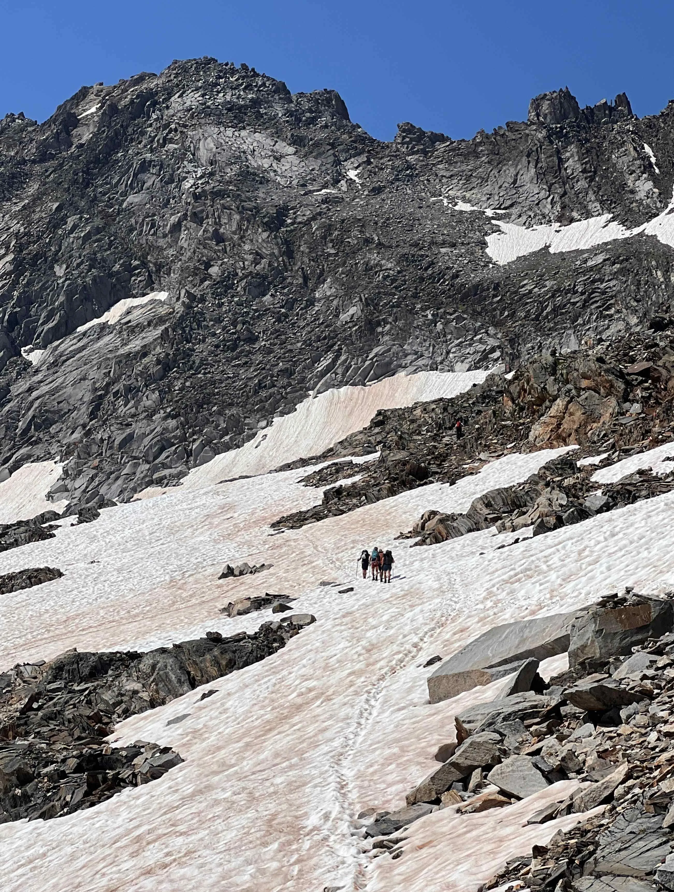
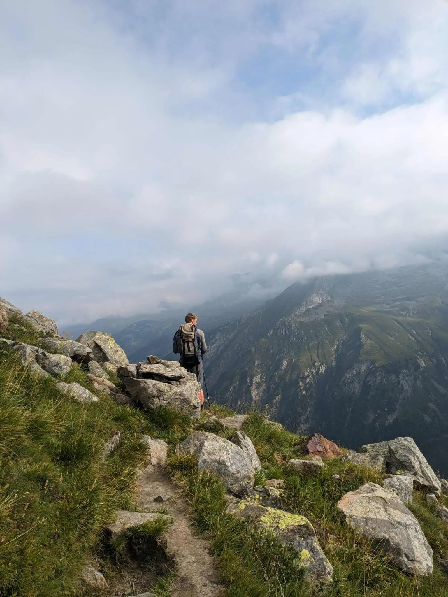
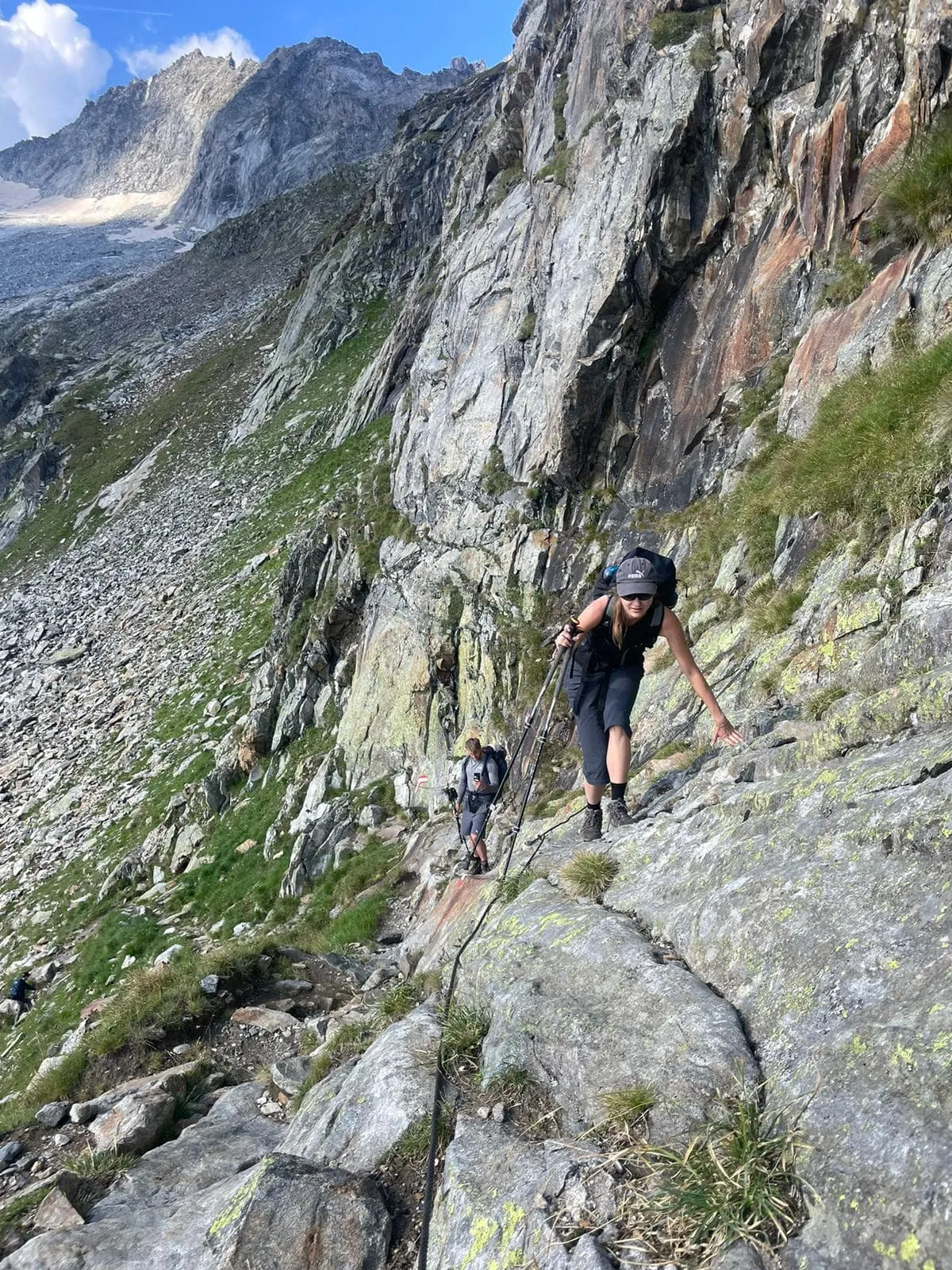
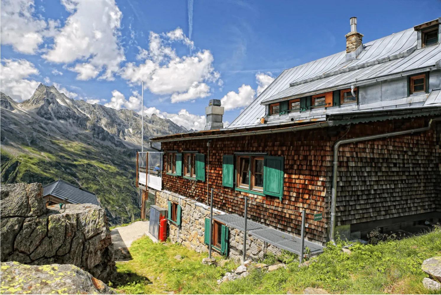
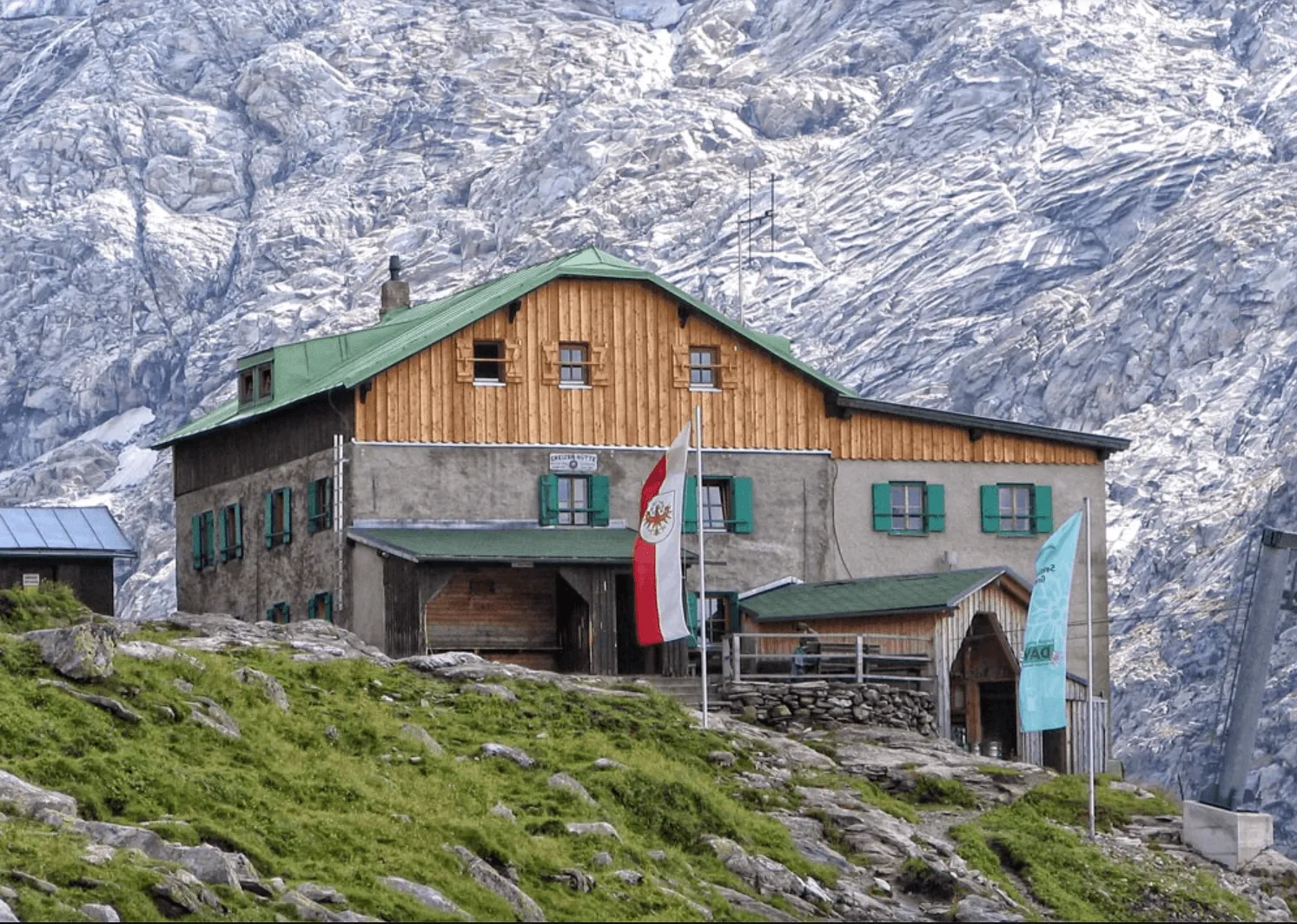
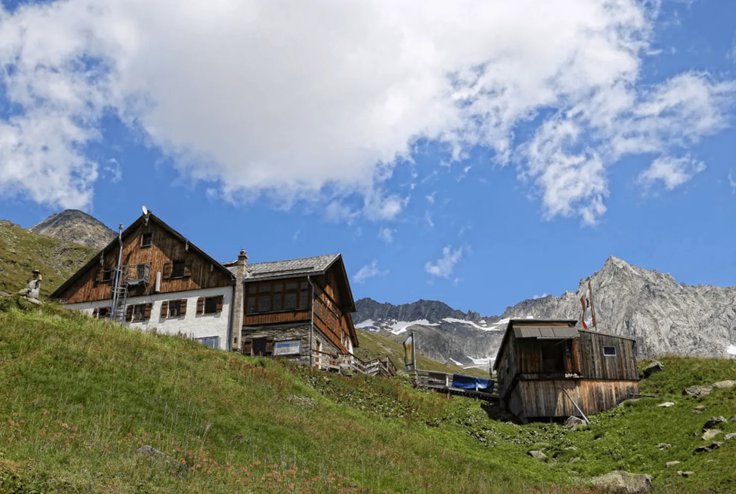
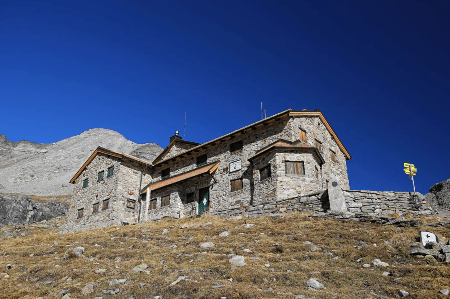
Are you ready for a wild hiking adventure? Then the Berliner Höhenweg should definitely be on your list. The challenging route leads through the high alpine terrain of the Zillertal Alps. With two tough mountain passes and the ascent of the 3,134 meter high Schönbichler Horn you'll tackle lots of vertical gain. The efforts are not in vain! With good weather, you'll have stunning views of the peaks and glaciers of the rugged massif.

The Berliner Höhenweg, also known as the Zillertaler Runde and in English as the Berlin High Trail, is a hiking route for experienced mountain hikers. The terrain can be technically challenging in some sections with steep trails, snow fields, and rocky terrain. It is possible to do a shortened version of this hike. During each stage, you pass an escape route, so you can exit the route prematurely if needed. In this blog post, we'll delve deeper into what to expect during this trek and how we can help you along the way.

What and where is the Berliner Höhenweg?

The Berliner Höhenweg is a circular hiking route in the Zillertal Alps. These heavily glaciated mountains are located in the Austrian state of Tyrol and form the border range with Italy. The route can be walked in both directions as the daily ascent and descent are comparable. The mountain landscape is incredibly rugged with a range of peaks over 3000 meters covered with numerous glaciers. The path leads to the vicinity of some of these glaciers. One of the highlights is a stay in the Berliner Hütte, built in 1879. It is one of the oldest and largest huts in Tyrol and is listed as an Austrian monument. The impressive interior is partly in its original state and is a must-visit for mountain hikers in the Zillertal.

As mentioned, the Berliner Höhenweg can be walked clockwise and in the opposite direction. At Bookatrekking.com, we choose to start in Mayrhofen and walk clockwise. The trek formally ends in Finkenberg, about 5 kilometers from Mayrhofen. For those who want to extend the trek, there is the possibility to switch to the Peter Habeler Runde, which overlaps with the end of the Berliner Höhenweg. We are happy to help you organise this!

Do you want to know more about hut-to-hut trekking in Austria? We wrote an informative blogpost about it.

What and where is the Berliner Höhenweg?

Book Now

Is the Berliner Höhenweg suitable for me?

Let's not beat around the bush, this challenging trek is not for everyone. There is quite a bit of climbing involved, but what makes the route difficult is the terrain. Paths are pretty rough higher up. Sometimes you cross snowfields, climb a steep section via ladders, or walk on a narrow path along a cliff. The Berliner Höhenweg is therefore only suitable for experienced mountain hikers who do not shy away from challenging terrain. Does this trek sound a bit too intense to do independently? Then we recommend organizing an arrangement with a (local) mountain leader. Another option is to book a nearby trek in the Zillertal that is easier in terms of difficulty level, such as the Peter Habeler Runde.

Did you know that we can book all huts and refuges for the Berliner Höhenweg for you? Check out all our options here.

What is the best season for the Berliner Höhenweg?

The best time to do the hiking tour is from July to September. Although the official season starts in June, we recommend going a bit later. Snow can linger here for a long time due to the orientation of the slopes. July and August are the high season, with relatively warm weather and many hikers on the route. Keep in mind that the weather in the mountains can change quickly. Tip: check the weather forecast before you hit the trail. Later in this blog, you will find a packing list with the essential equipment for this trek. The best period is the first half of September, with more stable weather and fewer tourists. At the end of September, the huts close, as the weather becomes more unpredictable and the chance of snowfall increases.

Berliner Höhenweg Map and Navigation

There are plenty of maps and guidebooks that can help you do the Berliner Höhenweg or any other trek in the Zillertaler Alpen. Below you can find a map with an overview of the route.

At Bookatrekking.com, we not only book your huts, we also send you on your way with a comprehensive hiking guide with the most important information for your Berliner Höhenweg, including interactive Komoot maps. Browse all our options here and turn your dreams into reality.

Berliner Höhenweg Itinerary

The program below covers the full Berliner Höhenweg 8-day route. However, we offer a shorter version of this trek and the possibility to add accommodation before and after them. Click here to look into all the alternatives we offer within the Berliner Höhenweg circuit.

Day
1

Mayrhofen - Karl von Edelhütte

Duration: 05:50 h
Distance: 9 km
Ascent: 1600 m
The starting point is in Mayrhofen, where you can park your car. Walk towards the Ahornbahn and follow the Ziller river until the paved road turns into an unpaved one. From here, a well-defined path steeply ascends, with the Ahornbahn on your right and the Ziller on your left. After a challenging climb, you will reach the Wirtschaftshaus Alpenrose, where you can take a break on the terrace with a drink. After this welcome stop, it's time to climb again. The path zigzags uphill until it meets the path coming from the Ahornbahn. From here, you will walk for another half hour to reach the Karl von Edelhütte. Alternatively, you can take the Ahornbahn, which cuts 6 kilometers and 1300 meters of altitude gain from the route.

Karl von Edelhütte

Info
Karl von Edelhütte
Day
2

Karl von Edelhütte - Kasseler Hütte

Duration: 06:45 h
Distance: 13.1 km
Ascent: 540 m
Descent: 610 m
Today is a challenging day. High above the Stilluptal, you traverse below the peaks of the Ahornkam towards the Kasseler Hütte. Although you don't cross a real mountain pass, there is a lot of climbing and descending involved. The Krummschnabelscharte is literally the highlight of this stage, where you should not have a fear of heights. The narrow path runs along spectacular rock formations and is secured with a cable. After reaching the 2478-meter-high pass, you will continue towards the Nofertenschneid, another magnificent passage with pointed rocks. Here too, you can use cables to descend. From here, it is an 8-kilometer walk over uneven terrain to the Kasseler Hütte. Don't forget to enjoy the view from time to time!

Kasseler Hütte

Info
Kasseler Hütte
Day
3

Kasseler Hütte - Greizer Hütte

Duration: 05:45 h
Distance: 9.8 km
Ascent: 670 m
Descent: 620 m
From the hut, you walk towards the beautiful suspension bridge that hangs over the Stillupbach. Follow the path to the Eisenklamm gorge. Here the climb starts to the top of the Lappenscharte, a difficult pass at 2700 meters altitude. You walk along a narrow path along a deep ravine. Cables and railings have been installed to make this section safer. Just before the pass, you need to scramble here and there. Once you reach the top, you'll feel like you've climbed a mountain. The short descent to the Greizer Hütte is a bit easier. Time for a well-deserved Kaiserschmarrn!

Greizer Hütte

Info
Greizer Hütte
Day
4

Greizer Hütte - Berliner Hütte

Duration: 07:15 h
Distance: 10.8 km
Ascent: 1010 m
Descent: 1180 m
It is a good idea to warm up before starting this stage. The trail descends steeply for 400 meters towards the Floitenbach, a stream that drains the meltwater from the Floitenkees glacier. Then it's a challenging climb of about 1000 meters in altitude to the nördliche Mörchenscharte. Some sections are equipped with ladders and cables. This may be the hardest part of the Berliner Höhenweg. The Mörchenscharte itself is a narrow passage over the mountain ridge. The landscape here is incredibly rugged with many boulder fields and glaciers higher up. Do not underestimate the descent to the Berliner Hütte. You will descend over difficult terrain for 5 kilometers, dropping more than 800 meters.

Berliner Hütte

Info
Berliner Hütte
Day
5

Berliner Hütte - Furtschaglhaus

Duration: 06:50 h
Distance: 8.7 km
Ascent: 1080 m
Descent: 830 m
You cross the Hornkeesbach over smooth rock surfaces and stay at the same altitude until the trail junction. Like the previous days, today involves another ascent, this time up the Schönbichler Scharte, with 3060 meters the highest pass of the Berliner Höhenweg. This stage feels like an alpine experience. You walk almost directly under the glaciers and have a view over the entire Zillertal Alps. As a bonus, from the pass you can climb the Schönbichler Horn (3134m). The top of the pass is secured with cables. The steep descent takes you 800 meters lower to the Furtschaglhaus.

Furtschaglhaus

Info
Furtschaglhaus
Day
6

Furtschaglhaus - Friesenberghaus

Duration: 09:20 h
Distance: 18.5 km
Ascent: 1050 m
Descent: 860 m
After a short steep descent, you walk comfortably on flat terrain along the shores of the Schlegeis reservoir. At the north end of the lake, you can have a drink and eat something before climbing again. At the intersection of two trails, around an altitude of 2350 meters, you will find the fantastic Olpererhütte. This is also an option for lunch. Further along the route, you will cross the suspension bridge with a clear view of the Schlegeisspeicher. From here it's another two hours of walking to the Friesenberghaus.

Friesenberghaus

Info
Friesenberghaus
Day
7

Friesenberghaus - Gamshütte

Duration: 08:30 h
Distance: 16.6 km
Ascent: 560 m
Descent: 1110 m
The last long hiking day from Friesenberghaus to Gamshütte should not be underestimated. You will quickly pass by the Wesendlkarsee, a beautiful mountain lake. Are you brave enough to take a swim? Along the flanks of the Höher Riffler, you walk to Pitzenalm. The trail then becomes more challenging, with large scree fields making walking more difficult. When you see Mayrhofen in the distance, it is not far to Gamshütte.

Gamshütte

Info
Gamshütte
Day
8

Gamshütte - Finkenberg - Mayrhofen

Duration: 02:50 h
Distance: 6.9 km
Descent: 1050 m
On the last day, you mainly descend through pine forests and alpine meadows. Soon you will walk into the cute village of Finkenberg from where you can take a bus or taxi back to your well-deserved hotel in Mayrhofen. Here you can look back on an epic trek!
Hide entire itinerary

Getting to and from Mayrhofen

If you are flying, you have two options, Innsbruck or Munich. Both airports have good connections to the starting point of Mayrhofen.

Bus

If you're coming by public transport, we recommend taking the train. It's faster, more efficient, and more comfortable.

Car

The drive from Munich to Mayrhofen takes two hours. If you're coming from Innsbruck, it's only an hour.

Train

Take the train from Munich Central Station to Venezia S. Lucia. Transfer at Jenbach to the train to Mayrhofen Bahnhof. The total travel time is about 2.5 hours. From Innsbruck, the travel time is a bit shorter, about 1.5 hours, also with a transfer at Jenbach.

Packing List for the Berliner Höhenweg

It doesn't matter where you are going trekking or for how long: Carrying the right equipment with you is paramount. For a hiking trip in the mountains, you will need, first and foremost, a good backpack. Its size will depend on how many days you will be spending in the mountains, the season, and the clothes you will be taking with you. We have prepared a packing list with some essential clothing that you should include and some extras that you may find useful:
  • Essentials

  • Extras

How much does it cost to hike the Berliner Höhenweg?

A hut-to-hut hike really doesn't have to break the budget. The huts are usually simply equipped, but offer everything you need to recharge your mental and physical batteries for the next few days of hiking. For 8 days on the Berliner Höhenweg, you can expect to pay around 70 to 80 EUR per hiking day. This includes route details, navigation assistance, your accommodation in a hut and half board in the form of breakfast and dinner. For hut tours in general, we advise you to bring 40 to 60 EUR pocket money. This is for lunch and your drinks. Most of the pocket money usually goes for the ice-cold beer with our name on it in the next hut :)

Not sure yet or want to discuss your plans for the Berliner Höhenweg with one of our trekking experts? Get in touch today and turn your dreams into memories!

What to do in case of emergency?

There is an emergency situation when a human life (yours or someone else's) is in danger and you cannot do anything to solve the situation. You should call for help if there has been an accident, someone is stuck, you are lost or in trouble and cannot continue due to the time of day or weather conditions, or if you are stuck due to technical climbing challenges beyond your capabilities.

The most important thing to do in an emergency situation is to remain calm and assess the situation. Do not panic and do not take pointless risks if the people in need are difficult to reach. In case of emergency, first and foremost, call for help. When calling for help, make sure to provide your location and the number of victims and type of injuries. Then, protect the victim from cold and other environmental threats and provide first aid, if you are capable.

Emergency numbers for Austria

  • European emergency number: 112
  • Mountain rescue: 140

Safe hiking tips for the Berliner Höhenweg

When you go on walking holidays it is wise to be aware of a few points. Even if this is not your first time, you should never underestimate the mountains. Good tour planning and compliance with the regulations on the mountains will significantly increase safety. To ensure that your hiking holiday is a safe and enjoyable experience, here below you can find a list of 8 recommendations for safe hiking in the mountains:
  • Know your limits

    Hiking the Berliner Höhenweg is the perfect outlet to escape from daily life. It is an endurance sport along with a beautiful nature experience with a positive effect on body and mind —as long as one is in good shape and has a realistic picture of one's possibilities and limits—. Never overestimate yourself or underestimate the route. Don't overdo it! Always choose the slower variant and take more time for your plans. Hiking under time pressure is not fun and at too fast a pace it can be dangerous. Be wise!

  • Plan carefully

    Good planning is half the work! Hiking maps, literature, the Internet and expert advice are invaluable when planning the route in the Berliner Höhenweg and enable you to determine the length, altitude difference, difficulty and conditions of the hike. When planning group treks, the itinerary should always be planned for the weakest member of the group! The weather in the mountains can change incredibly quickly and rain, wind and cold all increase the risk factor. For this reason, always check the weather forecast beforehand and contact our trekking experts to find your way around before you start.

  • Be fully equipped

    Equipment is everything. In the most extreme case, it makes the difference between life and death, and in any case, it definitely makes the difference between having fun and having a bad time. Food and water, sunscreen and waterproof and warm clothes must always be in your backpack, as well as a first aid kit and a mobile phone with a full battery (in case there is an emergency). However, packing light makes walking easier, so don't take too much extra luggage with you. Your equipment should always be suitable for the terrain you'll be hiking on in the Berliner Höhenweg.

  • Wear suitable footwear

    Good walking shoes protect your feet and provide a better fit. Shoes with a good fit, with non-slip soles, water-resistant and lightweight are a must for additional walking pleasure during the Berliner Höhenweg. Trail running shoes are great for a weekend in the mountains, but on longer hikes or more technical trails, you'll want at least A/B hiking boots. That means it is recommended wearing high mountain shoes that are water-repellent with extra ankle support to prevent sprains.

  • Stay on marked trails

    Berliner Höhenweg has endless marked hiking trails, which are controlled and maintained and should not be deviated from. It may be tempting, but it's not a good idea to take shortcuts or alternative routes through unmarked terrain. It increases the risk of disorientation and you're more likely to get lost and have accidents or fall in the mountains. Even steep slopes of packed old snow are often underestimated and dangerous. Are you in doubt? Better don't do it. For easy navigation we work with our trusted partner Komoot, whose interactive maps, also available offline, provide you with the necessary digital means to get from A to B. As a backup, make sure to bring a hiking guide or a paper map with you. FYI, 75% of stumbles occur due to carelessness on marked paths or roads, not in open terrain!

  • Take regular breaks

    Remember you're on a hiking holiday. Timely and regular breaks not only provide welcome relaxation but also make it possible to enjoy the Berliner Höhenweg. The body needs a regular food and drink intake to maintain performance and concentration. Our advice is that if you have little time, it's better to follow the short itinerary than to speed up the long one.

  • Stay reachable

    If you are hiking solo or in small groups it is advisable to inform people back home about your plans, what route you are taking and when you plan to return. Even small incidents can lead to unpleasant emergencies so make sure you are available at all times. Bring a charged phone containing at least the phone numbers of immediate family members, your accommodations en route and the emergency phone numbers operating in the Berliner Höhenweg.

  • Respect nature

    Leave no rubbish behind, prevent noise, stay on the marked trails, do not disturb wildlife or grazing animals, and respect protected areas.

Where Can I Book the Berliner Höhenweg?

At Bookatrekking.com you can book the self-guided Berliner Höhenweg and many other treks. We take care of all the details for you, including arranging accommodations and providing you with relevant information well in advance of your trek. Find our offers here. Our easy-to-use platform allows you to browse and compare different trekking options and find the perfect fit for your interests, abilities, and budget.

If you have any questions about a specific trek or need help choosing the right one for you, our team of trekking experts is here to assist you. Simply reach out to us and we will be happy to provide you with personalized recommendations and advice to help you plan the trekking adventure of a lifetime.

Is the Berliner Höhenweg not your cup of tea and are you looking for other epic adventures? Check out one of our following blog posts:

Comments

About Us

At Bookatrekking.com, you will find the trek that will make your life unforgettable. Whether you want to explore the Inca Trail or climb Kilimanjaro. Bookatrekking.com has a wide and varied range of first-class treks. No false promises are made here. Transparent prices and bookings are fixed instantly. Find, compare, book and trek!
Read more about us
About Us

Also Interesting

Show more