Hiking in the Sauerland: The Best Areas, Trails and Multi-Day Routes

Hiking in the Sauerland: The Best Areas, Trails and Multi-Day Routes
Trekking experts per destination
Free cancellation up to eight weeks in advance
Quick personal advice

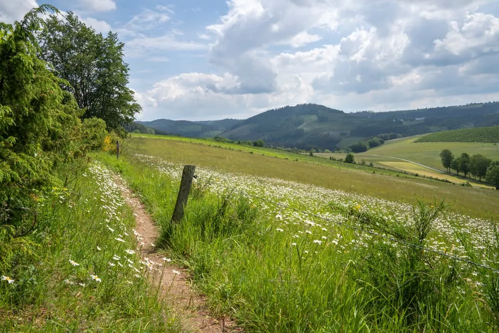
The Sauerland is the most heavily forested upland region in Germany, a landscape of broad wooded ridges rising to just over 800 meters in the state of North Rhine-Westphalia, about an hour east of Dortmund and Cologne and easy to reach by train. Hiking in the Sauerland has nothing to do with alpine technique or exposure: the trails are superbly waymarked, the whole region is set up for walkers, and the path network is one of the densest in Germany. What you get is stream valleys of spruce and beech, reservoirs filling the bottoms of the valleys, half-timbered villages and long open ridges. The region has several faces: the Rothaar mountains with Winterberg and the Kahler Asten as the high points, the Sorpe, Bigge and Henne reservoirs, the rolling country around Schmallenberg and its Wanderdörfer, and Willingen just across the state line in Hessen. At Bookatrekking we book the hotels, move your luggage between overnight stops and give you our app with offline maps, GPX tracks and a daily weather forecast. This guide covers the sub-regions, the multi-day routes, day hikes, difficulty, the best season to go and which trip fits you.


What makes hiking in the Sauerland so special?

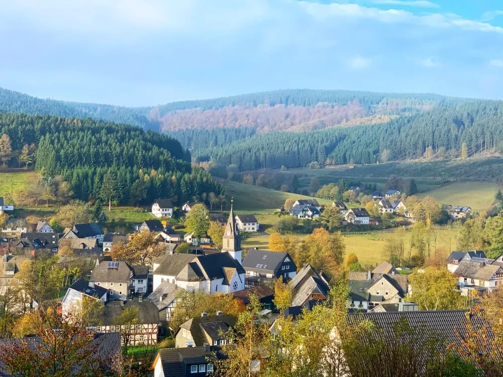
Hiking in the Sauerland means walking in a forested upland region in southeastern North Rhine-Westphalia, with ridges reaching just over 800 meters. The Langenberg (843 m) and the Kahler Asten (841 m) are the two highest points, but no single summit is what makes this landscape work. It is the combination: spruce and beech woods covering the ridges, broad crests with long views, reservoirs filling the valleys, stream valleys with grazing cattle, and hundreds of half-timbered villages that look as though they have always been there.

Thanks to the Wanderdörfer quality mark and the Premiumweg certification awarded by the German Hiking Association, the region is built around walkers. Signposting is consistent, benches and information boards sit exactly where you want them, and every village carrying the Wanderdörfer mark has a waymarked trail leaving straight from the center. Planning a walking holiday here, you never spend long looking for the next marked path.

It is worth being honest about one thing: the spruce plantations have suffered in places from drought and bark beetle damage. The cleared patches make parts of the landscape more open and younger than it was, though they come with an upside. The long views from the high ridges are wider now than they were ten years ago.


Where is the Sauerland and how do you get there?

The Sauerland covers roughly the country between Dortmund in the north, Kassel in the east, Siegen in the south and the Ruhr valley in the west. Most of it sits in the German state of North Rhine-Westphalia, with a spur reaching into Hessen.

The natural gateways are Winterberg and Willingen in the high east, Schmallenberg and Bad Berleburg in the middle, Brilon and Olsberg in the north, Sundern and Arnsberg by the western reservoirs, and Siegen in the south. Which village you use as a base depends on the kind of walking you have in mind.

By train you travel via Dortmund or Hagen to Winterberg or Willingen, and regional buses connect onward to the walking villages from there. Public transport works best when you already know which village you are heading for, because this is thinly populated country and buses do not run continuously. By car, the A46 and A45 motorways bring you into the heart of the region. International visitors usually fly into Düsseldorf, Cologne or Frankfurt and continue by rail.


The best hiking areas in the Sauerland

The Sauerland is not a one-note destination. Each sub-region has its own character, its own kind of landscape and its own rhythm. These are the five areas every walker should know about.

The Rothaar mountains and the Kahler Asten

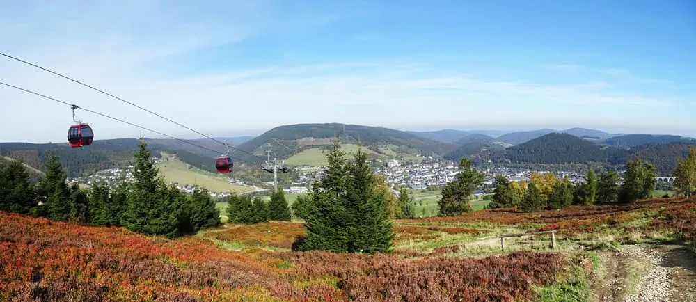
The heart of the region is the Rothaargebirge, the long high ridge running north to south through the Sauerland. Its highest plateau is the Kahler Asten (841 m), a raised bog with a weather tower that looks out over much of the region on a clear day. Around the Asten lies the Hochheide, an open heath landscape that is unusual for this part of Germany. This is also where the region's best-known long-distance trail begins. The Rothaar mountains draw experienced day walkers who come for the views and the height, but they work just as well for beginners looking for a quiet walk in the woods.

Winterberg and the surrounding area

Hiking Winterberg is about far more than the village itself. Winterberg sits on the flanks of the Rothaar mountains, surrounded by wooded ridges, small valleys and open plateaus. One of the more striking natural sights nearby is the Bruchhauser Steine near Olsberg: four free-standing basalt towers that rise meters above the treetops and give a wide view in good weather. The Winterberg hiking trails range from short loops of a few kilometers to full days that take in several tops, and Winterberg is a logical overnight stop on the multi-day routes.

The Schmallenberg Sauerland and the Wanderdörfer

Walking around Schmallenberg means rolling farmland with a denser network of waymarked loops than anywhere else in the region. Schmallenberg is itself one of the Wanderdörfer, villages that have won national gold awards for landscape stewardship and community effort. The half-timbered houses, generous gardens and immaculate village centers make the coffee stop as appealing as the trail. If you want quiet, variety and a human scale, this is the loveliest corner of the Sauerland.

Willingen and the Upland

Willingen has a flavor of its own. It lies just across the line in Hessen, in the Upland, an area that is quieter and less touristed than Winterberg without giving anything away in scenery. The Ettelsberg is the local high point, with a broad view back toward the Rothaar mountains. The raised bog around Willingen is fragile and carefully protected. Trails here follow stream valleys and climb through forest to open ridges, and the waymarking ties straight into the Rothaarsteig markers, so you can step from a day loop onto the long-distance route without a break.

The reservoirs around Sundern and Arnsberg

The western Sauerland has a completely different character from the high ridges in the east. Around the Sorpesee, the Biggesee and the Hennesee the land is flatter and more open. Shoreline paths run along the water, through broadleaf woods and over soft hills with no climbs worth the name. This is the area for an easier day, for families with young children, or for anyone who wants a base that is simple to reach. The mix of lake, forest and village makes the west a good complement to a multi-day route.


Multi-day hiking in the Sauerland: from a long weekend to the full route

A multi-day walk here works like this: you start each day in a new village, your luggage travels ahead to the next hotel or Gasthof, and you walk the route with a light day pack. That difference in weight matters in the Sauerland, because every day the trail climbs back up to the ridge before dropping down the other side.

Bookatrekking offers three Rothaarsteig trips, each aimed at a different kind of walker.

The Rothaarsteig long weekend from Winterberg is the ideal introduction if you only have four days free, or if you want a taste of the region before committing to something longer. You walk the two finest stages of the Rothaar mountains, with Winterberg at the center. See the trip page for current pricing.

The best of the Rothaarsteig in five days takes you along the most celebrated sections of the trail: from Brilon through the high ridges to Winterberg and on toward Schmallenberg. Daily distances run up to 25 kilometers, but you always walk with a light pack. See the trip page.

If you want to walk the whole ridge from north to south, choose the full Rothaarsteig in ten days: Brilon to Dillenburg, 164.7 kilometers, with the longest day at 25.2 kilometers. This is the trip for walkers with time who want to get to know the entire region, from the highest plateaus to the lower forests of the Lahn-Dill country. See the trip page.

If you would rather sleep simply and enjoy a more communal atmosphere, our guide to hut-to-hut hiking in Germany explains how that works. For the full range of multi-day walking holidays in Germany, see our hiking in Germany page.


The Rothaarsteig in brief

The Rothaarsteig runs roughly 154 kilometers from Brilon in the north to Dillenburg in the south, following the crest of the Rothaar mountains past the Kahler Asten and the sources of the Ruhr, Lenne, Eder and Sieg. It is known as "the way of far views" and is one of the most popular long-distance trails in Germany. Most walkers do a section of four or five days; the whole trail takes about ten days.

The full stage-by-stage description, with distances, ascent and starting points, is in our detailed Rothaarsteig route guide.


Day hikes and shorter loops in the Sauerland

The region is excellent for day walking and short loops without an overnight stop. A selection of the favorites:

The loop over the Kahler Asten from Winterberg crosses the Hochheide and, on a clear day, gives a view over much of the Rothaar mountains. The Bruchhauser Steine near Olsberg make a day hike in themselves: four basalt towers standing high above the forest, reached on woodland paths. The shoreline loops around the Sorpesee and the Hennesee are flatter and suit families or an easier day. The half-timbered loops out of Schmallenberg and the surrounding Wanderdörfer are short, easy to follow and beautifully signposted. The raised bog near Willingen is the most remarkable ecosystem in the region and is crossed on boardwalks laid to protect the fragile ground.

Beyond these loops, the Sauerland-Waldroute, the Rothaarsteig-Spur and the Premiumweg circuits are the most used waymarked networks in the region. The Wanderdörfer markers take you from the village center straight into the landscape without a map.

Hiking the Sauerland in winter deserves an honest word. The high ground around Winterberg and Willingen sees regular snow, and winter walking trails are cleared for anyone drawn to a silent landscape. The high Sauerland is at its quietest and most atmospheric then, especially on a bright winter day. At the same time, paths can be icy and impassable, daylight is short, and not every mountain inn stays open. Our multi-day trips run in the summer half of the year; for winter walking you are better off with a free weekend based in one place.


How hard is hiking in the Sauerland, and who is it for?

Hiking in the Sauerland is upland walking, not mountaineering. There are no cables, no scrambling and no exposure on any of the routes we sell. Daily stages generally fall between 15 and 25 kilometers, with steady climbs up to the ridges followed by long, relatively level stretches along the crest. If you are comfortable with a 20-kilometer day on flat ground at home, a few focused training walks will get you ready for this.

The real things to watch are different. Forest tracks can be muddy and slick after rain, the high ridges catch a stiff wind, and morning fog can be thick. No single climb is dramatic, but the ascent adds up over the course of a day. Plan for that and the terrain works in your favor.

These trips suit first-time multi-day walkers stepping beyond the single-day hike, families with children of about ten and up on the shorter stages, and anyone looking for a first point-to-point walk without the pressure of an alpine route.


The best time of year for hiking in the Sauerland

The Sauerland is walkable year-round, but every season has its trade-offs.

April and May bring fresh green, full streams and quiet trails. The forest canopy is still thin and the views are sharp. Mornings can be cold, but walking in the afternoon is pleasant. A good window if you want to avoid crowds.

June to August is the warmest and busiest season. The forest gives a lot of shade, which makes the heat manageable. Watch for afternoon thunderstorms, which build quickly over the high ridges. This is the prime window for our multi-day trips.

September and October are the best months of all for Sauerland hiking. The weather settles, the views are the clearest of the year and the beech woods turn from green to gold and red. Paths are dry and firm underfoot, and the crowds thin out fast once the summer holidays end.

November to March bring short daylight, a real chance of snow and ice on the plateaus around Winterberg and Willingen, and patchy opening hours at the mountain inns. Our multi-day trips are most comfortable in the summer half of the year.

Our app shows the current forecast for each overnight stop, based on the coordinates of where you are sleeping, so every evening you know exactly what the next day holds.


Accommodation and luggage transfer in the Sauerland

The Sauerland has no mountain hut system like the Alps. At each overnight stop you stay in a hotel, a Gasthof, a Landhotel or a guesthouse. The Gasthöfe along the trail tend to be family-run, with their own restaurant, a central place in village life and a breakfast that carries you through the day.

Luggage transfer here is not a luxury but a practical choice, because the route climbs back to the ridge every single day. Doing that with five kilos on your back is a very different experience from doing it with fifteen. Our trips include bed and breakfast, luggage transfer between overnight stops, a detailed route description and the Bookatrekking app with offline maps, GPX tracks and a weather forecast for each stop. You never have to navigate, and every evening you know what the weather will do tomorrow.

If you would rather sleep in shared quarters and prefer a simpler atmosphere, our guide to hut-to-hut hiking in Germany shows what that alternative looks like.


Which hike in the Sauerland is right for you?

Trip Days Who it suits Price
Rothaarsteig long weekend from Winterberg 4 A short first taste, few days free See the trip page
The best of the Rothaarsteig 5 The classic sections in one week See the trip page
Full Rothaarsteig 10 The whole trail, Brilon to Dillenburg See the trip page

Per person, based on two travelers. See each trip page for current pricing.

The choice is straightforward. A long weekend and a wish to try the region first: take the four-day trip. A free week and an appetite for the best-known sections: take five days. The whole ridge, with two weeks to spend: take ten days. Only interested in day walks with no overnight stops along the way: base yourself in Winterberg, Willingen or Schmallenberg and explore from there.

A word on navigation. Trails here are marked with the reclining "R" of the Rothaarsteig, the purple Premiumweg signs of the Wanderdörfer and the yellow "W" of the Sauerland-Waldroute. On our trips you never have to find the way yourself: the app carries the offline map with the GPX track and shows your position in real time. If you want a paper backup as well, you can request one with your route description.

For every walking holiday in Germany we offer, from the Eifel to the Bavarian Alps, you will find the complete overview on our landing page.


Frequently asked questions about hiking in the Sauerland

  • What is the most beautiful hiking area in the Sauerland?

    The finest walking area in the Sauerland is the Rothaar range, with the Kahler Asten (841 m) and the country around Winterberg as the high point. The mix of raised bog, beech and spruce forest, broad ridges with long views and superbly waymarked trails makes this the most varied and most spectacular part of the region.

  • What is the best hiking trail in the Sauerland?

    The best trail in the Sauerland is the Rothaarsteig, a long-distance path from Brilon to Dillenburg along the crest of the Rothaar mountains. It is known as "the way of far views." If you prefer shorter loops, the Premiumweg circuits of the Wanderdörfer around Schmallenberg and Willingen are especially rewarding.

  • Which are the nicest villages in the Sauerland?

    The most appealing villages in the Sauerland are Schmallenberg, Winterberg, Willingen, Brilon, Olsberg and Sundern. Schmallenberg and the surrounding Wanderdörfer have won national gold awards for their half-timbered houses, gardens and community spirit. Winterberg is the best-known resort town; Willingen is quieter but sits in scenery that is every bit as good.

  • What is the best walk near Winterberg?

    The best walk near Winterberg is the loop over the Kahler Asten through the Hochheide, with views across the Rothaar range. If you want to go further afield, make the day trip to the Bruchhauser Steine near Olsberg: four free-standing basalt towers above the forest with a wide view from the top.

  • When is the best time to visit the Sauerland?

    The best time to visit the Sauerland is September and October: settled weather, clear long views and superb fall color in the beech woods. April and May are quiet and freshly green. June to August is warm but busy. In winter, trails on the high ridges can be icy and impassable and the days are short.

  • What are the best stages of the Rothaarsteig?

    The stages through the highest part of the Rothaar mountains, around the Kahler Asten and between Willingen and Winterberg, are the ones most walkers rate highest. For the full stage-by-stage description with distances and ascent, see our detailed Rothaarsteig route guide.

  • Are there waterfalls in the Sauerland?

    The Sauerland has no large waterfalls, but it does have cascades on an upland scale: small, atmospheric falls in stream valleys such as those near Plettenberg and in the Bilstein area. After a wet spell in spring the streams run fullest and the falls are at their most impressive. Most are reached on waymarked trails.

  • What is the best hiking trail in Willingen?

    The best trail in Willingen crosses the raised bog around the Ettelsberg, with views over the Rothaar mountains and the Upland. The Rothaarsteig-Spur out of Willingen connects directly to the main long-distance trail. For a shorter loop, the Hochheide path near Willingen is the most remarkable, thanks to its protected ecosystem.


    Want to compare every walking holiday in Germany side by side, from the Sauerland to the Zugspitze? See the complete range on our hiking holidays in Germany page. For a wider look at the finest routes and regions, read our article on hiking in Germany.

Packing List for the Rothaarsteig

It doesn't matter where you are trekking or for how long: carrying the right equipment with you is paramount. For a hiking trip in the mountains, a good is backpack essential. Its size will depend on how many days you will be spending in the mountains, the season, and the clothes you will be taking with you. We have prepared a packing list with some essential clothing that you should include and some extras that you may find useful:
  • Essentials

  • Extras

Safe Hiking Tips for the Rothaarsteig

When hiking, it is wise to be aware of a few points. Even if this is not your first time, you should never underestimate the mountains. Good tour planning and compliance with the regulations in the mountains will significantly increase safety. To ensure that your hiking adventure is a safe and enjoyable experience, here below you can find a list of 8 recommendations for safe hiking in the mountains:
  • Know your limits

    Hiking the Rothaarsteig is the perfect outlet to escape from daily life. It is an endurance sport along with a beautiful nature experience with a positive effect on body and mind —as long as one is in good shape and has a realistic picture of one's possibilities and limits—. Never overestimate yourself or underestimate the route. Don't overdo it! Always choose the slower option and take more time for your plans. Hiking under time pressure is not fun and at too fast a pace it can be dangerous. Be wise!

  • Plan carefully

    Good planning is half the work! Hiking maps, literature, the Internet and expert advice are invaluable when planning the route of the Rothaarsteig and enable you to determine the length, altitude difference, difficulty and conditions of the hike. When planning group treks, the itinerary should always be planned for the weakest member of the group! The weather in the mountains can change incredibly quickly and rain, wind and cold all increase the risk factor. For this reason, always check the weather forecast beforehand and contact our trekking experts to find your way before you start.

  • Be fully equipped

    Equipment is everything. In the most extreme case, it makes the difference between life and death, and in any case, it definitely makes the difference between having fun and having a bad time. Food and water, sunscreen and waterproof and warm clothes must always be in your backpack, as well as a first aid kit and a mobile phone with a full battery (in case there is an emergency). However, packing light makes hiking easier, so don't take too much extra luggage with you. Your equipment should always be suitable for the terrain you'll be hiking on in the Rothaarsteig.

  • Wear suitable footwear

    Good walking shoes protect your feet and provide a better fit. Shoes with a good fit, with non-slip soles, water-resistant and lightweight are a must for additional walking pleasure during the Rothaarsteig. Trail running shoes are great for a weekend in the mountains, but on longer hikes or more technical trails, you'll want at least A/B hiking boots. That means it is recommended wearing high mountain shoes that are water-repellent with extra ankle support to prevent sprains.

  • Stay on marked trails

    Rothaarsteig has endless marked hiking trails, which are controlled and maintained and should not be deviated from. It may be tempting, but it's not a good idea to take shortcuts or alternative routes through unmarked terrain. It increases the risk of disorientation and you're more likely to get lost and have accidents or fall in the mountains. Even steep slopes of packed old snow are often underestimated and dangerous. Are you in doubt? Better don't do it. For easy navigation we work with our trusted partner Komoot, whose interactive maps, also available offline, provide you with the necessary digital means to get from A to B. As a backup, make sure to bring a hiking guide or a paper map with you. FYI, 75% of stumbles occur due to carelessness on marked paths or roads, not in open terrain!

  • Take regular breaks

    Remember you're on a hiking trip. Timely and regular breaks not only provide welcome relaxation but also make it possible to enjoy the Rothaarsteig. The body needs a regular food and drink intake to maintain performance and concentration. Our advice is that if you have little time, it's better to follow the short itinerary than to speed up the long one.

  • Stay reachable

    If you are hiking solo or in small groups it is advisable to inform people back home about your plans, what route you are taking and when you plan to return. Even small incidents can lead to unpleasant emergencies so make sure you are available at all times. Bring a charged phone containing at least the phone numbers of immediate family members, your accommodations en route and the emergency phone numbers operating on the Rothaarsteig.

  • Respect nature

    Leave no rubbish behind, prevent noise, stay on the marked trails, do not disturb wildlife or grazing animals, and respect protected areas.

Where Can I Book the Rothaarsteig?

At Bookatrekking.com you can book the self-guided Rothaarsteig and many other treks. We take care of all the details for you, including arranging accommodations and providing you with relevant information well in advance of your trek. Find our offers here. Our easy-to-use platform allows you to browse and compare different trekking options and to find the perfect fit for your interests, abilities, and budget.

If you have any questions about a specific trek or need help choosing the right one for you, our team of trekking experts is here to assist you. Simply reach out to us and we will be happy to provide you with personalized recommendations and advice to help you plan the trekking adventure of a lifetime.

About Us

At Bookatrekking.com, you will find the trek that will make your life unforgettable. Whether you want to explore the Inca Trail or climb Kilimanjaro. Bookatrekking.com has a wide and varied range of first-class treks. No false promises are made here. Transparent prices and bookings are fixed instantly. Find, compare, book and trek!
Read more about us
About Us
About Us