The Meraner Höhenweg: The Circular Route of South Tyrol

Sierd van der Bij
Sierd van der Bij
14 Oct 2024
The Meraner Höhenweg: The Circular Route of South Tyrol
Quick personal advice
Free cancellation up to eight weeks in advance
Trekking experts per destination

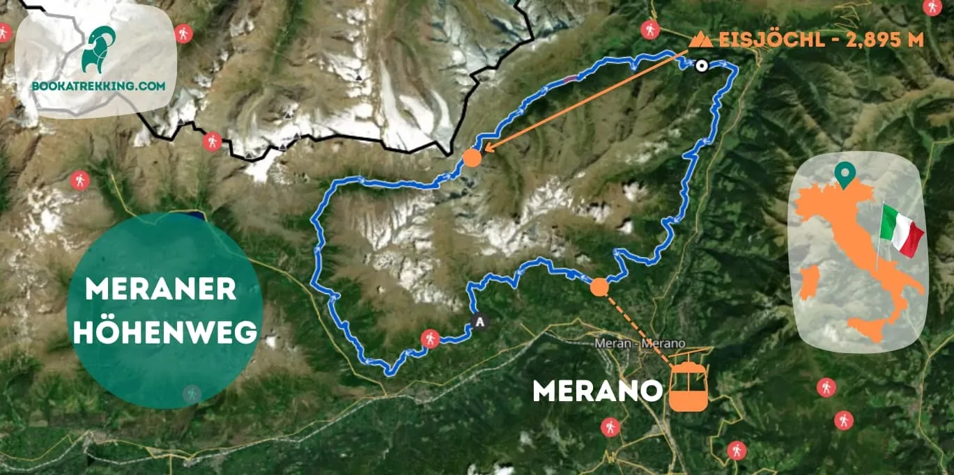
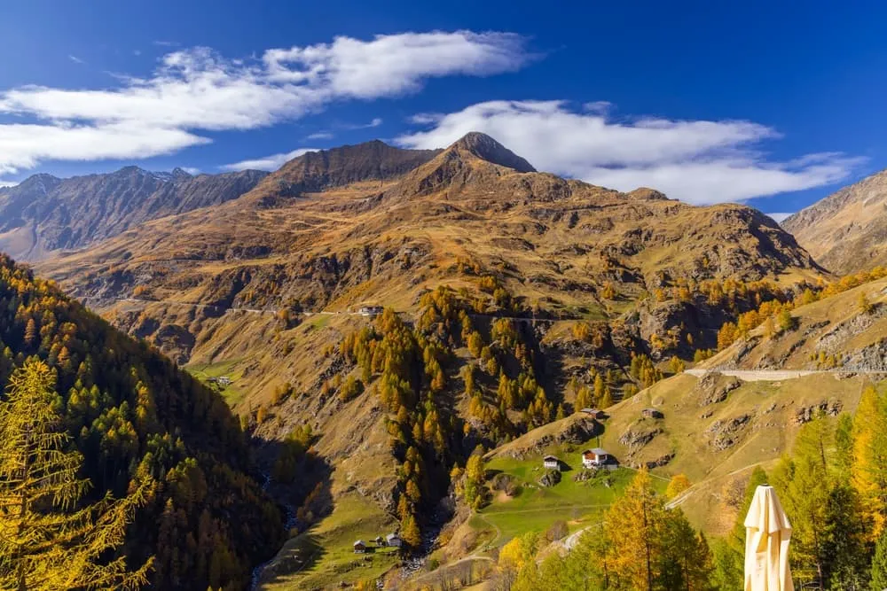
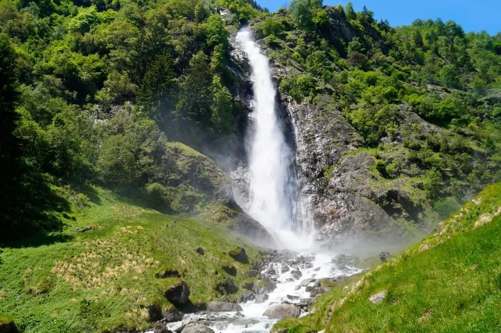
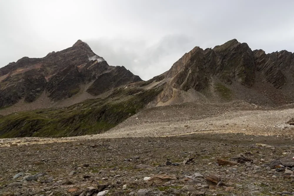
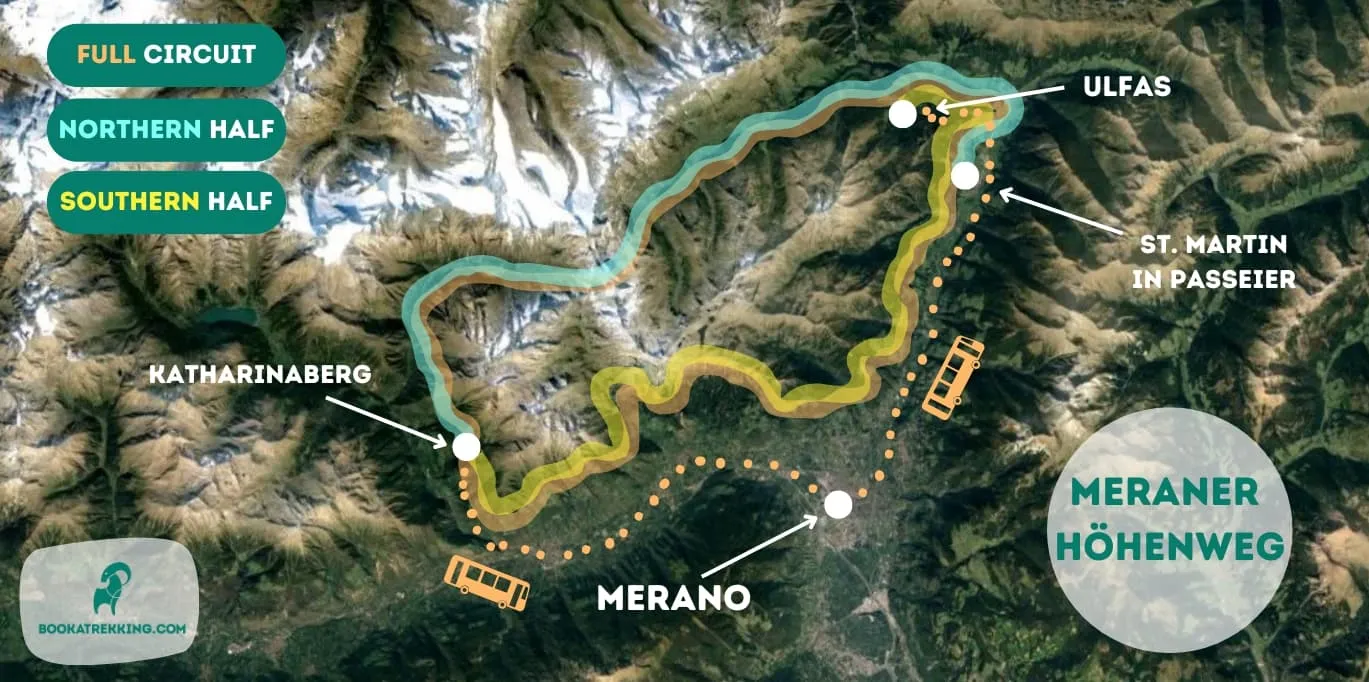
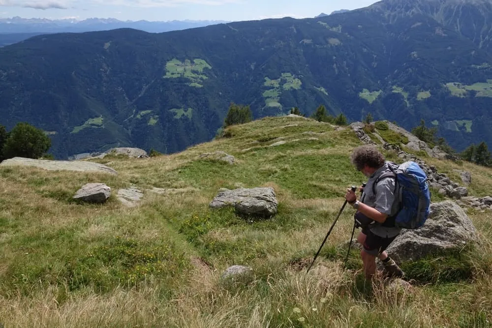
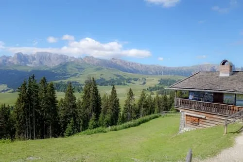
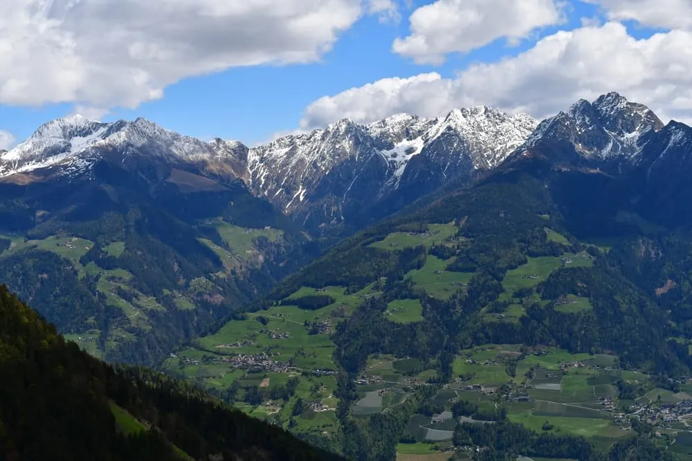
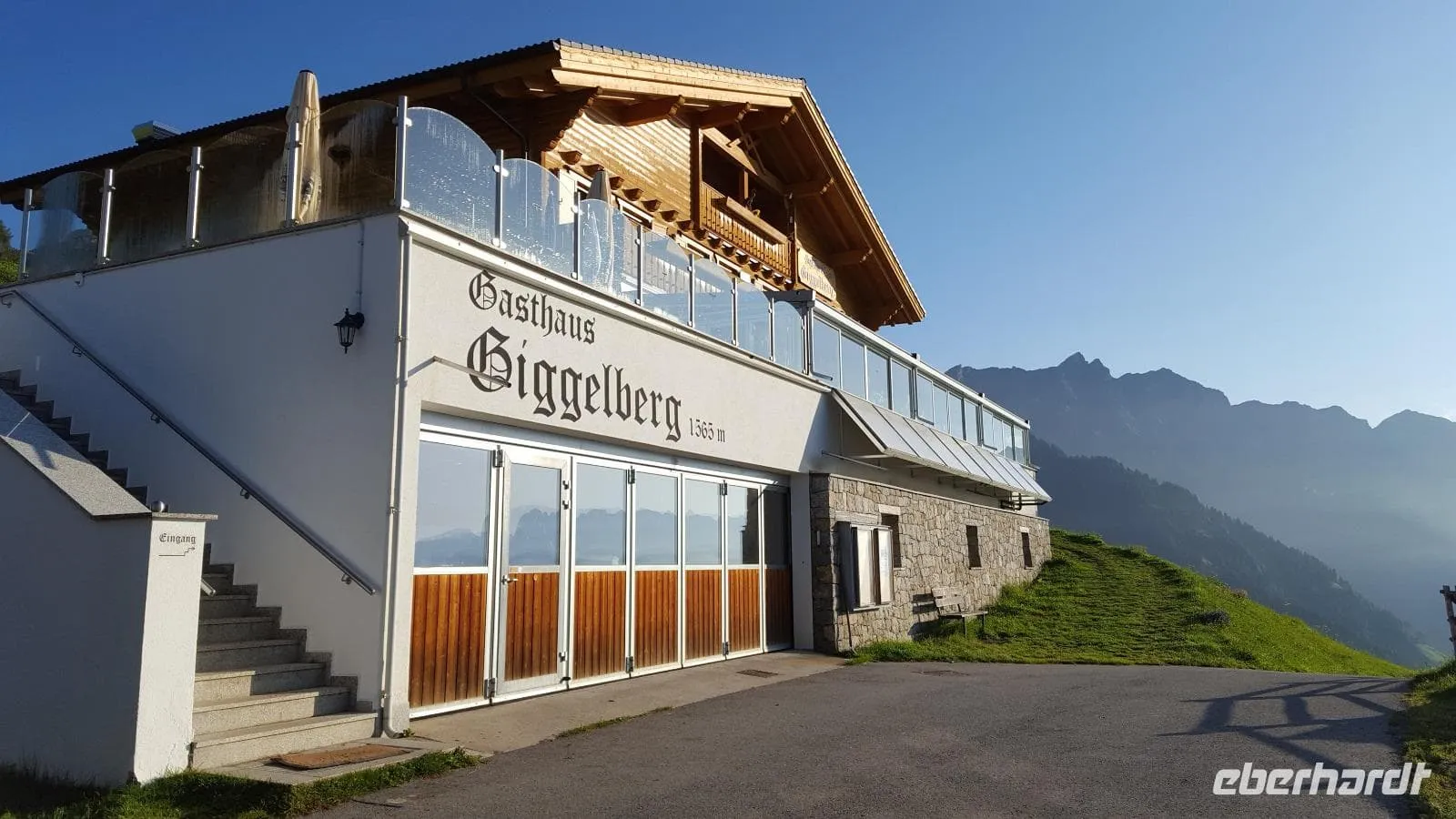
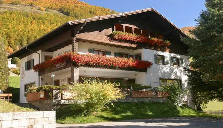
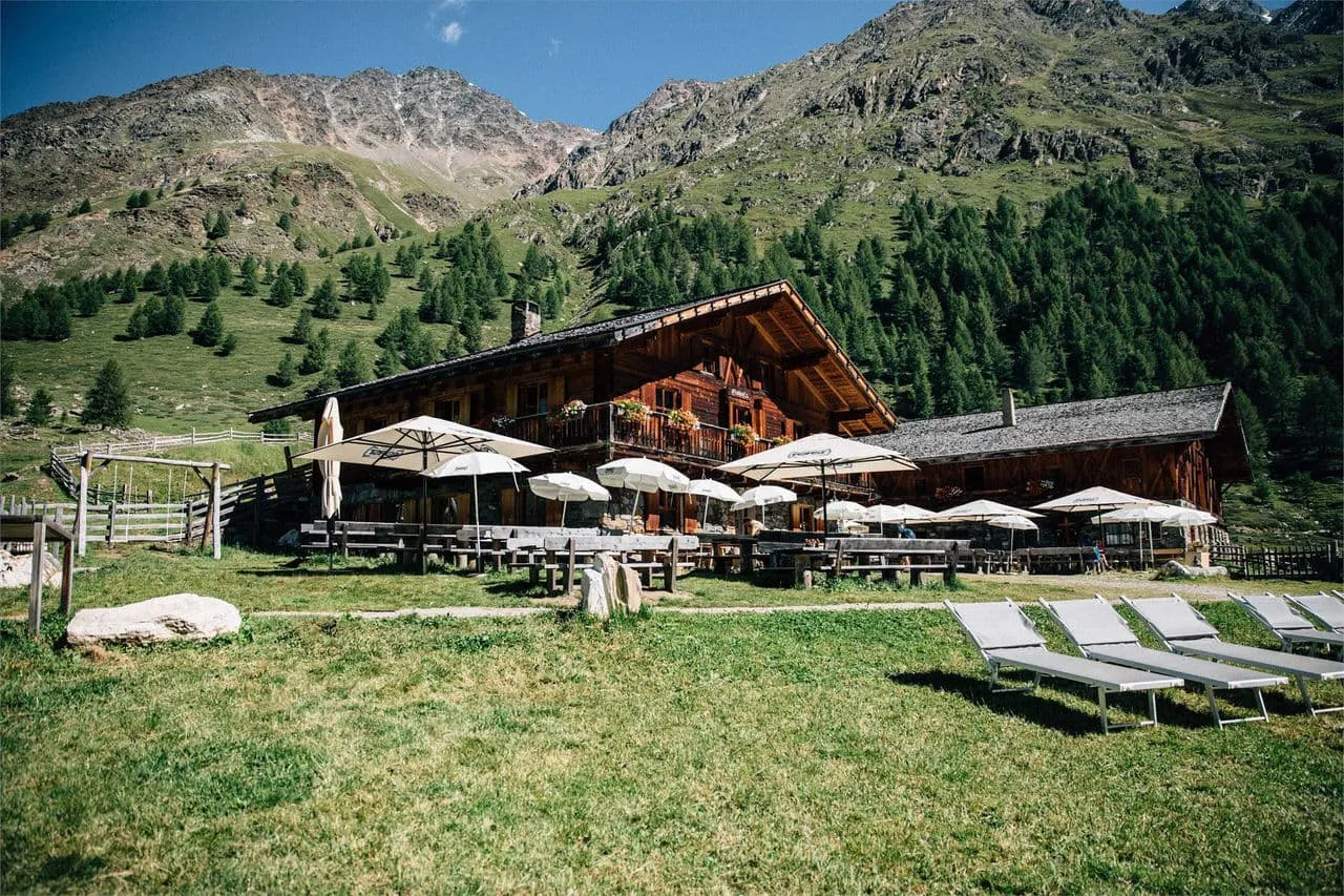
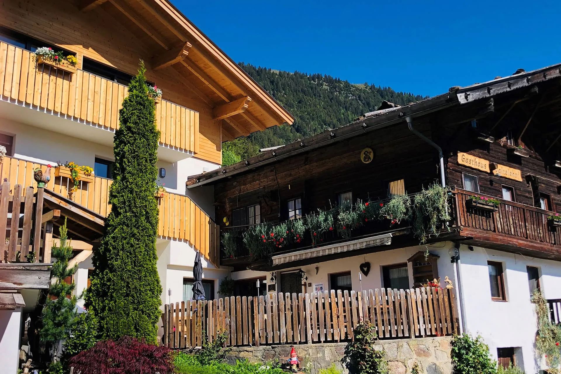
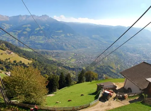
The Meraner Höhenweg, or Merano High Mountain Trail, is a 100-kilometer circular trek through the stunning Texelgruppe Nature Park in South Tyrol. It’s a must-do for hikers of all levels, offering everything from lush forests to rugged, rocky landscapes. Whether you're a trekking newbie or a seasoned hiker, this trail is as rewarding as it is accessible, and you can complete the full loop in 5 to 8 days, depending on your pace. Plus, the cozy alpine huts and charming hotels along the way offer the warm South Tyrolean hospitality you won’t forget.

What sets the Meraner Höhenweg apart is how it lets you truly experience South Tyrol’s natural beauty and culture without needing technical skills. Unlike tougher routes like the Alta Via 2, this trail strikes the perfect balance between breathtaking scenery and rich cultural stops. In this post, we’ll cover everything you need to know to plan your trek!

What and Where Is The Meraner Höhenweg

The Meraner Höhenweg, also known as the Alta Via di Merano in Italian, is a great option for anyone wanting to experience both nature and South Tyrolean culture. This 100-kilometer loop around the Texelgruppe Nature Park takes you through vineyards, alpine meadows, and mountain ridges, making it one of the most enjoyable and accessible trails in the area. While it’s less demanding than some other Italian treks, it still offers plenty of adventure and stunning views, suitable for hikers of all levels. The variety of terrain, from meadows to rocky paths, keeps the journey interesting.

You won’t be climbing any major peaks, but the Texelgruppe mountains, part of the Ötztal Alps, create a striking backdrop throughout the hike. Peaks like the Roteck, over 3,000 meters high, and the rugged ridgelines add to the region's wild beauty. Along the way, mountain huts and hotels provide comfort and the warm hospitality South Tyrol is known for, with many offering amazing views over the valleys. The trek starts in Merano, famous for its relaxed vibe and thermal baths, and is easy to reach from Bolzano or Innsbruck. Whether you’re an experienced hiker or just looking for a moderate trek, the Meraner Höhenweg is a perfect way to explore South Tyrol’s nature and culture.

What and Where Is The Meraner Höhenweg

Book Now

Is the Meraner Höhenweg for me?

The Meraner Höhenweg might not be as intense as some of the treks in the Dolomites, but at 100 kilometers, it’s still a serious undertaking. While it’s not overly technical, it offers enough of a challenge to keep things interesting, with daily hikes ranging from 4 to 8 hours, depending on the stages you choose.

You won’t be climbing the highest peaks, but you’ll walk along beautiful ridges and pass mountain huts with panoramic views that will make you feel like you’re on top of the world. The highest point on the trail is about 2,900 meters, but most of the route stays at lower elevations, so altitude won’t be a major concern. Plus, with a mix of mountain huts and Tyrolean hotels along the way, you can travel light and enjoy the hike, the scenery, and some great South Tyrolean food.

The trail begins in Merano, a lovely spa town that's easy to reach from Bolzano or Innsbruck. Whether you’re an experienced trekker or just looking for a bit of adventure, the Meraner Höhenweg strikes a great balance between challenging and enjoyable. It’s a fantastic way to experience South Tyrol’s diverse landscape without needing advanced technical skills.

Is the Meraner Höhenweg for me?

Did you know that we can book all huts and refuges for the Meraner Höhenweg for you? Check out all our options here.

What Is The Best Season for The Meraner Höhenweg?

The best time to hike the Meraner Höhenweg is from late June to mid-September, similar to other treks in Europe. Outside this window, the mountain huts along the route are closed, making hut-to-hut trekking impossible. During summer, you can expect mostly sunny skies and clear views, though occasional rain showers or afternoon thunderstorms are common. Snow isn’t usually an issue, and any that falls tends to melt quickly, keeping the trail accessible.

Be ready for changing weather: pack waterproof and warm layers for cool mornings and evenings, but also lighter gear for warmer afternoons. Shorts might seem appealing, but don’t rely on them alone! July and August are the busiest months, attracting both international hikers and locals, so if you’re trekking during this time—especially around school holidays—booking your huts and hotels in advance is a smart move. Despite the crowds, the Meraner Höhenweg offers stunning scenery and mostly great weather, as long as you’re prepared for shifting temperatures and the occasional storm.

What Is The Best Season for The Meraner Höhenweg?

Meraner Höhenweg Map and Navigation

There are many maps and guidebooks available to help you navigate the Meraner Höhenweg or other treks in the South Tyrol region. These resources offer valuable insights and route details to make your hike more enjoyable. Below, you’ll find a map providing an overview of the Meraner Höhenweg trail:

Classic 6-day Itinerary for the Meraner Höhenweg: Day by Day

The Meraner Höhenweg, or Alta via di Merano in Italian, can be completed in 5 to 8 days, depending on your pace, with overnight stays in mountain huts and hotels along the way. Each day covers a different section of the trail, taking you through changing landscapes with beautiful views. Here’s what a 6-day trek might look like:

Stage 1: Hochmuth to Giggelberg

Duration: 4:30 h
Distance: 13.5 km
Ascent: 875 m
Descent: 657 m

The trek starts at Hochmuth cable car station, above Tirol Castle. After taking the cable car up, follow trail No. 24 past Gasthof Hochmuth and the Leiteralm to the Hochganghaus. The path becomes more rugged as you continue to Nassereith-Hütte near Partschins Waterfall, before finishing at Berggasthaus Giggelberg.

Stage 2: Giggelberg to Katharinaberg

Duration: 4:30 h
Distance: 14.5 km
Ascent: 631 m
Descent: 967 m

Starting from Giggelberg, this stage follows the “Gorge of 1000 Steps” and passes through dry slopes dotted with juniper bushes. The trail leads into the Schnals Valley, with views of Juval Castle, and ends in the village of Katharinaberg.

Stage 3: Katharinaberg to Eishof

Duration: 4:20 h
Distance: 12.7 km
Ascent: 1039 m
Descent: 208 m

The trail takes you into the Pfossental Valley, with stops at Vorderkaser-Alm and Gasthof Jägerhof. Passing several huts, you end at the Eishof, a meadow below 3,000-meter peaks, offering a peaceful setting at the valley’s end.

Stage 4: Eishof to Pfelders

Duration: 6 h
Distance: 17.7 km
Ascent: 843 m
Descent: 1291 m

From Eishof, you climb to Eisjöchl, the highest point of the trail at 2,895 meters. After taking in the views, descend to the car-free village of Pfelders for the night.

Stage 5: Pfelders to Matatz

Duration: 4:40 h
Distance: 17.8 km
Ascent: 463 m
Descent: 1029 m

This stage takes you through quiet valleys and small villages, passing farms and following mountain streams before reaching Matatz.

Stage 6: Matatz to Hochmuth

Duration: 6:40 h
Distance: 18.5 km
Ascent: 1297 m
Descent: 1004 m

The final stage connects several mountain farms, with frequent ascents and descents. It passes through valleys and forests, finishing back at Hochmuth to complete the loop.

Looking for a shorter trek? The Meraner Höhenweg can easily be split into northern and southern sections, each offering stunning views and varied terrain. Perfect if you only have a few days or want to take it easy!

Not sure yet or want to discuss your plans for the Meraner Höhenweg with one of our trekking experts? Get in touch today and turn your dreams into memories!

Meraner Höhenweg: a Circular Route

The Meraner Höhenweg, or Alta Via di Merano, is a circular route, so you can start your trek from any stage, offering flexibility in how you plan your hike. A great advantage of this design is that you can choose a starting point that fits your schedule. However, it’s recommended to start at either Hochmuth or the Texelbahn stations, where cable cars take you straight into the mountains, saving you time and effort. This way, you can skip the initial climb and jump right into the beautiful views.

You can hike the full trail or just a few stages, depending on how much time you have. The trail can be divided into northern and southern sections. The northern section is more challenging, with steeper climbs and rougher terrain, while the southern section offers easier, more gradual ascents, making it ideal for a less strenuous hike. If you want to avoid the tougher parts of the northern section, there’s an alternate route with a simpler path, allowing you to enjoy the scenery without tackling the hardest terrain.

Meraner Höhenweg: a Circular Route

Accommodation on the Meraner Höhenweg

The accommodations on the Meraner Höhenweg are a big part of the trek, offering a mix of mountain huts and hotels depending on where you are. Whether you're up in the mountains or in small villages, these places provide more than just a bed—they give you a real taste of South Tyrolean hospitality. In the huts, you'll get simple dorm-style beds and hearty local meals, while the hotels offer more privacy and comfort. After a day of hiking, you can relax, enjoy a good meal, and chat with other hikers. Each stop, with its peaceful setting, adds to the experience.

Packing List for the Meraner Höhenweg

No matter how long you're hiking, having the right gear is key—especially on multi-day treks. A good backpack is essential, and its size will depend on how many days you're on the trail, the season, and what clothing you need. To help you get ready, we've made a packing list with the basics and a few extras that might be useful. With the right gear, you’ll be all set to enjoy your hike on the Meraner Höhenweg!

Getting to and from Merano

The Meraner Höhenweg, or Alta Via di Merano, is easy to access from several points, with the most popular being the Hochmuth and Texelbahn cable car stations near Merano. These cable cars take you straight into the mountains, skipping the initial climb and putting you right on the trail.

By bus:

Merano is well-connected by public transport. You can get there by train or bus from cities like Bolzano (40 minutes) or Innsbruck (about 2 hours). From Merano, local buses will take you to the cable car stations.

By car:

If you're driving, parking is available near both cable car stations for a small fee. Merano is a 30-minute drive from Bolzano and about 2 hours from Innsbruck or Verona. From there, you can head straight to the cable cars to start your hike.

Getting to and from Merano

At Bookatrekking.com, we not only book your huts, we also send you on your way with a comprehensive hiking guide with the most important information for your Meraner Höhenweg, including interactive Komoot maps. Browse all our options here and turn your dreams into reality.

How much does hiking the Meraner Höhenweg cost?

A hut-to-hut trek doesn’t have to be expensive, and the Meraner Höhenweg is a perfect example. Along this scenic route, you’ll find a mix of mountain huts and charming hotels, many of which offer breakfast or half-board options to make your trek as comfortable as possible. For a 6 or 7-day trek on the Meraner Höhenweg, you can expect to spend around 100 euros per hiking day. This typically covers your accommodation, and sometimes includes meals like breakfast or half-board when available. It also includes all the essential route information and navigation assistance you’ll need. We also recommend taking about 40 to 60 euros in pocket money per day to cover extras like lunch, snacks, or drinks along the way.

How much does hiking the Meraner Höhenweg cost?

Comments

About Us

At Bookatrekking.com, you will find the trek that will make your life unforgettable. Whether you want to explore the Inca Trail or climb Kilimanjaro. Bookatrekking.com has a wide and varied range of first-class treks. No false promises are made here. Transparent prices and bookings are fixed instantly. Find, compare, book and trek!
Read more about us
About Us

Also Interesting