Dolomiti di Brenta Trek: Hut-to-Hut in the Brenta Dolomites

Dolomiti di Brenta Trek: Hut-to-Hut in the Brenta Dolomites
Trekking experts per destination
Free cancellation up to eight weeks in advance
Quick personal advice

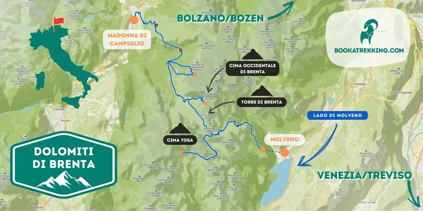
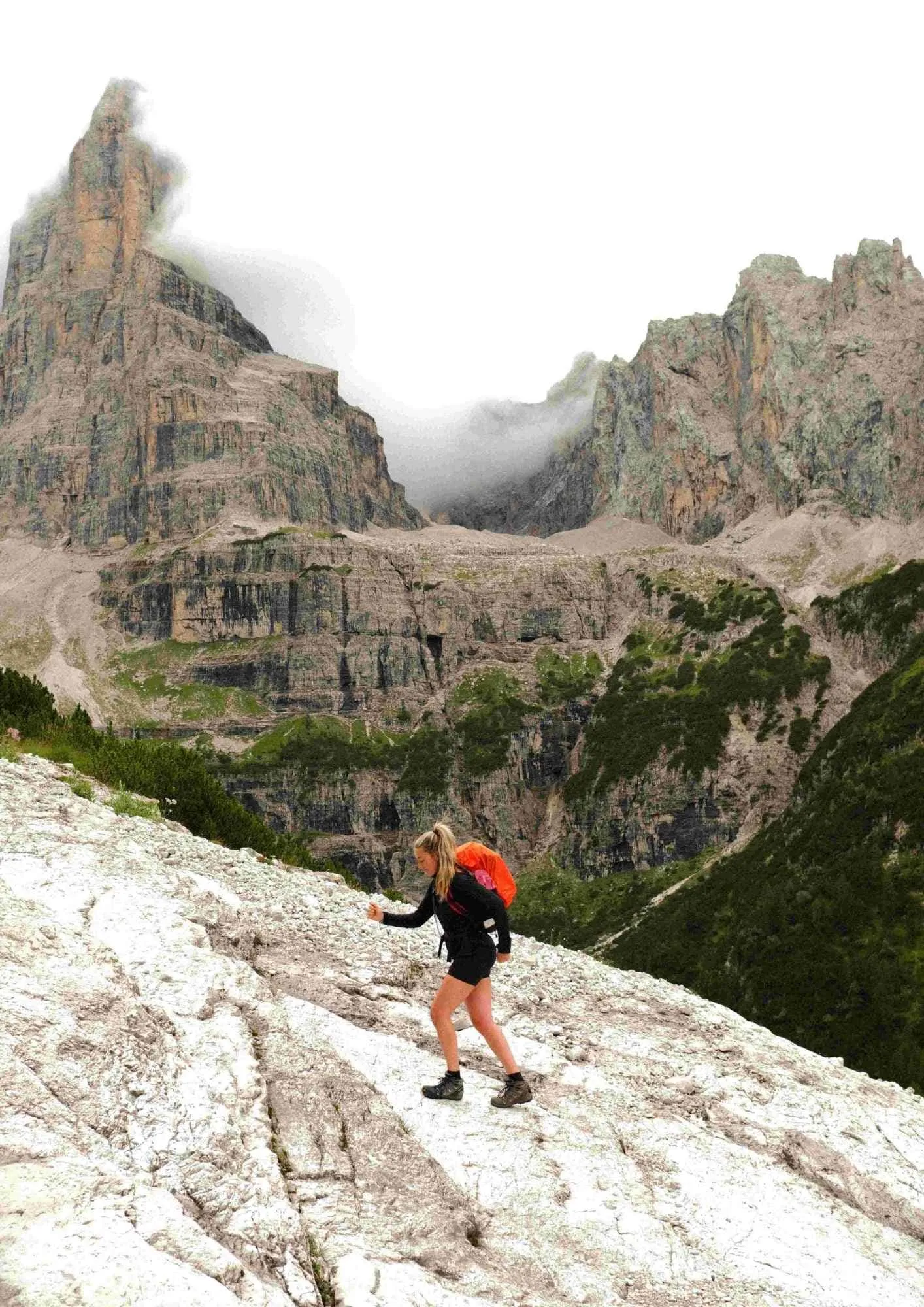
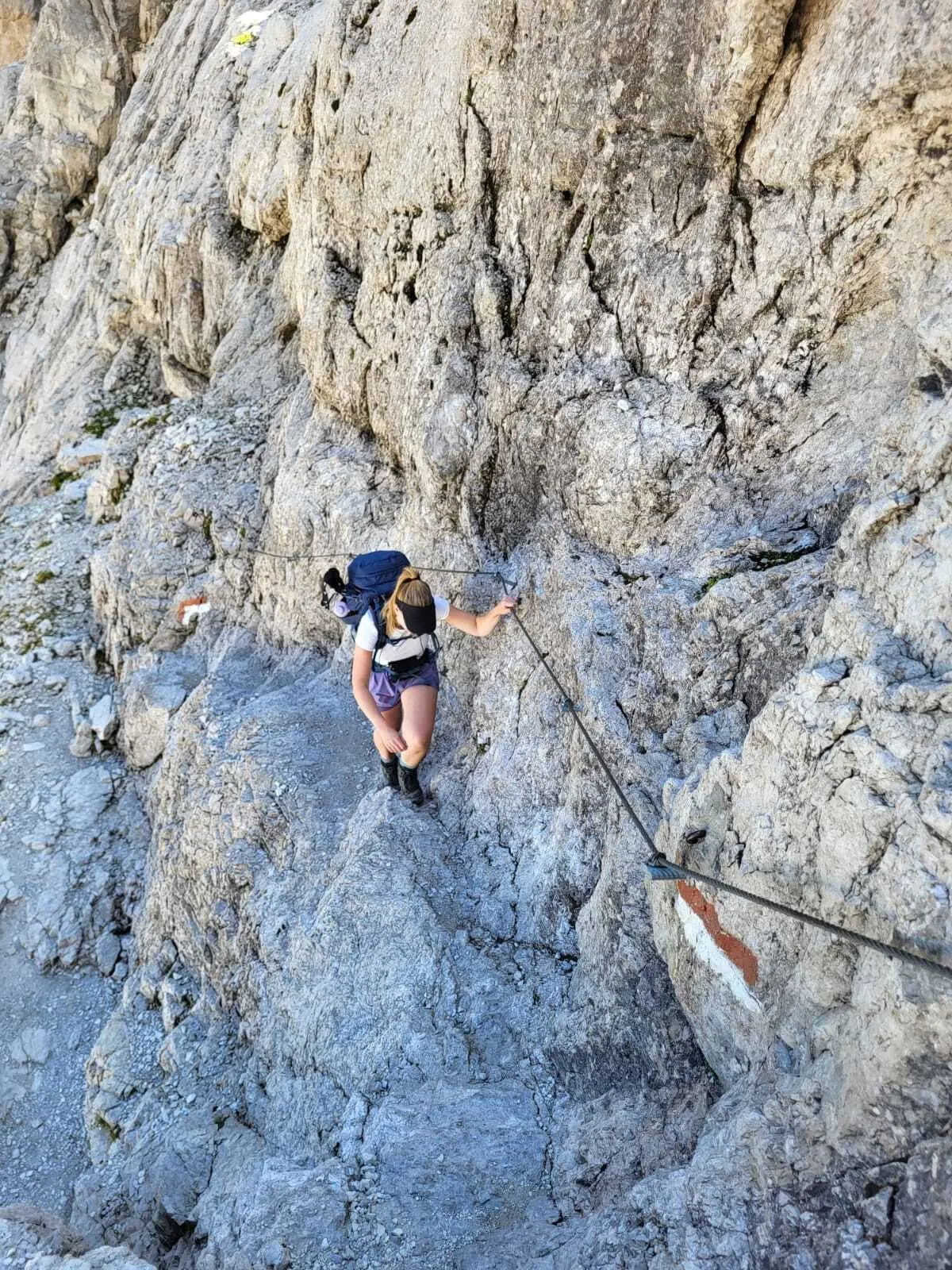
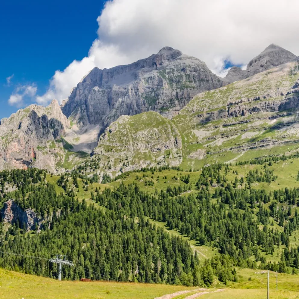
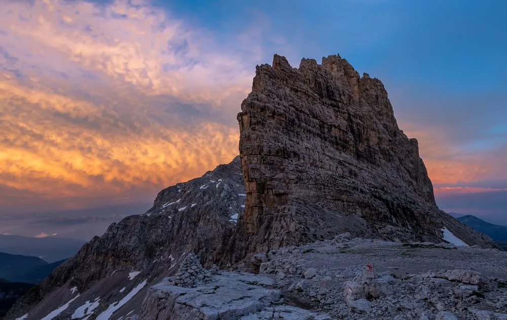
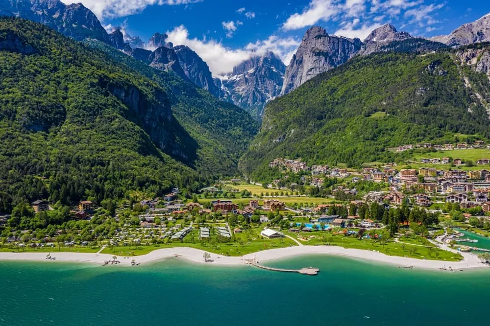
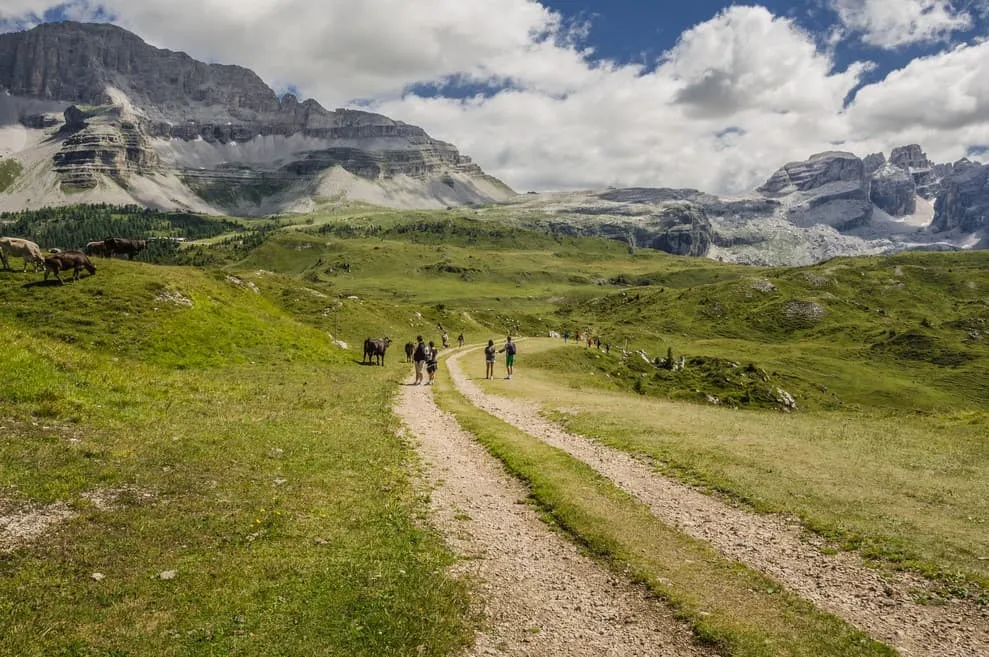
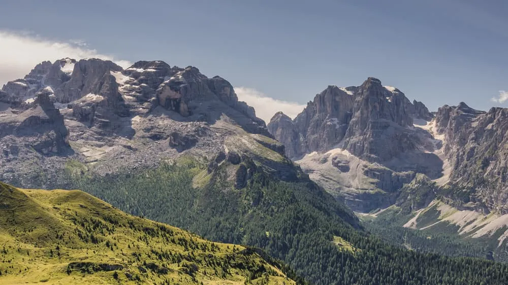
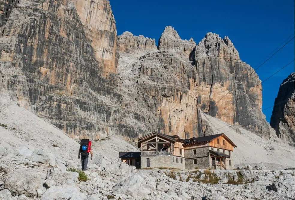
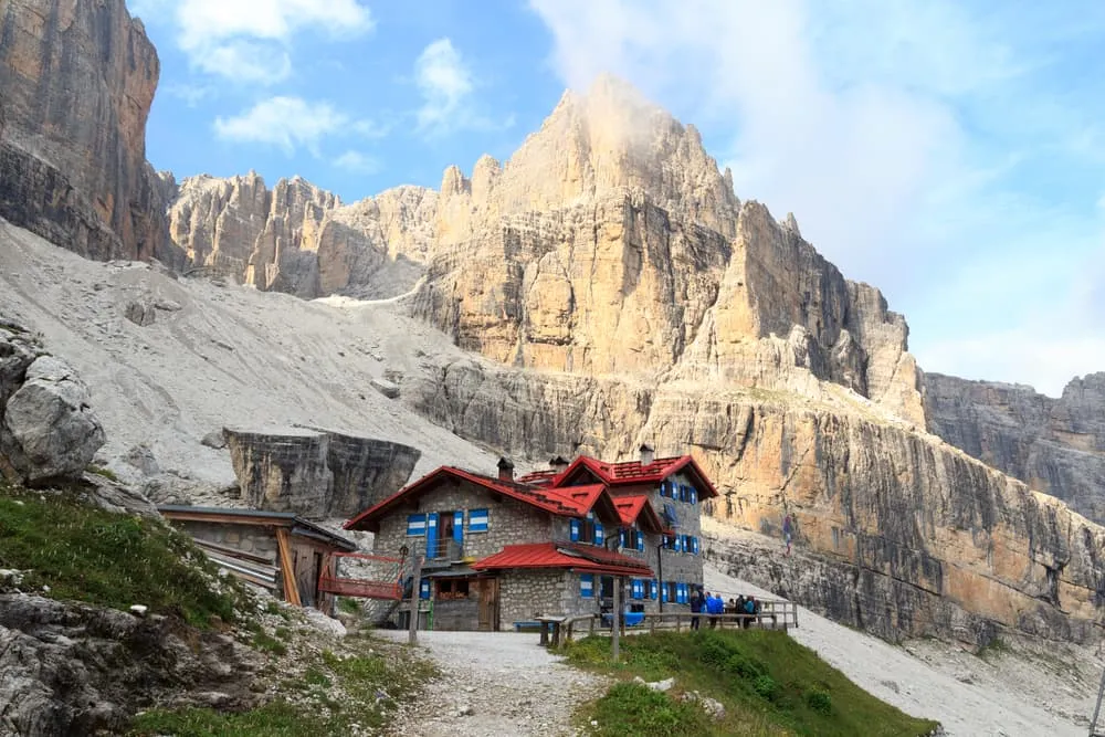
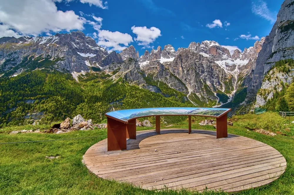
Tucked away in the heart of the Italian Alps, the Dolomiti di Brenta are an alpine treasure waiting to be discovered. This UNESCO World Heritage Site in Trentino offers a landscape of contrasts: limestone peaks piercing the sky, alpine meadows stretching for miles, and unspoiled valleys that feel like a step back in time. For the adventurous, the Brenta Dolomites are a dream come true. Well-marked trails lead you into one of the most striking mountain ranges in the Alps. Whether you're an experienced trekker or someone who loves a good outdoor challenge, the Brenta Dolomites will leave you in awe.

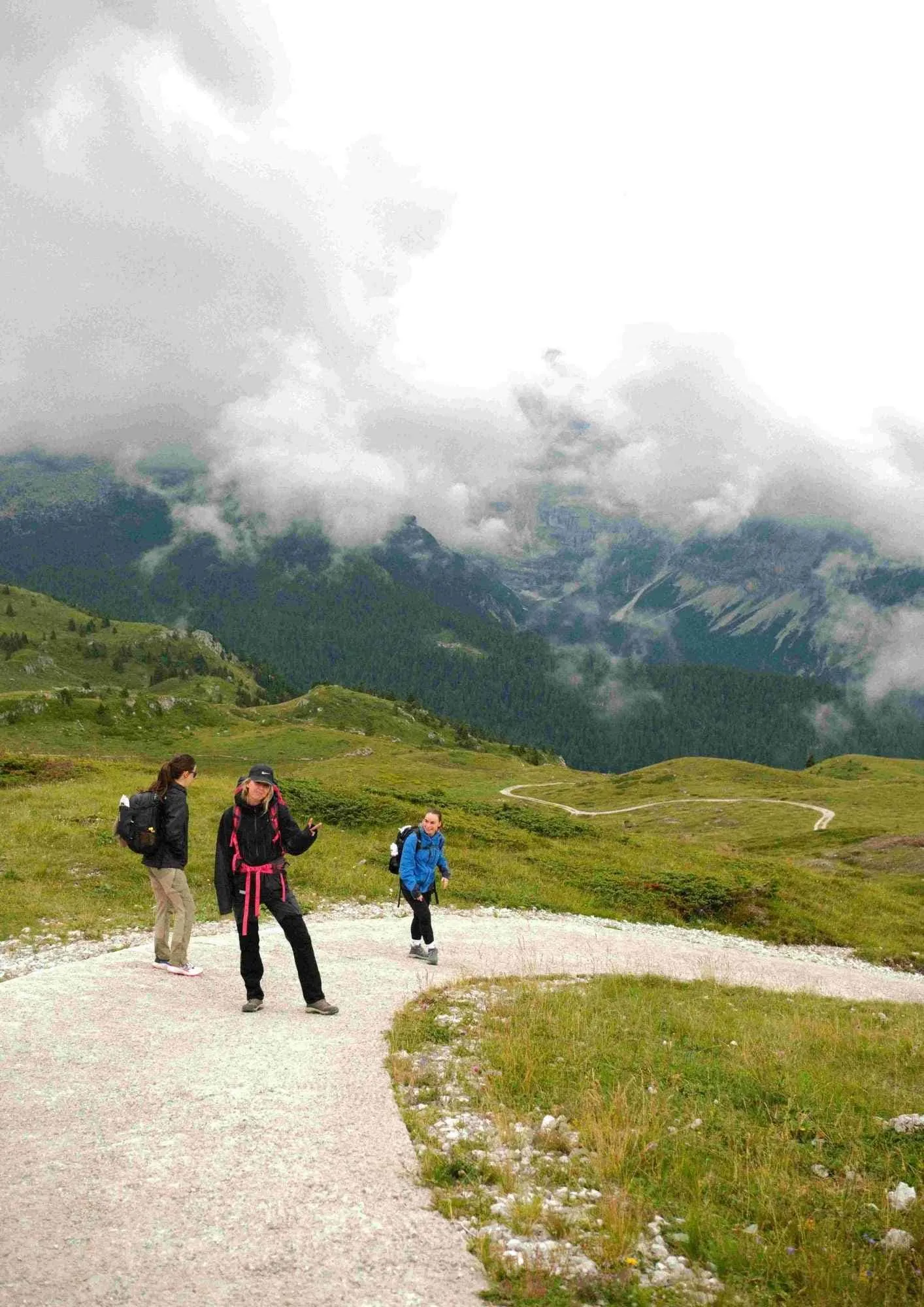
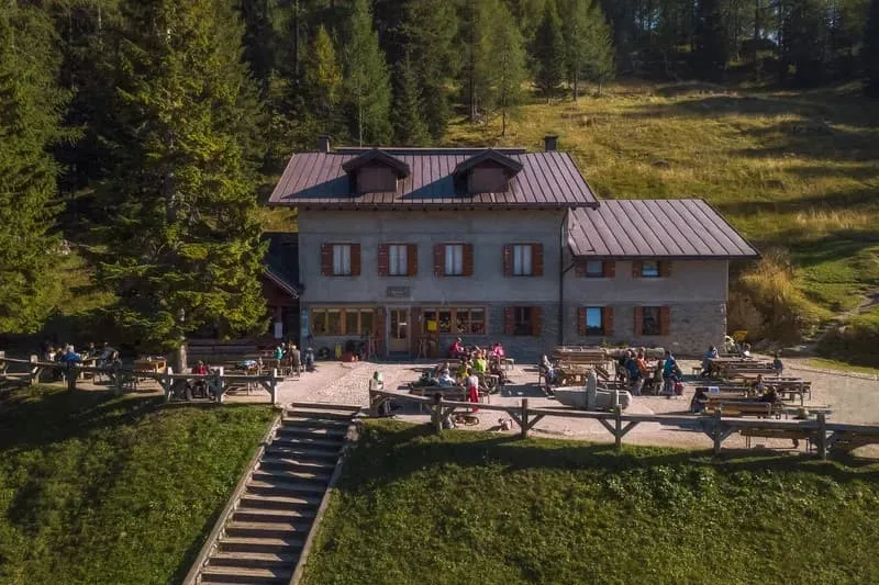
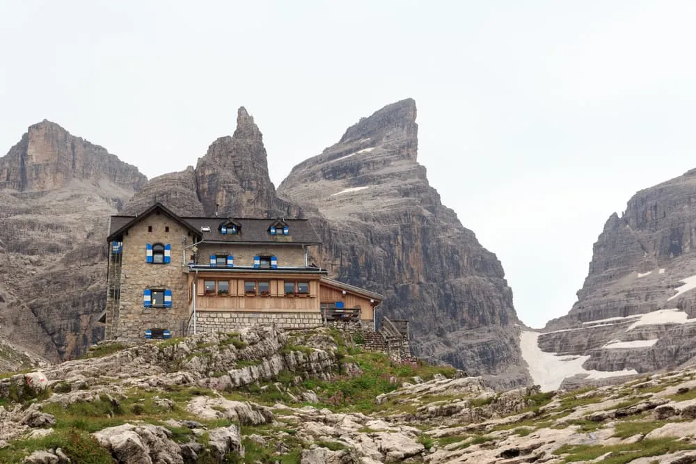
But these mountains aren't just about the trails—they’re a window into Italian mountain culture, alpine huts, and Trentino cuisine. It’s the perfect balance: the challenge of climbing followed by the comfort of a rifugi. From steep climbs with sweeping views to peaceful paths through wildflower meadows, the Brenta Dolomites offer a unique experience. Are you ready to discover this gem of the Italian Alps? Let’s go!

What and Where Are the Brenta Dolomites?

Located in western Trentino, the Brenta Dolomites are a mountain range that forms part of the Southern Calcareous Alps. This UNESCO World Heritage Site covers an area of about 40 km from north to south and 12 km from east to west, bordering the Val di Sole to the north, the Giudicarie Valleys to the south, the Adige Valley to the east and the Val Rendena to the west. Unlike their eastern counterparts, the Brenta Dolomites are the only dolomitic group west of the Adige River, resulting in a unique blend of geological formations and landscapes.

The Dolomiti di Brenta are famous for their dramatic rocky towers, spires and pinnacles, making them a paradise for climbers and hikers alike. The range boasts several peaks over 3,000 metres high, with Cima Tosa (3,173 m) and Cima Brenta (3,151 m) among the most prominent. Climbers are attracted by the famous "Via delle Bocchette", a series of fixed rope routes that cross the heart of the Brenta range. In addition to the rugged terrain, the Brenta Dolomites are part of the Adamello Brenta Natural Park, a protected area that is home to a rich variety of flora and fauna, including a small population of brown bears.

What and Where Are the Brenta Dolomites?

Highlights on the Brenta Trek

From the picturesque town of Madonna di Campiglio to Molveno, you'll cross steep terrain, reach panoramic viewpoints and sleep in historic huts. Every day reveals a new facet of the Brenta Dolomites:

Monte Spinale Viewpoint

Located above Madonna di Campiglio, Monte Spinale (2,103m) is a must for anyone exploring the Brenta Dolomites. This alpine destination offers views of the Presanella Group, the Brenta rock formations and the valleys below. Accessible by an easy hike or a cable car ride, it's the perfect place to take a break and enjoy the view.

Monte Spinale Viewpoint
Stopover at Rifugio Casinei

Stopover at Rifugio Casinei

Situated at a strategic crossroads, the Rifugio Casinei (1825m) is the main link between the paths leading to the Rifugio Tuckett or to the Vallesinella waterfalls, making it an obligatory stop in the area. Take a break from your adventure or enjoy a plate of typical Trentino cuisine.

Cima Tosa: the Highest Peak of the Brenta Dolomites

At 3,173 masl, Cima Tosa is in the centre of the Brenta Group, bordered to the north by the Brenta Valley, to the south by the Val d'Ambiez and to the east by the Pozza Tramontana, an elliptical glacial karst basin. Stay tuned for stage 3!

Cima Tosa: the Highest Peak of the Brenta Dolomites
The Awarded Lago di Molveno

The Awarded Lago di Molveno

Voted the most beautiful lake in Italy for 7 years in a row, the crystal clear waters of Lake Molveno make it a true Alpine gem. Situated at the foot of the Brenta Dolomites and within the Adamello-Brenta Natural Park, the town of Molveno lies gently on its shores.

Is the Brenta Trek for Me? - Difficulty

The Brenta Trek is perfect for trekkers looking for a mix of adventure, alpine landscapes and welcoming huts. Although there are no via ferrata sections or technical climbs, this trek is no walk in the park. The trails are classified as moderate to difficult (T2/T3), with steep climbs and descents, uneven terrain and long days of walking.

You'll need a good level of fitness, sure-footedness and confidence to complete the stages. The ascent can be challenging, but the rewards are worth every step - sweeping views of limestone peaks and alpine meadows and the thrill of exploring this lesser-known Alpine region. If you're an experienced hiker who loves the idea of combining physical challenge with moments of tranquillity, the Brenta Trek is for you.

Is the Brenta Trek for Me? - Difficulty

When is the Best Season for Hiking in the Dolomiti Di Brenta?

The best time to walk in the Brenta Dolomites is in summer, from mid-June to mid-September. During these months the paths are free of snow, the refuges are open and the weather is generally favourable for mountain hikes. Here's what you can expect:

  • June and July: Start of the walking season. Trails are lush, with wildflowers in full bloom, and temperatures are pleasant, especially at higher altitudes. It's also less crowded than August.
  • August: The most popular time to visit, as European travellers take their summer holidays. Although the paths and refuges can be busier, the long, sunny days make this a great time to explore the Brenta Dolomites.
  • September: A favourite for experienced hikers. The weather remains mild, the crowds thin and the autumn colours begin to add a new layer of beauty to the landscape.

Always remember that mountain weather can be unpredictable. It's important to check the forecast before you set off, bring the right equipment and be prepared for sudden changes. Winter snow can last until June on the higher routes, so early season walkers should check conditions before setting off.

For those who wish to avoid the summer rush and still enjoy ideal walking conditions, early July or September is often the best time to explore the Brenta Dolomites.

When is the Best Season for Hiking in the Dolomiti Di Brenta?

How to Get To and From the Start and End Point of the Trek

As mentioned above, your trek begins in the touristy area of Madonna di Campiglio and ends in Molveno.

You can reach Madonna di Campiglio, by various means of transport. If you are flying into Italy, the nearest airports are Verona Villafranca (VRN), Bergamo Orio al Serio (BGY) and Bolzano Dolomiti (BZO), from where you can continue your trip by bus, train or car. If you prefer to drive, simply follow the signs for Madonna di Campiglio on the A22 Brennero motorway. If you are travelling by train, the nearest major station is Trento, from where you can take a Trentino Trasporti bus to your destination. There are also direct bus connections from the main cities and airports in Northern Italy, making this Alpine destination easily accessible.

At the end of your Brenta Trek, to return to your next destination from the village of Molveno, you can take a bus back to Trento, arriving in about 1 hour. Once in Trento, you can rent a car or take a train or bus to your final destination. The nearest airport, served by shuttle buses from Trento railway station, is Verona.

Please note that public transport schedules can vary according to the season, so it's advisable to check the latest timetables before planning your trip. For detailed timetables and further information please visit the Molveno or Madonna di Campiglio tourist websites or contact our Trekking Experts.

How to Get To and From the Start and End Point of the Trek

4-day Trek in the Dolomiti di Brenta: Day by Day Itinerary

This trek through the Brenta Dolomites combines challenging paths, welcoming huts and spectacular views, it's the ultimate trek for experienced trekkers looking for both adventure and natural beauty.
Day
1

Madonna di Campiglio - Rifugio Tuckett

Duration: 05:00 h
Distance: 11.3 km
Ascent: 1130 m
Descent: 400 m

Starting from the alpine town of Madonna di Campiglio, your adventure begins with a choice: take the easy way up to the Grostè Pass by cable car, or take on the challenge of the ascent on foot - and earn these views the hard way!

From the Grostè Pass, path 316 winds through rocky outcrops and tranquil pastures on a gentle descent to the Tuckett Hut. Along the way you'll be rewarded with views of the Presanella, Adamello and Brenta mountain ranges. A warm welcome awaits you at this refuge, a favourite stop for hikers and the perfect place to relax and recharge your batteries.

Note: On some days, you may need to retrace your steps briefly from the hut to rejoin the main trail, a small price to pay for such unforgettable overnight spots!

Rifugio Tuckett

Info
Rifugio Tuckett
Rifugio Tuckett
Day
2

Rifugio Tuckett - Rifugio Alimonta

Duration: 04:50 h
Distance: 9.3 km
Ascent: 860 m
Descent: 510 m

The day begins at Rifugio Tuckett, where the trail gently descends through rugged, rocky terrain towards the heart of the Brenta Dolomites. With imposing peaks towering above you, each step feels somewhat epic. The well-marked path keeps you on track, opening up to reveal pale limestone towers, hanging glaciers, and deep, shadowed gullies.

As you leave the Casinei hut behind, you continue down the valley. Around halfway through the stage, you follow part of the lower-altitude alternative route, the Sentiero Violi. There is little equipment here, just a couple of short cables for added security on narrow sections. While not particularly difficult, this section marks the beginning of a long ascent towards your hut. Higher up, the slope steepens over loose rocks and uneven ground, with slender rock spires providing constant drama all around you.

The final stretch climbs into a rocky cirque where the iconic Rifugio Alimonta appears, perched among boulders and snow patches at 2,580 metres. As you reach the terrace, you are surrounded by a crown of jagged peaks. Here, you can rest, fill your water bottle and watch the evening light slide across the Crozzon and its neighbours while thinking about tomorrow's adventures.

Rifugio Alimonta

Info
Rifugio Alimonta
Rifugio Alimonta
Day
3

Rifugio Alimonta - Rifugio Agostini

Duration: 05:30 h
Distance: 11.7 km
Ascent: 670 m
Descent: 870 m

From the rocky terrace of Rifugio Alimonta, today's stage links two high alpine basins in the heart of the Brenta. The pale walls of Cima Tosa (3,136 m), Crozzon di Brenta (3,135 m) and Cima d'Ambiez (3,102 m) tower above you like a circle of stone. The day involves long descents and steady climbs, with glacial hollows and scree being traded for green pastures and water-worn slabs.

The trail starts with a steep descent via rocky zigzags, taking you back to Rifugio Maria e Alberto al Brentei. As you contour through boulder fields, you pass the basin in the lower valley just before the main ascent to Bocca di Brenta (2,560 m), a high pass overlooking the Val d'Ambiez. The narrow, exposed T3 path winds its way up ledges and rubble slopes, offering increasingly expansive views of the Brenta chain. You may find cables and steps along the way to provide additional support.

You have now reached Rifugio Tommaso Pedrotti, the perfect halfway point after the challenging start. Follow the Sentiero 'Elio Palmieri Basso', which starts with a series of zigzags and leads you through softer terrain towards a high cirque dotted with slabs and patches of grass surrounding Pozza Tramontana and overlooking the rocky valley. Another zigzagging path will take you up to Costa di Ceda, where you can enjoy stunning vistas of Cima Tosa and Cima Brenta. You will then pass Forcolotta di Noghera (2,423 m) and traverse undulating terrain and broken limestone to reach Rifugio Agostini, perched on a rocky shoulder beneath Cima d'Ambiez. Once you arrive, you can watch the last light fade from the surrounding towers.

Note: Keep in mind that if you go at the beginning of the season, there may still be snow, which makes the route potentially dangerous without snow equipment.

Rifugio Agostini

Info
Rifugio Agostini
Rifugio Agostini
Day
4

Rifugio Agostini - Rifugio Malga Andalo - Molveno

Duration: 08:10 h
Distance: 19.6 km
Ascent: 500 m
Descent: 2030 m

Leaving the rocky basin of Rifugio Agostini, you first retrace your steps towards Rifugio Tommaso Pedrotti for around 6kms. The balcony views of Cima d'Ambiez, Cima Tosa and Cima Brenta feel different in the morning light, knowing that by evening you will be down among forests and water again. After a last look back at the high walls, the route begins its long undulating descent, trading scree and limestone ledges for meadows, streams and finally the blue of the lake far below.

The day starts going back via Forcolotta di Noghera (2,423 m) and Costa di Ceda until reaching Pedrotti Hut. Beyond that point, the character of the route changes as you begin the main descent into the upper Val delle Seghe, following rocky terraces and gullies between high peaks. Gradually, the path winds through pastures, scattered pines and streams, eventually reaching the open meadows around Rifugio Selvata, halfway through the day. Here, in the woods, an equipped trail section begins (known as Sentiero attrezzato Celeste Donini) with an exposed path secured with ropes and steps, a challenging passages where sure-footedness required. If you continue walking a little further among the trees, you will reach the Malga Andalo hut.

From there, the trail continues to lose height on forest paths and broad tracks, accompanied by the sound of water in the distant Rio Massodi. Glimpses of the turquoise lake appear between the trees, growing larger as you approach the valley floor. A final gentle stretch brings you into the village of Molveno. Time to swap boots for sandals and enjoy the evening light on the water and the Brenta skyline.

Note: If you prefer an easier and stress-free option to descend to Molveno, you can take a Jeep Taxi from Rifugio Malga Andalo.

The Brenta Dolomites Tour vs Other Treks in The Dolomites

The Dolomites (Italy) are one of the most popular hiking destinations in Europe. What makes them so popular is the variety of options available, such as the Alta Via della Marmotta, the Alta Via del Granito or the Palaronda Trek.

The Brenta Trek stands out from other popular routes in the Dolomites for its unique combination of remoteness, dramatic beauty and challenging sections. While classic routes such as the Alta Via 1 or the Tre Cime di Lavaredo Hike are renowned for their landscapes and accessibility, they also tend to attract larger crowds. Trekking in the Dolomiti di Brenta, on the other hand, offers a more tranquil and intimate experience in the heart of the Adamello-Brenta Natural Park, allowing hikers to get in touch with an unspoilt area. For experienced hikers used to high altitude and adrenaline, the Brenta Trek is the perfect excursion.

The geological formations of the Brenta Dolomites, such as the towering Cima Tosa and several other peaks over 3000m, give the landscape a distinctive character. Unlike the photogenic but relatively uniform peaks of other Dolomite groups, the jagged peaks of the Brenta Dolomites feel wilder and more untamed. This makes the Brenta Trek an ideal choice for those looking for an off-the-beaten track adventure with all the charm of the Dolomites.

Map and Navigation for Your Dolomiti di Brenta Trek

Navigation in the Brenta Dolomites is easy thanks to its well-marked paths. The routes are part of the Adamello-Brenta Natural Park and are clearly marked with trail numbers and directional signs, making them easy to follow. To enhance your navigation, this online map provides GPS guidance and route details for the trek. It is also advisable to carry a paper map for extra safety, especially in remote areas.

Staying in Rifugios in the Brenta Dolomites

One of the highlights of trekking in the Brenta Dolomites is the possibility of staying in traditional mountain huts, comfortable and pleasant after a long day's trekking. These refuges are strategically placed along the route and will allow you to rest and recharge your batteries.

The rifugi of the Brenta Dolomites are renowned for their hospitality and authentic alpine atmosphere. Many are family-run and serve delicious local dishes such as polenta, speck and authentic Italian pasta. Imagine ending the day with a plate of tagliatelle al ragù and a cold beer, while enjoying the views...

Refuge accommodation is simple but comfortable. Dormitory-style bunk beds are the norm, although some huts offer private rooms for those seeking more privacy and comfort. Bedding is usually provided, but it is advisable to bring a lightweight sleeping bag liner for extra comfort and hygiene. Most huts have basic facilities, including running water, toilets and even showers (although hot water may be available for a small fee). Some also offer Wi-Fi, but with the scenery so beautiful, you may prefer to disconnect and soak up the alpine tranquillity.

Staying in a refuge isn't just about resting, it's an essential part of your trekking experience. Swapping stories with fellow hikers over dinner, watching the sunset from a mountain terrace and waking up to fresh mountain air are moments that will make your trek in the Brenta Dolomites unforgettable.

Packing List for the Dolomite di Brenta Trek

It doesn't matter where you are trekking or for how long: carrying the right equipment with you is paramount. For a hiking trip in the mountains, a good is backpack essential. Its size will depend on how many days you will be spending in the mountains, the season, and the clothes you will be taking with you. We have prepared a packing list with some essential clothing that you should include and some extras that you may find useful:
  • Essentials

  • Extras

Dolomite di Brenta Trek 8173

Where Can I Book the Dolomite di Brenta Trek?

At Bookatrekking.com you can book the self-guided Dolomite di Brenta Trek and many other treks. We take care of all the details for you, including arranging accommodations and providing you with relevant information well in advance of your trek. Find our offers here. Our easy-to-use platform allows you to browse and compare different trekking options and to find the perfect fit for your interests, abilities, and budget.

If you have any questions about a specific trek or need help choosing the right one for you, our team of trekking experts is here to assist you. Simply reach out to us and we will be happy to provide you with personalized recommendations and advice to help you plan the trekking adventure of a lifetime.

About Us

At Bookatrekking.com, you will find the trek that will make your life unforgettable. Whether you want to explore the Inca Trail or climb Kilimanjaro. Bookatrekking.com has a wide and varied range of first-class treks. No false promises are made here. Transparent prices and bookings are fixed instantly. Find, compare, book and trek!
Read more about us
About Us
About Us

Also Interesting