The walking routes in South Limburg range from short loops of five to six kilometres to station-to-station walks of 16.5 and 23 kilometres. Below are eight of the finest walks in the region, each with its starting point, waymarking and highlights. You can find the route descriptions and GPX files at Natuurmonumenten, Visit Zuid-Limburg and NS (Dutch Railways).
Through the Geul valley near Epen (6 km)
Distance: 6 km · Start: Epen · Waymarking: no posts in the field, download the route from Natuurmonumenten
Walking in Epen means walking along the lifeline of the Geul valley. This route by the nature conservation organisation Natuurmonumenten takes you through hay meadows, past hedges, sunken lanes and half-timbered houses and over the slopes. The base of the church in Epen is built from Carboniferous sandstone, some 300 million years old; the Geul valley is the only place in the Netherlands where this rock reaches the surface. With a bit of luck you will spot a hazel dormouse in the hedges, a rare species that in the Netherlands only lives in this part of Limburg.
Vijlenerbos route near Vijlen (5.7 km)
Distance: 5.7 km · Start: car park by the forest café in the Vijlenerbos · Waymarking: green Staatsbosbeheer posts
At around 650 hectares, the Vijlenerbos is the most elongated woodland in the Netherlands. The route has considerable height differences, and after every steep climb you look out over the Geul valley. A short route for anyone who wants to practise the Limburg climbs, and good preparation for a longer multi-day hike.
Vaalserberg and the Three-Country Point (5.1 km)
Distance: 5.1 km · Start: Drielandenpunt on the Vaalserberg (322 m) · Waymarking: signposted via walking junctions
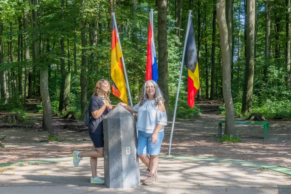
The Drielandenpunt, or Three-Country Point, on the Vaalserberg is the highest point of the European part of the Netherlands, at 322 metres. This is where the Netherlands, Belgium and Germany meet. The route runs from here to the Vijlenerbos and back, passing the Wilhelmina Tower for an extra view over three countries. A short route with plenty of views.
Around the Gulperberg in Gulpen (6.1 km)
Distance: 6.1 km · Start: village centre of Gulpen · Waymarking: signposted via walking junctions
Walking around Gulpen is all about the Gulperberg, with fine views over the rolling landscape. The route starts and ends in the village centre of Gulpen and runs over and around the hill. In the village you will find the Neubourgermolen mill and the Gulpener brewery. A handy route if you are staying in Gulpen and want to stretch your legs for a morning.
Castle walk in Valkenburg (8 km)
Distance: 8 km · Start: Bogaardlaan in Valkenburg · Waymarking: route description from Visit Zuid-Limburg
Hiking in Valkenburg along the Geul takes you past two castles. Kasteel Schaloen has a moat, a historic water mill and a castle garden. A little further on lies Kasteel Oost. The route combines the Geul, the rolling hills and cultural history; afterwards you are only a few minutes from a terrace in Valkenburg.
Sint-Pietersberg circular walk (10.8 km)
Distance: 10.8 km (shorter green route approx. 5 km) · Start: Oog van Sint Pieter car park · Waymarking: red triangles
Walking on the Sint-Pietersberg takes you past Fort Sint Pieter, over chalk grassland rich in butterflies and along the edge of the former ENCI quarry. Eagle owls have bred in the quarry wall since 1998. The long version of 10.8 km also takes you past the Duivelsgrot cave and a viewpoint over the Maas valley; the shorter route of five kilometres is a good warm-up.
From Maastricht station to Valkenburg (16.5 km)
Distance: 16.5 km · Start: Maastricht station · Waymarking: route description and GPX from NS
This NS route links two stations via the hills and the Geul valley. From Maastricht you walk along the Groene Loper into the hills, pass the Curfsgroeve quarry and descend through the Geul valley to Valkenburg. If you like, you can walk another four kilometres to Schin op Geul station. A logistically easy route: you leave the car at home and take the train at both ends.
Through the Savelsbos from Maastricht to Eijsden (23 km)
Distance: 23 km · Start: Maastricht station · Waymarking: route description and GPX from NS
The longest day walk on this list leads through the old Savelsbos woods, with tall trees, sunken lanes, marl quarries and fruit orchards. Parts of the Pieterpad run along here too. After rain the paths are very muddy and slippery, so shoes with a good tread are no luxury. The walk ends at Eijsden station.