Gokyo Trek: Off the Beaten Track in the Everest Region

By Jan Bakker

Find that one special trekking
Search
Gokyo Trek: Off the Beaten Track in the Everest Region
Quick personal advice
Free cancellation up to two weeks in advance
Trekking experts per destination

Every year an estimated 40,000 trekkers set out from Lukla to trek to the most famous campsite in the world, Everest Base Camp. It can get busy on the trails and in the Sherpa villages along the way. Is there a different, less-trodden route where you can still see the world’s highest peaks? Yes there is! The Gokyo Valley is the best kept secret in the Everest region. Think emerald mountain lakes, the longest glacier in Nepal and a view of four mountains above 8000 meters. Sounds too good to be true, right?

I’m Jan and I’ve been roaming high altitude mountains in Asia and beyond for almost 20 years, including the Nepali Himalayas and the Pamirs in Central Asia. Because the Gokyo trek is well away from the crowded trails to EBC it makes it a solid favorite of mine for the Everest region. What makes this trek so amazing? Let us tell you why!

Gokyo Trek: Getting Away From The Crowds

The Gokyo Trek is a great alternative to the Everest Base Camp Trek. We actually like to think it’s better for 5 reasons.

1. No crowds

There’s hardly any other hikers and we love it. Trek in solitude, surrounded by a (literally) breathtaking landscape.

2. The Gokyo Lakes

Check the pictures beneath this chapter. Do we need to say more?

3. The Ngozumpa glacier

It may not be common knowledge, but the Ngozumpa glacier is the largest glacier in Nepal and the entire Himalayas for that matter. It’s best viewed from the top of Gokyo Ri, see reason number four.

4. Gokyo Ri

The view from the 5,357m high summit only knows superlatives. Four 8000m+ peaks including Mount Everest, the highest freshwater lake system in the world and the longest glacier in the Himalayas. In one word EPIC.

5. Traditional villages

The villages in the Gokyo Valley are to some extent unspoiled by tourism. The pace is slow, the views are beautiful and the people are friendly.

Gokyo Trek: Getting Away From The Crowds

Book Now

The stretch from Lukla and Namche Bazaar and back is shared with the EBC trek. There are lots of hikers on the trail and the villages are bustling. Namche Bazaar is considered the Sherpa capital of the Khumbu, and it is indeed the largest settlement in the Everest region. Just north of Namche, the trail branches. The path descending to the Dudh Koshi River is the route to the foot of Mount Everest. The trail that keeps ascending leads up the valley west of Everest to the village of Gokyo.

At the foot of Gokyo Ri, this small hamlet with stone houses is one of the highest permanent settlements on the planet. Gokyo at 4,790 meters above sea level is an important center in the region.The location is absolutely spectacular, wedged between the Ngozumpa glacier and Lake Dudh Pokhari. And it is the starting point for the Gokyo Ri trek and the crossing of the 5,360m high mountain pass Renjo La. An average of 7,000 pilgrims visit Gokyo Lakes annually, which is worshiped as the home of the snake god Nag Devata; on the western shore of the lake is a temple of the Hindu deities Vishnu and Shiva. The belief that birds and wildlife in this area should not be harmed has traditionally protected the fauna.

Gokyo Valley Trek 3282

How Difficult Is the Gokyo Trek?

Does off the beaten path mean the trail is in a bad shape or there is no trail at all? Well, there is often some truth in that. The more often people walk on a designated trail, such as the Annapurna Circuit or the Everest Base Camp route, the more worn that trail becomes. In that sense the Gokyo Trek is a little harder. The path is rougher, especially if you do our 12-day Gokyo Ri trek with the Renjo La pass. You have to pay more attention to your footing, which is hard with such great views all around you. But it is still walking rather than climbing. The hardest part of the trek? The extreme altitudes, no doubt. The village Gokyo is already at an altitude of 4,790m, the highest place to stay on the route. The climb up the “hill” Gokyo Ri leads to an elevation of a whopping 5,357m, easily higher than any mountain in western Europe and the Lower 48 in the USA. Further in this blog we’ll give tips on how you can scale a peak this high and how to prevent altitude sickness. So, is the Gokyo Trek difficult? Not so much. Is it tough? Hell yeah!

How Difficult Is the Gokyo Trek?

Which Treks Lead Me to Gokyo Ri and the Gokyo Lakes?

There are several different ways to see the highlights of the Gokyo region. You can do a specific Gokyo Ri Trek or Gokyo Lake Trek, but you can also do the Everest Base Camp Trek in combination with the Three High Passes. Or you can simply make an extension of the Everest Base Camp Trek and add the Gokyo Lakes to the mix.

Which Treks Lead Me to Gokyo Ri and the Gokyo Lakes?

When to Hike the Gokyo Valley?

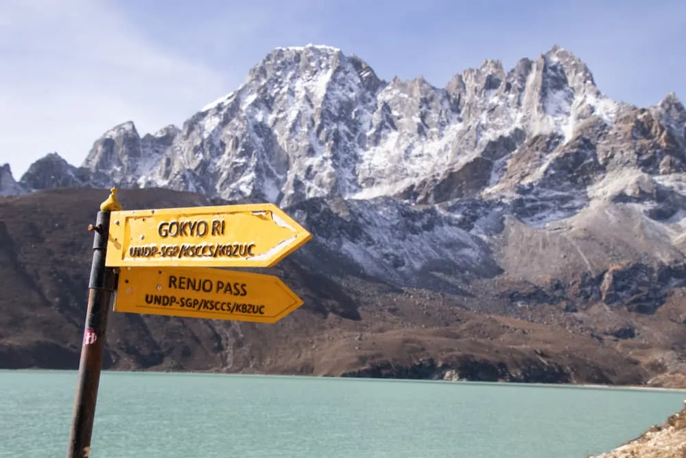
The Everest Region, along with most of the other trekking areas in Nepal, has four distinct seasons. Spring, summer, autumn and winter. The months from March to May, pre-monsoon, and from October to early December, post-monsoon, are the most popular for trekking to the Gokyo Valley. Every season offers its own excitement and atmosphere and in principle, you can go trekking year-round. There are good reasons why spring and autumn are considered the trekking season. Below we’ll give you a run-down of what each of the seasons are like.

Spring

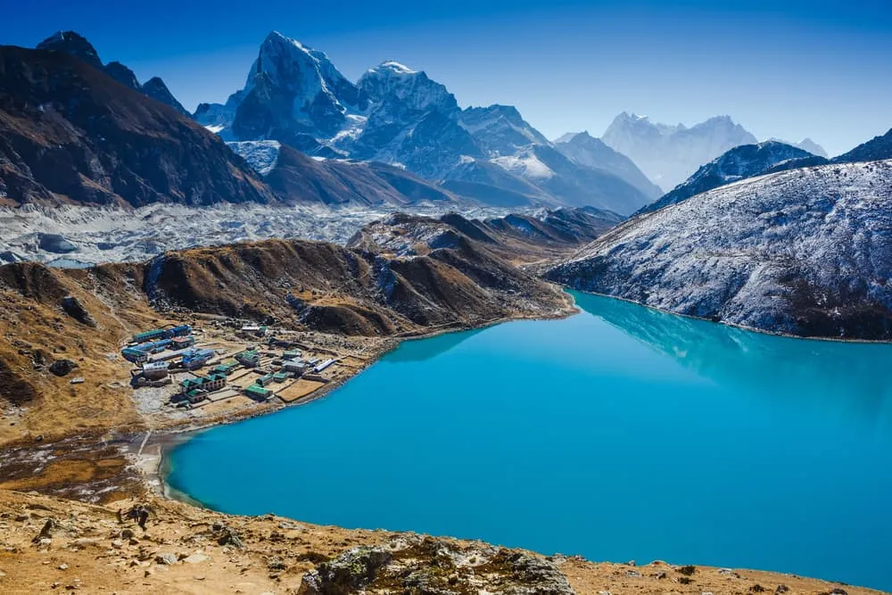
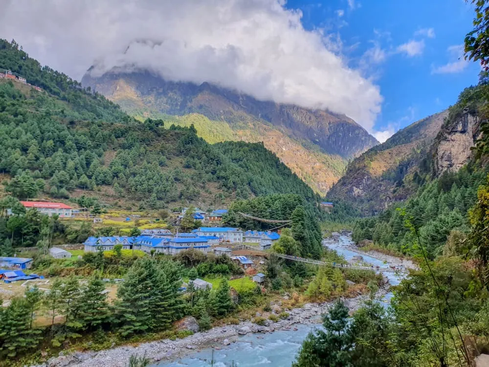
Spring (March-May) is the main season and trekkers from around the globe come to the Everest region in large numbers. In springtime, the temperature is mild, the precipitation is low and the trekking conditions are great. On the trail to the high peaks it’s buzzing with excitement and anticipation to see the world’s highest peaks in all their glory. For the Gokyo Lakes trek, it gets busy up to Namche Bazaar, but therefore it’s a great time to connect with like-minded people and chat about everything adventure. After that you’ll hit the quiet trails. While temperatures in daytime along the trek are balmy, the Gokyo Valley temperature can still dip below freezing level at night and in the early morning. Check our packing list for the trek further in this blog post.

Summer

Summer season falls in the months of June, July and August. Summer is the month with the highest temperatures and in that sense it is quite pleasant. However, this is also the monsoon season, and it rains a lot. The chance of seeing the mountains around you is smaller as it is cloudy most of the time. The trail will be wet and slippery and there is an increased risk of landslides. On the flipside, it’s not very busy on the route and the sherpa villages feel more serene.

Autumn

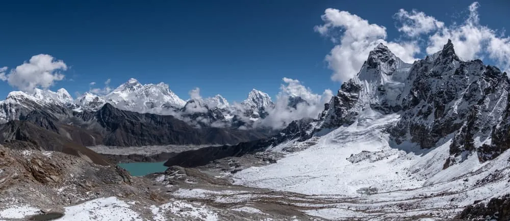
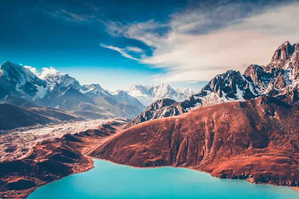
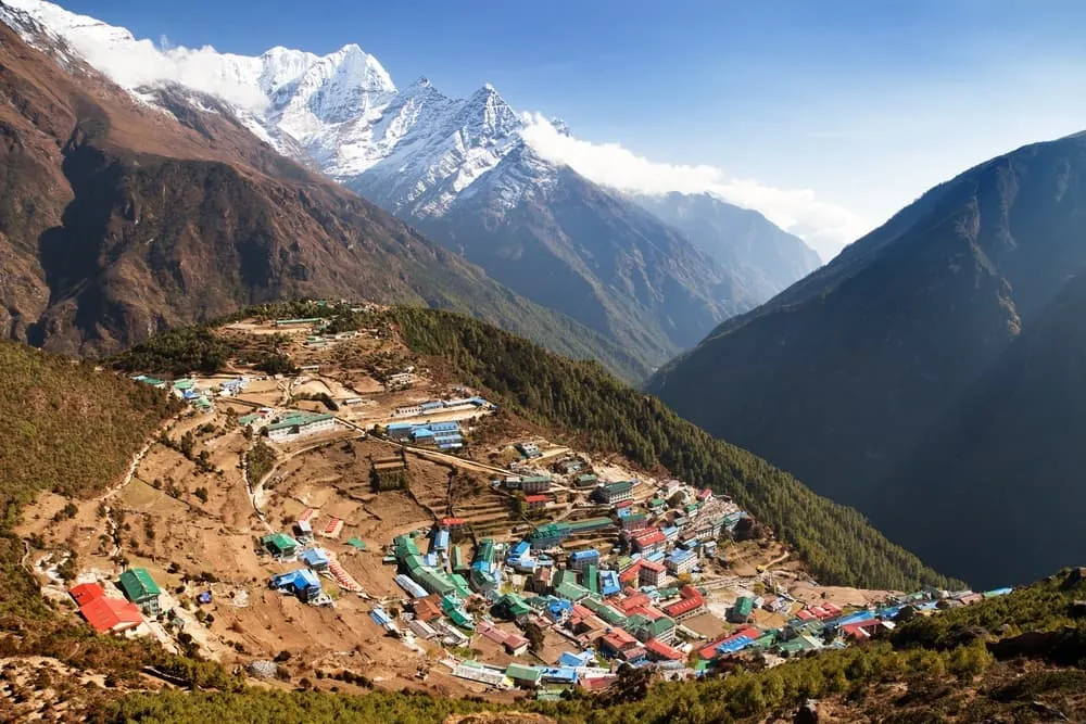
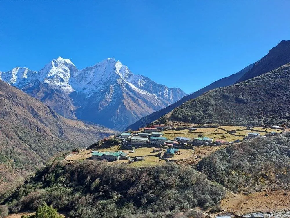
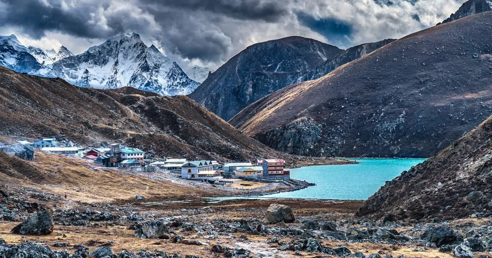
Autumn in the Khumbu (September, October, November) is, like springtime, prime trekking season with similar trekking conditions. The big difference is that the air in spring is sometimes a little hazy due to the dust in the atmosphere. Post-monsoon the air is very clear, allowing for stunning views of the mountains.

Winter

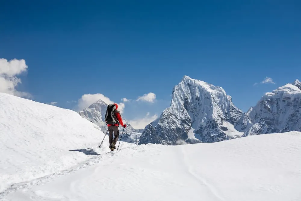
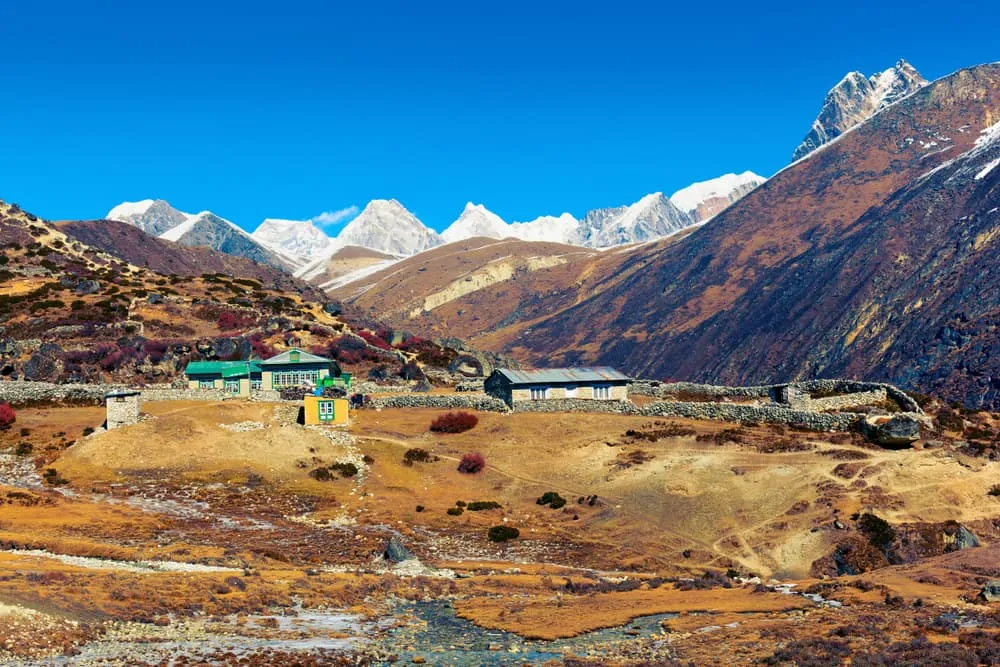
Winter season runs from December to February. This period is the hardest time to trek in the Everest Region. With the Gokyo Ri and Renjo La elevations exceeding the 5000 meters mark, it gets extremely cold. Night temperatures drop to -20 degrees Celsius. Add wind and snowfall and you’ve got yourself a proper winter expedition. It really adds to the Gokyo Ri trek difficulty. Why do we still run treks in the Gokyo Valley in winter? We work with some of the best trekking companies in Nepal. Besides trekking trips they also organize climbing expeditions to some of the highest peaks in the Himalayas. Our partners can keep you safe and comfortable, even in these cold conditions. And you will probably have the entire route to yourself!

Not sure yet or want to discuss your plans for the Gokyo Valley Trek with one of our trekking experts? Get in touch today and turn your dreams into memories!

How to Scale A 5000er Like the Gokyo Ri?

Going up extreme altitudes can be quite daunting. If it’s the first time you go trekking above 5000 meters you may question if your body is going to react well to the altitude. I learned a lot from my experience climbing my first 5000-er, Mount Damavand (5609m) in Iran. The main take-away of this climb was to trust the process. At Bookatrekking.com we always build in a solid acclimatization schedule in our itineraries, allowing trekkers to get used to higher altitudes gradually. There’s no point getting nervous about it and it’s probably counterproductive as well. Keep in mind that the climb up Gokyo Ri is optional. If your body is not feeling it, you can always go back.

The vertical gain is roughly 560 meters and your highly experienced guide will make sure your walking pace is right. Think of the otherworldly views when you reach the summit! It is worth a little hardship. Lined up in front of you are Mount Everest (8848m), Lhotse (8516m), Makalu (8481m) and Cho Oyu (8201m). Below you see the stunning glacial Gokyo Lakes. In the chapter Gokyo Trek and Altitude Sickness we delve deeper in how to recognize and prevent altitude sickness.

How to Scale A 5000er Like the Gokyo Ri?

What Is a Great Itinerary For the Gokyo Ri Trek?

This Gokyo Valley Trek offers enough time to acclimatize and enjoy the highlights of Gokyo Ri and its surroundings.

Day
1

Fly to Lukla , trek to Phakding

Duration: 02:30 h
Distance: 7.3 km
Ascent: 160 m
Descent: 370 m
We’ll board a flight to Lukla (2810m). You will be able to enjoy the beauty of splendid hills, rivers and mountains during the 30 minute flight. On reaching Lukla airport, you’ll be introduced to your porter, and served a wholesome breakfast. After that, we will head north to Phakding (2620m). It is an easy 3 hour hike through the Dudhkoshi valley. We will head north from the airstrip to Chheplung (2700m) and cross the crystal clear Thadokoshi on a locally built suspension bridge. Past the bridge, you can witness KusamKanggru (6367m), which is one of the toughest mountains to conquer. Away from the ThadoKoshi, the trail continues towards the Ghat (2590m) and we will cross a ridge marked with painted Mani stones. We will reach the beautiful tribal village of Phakding where you will stay overnight.

Phakding

Info
Phakding
Day
2

Trek to Namche Bazaar

Duration: 04:30 h
Distance: 10.5 km
Ascent: 910 m
Descent: 150 m
Heading for the Namche Bazaar, we cross through the hamlet of Zamphute and Tok Tok to see dazzling Thamserku glistening in the sun that stays all the way with us in most of our trek. Passing through the scenic Sherpa villages of Benkar, Chumoa and Monjo, we reach Utche Choling Gompa on a bluff abutting the Dudhkoshi river and further we make our way between the bluff to the entrance of Sagarmatha National Park, a UNESCO declared world heritage site. Completing halfway to Namche Bazaar, we head for the second half of the march that would likely to take more time due to steep climb at the end. Crossing through the last village of Jorsale, a steep stepped path leads us to an amazing high bridge over the Dudhkoshi River gorge and just before this bridge, the Dudhkoshi is met by its tributary, the BhoteKoshi.

Namche Bazaar

Info
Namche Bazaar
Day
3

Acclimatize at Namche Bazaar

We have an acclimatization day at Namche Bazaar. To help our body better adapt to the high altitude, we can take short walks or climb few hundred feet during the day to have a look in the villages, houses, terraced fields and snowy mountains of Kwangde, Khumbu peak, Thamserku, Kusum Kanguru and the village’s big weekly event, the Saturday market to have fun mingling with the crowds and watching men and women in traditional attire.

Namche Bazaar

Info
Namche Bazaar
Day
4

Hike to Dole

Duration: 07:00 h
Distance: 11.7 km
Ascent: 1010 m
Descent: 410 m
A little climb to the ridge top out of Namche will grant us a glorious view of Everest and Lhotse. From there, we will continue the mainstream trail. All through the trail, you will witness vendors selling Tibetan handiworks. After we arrive at the crossroad, which lies considerably high all above the DudhKoshi, the trail is divided. The upward trail, which we will follow stretches to Mon La Pass. The downhill trail leads to Everest base camp. We will follow the pass to reach Phortse Tanga and trail steeply to rhododendron jungles. After that, we will arrive at Dole, where you will admire Khumbila and Tawache (6,542m). We will explore around Dole, and stay overnight.

Dole

Info
Dole
Day
5

Trek to Machhermo

Duration: 03:00 h
Distance: 5.1 km
Ascent: 400 m
Descent: 50 m
It’s a short trek of only 1-2 hours to limit the rate of vertical gain. From Dole it’s a steep climb out of the forest to an increasingly barren hillside. We pass through many summer settlements which are used when yaks are taken here to graze in the summer months. Continuing past the village of Lhabarma the trail climbs gently past a large chorten to Luza and the trail continues to climb to reach a chorten and fluttering prayer flags on the outskirts of Machhermo tucked into a wide flat bottomed valley below the terminal moraine of the Ngozumpa glacier.

Machhermo

Info
Machhermo
Day
6

Trek to Gokyo

Duration: 03:45 h
Distance: 7.3 km
Ascent: 400 m
Descent: 20 m
Climbing steeply up a scrubby slope to a collection of chortens on the hilltop and passing by the good views of Kantega and Cho Oyu we soon reach a tiny settlement of Pangka village at the end of the Ngozumpa glacier. Wedged between the mountain wall and the crumbling mound of sand and gravel are the six sacred lakes which reflect the peaks in their calm mirrored surfaces. Immediately after crossing the bridge we reach the first lake and crossing through the barren landscapes pass through the second lake and finally we reach the village of Gokyo on the shores of the third lake known as Dudh Pokhari.

Gokyo

Info
Gokyo
Day
7

Climb Gokyo Ri and trek to Dole

Duration: 06:00 h
Distance: 12.4 km
Ascent: 80 m
Descent: 800 m
Early in the morning, we will scale 5,357m high Gokyo Ri from where you have stunning views of Everest, Cho Oyu, Lhotse, Makalu among other Himalayan giants. We'll hike to the fifth lake from where we descend back to Dole to spend the night.

Dole

Info
Dole
Day
8

Trek to Namche Bazaar via Khumjung

Duration: 06:30 h
Distance: 12 km
Ascent: 410 m
Descent: 1020 m
Descend to Namche Bazaar via typical Sherpa village of Khumjung. Leaving the mountains behind our descent continues back to the town of Namche Bazaar.

Namche Bazaar

Info
Namche Bazaar
Day
9

Trek to Lukla

Duration: 07:00 h
Distance: 18 km
Ascent: 530 m
Descent: 1080 m
Finally we return to Lukla following the Dudhkoshi River, where the trek ends. We will spend the night in Lukla.

Lukla

Info
Lukla
Day
10

Fly back Kathmandu

Early morning air trip from Lukla to Kathmandu. Don’t forget to pick a seat on the right side, to see the spectacular mountain views again. On reaching Kathmandu, it will be time to say goodbye! May you enjoy the rest of your journey here in Nepal.
Hide entire itinerary

Gokyo Trek Map

This Gokyo Ri trek map gives you an overview of the options in the Gokyo Valley.

What Permits Do I Need For Gokyo Ri and Sagarmatha National Park?

To embark on the journey to Gokyo Ri and the Gokyo Lakes within Sagarmatha National Park, specific permits are essential:

Acquire TIMS (Trekkers Information Management System)

This particular permit holds significance for any trekker aiming to explore Nepal. Whether navigating the Annapurna Circuit or trekking to Poon Hill, TIMS is a mandatory requirement. The cost for this permit is NRS 2000 per person, equivalent to approximately 17 USD or 15 EUR.

Secure the Sagarmatha National Park Entry Permit

Access to Sagarmatha National Park, the habitat of Gokyo Lakes and Gokyo Ri, necessitates obtaining an entry permit. This permit incurs a fee of 30 USD plus government tax.

Obtain the Khumbu Pasang Lhamu Rural Municipality Permit

Issued by the local government, this permit is obligatory for all trekkers exploring the Khumbu region, encompassing Namche Bazaar, Tengboche, Dingboche, and other villages.

Your trekking provider will handle all the necessary arrangements for these permits.

What Permits Do I Need For Gokyo Ri and Sagarmatha National Park?

How To Identify and Prevent AMS On The Gokyo Valley Trek?

It's essential to understand that altitude sickness can affect anyone, regardless of age, fitness level, or previous high-altitude experience. These days there are several tools to monitor your health at altitude. A widely-used (analog) method is the Lake Louise score card. It ticks the altitude symptoms while keeping the severity in mind. It’s a common tool used by guides. Nowadays, most trekking and mountain guides bring a blood oxygen saturation meter, which also measures the heart rate. These are key indicators whether a person adapts to altitude well or not. AMS can occur when trekking the Gokyo Valley Trek. Below you can find everything you need to know about altitude sickness.

  • Acute Mountain Sickness (AMS)

    Altitude sickness, also known as Acute Mountain Sickness (AMS) is a health condition that occurs when someone is exposed to low levels of oxygen at higher altitudes. AMS is a serious condition and as the name suggests acute. It needs to be dealt with immediately, as it is potentially life-threatening. Most people will experience some mild symptoms of altitude sickness. It’s important to be aware of these symptoms and act before symptoms become more severe. Below we break down the different forms of AMS and how you can reduce the risk of getting it.

    AMS symptoms

    It is key to know how to identify altitude illness. You may experience the following symptoms due to the jump in altitude: headache, lack of appetite, breathing difficulties, insomnia, nausea and vomiting. The intensity and severity of these symptoms may increase with altitude and an overall feeling of fatigue will take all your joy away. This may further deteriorate to one of these life-threatening conditions.

    High Altitude Pulmonary Edema (HAPE): HAPE is a condition in which fluid accumulates in the lungs, making it difficult to breathe. Symptoms may include shortness of breath, a persistent cough, chest tightness, and an increased heart rate. It can be a life-threatening condition and requires immediate descent to lower altitudes and, in severe cases, medical treatment.

    High Altitude Cerebral Edema (HACE): HACE is a more serious condition in which fluid accumulates in the brain. Symptoms may include severe headaches, confusion, loss of coordination, and altered mental status. HACE is also a medical emergency and requires immediate descent and medical attention. Below 7 ways of minimizing the risk of AMS:

    • 1. Gradual Ascent

      One of the most effective ways to prevent AMS is to ascend gradually. When traveling to high altitudes, try to take several days to acclimatize before going higher. This allows your body to adapt to the reduced oxygen levels. All our treks in Nepal keep sufficient acclimatization into account.

    • 2. Stay Hydrated

      Dehydration can increase the risk of AMS, so drink plenty of fluids. Avoid excessive alcohol and caffeine consumption, as they can contribute to dehydration.

    • 3. Diet

      Consume a balanced diet with adequate carbohydrates and avoid heavy, fatty meals. Carbohydrates can help your body utilize oxygen more efficiently at high altitudes.

    • 4. Medication

      Some individuals may consider taking medication, such as acetazolamide (Diamox), to help prevent AMS. Consult with a healthcare professional before using any medication, and be aware of potential side effects.

    • 5. Rest

      Ensure you get enough sleep and rest during your ascent. Fatigue can increase the risk of AMS.

    • 6. Avoid Overexertion

      Pace yourself and avoid overexertion. Listen to your body, and if you experience symptoms of AMS, rest or descend to a lower altitude.

    • 7. Descend if Symptoms Persist

      If you experience symptoms of AMS, such as headache, nausea, dizziness, or difficulty breathing, it's crucial to descend to a lower altitude. Symptoms should not be ignored or dismissed.

The Spectacular Flight From Kathmandu to Lukla

The 25-minute flight to Lukla from Kathmandu Tribhuvan International Airport (TIA) takes you to Tenzing-Hillary Airport (LUA), named after the famous pioneers Edmund Hillary and Tenzing Norgay. The airport is known for its exciting landing strip. Departures and arrivals can be irregular as they depend on the weather conditions. The video shows the landing in Lukla.

What Are The Teahouses on the Gokyo Ri Trek Like?

Within the realm of trekking, tea houses, also known as Bhatti, serve as quaint accommodations akin to small hotels. Despite their modest size, these establishments offer a certain level of comfort. However, comfort in this elevated and remote region is subjective. Tea houses provide comfort in the sense that they offer shelter and the opportunity to relish warm, home-cooked meals. Operated by local families, these establishments open their doors to passing trekkers.

With the surge in popularity of trekking in Nepal in recent years, an increasing number of tea houses have emerged along the country's trekking routes. The quality of tea houses tends to improve on more frequented routes. Along the Gokyo Trek, these accommodations offer good value for money. Expect amenities such as flush toilets, hot showers, and, in some cases, even wireless internet up to Namche Bazaar. Note that there may be an additional charge for using these facilities. As you ascend, the teahouses become more basic, especially on less-traveled paths like the Gokyo Trek in comparison to the Everest Base Camp route.

Packing List for the Gokyo Valley Trek

Trekking in Nepal requires decent gear. Especially the basics like an 80-90 L backpack and quality trekking socks. Read an extensive blog here about what to bring with you.
  • Documents

  • Sleep

  • Footwear

  • Clothing

  • Accessories

Where Can I Book the Gokyo Valley Trek?

At Bookatrekking.com you can book this trek and many others. Our guided options come with experts on the ground, and offer you a convenient, stress-free, safe, and educational way to explore the outdoors. Find our offers here. Our easy-to-use platform allows you to browse and compare different trekking options and find the perfect fit for your interests, abilities, and budget.

If you have any questions about a specific trek or need help choosing the right one for you, our team of trekking experts is here to assist you. Simply reach out to us and we will be happy to provide you with personalized recommendations and advice to help you plan the trekking adventure of a lifetime.

Is this not your cup of tea and are you looking for other epic adventures? Check out one of our blog posts:

Comments

About Us

At Bookatrekking.com, you will find the trek that will make your life unforgettable. Whether you want to explore the Inca Trail or climb Kilimanjaro. Bookatrekking.com has a wide and varied range of first-class treks. No false promises are made here. Transparent prices and bookings are fixed instantly. Find, compare, book and trek!
Read more about us
About Us

Also Interesting

Read more