Pembrokeshire Coast Path: Everything You Need to Know!

By Natascha Langelaan

Find that one special trekking
Search
Pembrokeshire Coast Path: Everything You Need to Know!
Quick personal advice
Free cancellation up to two weeks in advance
Trekking experts per destination

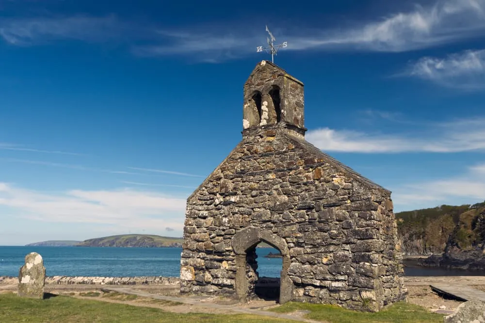
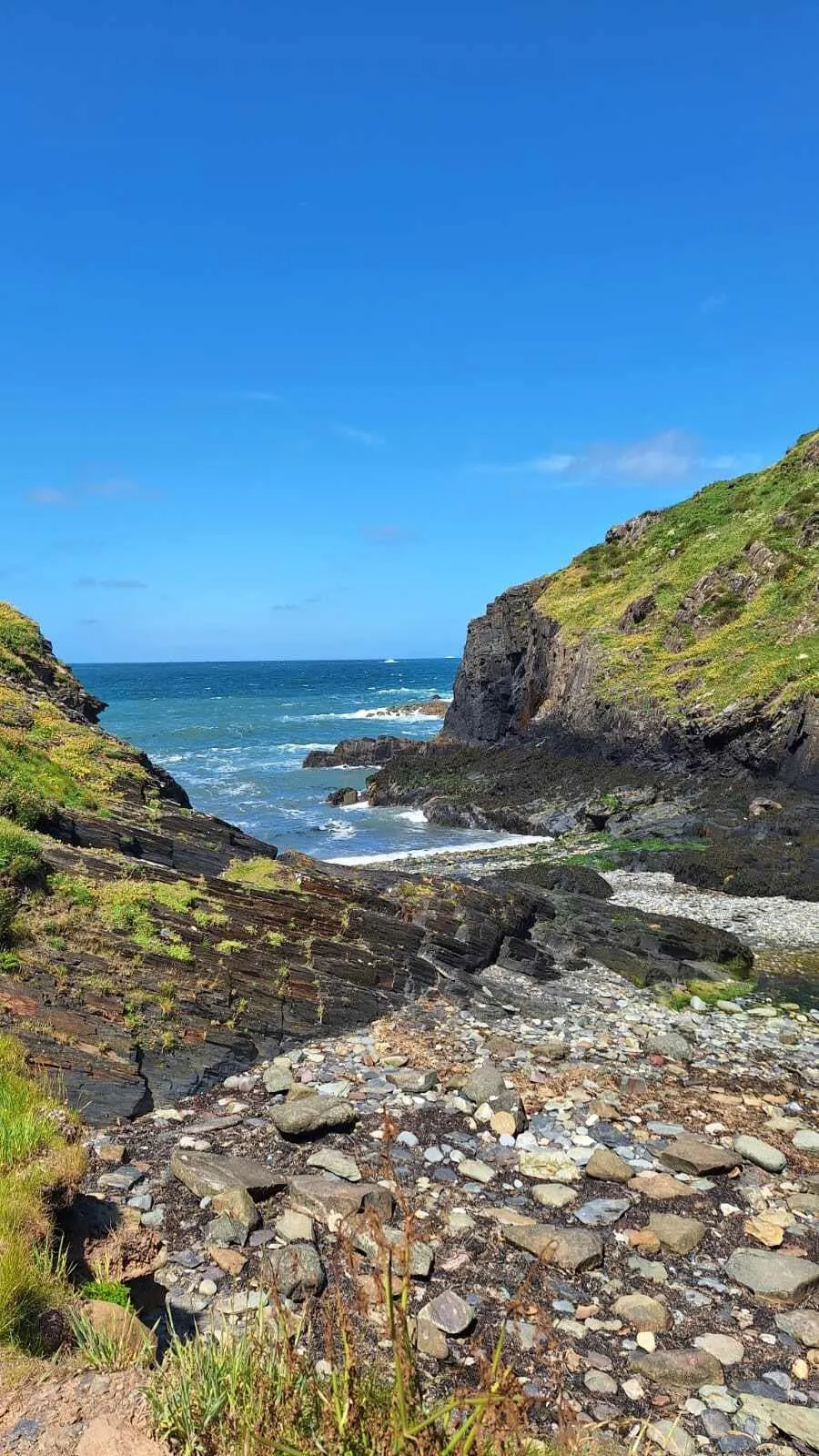
Have you always dreamed about wandering along the wild and rugged coastline of Wales? Now is your chance! Walk the Pembrokeshire Coast Path along Wales' western peninsula. You'll find remote beaches, castle ruins, old fishing villages, and traditional Welsh towns. Follow the cliff-top trails and listen to the Atlantic waves crashing into sea caves below. Spot puffins and seals enjoying this coastal habitat. In this blog post, you'll find everything you need to know to walk the Pembrokeshire Coast Path, including tips on the route, a map, distance, accommodation possibilities and much more!

The Pembrokeshire Coast Path is a long-distance walk in Wales. The entire route is 300 km long, or 186 miles, and leads you through some of Britain's most breathtaking coastal landscapes in around two weeks. You will walk almost entirely through the Pembrokeshire Coast National Park - Britain's only coastal park. If two weeks is too much for you, you can also choose to walk the best part. Which one? We'll help you decide. Let's go!

Origins of the Pembrokeshire Coast Path

The Pembrokeshire Coast Path was officially opened in 1970 and was the first national footpath in Wales. The official path is 300 kilometres, or 186 miles, and runs from Amroth to St Dogmaels. The Pembrokeshire Coast Path is part of the Wales Coast Path, which is 1400 kilometres, or 870 miles, long and runs along the entire coast of Wales. The Pembrokeshire Coast Path passes through 58 beaches and 14 harbours. The total ascent and descent over the entire length of the path is approximately 10668 metres, which is almost as high as Mount Everest.

The Pembrokeshire Coast Path not only offers walkers spectacular coastal scenery but also shows that humans have lived here for centuries. It is an area that is mainly formed by the activities of fishing and farming, as can be seen in the small coastal artificial settlements and the agricultural landscape. These villages were not only providers of food, they also linked Pembrokeshire to what, in the days before road and rail, was the main highway from the sea. Many reminders of this maritime tradition can be seen along the path, from Stone Age Neolithic cromlechs and Iron Age hillforts.

Origins of the Pembrokeshire Coast Path

Book Now

Did you know that we can book all overnight accommodation for the Pembrokeshire Coast Path for you? Check out all our options here.

Distance: How Long Is The Best Part of the Pembrokeshire Coast Path?

The best part of the Pembrokeshire Coast Path starts in Broad Haven and ends in Cardigan. The route is 138 kilometres, or 85 miles, long and is divided into 6 stages. The route takes you through Britain's beautiful coastal landscape, past remote beaches, castle ruins and small fishing villages. The trail also takes you past prehistoric monuments, such as Stone Age cromlechs and Iron Age hillforts. Along the way, you may also spot puffins and seals enjoying the scenery.

Pembrokeshire Coast Path: Weather and Best Season

The Pembrokeshire Coast Path is best walked between mid-June and the end of July, although the path is accessible all year round. The months of June and July have the lowest rainfall and average temperatures of 17 °C. In the months of April and May, there is also relatively little rain, only then, the temperature is 12 °C on average. August is one of the warmer months, with an average of 18 °C, however, this is a rainy month. It always feels a little chilly when walking the Pembrokeshire Coast Path, as it is quite windy at the coast.

Pembrokeshire Coast Path Map

Below is a map of the 6 stages of the Pembrokeshire Coast Path, starting in Broad Haven, next to Haverfordwest, and ending in Cardigan.

Pembrokeshire Coast Path: Route From Day to Day

The Pembrokeshire Coast Path is divided into 6 stages, starting in Broad Haven and ending in Cardigan. You can also skip the first day to have a 5-day walk.

Day
1

Broad Haven to Solva

Duration: 06:06 h
Distance: 18.2 km
Ascent: 360 m
Descent: 320 m
You start in Broad Haven, where you soon leave the beach behind and get great views over Broad Haven. You pass Nolton Haven, which used to be a small coal port. The path takes you past Newgale, which has spectacular views. You pass Pen-y-cwm beach, which is a perfect place for a picnic. Further on, you get a view of Solva, today's destination, and pass a chambered tomb.

The Cambrian Inn (Solva)

Info
The Cambrian Inn (Solva)
Day
2

Solva to St. Davids

Duration: 06:08 h
Distance: 19.3 km
Ascent: 190 m
Descent: 170 m
Today you start at Caerfai Bay, a small sandy beach. Then you'll pass the harbor of Porth Clais. Here you will find a small café for a coffee and plenty of benches to enjoy the view. The path leads you past the Natural Rock Arch, a rock arch created by eroded limestone.

Glendower B&B (St. Davids)

Info
Glendower B&B (St. Davids)
Day
3

St. Davids to Abercastle

Duration: 07:20 h
Distance: 27.1 km
Ascent: 350 m
Descent: 410 m
The trail starts at St. David's Head, a headland near the beach. Here you have beautiful views over the Irish Sea. You then pass Blue Lagoon, a former slate pit with deep blue water. The path leads you along Traeth lyfn, a beautiful sandy and rocky beach surrounded by towering cliffs.

Garn Isaf Guesthouse (Abercastle)

Info
Garn Isaf Guesthouse (Abercastle)
Day
4

Abercastle to Fishguard

Duration: 07:41 h
Distance: 27.9 km
Ascent: 480 m
Descent: 430 m
The path takes you past various pretty bays. You'll then pass Strumble Head Lighthouse, which is located on a small island just off the coast. This lighthouse was built in 1908 to mark the dangerous stretch of the coast between Ireland and Wales. You can visit the lighthouse by crossing a small suspension bridge. The path continues to Carregwastad, a memorial stone marking the spot where the French landed during the last invasion of Britain in 1797.

The Ferryboat B&B (Fishguard)

Info
The Ferryboat B&B (Fishguard)
Day
5

Fishguard to Newport

Duration: 05:28 h
Distance: 19.6 km
Ascent: 360 m
Descent: 390 m
Today you start at Fishguard Fort, which was built between 1781 and 1785 after the American hijacker Black Prince invaded the harbor when locals refused to pay £1,000 ransom for a confiscated boat. Later, in 1797, the fort repelled an invasion by the French with a single cannonball. The path continues and after a short, steep ascent, you have a wonderful view over Pwllgwaelod towards Cwm-yr-Eglwys.

The Golden Lion Hotel (Newport)

Info
The Golden Lion Hotel (Newport)
Day
6

Newport to Cardigan

Duration: 07:54 h
Distance: 28.1 km
Ascent: 560 m
Descent: 560 m
After a hearty breakfast in your hotel in Cardigaj, your Pembrokeshire Coast Path adventure comes to an end. We hope you've had an unforgettable experience exploring this trail and we look forward to welcoming you back!
Hide entire itinerary

Pembrokeshire Coast Path Accommodation

On the Pembrokeshire Coast Path, you can either stay in a cosy hotel, B&B or hostel, with breakfast included where possible, in a small village, hamlet or town. You can also choose to camp since wild camping along the Pembrokeshire Coast Path is allowed. However, accommodation options can sometimes be limited. The problem with the Pembrokeshire Coast Path is that the stages usually finish in small villages or even hamlets, where there are usually only 1 or sometimes 2 accommodation options. So if the accommodation is fully booked, you may have to walk a longer distance or take a transfer.

Pembrokeshire Coast Path Accommodation

Not sure yet or want to discuss your plans for the Pembrokeshire Coast Path with one of our trekking experts? Get in touch today and turn your dreams into memories!

Luggage Transport on the Pembrokeshire Coast Path

The Pembrokeshire Coast Path is a very popular walk attracting thousands of tourists every year. Thanks to its popularity, there is always the option of transporting your luggage. Your suitcase will be collected from your hotel each morning and waiting for you at your next hotel at the end of the day. Pretty convenient, right?

Walking the Pembrokeshire Coast Path: Starting and Ending Point

The Pembrokeshire Coast Path starts in Broad Haven and ends in Cardigan. The path can be walked in both directions, but Cardigan is a large town with lots to do. That's why we took it as our ending point.

Starting point

To get to Broad Haven, the easiest option is to take the plane, train or bus to Cardiff. From there, you can travel to Broad Haven by train and bus in about 3 hours. Broad Haven does not have a rich history but has been a seaside resort since 1800.

Ending point

The Pembrokeshire Coast Path ends in Cardigan. From here you can easily travel back to Cardiff by train. This takes about 4 hours. Cardigan is one of Wales' most historic cities, with its ancient history, modern conveniences and beautiful scenery. Cardigan is an old-fashioned Welsh market town but at the same time very arty and a bit hippy.

Walking the Pembrokeshire Coast Path: Starting and Ending Point

Packing List for the Pembrokeshire Coast Path

No matter where you go hiking or for how long, bringing the right equipment is of utmost importance. For your hike, the first thing you need is a good backpack. The size of it will depend on the number of days you will be trekking, the season and the clothes you take with you. If you have luggage transport, the comfort level of your daypack is most important. We have compiled a packing list with a few essential items of clothing you should bring and some extras you might find useful:
  • Essentials

  • Extras

At Bookatrekking.com, we not only book your accommodation and luggage transport, we also send you on your way with a comprehensive hiking guide with the most important information for your Pembrokeshire Coast Path, including interactive Komoot maps. Browse all our options here and turn your dreams into reality.

Safety tips for the Pembrokeshire Coast Path

Although this is far from being a trek in the Himalayas, unexpected things can always happen and you might also find obstacles on the hiking trails along the way. The Pembrokeshire Coast Path is safe, the trails are quite straight forward and there is not an extreme difference in altitude. However, for your safety, every hike deserves a level of respect; respect for the terrain, the trails, wildlife and vegetation, local rules and regulations, and above all, your physical capabilities and safety. Therefore, for an unforgettable and safe hiking memory, please keep the following safety recommendations in mind:

  • Know your limits

    Always prepare each stage carefully to use your energy wisely, respect your physical and mental limitations, and avoid taking unnecessary risks. When ascending or descending, if applicable, always use the aids provided, such as handrails and ropes. Is this trek suitable for you? Well, familiarize yourself with the grading system and figure out if this trek matches your capabilities. If you still need professional advice you can always contact Bookatrekking.com experts.

  • Stay on marked trails

    The most important thing is to never leave the marked paths. For easy navigation we work with our trusted partner Komoot, whose interactive maps, also available offline, provide you with the necessary digital means to get from A to B in the Pembrokeshire Coast Path. As a backup, make sure to bring a hiking guide or a paper map with you.

  • Fully equipped

    Make sure you have the necessary gear for the conditions you'll be facing, including appropriate clothing, footwear, and any necessary equipment for the terrain you'll be hiking on. Always wear clothing adapted to the weather of Pembrokeshire Coast Path and protect yourself from cold and wetness or heat and sun. Besides, make sure you carry enough food and water for the duration of your trek. On the way, you might (or might not) be able to buy snacks.

  • Stay reachable

    If you are hiking solo or in small groups it is advisable to inform people back home about your plans, what route you are taking and when you plan to return. Even small incidents can lead to unpleasant emergencies so make sure you are available at all times. Bring a charged phone containing at least the phone numbers of immediate family members, your accommodations en route and the emergency phone numbers operating in the Pembrokeshire Coast Path.

  • Respect for nature

    Do not litter, prevent noise, stay on the marked trails, do not disturb wildlife or grazing animals, and respect protected areas.

Where Can I Book the Pembrokeshire Coast Path?

At Bookatrekking.com you can book the self-guided Pembrokeshire Coast Path and many other treks. We take care of all the details for you, including arranging accommodations, organizing luggage transportation and providing you with relevant information well in advance of your trek. Find our offers here. Our easy-to-use platform allows you to browse and compare different trekking options and find the perfect fit for your interests, abilities, and budget.

If you have any questions about a specific trek or need help choosing the right one for you, our team of trekking experts is here to assist you. Simply reach out to us and we will be happy to provide you with personalized recommendations and advice to help you plan the trekking adventure of a lifetime.

Is the Pembrokeshire Coast Path not your cup of tea and are you looking for other epic adventures? Check out one of our following blog posts:

Comments

About Us

At Bookatrekking.com, you will find the trek that will make your life unforgettable. Whether you want to explore the Inca Trail or climb Kilimanjaro. Bookatrekking.com has a wide and varied range of first-class treks. No false promises are made here. Transparent prices and bookings are fixed instantly. Find, compare, book and trek!
Read more about us
About Us

Also Interesting

Show more