Hiking the Eifelsteig: Discover Eifel National Park

Sierd van der Bij
Sierd van der Bij
Sierd van der Bij
28 Feb 2024 12 min read
Hiking the Eifelsteig: Discover Eifel National Park
Trekking experts per destination
Free cancellation up to eight weeks in advance
Quick personal advice

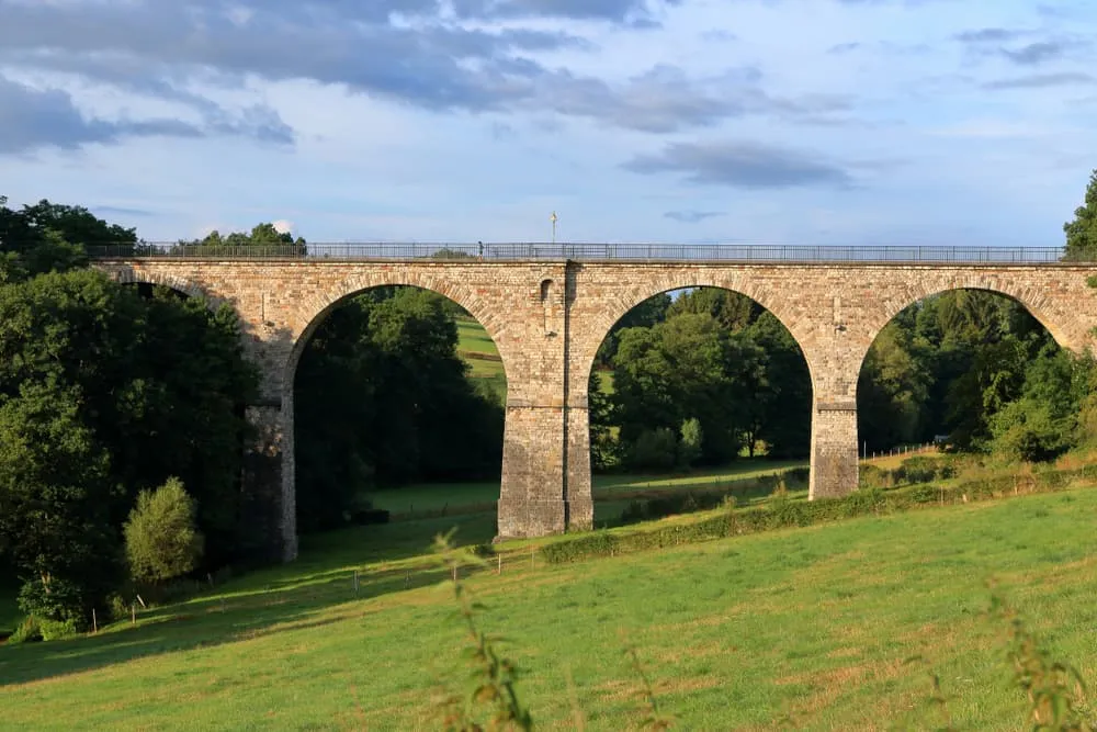
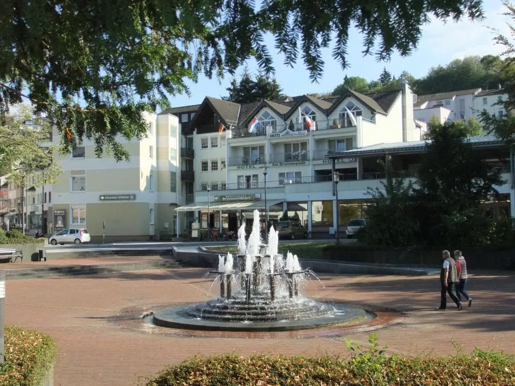
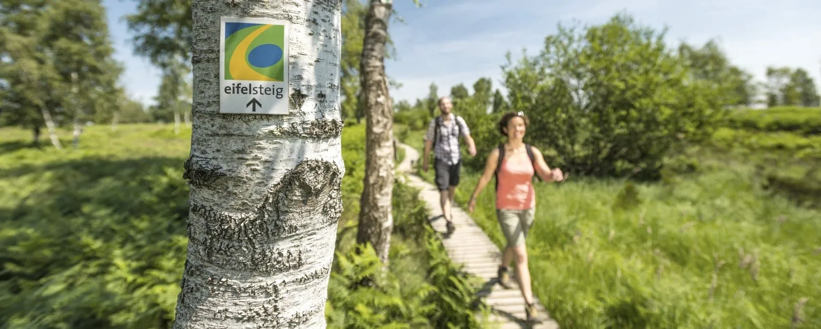
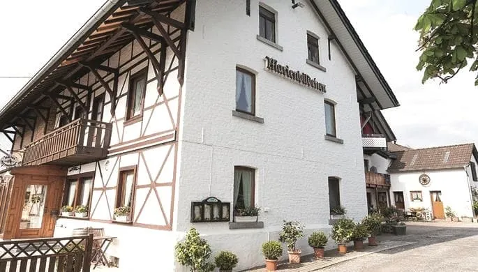
The Eifelsteig is a 313-kilometer long-distance hiking trail divided into 15 stages in the German Eifel region. Hike from Aachen in Nordrhein-Westfalen (North Rhine-Westphalia) to beautiful Trier in Rheinland-Pfalz (Rhineland-Palatinate) and experience Germany at its best. Together with Rheinsteig, Malerweg, Rothaarsteig, and Moselsteig, the Eifelsteig is one of the classics for a German hiking holiday. On the Eifelsteig, you are always accompanied by the elements. The motto of the Eifelsteig is therefore "Wo Fells und Wasser Dich begleiten. Just you, the Water and the Rocks." Read our blog post about the Eifelsteig, discover the most beautiful stages, and prepare yourself well for the Eifelsteig Route using GPX files.

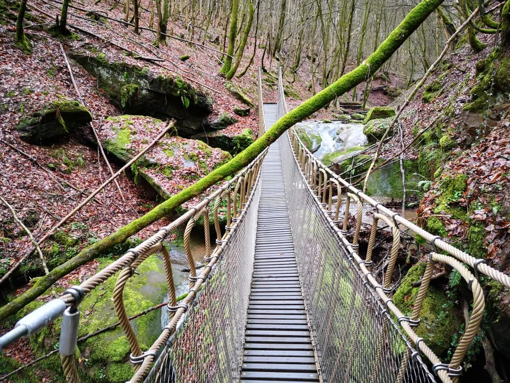
On the 313 km long Eifelsteig, hikers can intensively experience the different facets of the Eifel low mountain range. The seasons constantly give the route a new face. Thus, every time of year has its own charm. In spring, the Eifel awakens with colourful meadows and flowering hedges, followed by the famous broom blossoms - called the "Eifel Gold" by its inhabitants. The Eifel has a warm climate in summer when the forests and streams provide the necessary coolness. The autumn colours of the Eifel are also worthwhile and in winter the Eifel is perhaps at its best.

Where Is the Eifelsteig?

The Eifelsteig runs through the so-called Eifel Region in Western Germany. It runs quite close to Belgium and it's not far from the Dutch border. The Eifel region is an attractive area of highlands between Aachen, Cologne, Koblenz, and Trier which is quite untypical of the rest of Germany’s landscapes. Visitors don’t normally think of this nation as volcanic territory, but dormant volcanoes have formed a lot of the higher ground, although it’s hard to spot their influence in the likes of the Swabian Alps, for example, down near Stuttgart, where erosion has produced a plateau.

Did you know that we can book all overnight accommodation for the Eifelsteig for you? Check out all our options here.

Eifelsteig - A 'Premium Hiking Trail'

The Eifelsteig, just like the Rheinsteig for example, is Long-Distance Hiking Trails that has been awarded the "Premium Wanderwege" seal of approval by the German Wanderinstitut. According to the Wanderinstitut, a Premium Wanderweg is characterised by "excellent markings and a particularly high level of experience". Premium hiking trails guarantee a balanced and beautiful hiking experience. Pleasant paths and trails, great views, beautiful forest scenes, water bodies, rock structures, well-maintained rest and relaxation areas, cultural and historical treasures, and many other aspects make hiking on premium trails a special pleasure.

Click here for all our Eifelsteig packages

What Is the Best Season for the Eifelsteig?

The seasons in the German Eifel are more or less the same as in the rest of Northwestern Europe. That means nice summers, beautiful mild spring and autumn seasons when you're lucky and avoid too much rain, and wet and sometimes cold winters. The best seasons for hiking the Eifelsteig are spring, summer or autumn. Of course, you should dress more warmly in spring and autumn than in summer. Although the Eifelsteig is not recommended during winter, there are nevertheless hikers who brave the Eifelsteig even then. With good preparation and a slightly larger packing list, the Eifelsteig in winter can be an unforgettable adventure.

Where Can I Find an Eifelsteig Trail Map?

To get an idea of how the Eifelsteig passes through Nordrhein-Westfalen and Rheinland-Pfalz, check out the map of the Eifelsteig route below. If you are looking for GPX files for a a more detailed map, read on.

All Eifelsteig Stages

Day
1

Arrival in Blankenheim

On your first day you will travel to Blankenheim on your own. The first day you will have time to visit Blankheim and you can enjoy some food and drinks. Enjoy your schnitzel in the evening, but don't drink too much beer. Tomorrow the hike begins!

Hotel Finkenberg (Blankenheim)

Info
Hotel Finkenberg (Blankenheim)
Day
2

Blankenheim to Kerpen

Duration: 08:20 h
Distance: 30 km
Ascent: 530 m
Descent: 550 m

This one moves through the northern Eifel in a fine, steady rhythm, linking forest, open fields and a string of quiet villages. You leave Blankenheim behind on soft woodland paths, then drift into wider country with long views and that calm, rolling feel the region does so well. Nothing comes all at once here. It is a stage of small climbs, relaxed descents and a route that keeps changing colour under your boots.

From the outskirts of Blankenheim, the trail slips past the Ahrquelle area and into beech woods before opening toward the Schafbachtal and the lanes around Alendorf. There are broad meadows, patches of old hedgerow country and a few lovely outlooks where the land starts to breathe wider. Later, the route curls through more forest and field paths, with the most noticeable climbing coming in short pulls rather than one long haul.

The final stretch settles down nicely as you near Kerpen, with the landscape turning quieter again and the village sitting loosely among the folds of the hills. The approach feels rural and unhurried, with paths and lanes leading you gently toward your stay just outside town. After a day of constant movement through woods and open country, the accommodation comes at just the right moment, a calm place to drop the pack and let the stage fade out softly.

Die Strumpffabrik - Guesthouse (Kerpen)

Info
Die Strumpffabrik - Guesthouse (Kerpen)
Day
3

Kerpen to Hillesheim

Duration: 05:10 h
Distance: 18.8 km
Ascent: 300 m
Descent: 310 m

This stage feels compact, but it keeps shifting shape as you walk from the quiet edge of Kerpen toward the little bustle of Hillesheim. Before reaching the village, the route first brushes past Nohner Mühle and the volcanic landscape around it, then rolls on toward picturesque Kerpen. With Kerpen Castle adding a strong sense of place, this is a lovely spot for a coffee break before the trail carries on through open country.

From the Nohner Mühle area, the path moves through a landscape marked by volcanic history, passing the Rockeskyller Kopf, a volcanic cone of 533 m. After that, the route reaches Kerpen, where village lanes and views of the castle give the day a memorable early highlight. Beyond Kerpen, the trail opens into farmland and calm tracks around Berndorf, with old quarry terrain and wide Vulkaneifel views adding texture to the second half.

The run-in to Hillesheim comes with a softer rhythm again, as tracks and lanes guide you back toward town. After the more open middle section, the arrival feels easy and well timed, with the first houses and streets bringing that familiar end-of-the-day lift. Your accommodation lands as a welcome reset point, somewhere to ease out of the walking flow and settle into the evening.

Gästehaus Kloep (Hillesheim)

Info
Gästehaus Kloep (Hillesheim)
Day
4

Hillesheim to Gerolstein

Duration: 06:05 h
Distance: 21.2 km
Ascent: 430 m
Descent: 510 m

This one starts by dropping gently into the Bolsdorf Valley, where the day eases in beside the Kyll before the route begins to show its teeth. From there, the landscape keeps changing, from river scenery to forested slopes and rocky volcanic terrain. It is a stage with real variety and a strong geological backbone, finishing with a memorable approach into Gerolstein through a landscape shaped by deep time and steep stone.

Early on, you descend through the Bolsdorf Valley to the Kyll, then turn into the forest for a steep climb that quickly lifts you above the valley floor. Higher up, you reach the Rother Kopf caves, a fine reward after the ascent. The trail then continues over the imposing Auberg, with open stretches, woodland and rugged outcrops giving the route a steady sense of drama.

Closer to Gerolstein, the route passes the famous coral reef, formed 390 million years ago by reef-building organisms. Spectacular rock formations and the striking beechwood caves line the trail and give the final section real character. The arrival into town feels earned, with the rocky landscape slowly giving way to streets, rooftops and a welcome place to stay, perfect for taking the weight off your legs and letting the day settle.

Hotel Garni am Brunnenplatz (Gerolstein)

Info
Hotel Garni am Brunnenplatz (Gerolstein)
Day
5

Gerolstein to Daun

Duration: 07:25 h
Distance: 25.4 km
Ascent: 710 m
Descent: 620 m

This is a day of two clear moods. The first half stays mostly under the trees, moving through light forest in a cool, steady flow that works beautifully on warmer days. Then the route changes character after Neroth, becoming more dramatic as it drops into the valley of the Little Kyll and climbs hard again toward the heights above. It is a stage that starts sheltered and calm, then gradually sharpens into something more rugged and wide-open.

Early on, the trail runs for hours through airy woodland, with only the Dietzenley breaking the forest rhythm. This volcanic spire, crowned by an observation tower, delivers an impressive view across the Kyll Valley and the surrounding hills. After that, the route keeps rolling through the woods toward Neroth, where the village marks a natural halfway point and a good place to pause before the tougher second section begins.

From Neroth, you enter the valley of the Little Kyll and take on a steep climb of around 200 metres to cross the summit of the Nerother Kopf. That effort gives the second half its edge, before the route gradually releases you toward Daun. The arrival feels well earned, with the town appearing after a day of forest shade, volcanic heights and deep-cut valleys. Your accommodation comes as a welcome landing spot to let the legs finally switch off.

Hotel Panorama (Daun)

Info
Hotel Panorama (Daun)
Day
6

Daun to Manderscheid

Duration: 07:40 h
Distance: 26.4 km
Ascent: 620 m
Descent: 680 m

This stage heads straight into the heart of the Vulkaneifel. The opening section climbs firmly from Daun toward the maars, where dark-blue water, golden broom and wide horizons come together in a landscape that feels almost painted. It is a route of strong contrasts. First the volcanic heights, then the quiet green floor of the Lieser valley, and finally a dramatic finish above the river near Manderscheid.

The first hours ask for a solid effort, with a steep ascent up to the maars and a real sense of entering the volcanic core of the region. Up there, the scenery opens wide, and the colours do the work: dark water, bright broom and open sky. Later, the mood shifts completely as the trail drops into the Lieser valley, where green meadows and silence stretch out around you, before the route continues through calm oak forests.

The finale saves something special. Near Manderscheid, the trail turns rocky and runs high above the river, bringing that last bit of excitement to the legs. Then come the castles near town, giving the arrival real drama and a fine sense of reward. After the stillness of the valley and the steady pull of the climbs, your accommodation feels like the perfect place to land and let the whole day click into place.

Altes Forsthaus (Manderscheid)

Info
Altes  Forsthaus (Manderscheid)
Altes Forsthaus (Manderscheid)
Day
7

Departure

After breakfast and after you have checked out of your hotel, your trip comes to an end. There are good bus and train connections back to Blankenheim to pick up your car again if necessary. These costs are not included.

Not sure yet or want to discuss your plans for the Eifelsteig with one of our trekking experts? Get in touch today and turn your dreams into memories!

Eifelsteig Waymarking

Since the Eifelsteig is a Premium Hiking Trail, you can be sure that the Eifelsteig trail is excellently marked. The Eifelsteig logo appears on signposts and trees along the route. Follow the signs and the 313 kilometres and 15 stages of the Eifelsteig are easy to follow. For extra security, you can always use a GPS system and the GPX files belonging to the Eifelsteig.

Eifelsteig Waymarking

Packing List for the Eifelsteig

No matter where you go hiking or for how long, bringing the right equipment is of utmost importance. For your hike, the first thing you need is a good backpack. The size of it will depend on the number of days you will be trekking, the season and the clothes you take with you. If you have luggage transport, the comfort level of your daypack is most important. We have compiled a packing list with a few essential items of clothing you should bring and some extras you might find useful:
  • Essentials

  • Extras

Eifelsteig Accommodation: Hotel or Gasthof

The Eifel is popular among both domestic and international tourists. You will therefore find plenty of accommodation options here. During your hike, you will always stay in typical Gasthöfe and Hotels. The Gasthöfer and Hotels along the Eifelsteig are usually family-run businesses, often accompanied by an in-house restaurant(s) and bar and play a central role in the community life of the village or town. In the wine villages, you can also enjoy wine tastings. A buffet breakfast is always included and it is possible to make a sandwich for the road. A typical example of a Gasthof along the Eifelsteig:

Eifelsteig Accommodation: Hotel or Gasthof

At Bookatrekking.com, we not only book your accommodation and luggage transport, we also send you on your way with a comprehensive hiking guide with the most important information for your Eifelsteig, including interactive Komoot maps. Browse all our options here and turn your dreams into reality.

Safety tips for the Eifelsteig

Although this is far from being a trek in the Himalayas, unexpected things can always happen and you might also find obstacles on the hiking trails along the way. The Eifelsteig is safe, the trails are quite straight forward and there is not an extreme difference in altitude. However, for your safety, every hike deserves a level of respect; respect for the terrain, the trails, wildlife and vegetation, local rules and regulations, and above all, your physical capabilities and safety. Therefore, for an unforgettable and safe hiking memory, please keep the following safety recommendations in mind:

  • Know your limits

    Always prepare each stage carefully to use your energy wisely, respect your physical and mental limitations, and avoid taking unnecessary risks. When ascending or descending, if applicable, always use the aids provided, such as handrails and ropes. Is this trek suitable for you? Well, familiarize yourself with the grading system and figure out if this trek matches your capabilities. If you still need professional advice you can always contact Bookatrekking.com experts.

  • Stay on marked trails

    The most important thing is to never leave the marked paths. For easy navigation we work with our trusted partner Komoot, whose interactive maps, also available offline, provide you with the necessary digital means to get from A to B in the Eifelsteig. As a backup, make sure to bring a hiking guide or a paper map with you.

  • Fully equipped

    Make sure you have the necessary gear for the conditions you'll be facing, including appropriate clothing, footwear, and any necessary equipment for the terrain you'll be hiking on. Always wear clothing adapted to the weather of Eifelsteig and protect yourself from cold and wetness or heat and sun. Besides, make sure you carry enough food and water for the duration of your trek. On the way, you might (or might not) be able to buy snacks.

  • Stay reachable

    If you are hiking solo or in small groups it is advisable to inform people back home about your plans, what route you are taking and when you plan to return. Even small incidents can lead to unpleasant emergencies so make sure you are available at all times. Bring a charged phone containing at least the phone numbers of immediate family members, your accommodations en route and the emergency phone numbers operating in the Eifelsteig.

  • Respect for nature

    Do not litter, prevent noise, stay on the marked trails, do not disturb wildlife or grazing animals, and respect protected areas.

Where Can I Book the Eifelsteig?

At Bookatrekking.com you can book the self-guided Eifelsteig and many other treks. We take care of all the details for you, including arranging accommodations, organizing luggage transportation and providing you with relevant information well in advance of your trek. Find our offers here. Our easy-to-use platform allows you to browse and compare different trekking options and find the perfect fit for your interests, abilities, and budget.

If you have any questions about a specific trek or need help choosing the right one for you, our team of trekking experts is here to assist you. Simply reach out to us and we will be happy to provide you with personalized recommendations and advice to help you plan the trekking adventure of a lifetime.

About Us

At Bookatrekking.com, you will find the trek that will make your life unforgettable. Whether you want to explore the Inca Trail or climb Kilimanjaro. Bookatrekking.com has a wide and varied range of first-class treks. No false promises are made here. Transparent prices and bookings are fixed instantly. Find, compare, book and trek!
Read more about us
About Us
About Us

Also Interesting