Escapardenne: The Lee and Eislek Trail through the Ardennes

Find that one special trekking
Search
Escapardenne: The Lee and Eislek Trail through the Ardennes
Quick personal advice
Free cancellation up to two weeks in advance
Trekking experts per destination

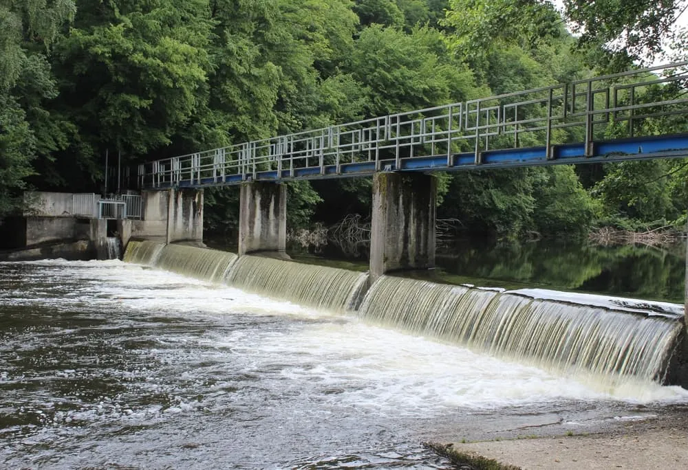
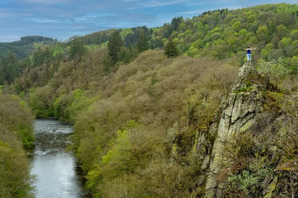
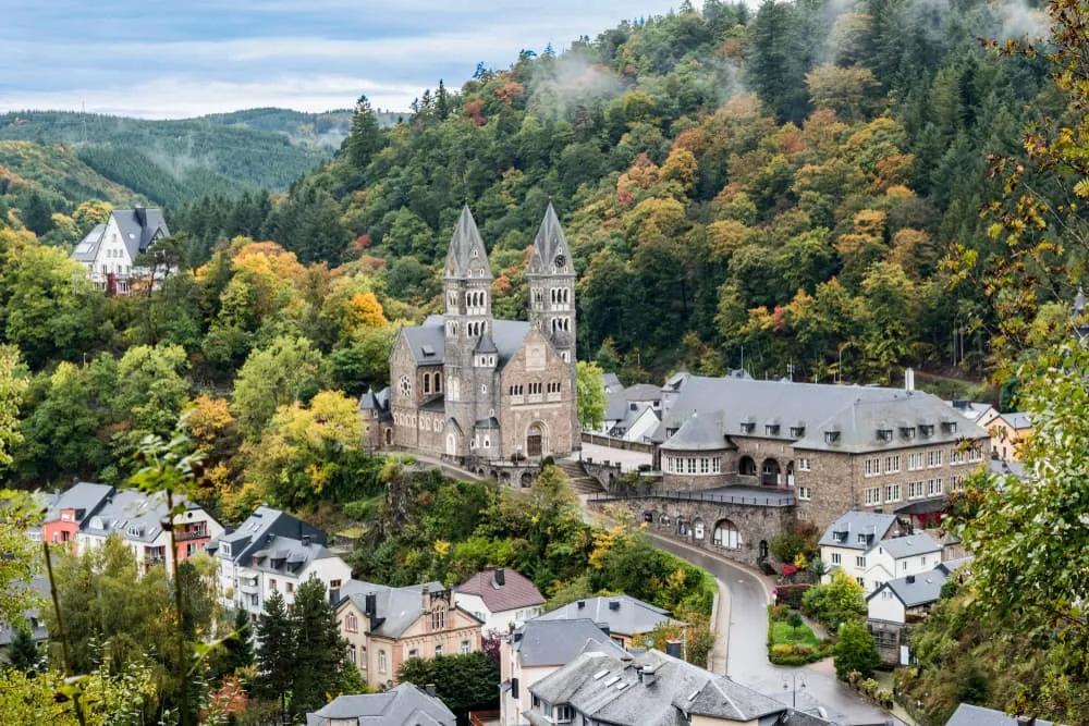
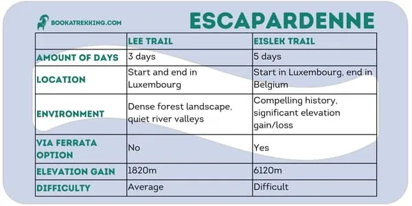
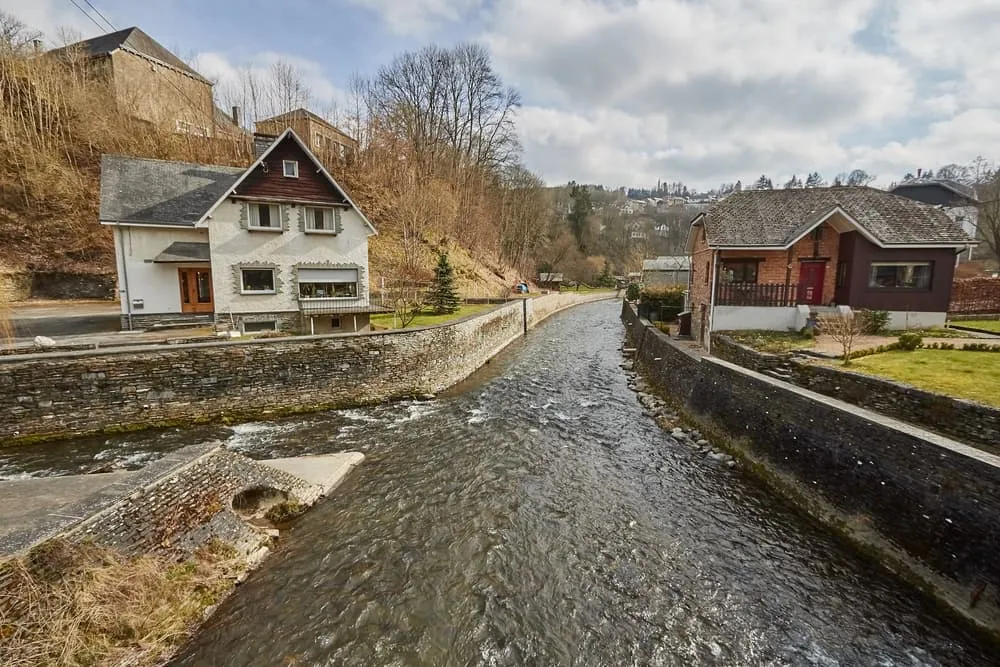
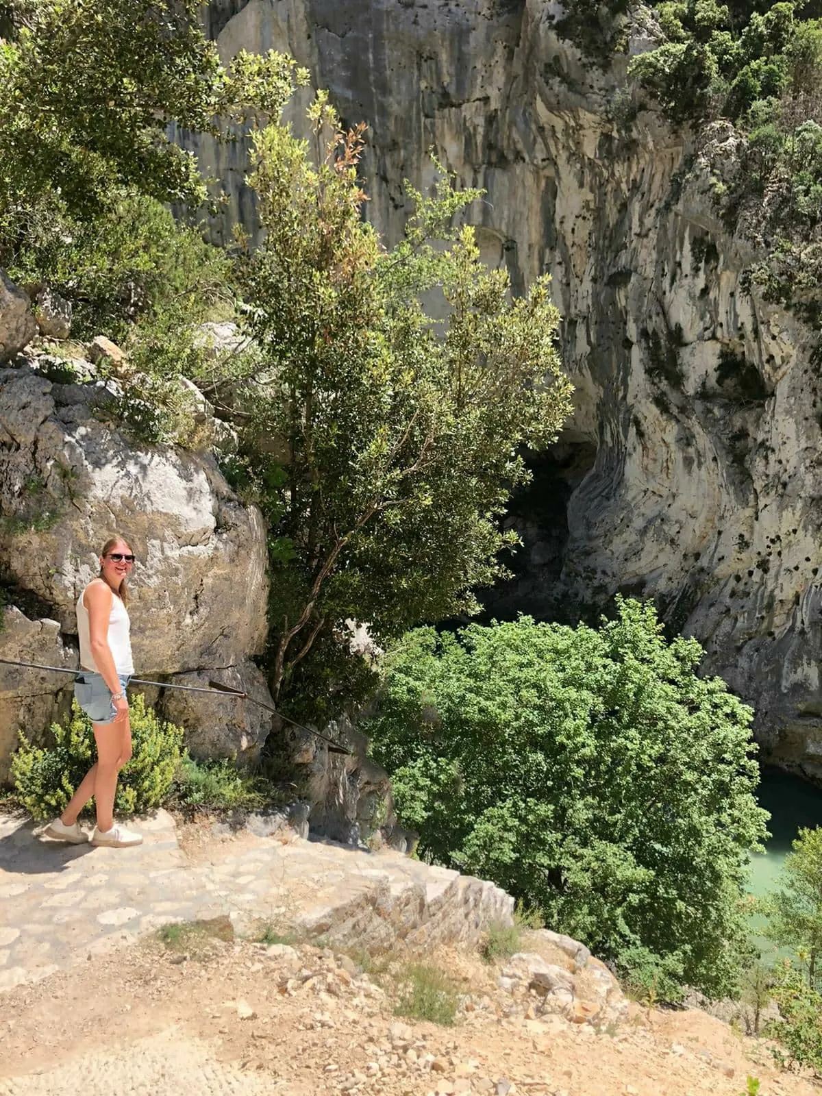
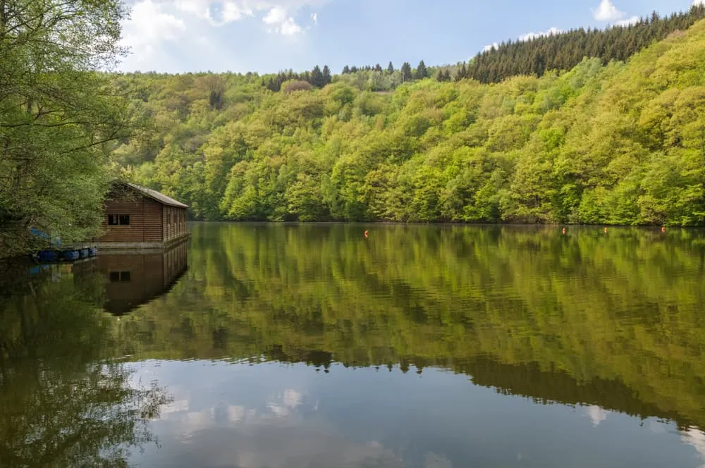
The Escapardenne: an escape on foot in the Ardennes. The Escapardenne is a hiking trip itself, but is also a combination of two of the most fun and exciting trails in Luxembourg and the Belgian Ardennes: the Lee Trail and the Eislek Trail. Three hikes at once and quite a few height meters? Definitely, and this partially in one of the smallest countries in the European Union.

The Escapardenne has the label ‘Leading Quality Trails - Best of Europe’, and that is definitely something. It is the combination of the Lee Trail and the Eislek Trail and when you hike the full trip, you will start in Luxembourg, but you will end in Belgium. You are literally crossing the border. Does this excite you as well? Allez!

What and Where Is the Escapardenne?

The best and most beautiful trails of Europe are not expected to be found in one of the smaller countries. However, this is nothing but the truth, in Luxembourg and Belgium you will find two of the ‘Leading Quality Trails - Best of Europe’, namely the Lee Trail and the Eislek Trail. These two hikes together are called the Escapardenne Trail. This 159 kilometer long hike is divided into the relatively short Lee Trail. This hike is only 53 kilometers, which can be hiked in 3 days. The remaining 106 kilometers are part of the Eislek Trail.

When hiking the Lee Trail, you will start and end in Luxembourg, while the Eislek Trail will guide you to Belgium. Both hikes are qualified as ‘Leading Quality Trails - Best of Europe’, and that is one of the things that makes these hikes so special.

I can hear you think, ‘Leading Quality Trails - Best of Europe’, what exactly is that? The German Hiking Association is ranking each hike in Europe to see if it qualifies for this title, but of course, none of the hikes is just getting this title, and the conditions that need to be met are not mild. At least 35% of the hike must consist of natural paths and no more than 3% of busy roads. In addition, there must be at least two changes in the landscape within 8 kilometers, there must be good public transport connections, and finally, there must be a possibility of having luggage transported along the way.

What and Where Is the Escapardenne?

Book Now

The Escapardenne Lee Trail

It may not immediately come to mind, and many end up for a hike in the Belgian Ardennes. Yet it's more than worth the travel a little further to be amazed by the Luxembourg Ardennes. In approximately 3 to 4 hours by bus from Brussels, you can find the Escapardenne Lee Trail.

Lee in Luxembourgish means a "lei," or, the foothills and rocky cliffs you find a lot in this area. So you won't be surprised to find many of these rocky outcroppings on this hike.

The Lee Trail is the first section of the Escapardenne Trail. This 3-day hike starts in Ettelbruck, and ends in Kautenbach, and is thus located entirely in Luxembourg. This trail leads you through the dense forest landscape of the Luxembourg Ardennes, encountering quiet river valleys and following bits of railroad tracks. With just under 2,000 meters of elevation gain, this route is intended for adventurous, athletic hikers and nature lovers.

Escapardenne Lee Trail: Map and Navigation

You will find numerous maps and travel guides available to help you navigate the Lee Trail. Below, you will find an outlining of the 3 stages of this hike.

Escapardenne Lee Trail: Route from Day to Day

Day
1

Arrival in Ettelbruck

Today you will have to make your way to Ettelbruck. Here, you will spend the night preparing for your Escapardenne Trail adventure.

Hotel Herckmans (Ettelbruck)

Info
Hotel Herckmans (Ettelbruck)
Day
2

Ettelbruck - Bourscheid-Moulin

Duration: 06:30 h
Distance: 17.8 km / 11.1 mi
Ascent: 600 m / 1969 ft
Descent: 570 m / 1870 ft
Lowest Point: 200 m / 656 ft
Highest Point: 470 m / 1542 ft
The starting point of the Escapardenne Lee Trail can be found at the bus station in Ettelbruck. From here you hike toward the Patton monument, a general in the U.S. Army during World War II. The trail leads you along the edge of the plateau toward Erpeldange-sur-Sûre, or, Erpeldingen an der Sûre, which you hike through. You continue on your way and arrive at the Predigtstuhl, from where St. Willibrord preached to forest workers on the other side of the river after he failed to do so in the village. A steep climb is followed by stunning views of Gringlee. Make sure to bring non-slip shoes if the weather is bad. After a final, steep, descent you will arrive in Bourscheid-Moulin, where you will find your accommodation for tonight.

Cocoon Hotel La Rive (Bourscheid)

Info
Cocoon Hotel La Rive (Bourscheid)
Day
3

Bourscheid-Moulin - Hoscheid

Duration: 06:50 h
Distance: 18.3 km / 11.4 mi
Ascent: 700 m / 2297 ft
Descent: 440 m / 1444 ft
Lowest Point: 230 m / 755 ft
Highest Point: 500 m / 1640 ft
You continue the first part of this hiking day along the Sûre, on a nature trail, along the railroad. You leave the villages behind and start climbing. As you hike along the forest path, you pass Bourscheid, and get a view of Napoleonsknäppchen. This tree was planted in 1811 in honor of the birth of Napoleon's son. The route continues to Dirbach, a small village nestled between the cliffs. You continue your way along the Sûre and a bit along the railroad, passing the Goebelsmühle train station. The path leads you further between the forest's thorn, with beautiful views of the Schlinder valley. Just before you arrive in Hoscheid, you hike over Crête rocheuse de Molberlee, a unique mountain camp trail that is home to many rare animal and plant species. Non-slip shoes are also recommended here, especially if it has been raining.

Hotel Restaurant des Ardennes (Hoscheid)

Info
Hotel Restaurant des Ardennes (Hoscheid)
Day
4

Hoscheid - Kautenbach

Duration: 05:30 h
Distance: 15.1 km / 9.4 mi
Ascent: 430 m / 1411 ft
Descent: 650 m / 2133 ft
Lowest Point: 260 m / 853 ft
Highest Point: 490 m / 1608 ft
Today you hike through the village of Hoscheid before descending into the valley of Lëtschbaach. After an ascent with several hairpin turns, you continue to the Chapel of St-Michel. The chapel is not open to the public, but you can peek inside through the peepholes in the doors. The trail crosses the road CR 348, then you descend to Hoflee and cross Gëischelterbaach. The trail officially turns right, but we recommend turning left first. This is because here you will find Hockslay, where you have a beautiful panoramic view of the surroundings. Now this is a perfect place for a picnic. After you have fully enjoyed your time here, hike down the same bit again, and then continue with the last part of the route. Here you will be treated to beautiful views of Kautenbach, the end point for today.

Hotel Huberty Kautenbach (Kautenbach)

Info
Hotel Huberty Kautenbach (Kautenbach)
Day
5

Departure

After breakfast, our services and your Escapardenne Lee Trail adventure will be over. Have a safe trip back home!
Hide entire itinerary

Not sure yet or want to discuss your plans for the Escapardenne Trail with one of our trekking experts? Get in touch today and turn your dreams into memories!

The Escapardenne Eislek Trail

The Escapardenne Eislek Trail is probably the best-known trail in the Benelux among hikers who want to train for a real hut hike in the Alps, and is even sometimes compared to the GR20 on Corsica. Indeed, the deeply incised valleys provide a good number of altimeters in one of the rougher parts of the Ardennes.

The Eislek Trail is the second part of the Escapardenne Trail and runs from Kautenbach to La Roche-en-Ardenne, in 106 kilometers. This is a long-distance trail that connects the Grand Duchy of Luxembourg with the Walloon province of Luxembourg. So it crosses borders, and not just literally!

In this hike you will again find a lot of variation in the surroundings and you will have considerable ascents and descents. In addition, in this route you will find a compelling history, and the dream of William of Orange is vividly told. It is also possible to take the via ferrata here, if you dare.

This is the first hiking trail in the Benelux that was designed according to the strict European standards for a 'Leading Quality Trail'.

Escapardenne Eislek Trail: Map and Navigation

You will find numerous maps and travel guides available to help you navigate the Eislek Trail. Below, you will find an outlining of the 5 stages of this hike.

Escapardenne Eislek Trail: Route from Day to Day

Day
1

Arrival in Kautenbach

Today you will have to make your way to Kautenbach. Here, you will spend the night preparing for your Escapardenne Eislek Trail adventure.

Hotel Huberty Kautenbach (Kautenbach)

Info
Hotel Huberty Kautenbach (Kautenbach)
Day
2

Kautenbach - Clervaux

Duration: 08:45 h
Distance: 24 km / 14.9 mi
Ascent: 820 m / 2690 ft
Descent: 660 m / 2165 ft
Lowest Point: 260 m / 853 ft
Highest Point: 470 m / 1542 ft
At the station of Kautenbach you will find the starting point of the Escapardenne Eislek Trail. You start right away with a tough first hiking day, so make sure you leave on time. Soon, after a steep climb, you have a beautiful panoramic view of Kautenbach. Soon you pass the campsite of the same name. After this, the trail leads you past Schüttburg, a castle 85 meters above the valley of the Clerve. The trail continues in the direction of Lellingen over which you have beautiful views just before you descend. You walk a short distance along the railroad track, and this gives you the opportunity to also take a look at Lellingen itself. You continue along the Geeslay rock and walk past the villages of Wilwerwiltz and Enscherange. You continue on forest paths towards Drauffelt, then walk through the Irbich valley. A little further on you have the first beautiful views of the St. Mauritius Abbey of Clervaux, which is getting closer and closer. After a descent you will reach the overnight location for tonight, in Clervaux.

Koener Hotel & Spa (Clervaux)

Info
Koener Hotel & Spa (Clervaux)
Day
3

Clervaux - Moulin d'Asselborn

Duration: 06:50 h
Distance: 19.6 km / 12.2 mi
Ascent: 480 m / 1575 ft
Descent: 470 m / 1542 ft
Lowest Point: 370 m / 1214 ft
Highest Point: 500 m / 1640 ft
Today you leave Clervaux behind, and follow the trail towards the mysterious forest of Beischend. Along the route you will find several memorials, such as a plane shot down by "Friendly Fire" or the Cinqfontaines, and an old monastery built at the beginning of the 20th century. The Troine River is one of the last Luxembourg rivers you will see along the way. It is almost completely in its natural state. Following the path to the source of this river, the mill of Asselborn appears on the horizon. In this mill, in addition to a hotel and restaurant, you will find an art gallery and mill museum. In addition, you can witness the operation of the water mill.

Domaine du Moulin d'Asselborn (Moulin d’Asselborn)

Info
Domaine du Moulin d'Asselborn (Moulin d’Asselborn)
Day
4

Moulin d'Asselborn - Houffalize

Duration: 06:40 h
Distance: 20.4 km / 12.7 mi
Ascent: 230 m / 755 ft
Descent: 300 m / 984 ft
Lowest Point: 340 m / 1115 ft
Highest Point: 510 m / 1673 ft
Leaving the Asselborn mill, the trail follows the valley until it reaches Barteshaus. This is an old farmhouse, located in the center of the picturesque village of Hoffelt, in the heart of the Luxembourg Ardennes. Here you will find the remains of the canal between the Meuse and Moselle rivers, an idea of Napoleon. After about 8 kilometers of walking you pass the border between Luxembourg and Belgium! Here you directly find La Ligne des Crêtes, the old railroad line between Bastogne and Gouvy. A little further on you pass the entrance to the canal tunnel between the Meuse and Moselle rivers. This tunnel was never completed because Belgium became independent in 1830. You continue your way through the woods and pass Le Moulin Lemaire before arriving in Houffalize, formerly an important center for leather tannery and milling.

Hotel du Commerce (Houffalize)

Info
Hotel du Commerce (Houffalize)
Day
5

Houffalize - Nadrin

Duration: 08:15 h
Distance: 23.5 km / 14.6 mi
Ascent: 580 m / 1903 ft
Descent: 600 m / 1969 ft
Lowest Point: 270 m / 886 ft
Highest Point: 440 m / 1444 ft
You leave Houffalize via a steep path in the old part of the town and soon you are back in the forest. You cross the Petit-Eau, a tributary of the Ourthe. After a steep climb, you'll reach Nabiselle, a plateau with beautiful views. A little further on you will have to cross the Ourthe via a footbridge, above a small weir. Then you have a beautiful panoramic view of the Barrage de Nisramont reservoir, where the western and eastern Ourthe merge. You pass Laid Tier, and a little further in the route, you can make a choice in the route. You can choose to follow the route as we have described it, but you must be focussed. Should it be rainy or already getting dark, at this point it is better to choose the descent. You pass the Nisramont dam complex, built in 1958. Just before you reach Nadrin, you will find Le Hérou, a 1,400-meter-long rock face that rises almost vertically along the Ourthe River.

La Fermette Blanche (Nadrin)

Info
La Fermette Blanche (Nadrin)
Day
6

Nadrin - La Roche-en-Ardenne

Duration: 06:55 h
Distance: 18.8 km / 11.7 mi
Ascent: 580 m / 1903 ft
Descent: 670 m / 2198 ft
Lowest Point: 220 m / 722 ft
Highest Point: 440 m / 1444 ft
From Nadrin, for the first part, you have the choice of which path to take. If you keep to the right, you follow the path as we describe it here. Are you looking for something more challenging? Then keep left, which will lead you to a via ferrata and you will climb Le Hérou by means of chains hanging along the rock. If it is raining, it is wise to keep to the right, and thus skip this challenging section. You start with a fast and steep climb to get to Le Hérou, from where you also have an immediate steep descent, to the foot of the rock. The trail leads you further through the forest, until you pass Le Cheslé. This is a Celtic camp near the village of Bérismenil, and was a former refuge for the inhabitants of nearby villages. A little further on you pass the propeller monument, where a propeller from the B17 that crashed during World War II. You continue walking through the woods, along streams and with beautiful views of Maboge, and the end point of this hike, La Roche-en-Ardenne.

Hotel Beau Rivage (La Roche-en-Ardenne)

Info
Hotel Beau Rivage (La Roche-en-Ardenne)
Day
7

Departure

After breakfast, our services and your Escapardenne Trail adventure will be over. Have a safe trip back home!
Hide entire itinerary

Do I Do the Lee Trail or the Eislek Trail?

As a true hiking enthusiast, you obviously want to do both trips, completing the entire Escapardenne Trail. Do you have to choose? Then below you can find a handy overview of the differences, so you can choose the right route for you.

Do I Do the Lee Trail or the Eislek Trail?

Escapardenne Hiking Pass

A hiking pass? Yes, that is correct. On the Escapardenne Trail you can collect stamps and a full card means a nice reward!

So how does this work? In cooperation with the hiking associations of Belgium and Luxembourg you can collect stamps along the Escapardenne Trail. You do this after each stage, at a designated stamping post. You show your hiking pass and stamp it. At the end of the hike, go to the Tourist Info in La Roche-en-Ardenne with your full hiking pass. Here you will receive your certificate and a fabric badge. How nice is that?

Escapardenne Hiking Pass

What Is the Best Season for the Escapardenne Trail?

So the Escapardenne Trail consists of two long-distance trails in Luxembourg and Belgium and are fine to hike year-round. Of course, there is a high season and it is also no surprise that it is in the summer. Then keep in mind that some villages along the route attract not only hikers but also a lot of other tourists. Consequently, between May and October, some of the hot spots along the Escapardenne Trail can be extremely busy. The most colorful seasons for the Escapardenne Trail are in spring and fall. Temperatures are mild, but always allow for the occasional rain shower. In winter you can hike the Escapardenne Trail, but luggage transport is not available during this time, and between November and March the trails can be slippery.

Did you know that we can book all overnight accommodation for the Escapardenne Trail for you? Check out all our options here.

Where Will I Stay During the Escapardenne Trail?

On the Escapardenne Trail you can either spend the night at a cozy hotel in a small town or camping in one of the several camping sites along the way. The accommodation options, however, can be a bit limited at times. The thing with the Escapardenne Trail is that the stages start and end mostly in very small towns, where there usually are only 1, 2, or maybe 3 accommodation options. The Escapardenne Trail is one of the most popular treks in the Ardennes and it welcomes thousands of trekkers every year. Arranging the stages and booking the accommodation should not be taken lightly, since the hotels get fully booked months in advance. Wild camping along the hike is strictly forbidden.

Where Will I Stay During the Escapardenne Trail?

How Does Luggage Transport Work on the Escapardenne Trail?

The Escapardenne Trail is a popular trek and attracts thousands of tourists every year. Thanks to its popularity, a large tourism industry has developed around it and there are numerous services that will make your hike easier and lighter. One of these services is luggage transport. This service is also very popular on other treks in Europe, such as the Malerweg in Germany. There are several agencies that offer luggage transfers during the Escapardenne Trail, and most offer their service for the entire trek for about €150. All you have to do is make sure your bag is ready at the lobby, weighing no more than 15 or 20 kilos. While you are enjoying a wonderful day of hiking, your luggage will be taken to the next place and will be ready when you arrive in the afternoon. Pretty convenient, right?

At Bookatrekking.com, we not only book your accommodation and luggage transport, we also send you on your way with a comprehensive hiking guide with the most important information for your Escapardenne Trail, including interactive Komoot maps. Browse all our options here and turn your dreams into reality.

Getting to and From the Escapardenne Trail

The Escapardenne Trail starts in Ettelbruck and ends in La Roche-en-Ardenne. No matter where you start and what your end point is, the public transport connections are very well arranged. In Luxembourg, they are even free.

By plane:

It is the easiest to fly out to Brussels or Antwerp, and take public transportation from here. From Brussels, you can travel to Ettelbruck in approximately 4 hours, from Antwerp, this trip will take you 4 to 4.5 hours. From La Roche-en-Ardenne, you can easily travel back to Brussels, which takes you about 3 hours. To get to Antwerp from La Roche-en-Ardenne will take you approximately 3.5 hours.

By car:

You can easily leave your car in both Ettelbruck and La Roche-en-Ardenne, at one of the accommodations or at a parking lot nearby. Ettelbruck is about a 2.5 hour drive from Brussels, and a 3-hour drive from Antwerp. La Roche-en-Ardenne is about a 2-hour drive from Antwerp or Brussels.

Getting to and From the Escapardenne Trail

How Much Does the Escapardenne Cost?

An amazing hike in the Ardennes really doesn't have to be expensive. Accommodations along the trail are usually basic, but offer everything you need to recharge your mental and physical batteries for the next hiking day(s). For 3 days on the Lee Trail, you can count on about 100 to 110 EUR per hiking day. For 5 days on the Eislek Trail you can also count on about 100 to 110 EUR per hiking day.

This includes route description, navigation help, your accommodation in a hotel or guesthouse, and breakfast if possible. In addition, your luggage will be transported from accommodation to accommodation, so all you need to bring yourself is a daypack with some food and drinks for the road. In addition, we recommend bringing 60 to 80 EUR pocket money per day. This is for lunch, dinner and your drinks. Most of our pocket money usually goes toward that ice cold beer at the next accommodation.

Where Can I Book the Escapardenne Trail?

At Bookatrekking.com you can book the self-guided Escapardenne Trail and many other treks. We take care of all the details for you, including arranging accommodations, organizing luggage transportation and providing you with relevant information well in advance of your trek. Find our offers here. Our easy-to-use platform allows you to browse and compare different trekking options and find the perfect fit for your interests, abilities, and budget.

If you have any questions about a specific trek or need help choosing the right one for you, our team of trekking experts is here to assist you. Simply reach out to us and we will be happy to provide you with personalized recommendations and advice to help you plan the trekking adventure of a lifetime.

Is the Escapardenne Trail not your cup of tea and are you looking for other epic adventures? Check out one of our following blog posts:

Comments

About Us

At Bookatrekking.com, you will find the trek that will make your life unforgettable. Whether you want to explore the Inca Trail or climb Kilimanjaro. Bookatrekking.com has a wide and varied range of first-class treks. No false promises are made here. Transparent prices and bookings are fixed instantly. Find, compare, book and trek!
Read more about us
About Us

Also Interesting

Show more