How to Walk Rota Vicentina's Fisherman's Trail in Portugal

Jan Bakker
Jan Bakker
Jan Bakker
28 Feb 2024 14 min read
How to Walk Rota Vicentina's Fisherman's Trail in Portugal
Trekking experts per destination
Free cancellation up to eight weeks in advance
Quick personal advice

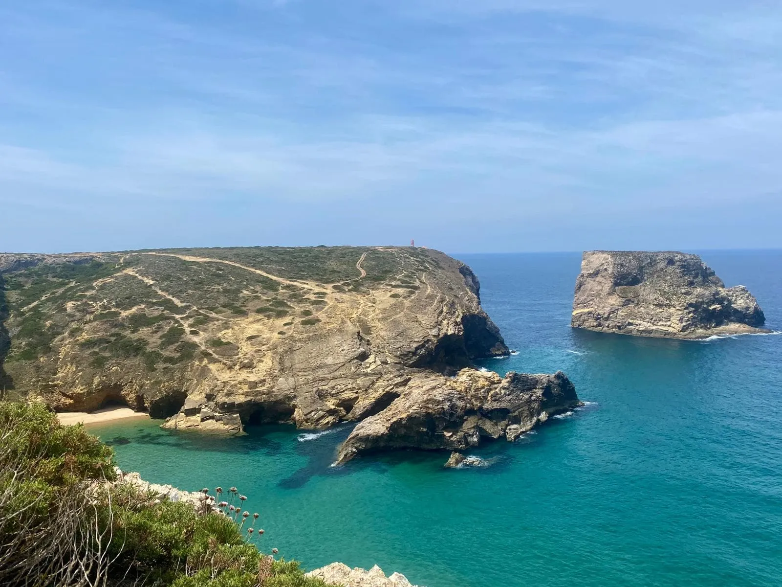
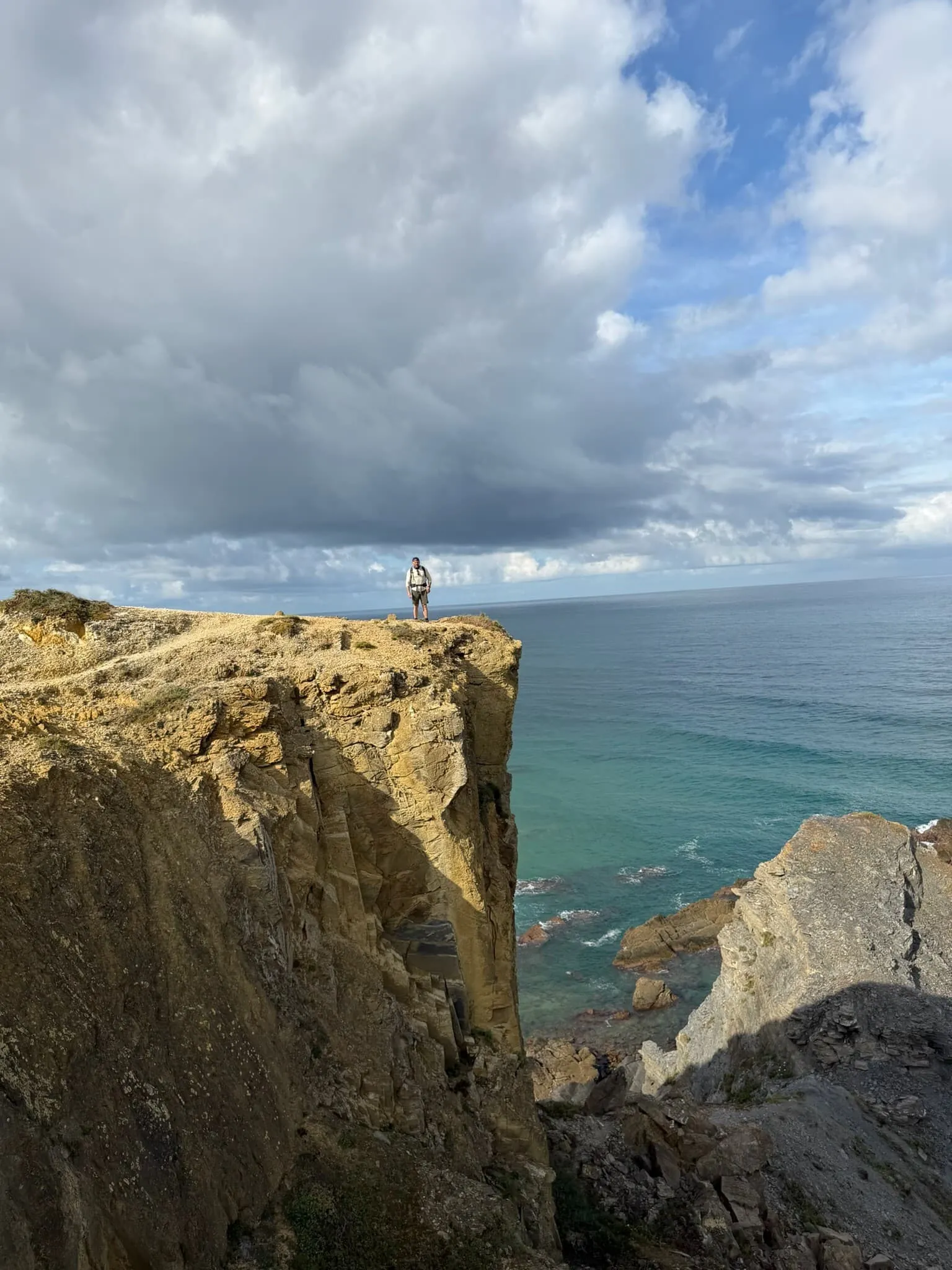
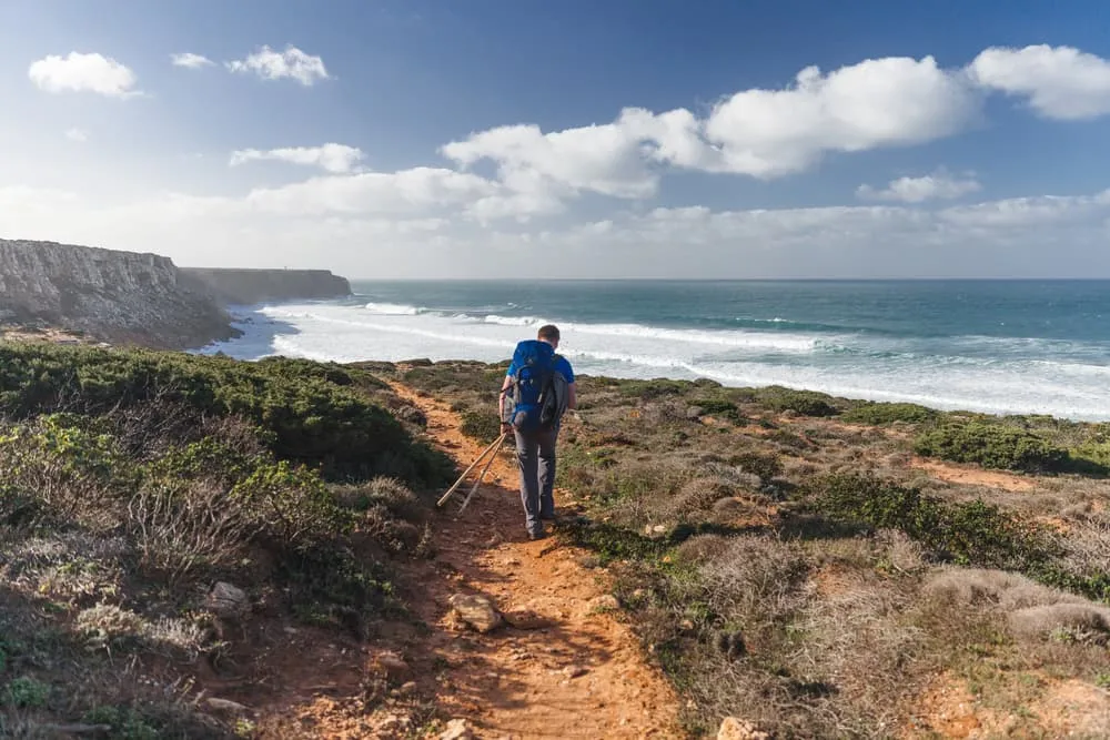
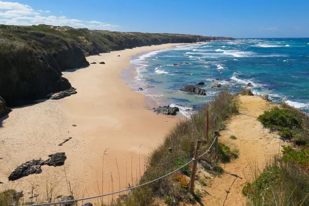
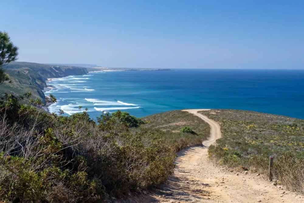
Fancy hiking one of the world’s most beautiful coastal trails along the rugged, sunkissed coast of southern Portugal? Explore secluded coves, endless stretches of deserted beaches and cute little fishing villages on the Fisherman’s Trail. The route follows the rocky shores of the Atlantic Ocean on sandy, single track pathways that were created by the local fishermen. If you’re looking for sun, solitude and spectacular sea views, then the Fisherman’s Trail is calling you. Don’t forget your swimsuit!

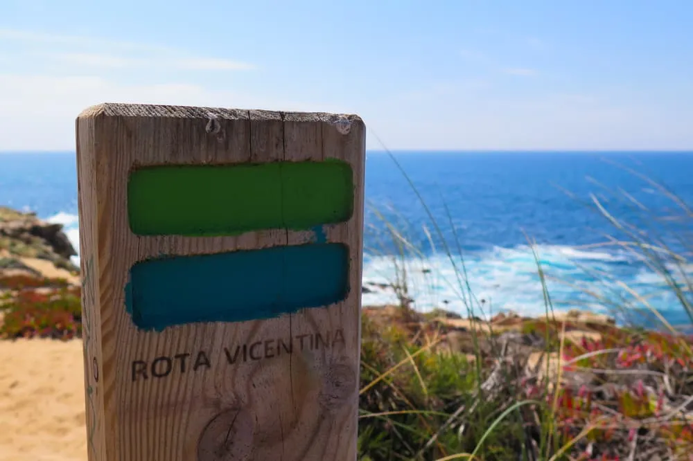
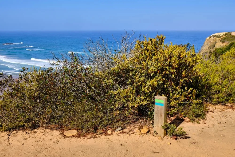
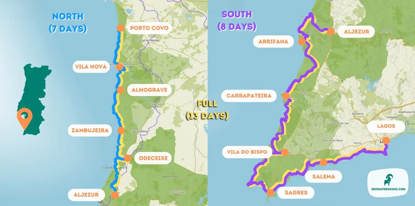
The Fisherman’s Trail is part of the Rota Vicentina trail network in southern Portugal. The well-marked trail winds along the coast from Porto Covo to Lagos for almost 230 km. You can hike it in 11 stages, though it is possible to do the northern or southern half of the route separately. Distances are manageable, but keep in mind that over 60% of the paths are sandy, making the walking a little bit harder. If you're looking for unforgettable walking holidays in Portugal, this trail is a true gem. In this blog post, we share our tips and tricks on how to hike the Fisherman's Trail.

Are the Rota Vicentina and the Fisherman’s Trail the Same Walking Route?

The Rota Vicentina is a 750 km long network of walking trails in the southwest of Portugal. It includes 24 short circular walking routes, a long-distance trail called the Historical Way and as far as we are concerned the most attractive route of them all, the Fisherman’s Trail. For 230 kilometres this route winds along the pristine Portuguese coast from Porto Covo to Lagos via secluded coves and beaches and dips down to the spectacular southwestern tip of Portugal, Cabo de São Vicente. The entire southwest coast is a protected area called the Southwest Alentejo and Vicentine Coast Natural Park. Its protective status prevents mass coastal development, and aims to preserve the natural and cultural heritage of the region. This is one of the very few coastal areas in southern Europe where such a legislation is in place and it’s therefore an ideal destination for those who are seeking a walking holiday along an unspoilt, authentic coastline.

Are the Rota Vicentina and the Fisherman’s Trail the Same Walking Route?

Where Is the Fisherman’s Trail?

The Fisherman’s Trail starts in Porto Covo, a quaint fishing village in the southern part of the province of Setubal. The travel distance from Portugal’s capital Lisbon is roughly 170 km. This variation of the Rota Vicentina runs along Portugal’s stunning coastal trails to Lagos, a small charming city in the Algarve. As stated before, the full route is 230 km long and can be walked in both directions. Most trekkers choose to walk the Fisherman’s Trail in a north to south direction. This is a great way to extend your trip with a few recovery days on one of Algarve’s golden beaches. For those with less time, the trail can be walked in two separate sections with Aljezur as the main hub halfway.

The trailhead at Porto Covo is well-served by the bus company Rede Expressos from Lisbon, and the journey takes about three hours. Aljezur is perfectly located halfway the Fisherman’s Trail and it takes less than an hour by bus to get to and from Lagos. The closest international airport from Lagos is in Faro.

When Is the Best Time to Walk the Fisherman’s Trail?

The Fisherman’s Trail is a year-round walking route. When you choose your dates there are two considerations to make.

Weather

Southern Portugal is never really cold, even in winter. But as it is right on the edge of the Atlantic Ocean, the weather can be stormy and blustery at times and you will need some warmer clothes from December to March. The best time to go is in spring time (April-May) and autumn (October-November). Summers are hot and that takes us to the second consideration for choosing the time to go: crowds.

Holiday season

Two months of the year, July and August, the Fisherman’s Trail gets busy. Guesthouses, hostels and hotels along the route are usually fully booked in advance. The shoulder seasons spring and autumn are much more quiet, with a chance to have a beach or the trail to yourself. If you really want to get away from people then winter time is the ideal time to hike the Fisherman’s Trail.

When Is the Best Time to Walk the Fisherman’s Trail?

What’s the Food and Accommodation Like on the Fisherman’s Trail?

You are on the Fisherman’s Trail, so it’s not a surprise seafood is the main food staple wherever you go. The Portuguese have turned the preparation of seafood into an art form, and hard choices have to be made when the menu is presented. Portugal’s absolute favourite dish is Bacalhau, or cod in English. It comes in many varieties and you can get it in almost every restaurant. Other favourites include Cataplana de Marisco, a hearty seafood stew and Polvo à Lagareiro, which is roasted octopus with olives and potato. And what local snack to bring on the trail? Bring a bag of Pastel de Nata, a sweet pastry with custard, that will keep you going!

The southwestern coastline is protected and you won’t see mass scale resorts and hotels en route. Villages offer authentic, locally owned accommodation, often very close to the sea. We typically book 3-star hotels and guesthouses with excellent reviews. At Bookatrekking.com, we know which charming guesthouse to arrange for you on the Fisherman’s Trail.

The Fisherman’s Trail is well-signposted with its typical blue and green markers. The ocean is never far away and is a great handrail for navigation as well. However, there are plenty of maps and guidebooks available to give you more in-depth information about the route. Below you can find an overview map of the Fisherman's Trail.

Navigation on the Fisherman’s Trail

Fisherman’s Trail - Northern Half

The northern half of the Fisherman’s Trail starts in Porto Covo, a sleepy historic fishing village just south of the fortified town of Sines. In terms of seascapes, the first days of the walk kick off really well. The sandy trail meanders through the coastal dunes and passes small secluded coves and broad beaches that are often accessible from the main trail. The majority of the path runs above the coastal cliffs, veering inland at times through coastal shrubs and woodlands. In summer you can spot storks nesting on the rocky outcrops, perched high above the crashing waves of the Atlantic Ocean. Although the elevation difference is small, on average 170 metres per day, the walking itself is quite strenuous due to the soft sand. Along the way it’s surprisingly underdeveloped, so don’t expect to find  restaurants or shops. You will have to carry a lunch pack and picnic (on the beach!) on most days. The great thing about walking all day on sand with a silty sea breeze? You can treat yourself to a plate with the catch of the day and an ice cold Sagres, Portugal's favourite beer! The northern half ends in Aljezur, from where it’s an easy transfer to Lagos and the Algarve.

Day
1

Porto Covo - Vila Nova de Milfontes

Duration: 04:35 h
Distance: 18.3 km
Ascent: 130 m
Descent: 130 m
Today, your path will follow the shoreline. Traverse the expansive area of sandy hills along the Ilha do Pessegueiro, Aivados, and Malhão beaches, where you may stumble upon secluded coves and caves. The landscape ahead will consist mainly of sand dunes, yet the many beaches you encounter will leave you in awe. Spend the night in Vila Nova de Milfontes.

Villa Eira (Vila Nova de Milfontes)

Info
Villa Eira (Vila Nova de Milfontes)
Day
2

Vila Nova de Milfontes - Almograve

Duration: 04:15 h
Distance: 15.6 km
Ascent: 160 m
Descent: 160 m

The route leaves Vila Nova de Milfontes with a grand view over the Mira River, the bridge and the blue Atlantic waiting beyond. It is a more relaxed stage than the first, but still full of coastal sparkle, with cliffs, beach caves and sandy paths keeping the day lively.

You can cross the Mira by bridge or, when available, take the small ferry for a softer start. Beyond the river, the trail follows the coast past beach caves, a rope-assisted beach passage and a tunnel of vegetation that feels like nature made a little secret doorway. Brejo Largo Beach is one of the beauties here, with cliffs and wild rock shapes stealing the show.

Approaching Almograve, the route becomes calmer and the village appears with that easy Alentejo charm. Almograve Beach Hostel is your landing place, simple and welcoming, close enough to the sea to keep the Atlantic soundtrack in your head a little longer.

Almograve Beach Hostel (Almograve)

Info
Almograve Beach Hostel (Almograve)
Day
3

Almograve - Zambujeira do Mar

Duration: 05:10 h
Distance: 19.3 km
Ascent: 230 m
Descent: 220 m

This is a proper coastal beauty from Almograve to Zambujeira do Mar, with fishing harbours, pine shade, open cliffs and the famous storks nesting where the land drops into the sea. It has a tougher feel, but also that juicy “yes, this is why we walk” energy.

The path first heads towards the Almograve and Porto Lapa de Pombas coastal trail before entering a pine forest, a welcome pocket of shade after the open coastline. Carraca Beach, the Costa Vicentina rock arch and wave-carved cliffs add plenty of wow. Later, a descent towards Porto das Barcas fishing harbour brings steps, wooden sections and a bit of careful footwork.

The last approach to Zambujeira do Mar is a fine one, with Nossa Senhora Beach offering one more salty invitation before the whitewashed village rises above the cliffs. Rosa dos Ventos is your home for the night, the kind of place where tired calves and happy faces make perfect sense.

Rosa dos Ventos (Zambujeira do Mar)

Info
Rosa dos Ventos (Zambujeira do Mar)
Day
4

Zambujeira do Mar - Odeceixe

Duration: 05:20 h
Distance: 19.3 km
Ascent: 280 m
Descent: 310 m

From Zambujeira do Mar, the coast turns on the charm with secret beaches, cliff paths and wide Atlantic views all the way towards Odeceixe. The route has a few more ups and downs, but the scenery keeps handing out prizes like a generous maître d’.

Praia dos Alteirinhos appears early, tucked below the cliffs with a waterfall adding a little magic. Alvorião Beach follows with its rocky walls, then the trail rolls through wildflower paths and viewpoints over the Southwest Alentejo and Vicentine Coast Natural Park. Near the end, the view over Odeceixe Beach and the Seixe River mouth is pure postcard thunder.

The arrival into Odeceixe brings a change of mood, from exposed cliffs to a village with a gentle, lived-in rhythm. After crossing safely via the bridge when river conditions demand it, Bohemian Antique Guesthouse waits with character, comfort and a well-earned chance to put your feet up.

Bohemian Antique Guesthouse (Odeceixe)

Info
Bohemian Antique Guesthouse (Odeceixe)
Day
5

Odeceixe - Aljezur

Duration: 07:20 h
Distance: 23.2 km
Ascent: 190 m
Descent: 180 m
Continuing your journey from Odeceixe, you'll maintain a southward course along the coastal path, meandering through the picturesque coastal area. After a long day on the trail you will eventually arrive at the enchanting Moorish village of Aljezur, steeped in rich history and cultural heritage.

Walking the Fisherman’s Trail 

Walking the full version of the Fisherman’s Trail can take 11 to 13 days. However, not all of us have the luxury to embark on such a long hike. Besides offering the full hike, we created two shorter versions of the route, the northern half and the southern half. Let’s get deeper into what to expect for each half.

Fisherman’s Trail - Southern Half

The southern stretch of the Fisherman’s Trail is a little harder than the northern part. Apart from the distance, the daily vertical gain and loss is higher, though still very manageable. From Aljezur, which is slightly inland, you walk to Arrifana, a famous surf spot and brilliant place to wind down. South of Arrifana is truly pristine with very little human interference apart from the trail. Often the route winds inland through the dunes that are covered in heather, thistles and fragrant shrubs. It eventually leads to the highlight of the Fisherman’s Trail, Cabo de São Vicente. Marked by the stunning red and white lighthouse on top of the cliff, this is continental Europe’s most southwestern point. From here, the trail heads east along the golden coastline of the Algarve province. The walk ends in Lagos, where you can replenish your burned calories in some of the best restaurants on the south coast.

Day
1

Aljezur - Arrifana

Duration: 05:45 h
Distance: 17.3 km
Ascent: 250 m
Descent: 260 m
From Aljezur, slightly inland, you'll head back to the coast following the course of Ribiera de Aljezur. Once you hit the coast you walk south again along the craggy coast. The day ends in Arrifana, a famous spot among surfers for its great waves.

Utopia Guest House (Arrifana)

Info
Utopia Guest House (Arrifana)
Day
2

Arrifana - Carrapateira

Duration: 05:55 h
Distance: 21.6 km
Ascent: 290 m
Descent: 360 m

From Arrifana to Carrapateira, the route feels spacious and wild, with the ocean often just out of sight before returning in full cinematic style near Praia da Bordeira. It is a long and demanding stage, but the landscapes have serious main-character energy.

The trail leaves Arrifana and heads through inland tracks, heathland and sandy sections across the protected coast. After a quieter middle part, the landscape opens again near the cliffs above Praia da Bordeira. The viewpoint over the huge beach and Vicentine Coast is a cracker, especially when the tide reshapes the sand below.

After crossing the small river near Bordeira, the route turns inland for the final stretch to Carrapateira. Carrapateira Lodge is your resting place, with the village offering a relaxed surfer-meets-fisherman atmosphere and enough calm to recharge for the wilder coastline ahead.

Carrapateira Lodge (Carrapateira)

Info
Carrapateira Lodge (Carrapateira)
Day
3

Carrapateira - Vila do Bispo

Duration: 05:50 h
Distance: 20.1 km
Ascent: 540 m
Descent: 480 m

This stretch towards Vila do Bispo is one of the tougher coastal days, with more climbing, steeper dips and a rougher rhythm underfoot. The reward is a fierce and beautiful shoreline, the kind that makes you stop talking and just stare for a moment.

From Carrapateira, the route works along a raw section of coast where paths rise and fall above bays and cliffs. One notable section has a steep ascent and descent towards a bay, so careful steps matter here. The coastline keeps switching between open ocean views, sandy tracks and rocky passages, with every turn saying: welcome to the wild Algarve.

The final kilometres leave the coast and guide you inland to Vila do Bispo, where the atmosphere becomes quieter and more practical. Hotel Mira Sagres offers a comfortable finish, and after this punchy stage, even the simplest chair can feel like a throne.

Hotel Mira Sagres (Vila do Bispo)

Info
Hotel Mira Sagres (Vila do Bispo)
Day
4

Vila do Bispo - Sagres

Duration: 06:00 h
Distance: 21.8 km
Ascent: 240 m
Descent: 300 m

From Vila do Bispo, the route heads for one of Europe’s great edge-of-the-map moments: Cabo de São Vicente. The coastline is open, rugged and wind-shaped, with cliffs that feel carved for drama and a lighthouse waiting like a red-and-white exclamation mark.

The first views of Cabo de São Vicente come early, teasing the big arrival. The trail then follows cliffs through the Southwest Alentejo and Vicentine Coast Natural Park, with the Atlantic booming below. At the cape, the lighthouse and cliffs mark a mighty turning point: no more south-westerly wandering, now the route bends east towards Sagres.

Sagres arrives with fortifications, surf culture and a wonderful end-of-the-world feeling. Residência Júlio is your place for the night, close to the historic town and perfectly placed for a sunset wander if the wind has not completely rearranged your hairstyle.

Residência Júlio (Sagres)

Info
Residência Júlio (Sagres)
Day
5

Sagres - Salema

Duration: 05:35 h
Distance: 20 km
Ascent: 320 m
Descent: 340 m

Leaving Sagres, the trail follows the southern Algarve coast, where golden beaches, limestone cliffs and deep-blue water take over the stage. It is a demanding walk with some technical sections, but the scenery has that sunlit, salty swagger only this coast can deliver.

The route rolls east along exposed coastal paths, passing viewpoints, coves and cliff edges that require attention, especially near rougher or narrow passages. The Atlantic feels different here, warmer in colour and mood, but still powerful. Beaches appear between the cliffs like little rewards, while the path keeps asking for steady feet and a good dose of respect.

Salema welcomes you as a small fishing village with a beach right at its heart and a relaxed Algarve glow. Salema Beach Apartment is the night’s base, ideal for sliding from hiking mode into seaside mode without needing much persuasion.

Salema Beach Apartment (Salema)

Info
Salema Beach Apartment (Salema)
Day
6

Salema - Lagos

Duration: 07:20 h
Distance: 22.1 km
Ascent: 370 m
Descent: 370 m
The final leg of what's been an epic journey along the southwest coast of Portugal. Lagos is where the Fisherman's Trail ends. For those with a little extra time we recommend hanging around the Algarve coast to recover and replenish all those calories burned.

Packing List for the Fisherman's Trail

No matter where you go hiking or for how long, bringing the right equipment is of utmost importance. For your hike, the first thing you need is a good backpack. The size of it will depend on the number of days you will be trekking, the season and the clothes you take with you. If you have luggage transport, the comfort level of your daypack is most important. We have compiled a packing list with a few essential items of clothing you should bring and some extras you might find useful:
  • Essentials

  • Extras

Is It Expensive to Walk the Fisherman’s Trail?

It’s easy and cheap to fly to Portugal’s capital Lisbon and Faro in the Algarve. Portugal itself is one of the cheapest countries in Western Europe to travel in. Getting to and from the trailhead/end by public transport is efficient and won’t cost more than 50 Euro in total. A local draught beer in Portugal costs 2 Euro and you can have a meal for around 10 Euro. Breakfast is ready for you every day so you only have to put money aside for your lunch and dinner. And a trip at Bookatrekking.com? For less than 700 Euro per person, you can already be on the trail with a comprehensive offer from Bookatrekking.com.

Is It Safe to Walk the Fisherman’s Trail Independently?

The Fisherman’s Trail is a safe trail to hike independently. In the towns, though, keep an eye out for petty crime. This means pickpocketing and muggings can occur. This is relative to any other holiday destinations in Western Europe. On beaches, always keep a close eye on the warning flags and don't swim too far into the sea. The currents in the Atlantic Ocean can be very strong and drownings do occur on the Portuguese coast. Some of the trail sections get close to the cliffs. Make sure you keep your distance, as some cliff edges may collapse due to erosion. Bring enough water, make sure your phone is charged and it's a good idea to bring a map, which you can buy in Porto Covo. On the Fisherman’s Trail, you are never far from civilisation and you will always meet several people on the route.

Is It Safe to Walk the Fisherman’s Trail Independently?

Safety tips for the Fisherman's Trail

Although this is far from being a trek in the Himalayas, unexpected things can always happen and you might also find obstacles on the hiking trails along the way. The Fisherman's Trail is safe, the trails are quite straight forward and there is not an extreme difference in altitude. However, for your safety, every hike deserves a level of respect; respect for the terrain, the trails, wildlife and vegetation, local rules and regulations, and above all, your physical capabilities and safety. Therefore, for an unforgettable and safe hiking memory, please keep the following safety recommendations in mind:

  • Know your limits

    Always prepare each stage carefully to use your energy wisely, respect your physical and mental limitations, and avoid taking unnecessary risks. When ascending or descending, if applicable, always use the aids provided, such as handrails and ropes. Is this trek suitable for you? Well, familiarize yourself with the grading system and figure out if this trek matches your capabilities. If you still need professional advice you can always contact Bookatrekking.com experts.

  • Stay on marked trails

    The most important thing is to never leave the marked paths. For easy navigation we work with our trusted partner Komoot, whose interactive maps, also available offline, provide you with the necessary digital means to get from A to B in the Fisherman's Trail. As a backup, make sure to bring a hiking guide or a paper map with you.

  • Fully equipped

    Make sure you have the necessary gear for the conditions you'll be facing, including appropriate clothing, footwear, and any necessary equipment for the terrain you'll be hiking on. Always wear clothing adapted to the weather of Fisherman's Trail and protect yourself from cold and wetness or heat and sun. Besides, make sure you carry enough food and water for the duration of your trek. On the way, you might (or might not) be able to buy snacks.

  • Stay reachable

    If you are hiking solo or in small groups it is advisable to inform people back home about your plans, what route you are taking and when you plan to return. Even small incidents can lead to unpleasant emergencies so make sure you are available at all times. Bring a charged phone containing at least the phone numbers of immediate family members, your accommodations en route and the emergency phone numbers operating in the Fisherman's Trail.

  • Respect for nature

    Do not litter, prevent noise, stay on the marked trails, do not disturb wildlife or grazing animals, and respect protected areas.

Where Can I Book the Fisherman's Trail?

At Bookatrekking.com you can book the self-guided Fisherman's Trail and many other treks. We take care of all the details for you, including arranging accommodations, organizing luggage transportation and providing you with relevant information well in advance of your trek. Find our offers here. Our easy-to-use platform allows you to browse and compare different trekking options and find the perfect fit for your interests, abilities, and budget.

If you have any questions about a specific trek or need help choosing the right one for you, our team of trekking experts is here to assist you. Simply reach out to us and we will be happy to provide you with personalized recommendations and advice to help you plan the trekking adventure of a lifetime.

About Us

At Bookatrekking.com, you will find the trek that will make your life unforgettable. Whether you want to explore the Inca Trail or climb Kilimanjaro. Bookatrekking.com has a wide and varied range of first-class treks. No false promises are made here. Transparent prices and bookings are fixed instantly. Find, compare, book and trek!
Read more about us
About Us
About Us

Also Interesting