Venediger Höhenweg: Hut-To-Hut Hike Around the Grossvenediger

Find that one special trekking
Search
Venediger Höhenweg: Hut-To-Hut Hike Around the Grossvenediger
Quick personal advice
Free cancellation up to two weeks in advance
Trekking experts per destination

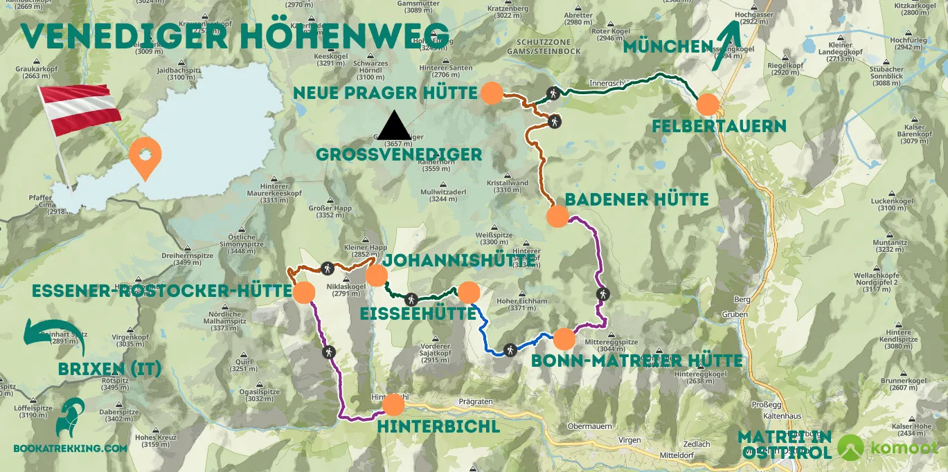
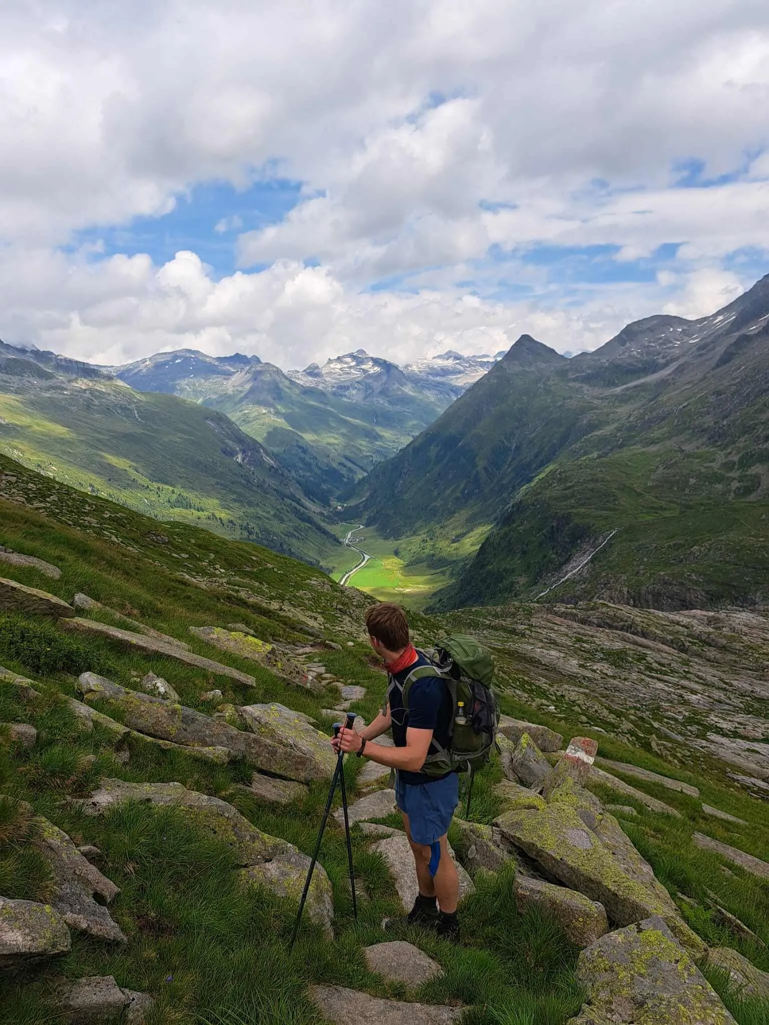
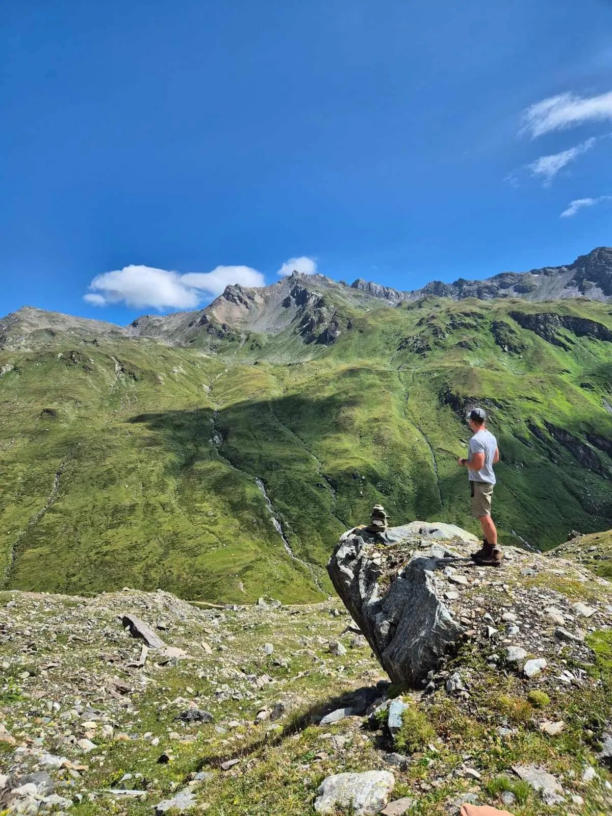
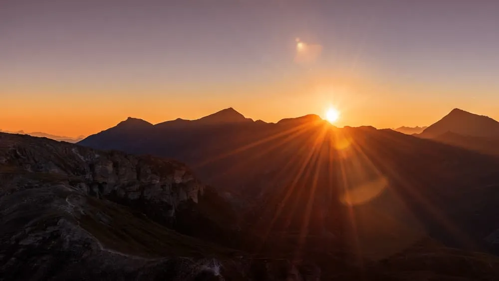
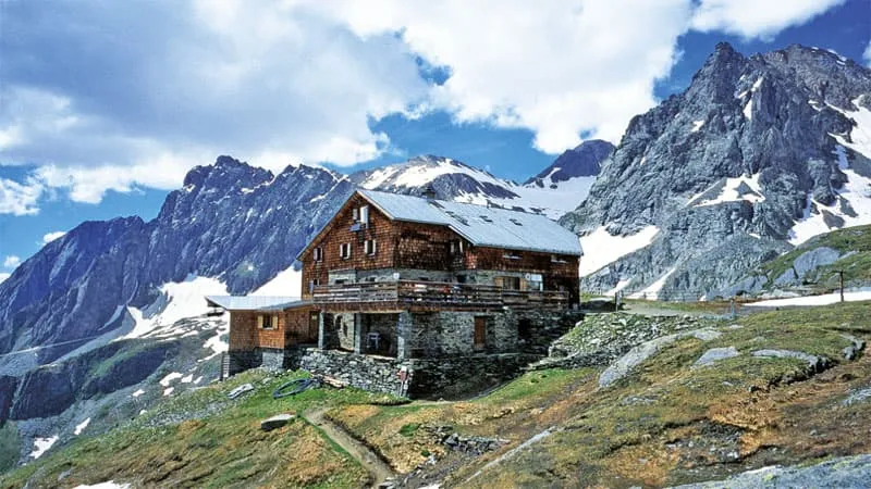
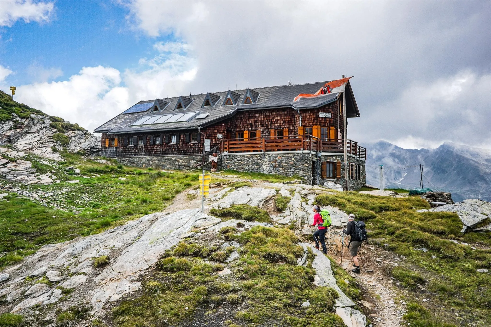
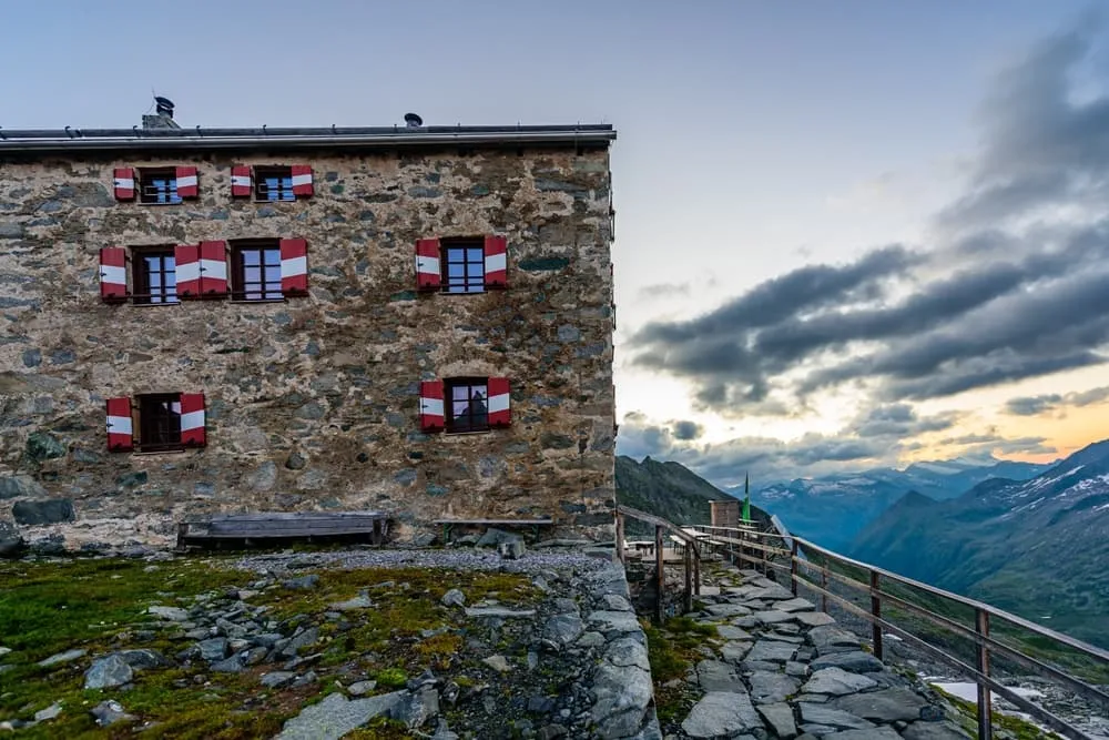
Have you completed your first hut-to-hut hike and are you ready for your next mountain adventure? Then the Venediger Höhenweg, or the Venediger High Trail, is your next step! The diverse mountain landscape leads you around the fourth-highest peak in Austria, the impressive Grossvenediger. With a multitude of ascents and descents, including the Türmljoch, the Venediger Höhenweg offers more challenges than the southerly located Lasörling Höhenweg. Take your next step as a mountain adventurer. Are you up for the challenge?

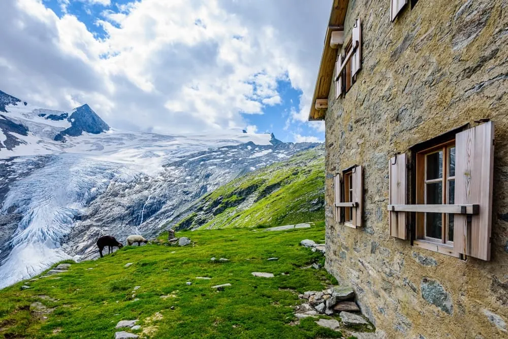
In the case of the tough bigger sister of the Lasörling Höhenweg, the 3,666-meter (12.027 feet) high peak Grossvenediger takes center stage. Also known as the "Ehrwürdige Majestät," which translates to "Honorable Majesty" in English, this is a mighty peak entirely made of ice. Keep in mind that you won't be climbing Grossvenediger; you'll be walking around it. In this blog post, we'll take you along the Venediger Höhenweg and show you what to expect from this moderately challenging hike. Is it something for you?

What and Where is the Venediger Höhenweg?

The Venediger Höhenweg is a 7-day hut-to-hut hike that takes you through the beautiful Austrian Alps, spanning a distance of 60 kilometers (37,3 miles). This route can be found in East Tyrol and is divided into northern and southern halves, making it possible to hike in both directions. The most popular route is from south to north, starting in Hinterbichl, conquering 7,920 meters (25.984 feet) of elevation, and finishing at the Matreier Tauernhaus in Felbertauern. This way, you begin on relatively "easy" terrain and gradually build up the challenge. Perhaps most importantly, you save the breathtaking view of the imposing Grossvenediger for your final hiking days. The narrow, steep paths of this red-marked route provide numerous panoramic views, waterfalls, and mountain ridges.

The Venediger Höhenweg can be found in Europe's largest and Austria's oldest national park: the Hohe Tauern National Park. Since 1981, this park covers over 1,800 square kilometers (695 square miles) and hosts a staggering 266 peaks above 3,000 meters (9.842 feet). Among them are the Grossvenediger and the Grossglockner, with the latter being Austria's highest mountain standing at 3,798 meters (12.460 feet). This extensive natural area is home to around 10,000 different flora and fauna species. During your Venediger Höhenweg hike, you might just spot a small marmot, or "Murmeltier" in German, emerging from the ground.

What and Where is the Venediger Höhenweg?

Book Now

Did you know that we can book all huts and refuges for the Venediger Höhenweg for you? Check out all our options here.

Is the Venediger High Trail Suitable for Me?

The Venediger Höhenweg is not an easy hike, but then again, no mountain hike is. Due to the diverse nature of the terrain, you should be prepared for various situations. The journey begins with well-maintained paths, but as you delve deeper into the mountains, the demands will be greater. The terrain becomes uneven, rocky, and you should leave any fear of heights at home.

If you're looking for a more challenging hike than the Salzburger Almenweg or the Lasörling Höhenweg but aren't quite ready for the Stubaier- or Berliner Höhenweg, then the Venediger Höhenweg might be the perfect option. The Venediger Höhenweg features many narrow paths with occasional steep cliffs alongside them. Additionally, during some stages, climbing and using steel cables are necessary. In short, you should already have some mountain hiking experience under your belt and be ready for the next challenge. Fortunately, all this effort results in a hike with fantastic views, making it an experience to be proud of.

Is the Venediger High Trail Suitable for Me?

Venediger Höhenweg or Lasörling Höhenweg?

This is a good question! They share the same starting point, explore the same area, and even have a similar number of hiking days. What sets them apart then, and which route is better for you? Well, the Lasörling Höhenweg is a suitable choice for most beginners looking to experience a real hut-to-hut hike in the mountains for the first time. The mountain paths are generally well-defined and suitable for dogs and children. On the other hand, the Venediger Höhenweg takes things up a notch. Here, the terrain becomes uneven, paths are less visible, and you will encounter more elevation gain. In addition to an extra 1.000 meters (3.280 feet) of elevation gain, the total Venediger Höhenweg also includes 5 additional hours of hiking and 7 extra kilometers (4,3 miles). If you've already completed the Lasörling Höhenweg, then the Venediger Höhenweg is the perfect next step.

What Is the Best Season for the Venediger Höhenweg?

The season for the Venediger High Trail, like many hut-to-hut hikes in the Alps, typically runs from mid/late June to mid-September. The huts where you'll stay are closed in other months as they become inaccessible due to snow and inclement weather. Generally, Austria experiences warm summers with pleasant temperatures at higher altitudes and plenty of sunshine. However, the Alps are unpredictable, and the weather can easily change. What may be a sunny day one moment can turn into a rainy one the next. Fortunately, rain often comes in the afternoon, so starting your hike early can help you avoid it.

Because you'll be dealing with higher altitudes, it's possible to encounter snow on the trails at the beginning and end of the season. This means that temperatures may also be lower, but with the right equipment, this shouldn't be a problem. As you can see, preparation is essential for a hut-to-hut hike. To assist you with this, we have compiled a packing list later in this blog.

Due to European vacation periods, July and August are the busiest months. Austria is a popular hiking destination for many, and for good reason. Fortunately, many huts are prepared for this and offer plenty of beds. To be sure of a spot on your favorite route, it's never too early to make a booking.

What Is the Best Season for the Venediger Höhenweg?

Venediger Höhenweg Map and Navigation

There are many different maps and guidebooks available to help you navigate the Venediger Höhenweg or other hiking trails in the Hohe Tauern National Park. Below is a map providing an overview of the route and all the stages of the different variants.

Where Do I Sleep During the Venediger Höhenweg?

Perhaps you're familiar with the British Mountaineering Council or the Italian Club Alpino Italiano (CAI). These organizations are entirely dedicated to mountain sports, and each country has its own variant. Belgium has BKF and the Netherlands calls it the NKBV. Austria also has its own association, the Österreichischer Alpenverein, or ÖAV for short. Together with the Deutscher Alpenverein (DAV), the association of Germany, they are continuously working on the well-being of mountain trails, nature, and the maintenance of the mountain huts affiliated with them.

During your Venediger Höhenweg hike, you will often stay in mountain huts affiliated with the ÖAV or DAV. You will even come across one of Austria's oldest mountain huts during your last stages. Built by the Alpen Club, the 2,489 meters (8.166 feet) high Alte Prager Hütte, celebrated its 150th anniversary in 2022. While this hut is no longer in use today, it has been transformed into a museum, some of which can also be seen in its replacement, the Neue Prager Hütte.

Life in local mountain huts is simple and cozy. Together with other hikers, you'll enjoy a piece of Austrian culture and history. Basic amenities ensure you get through the night comfortably, and that the hut staff can provide you with delicious Tiroler Knödel or Käsespätzle. In the evening, you head to your dormitory early, where you crawl into your sleeping bag for a well-deserved rest. The next day, you rise early to start the next stage on time. Of course, you first enjoy breakfast and the beautiful surroundings where the huts are located.

Where Do I Sleep During the Venediger Höhenweg?

At Bookatrekking.com, we not only book your huts, we also send you on your way with a comprehensive hiking guide with the most important information for your Venediger Höhenweg, including interactive Komoot maps. Browse all our options here and turn your dreams into reality.

Venediger Höhenweg Day-to-Day Itinerary

The Venediger Höhenweg can be hiked in various ways. To give yourself sufficient time to fully enjoy the diverse nature, we've outlined the 7-day southern variant for you below. This version can also be shortened, which will make some hiking days longer and skip certain huts. You can also add overnight stays before and after the hike. Click here to view all the alternatives we offer within the Venediger Höhenweg circuit.

Day
1

Hinterbichl - Essener-Rostocker-Hütte

Duration: 04:30 h
Distance: 8.7 km
Ascent: 900 m
Descent: 40 m
You begin the Venediger Höhenweg journey with a leisurely walk from the cozy village of Hinterbichl. From here, you'll walk the first 3 km (1,8 miles) along the Isel River to the Ströden parking lot and the entrance to the Hohe Tauern National Park. To slightly shorten today's full distance, you could park at this lot and start your mountain adventure from here. The next 2 km (1,2 miles) are a tranquil stroll, and shortly after passing the Stornalm, today's challenge begins. The final 4 km (2,4 miles) involve a considerably steeper ascent, and after about 2.5 hours, you will have gained 640 meters (2.099 feet) in altitude. Don't forget to look around and enjoy the vast green plains, waterfalls, and bridges you encounter. At the end of this stage, you will find the Essener-Rostocker-Hütte, your accommodation for tonight.

Essener-Rostocker-Hütte

Info
Essener-Rostocker-Hütte
Day
2

Essener-Rostocker-Hütte - Johannishütte

Duration: 04:40 h
Distance: 7.7 km
Ascent: 560 m
Descent: 640 m
Today is all about the Türmljoch, which is located at an altitude of 2,844 meters (9.330 feet). After a good breakfast at the Essener-Rostocker-Hütte, pack your bag early and head northwest. The first 2 km (1,2 miles) involve a gradual ascent, and after about 1 hour, you'll be at the base of today's challenge. Over a span of 4.5 km (2.8 miles), you'll climb to 2,761 meters (9.058 feet) via zigzag paths, passing by the Türmljoch Spitze. It's a great spot for a short break with stunning views as clouds roll over the mountain peaks. After catching your breath, you'll descend to the Johannishütte, where a cold beer awaits you.

Johannishütte

Info
Johannishütte
Day
3

Johannishütte - Eisseehütte

Duration: 04:20 h
Distance: 5.5 km
Ascent: 800 m
Descent: 430 m
The real challenge of the Venediger Höhenweg begins today and can be compared slightly to some sections of the Stubaier Höhenweg. Are you ready for it? It's a relatively short 5 km (3,1 miles) that you need to cover, but today will test your mettle. The narrow paths and rugged terrain demand the right mindset. Fortunately, you'll be aided by the steel cables in the mountains that you can hold onto. With some climbing and scrambling, you'll be guided over the Zopetscharte (2,958m/9.704ft) and past the Tulpspitze (3,054m/10.019ft). After ascending for 3.5 km (2,2 miles), the descent begins, which will take you down to a lower point in the same way and through the same landscape. Here, you can take a break at the Eisseehütte with other hikers. Not tired yet? You can continue hiking to the Eissee. More information about this in the Hiking Guide.

Eisseehütte

Info
Eisseehütte
Day
4

Eisseehütte - Bonn-Matreier Hütte

Duration: 04:45 h
Distance: 6.8 km
Ascent: 450 m
Descent: 220 m
Today is the shortest day of the Venediger Höhenweg. However, this doesn't make it any less beautiful. You'll be walking along narrow paths where you can look relatively steeply down the side, so be sure to leave your fear of heights at home. This provides impressive panoramic views of the surrounding mountain peaks and a true sense of freedom. After completing two-thirds of the hike, you'll need to climb steeply twice more over a span of 2,5 km (1,5 miles). Then, you'll arrive at the Bonn-Matreier Hütte, the endpoint for today.

Bonn-Matreier Hütte

Info
Bonn-Matreier Hütte
Day
5

Bonn-Matreier Hütte - Badener Hütte

Duration: 05:30 h
Distance: 9.2 km
Ascent: 530 m
Descent: 680 m
Your Venediger Höhenweg continues. During this stage, you'll begin with a short ascent to the highest point of the day. Once you reach 2.840 meters (9.317), you'll walk over the Galtenscharte with the 2.986-meter-high (9.796 feet) Galtenkogel on your right. Immediately after crossing the mountain ridge, the descent of over 500 meters (1.640 feet) begins. For 4 kilometers (2,5 miles), you'll walk through a lower-lying area where you'll trade the rocky landscape of the mountain ridge for greener plains. You'll pass narrow mountain paths and steep mountain walls before steadily ascending to the Badener Hütte.

Badener Hütte

Info
Badener Hütte
Day
6

Badener Hütte - Neue Prager Hütte

Duration: 05:10 h
Distance: 10.4 km
Ascent: 780 m
Descent: 630 m
Your day starts peacefully, but you'll soon be put to the test as you have to climb a small mountain wall using a steel cable. Be especially cautious if it has rained, as the rocks may be even more slippery. After conquering this short climb, you'll have about 1.5 kilometers (0,9 miles) at high altitude before descending about 580 meters (1.902 miles) to reach today's lowest point. You'll get to enjoy a slightly flatter path for a brief moment before continuing with today's ascent. During the last 3 kilometers (1,9 miles), you'll encounter glaciers, rocks eroded by meltwater, and the historic Alte Prager Hütte. A little further, you'll find the Neue Prager Hütte. Here, it's time to trade your hiking boots for a delicious Austrian Apfelstrudel and appreciate the surroundings of the Grossvenediger.

Neue Prager Hütte

Info
 Neue Prager Hütte
Day
7

Neue Prager Hütte - Matreier Tauernhaus

Duration: 04:30 h
Distance: 10.9 km
Descent: 1240 m
Today marks the relatively straightforward final stage of the Venediger Höhenweg. After breakfast, you'll walk back to the Alte Prager Hütte. Take one last look in the direction of the Grossvenediger before continuing with the steady 4,5-kilometer (2,8 miles) descent. Once you've reached the valley, it's still a little over 6 kilometers (3,7 miles) to the endpoint. After passing the Felsenkapelle, a small chapel built into the rock wall, the Matreier Tauernhaus is the last stop for today. Here, you can take the bus or a taxi to Matrei in Osttirol, and your beautiful Venediger Höhenweg adventure will come to an end. Well done!
Hide entire itinerary

Not sure yet or want to discuss your plans for the Venediger Höhenweg with one of our trekking experts? Get in touch today and turn your dreams into memories!

How Do I Get to the Starting and Ending Point of the Venediger Höhenweg?

The starting point of the Venediger Höhenweg is Hinterbichl, just like the Lasörling Höhenweg. The endpoint is located in Felbertauern. The nearest major city is Innsbruck, but due to the mountainous terrain between the two locations, it's better to consider Munich as a transit point.

By car
There are several ways to reach Hinterbichl, but due to its remote location, traveling by car is the easiest and quickest option. It takes approximately 11 to 12 hours to drive from Utrecht and Brussels, so consider an overnight stay somewhere halfway. In almost all cases, you will drive through Munich.

By public transportation
If you prefer to use public transportation, we recommend taking the train. This is the most comfortable way to travel from the Netherlands, Belgium, or Germany to Austria. From Munich, you can take the train to Kitzbühel, with a transfer in Wörgl. From there, you'll need to continue by bus to Hinterbichl. This journey takes approximately 5.5 hours.

To return from Felbertauern to Hinterbichl, you can use a bus connection, but it operates very sporadically. If you've missed the bus and don't want to wait for 3 hours, you can take a taxi or arrange transportation to Matrei in Osttirol. From there, it's about a 30-minute bus ride back to Hinterbichl. If you don't need to return to Hinterbichl, you can take a taxi from Felbertauern to Mittersill and then travel back to Munich from there.

Packing List for the Venediger Höhenweg

It doesn't matter where you are going trekking or for how long: Carrying the right equipment with you is paramount. For a hiking trip in the mountains, you will need, first and foremost, a good backpack. Its size will depend on how many days you will be spending in the mountains, the season, and the clothes you will be taking with you. We have prepared a packing list with some essential clothing that you should include and some extras that you may find useful:
  • Essentials

  • Extras

What to Do in Case of an Emergency?

There is an emergency situation when a human life (yours or someone else's) is in danger and you cannot do anything to solve the situation. You should call for help if there has been an accident, someone is stuck, you are lost or in trouble and cannot continue due to the time of day or weather conditions, or if you are stuck due to technical climbing challenges beyond your capabilities.

The most important thing to do in an emergency situation is to remain calm and assess the situation. Do not panic and do not take pointless risks if the people in need are difficult to reach. In case of emergency, first and foremost, call for help. When calling for help, make sure to provide your location and the number of victims and type of injuries. Then, protect the victim from cold and other environmental threats and provide first aid, if you are capable.

Emergency numbers for Austria

  • European emergency number: 112
  • Mountain rescue: 140

How Much Does the Venediger Höhenweg Cost?

A hut-to-hut hike really doesn't have to break the budget. The huts are usually simply equipped, but offer everything you need to recharge your mental and physical batteries for the next few days of hiking. For 7 days on the Venediger Höhenweg, you can expect to pay around 80 EUR/USD per hiking day. This includes route details, navigation assistance, your accommodation in a hut and half board in the form of breakfast and dinner. For hut tours in general, we advise you to bring 40 to 60 EUR/USD pocket money. This is for lunch and your drinks. Most of the pocket money usually goes for the ice-cold beer with our name on it in the next hut.

Safe hiking tips for the Venediger Höhenweg

When you go on walking holidays it is wise to be aware of a few points. Even if this is not your first time, you should never underestimate the mountains. Good tour planning and compliance with the regulations on the mountains will significantly increase safety. To ensure that your hiking holiday is a safe and enjoyable experience, here below you can find a list of 8 recommendations for safe hiking in the mountains:
  • Know your limits

    Hiking the Venediger Höhenweg is the perfect outlet to escape from daily life. It is an endurance sport along with a beautiful nature experience with a positive effect on body and mind —as long as one is in good shape and has a realistic picture of one's possibilities and limits—. Never overestimate yourself or underestimate the route. Don't overdo it! Always choose the slower variant and take more time for your plans. Hiking under time pressure is not fun and at too fast a pace it can be dangerous. Be wise!

  • Plan carefully

    Good planning is half the work! Hiking maps, literature, the Internet and expert advice are invaluable when planning the route in the Venediger Höhenweg and enable you to determine the length, altitude difference, difficulty and conditions of the hike. When planning group treks, the itinerary should always be planned for the weakest member of the group! The weather in the mountains can change incredibly quickly and rain, wind and cold all increase the risk factor. For this reason, always check the weather forecast beforehand and contact our trekking experts to find your way around before you start.

  • Be fully equipped

    Equipment is everything. In the most extreme case, it makes the difference between life and death, and in any case, it definitely makes the difference between having fun and having a bad time. Food and water, sunscreen and waterproof and warm clothes must always be in your backpack, as well as a first aid kit and a mobile phone with a full battery (in case there is an emergency). However, packing light makes walking easier, so don't take too much extra luggage with you. Your equipment should always be suitable for the terrain you'll be hiking on in the Venediger Höhenweg.

  • Wear suitable footwear

    Good walking shoes protect your feet and provide a better fit. Shoes with a good fit, with non-slip soles, water-resistant and lightweight are a must for additional walking pleasure during the Venediger Höhenweg. Trail running shoes are great for a weekend in the mountains, but on longer hikes or more technical trails, you'll want at least A/B hiking boots. That means it is recommended wearing high mountain shoes that are water-repellent with extra ankle support to prevent sprains.

  • Stay on marked trails

    Venediger Höhenweg has endless marked hiking trails, which are controlled and maintained and should not be deviated from. It may be tempting, but it's not a good idea to take shortcuts or alternative routes through unmarked terrain. It increases the risk of disorientation and you're more likely to get lost and have accidents or fall in the mountains. Even steep slopes of packed old snow are often underestimated and dangerous. Are you in doubt? Better don't do it. For easy navigation we work with our trusted partner Komoot, whose interactive maps, also available offline, provide you with the necessary digital means to get from A to B. As a backup, make sure to bring a hiking guide or a paper map with you. FYI, 75% of stumbles occur due to carelessness on marked paths or roads, not in open terrain!

  • Take regular breaks

    Remember you're on a hiking holiday. Timely and regular breaks not only provide welcome relaxation but also make it possible to enjoy the Venediger Höhenweg. The body needs a regular food and drink intake to maintain performance and concentration. Our advice is that if you have little time, it's better to follow the short itinerary than to speed up the long one.

  • Stay reachable

    If you are hiking solo or in small groups it is advisable to inform people back home about your plans, what route you are taking and when you plan to return. Even small incidents can lead to unpleasant emergencies so make sure you are available at all times. Bring a charged phone containing at least the phone numbers of immediate family members, your accommodations en route and the emergency phone numbers operating in the Venediger Höhenweg.

  • Respect nature

    Leave no rubbish behind, prevent noise, stay on the marked trails, do not disturb wildlife or grazing animals, and respect protected areas.

Where Can I Book the Venediger Höhenweg?

At Bookatrekking.com you can book the self-guided Venediger Höhenweg and many other treks. We take care of all the details for you, including arranging accommodations and providing you with relevant information well in advance of your trek. Find our offers here. Our easy-to-use platform allows you to browse and compare different trekking options and find the perfect fit for your interests, abilities, and budget.

If you have any questions about a specific trek or need help choosing the right one for you, our team of trekking experts is here to assist you. Simply reach out to us and we will be happy to provide you with personalized recommendations and advice to help you plan the trekking adventure of a lifetime.

Is the Venediger Höhenweg not your cup of tea and are you looking for other epic adventures? Check out one of our following blog posts:

Comments

About Us

At Bookatrekking.com, you will find the trek that will make your life unforgettable. Whether you want to explore the Inca Trail or climb Kilimanjaro. Bookatrekking.com has a wide and varied range of first-class treks. No false promises are made here. Transparent prices and bookings are fixed instantly. Find, compare, book and trek!
Read more about us
About Us

Also Interesting

Show more